Embed Size (px)
Citation preview

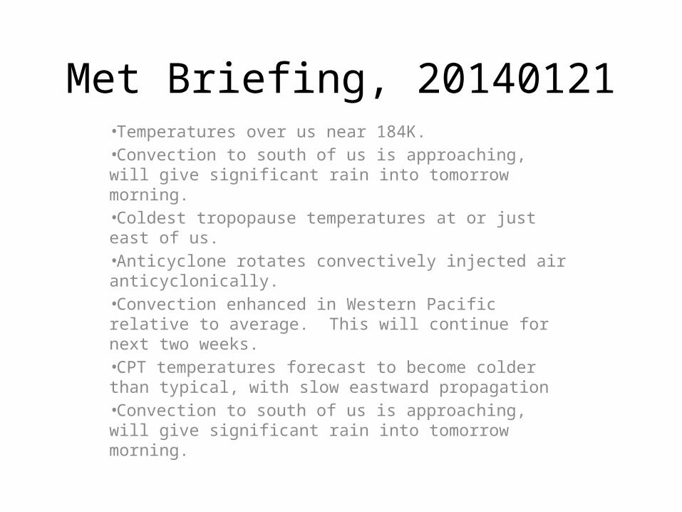
Met Briefing, 20140121•Temperatures over us near 184K.•Convection to south of us is approaching, will give significant rain into tomorrow morning.•Coldest tropopause temperatures at or just east of us.•Anticyclone rotates convectively injected air anticyclonically.•Convection enhanced in Western Pacific relative to average. This will continue for next two weeks.•CPT temperatures forecast to become colder than typical, with slow eastward propagation•Convection to south of us is approaching, will give significant rain into tomorrow morning.
Met Briefing, 20140121•Temperatures over us near 184K.•Convection to south of us is approaching, will give significant rain into tomorrow morning.•Coldest tropopause temperatures at or just east of us.•Anticyclone rotates convectively injected air anticyclonically.•Convection enhanced in Western Pacific relative to average. This will continue for next two weeks.•CPT temperatures forecast to become colder than typical, with slow eastward propagation•Convection to south of us is approaching, will give significant rain into tomorrow morning.

Minimum temperature near -90 (183.5K) near 56kft. Seeing more midlevel moisture, largely advected from the south from tropical system headed our way.
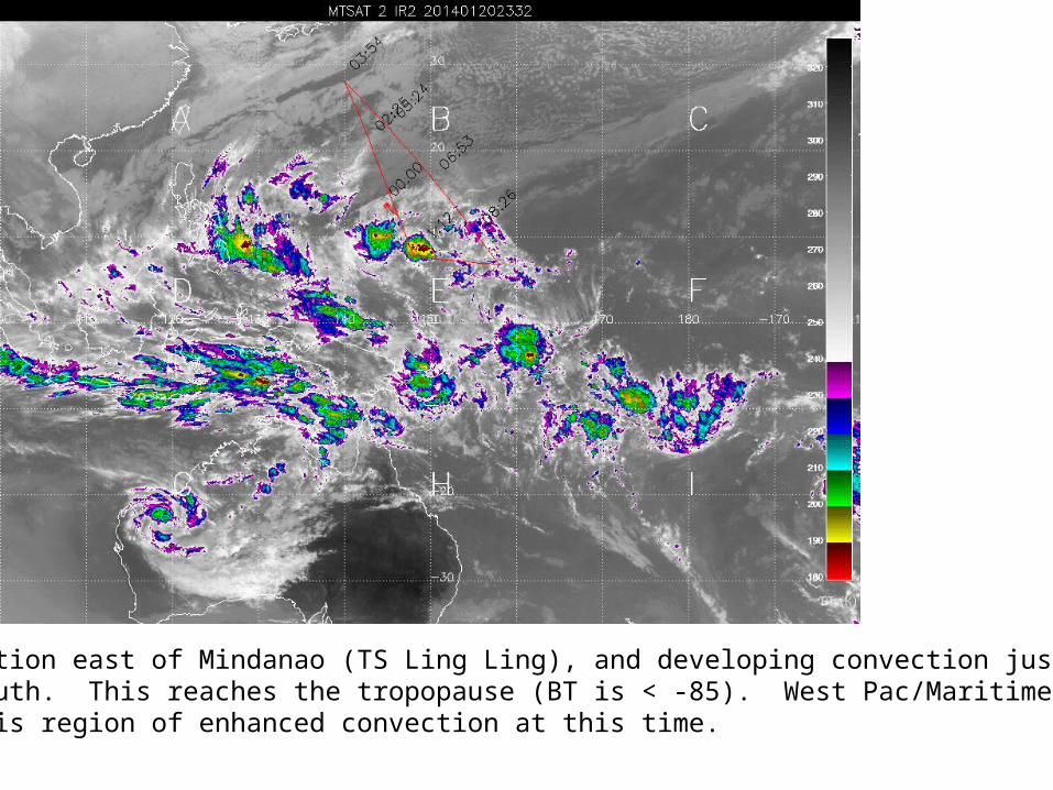
Note convection east of Mindanao (TS Ling Ling), and developing convection just to the south. This reaches the tropopause (BT is < -85). West Pac/Maritime Continent is region of enhanced convection at this time.
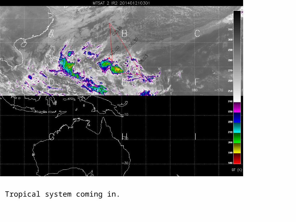
Tropical system coming in.

Anticyclone moves the air injected by this enhanced convection .

Convection (asterisks) injects air near 100mb which is transported by the upper level anticyclone

Long range forecast of convection – forecast an enhancement over our longitudes, but not the usual MJO-like propagation.

Today Tomorrow
Thursday Friday

Cold pool displaced eastward with altitude – typical winter pattern (Randel and Wu).

We are forecast to be anomalously cold this week, with gradual eastward propagation

Similar picture at our latitude.
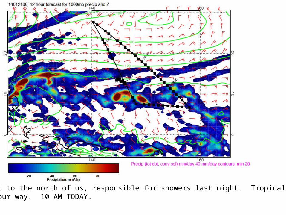
Shear line just to the north of us, responsible for showers last night. Tropical system to the south headed our way. 10 AM TODAY.
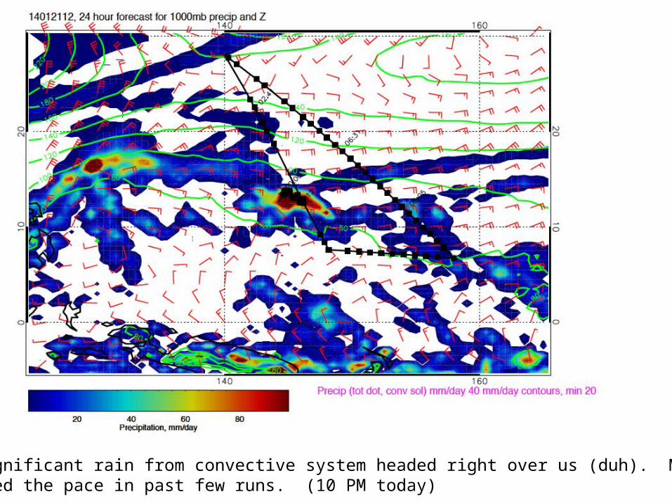
Prog has significant rain from convective system headed right over us (duh). Models have accelerated the pace in past few runs. (10 PM today)

Most rain past us by 10 AM tomorrow as tropical system moves north.

Some rain expected around landing time for Thursday’s flight as front approaches. Winds SSW at <10knots.

Friday has weak winds as shear line approaches, but Saturday will be windy, possibly out of limits.
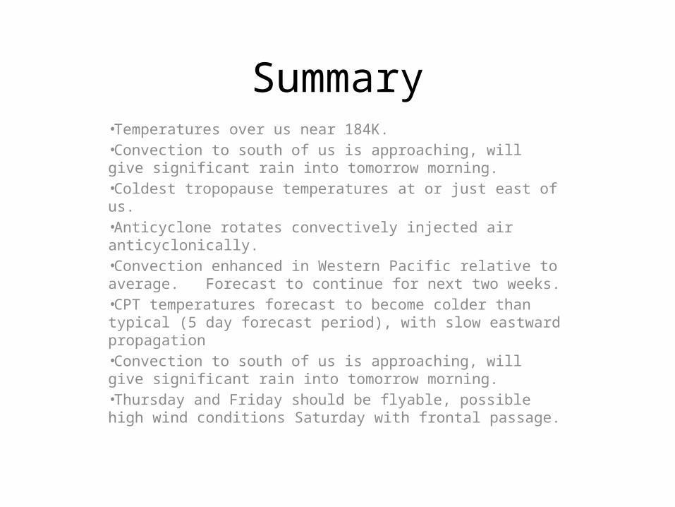
Summary•Temperatures over us near 184K.•Convection to south of us is approaching, will give significant rain into tomorrow morning.•Coldest tropopause temperatures at or just east of us.•Anticyclone rotates convectively injected air anticyclonically.•Convection enhanced in Western Pacific relative to average. Forecast to continue for next two weeks.•CPT temperatures forecast to become colder than typical (5 day forecast period), with slow eastward propagation•Convection to south of us is approaching, will give significant rain into tomorrow morning.•Thursday and Friday should be flyable, possible high wind conditions Saturday with frontal passage.


![The Coldest Girl in Coldtown by Holly Black [SAMPLE]](https://img.pdfslide.net/doc/110x75/55cf9cc3550346d033aaf488/the-coldest-girl-in-coldtown-by-holly-black-sample.jpg)