Embed Size (px)
Citation preview

MICHAEL DAVISPHD CANDIDATE
THE OHIO STATE UNIVERSITY
Clouds
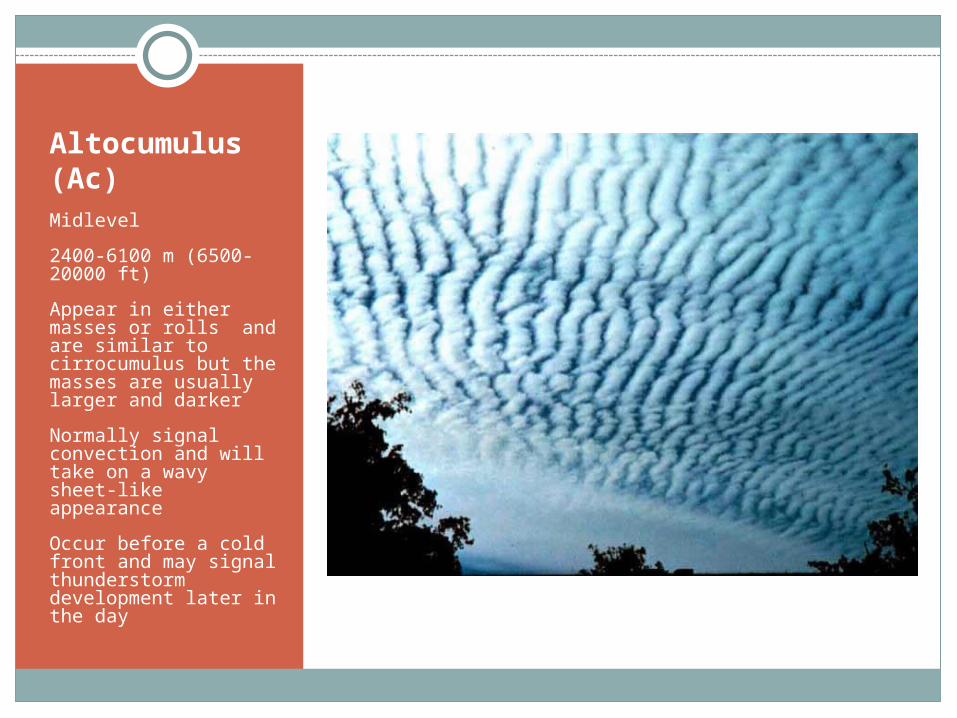
Altocumulus (Ac)Midlevel
2400-6100 m (6500-20000 ft)
Appear in either masses or rolls and are similar to cirrocumulus but the masses are usually larger and darker
Normally signal convection and will take on a wavy sheet-like appearance
Occur before a cold front and may signal thunderstorm development later in the day
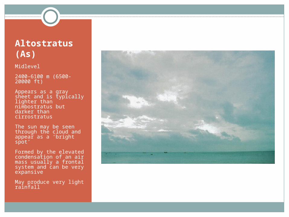
Altostratus (As)Midlevel
2400-6100 m (6500-20000 ft)
Appears as a gray sheet and is typically lighter than nimbostratus but darker than cirrostratus
The sun may be seen through the cloud and appear as a ‘bright spot’
Formed by the elevated condensation of an air mass usually a frontal system and can be very expansive
May produce very light rainfall

Arcus
A low level cloud usually on the front edge of a thunderstorm with the outflow boundary
2 types of arcus clouds:
Shelf cloud – low wedge shaped cloud that is attached to the thunderstorm
Roll cloud – detached, tube shaped cloud that appears to roll along a horizontal axis
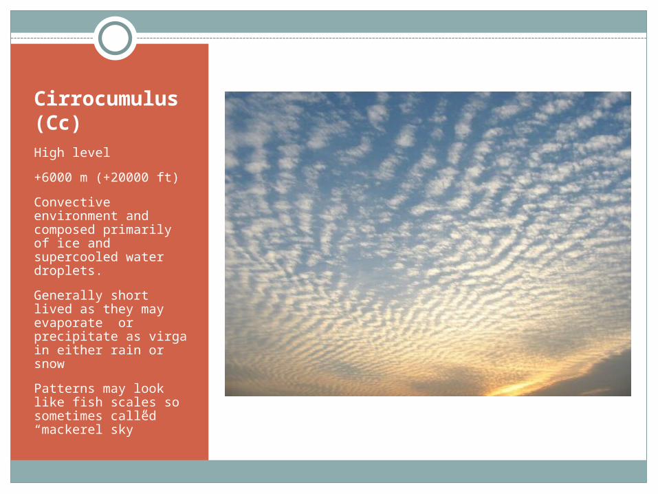
Cirrocumulus (Cc)High level
+6000 m (+20000 ft)
Convective environment and composed primarily of ice and supercooled water droplets.
Generally short lived as they may evaporate or precipitate as virga in either rain or snow
Patterns may look like fish scales so sometimes called “mackerel sky”
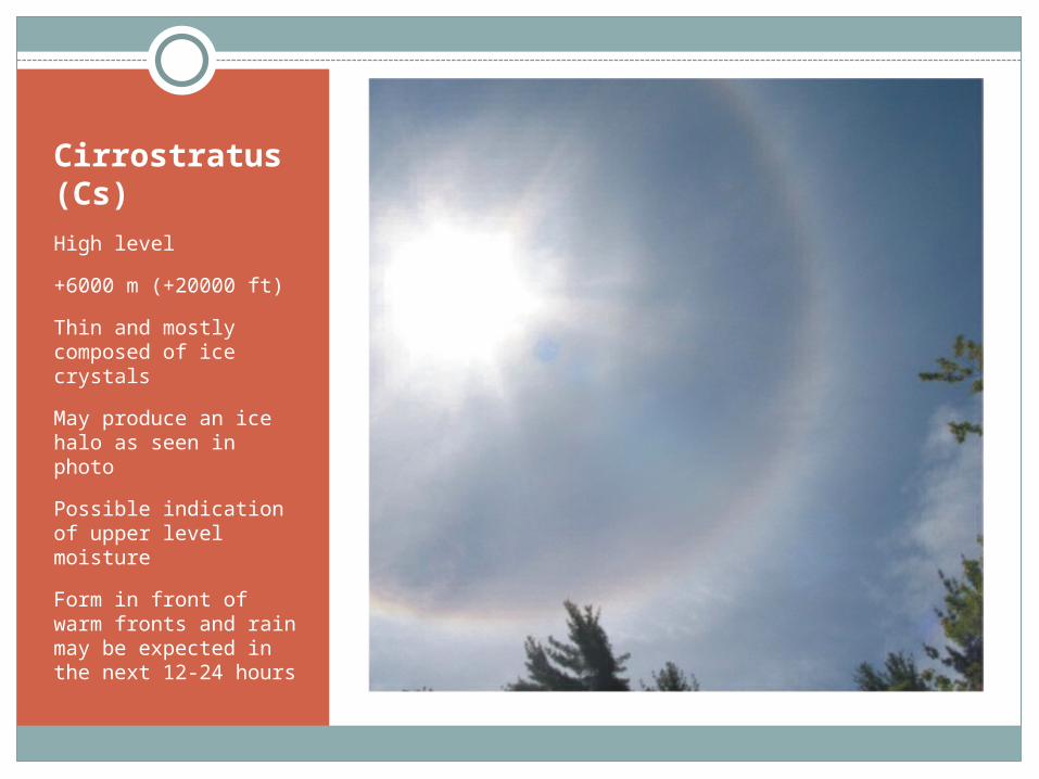
Cirrostratus (Cs)
High level
+6000 m (+20000 ft)
Thin and mostly composed of ice crystals
May produce an ice halo as seen in photo
Possible indication of upper level moisture
Form in front of warm fronts and rain may be expected in the next 12-24 hours
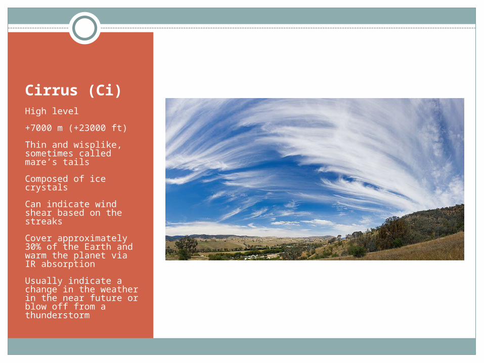
Cirrus (Ci)High level
+7000 m (+23000 ft)
Thin and wisplike, sometimes called mare’s tails
Composed of ice crystals
Can indicate wind shear based on the streaks
Cover approximately 30% of the Earth and warm the planet via IR absorption
Usually indicate a change in the weather in the near future or blow off from a thunderstorm
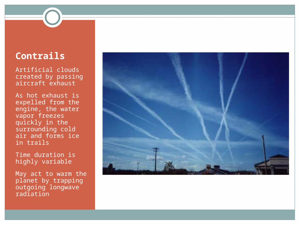
ContrailsArtificial clouds created by passing aircraft exhaust
As hot exhaust is expelled from the engine, the water vapor freezes quickly in the surrounding cold air and forms ice in trails
Time duration is highly variable
May act to warm the planet by trapping outgoing longwave radiation
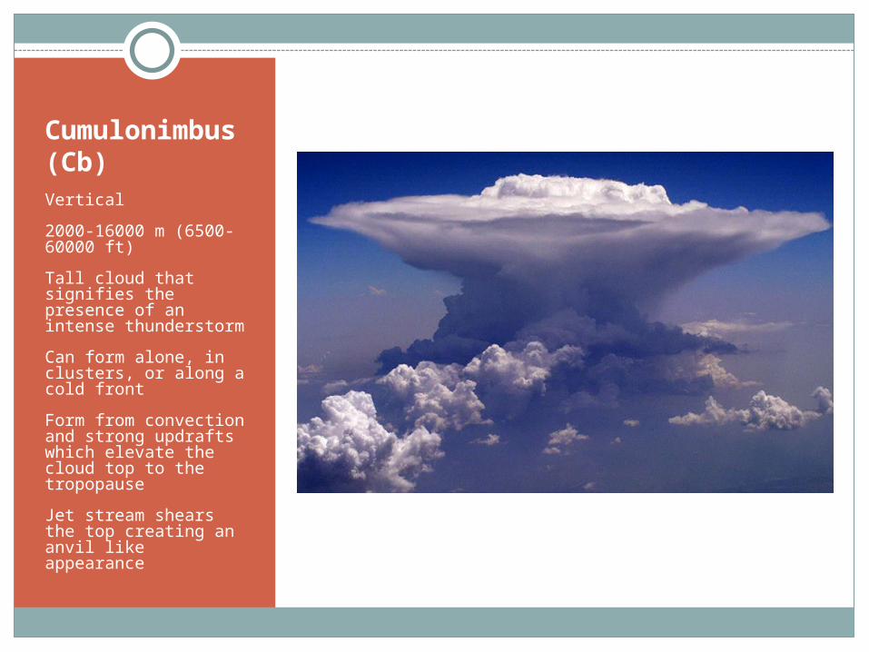
Cumulonimbus (Cb)Vertical
2000-16000 m (6500-60000 ft)
Tall cloud that signifies the presence of an intense thunderstorm
Can form alone, in clusters, or along a cold front
Form from convection and strong updrafts which elevate the cloud top to the tropopause
Jet stream shears the top creating an anvil like appearance
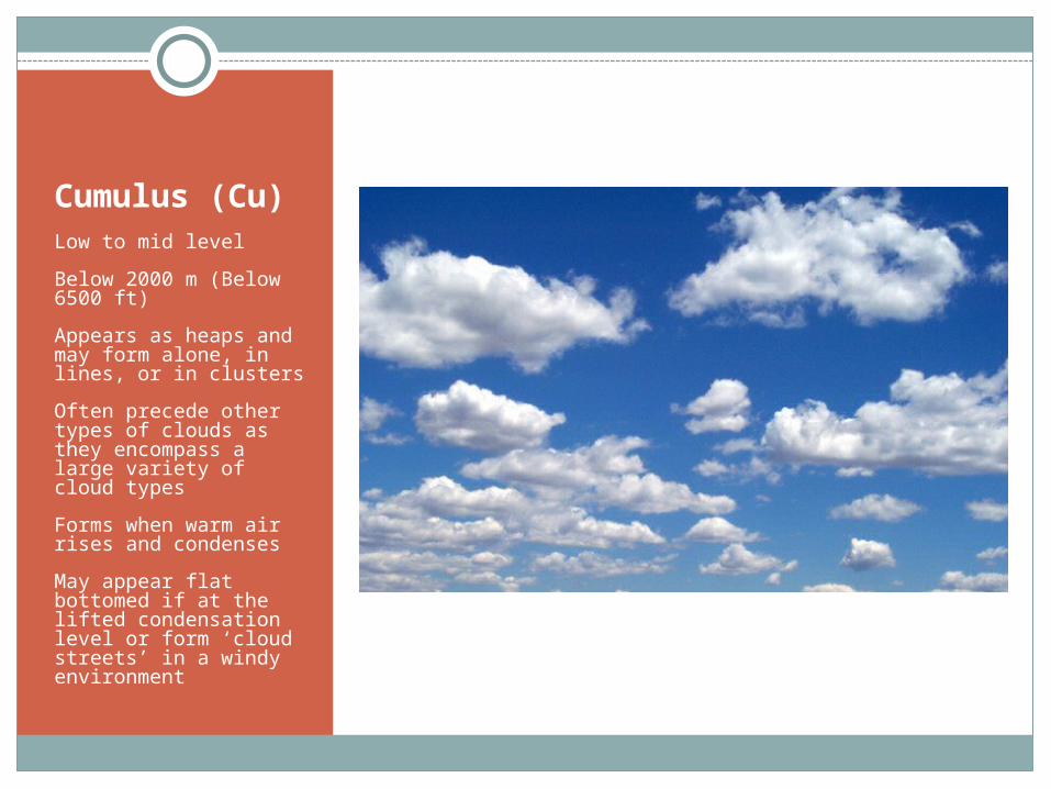
Cumulus (Cu)Low to mid level
Below 2000 m (Below 6500 ft)
Appears as heaps and may form alone, in lines, or in clusters
Often precede other types of clouds as they encompass a large variety of cloud types
Forms when warm air rises and condenses
May appear flat bottomed if at the lifted condensation level or form ‘cloud streets’ in a windy environment
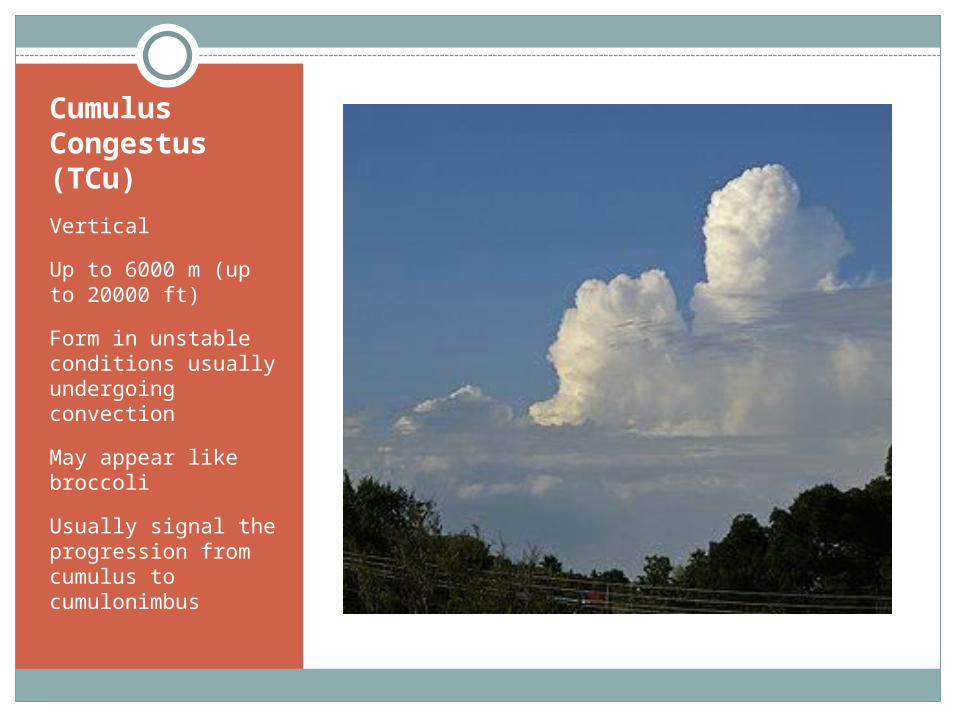
Cumulus Congestus (TCu)
Vertical
Up to 6000 m (up to 20000 ft)
Form in unstable conditions usually undergoing convection
May appear like broccoli
Usually signal the progression from cumulus to cumulonimbus
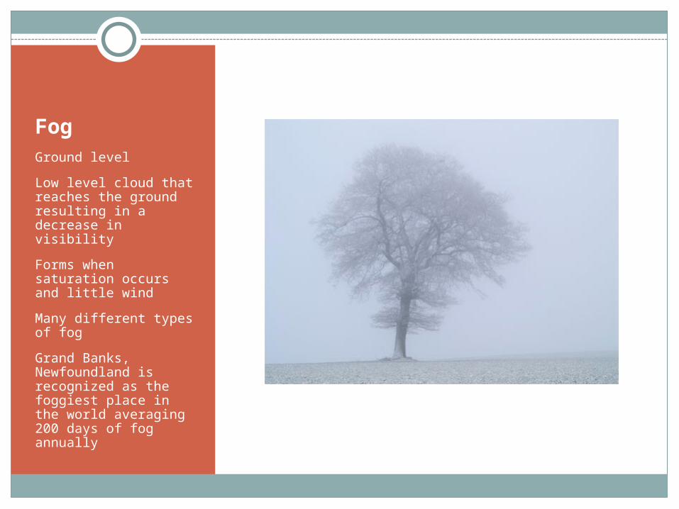
FogGround level
Low level cloud that reaches the ground resulting in a decrease in visibility
Forms when saturation occurs and little wind
Many different types of fog
Grand Banks, Newfoundland is recognized as the foggiest place in the world averaging 200 days of fog annually
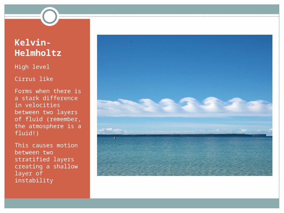
Kelvin-Helmholtz
High level
Cirrus like
Forms when there is a stark difference in velocities between two layers of fluid (remember, the atmosphere is a fluid!)
This causes motion between two stratified layers creating a shallow layer of instability
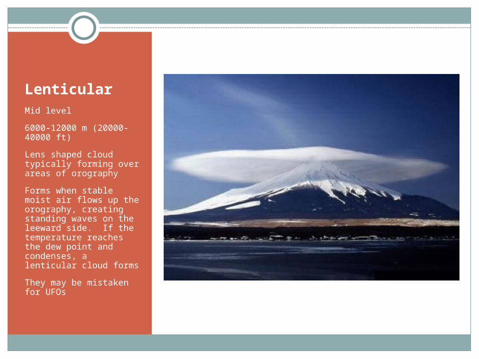
LenticularMid level
6000-12000 m (20000-40000 ft)
Lens shaped cloud typically forming over areas of orography
Forms when stable moist air flows up the orography, creating standing waves on the leeward side. If the temperature reaches the dew point and condenses, a lenticular cloud forms
They may be mistaken for UFOs
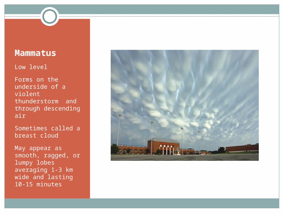
Mammatus
Low level
Forms on the underside of a violent thunderstorm and through descending air
Sometimes called a breast cloud
May appear as smooth, ragged, or lumpy lobes averaging 1-3 km wide and lasting 10-15 minutes
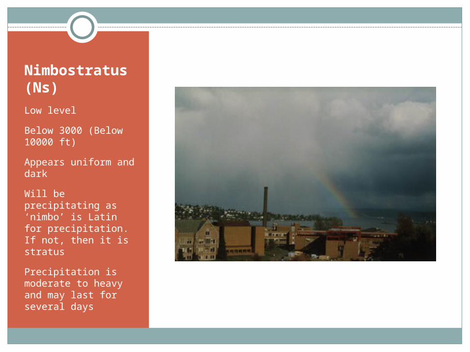
Nimbostratus (Ns)
Low level
Below 3000 (Below 10000 ft)
Appears uniform and dark
Will be precipitating as ‘nimbo’ is Latin for precipitation. If not, then it is stratus
Precipitation is moderate to heavy and may last for several days
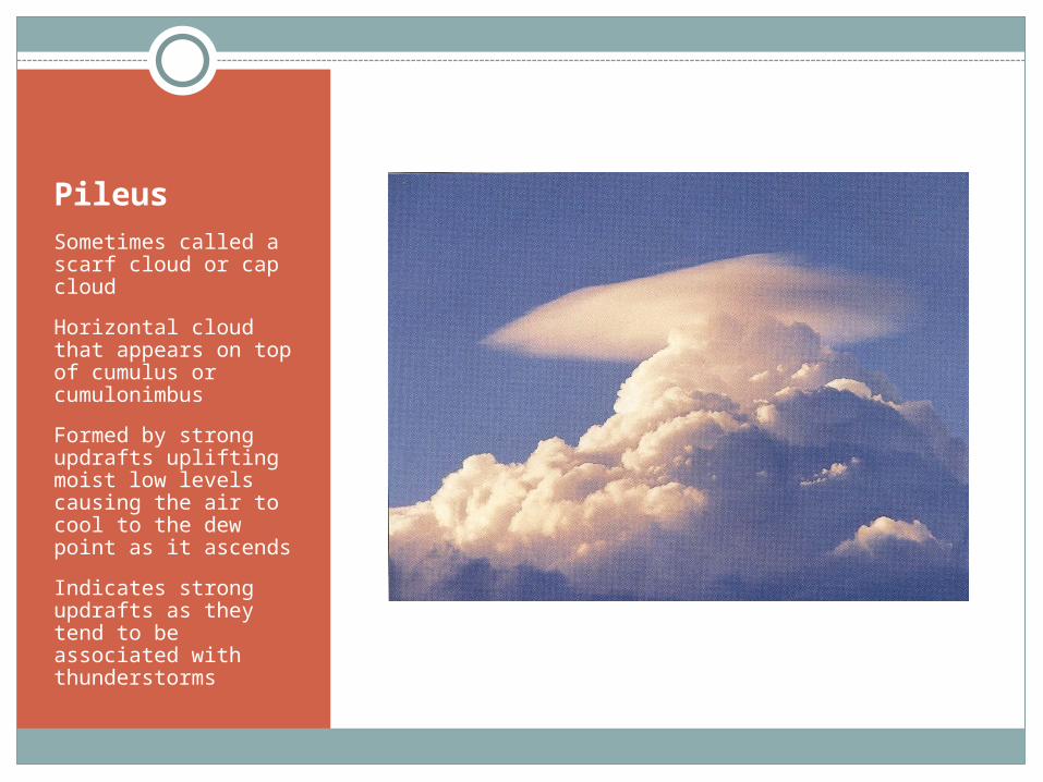
PileusSometimes called a scarf cloud or cap cloud
Horizontal cloud that appears on top of cumulus or cumulonimbus
Formed by strong updrafts uplifting moist low levels causing the air to cool to the dew point as it ascends
Indicates strong updrafts as they tend to be associated with thunderstorms
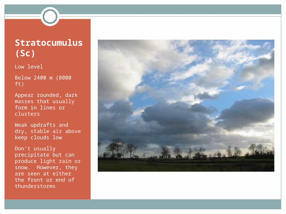
Stratocumulus (Sc)Low level
Below 2400 m (8000 ft)
Appear rounded, dark masses that usually form in lines or clusters
Weak updrafts and dry, stable air above keep clouds low
Don’t usually precipitate but can produce light rain or snow. However, they are seen at either the front or end of thunderstorms
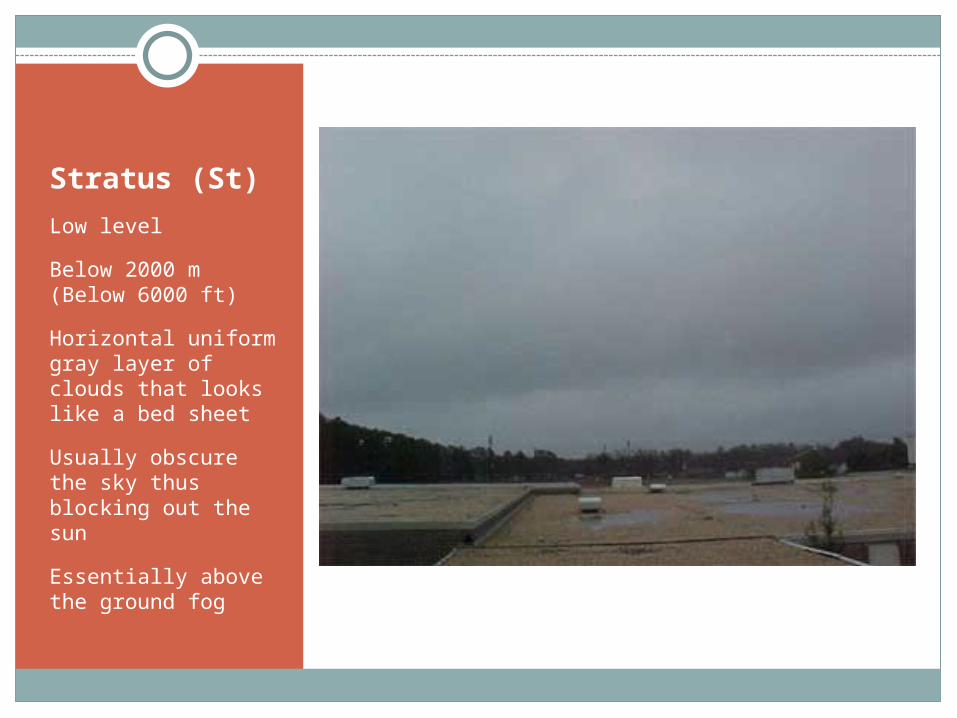
Stratus (St)
Low level
Below 2000 m (Below 6000 ft)
Horizontal uniform gray layer of clouds that looks like a bed sheet
Usually obscure the sky thus blocking out the sun
Essentially above the ground fog