Embed Size (px)
Citation preview

For a long time, software in mining has been
much more than a technical tool only used
by mine planners. It now underpins
everything on a modern minesite from
exploration through to reclamation, and in an
operating mine, beyond planning and
scheduling, it is at the core of Enterprise
Resource Planning (ERP) solutions that integrate
everything from fleet management packages
through to production reporting. But one
additional interesting area is how software can
enhance collaboration between mining staff in
terms of file and knowledge sharing.
In a November 2017 GEOVIA blog post, Raoul
Jacquand, GEOVIA CEO at Dassault Systèmes
stated: “The mining industry will not be immune
to digital disruption – consider the sharing
economy, where ride-sharing and apartment-
sharing has become the standard today in
industries we once regarded as traditional. What
if mining is, too, transformed by the sharing
economy? Building on the theme of sharing and
collaboration digitally, I would like to introduce
our GEOVIA community to GEOVIA POWER’BY, a
set of rich applications leveraging the power of a
social and collaborative enterprise-level
platform. These applications are tied to Roles
offered on the 3DEXPERIENCE platform, such as
Business Innovation, Industry Innovation and
Geology Modeler, which enable you to access
different capabilities and benefits. Think of it as
your digital workspace, starting with the
Business Innovation role which allows you to
share your files dynamically, visualise models in
3D, dashboard your data, start a community to
collaborate on projects and more.”
This post was followed up in December with
another launching the Business Innovation role
under the POWER’BY umbrella. “As your
personalised social and content collaboration
platform, the Business Innovation role enables
teams to work, share and learn on the cloud.”
An online video, available at
https://youtu.be/1lCP7LYlOD0 shows a typical
mining scenario, end of month reporting, and
how the platform enables better collaboration
and communication between team members.
This workflow demonstrates a typical use of the
platform’s social collaboration features in a
mining context. The official launch of POWER’BY
Social Collaboration to mining customers is
expected in Q1 2018.
Block caving and stoping softwareMoving on to another topic entirely, block caving
is an increasingly important mining method in
terms of overall contribution to commodities
supply, with new high tonnage, long term
00 International Mining | FEBRUARY 2018
Applicationseverywhere
MINING SOFTWARE
Paul Moore reports on someenhancements to existing block caving
software packages, as well as a newoffering in this area, as well as more
rental options, an imminent socialcollaboration offering, and as usual the
latest planning and schedulingsoftware updates
GEOVIA’s new POWER’BY is a set of richapplications leveraging the power of a socialand collaborative enterprise-level platform
Maptek CaveLogic incorporates operational and geotechnical constraints and takes dilution intoaccount by generating multiple scenarios for assessment

projects being developed all over the world,
from Wafi-Golpu in PNG to New Afton in Canada
and Argyle in Australia.
A new strategic panel caving product
developed by Maptek™ “targets the most cost
effective underground mining method in a
transparent, analytical way while maximising
productivity.” Panel, or block caving, is widely
considered the ‘new frontier’ as mining
operations move towards underground
methods.
Maptek CaveLogic allows engineers to more
effectively plan and reduce the financial risk
associated with this subsidence mining method
that involves massive volumes of material and
large investment. “The Maptek solution quickly
and easily simulates multiple scenarios for
identifying the best option,” said Vice President,
Maptek South America, Marcelo Arancibia who
previewed the new tool at the recent South
America Users Conference in Viña del Mar.
“Dynamic analysis using CaveLogic considers
the economic environment and generates
practical production plans quickly, easily,
accurately and interactively. The point of
difference with the Maptek approach is the
flexibility for handling project complexity and
individual customer needs.”
“CaveLogic incorporates operational and
geotechnical constraints and takes dilution into
account by generating multiple scenarios for
assessment. Unlike other panel caving systems,
results are readily visualised for determining
sequencing and are auditable for confident
decision support,” said Arancibia.
“Because the projected promised economic
value is associated with realistic plans,
operations will also benefit from tighter
integration between planning and operational
areas. Importantly for users, the calculations in
CaveLogic are transparent. The planning
engineer is in total control of tracking all of the
variables and processes. This leads to better
strategies with direct implications for improving
business outcomes.”
This latest Maptek development references
globalised environmental values and targets the
natural trend toward underground mining where
automation is the key to unlocking productivity,
safety and efficiency. The system works directly
with Maptek Vulcan™ mine planning systems.
CaveLogic is applicable to greenfield and
brownfield projects. It can also guide
management decisions at open pit operations
where feasibility studies are required to
evaluate the transition to underground mining.
For decades, mining companies have already
trusted GEOVIA PCBC’s footprint finder
application to quickly and effectively evaluate
the footprint of block cave operations. Now
PCSLC (for sub-level caving) has its own tool to
rapidly evaluate
sub-level cave
scenarios to determine
which option will be
most attractive and
robust.
Footprint Finder
for SLC (FFSLC) has
been designed to
quickly evaluate sub-level
caving scenarios using minimal inputs for
simplicity. The application converts a column of
blocks above a level into “rings”, and evaluates
the economic footprint for each SLC level.
Extraction percentages can be set to defaults or
can be optimised using the Footprint Finder
application.
A basic face shape can be set by azimuth, and
a rate of face advance used to determine the
sequence of mining. These parameters are
easily modified so that multiple SLC scenarios
and strategies can be modelled and compared.
The FFSLC determines the economic footprint
within a clipping boundary and applies the
extraction percentage profile based on the
number of levels (blocks/rings) that are above
the current level. In the image below, blocks on
the first level are all coloured in blue, these
blocks are all given an extraction percentage of
60% from the excel extraction profile input
because there are no rings above these blocks.
On the level below, there are both green and
blue blocks.
The green blocks sit directly below the first
level, and will be given the extraction
percentage of 80%, while the blue blocks on the
second level have no blocks/rings above and
will be given the extraction percentage of 60%.
Thus FFSLC is able to quickly model a desired
extraction percentage profile.
Furthermore, the FFSLC is able to optimise the
extraction percentage profile by using the
minimum and maximum extraction percentages
suggested to run multiple iterations and return
best result. The aim of the FFSLC is to achieve
the highest value which it accomplishes by
minimising dilution and maximising ore recovery.
It is able to do this by adjusting the extraction
percentage of each column of blocks to match
the shape and grade distribution of the orebody.
The level spacing can be quickly modified and
tested for sensitivity as the minimum and
maximum elevation for each level can be easily
set within excel. Mining levels are designated
with the type M, while block rings and external
material use the designation B and X
respectively. The results can be displayed
graphically with X, Y and Z offsets so that
levels can be shown side by side.
Grade elements are used for
tracking Primary, Secondary,
Tertiary and Quaternary material
movement. These grade
elements can be plotted to see
where material is coming from
on each level. Individual clipping
boundaries can be used for each
level to further restrict to
footprint shape as desired.
The sequence is easily
controlled by integers set
within the sectors attribute of
the block model. The desired face shape
can be created as an XY Curve and these curves
can be applied to each sector at a specified
azimuth.
The table sheet controls the period, target
tonnes, max active levels, and the maximum
advance distance for a given period. These all
combine to produce a production schedule for
the desired SLC scenario.
Christina Ludwicki, GEOVIA CBU Senior
Application Consultant at Dassault Systèmes,
concludes: “The FFSLC is exciting new tool
which can be used to rapidly evaluate and
analyse a wide variety of sub level caving
scenarios, quickly and efficiently.”
In another development, Dassault Systèmes
and Alford Mining Systems (AMS) in 2017 signed
a distribution agreement that will see the AMS
Stope Shape Optimizer (SSO) software
embedded and distributed within GEOVIA
Surpac in 2018. The AMS SSO software
generates optimum stope shapes for a range of
underground mining methods and produces
stope inventories from a block model that
spatially represents the location of the
mineralisation. SSO provides a stope shape that
maximizes recovered resource value above cut-
off grade whilst also catering for practical
mining parameters such as minimum and
maximum mining width, anticipated wall
dilutions, minimum and maximum wall angles,
minimum separation distances between parallel
and sub-parallel stopes, and minimum and
maximum stope heights and widths. Integration
of the SSO software within Surpac will benefit
underground mining customers and facilitate a
seamless user experience.
In June 2017, Hexagon Mining introduced
Stope Optimizer, a strategic mine planning tool
for underground. It automates the design of
stope shapes for a range of stoping methods.
Using constraints and design parameters, Stope
Optimizer provides the optimal stope shape
design to maximize the value of an orebody. The
outputs (stope wireframes, coded block model,
MINING SOFTWARE
FEBRUARY 2018 | International Mining 00
Footprint Finder for SLC (FFSLC) has beendesigned to quickly evaluatesub-level caving scenariosusing minimal inputs forsimplicity
and reports) are suitable for use in strategic and
tactical planning.
“Stope Optimizer allows you to quickly and
easily perform feasibility studies for
underground, as well as investigate stoping
frameworks and economic scenarios. Its
integration with the MineSight Mine Planning
Suite saves time and money because by
integrating with the block model and MineSight
3D, the output can be easily used in our
scheduling tools.”
“Mineral and metal deposits for global
consumer and technology evolution are located
deeper and deeper under the overburden of our
earth,“ said Product Manager, Alyson Cartwright.
“Stope Optimizer is the latest addition to our
dynamic catalog of standalone and full
integration-ready modules. These build upon our
specific product lines in pit mining and include
our latest acquisition, MiPlan tablet-based task
management.“
Hexagon adds HxGN Logic and SigmaIn September 2017, Hexagon Mining introduced
to its MineSight mine planning suite, HxGN Logic,
a product designed to help users easily create
process workflows for modelling. “The block
model is the foundation of all planning tools, and
to build a sound block model requires several
steps and checking along the way,” said Leo
Fernandes, Director, Product Management. “Logic
assists you through this process, and builds an
easy-to-understand set of steps.”
Logic includes security roles, an audit trail, and
flexible data sources, assisting users in
managing the process from drillholes to a model.
It builds upon the foundation of proven
MineSight Basis routines, moving them into an
easy-to-follow workflow-building tool. It also
integrates with MineSight’s other geology
solutions, allowing users to launch products such
as the Model Calculation Tool, or MineSight
Reserve from directly inside the tool. Other
features include:
n Modern interface
n Security and user roles
n Support for multiple languages
n Flexible data connections
The introduction of Logic was part of an
upgraded MineSight release that also includes an
improved MineSight 3D (MS3D). “MS3D Version
12.50 is an exciting update for the planning
flagship product, and including the following
features”:
n Support for extremely large images on
surfaces and new file type support
n Persist and remove surface “colour by”
options (i.e. strike/dip)
n Point cloud enhancements
n Adds ability to query points in a point cloud
n New properties dialog
n Adds the ability to snap, volume clip, query,
and show 2D views
n Adds the ability to view an AutoCAD drawing
directly from within MS3D
These releases followed the introduction of
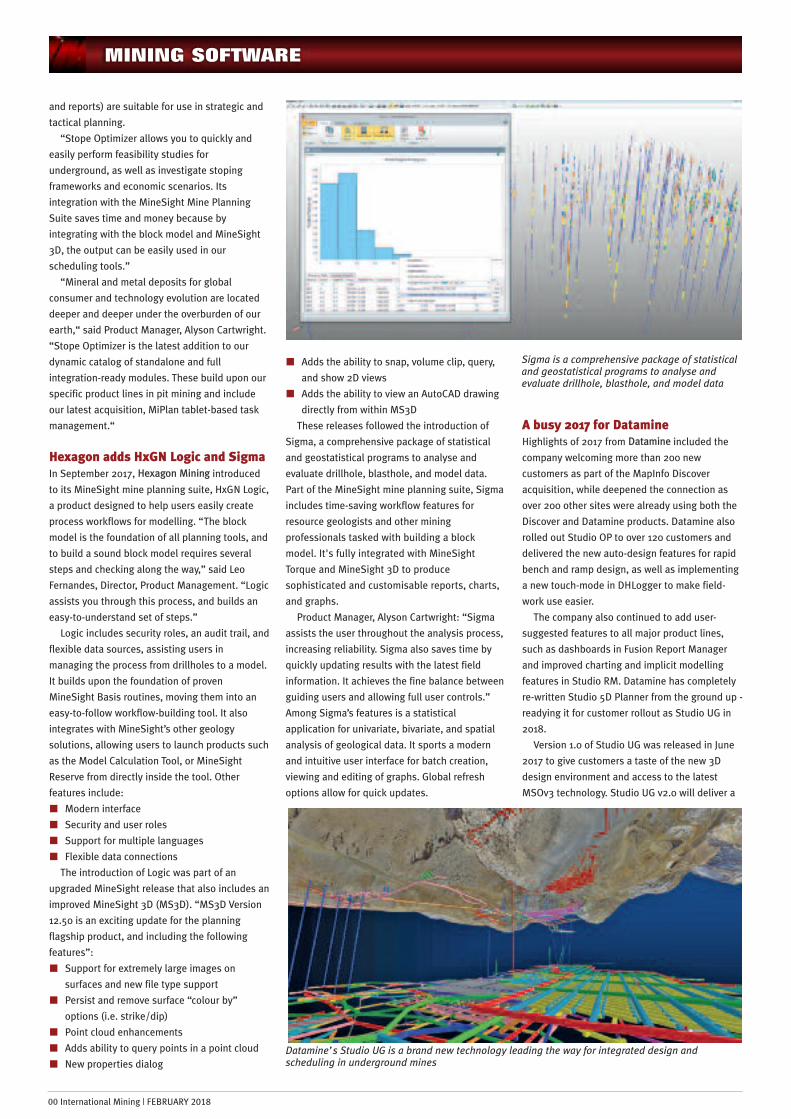
Sigma, a comprehensive package of statistical
and geostatistical programs to analyse and
evaluate drillhole, blasthole, and model data.
Part of the MineSight mine planning suite, Sigma
includes time-saving workflow features for
resource geologists and other mining
professionals tasked with building a block
model. It's fully integrated with MineSight
Torque and MineSight 3D to produce
sophisticated and customisable reports, charts,
and graphs.
Product Manager, Alyson Cartwright: “Sigma
assists the user throughout the analysis process,
increasing reliability. Sigma also saves time by
quickly updating results with the latest field
information. It achieves the fine balance between
guiding users and allowing full user controls.”
Among Sigma’s features is a statistical
application for univariate, bivariate, and spatial
analysis of geological data. It sports a modern
and intuitive user interface for batch creation,
viewing and editing of graphs. Global refresh
options allow for quick updates.
A busy 2017 for DatamineHighlights of 2017 from Datamine included the
company welcoming more than 200 new
customers as part of the MapInfo Discover
acquisition, while deepened the connection as
over 200 other sites were already using both the
Discover and Datamine products. Datamine also
rolled out Studio OP to over 120 customers and
delivered the new auto-design features for rapid
bench and ramp design, as well as implementing
a new touch-mode in DHLogger to make field-
work use easier.
The company also continued to add user-
suggested features to all major product lines,
such as dashboards in Fusion Report Manager
and improved charting and implicit modelling
features in Studio RM. Datamine has completely
re-written Studio 5D Planner from the ground up -
readying it for customer rollout as Studio UG in
2018.
Version 1.0 of Studio UG was released in June
2017 to give customers a taste of the new 3D
design environment and access to the latest
MSOv3 technology. Studio UG v2.0 will deliver a
MINING SOFTWARE
00 International Mining | FEBRUARY 2018
Sigma is a comprehensive package of statisticaland geostatistical programs to analyse andevaluate drillhole, blasthole, and model data
Datamine’s Studio UG is a brand new technology leading the way for integrated design andscheduling in underground mines
replacement for Studio 5D Planner scheduling
functionality that users have been awaiting.
Internal beta testing of this version is currently
underway. Customers will have access in early
2018 and the upgrade will be progressively
released throughout the year as customers have
time available to do their own testing and
familiarisation with the new product. “At
Datamine we are very excited about the speed,
efficiency and quality improvements in Studio UG
that make the job of mine planners a pleasure to
undertake.” The key improvements are
summarised as follows:
n Single step processing - one click delivers all
your wireframes, evaluation results and
schedule entities such as derived activities
n Huge speed improvements – completely new
wireframing and segmenting algorithms
deliver the data in a fraction of the time
n Multiple design files per type - makes it
easier to manage multiple designs in a single
scheduling project, avoiding the need for
combine and write-back processes.
n Improved EPS integration – dynamic
connection with changes reflected instantly
n 64 bit for large data sets, long field names,
mulitple 3D views with independent controls,
Ventsim integration, unlimited design
definitions, new auto-linking options
Elsewhere, the latest DataBlast update,
Version 2.0.0 is now being rolled out to
customers. DataBlast Version 2.0.0 “is a great
advance for the product with much of the
changes driven by feedback from customers.
With a multitude of enhancements, bug fixes, and
additional features added, this latest version of
DataBlast has been a massive undertaking. The
ability to integrate realised drill data back into
DataBlast has been an incredibly powerful tool,
making QAQC of drill patterns just simple. Having
this ability makes Charging and Initiation designs
much more accurate and helps users understand
their operations quicker and easier.”
Now added to the extensive list of supported
Drill Navigation systems, is Modular ProVision.
DataBlast features multiple methods of collecting
and integrating realised data from drill and blast
operations, making a powerful drill and blast
software system with the advantages of a robust
database. “Recognising the many weird and
wonderful ways people around the world manage
drill and blast, DataBlast now also allows users
to bring in realised data via CSV imports. With
this added flexibility, using the DataBlast
database system is even easier.”
DataBlast has now added a Fragmentation
Module, further closing the loop in drill and blast
operations. “Model multiple rock types and
compare particle size distribution of your drill
and blast designs to best achieve the blast result
desired. The module outputs elegant particle size
distribution graphs and tables to store against
your design.”
Mine planning – new TempoMinemax has announced the release of an all-
new Tempo for developing practical detailed
mining plans. Tempo has been redesigned based
on extensive industry collaboration to address
the challenges of translating strategic plans into
operational plans. “We’ve talked to many mine
planners out there who put a lot of effort into
developing high-value strategic mine plans, but
face difficulties transforming them into workable
detailed mine plans. The new Tempo is here to
bridge this gap and improve collaboration
between both levels of mine planning,” explains
Jim Butler, Minemax CEO.
With Tempo, planners can develop practical
plans that align with their strategic plan. Outputs
from any strategic scheduling software can guide
detailed planning in Tempo. For Minemax
Scheduler users, there is the added benefit of
effortless Scheduler-Tempo integration.
Tempo can also be used as a standalone tool
for creating optimal detailed plans respecting
mining, processing and trucking constraints. The
interactive user interface and guided workflows
make it easy to set up models for both block- and
polygon-based schedules.
Tempo incorporates multiple scheduling
technologies including the very fast Bienstock-
Zuckerberg (BZ) algorithm and the same 20-year
industry-proven MILP optimisation technology
found in Minemax Scheduler.
“Strategic mine planners can spend days just
trying to get a smoothed schedule – one where
the trucking or total material movement (TMM)
doesn’t have drastic peaks and valleys in it. This
process can be frustrating and take up valuable
time: when you fix one glaring dip or peak in the
schedule, another one appears somewhere else.”
The new smoothing constraints in Minemax
Scheduler 6.4.1 “give planners the ability to
produce a smooth practical schedule without all
those tedious manual iterations. The automated
smoothing means more time for running
additional scenarios or analysing results, and
there’s also the bonus of greater accuracy, and
even a better NPV.”
Minemax Scheduler’s new smoothing
constraints accomplish this by giving engineers
more control on the upward and downward
differences in material movement from one
period to another. “You just need to set this up as
difference constraints in your scenario and let the
optimisation find the best value schedule.”
This new release also solves another problem
planners have been struggling with: how to
ensure enough waste is mined for infrastructural
projects like roads and tailings dams before
processing can begin. Minemax Scheduler’s new
cumulative constraints make sure the necessary
amount of waste has been mined for construction
without over-constraining the schedule.
Minemax Scheduler 6.4.1 is available for
download to all maintained users the next time
they launch Minemax Software Manager (MSM).
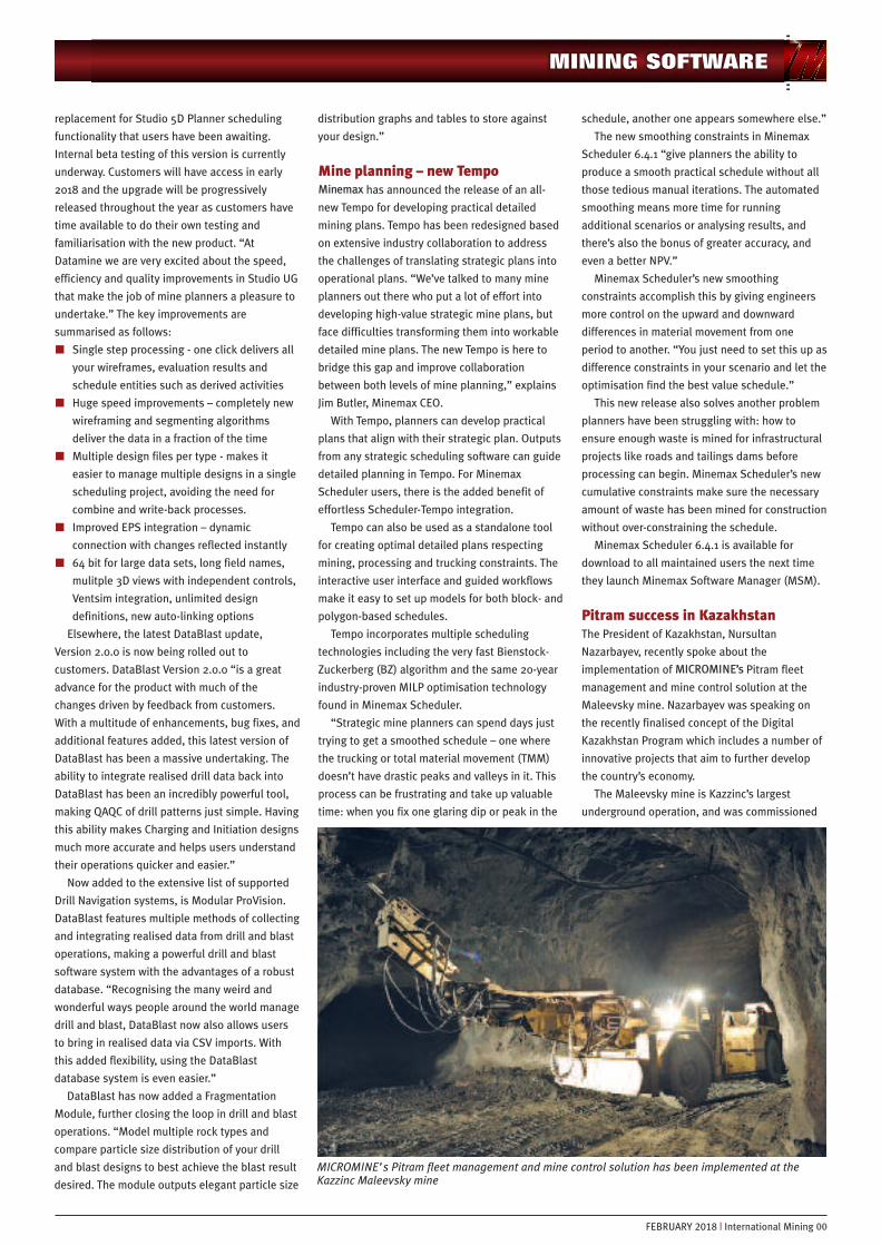
Pitram success in KazakhstanThe President of Kazakhstan, Nursultan
Nazarbayev, recently spoke about the
implementation of MICROMINE’s Pitram fleet
management and mine control solution at the
Maleevsky mine. Nazarbayev was speaking on
the recently finalised concept of the Digital
Kazakhstan Program which includes a number of
innovative projects that aim to further develop
the country’s economy.
The Maleevsky mine is Kazzinc’s largest
underground operation, and was commissioned
MINING SOFTWARE
FEBRUARY 2018 | International Mining 00
MICROMINE’s Pitram fleet management and mine control solution has been implemented at theKazzinc Maleevsky mine
00 International Mining | FEBRUARY 2018
in June 2000. It has a production of around 2.25
Mt/y.
President Nazarbayev introduced the Pitram
system and discussed the importance of digital
innovations in the mining industry and the wider
economy. MICROMINE Regional Manager Central
Asia Erick Kanaev commented: “It was a real buzz
for the MICROMINE team to hear the President of
Kazakhstan introduce the Pitram solution and
discuss the role data and technology will play in
the mining industry in the future.”
Pitram is a leading fleet management and
mine control solution that records data related to
equipment, personnel and materials, providing
an overall view of the current mine status and
therefore enabling improved control over
operations. Greater control allows sites to
increase production, reduce costs, and improve
safety and business intelligence. The Maleevsky
implementation took place in 2016 and
comprises of Pitram Mobile including Shift
Planner. Pitram Mobile enables the equipment
operators to capture data manually, via touch
screens, or automatically via integration with on-
board systems. By recording data related to
equipment, locations and operators, and
comparing this data to target values,
management will be able to gain greater control
of the production process. The ‘who’, ‘what’ and
‘where’ of mining activities are displayed so
management can monitor, analyse and respond
to events as they occur, eliminating obstacles
affecting the achievement of targets.
The Shift Planner module reflects the dynamic
environment of the mining operation by allowing
managers and supervisors to determine the best
way forward when delays or unexpected
occurrences affect task completion times.
“The Pitram implementation at Maleevsky was
a key strategic priority for Kazzinc and has
provided the company with greater control over
their operations,” Kanaev added.
Pitram will assist with increasing production,
reducing costs and improving business
intelligence and safety across the site.
Terrative and MineRP progressDundee Precious Metals Inc last year announced
that it had entered into a definitive agreement
with MineRP Holdings Proprietary Ltd, a provider
of integrated mining technical solutions, whereby
DPM has combined its proprietary wireless
underground communications technology,
managed within DPM’s Terrative Digital Solutions
division (Terrative), with MineRP, and acquired a
majority interest in MineRP. The deal was
completed in October 2017 when DPM acquired a
78% interest in the common shares of MineRP
Holdings Inc, a new Canadian subsidiary, which
holds all of the shares of MineRP, in exchange for
an investment of approximately $20 million in
cash and the transfer of the assets held within
Terrative.
“We are pleased to announce that the
transaction between DPM and MineRP has been
completed,” stated Rick Howes, President and
CEO at the time. “The combination of Terrative
and MineRP will create a leading technology
provider well positioned to further capture the
rapidly growing demand in the mining industry
for digital innovation,” added Howes.
With the August 2017 release of MineRP 4.0,
MineRP was in a position to extend its data-
integration capabilities to real-time operational
monitoring and control. For this purpose, the cost
effective, robust communication and data
acquisition technologies developed by Terrative,
combined with MineRP’s solutions will offer the
mining industry a fully integrated
communications platform and information
management framework to practically enable
millisecond mining.
“MineRP has always been at the forefront of
innovation focused on the Enterprise Big Data in
mining. Combined with the advanced digital
communication technologies offered by Terrative,
MineRP’s enterprise solutions provide a
revolutionary platform for robust digital
transformation for mining. The transaction
provides MineRP with the means to aggressively
implement our Spatial Enterprise Integration
strategy across the globe,” said Pieter Nel, CEO
of MineRP.
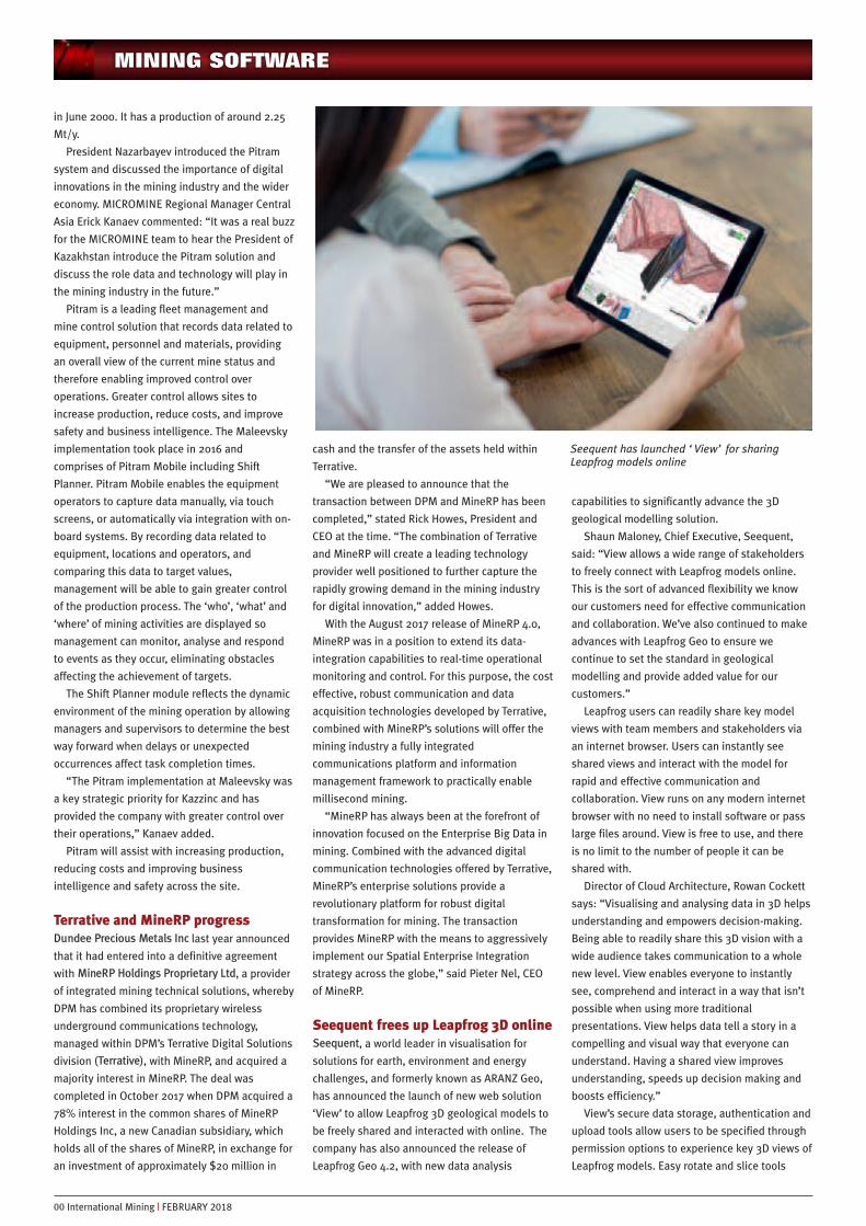
Seequent frees up Leapfrog 3D onlineSeequent, a world leader in visualisation for
solutions for earth, environment and energy
challenges, and formerly known as ARANZ Geo,
has announced the launch of new web solution
‘View’ to allow Leapfrog 3D geological models to
be freely shared and interacted with online. The
company has also announced the release of
Leapfrog Geo 4.2, with new data analysis
capabilities to significantly advance the 3D
geological modelling solution.
Shaun Maloney, Chief Executive, Seequent,
said: “View allows a wide range of stakeholders
to freely connect with Leapfrog models online.
This is the sort of advanced flexibility we know
our customers need for effective communication
and collaboration. We’ve also continued to make
advances with Leapfrog Geo to ensure we
continue to set the standard in geological
modelling and provide added value for our
customers.”
Leapfrog users can readily share key model
views with team members and stakeholders via
an internet browser. Users can instantly see
shared views and interact with the model for
rapid and effective communication and
collaboration. View runs on any modern internet
browser with no need to install software or pass
large files around. View is free to use, and there
is no limit to the number of people it can be
shared with.
Director of Cloud Architecture, Rowan Cockett
says: “Visualising and analysing data in 3D helps
understanding and empowers decision-making.
Being able to readily share this 3D vision with a
wide audience takes communication to a whole
new level. View enables everyone to instantly
see, comprehend and interact in a way that isn’t
possible when using more traditional
presentations. View helps data tell a story in a
compelling and visual way that everyone can
understand. Having a shared view improves
understanding, speeds up decision making and
boosts efficiency.”
View’s secure data storage, authentication and
upload tools allow users to be specified through
permission options to experience key 3D views of
Leapfrog models. Easy rotate and slice tools
MINING SOFTWARE
Seequent has launched ‘View’ for sharingLeapfrog models online

allow users of any experience level to see the
model from all angles and interact either with a
mouse or by touch-screen. Cockett adds: “It’s
also possible to tell the story of the modelling
process using compelling perspectives saved as
‘slides’, which help to focus the conversation on
key points of interest. View democratises access
to the data under discussion and the simplicity of
the web interface makes it ideal for all user
types.”
Leapfrog Geo’s latest 4.2 release significantly
advances capability with new tools for data
analysis. These new tools include scatter plots,
Q-Q plots, box plots, histograms and compositing
graphs, making effective use of Leapfrog’s highly
visual and interactive environment while helping
users gain new insights. Examples include the
ability to select data in the graph on the grade
distribution chart, filter in the 3D scene and then
visually interact and categorise. Users can also
visualise pre and post-composite histograms in a
single chart to validate compositing.
Visualisations have a sharp look and feel with a
report-ready appearance.
Seequent’s Director of Product and Innovation
Tim Schurr says: “We are committed to the
continual improvement of Leapfrog Geo to ensure
we set new standards in geological modelling.
We are well known for making frequent and
significant Leapfrog Geo upgrades and we plan to
maintain this trajectory. We are equally
committed to identifying new solutions like View
that extend Leapfrog’s value across our product
range and punctuate our intensive release
programme.”
Finally, Seequent has launched mineral
resource estimation solution Leapfrog® EDGE.
Leapfrog EDGE supports and advances industry
practices in mineral resource estimation by
applying the highly dynamic, intuitive and visual
capabilities that Leapfrog 3D geological
modelling solutions are world-renowned for. In a
streamlined workflow, Leapfrog EDGE introduces
innovative 3D visualisation to resource
estimation alongside industry standard tools for
estimating, domaining, geostatistical evaluation
and reporting.
Maloney stated: “Reliable resource estimation
is critical to create confidence for all levels of
decision makers. The geological model is the
foundation of any resource estimate so it was a
natural progression to develop a Leapfrog
solution for resource estimation. Leapfrog EDGE
builds on the success of Leapfrog Geo which
allows 3D geological models to be built in a very
dynamic and intuitive way.”
Using Leapfrog EDGE within Leapfrog Geo
creates a fully integrated workflow between the
geological model and the resource model,
allowing users to stay in the very visual and
dynamic Leapfrog environment. Estimates are
built from the Leapfrog model, avoiding data
corruption and error. A key feature of this
integration, is ‘dynamic updating’, where users
can add data or revise their interpretations at
any stage in the workflow and these changes
will automatically flow downstream and
update.
Schurr says: “This seamless connection
increases confidence as the user can give a
stronger emphasis to providing a robust
geological model to underpin the estimate.
Introducing this simple but substantial step
delivers major benefits as users can manage
change as they continue to interpret the
geology and make use of the latest
information.”
Leapfrog EDGE’s highly interactive data
visualisation tools for resource estimation help
users gain a greater understanding of their data.
Users can rapidly iterate and test different
parameters and then view the results in the rich
3D environment, whether it’s variography
estimation results or reporting and summarising.
The variogram tool is an example of a feature
that takes full advantage of Leapfrog’s highly
visual environment. Users can see the variogram
orientation and ranges in both 2D and 3D, and
then manipulate them directly in the 3D scene.
Changes dynamically update the variography and
block models. Schurr says: “We’ve had excellent
feedback from the pre-release programme. Users
are gaining new insight and clarity from
visualising and interacting with their resource
estimate the Leapfrog way.”
Leapfrog EDGE “has been thoughtfully crafted
with flexible workflows and uncluttered work
spaces designed to improve productivity and
reduce training time.” Schurr explains: “The tools
are user friendly, intuitive and easily accessible
so users can focus on the resource estimate
rather than mastering software. With sound
experience in resource estimation a new Leapfrog
EDGE user takes only a matter of days to become
proficient, while comparable software can take
months.”
GeoMine depolyed at RWTH AACHENUniversityThreeDify has announced the site-wide
deployment of its flagship product GeoMine to
the Institute of Mineral Resources Engineering
(MRE) at RWTH AACHEN University, the best
German University for Miners and Mining
according to the 2016 QS Rankings. This is a
significant win for ThreeDify as GeoMine is
replacing other General Mine Packages (GMPs)
for teaching and training of both students at the
University and mining professionals registered
for the European Mining Course (EMC) program,
“thanks to its integrated workflow, high
performance and ease of use. ThreeDify is
constantly evolving its products to help its clients
to be equipped for tomorrow. And with its
academic licensed software, ThreeDify is doing
the same for the next generation of mining
professionals.”
Recent developments in ThreeDify have been
focused on further refining the existing
integrated workflow between all GeoMine’s 10
modules to enhance flexibility and functionality,
and improve the overall user experience. “A key
differentiator for GeoMine over other GMPs is the
fact that GeoMine is a fully integrated solution
from geological modelling to production
scheduling in a single, unified workspace with no
data silos. This eliminates the need for
incremental import/export steps, and hence
greatly increases users’ productivity.” The
following is list of a few highlights:
- GeoModeler’s state-of-the-art surface
based Dynamic Anisotropy (DA) interpolation
system helps geologists improve accuracy of
their resource estimates.
- Octree based hybrid modelling kernel
enables handling of large and complex ore
deposits in a single session, which impose
challenges to conventional block modelling
MINING SOFTWARE
FEBRUARY 2018 | International Mining 00
ThreeDify has announced the site-widedeployment of its flagship product GeoMine tothe Institute of Mineral Resources Engineering(MRE) at RWTH AACHEN University
techniques. The maximum model space is half a
million x half a million x half a million instead of
1000 x 1000 x 1000 from traditional mining
software packages.
n FlowPit is more than 10 times faster than
most other pit optimizers on the market and it
can handle 100 million non-air blocks without
use of super-blocking. It is well-known that
super-blocking materially affects NPV or
solution accuracy.
n QuickPit is a rapid pit design tool which
allows mine planners to build a complete pit
or dump design with ramps in a matter of
minutes.
n The stope designs created by Stopemizer are
not only optimum for a given stope layout,
but also practical for engineering use as it
produces optimal mineable shapes in respect
of important geotechnical and geometric
constraints. Stopemizer can be applied not
only to all stoping methods, but also to all
caving methods including longwall, sub-level
caving and block caving.
n uCAD is a specialised CAD tool with both
manual and automatic level editors for
underground mine layout design.
n Optunimizer, an Open-pit to Underground
transition optimizer, is the only transition
optimization tool available in the market.
n OptimCut is a dynamic cu9t-off grade and
production rate schedule optimizer with an
integrated workflow and easy-to-use
graphical user interface (much easier to use
than other optimal scheduling tools which are
Excel spreadsheet based).
n iScheduler is an integrated activity and
resource based 3D mine production scheduler
for surface and underground mine
scheduling. It features a fully interactive 3D
activity and dependency editor, activity and
resource Gantt Charts, a PERT chart and a
Network Diagram, as well as a Resource
Leveling algorithm.
GeoMine has good compatibility with most
other file formats from 3rd party GMPs. “In
addition, our products are easy to use and cost
effective. Our licenses are very flexible. All the
modules within GeoMine can be licensed
independently. We provide web-based and on-
site training based on our customers’ needs.”
Deswik short-range ore controlmodelling & designIn 2017, Deswik released its short-range ore
control modelling & design tool, Deswik.OPSTS
(Open Pit Short-Term Scheduling). This tool
allows open pit mine planners to quickly produce
a production plan for the 9 to 12 weeks planning
range up, down to a daily planning resolution
from a single pit shell solid.
The overarching aim, when developing
Deswik.OPSTS was simplicity and speed. The
idea was to build a tool which could simply have
a single pit shell solid fed into it and within a few
seconds have a schedule created which has been
benched out and blocked. We have achieved this,
while also catering for complexities which come
from operating in the real world.
“The tool has been intended to provide
immediate feedback. As soon as you move a
point in your polygon or digitise a line, the solids
are cut, interrogated against the block model,
your formulae executed, and the task in the
scheduler updated with the new duration, and
the schedule recalculated. Normally a laborious
process in other products, it is executed
immediately in Deswik.OPSTS.”
“With the 2017.2 release, we have also
included support for drill and blast activities
which have a different shape to the excavation
task. As is the case in many operations, the drill
and blast process is run independent of the
excavation process, but, of course, they are inter-
dependent. So, if you have your blasting over a
15m bench defined using blast master polygons,
and mining is over 5m benches and you want to
allocate material destinations on a daily basis
(which is a lot smaller than the blasted area) –
Deswik.OPSTS can cater for this. Ensuring that
only blasted material is mined is also taken into
account automatically using dependencies
generated by the tool.”
As with all Deswik products it is nicely
integrated with other modules, including the
Deswik.OPDB (Open Pit Drill & Blast) and
Deswik.DO (Dig Optimizer) to streamline the
process.
Acquisitions: RPMGlobal acquiresMinVuRPMGlobal (RPM) recently entered into an
agreement to acquire 100% of the issued share
capital of MinVu, a privately owned Australian
headquartered group of companies and leading
global provider of mine-wide operational
reporting and analytics software solutions to the
mining industry.
This transaction represents the 7th software
acquisition RPM has undertaken in the past three
and a half years. It continues RPM’s
determination to deliver a complete Commercial
Off-the-Shelf enterprise platform for the mining
industry, built on open industry standards which
delivers a step change in value chain optimisation
through investments in software innovation.
MinVu are headquartered in Brisbane,
Australia and have been providing enterprise
operational software to their global customers
for over 18 years. Miners rely on the MinVu
products to understand exactly what their mining
equipment is doing at any time of the day or
night.
Development of the MinVu product has
involved significant customer engagement since
formation of the company in 1999. This
collaborative nature of development has resulted
in a comprehensive suite of integration adaptors
and data validation functionality being built. The
integration adaptors feed operational data into a
structured Operational Data Store which is used
by more than 250 standard reports and real time
dashboards.
The ability to connect and extract real-time
data from operational systems and then turn this
data into meaningful transaction based
information is at the heart of the MinVu
solutions. This includes, but is not limited to,
Fleet Management Systems (FMS), Dragline
Monitoring Systems, Dozer, Loader and Drill
positioning Systems and On-board Machine
Health Systems. All of this data is extracted,
validated and augmented to ensure that the
reports that are presented to operational
management can be used with absolute
confidence.
The mining companies that use MinVu every
day in their mining operations include BHP,
Glencore, Anglo American, South 32, Yancoal, US
Steel, Canadian Natural Resources, PT Bumi, Ok
Tedi, New Hope Corporation, Dominion
Diamonds, and Wesfarmers. MinVu allows these
mining companies to have a real-time view of
operational data (from all of the discrete items of
mining equipment operating in a mine) in one
report.
Commenting on this acquisition, RPM CEO and
Managing Director Richard Mathews said, “Since
acquiring a copy of the Fewzion Short Interval
Control (SIC) product twelve months ago we have
been building the underlying architecture to
enable us to deliver a fully automated Short
Interval Control system. Having the ability to
automatically take live data feeds off our
customer’s operational systems will dramatically
accelerate our move into the Short Interval
Control space where real time plan verses actual
performance is the goal.”
“MinVu is the only company that we know of
who have built a comprehensive suite of
standard integration adaptors across all key
operational systems that operate in a mine. As
such we believe the integration, data validation,
structured Operational Data Store (ODS) and
associated reporting will give RPM a commanding
head start over other software vendors who
decide they want to provide a mining Short
Interval Control system in the future.”
“While the major consideration for this
acquisition was advancement of our Short
Interval Control System many of our other
products will benefit from access to operational
data via our enterprise planning framework
(EPF).”
00 International Mining | FEBRUARY 2018
MINING SOFTWARE

“The company’s Ultra Short Term Planning
product XECUTE will be able to immediately
utilise the MinVu integration adaptors to bring
back data such as Equipment GPS coordinates,
actual bucket positions, material movements,
drill-hole details, actual production rates and
incorporate them into the production plan. This
will extend the functionality of XECUTE whilst
increasing the number of modules in the RPM
suite.”
“Our strategic maintenance product AMT will
use MinVu’s Operational Historian to store actual
health data from on-board systems to be
compared against planned maintenance events
and feed this into our Dynamic Life Cycle Costing
engine. This will bring together asset life cycle
costing and condition based monitoring.”
“Having an Operational Data Store enables
RPM to not only deliver rich plan vs actual
analysis, but we can use this data to adjust
planning parameters to align with what is
actually happening in the operations. This
seamless integration helps planners increase
the level of predictability in their production
plans.”
“RPM’s HAULSIM and SIMULATE products will
also benefit from being able to take direct feeds
from many different FMS systems. The GPS
position data as well as a detailed breakdown of
the haulage cycles will accelerate model
calibration. Importantly MinVu already has the
logic to clean the data (removing erroneous
results) which has always been the major issue
with the use of on-board data feeds.”
“The combination of RPM and MinVu’ product
offerings will create the most advanced single
vendor Short Interval Control System for mining
companies. It will assist to reduce the cost of
mining as operational staff will be able to
monitor the performance of their equipment in
real-time using the most advanced user interface
in the industry.”
Co-Founder and Director of MinVu, Mike Taylor
said: “For the last 18 years we have worked
tirelessly building software solutions with our
customers that help them improve their
operations. We have always wanted our products
to be integrated with the industry’s leading
production, costing and simulation systems and
this transaction delivers exactly that.”
“We have been very impressed with RPM’s
vision for the industry and the investment they
are making in their products in what has been a
difficult period for suppliers to the mining
industry. We are convinced that the MinVu
product suite will benefit from increased
investment and the sales and marketing support
which RPM can offer it right around the world. As
evidenced by the structure of this deal and the
consideration we have accepted for RPM shares,
we firmly believe in this complementary
combination of the two product suites and
management teams.”
Case study: Maptek EvolutionschedulingA high-grade gold deposit in Western Australia is
now relying on Maptek Evolution cloud-based
technology to solve scheduling challenges. The
Enterprise deposit is located 68 km northwest of
Kalgoorlie within the Ora Banda district on the
eastern limb of the Kurrawang Syncline.
Historically mined by open cut methods to 100 m
Enterprise is a large high-grade deposit and an
important component of the Norton Gold Fields
production plans in the next five years.
The technical services department wanted an
optimal scheduling solution for the open pit
operations that would allow them to work
directly with Multiple Indicator Kriging (MIK)
block models and non -MIK block models in the
same multi-mine schedule scenario. This would
reduce the amount of data manipulation required
and mitigate mine planning risks. Moreover, the
cost associated with waste material was an
important factor. In addition, the encapsulation
required to isolate the acid reactive material had
to be considered. Norton Gold Fields, part of Zijin
Mining Group, has acquired Maptek Evolution
software to help address these challenges.
At a strategic level, alternative scenarios
generated in Evolution will be evaluated from a
cutoff grade optimisation point of view, with
particular emphasis on the haulage component.
The productivity rate for each hydraulic excavator
model is associated within the block model for
each material type. This provides full flexibility
for the mine planning team to evaluate multiple
alternatives in a short time using cloud-based
technology.
Waste dump encapsulation is one aspect that
requires special attention from an environmental
viewpoint. Encapsulation needs to be controlled
during the scheduling process. Information is
imported into Evolution to allow simulation of
different mine schedule scenarios, ensuring that
this important variable cannot be ignored and is
managed efficiently.
The graphical interface provides the visual link
for communicating the mining implications of
different scenarios with various stakeholders,
improving understanding and subsequent
actions. Every piece of data is populated back
into the block model, allowing information to be
managed and shared across different
departments for incorporation in the short-term
mine planning process.
“Evolution has given the mine planning team
at Norton Gold Fields all of the tools and options
required to evaluate and add value to the
Enterprise project.”
Case study: Enhancing narrow veininterpretationThe Klondex Mines Ltd underground gold-silver
mine uses Maptek™ Vulcan™ to optimise
various stages of their operation. The Fire Creek
Mine, located in north-central Nevada, is a high
grade epithermal vein deposit. Underground bulk
sampling began in 2013 and commercial mining
commenced in 2014.
Fire Creek uses cut and fill and long hole
stoping mining methods. Both methods require
narrow mining dimensions to minimise dilution
and maximise ore recovery. The behaviour and
development of the veins at Fire Creek can be
complex, therefore detailed geological modelling
is required to optimise success.
In an effort to build a better model of the
deposit, geologists review historic core logs and
photos. As with many projects, geologists’
interpretations of drill core vary and logging data
is often inconsistent through different
generations.
Fire Creek is no exception. The geology team
has spent significant time sifting through historic
core photos and re-analysing core logs. To
facilitate this work, the geology team needed a
way to incorporate diamond drill core photos that
illustrate lithology, alteration and the various
styles of mineralisation alongside the geological
data within Maptek Vulcan.
Using Vulcan fundamentals learned on the job,
brainstorming sessions during a Maptek site
visit, and skills newly acquired during a lava
scripting course, the geology team was able to
turn this concept into reality.
A custom lava script was built off existing
Vulcan functionality to enable users to display
MINING SOFTWARE
FEBRUARY 2018 | International Mining 00
The Klondex Mines Ltd Fire Creek underground gold-silver mine uses Maptek™ Vulcan™ to optimisevarious stages of their operation

00 International Mining | FEBRUARY 2018
images of core boxes directly down the drill trace.
At the macro scale, geologists are able to view
the differences in lithology, rock conditions, and
alteration throughout multiple holes on drill fans
and in three dimensions. “It takes time up front
to set up the naming convention and then roll out
the new process to make sure the photos are
actually usable. But once the leg work is done,
being able to spin the drillholes around with the
photos loaded, adds a whole new dimension to
how we use our data,” commented mine
geologist Eric Hobbs.
The output allows the team to quickly review,
correct, and test broader interpretations,
providing a better understanding of the ore
system, which results in improved models.
With computing enhancements delivered in
Vulcan 10 and higher, the team is able to review
the image registrations, assay data, and other
geological information. Geologists can zoom out
to view broader alteration and lithology
differences between holes, or zoom in to the full
resolution of the photo to look at individual vein
textures and characteristics.
“When I am flagging a new drillhole, I load the
vein and lithology triangulations alongside the
core photos. I can see exactly what the intercepts
look like in relation to the surrounding drillholes
and data,” said Hobbs. “I can quickly view the
core photos for multiple drillholes from the same
drill fan and see how the vein behaves along
strike, changes in elevation, lithology and so on. I
can then make a confident judgement on how to
flag that intercept and adjust our lithology
triangulations on the fly,” he concluded.
The biggest benefit to the mine site is an
increased confidence and understanding of the
deposit. They are able to build and update
geological models significantly faster than
previously. This leads to more consistent logging
data, allowing for faster target recognition for
surface and underground drilling programs, and
ultimately results in better ore/waste calls from
the ore control geologists.
Through ‘out of the box thinking’ and lava
scripting training, Klondex geologists have
created a step change in the level of
understanding of the Fire Creek deposit.
Ventilation software partnershipRPMGlobal (RPM) in 2017 entered into a software
integration partnership with Chasm Consulting to
enable RPM and Chasm to further develop an
integration between the industry leading Chasm
mine ventilation software Ventsim™, with RPM’s
underground software solutions. RPM’s
underground software solutions provide a
platform for successful mine planning in
underground mines around the world. With the
latest in technology innovation at the core of
RPM’s software solutions, partnering with Chasm
for best-of-breed ventilation software was a
natural fit.
RPM says it knows that it is through the
connected, digital mine that mining companies
will be able to reduce costs, maximise
operations, increase productivity and deliver
shareholder value. “Our solutions have always
put the mining enterprise at the centre to ensure
that information across the entire mining value
chain is not siloed but shared empowering
stakeholders across the business to make
informed decisions about their operations. This
integration partnership illustrates RPM’s
continual drive to only deliver enterprise wide
solutions.”
Chasm Consulting’s Ventsim product is the
leading underground mining ventilation software
and was originally introduced to mining
operations in 1994 to help visually design,
improve and optimise underground ventilation
systems. It is now licensed to over 1,000 mine
sites, consultants, universities, governments and
research agencies around the world.
Under the integration agreement, RPM and
Chasm will collaboratively develop tight
integration between RPM’s Underground
Solutions and Chasm’s Ventsim, allowing joint
customers to quickly simulate mine ventilation as
the mine develops.
Commenting on the new software integration
partnership, RPM’s CEO and Managing Director
Richard Mathews said: “We are pleased to have
entered into the software integration agreement
and partnership with Chasm Consulting that will
allow RPM and Chasm to continue their work to
develop the integration between our market
leading solutions”
Mathews concluded “With over 1,000
customers of the Ventsim solution, they are
clearly the industry leader in underground mine
ventilation and we look forward to furthering the
integration of our respective products to deliver
real value to our underground mining customers
in delivering the digital mine.”
Geomorphic reclamation usingCarlson Natural RegradeA recent article detailed a geomorphic-based
process of mining reclamation carried out at the
El Site of El Machorro mine in SpainMachorro
mine (at the edge of the Alto Tajo Natural Park,
East Central Spain), which utilised the GeoFluv™
method within Carlson Natural Regrade software.
It was used to design small watersheds as part of
the mining reclamation topographical solution. In
addition to detailing the design and reclamation
with Natural Regrade, the paper also describes
their monitoring of the site for five years (2012–
2017) and the positive results following the
reclamation. Highlights include:
MINING SOFTWARE
RPMGlobal last year entered into a softwareintegration partnership with Chasm ConsultingPty Ltd (Chasm) to enable RPM and Chasm tofurther develop an integration between theventilation software Ventsim™, with RPM’sUnderground software solutions
The GeoFluv™ method implemented by the Carlson Natural Regrade software has been used at ElMachorro mine to design small watersheds as a mining reclamation topographical solution
00 International Mining | FEBRUARY 2018
n A geomorphic reclamation (GR) process –
designing, building and monitoring- is
described
n After adjustments to grading errors, the
reclaimed area has high landform stability.
n GR performed as an efficient alternative to
traditional mining reclamation.
“This research describes a geomorphic-based
process of mining reclamation carried out at the
El Machorro mine (at the edge of the Alto Tajo
Natural Park, East Central Spain) and its
monitoring for five years (2012–2017). The
GeoFluv™ method implemented by the Natural
Regrade software has been used to design small
watersheds as a mining reclamation
topographical solution. The procedure included:
(i) finding a suitable reference area with stable
landforms and acquiring inputs from them; (ii)
designing two first-order stream watersheds; (iii)
building the planned landscape; and (iv)
monitoring the hydrological and erosive –
sedimentary response of the reclaimed
watersheds. This process is in itself a contribution
to global advancement of reclamation best
practices, because there are very few geomorphic-
based mining reclamation examples, and even
fewer that include their multi-annual monitoring.
Sediment yields were obtained comparing Digital
Elevation Models (DEM) acquired by Total Station
(TS), Terrestrial Laser Scanning (TLS), differential
Global Positioning System (GPS) and topographic
reconstructions (interpretations). An H-flume with
turbidity and water pressure sensors allowed
quantifying runoff and suspended sediment.
Sediment yield progressively decreased with time
attaining a current low value (4.02 Mg ha−1
yr−1). Water discharge and suspended sediment
concentration have also decreased with time.
Initially, high sediment yield values were
obtained. They are interpreted as being
triggered by grading errors that deviated from
the design, so that runoff adjusted construction
irregularities during that period by erosion and
sedimentation. After those adjustments, the
reclamation surface became more reflective of
the design and the resulting surface remained
very ‘stable’. The deduction is that the
geomorphic-based reclamation has re-
established an approximate steady-state or
dynamic equilibrium, where hydrological and
erosive – sedimentary functionality operate now
at rates comparable to the surrounding natural
land. Although further research is required to
confirm long-term stability, geomorphic
reclamation appears as an efficient mining
reclamation alternative solution to the
traditional approach of gradient terraces and
downdrains, which require frequent and costly
maintenance, in the highly erodible setting of
the Alto Tajo Natural Park surroundings, as well
as in most open pit mines.”
Alastri’s tactical mine schedulingsolutionIn late 2016, after four years of development,
Alastri announced the release of the Alastri
Tactical Scheduler (ATS) for detailed tactical
scheduling in open-pit hard rock mines. At the
time the company stated: “Creating mine plans in
today’s cost-cutting environment requires that
engineers produce detailed schedules which can
be verified and trusted to ensure site production
targets will be met while adhering to strict
restrictions on available equipment and
operating expenses. ATS offers users the ability
to easily model their operations in an
unparalleled level of detail, incorporating
schedule solid creation and reserving, mixed-
fleet dynamic haulage (including autonomous
haulage), optimised grade targeting and
blending, and branching scenario scheduling.”
ATS had successfully passed rounds of client
testing on two of the largest and most complex
iron ore operations in Australia. Managing
Director Daniel Narayan commented: “We are
very pleased with how quickly new users were
able to configure complex scenarios and
generate practical schedules. Not only are our
clients generating more detailed and verifiable
mine schedules, they are also generating results
far faster than before.”
ATS is focused on detailed tactical mine
scheduling for any time horizon. For short term
scheduling, users are offered the ability to
precisely restrict their schedules based on
available loading and hauling units, including
fleets with different types of equipment with
complex loader-truck matching rules. For longer
term scheduling, users can provide ATS with
grade/blend targets and plant constraints, and
ATS automatically sends material to the right
destinations to achieve the highest value.
The scheduler is the achievement of a dream
that has been almost 20 years in the making for
Principal Consultant Max Bygraves. “Scheduling
is often about achieving a delicate balance
between multiple competing objectives – a
balance that can take years of experience to
master. We’ve incorporated domain knowledge
from decades of mine scheduling into ATS, so
that producing accurate schedules in time and on
budget is easier than ever.”
Alastri says it has a strong history of delivering
high-performance mine planning software. This
includes Haul Infinity and Rapid Reserver, which
are best-in-breed solutions for haulage modelling
and generating scheduling reserves respectively,
and are part of the ATS mine scheduling software
suite. “Historically, we have drawn on pc gaming
technology to create easy-to-use, attractive, and
responsive software for the mining industry,”
said Daniel Narayan. “In the course of creating
ATS, we have continued this trend, and have
developed new technology for automated setup,
faster scheduling, and more detailed and visually
impressive schedule animations.
Geosoft releases 9.3 software updateGeosoft has announced the release of its 9.3
software update for Oasis montaj, Target and
Target for ArcGIS. The release includes new 3D
visualisation features and enhancements,
including more voxel display options, improved
3D rendering, and the ability to create animated
videos from snapshots.
Geosoft’s 9.3 release delivers an improved 3D
experience, with new voxel smoothing and
display options, upgraded 3D graphics
performance, and the ability to create animated
movies of 3D models. The voxel smoothing
option uses real-time interpolation of data to
display a smooth image, making it easier to
interpret and understand the data by allowing
you to see more detail than with raw voxel cells.
New voxel caching and pyramiding algorithms
with OpenGL shader technology provide better
performance when displaying large voxel models.
The 3D animation tool combines multiple 3D
snapshots to create a video which can be saved
and shared, as a WMV or MP4 movie file, with
project stakeholders.
Within Target and Target for ArcGIS, new
classified colour options for 3D drillhole collars
and traces provide a convenient way to display
additional information about drillholes, such as
the drillhole status, project name, zone name, or
the year it was drilled. A new legend tab in the
3D Viewer enables quick and easy access to the
colour legend bar and editing tools.
The release also includes updates for many
Oasis montaj software extensions, with new
features added to VOXI Earth Modelling, Drillhole
Plotting, Induced Polarization, UXO Land, UXO
Marine and UX-Analyze.
RPM now offering rental optionsIn October 2017, RPMGlobal commenced
providing rental options for users of its software
as an alternative to its customary perpetual
licensing approach. Commenting on this strategic
change, RPM’s CEO and Managing Director,
Richard Mathews said: “After extensive
consultation with our investors we have decided
to evolve our conventional licensing approach,
which sees the company’s annual results heavily
impacted by ‘once off’ perpetual software license
sales that historically occur during our fourth
quarter each year, to include a software rental
option for our customers.”
“Whilst the key objective of this change is to
transition the company towards a recurring
revenue stream and reduce our reliance on fourth
quarter software sales, we do believe our
MINING SOFTWARE

00 International Mining | FEBRUARY 2018
MINING SOFTWARE
customers will be appreciative of the flexibility to
consider more than one way to gain access to our
software.”
“Technical mining software vendors have been
slow to provide rental or subscription type
offerings to their customers due to the strain this
approach puts on the company’s balance sheet
with the licence revenue, development costs and
potential infrastructure costs spread across
multiple years. Our already strong balance sheet
coupled with the timing of the company’s annual
maintenance invoicing to its customers which
occurs at the beginning of each calendar year,
means the time is right financially to make this
important structural change.”
“Software users across all industries have for
some time considered renting software as the
way of the future. However, mining is usually
carried out in isolated regions of the world which
have connectivity challenges not seen in other
industries. This is why miners have traditionally
struck with on premise software applications
operating on their own infrastructure. We have of
course been monitoring this trend over time and
the improvements in connectivity and technology
advances mean different methods of software
interaction are now becoming more commercially
and technically feasible.”
“In the mining industry traditional “cloud
competing” offerings will not always make sense
– especially where there are data intensive
applications, usage at remote sites where
network connectivity is poor or non-existent or
where the software needs to be interfaced with
different products that may not be network or
server enabled. Because of this RPM will
continue to offer the ability to procure licenses to
its software that can be installed on the
customer’s own IT systems at site.”
“RPM’s new rental models will enable our
customers to scale software usage up and down
over time according to their actual requirements
with minimal upfront risk or capital outlay. We
will also be offering a number of different
licensing options for our software products to
provide our customers with alternatives to the
traditional “user” type license restriction with a
“unit of measure” more applicable to our
customers’ operations. For example, in the case
of our AMT asset management software, we are
considering offering options where the
customer’s license is linked to their number of
“assets under maintenance”.”
Mathews concluded by saying “While this
change will affect many aspects of our business
including sales, marketing and product
development, the main impact will be a timing
one as traditional upfront revenue will instead be
spread across future years. Whilst the annuity
revenue delivered by software rentals will result
in a stronger underlying business our reported
annual financial results will understandably be
impacted in the first couple of years for the
benefit of future years.”
Software for virtual minesMining3 is commercialising a 3D-based software
platform that can create and simulate a virtual
mine. By positioning precisely where things are
underground, it opens up opportunities such as
controlling robots and tracking movement of ore
of different grades. “Imagine being able to
control a vehicle or drone inside a mineshaft from
anywhere in the world without fear of it crashing
into mine walls or workers. Picture being able to
track the metal in a car chassis from ore to
finished product. Or, consider the ability to store
data so that it interacts automatically with
information from other sources to provide a more
profound understanding of a mine and its grade.
Such things are fast becoming possible using a
new 3D-based internet platform known as
VoxelNET.”
The technology has been developed through
Mining3 — the industry-funded partnership
between industry, original equipment
manufacturers (OEMs) and several research
groups that include CSIRO. “VoxelNET is all about
a more efficient way of storing, analysing,
sharing and visualising spatially-based
information,” CSIRO 3D system researcher and
Mining3 technology leader, Charlotte Sennersten,
says. “It is ideal for spatially-based enterprises,
but particularly for the mining and minerals
industries.”
The internet systems currently used to store,
analyse, transmit and display information was
built for handling 2D text and documents. It has
to be modified with software plug-ins to work
and display information in 3D and VoxelNET
supports this directly. VoxelNET can be used to
generate a virtual mine and simulate its
operation in 3D. It stores remote sensing
information on the fly and enables the tracking or
control equipment or material remotely. It is also
able to be shared and accessed by different
devices simultaneously and can pull data from a
range of sources such as sensors, CAD files and
point cloud devices.
The virtual 3D space is made up of voxels, an
equivalent to 2D pixels on a screen. Voxels are
cubes, the size of which can be defined to fit the
task at hand. Each voxel in VoxelNET can be
precisely located. The voxels can hold
information such as density, ore grade, rock
hardness, or even safety regulations and legal
requirements. They can be programmed to store,
integrate and cross-correlate data from many
different sources. They can also act
autonomously to find and process data, and to
interact with each other in precise ways.
The voxels come in several different varieties.
“Spatial voxels”, for instance, are linked directly
to a precisely defined one-metre by one-metre
grid of the Earth’s surface — from 5 km
underground to 20 km above ground. They can
be used to simulate and connect to reality.
Whereas, the matter within “material voxels” can
be labelled and traced wherever it moves. Every
step and change can be accounted for using the
new blockchain technology. The provenance of
ores of different grades can be sourced and
traced to enable precise planning for mining with
lower impact.
Voxels and the data they contain can also be
subject to different defined layers of security.
Broad access can be allowed to some information
or simulations, while access to more confidential
information can be restricted. Data can be
spatially tagged or completely anonymised. The
platform already allows input of drillhole data,
real-time vehicle data, remote-sensing data and
2D and 3D maps by a single client or user. The
applications supported include simulation,
remote vehicle control and interactive
visualisation.
Mining3 is commercialising the VoxelNET 3D-based software platform that can create andsimulate a virtual mine

At present, VoxelNET is only available through
consultation with researchers at Mining3. This
year, it is hoped it will be released as a
commercial product. Mining3 is looking at how to
support its ongoing development into a cloud-
based distributed platform. IM
MINING SOFTWARE
00 International Mining | FEBRUARY 2018