Embed Size (px)
Citation preview
Mission Bay RowingTraffic Pattern & Safety
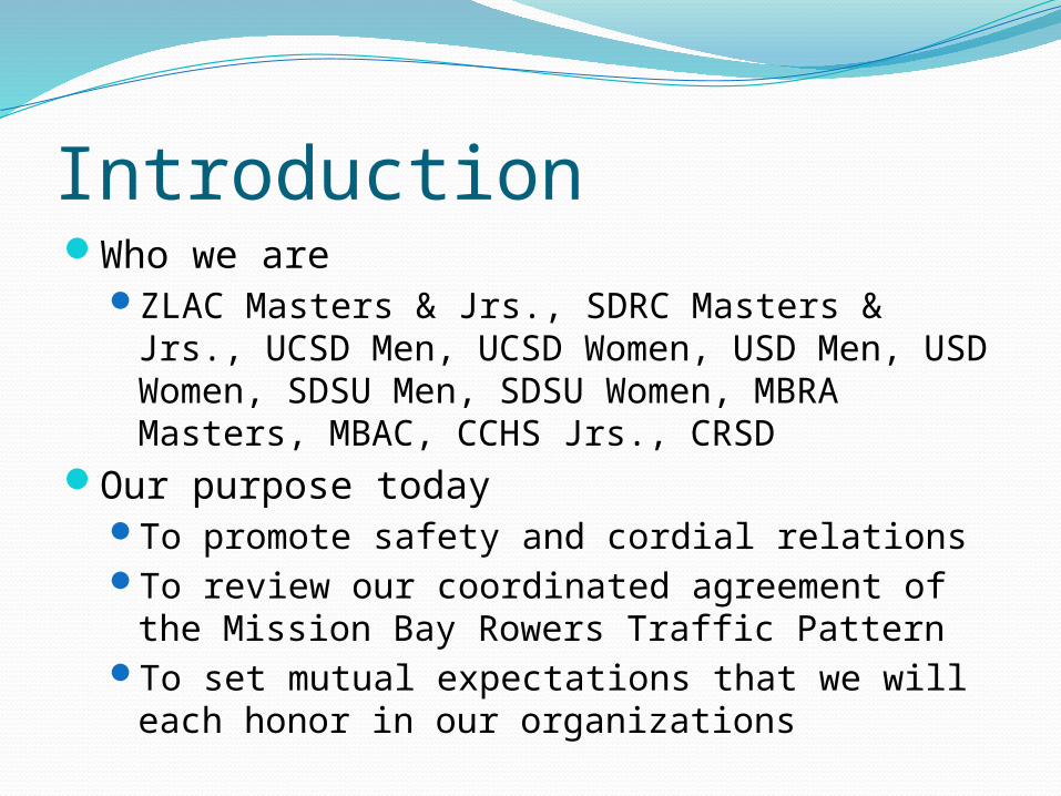
IntroductionWho we are
ZLAC Masters & Jrs., SDRC Masters & Jrs., UCSD Men, UCSD Women, USD Men, USD Women, SDSU Men, SDSU Women, MBRA Masters, MBAC, CCHS Jrs., CRSD
Our purpose todayTo promote safety and cordial relationsTo review our coordinated agreement of the
Mission Bay Rowers Traffic PatternTo set mutual expectations that we will each
honor in our organizations
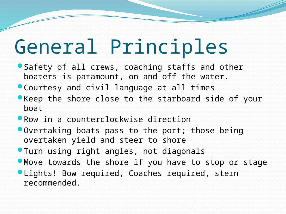
General PrinciplesSafety of all crews, coaching staffs and other boaters
is paramount, on and off the water.Courtesy and civil language at all timesKeep the shore close to the starboard side of your
boatRow in a counterclockwise directionOvertaking boats pass to the port; those being
overtaken yield and steer to shoreTurn using right angles, not diagonalsMove towards the shore if you have to stop or stageLights! Bow required, Coaches required, stern
recommended.
Safety San Diego Mission Bay Lifeguard – on water
619-221-8800Off the water, dial 911US Rowing Safety Information
http://www.usrowing.org/safety.aspxBasics
Each organization has a safety policy, read itKnow how to swimUnderstand basic safety & emergency proceduresKnow the weatherKnow the traffic pattern
Handling ProblemsStop your boat and don’t contribute to, or
become part of an existing problemBe cordial and direct with regard to continuing
your respective rows – stay focused and safeDiscuss the issue with your safety officer,
coach, captain, or other leadership off the water
Leadership is encouraged to contact other leadership, express the date, time, place of the incident in the form of accurate feedback.
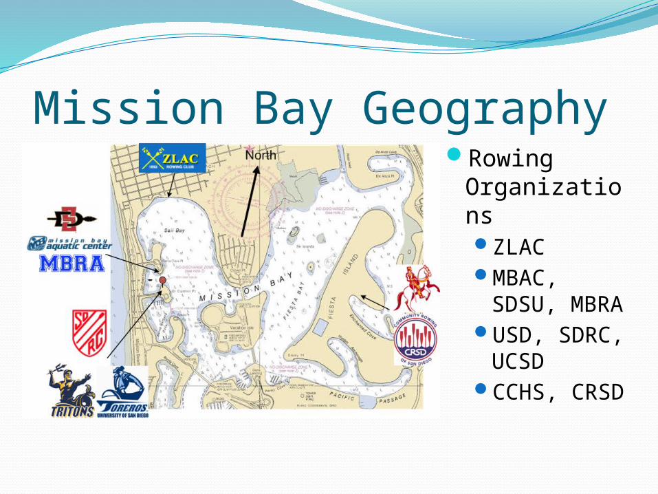
Mission Bay GeographyRowing
OrganizationsZLACMBAC,
SDSU, MBRA
USD, SDRC, UCSD
CCHS, CRSD
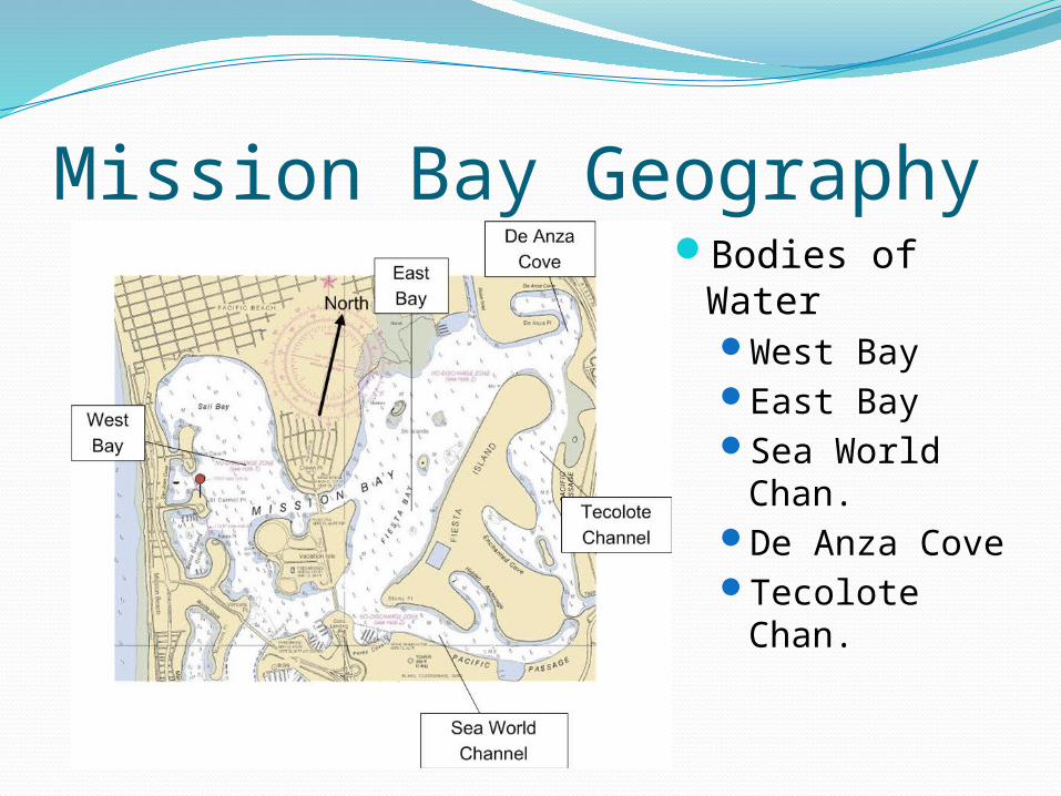
Mission Bay GeographyBodies of
WaterWest BayEast BaySea World
Chan.De Anza CoveTecolote
Chan.
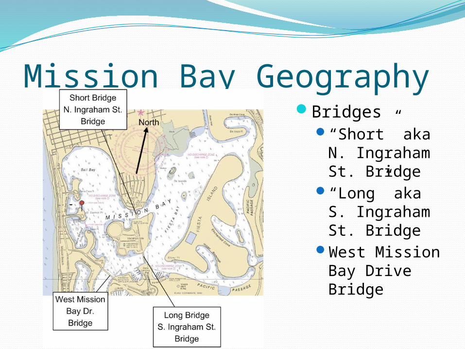
Mission Bay GeographyBridges
“Short” aka N. Ingraham St. Bridge
“Long” aka S. Ingraham St. Bridge
West Mission Bay Drive Bridge
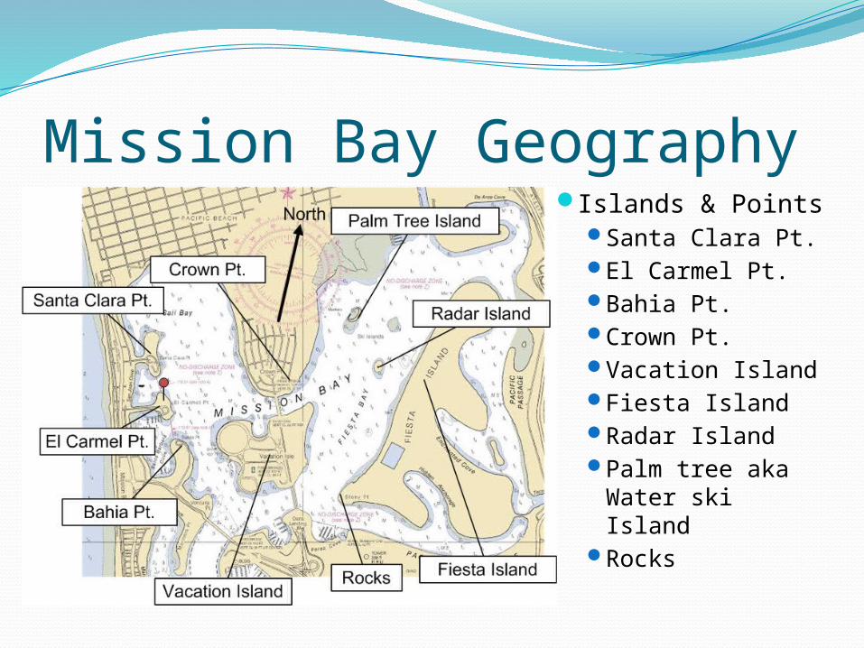
Mission Bay GeographyIslands & Points
Santa Clara Pt.El Carmel Pt.Bahia Pt.Crown Pt.Vacation IslandFiesta IslandRadar IslandPalm tree aka
Water ski IslandRocks
General Traffic FlowCounterclockwiseStarboard oar closest to shoreCross traffic patterns at a 90 degree angle,
not diagonalsStage outside of traffic lanes and close to
shoreNo stopping in Sea World channelDon’t take your half from the middle
Divide the area into thirds, row in the outer third, not the middle of the pattern
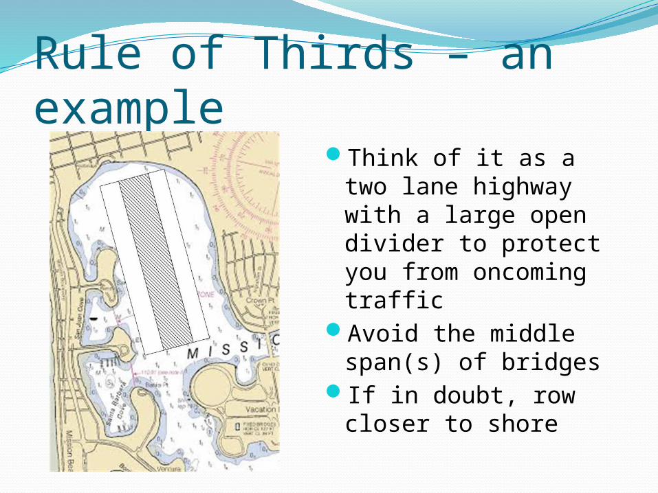
Rule of Thirds – an exampleThink of it as a two
lane highway with a large open divider to protect you from oncoming traffic
Avoid the middle span(s) of bridges
If in doubt, row closer to shore
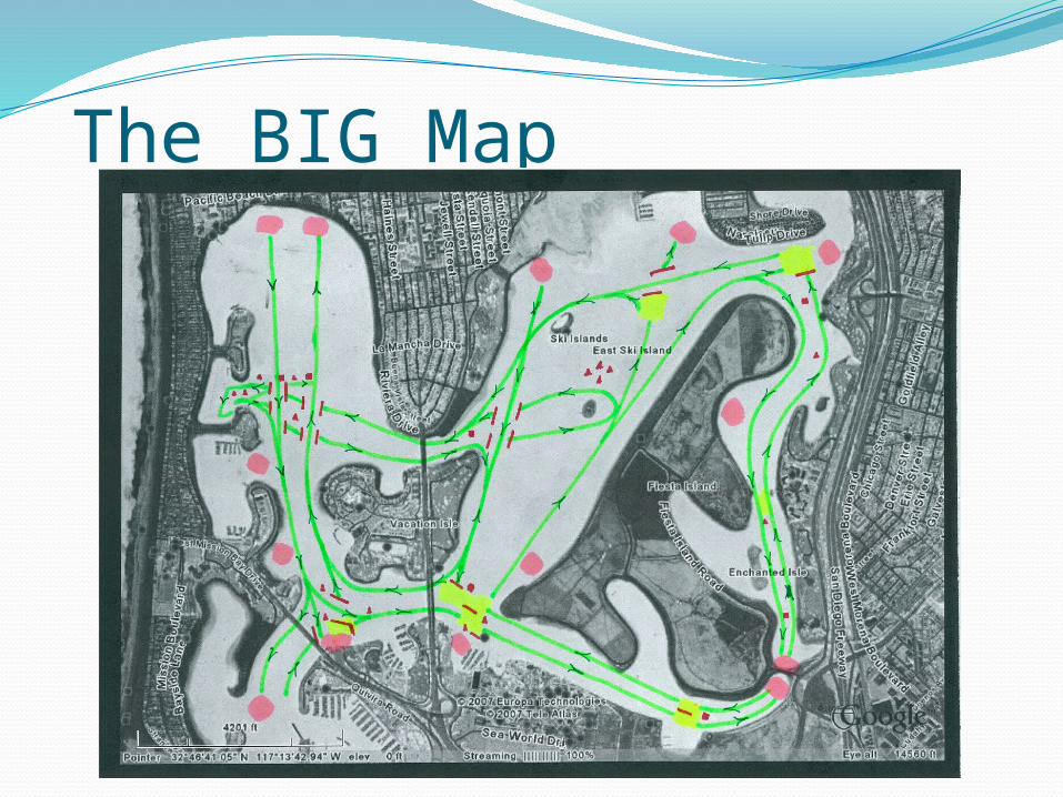
The BIG Map
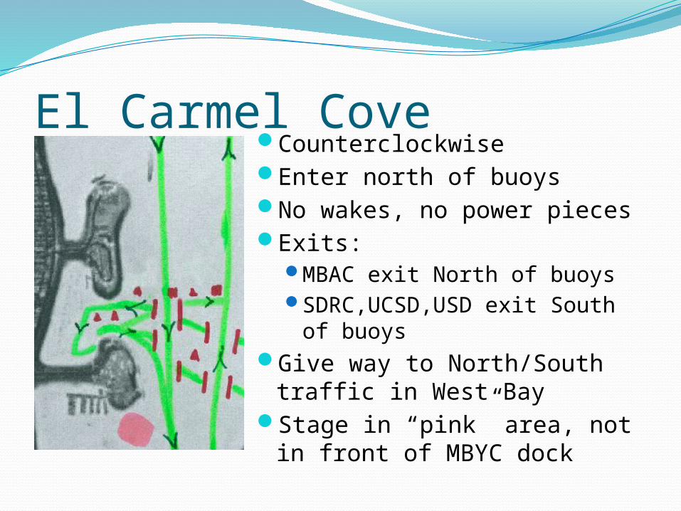
El Carmel CoveCounterclockwiseEnter north of buoysNo wakes, no power piecesExits:
MBAC exit North of buoysSDRC,UCSD,USD exit South
of buoysGive way to North/South
traffic in West BayStage in “pink” area, not in
front of MBYC dock
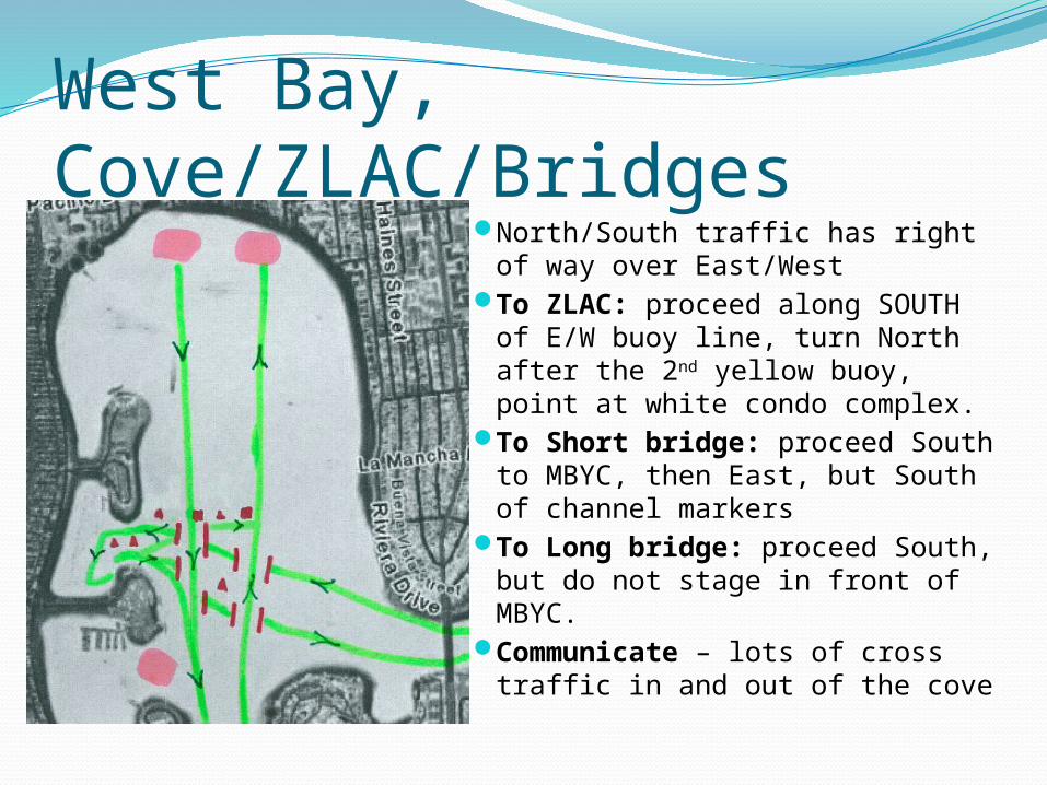
West Bay, Cove/ZLAC/BridgesNorth/South traffic has right of
way over East/WestTo ZLAC: proceed along
SOUTH of E/W buoy line, turn North after the 2nd yellow buoy, point at white condo complex.
To Short bridge: proceed South to MBYC, then East, but South of channel markers
To Long bridge: proceed South, but do not stage in front of MBYC.
Communicate – lots of cross traffic in and out of the cove
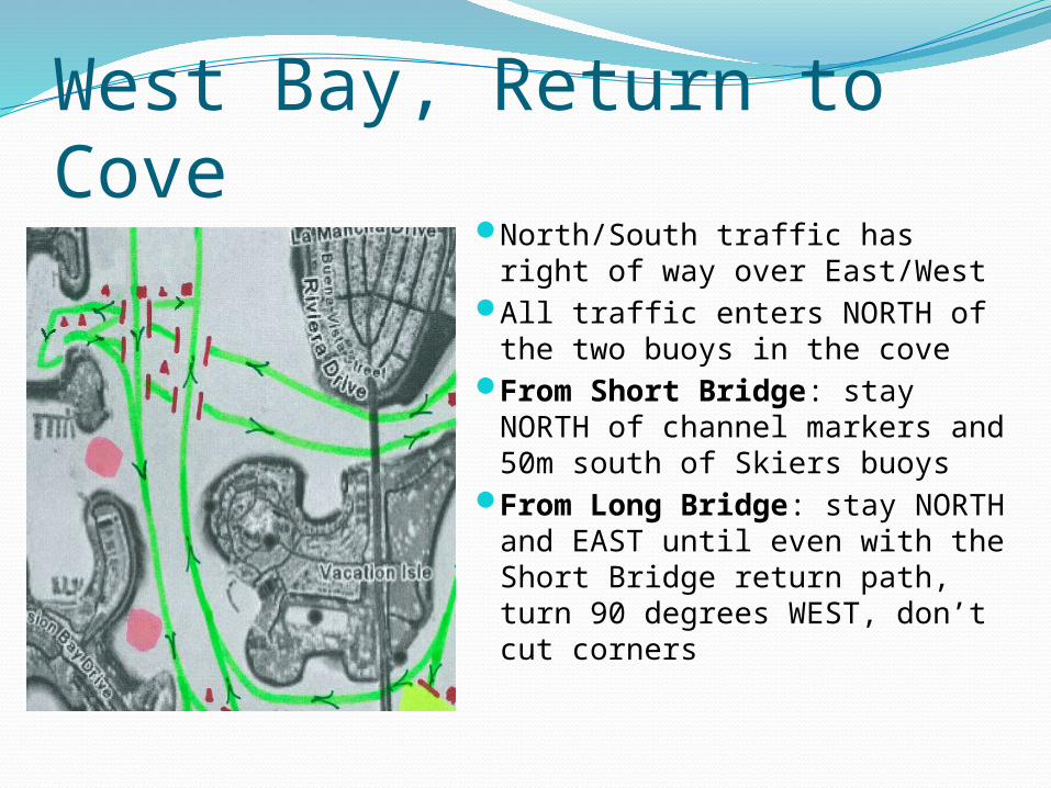
West Bay, Return to CoveNorth/South traffic has right
of way over East/WestAll traffic enters NORTH of
the two buoys in the coveFrom Short Bridge: stay
NORTH of channel markers and 50m south of Skiers buoys
From Long Bridge: stay NORTH and EAST until even with the Short Bridge return path, turn 90 degrees WEST, don’t cut corners
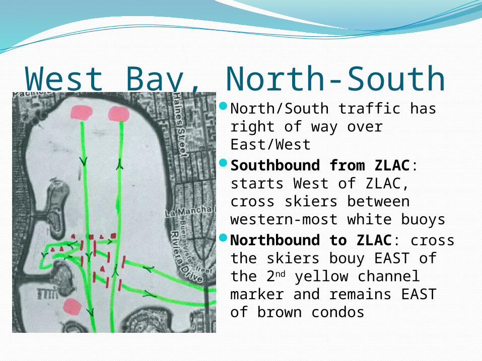
West Bay, North-SouthNorth/South traffic has
right of way over East/West
Southbound from ZLAC: starts West of ZLAC, cross skiers between western-most white buoys
Northbound to ZLAC: cross the skiers bouy EAST of the 2nd yellow channel marker and remains EAST of brown condos
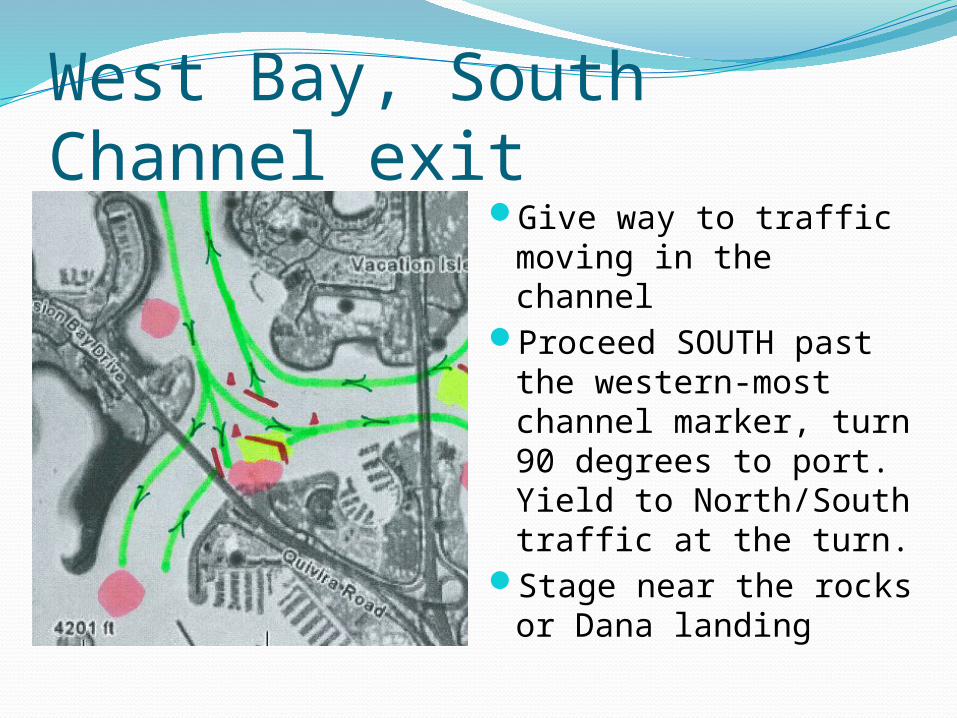
West Bay, South Channel exitGive way to traffic
moving in the channelProceed SOUTH past
the western-most channel marker, turn 90 degrees to port. Yield to North/South traffic at the turn.
Stage near the rocks or Dana landing
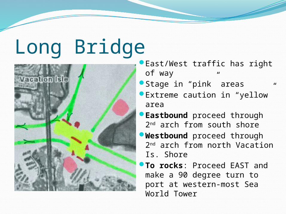
Long BridgeEast/West traffic has right of
wayStage in “pink” areasExtreme caution in “yellow”
areaEastbound proceed through
2nd arch from south shoreWestbound proceed through
2nd arch from north Vacation Is. Shore
To rocks: Proceed EAST and make a 90 degree turn to port at western-most Sea World Tower
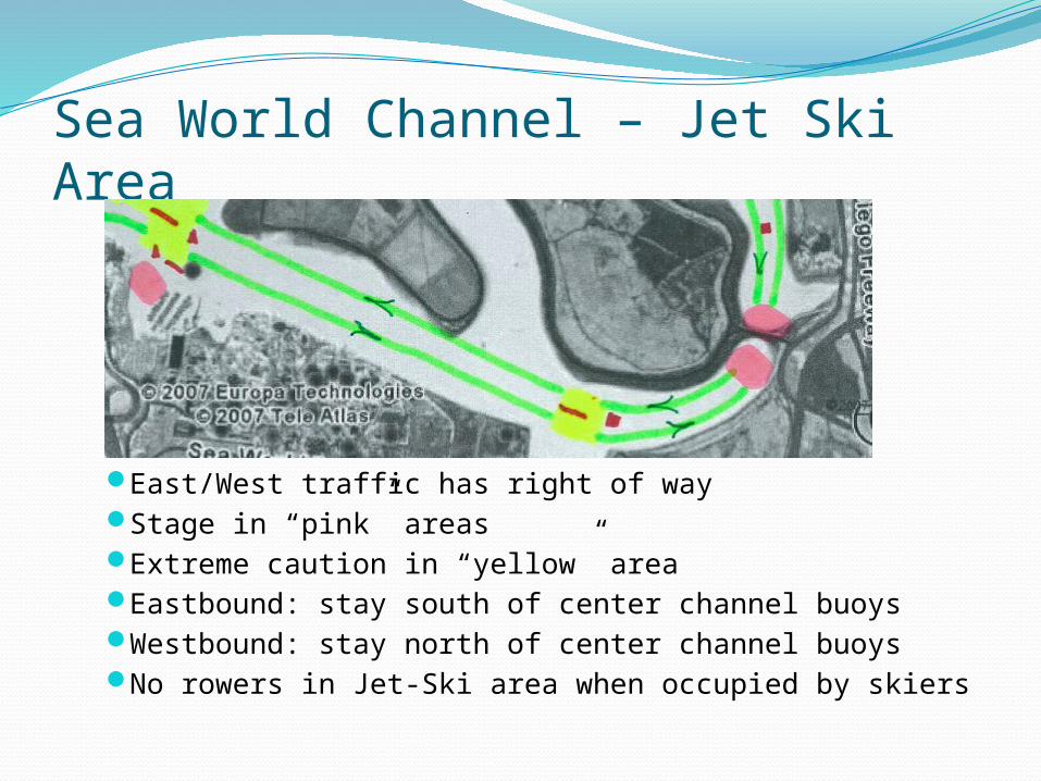
Sea World Channel – Jet Ski Area
East/West traffic has right of wayStage in “pink” areasExtreme caution in “yellow” areaEastbound: stay south of center channel buoysWestbound: stay north of center channel buoysNo rowers in Jet-Ski area when occupied by skiers
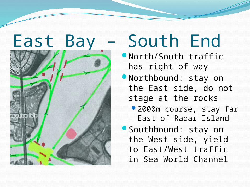
East Bay – South EndNorth/South traffic has
right of wayNorthbound: stay on
the East side, do not stage at the rocks2000m course, stay far
East of Radar IslandSouthbound: stay on
the West side, yield to East/West traffic in Sea World Channel
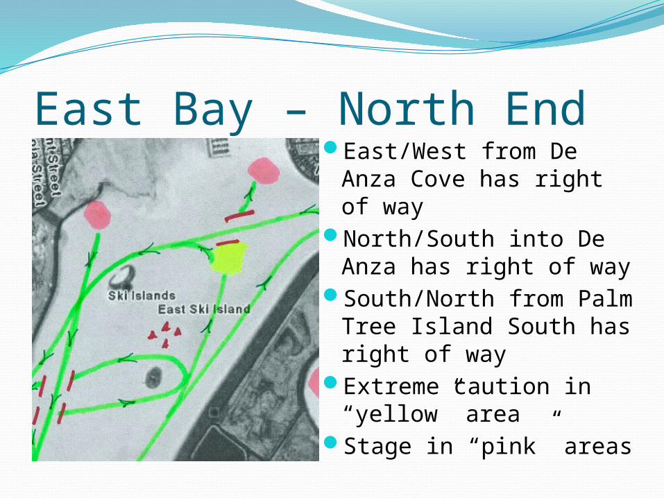
East Bay – North EndEast/West from De
Anza Cove has right of way
North/South into De Anza has right of way
South/North from Palm Tree Island South has right of way
Extreme caution in “yellow” area
Stage in “pink” areas

De Anza Cove, TecoloteEnter with buoys to port,
stay WEST heading SOUTH
Exit with buoys to port, stay EAST of yellow exit buoy, row NORTH further than you think, then turn 90 degrees WEST, yield to East/West traffic
Extreme caution in “yellow” area
Stage in “pink” area
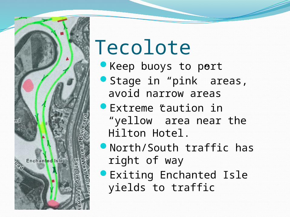
TecoloteKeep buoys to portStage in “pink” areas, avoid
narrow areasExtreme caution in “yellow”
area near the Hilton Hotel.North/South traffic has right of
wayExiting Enchanted Isle yields
to traffic
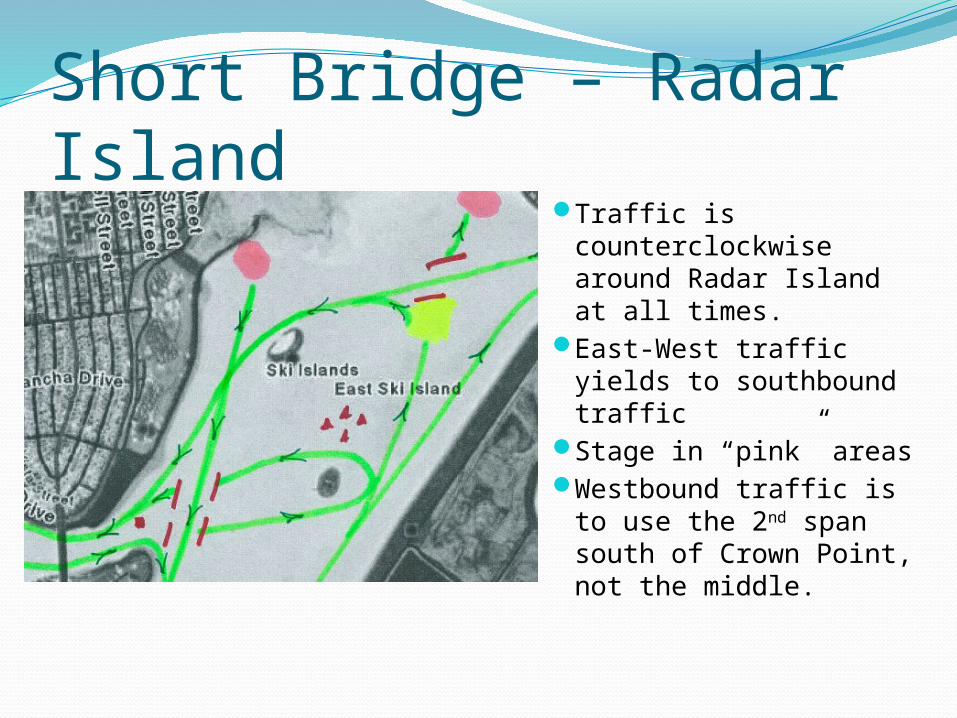
Short Bridge – Radar IslandTraffic is
counterclockwise around Radar Island at all times.
East-West traffic yields to southbound traffic
Stage in “pink” areasWestbound traffic is
to use the 2nd span south of Crown Point, not the middle.
Pattern ExceptionsExceptions are rare and predictable. Talk to
your coach, captain, or other leadershipFall Classic – November
Reverses traffic pattern East of Short bridge, North to Crew Classic finish line
Crew Classic – March/AprilEast bay and Sea World patterns change to
CLOCKWISEVarious junior regattas may change the
pattern
Race Courses1000m course marked in Sea World channel2000m course from the Rocks, north along
Fiesta IslandWires-to-Poles from Sea World towers north
along Fiesta Island, South in Tecolote channel, around Enchanted Isle, North out of Tecolote, West around Palm Tree Island, South along Vacation Island, West through the Long bridge, North to MBYC channel buoy.
West Bay from W. Mission Bay Dr. Bridge North to ZLAC
Race CoursesFall Classic – Sea World West through Long
Bridge, South around Vacation Island, East through Short Bridge, North to Crew Classic finish
Crew Classic – Sea World towers north to Palm Tree Island, 8 lanes across
Lights & ClothingBow lights are required, red & green (port &
starboard), attached to the bow marker clip or well forward of the washbox.
Stern lights are highly recommended, white only, mounted aft of the stern washbox or above the stern.
Coaches launches must be properly illuminated with a white light
Wear high visibility clothing, bright white, fluorescent colors, reflective strips. Refrain from dark colors.
Safe Weather ConditionsDo not row if the environmental conditions are not safeFog: When the lights of the Ingraham St. bridge
cannot be seen from El Carmel or Santa Clara point, rowing is not advised (not permitted at SDRC)
Electrical storms: Rowing is not advised (or permitted at SDRC) if there is lightning, thunder, or hair standing on end. If you are on the water, head to shore, and move away from your boat, and oars
Wind: Rowing is not recommended if whitecaps or worse are present.
Water quality: Mission Bay may be, at times, not conducive to rowing, especially 48 hours after a storm.
Misc.MBAC & others run Learn to Row classes in
the El Carmel / Santa Clara cove with novice eights and barges
SDRC hosted Mission Bay Safety Documentshttp://www.sandiegorowing.org/rowing-safety-i
nformationMission Bay Park regulations
http://www.sandiego.gov/planning/programs/parkplanning/pdf/mbpmasterplan9.pdf