Embed Size (px)
Citation preview
1NEURISA 2009
The Integration of ArcGIS Server with Google Maps:
Presented by:
William Witts
MIT Department of FacilitiesFacility Information [email protected]
MIT’s Online Campus Map
2NEURISA 2009
Agenda
• Introduction
• History of online campus map, “Whereis”
• Why Whereis was updated
• New Whereis – ArcGIS Server
• Future plans
3NEURISA 2009
• Responsible for:
Archives and record documents
Space accounting
Campus mapping
Utility distribution plans
Application support
• Belong to Facilities IT Group
Work with Application Desktop Services
Facility Information Systems
4NEURISA 2009
Whereis
5NEURISA 2009
• Online map in 1997 Map
Static GIFs
Site was maintained by IS&T.
Was not dynamic in nature
Worked well, but wanted to be less work
to maintain
Disassociated from other data (not the
official source)
History of online map
6NEURISA 2009
• 2002 meeting of Facilities and
Homepage Team
Wanted to update maps
Need a better process to update map
Scalable and able to stand the test of
time
Facilities would maintain map data and
IS&T would manage service and content
History of online map
7NEURISA 2009
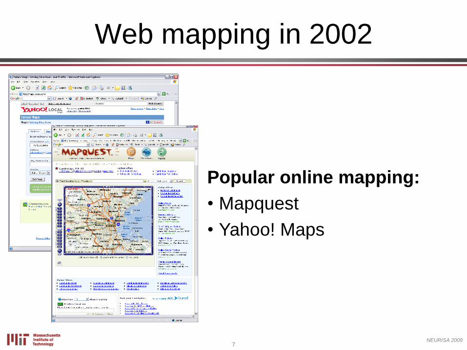
Web mapping in 2002
MapQuest
Popular online mapping:
• Mapquest
• Yahoo! Maps
8NEURISA 2009
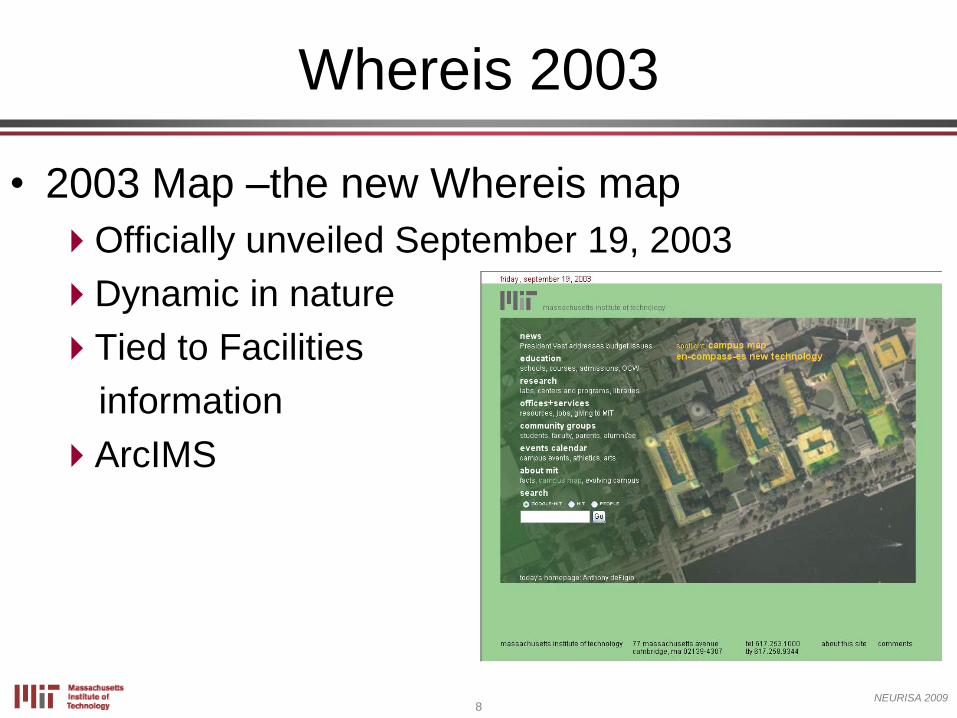
• 2003 Map –the new Whereis map
Officially unveiled September 19, 2003
Dynamic in nature
Tied to Facilities
information
ArcIMS
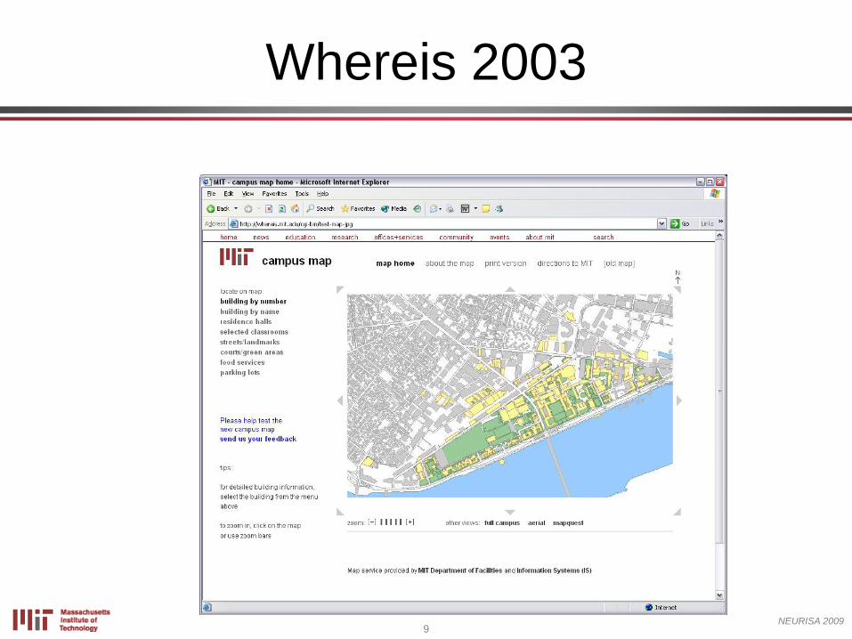
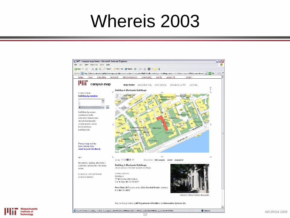
Whereis 2003
9NEURISA 2009
Whereis 2003
10NEURISA 2009
Whereis 2003
11NEURISA 2009
• Provided more functionality
Could now locate an MIT building,
department, office, or other location
Get directions to MIT
Provide links for other departments
More information about what is in a
building
Add other information, such as aerial
photography
Whereis 2003
12NEURISA 2009
• ArcIMS back end
• 1 request, 1 map
• Anywhere between 800 and 2000 map
requests an hour
• Very little down time
Whereis 2003
13NEURISA 2009
• Two separate ArcIMS installations
• Map data “slight disconnect”
• Need to acquire data through the
region
• Map service was dated
• Users expected higher level of
interactivity
Issues with 2003 Whereis
14NEURISA 2009
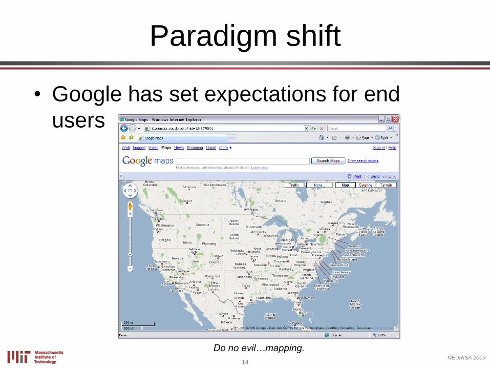
Do no evil…mapping.
Paradigm shift
• Google has set expectations for end
users
15NEURISA 2009
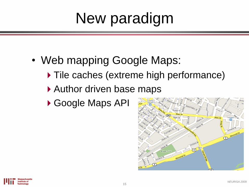
• Web mapping Google Maps:
Tile caches (extreme high performance)
Author driven base maps
Google Maps API
New paradigm
16NEURISA 2009
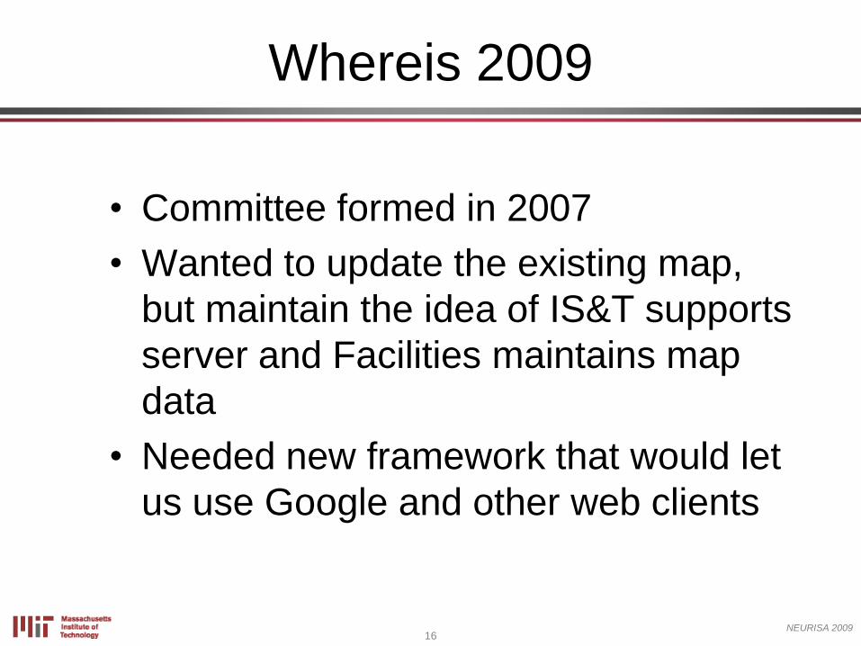
• Committee formed in 2007
• Wanted to update the existing map,
but maintain the idea of IS&T supports
server and Facilities maintains map
data
• Needed new framework that would let
us use Google and other web clients
Whereis 2009
17NEURISA 2009
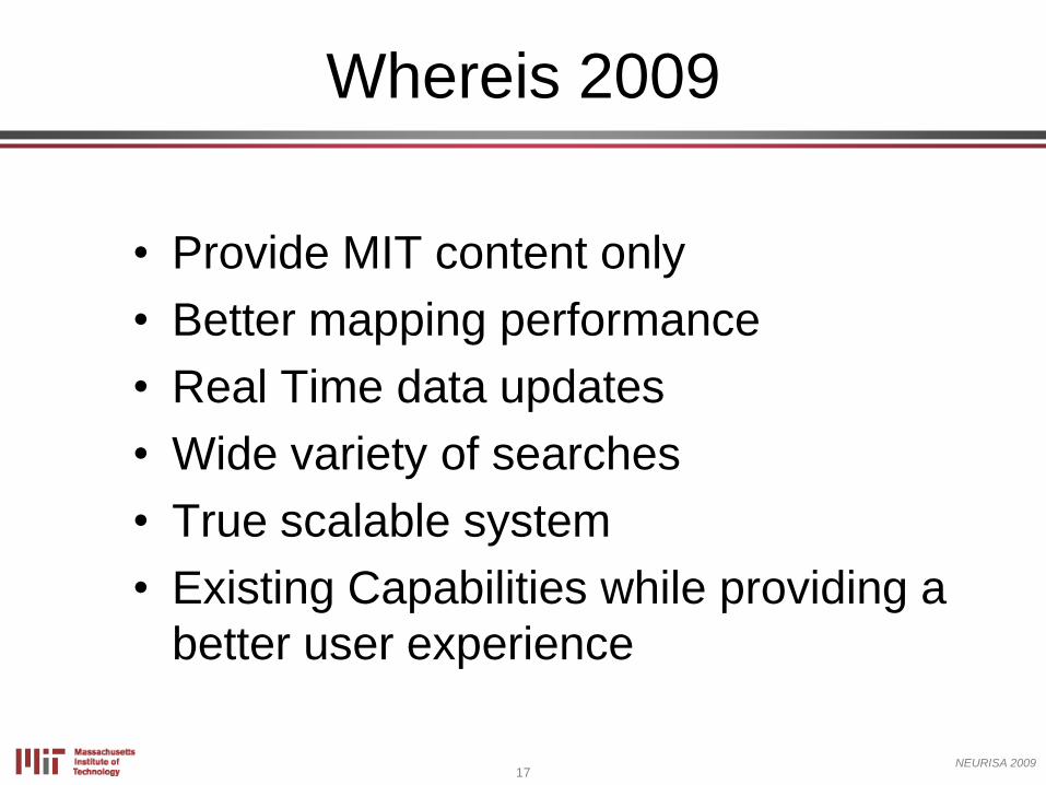
• Provide MIT content only
• Better mapping performance
• Real Time data updates
• Wide variety of searches
• True scalable system
• Existing Capabilities while providing a
better user experience
Whereis 2009
18NEURISA 2009
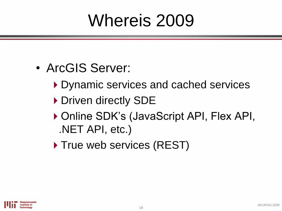
• ArcGIS Server:
Dynamic services and cached services
Driven directly SDE
Online SDK’s (JavaScript API, Flex API,
.NET API, etc.)
True web services (REST)
Whereis 2009
19NEURISA 2009
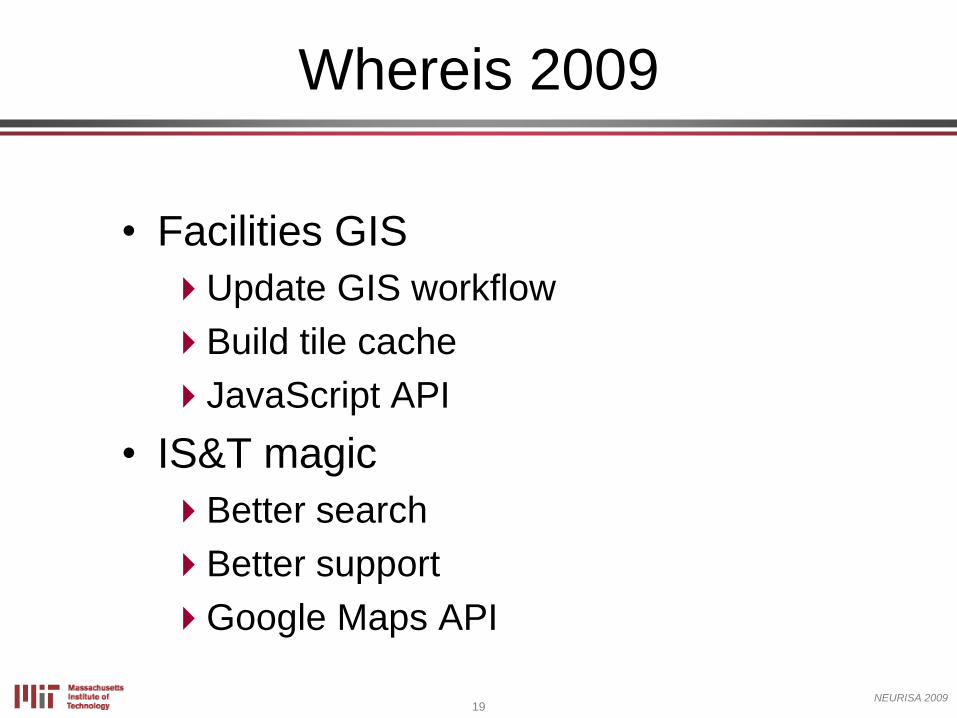
• Facilities GIS
Update GIS workflow
Build tile cache
JavaScript API
• IS&T magic
Better search
Better support
Google Maps API
Whereis 2009
20NEURISA 2009
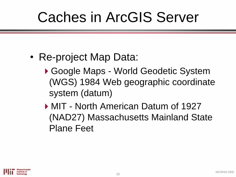
• Re-project Map Data:
Google Maps - World Geodetic System
(WGS) 1984 Web geographic coordinate
system (datum)
MIT - North American Datum of 1927
(NAD27) Massachusetts Mainland State
Plane Feet
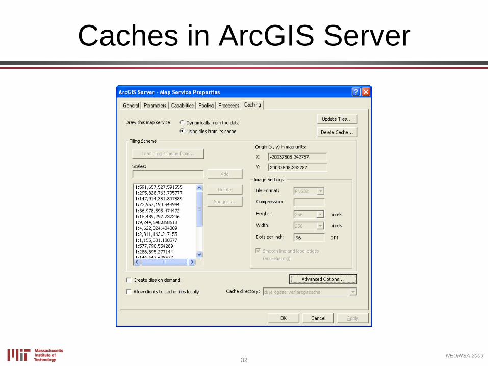
Caches in ArcGIS Server
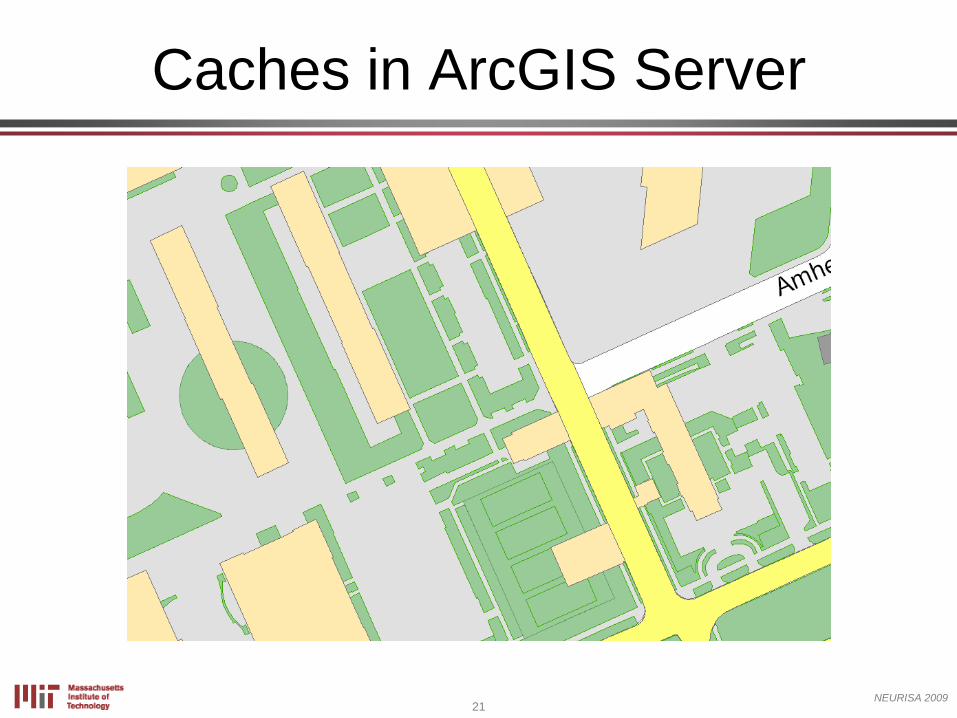
21NEURISA 2009
Caches in ArcGIS Server
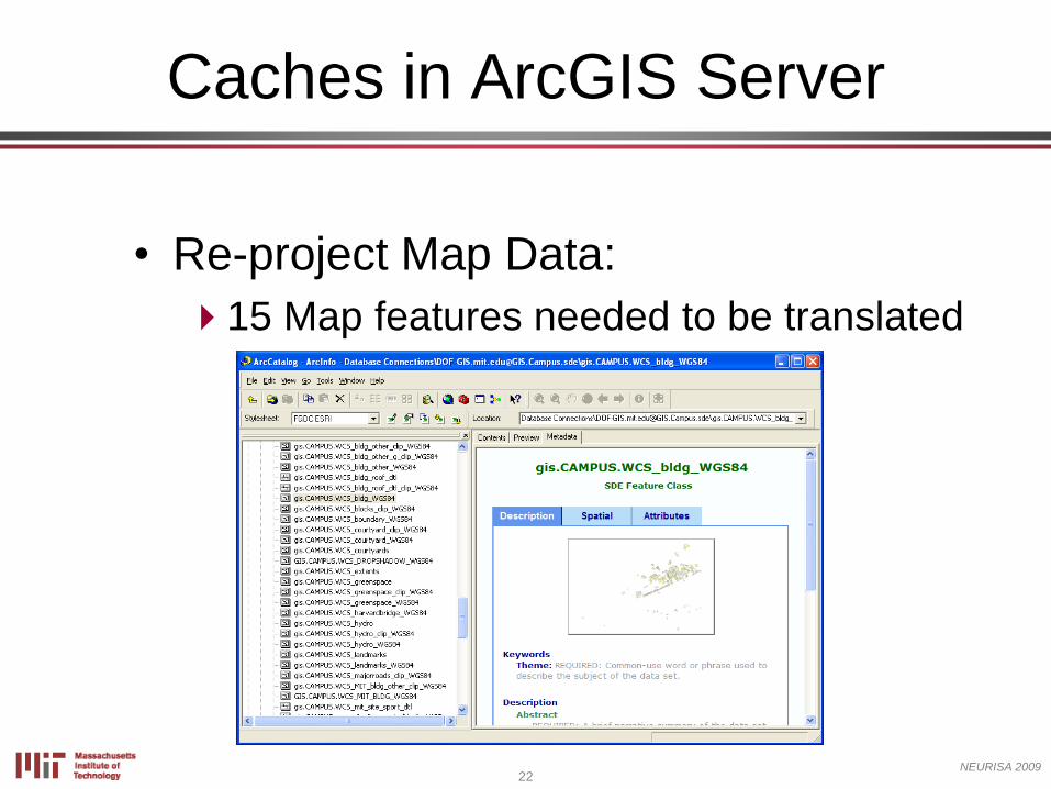
22NEURISA 2009
• Re-project Map Data:
15 Map features needed to be translated
Caches in ArcGIS Server
23NEURISA 2009
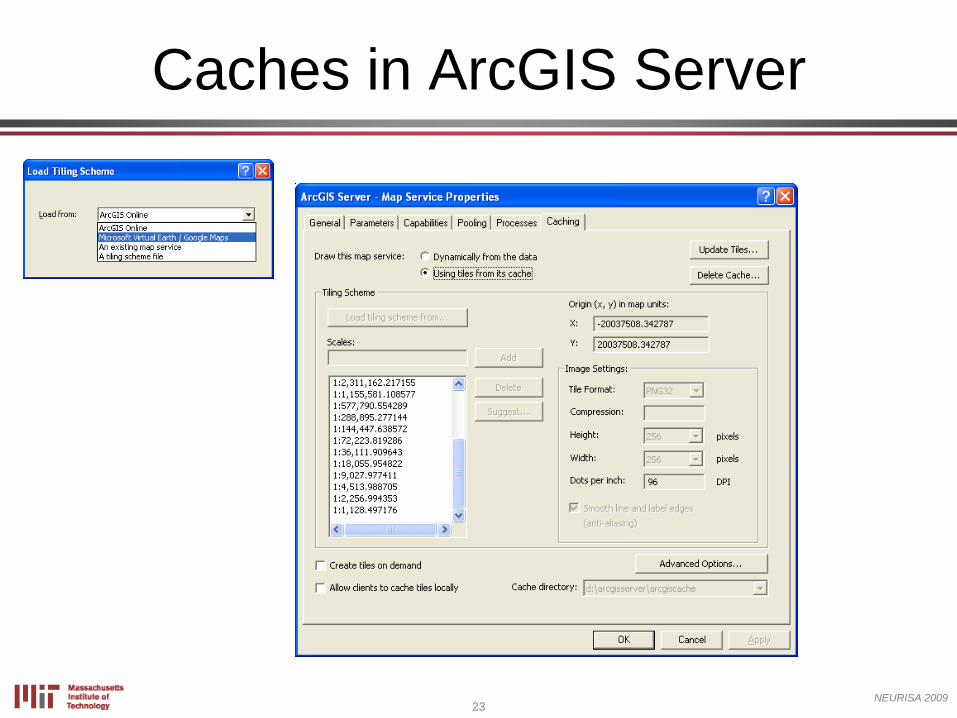
Caches in ArcGIS Server
24NEURISA 2009
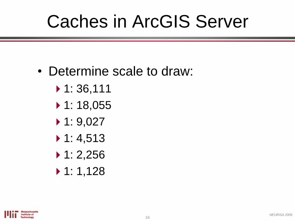
• Determine scale to draw:
1: 36,111
1: 18,055
1: 9,027
1: 4,513
1: 2,256
1: 1,128
Caches in ArcGIS Server
25NEURISA 2009
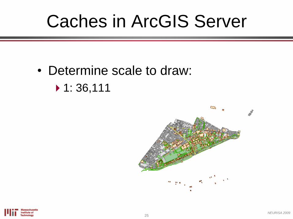
• Determine scale to draw:
1: 36,111
Caches in ArcGIS Server
26NEURISA 2009
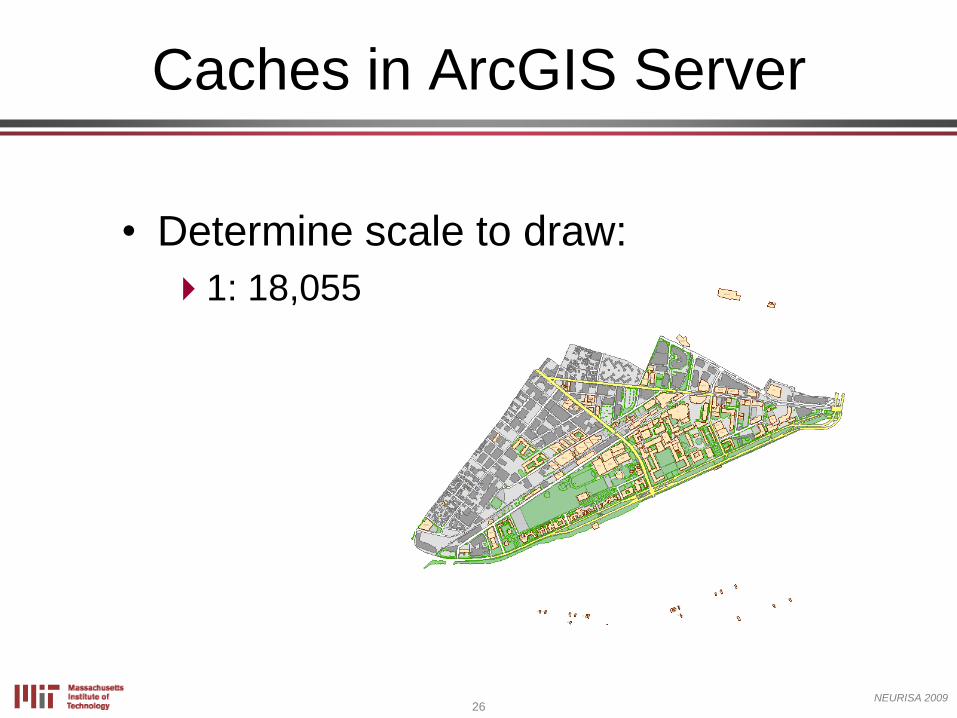
• Determine scale to draw:
1: 18,055
Caches in ArcGIS Server
27NEURISA 2009
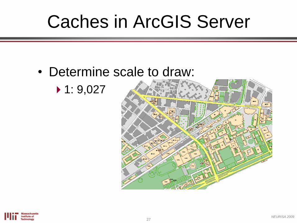
• Determine scale to draw:
1: 9,027
Caches in ArcGIS Server
28NEURISA 2009
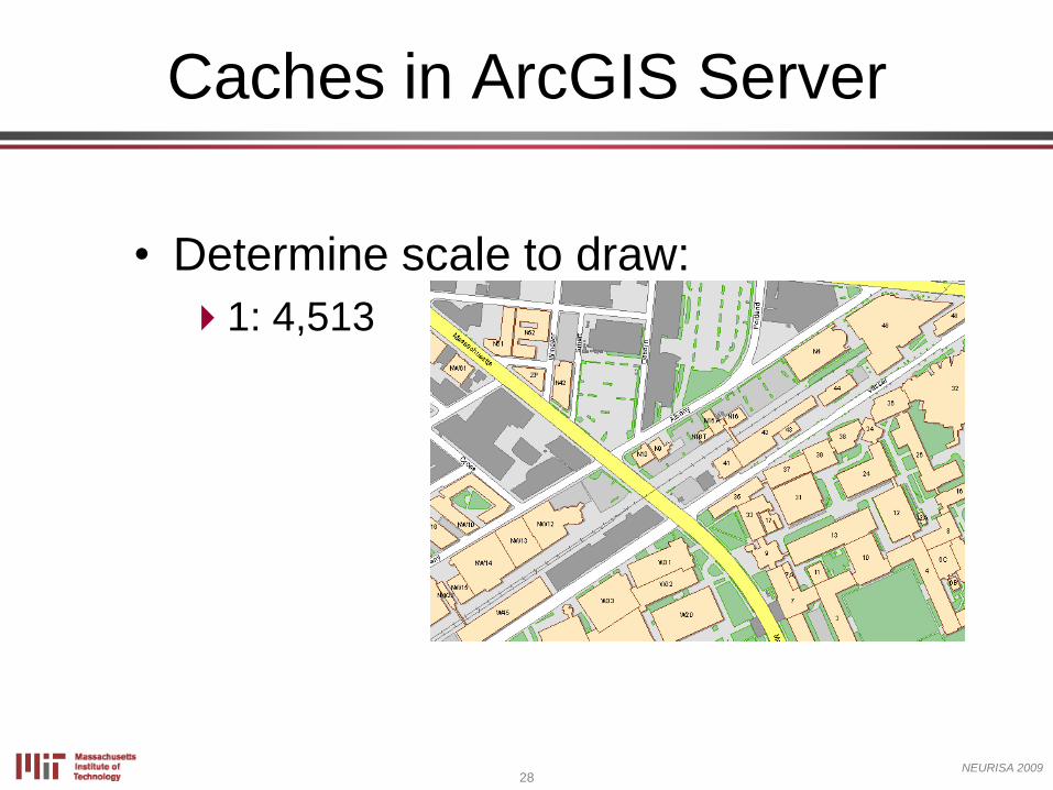
• Determine scale to draw:
1: 4,513
Caches in ArcGIS Server
29NEURISA 2009
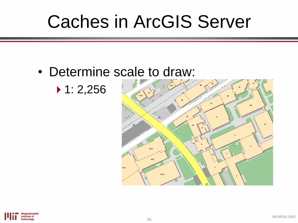
• Determine scale to draw:
1: 2,256
Caches in ArcGIS Server

30NEURISA 2009
• Determine scale to draw:
1: 1,128
Caches in ArcGIS Server
31NEURISA 2009
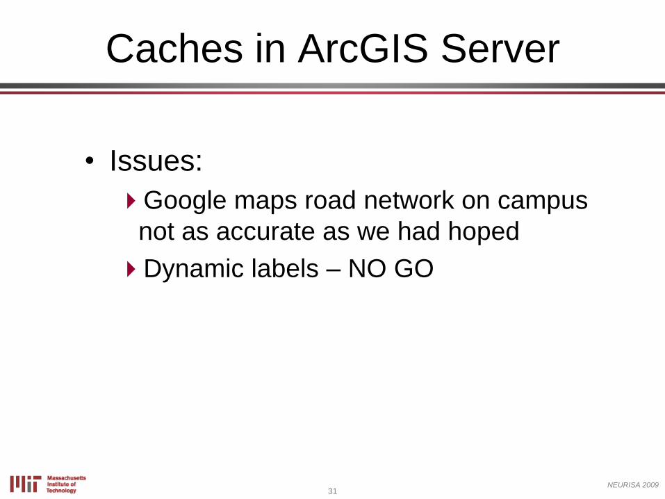
• Issues:
Google maps road network on campus
not as accurate as we had hoped
Dynamic labels – NO GO
Caches in ArcGIS Server
32NEURISA 2009
Caches in ArcGIS Server
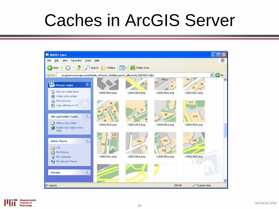
33NEURISA 2009
Caches in ArcGIS Server
34NEURISA 2009
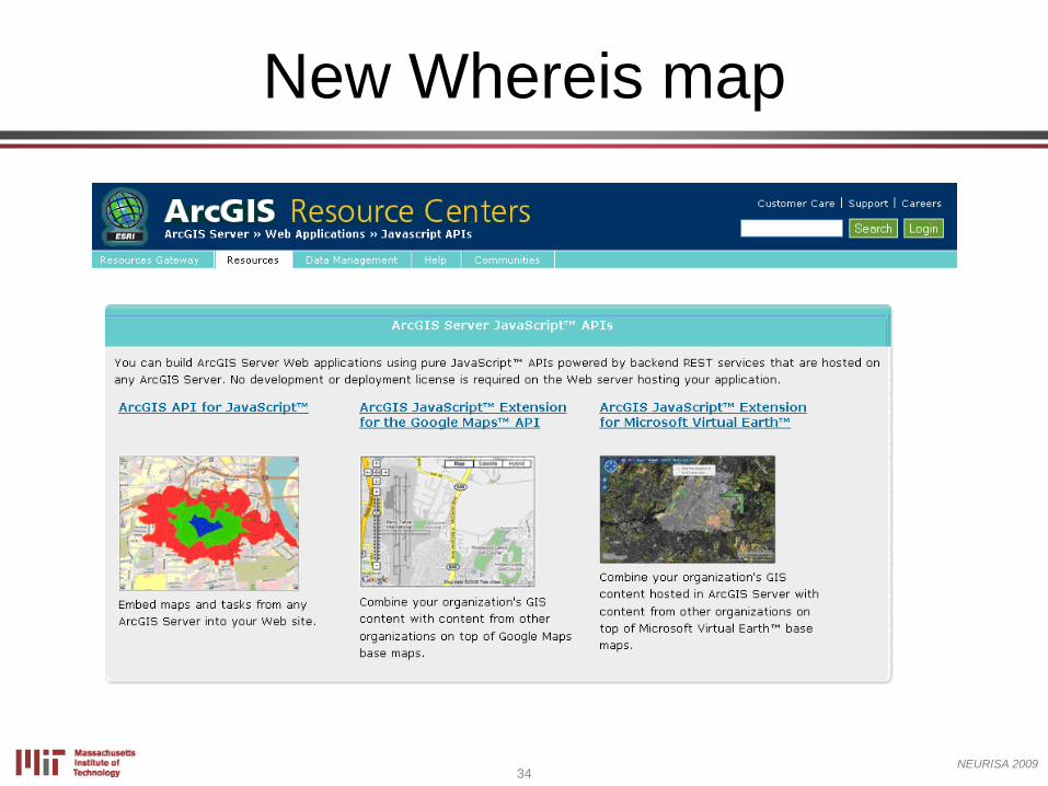
New Whereis map
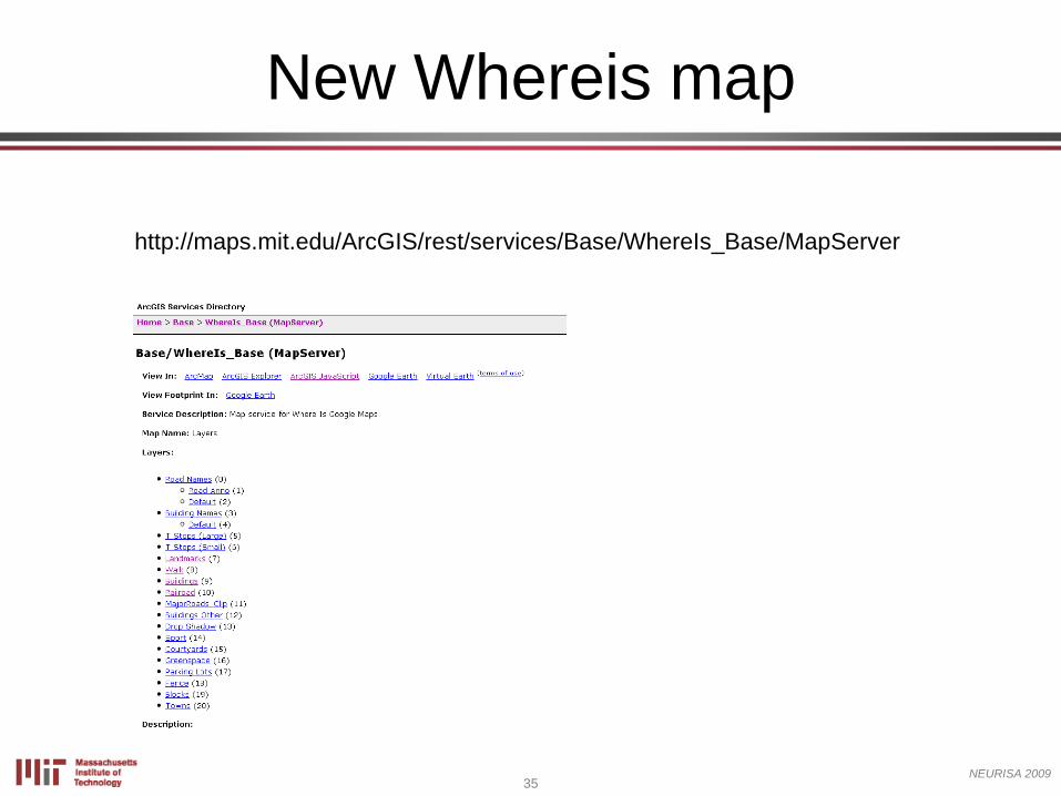
35NEURISA 2009
http://maps.mit.edu/ArcGIS/rest/services/Base/WhereIs_Base/MapServer
New Whereis map
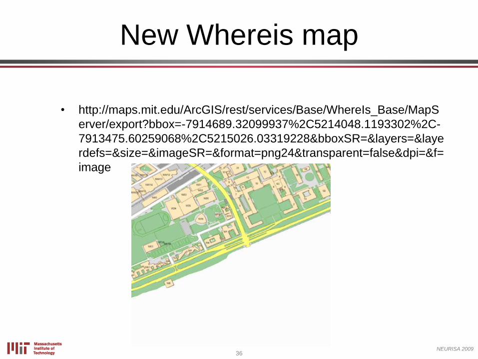
36NEURISA 2009
• http://maps.mit.edu/ArcGIS/rest/services/Base/WhereIs_Base/MapS
erver/export?bbox=-7914689.32099937%2C5214048.1193302%2C-
7913475.60259068%2C5215026.03319228&bboxSR=&layers=&laye
rdefs=&size=&imageSR=&format=png24&transparent=false&dpi=&f=
image
New Whereis map
37NEURISA 2009
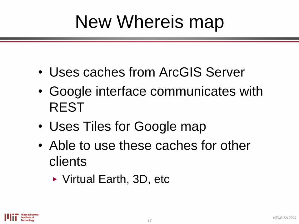
• Uses caches from ArcGIS Server
• Google interface communicates with
REST
• Uses Tiles for Google map
• Able to use these caches for other
clients
N Virtual Earth, 3D, etc
New Whereis map
38NEURISA 2009
Whereis beta demo
New Whereis map
39NEURISA 2009
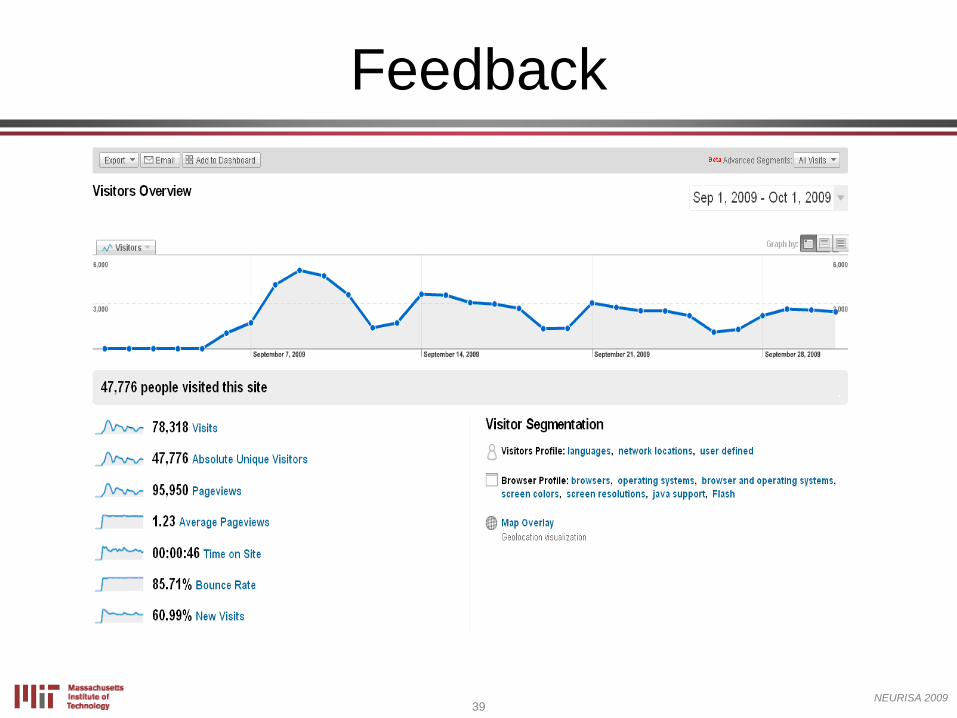
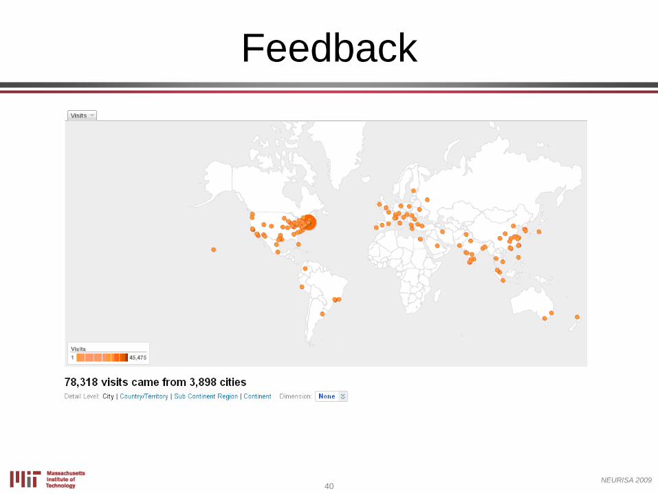
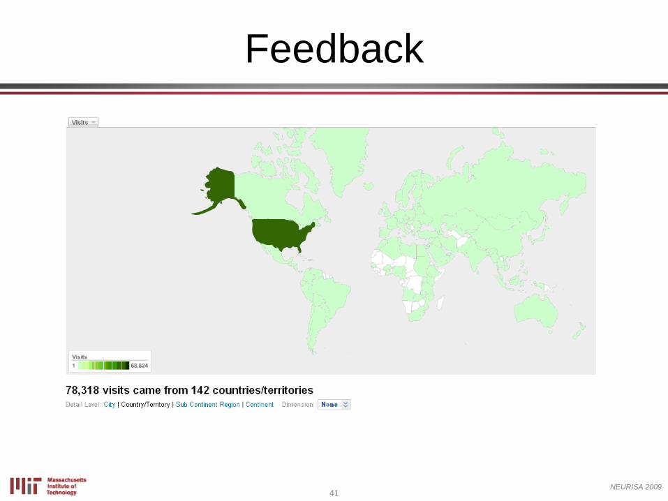
Feedback
40NEURISA 2009
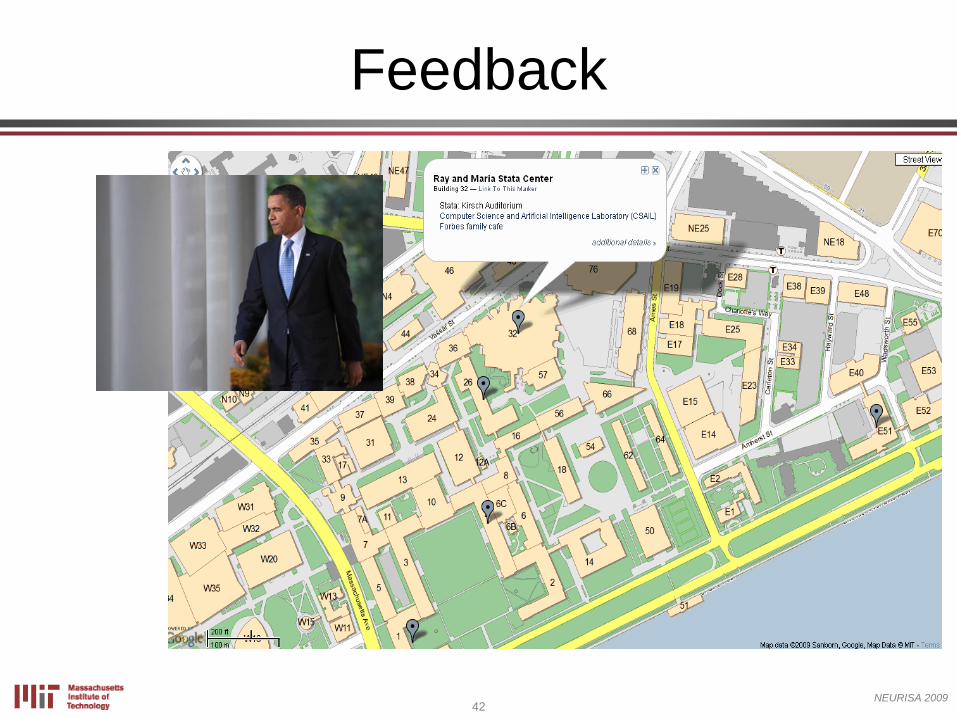
Feedback
41NEURISA 2009
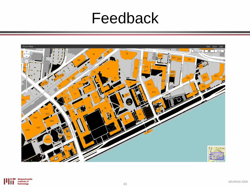
Feedback
42NEURISA 2009
Feedback
43NEURISA 2009
Feedback
44NEURISA 2009
Feedback
• Let us know!
http://whereis.mit.edu/
45NEURISA 2009
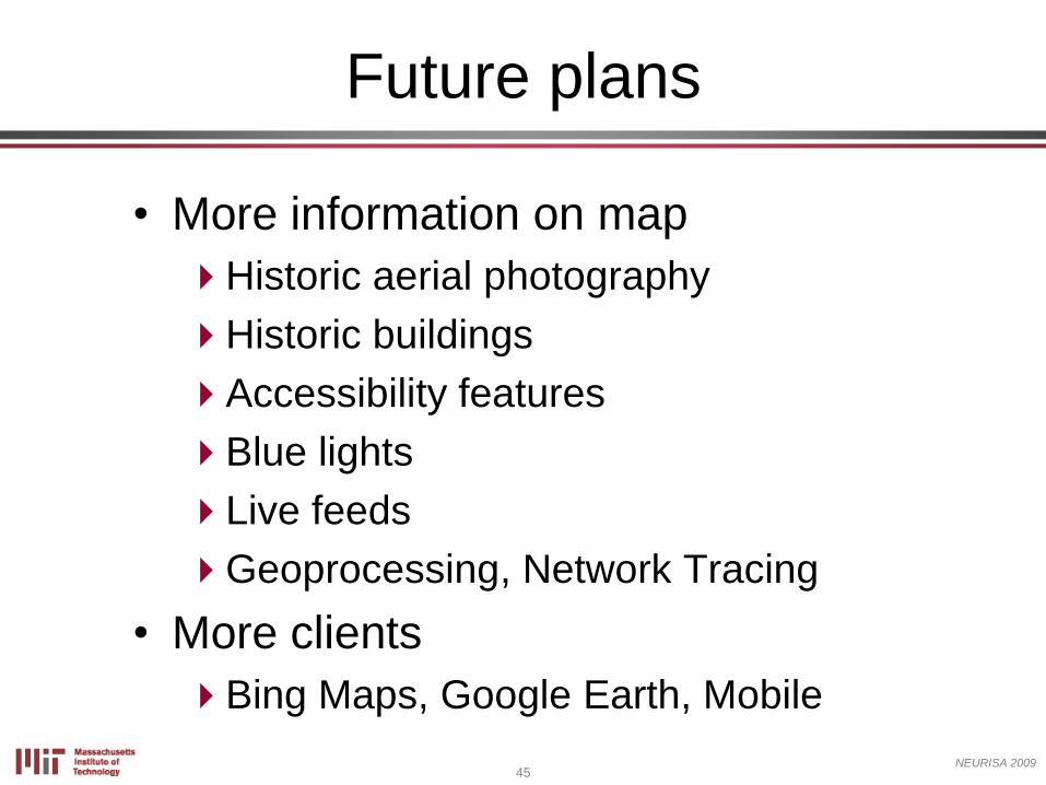
Future plans
• More information on map
Historic aerial photography
Historic buildings
Accessibility features
Blue lights
Live feeds
Geoprocessing, Network Tracing
• More clients
Bing Maps, Google Earth, Mobile
46NEURISA 2009
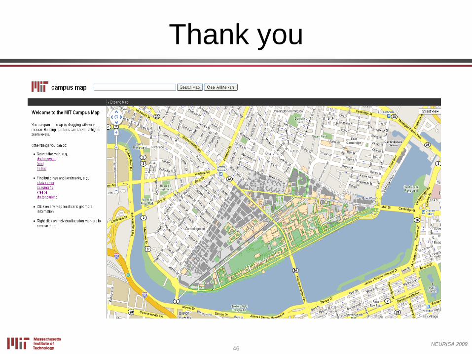
Thank you