Embed Size (px)
Citation preview

Mobile Maps: Understanding Soils and Landscapes Using GIS in the Field
Darrell G. Schulze & Phillip R. OwensAgronomy DepartmentPurdue UniversityWest Lafayette, IN
Outline
• Using GIS to teach soil science• Some practical aspects of using GIS
in the field

Background
• Soils occur in landscapes in predictable, repeating patterns−parent material−topography −vegetation−climate−time of formation

Background
• Soils occur in landscapes in predictable, repeating patterns.

Instructional Problem
• It is easy to see differences over a few 10’s of meters.

Instructional Problem
• It is difficult to see differences
−when vegetation covers surface
−as distances and the size of the features increase• 100’s of meters to 100’s of kilometers

Instructional Problem• Helping students (and teachers!) develop their
own mental models of soil landscapes.
Conceptual models presented in the
classroom
Landscape features in the field

Instructional Solution
• Refer to well-designed maps while observing features in the field.

Paper Maps?
• Advantages−inexpensive, low-tech
• Disadvantages−need several map scales
• small scale for overview, large scale for details −need different kinds of maps
• topographic maps, geology maps, soil maps, etc.−difficult to locate one’s position on map
• especially when driving

Electronic Maps?
• Advantages−potential for many maps−vary map scale as needed−locate position with GPS unit
• Disadvantages−expense−need electric power −possible reliability issues

Taking Computers to the Field• must be rugged−dirt, water, bumps, etc.

Taking Computers to the Field• must be rugged−dirt, water, bumps
• display must be visible in sunlight

Extremely Rugged Tablet PCs
• Hammerhead Xtreme
−www.drs-ts.com

Extremely Rugged Tablet PCs
• Hammerhead Xtreme
−www.drs-ts.com • 933 MHz or 1.1 GHz Pentium III• 40 gigabyte hard drive• all-vis display (sunlight readable)• Windows XP Tablet Edition• External Garmin GPS10x• external accessories−power supplies for 12 V & 120 V,
extra batteries

Software
• ArcGIS 9.2−supports GPS receiver
• location on the maps is always displayed

Tablet PCs & GIS in the Field
College of Agriculture Instructional Innovation Grant Program and Purdue Agronomy Department
ITaP Teaching & Learning with Technology Digital Content Development Grant

Primary Data Sets for Tippecanoe County• Indiana 2005 Digital Elevation Model
−Indiana Spatial Data Portal−1.5 x 1.5 m, down-sampled to 5 x 5 m−hillshade & transparent color ramp
• SSURGO Soils −NRCS Soil Data Mart−detailed, 2nd order soil survey
• covers almost all of agricultural areas of U.S.−soil parent material, loess thickness, drainage
class• Other maps
−roads, towns, aerial photography, etc.−downloaded from IndianaMap

Soil Maps
• Dominant Soil Parent Material−based on soil series description−generally deepest material, or most
unique material in profile• Loess Depth−thickness of wind-blown silt
• Soil Drainage Class−presence of a seasonal high water
table

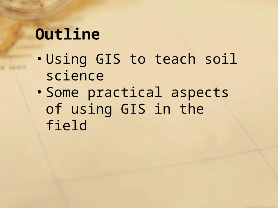
Dominant Soil Parent Materials for Tippecanoe County
• wide variety of glacial deposits−till (dense)−glaciofluvial sediments−outwash (coarse sand & gravel)−alluvium (modern flood plains)−eolian sands & sandy sediments−lacustrine deposits (deep silts)−organic deposits (anywhere in profile)
• residuum (sandstone & siltstone)• water

Elevation
• hillshade
20 miles

Elevation
• hillshade + transparent color ramp
• 510 to 834 ft.(155 to 254 m) ASL

Elevation
• hillshade
Soil Parent Material• red = till• pink =
glaciofluvial sediments
• green = outwash• lt. blue = alluvium

Loess Depth• white = <10 in.• dk. blue = > 55 in

Soil Parent Material• red = till• pink =
glaciofluvial sediments
• green = outwash• lt. blue = alluvium

Ice Fronts, Tunnel Valleys, Eskers
ice front
tunnel valle
y?
tunnel
val
leys
& esk
ers
ice front

Wild Cat Creek Flowed Here

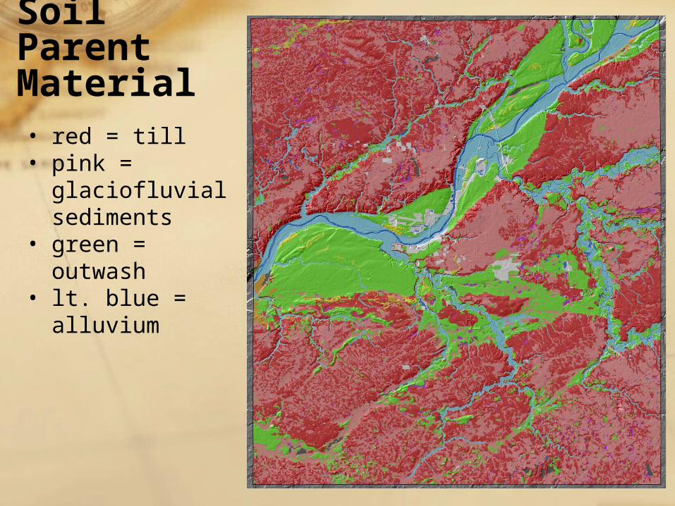
An Esker
An Esker

An Esker
esker
kame
esker trough
bedrockoutcrop
gravel pit4 miles

A Scoured Outwash Plain

A Scoured Outwash Plain
~9 miles

A Scoured Outwash Plain


Fall 2005
Fall 2006
Tablet PCs on All Day Field Trips

Northern Indiana Field Trip
89 milesGlacier
OutwashPlain
EndMoraine
SandPlain
MichiganCity
WestLafayette

Outline
• Using GIS to teach soil science• Some practical aspects of using GIS
in the field

Software with GPS support
• ArcGIS 9.0 or higher−http://www.esri.com
• Google Earth−http://earth.google.com
• Global Mapper−http://www.globalmapper.com

GPS receiver
• use high sensitivity receiver −i.e., Garmin GPS10x
(SiRFstarIII receiver)−receives signal inside bus or
van, in woods• Bluetooth
−reduces cords−may be problematic

Future Plans
• Integrating Spatial Educational Experiences (Isee) into Crop, Soil, and Environmental Science Curricula−expand our data model to the whole state−make data available via the Internet
• Google Earth −integrate a geospatial approach into our
undergraduate teaching program

“… a bird’s eye view with x-ray vision …”