Embed Size (px)
Citation preview
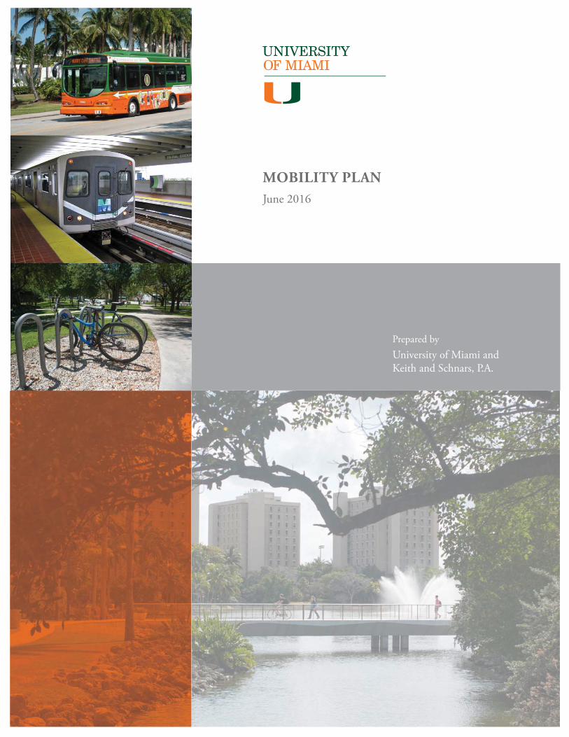
MOBILITY PLANJune 2016
Prepared by University of Miami andKeith and Schnars, P.A.
University of Miami Mobility Plan June 2016 | Page i
Execu ve Summary. . . . . . . . . . . . . . . . . . . . . . . . . . . . . . . . . . . . . . . . . 1
University of Miami Mobility Plan . . . . . . . . . . . . . . . . . . . . . . . . . . . . . . . . 6
A. Residen al Campus Strategy . . . . . . . . . . . . . . . . . . . . . . . . . . . . . . . . . . 8A.1. On-Campus Residen al .......................................................................................... 8A.2. Off Campus/ Non-University Residen al ............................................................... 9
B. Parking Management Program and Policies. . . . . . . . . . . . . . . . . . . . . . . . . . 9B.1. No Freshmen Car Policy ....................................................................................... 10B.2. Commuter (Students, Faculty, Staff ) Restric ons ............................................... 10B.3. Service and Deliveries .......................................................................................... 10
C. Neighborhood Traffi c Improvements . . . . . . . . . . . . . . . . . . . . . . . . . . . . 11
D. Reduc on of Traffi c North of Lake Osceola . . . . . . . . . . . . . . . . . . . . . . . . . 11
E. Public Transit Program . . . . . . . . . . . . . . . . . . . . . . . . . . . . . . . . . . . . 12E.1. Metrobus ............................................................................................................. 13E.2. Metrorail .............................................................................................................. 14
F. Trip-Sharing Programs. . . . . . . . . . . . . . . . . . . . . . . . . . . . . . . . . . . . . 15F.1. Zipcar ................................................................................................................... 15F.2. Campus Taxi Stand and App-based Transporta on Services ............................... 16F.3. Car/ Van Pool ....................................................................................................... 16
G. Hurry ’Canes Shu le Program . . . . . . . . . . . . . . . . . . . . . . . . . . . . . . . . 16G.1. On-Campus Shu les ............................................................................................ 17G.2. Off -Campus, Recrea onal and Shopping Shu les ............................................... 17
H. Bicycle and Pedestrian Programs. . . . . . . . . . . . . . . . . . . . . . . . . . . . . . . 18H.1. UBike .................................................................................................................... 18H.2. Pedestrian and Bike Pathways ............................................................................. 20
I. Enhanced Campus Life Programming . . . . . . . . . . . . . . . . . . . . . . . . . . . . 20
J. Regional Traffi c Studies . . . . . . . . . . . . . . . . . . . . . . . . . . . . . . . . . . . . 21
Appendix
1. Mobility Plan Matrix. . . . . . . . . . . . . . . . . . . . . . . . . . . . . . . . . . . . . . 22
2. Campus Parking Supply . . . . . . . . . . . . . . . . . . . . . . . . . . . . . . . . . . . . 23
3. Campus Parking Zones . . . . . . . . . . . . . . . . . . . . . . . . . . . . . . . . . . . . 24
Exhibits
A. 1990 - 2016 Local Traffi c Counts . . . . . . . . . . . . . . . . . . . . . . . . . . . . . . . . 7
B. Adopted Master Plan . . . . . . . . . . . . . . . . . . . . . . . . . . . . . . . . . . . . . . 8
C. Campus Parking Map . . . . . . . . . . . . . . . . . . . . . . . . . . . . . . . . . . . . . . 9
D. Internal Road Phase I and Loca on of Eliminated Spaces . . . . . . . . . . . . . . . . . . . . . 12
E. Transit Availability Map . . . . . . . . . . . . . . . . . . . . . . . . . . . . . . . . . . . . 13
F. Campus Shu le Map . . . . . . . . . . . . . . . . . . . . . . . . . . . . . . . . . . . . . 17
Table of Contents
University of Miami Mobility Plan June 2016 | Page 1
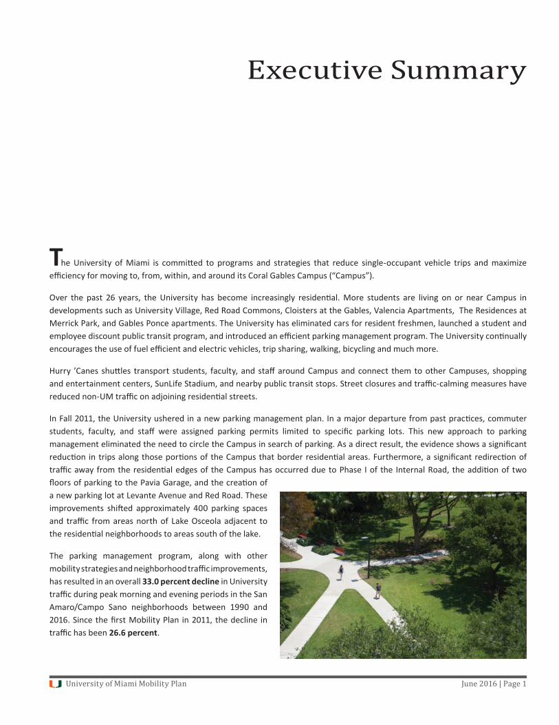
The University of Miami is commi ed to programs and strategies that reduce single-occupant vehicle trips and maximize effi ciency for moving to, from, within, and around its Coral Gables Campus (“Campus”).
Over the past 26 years, the University has become increasingly residen al. More students are living on or near Campus in developments such as University Village, Red Road Commons, Cloisters at the Gables, Valencia Apartments, The Residences at Merrick Park, and Gables Ponce apartments. The University has eliminated cars for resident freshmen, launched a student and employee discount public transit program, and introduced an effi cient parking management program. The University con nually encourages the use of fuel effi cient and electric vehicles, trip sharing, walking, bicycling and much more.
Hurry ’Canes shu les transport students, faculty, and staff around Campus and connect them to other Campuses, shopping and entertainment centers, SunLife Stadium, and nearby public transit stops. Street closures and traffi c-calming measures have reduced non-UM traffi c on adjoining residen al streets.
In Fall 2011, the University ushered in a new parking management plan. In a major departure from past prac ces, commuter students, faculty, and staff were assigned parking permits limited to specifi c parking lots. This new approach to parking management eliminated the need to circle the Campus in search of parking. As a direct result, the evidence shows a signifi cant reduc on in trips along those por ons of the Campus that border residen al areas. Furthermore, a signifi cant redirec on of traffi c away from the residen al edges of the Campus has occurred due to Phase I of the Internal Road, the addi on of two fl oors of parking to the Pavia Garage, and the crea on of a new parking lot at Levante Avenue and Red Road. These improvements shi ed approximately 400 parking spaces and traffi c from areas north of Lake Osceola adjacent to the residen al neighborhoods to areas south of the lake.
The parking management program, along with other mobility strategies and neighborhood traffi c improvements, has resulted in an overall 33.0 percent decline in University traffi c during peak morning and evening periods in the San Amaro/Campo Sano neighborhoods between 1990 and 2016. Since the fi rst Mobility Plan in 2011, the decline in traffi c has been 26.6 percent.
Executive Summary
University of Miami Mobility Plan June 2016 | Page 2
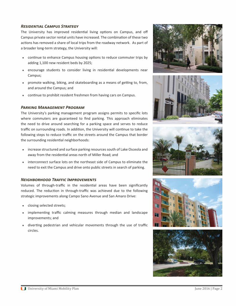
R C SThe University has improved residen al living op ons on Campus, and off Campus private sector rental units have increased. The combina on of these two ac ons has removed a share of local trips from the roadway network. As part of a broader long-term strategy, the University will:
con nue to enhance Campus housing op ons to reduce commuter trips by adding 1,100 new resident beds by 2025;
encourage students to consider living in residen al developments near Campus;
promote walking, biking, and skateboarding as a means of ge ng to, from, and around the Campus; and
con nue to prohibit resident freshmen from having cars on Campus.
P M PThe University’s parking management program assigns permits to specifi c lots where commuters are guaranteed to fi nd parking. This approach eliminates the need to drive around searching for a parking space and serves to reduce traffi c on surrounding roads. In addi on, the University will con nue to take the following steps to reduce traffi c on the streets around the Campus that border the surrounding residen al neighborhoods:
increase structured and surface parking resources south of Lake Osceola and away from the residen al areas north of Miller Road; and
interconnect surface lots on the northeast side of Campus to eliminate the need to exit the Campus and drive onto public streets in search of parking.
N T IVolumes of through-traffi c in the residen al areas have been signifi cantly reduced. The reduc on in through-traffi c was achieved due to the following strategic improvements along Campo Sano Avenue and San Amaro Drive:
closing selected streets;
implemen ng traffi c calming measures through median and landscape improvements; and
diver ng pedestrian and vehicular movements through the use of traffi c circles.
University of Miami Mobility Plan June 2016 | Page 3
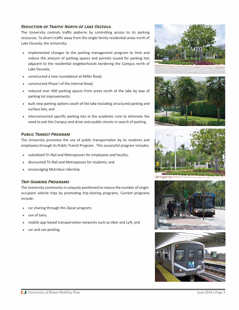
R T N L OThe University controls traffi c pa erns by controlling access to its parking resources. To divert traffi c away from the single-family residen al areas north of Lake Osceola, the University:
implemented changes to the parking management program to limit and reduce the amount of parking spaces and permits issued for parking lots adjacent to the residen al neighborhoods bordering the Campus north of Lake Osceola;
constructed a new roundabout at Miller Road;
constructed Phase I of the Internal Road;
reduced over 400 parking spaces from areas north of the lake by way of parking lot improvements;
built new parking op ons south of the lake including structured parking and surface lots; and
interconnected specifi c parking lots in the academic core to eliminate the need to exit the Campus and drive onto public streets in search of parking.
P T PThe University promotes the use of public transporta on by its students and employees through its Public Transit Program. This successful program includes:
subsidized Tri-Rail and Metropasses for employees and faculty;
discounted Tri-Rail and Metropasses for students; and
encouraging Metrobus ridership.
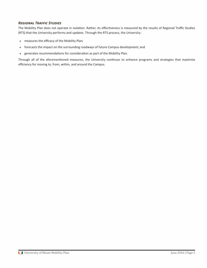
T -S PThe University community is uniquely posi oned to reduce the number of single-occupant vehicle trips by promo ng trip-sharing programs. Current programs include:
car sharing through the Zipcar program;
use of taxis;
mobile app-based transporta on networks such as Uber and Ly ; and
car and van pooling.
University of Miami Mobility Plan June 2016 | Page 4
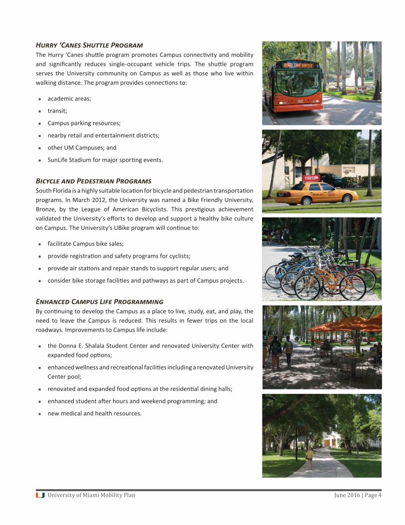
H ‘C S PThe Hurry ‘Canes shu le program promotes Campus connec vity and mobility and signifi cantly reduces single-occupant vehicle trips. The shu le program serves the University community on Campus as well as those who live within walking distance. The program provides connec ons to:
academic areas;
transit;
Campus parking resources;
nearby retail and entertainment districts;
other UM Campuses; and
SunLife Stadium for major spor ng events.
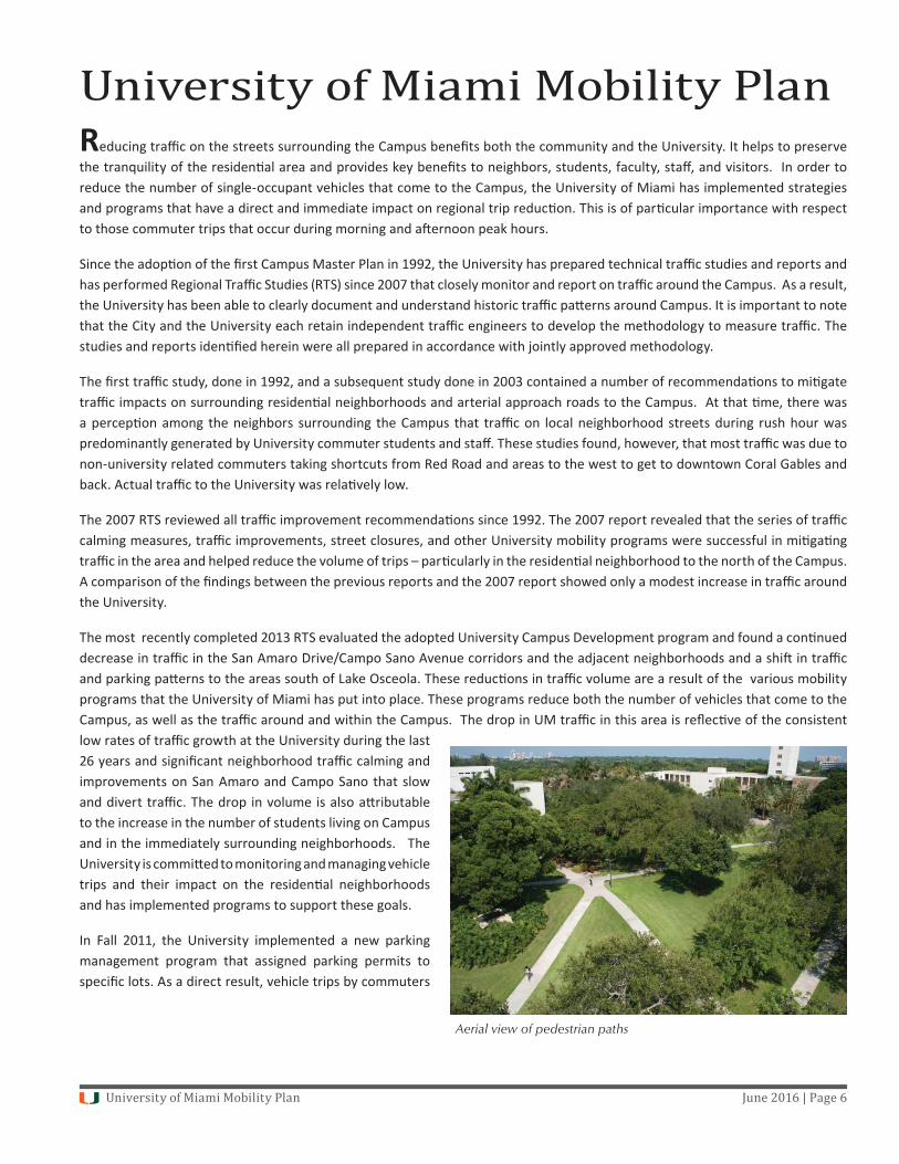
B P PSouth Florida is a highly suitable loca on for bicycle and pedestrian transporta on programs. In March 2012, the University was named a Bike Friendly University, Bronze, by the League of American Bicyclists. This pres gious achievement validated the University’s eff orts to develop and support a healthy bike culture on Campus. The University’s UBike program will con nue to:
facilitate Campus bike sales;
provide registra on and safety programs for cyclists;
provide air sta ons and repair stands to support regular users; and
consider bike storage facili es and pathways as part of Campus projects.
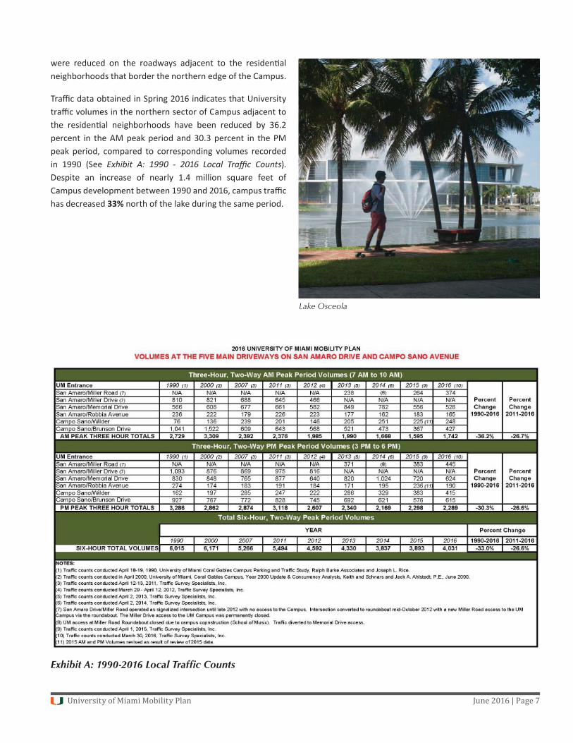
E C L PBy con nuing to develop the Campus as a place to live, study, eat, and play, the need to leave the Campus is reduced. This results in fewer trips on the local roadways. Improvements to Campus life include:
the Donna E. Shalala Student Center and renovated University Center with expanded food op ons;
enhanced wellness and recrea onal facili es including a renovated University Center pool;
renovated and expanded food op ons at the residen al dining halls;
enhanced student a er hours and weekend programming; and
new medical and health resources.
University of Miami Mobility Plan June 2016 | Page 5
R T SThe Mobility Plan does not operate in isola on. Rather, its eff ec veness is measured by the results of Regional Traffi c Studies (RTS) that the University performs and updates. Through the RTS process, the University:
measures the effi cacy of the Mobility Plan;
forecasts the impact on the surrounding roadways of future Campus development; and
generates recommenda ons for considera on as part of the Mobility Plan.
Through all of the aforemen oned measures, the University con nues to enhance programs and strategies that maximize effi ciency for moving to, from, within, and around the Campus.
University of Miami Mobility Plan June 2016 | Page 6
Reducing traffi c on the streets surrounding the Campus benefi ts both the community and the University. It helps to preserve the tranquility of the residen al area and provides key benefi ts to neighbors, students, faculty, staff , and visitors. In order to reduce the number of single-occupant vehicles that come to the Campus, the University of Miami has implemented strategies and programs that have a direct and immediate impact on regional trip reduc on. This is of par cular importance with respect to those commuter trips that occur during morning and a ernoon peak hours.
Since the adop on of the fi rst Campus Master Plan in 1992, the University has prepared technical traffi c studies and reports and has performed Regional Traffi c Studies (RTS) since 2007 that closely monitor and report on traffi c around the Campus. As a result, the University has been able to clearly document and understand historic traffi c pa erns around Campus. It is important to note that the City and the University each retain independent traffi c engineers to develop the methodology to measure traffi c. The studies and reports iden fi ed herein were all prepared in accordance with jointly approved methodology.
The fi rst traffi c study, done in 1992, and a subsequent study done in 2003 contained a number of recommenda ons to mi gate traffi c impacts on surrounding residen al neighborhoods and arterial approach roads to the Campus. At that me, there was a percep on among the neighbors surrounding the Campus that traffi c on local neighborhood streets during rush hour was predominantly generated by University commuter students and staff . These studies found, however, that most traffi c was due to non-university related commuters taking shortcuts from Red Road and areas to the west to get to downtown Coral Gables and back. Actual traffi c to the University was rela vely low.
The 2007 RTS reviewed all traffi c improvement recommenda ons since 1992. The 2007 report revealed that the series of traffi c calming measures, traffi c improvements, street closures, and other University mobility programs were successful in mi ga ng traffi c in the area and helped reduce the volume of trips – par cularly in the residen al neighborhood to the north of the Campus. A comparison of the fi ndings between the previous reports and the 2007 report showed only a modest increase in traffi c around the University.
The most recently completed 2013 RTS evaluated the adopted University Campus Development program and found a con nued decrease in traffi c in the San Amaro Drive/Campo Sano Avenue corridors and the adjacent neighborhoods and a shi in traffi c and parking pa erns to the areas south of Lake Osceola. These reduc ons in traffi c volume are a result of the various mobility programs that the University of Miami has put into place. These programs reduce both the number of vehicles that come to the Campus, as well as the traffi c around and within the Campus. The drop in UM traffi c in this area is refl ec ve of the consistent low rates of traffi c growth at the University during the last 26 years and signifi cant neighborhood traffi c calming and improvements on San Amaro and Campo Sano that slow and divert traffi c. The drop in volume is also a ributable to the increase in the number of students living on Campus and in the immediately surrounding neighborhoods. The University is commi ed to monitoring and managing vehicle trips and their impact on the residen al neighborhoods and has implemented programs to support these goals.
In Fall 2011, the University implemented a new parking management program that assigned parking permits to specifi c lots. As a direct result, vehicle trips by commuters
University of Miami Mobility Plan
Aerial view of pedestrian paths
University of Miami Mobility Plan June 2016 | Page 7
were reduced on the roadways adjacent to the residen al neighborhoods that border the northern edge of the Campus.
Traffi c data obtained in Spring 2016 indicates that University traffi c volumes in the northern sector of Campus adjacent to the residen al neighborhoods have been reduced by 36.2 percent in the AM peak period and 30.3 percent in the PM peak period, compared to corresponding volumes recorded in 1990 (See Exhibit A: 1990 - 2016 Local Traffi c Counts). Despite an increase of nearly 1.4 million square feet of Campus development between 1990 and 2016, campus traffi c has decreased 33% north of the lake during the same period.
Exhibit A: 1990-2016 Local Traffic Counts
Lake Osceola
University of Miami Mobility Plan June 2016 | Page 8
The University’s Mobility Plan is comprised of a series of components as described below:
A. Residen al Campus Strategy
An important goal of the University’s strategic plan is to con nue the evolu on into a predominantly residen al Campus. The University is commi ed to providing more student housing by 2025 and con nuing to expand Campus life facili es. The increased number of students living on Campus has a direct correla on with reduced traffi c during peak hours.
Campus residents with cars are prohibited from driving their vehicles around Campus. Instead, they are encouraged to travel by Hurry ’Canes shu les, bike or foot. By growing the on-Campus residen al popula on and associated parking limita ons, Campus area traffi c is reduced. See Mobility Plan Matrix, Appendix 1, for informa on on Campus popula on under the Residen al Campus Strategy.
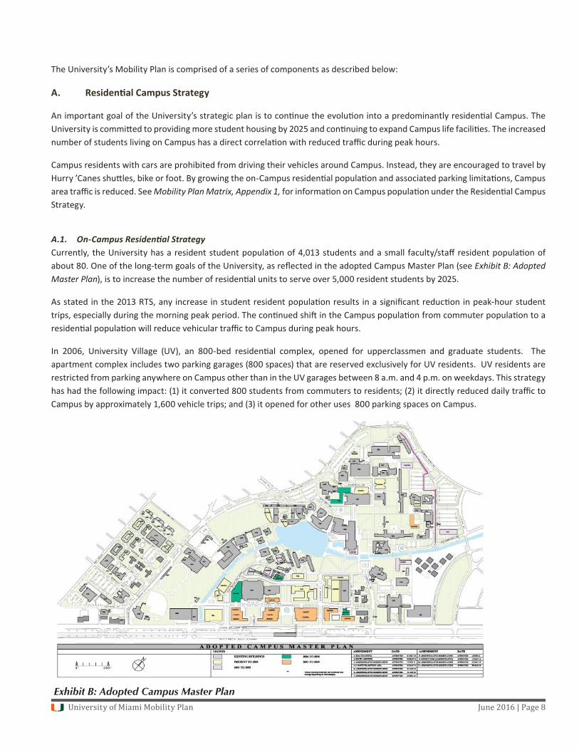
A.1. On-Campus Residen al StrategyCurrently, the University has a resident student popula on of 4,013 students and a small faculty/staff resident popula on of about 80. One of the long-term goals of the University, as refl ected in the adopted Campus Master Plan (see Exhibit B: Adopted Master Plan), is to increase the number of residen al units to serve over 5,000 resident students by 2025.
As stated in the 2013 RTS, any increase in student resident popula on results in a signifi cant reduc on in peak-hour student trips, especially during the morning peak period. The con nued shi in the Campus popula on from commuter popula on to a residen al popula on will reduce vehicular traffi c to Campus during peak hours.
In 2006, University Village (UV), an 800-bed residen al complex, opened for upperclassmen and graduate students. The apartment complex includes two parking garages (800 spaces) that are reserved exclusively for UV residents. UV residents are restricted from parking anywhere on Campus other than in the UV garages between 8 a.m. and 4 p.m. on weekdays. This strategy has had the following impact: (1) it converted 800 students from commuters to residents; (2) it directly reduced daily traffi c to Campus by approximately 1,600 vehicle trips; and (3) it opened for other uses 800 parking spaces on Campus.
Exhibit B: Adopted Campus Master Plan
University of Miami Mobility Plan June 2016 | Page 9
The UV residen al complex also includes 16 two-and-three bedroom townhome units with enclosed garages and two surface lots for faculty and staff families. In some cases, more than one household member is employed by the University. The es mated trip reduc on is approximately 130 trips per day during peak hours and frees up about 30 Campus parking spaces.
The number of residen al beds on campus will be increased in two phases by 2025. The fi rst phase will include over 1,000 new beds in two new buildings south of the Lake by Fall 2019. The second phase will improve the Hecht-Stanford complex and renovate other exis ng residen al buildings.
A.2. Off-Campus/Non-University Residential Development A signifi cant amount of the private-sector residen al development near Campus serves students including the Cloisters, Red Road Commons, The Residences at Merrick Park, Gables Ponce and various other projects in the nearby South Miami and Merrick Park areas including across US-1. The University es mates that more than 1,600 students are now living in the vicinity and are either walking, biking, or using public transit to get to the Campus.
B. Parking Management Program and Policies
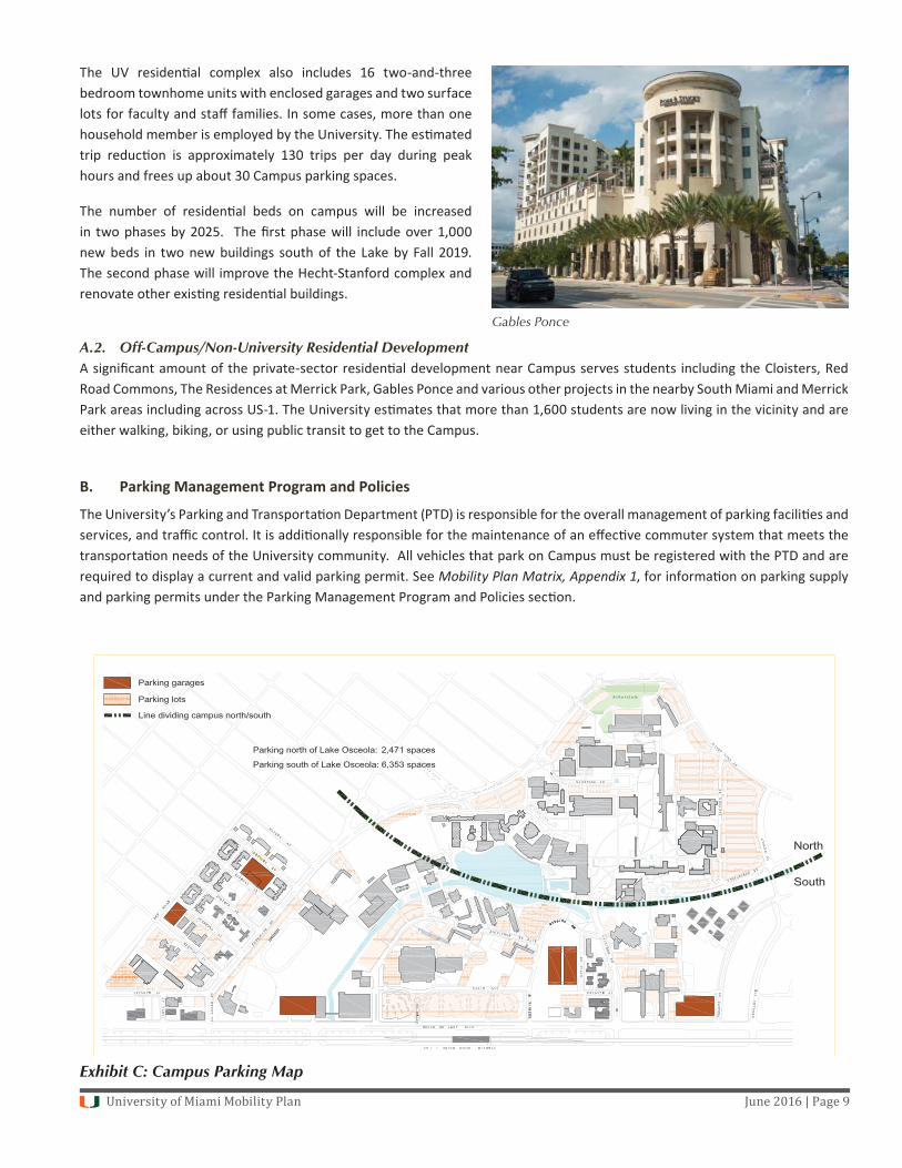
The University’s Parking and Transporta on Department (PTD) is responsible for the overall management of parking facili es and services, and traffi c control. It is addi onally responsible for the maintenance of an eff ec ve commuter system that meets the transporta on needs of the University community. All vehicles that park on Campus must be registered with the PTD and are required to display a current and valid parking permit. See Mobility Plan Matrix, Appendix 1, for informa on on parking supply and parking permits under the Parking Management Program and Policies sec on.
Gables Ponce
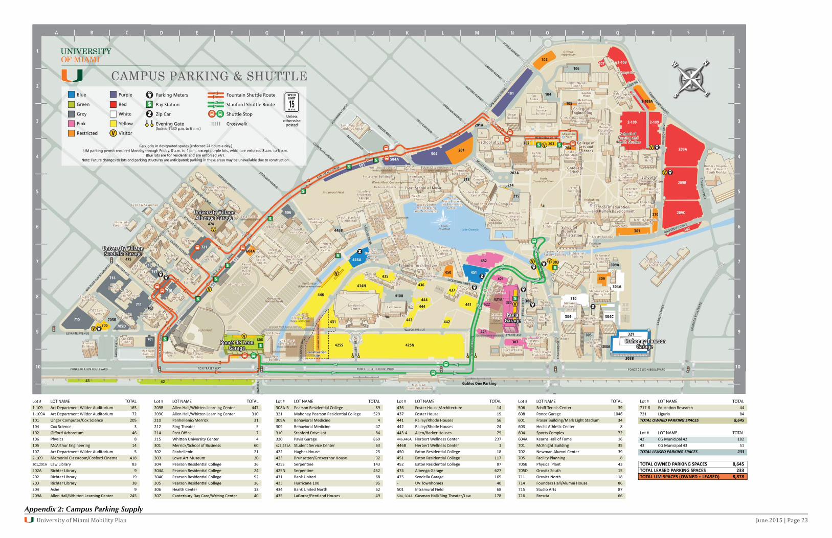
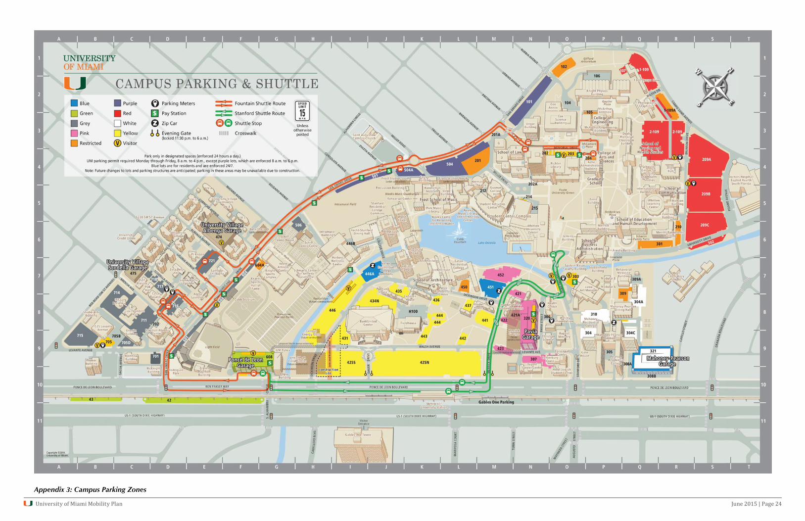
Exhibit C: Campus Parking Map
University of Miami Mobility Plan June 2016 | Page 10
The University has 8,824 parking spaces distributed among surface lots and fi ve parking garages (see Appendix 2: Campus Parking Supply). Of these spaces, 2,471 spaces are located north of Lake Osceola, and the remaining 6,353 spaces are located to the south of the lake with 3,240 of these spaces located in parking garages. Based on a parking accumula on study conducted in October 2011, there is a daily average vacancy of approximately 2,000 spaces during peak occupancy hours. The average daily vacancy was determined based on data collected during 12 consecu ve hours (7 a.m. to 7 p.m.) on two consecu ve days by Keith and Schnars, P.A. The University of Miami Parking and Transporta on Department also monitors parking usage on a daily basis as part of opera ons protocols for parking management purposes.
B.1. No Freshmen Resident Car PolicyIn 2008, the University implemented a policy that restricted fi rst-year resident students from bringing a car on Campus, which immediately and directly reduced parking demand by approximately 500 cars and decreased vehicle trips accordingly.
B.2. Commuter (Students, Faculty, Staff ) Restric ons One characteris c of parking behavior is the tendency of drivers to seek parking as close to their des na on as possible. Therefore, the Campus core area, located to the north of Lake Osceola, with approximately 2,500 spaces, is the most desirable area for parking. These lots are also the closest to the residen al neighborhoods bordering the University.
In Fall 2011, the University implemented a parking management program that issues parking permits for commuter students, faculty, and staff to specifi c parking lots iden fi ed by various colors (See Appendix 3: Campus Parking Zones). The number of permits sold for each parking area is calibrated to the number of parking spaces in interconnected lots of the same color. This ensures that commuters will not have diffi culty fi nding a space in their assigned lot and nearly eliminates the need for commuters to u lize an external surface road to search for parking once they have entered their assigned lot on Campus. Due to the distribu on of parking on Campus, with nearly three-quarters of parking resources located south of Lake Osceola, the program has served to redirect commuters from lots north of the lake to areas south of the lake, further away from the surrounding residen al neighborhoods.
B.3. Service and DeliveriesService and delivery vehicles are encouraged to u lize Ponce de Leon Boulevard to access the Campus. This reduces the number of delivery vehicles that approach the Campus through the residen al neighborhoods. In addi on, the University has reduced the number of service vehicles that are in use on Campus and has added numerous electric vehicles to its fl eet.
Medians
University of Miami Mobility Plan June 2016 | Page 11
C. Neighborhood Traffi c Improvements
Over the past 24 years, a number of traffi c improvements to the roadways separa ng the Campus from the neighborhoods have helped divert, reduce, and calm traffi c. Many residen al streets south of Miller Road (Mataro, Delgado, Zoreta, Consolata, and Zuleta Avenues) and along the Red Road corridor were closed by way of resident pe ons to the City. The City installed medians and plan ngs on San Amaro Drive and along Ponce de Leon that have helped calm and reduce traffi c. The most successful traffi c calming improvements are found along the San Amaro Drive/Campo Sano Avenue corridors. These improvements include enhanced sidewalks, medians, landscaping, ligh ng and limita on of access points to the residen al cross streets in the area. These improvements have had a posi ve impact on reducing speed and minimizing cut-through traffi c into residen al neighborhoods. The 2007 and 2013 RTS reports confi rm the eff ec veness of these improvements by showing that traffi c volumes have been decreasing on neighboring residen al streets.
In Fall 2012, the signalized intersec on at Miller Road and San Amaro Drive was eliminated and a roundabout was constructed in its place. The former Miller Drive entrance to the north of the intersec on was closed and a new entrance to the Campus was provided directly accessed from the circle. The roundabout ended the stop and go traffi c that previously existed at the signalized intersec on and serves as an eff ec ve traffi c calming feature. In Fall 2016, the University Hurry’ Cane shu le will enter the Campus at the new Miller Road entrance instead of con nuing north on San Amaro to Memorial Drive, further reducing traffi c in the bordering residen al streets.
D. Reduc on of Traffi c North of Lake Osceola
In the early 1990’s, a general belief existed that the University was the primary generator of all the traffi c in the area. This belief predated the RTS reports which demonstrated the limited growth of University traffi c, and in some cases, the reduc on of University traffi c over me. This conclusion is supported by the traffi c data, notwithstanding the 1.4 million square feet of Campus development that occurred since the fi rst traffi c study was conducted in 1992.
The Spring 2016 traffi c counts north of Miller Road demonstrate that, since 2011, University traffi c has been reduced by nearly 26.7 percent in the AM peak period and by 26.6 percent in the PM peak hours (see Exhibit A: 1990-2016 Local Traffi c Counts) by adding more student housing, more parking south of Lake Osceola, restric ng parking, elimina ng resident freshmen cars, encouraging alternate modes of transporta on, changing the parking management program, and comple ng the Miller roundabout and Phase I of the Internal Road in Fall 2012.
Campo Sano Drive Median
Traffic Circle
University of Miami Mobility Plan June 2016 | Page 12
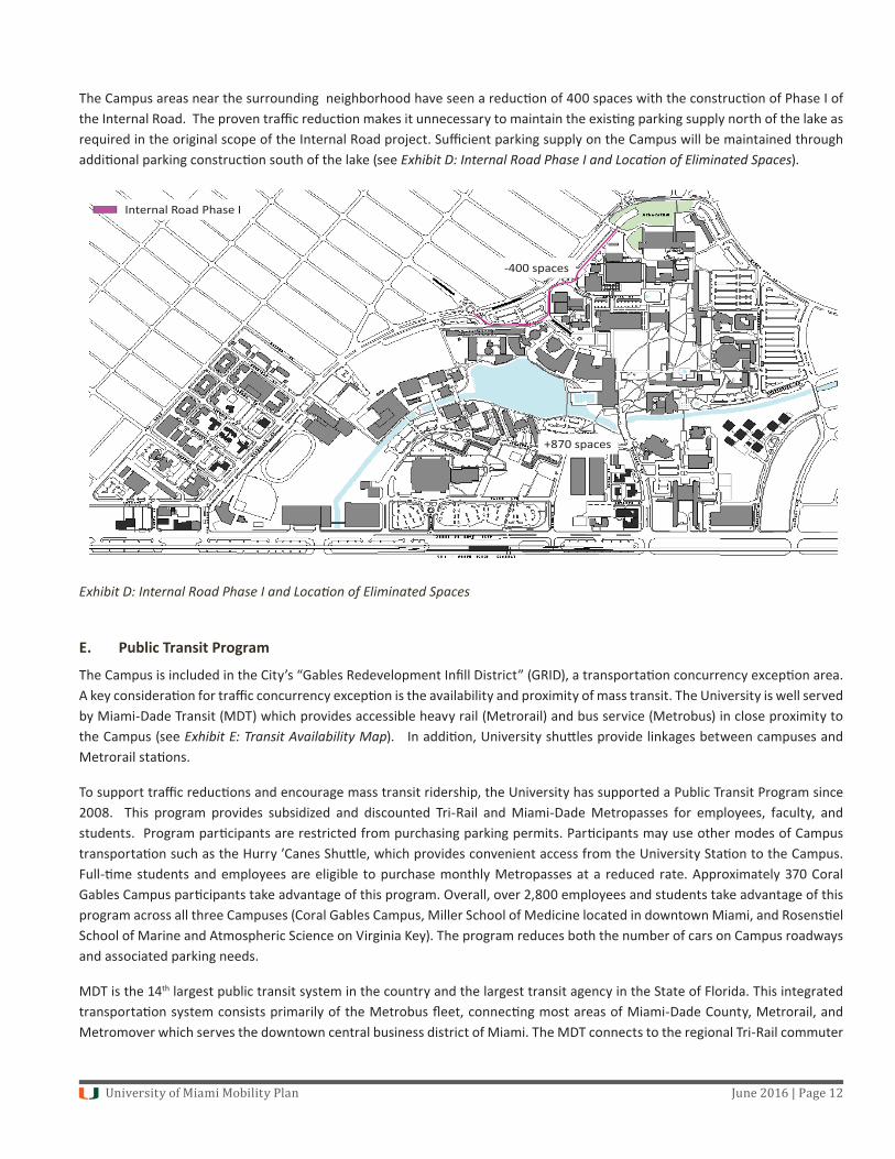
The Campus areas near the surrounding neighborhood have seen a reduc on of 400 spaces with the construc on of Phase I of the Internal Road. The proven traffi c reduc on makes it unnecessary to maintain the exis ng parking supply north of the lake as required in the original scope of the Internal Road project. Suffi cient parking supply on the Campus will be maintained through addi onal parking construc on south of the lake (see Exhibit D: Internal Road Phase I and Loca on of Eliminated Spaces).
Exhibit D: Internal Road Phase I and Loca on of Eliminated Spaces
E. Public Transit Program
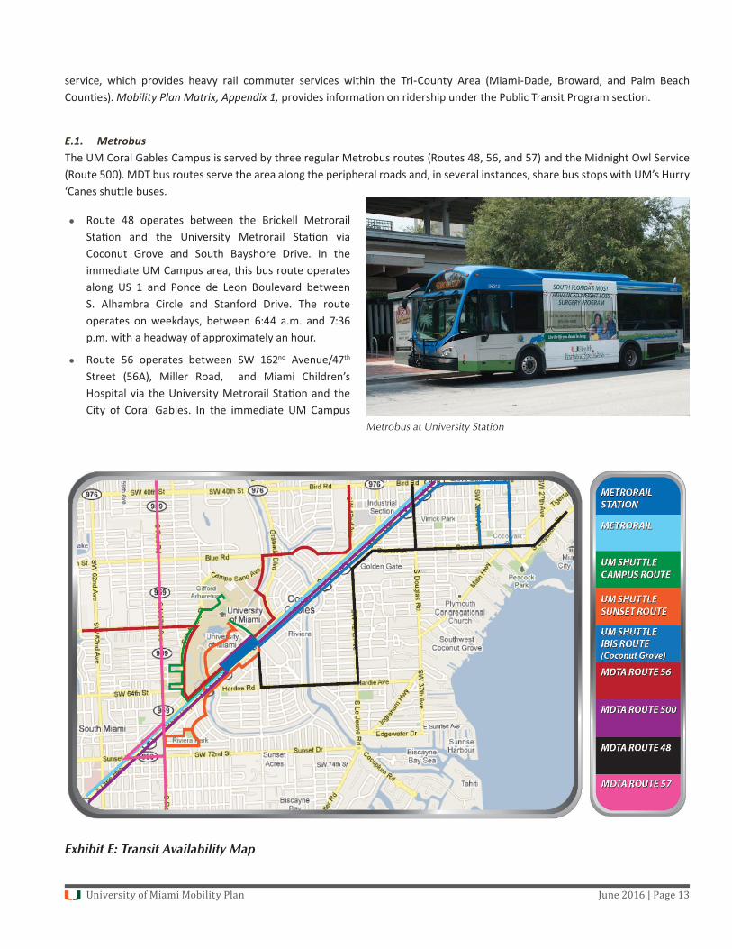
The Campus is included in the City’s “Gables Redevelopment Infi ll District” (GRID), a transporta on concurrency excep on area. A key considera on for traffi c concurrency excep on is the availability and proximity of mass transit. The University is well served by Miami-Dade Transit (MDT) which provides accessible heavy rail (Metrorail) and bus service (Metrobus) in close proximity to the Campus (see Exhibit E: Transit Availability Map). In addi on, University shu les provide linkages between campuses and Metrorail sta ons.
To support traffi c reduc ons and encourage mass transit ridership, the University has supported a Public Transit Program since 2008. This program provides subsidized and discounted Tri-Rail and Miami-Dade Metropasses for employees, faculty, and students. Program par cipants are restricted from purchasing parking permits. Par cipants may use other modes of Campus transporta on such as the Hurry ’Canes Shu le, which provides convenient access from the University Sta on to the Campus. Full- me students and employees are eligible to purchase monthly Metropasses at a reduced rate. Approximately 370 Coral Gables Campus par cipants take advantage of this program. Overall, over 2,800 employees and students take advantage of this program across all three Campuses (Coral Gables Campus, Miller School of Medicine located in downtown Miami, and Rosens el School of Marine and Atmospheric Science on Virginia Key). The program reduces both the number of cars on Campus roadways and associated parking needs.
MDT is the 14th largest public transit system in the country and the largest transit agency in the State of Florida. This integrated transporta on system consists primarily of the Metrobus fl eet, connec ng most areas of Miami-Dade County, Metrorail, and Metromover which serves the downtown central business district of Miami. The MDT connects to the regional Tri-Rail commuter
400 spaces
Internal Road Phase I
+870 spaces
University of Miami Mobility Plan June 2016 | Page 13
service, which provides heavy rail commuter services within the Tri-County Area (Miami-Dade, Broward, and Palm Beach Coun es). Mobility Plan Matrix, Appendix 1, provides informa on on ridership under the Public Transit Program sec on.
E.1. MetrobusThe UM Coral Gables Campus is served by three regular Metrobus routes (Routes 48, 56, and 57) and the Midnight Owl Service (Route 500). MDT bus routes serve the area along the peripheral roads and, in several instances, share bus stops with UM’s Hurry ‘Canes shu le buses.
Route 48 operates between the Brickell Metrorail Sta on and the University Metrorail Sta on via Coconut Grove and South Bayshore Drive. In the immediate UM Campus area, this bus route operates along US 1 and Ponce de Leon Boulevard between S. Alhambra Circle and Stanford Drive. The route operates on weekdays, between 6:44 a.m. and 7:36 p.m. with a headway of approximately an hour.
Route 56 operates between SW 162nd Avenue/47th Street (56A), Miller Road, and Miami Children’s Hospital via the University Metrorail Sta on and the City of Coral Gables. In the immediate UM Campus
Metrobus at University Station
Exhibit E: Transit Availability Map
University of Miami Mobility Plan June 2016 | Page 14
area, this bus route operates along University Drive (Doctors’ Hospital), Pisano Avenue, Granada Boulevard, Ponce de Leon Boulevard (including the University Metrorail Sta on), San Amaro Drive, and Miller Road. The route operates on weekdays, between 5:58 a.m. and 8:01 p.m. with a headway that varies between 40 to 67 minutes.
Route 57 operates between the MIA Metrorail Sta on and the Jackson South Hospital via the Miami Interna onal Airport, South Miami Metrorail Sta on, Red Road (NW/SW 57th Avenue), and the SW 152nd Street Park and Ride, Jackson South Hospital. In the immediate UM Campus area, this bus route operates along SW 57th Avenue on the southwestern boundary of the Campus. The route operates on weekdays between 6:31 a.m. and 7:30 p.m. with a headway that varies between 40 to 65 minutes.
Route 500 Midnight Owl operates on a 60-minute headway schedule on all days of the week from around 12:32 a.m. un l about 5:32 a.m. The buses stop at or near Metrorail sta ons, from Dadeland South to the Government Center sta on, including the University Metrorail sta on. In the immediate Campus area, the route operates along Ponce de Leon Boulevard between Stanford Drive and South Alhambra Circle.
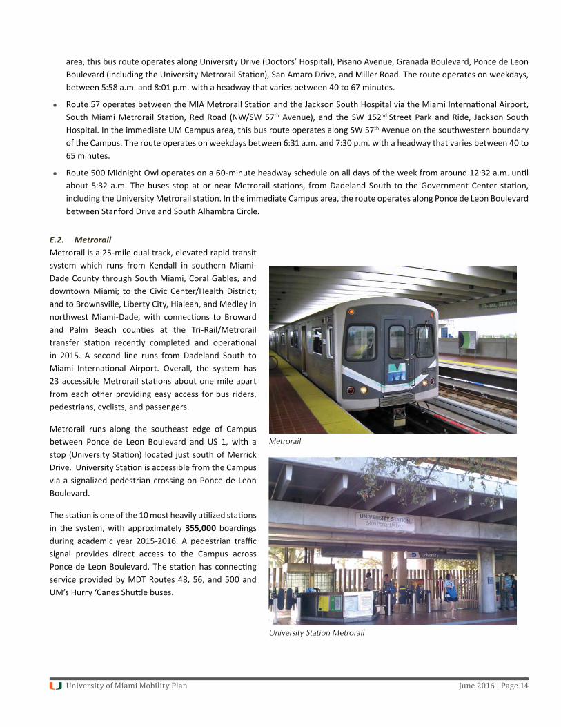
E.2. MetrorailMetrorail is a 25-mile dual track, elevated rapid transit system which runs from Kendall in southern Miami-Dade County through South Miami, Coral Gables, and downtown Miami; to the Civic Center/Health District; and to Brownsville, Liberty City, Hialeah, and Medley in northwest Miami-Dade, with connec ons to Broward and Palm Beach coun es at the Tri-Rail/Metrorail transfer sta on recently completed and opera onal in 2015. A second line runs from Dadeland South to Miami Interna onal Airport. Overall, the system has 23 accessible Metrorail sta ons about one mile apart from each other providing easy access for bus riders, pedestrians, cyclists, and passengers.
Metrorail runs along the southeast edge of Campus between Ponce de Leon Boulevard and US 1, with a stop (University Sta on) located just south of Merrick Drive. University Sta on is accessible from the Campus via a signalized pedestrian crossing on Ponce de Leon Boulevard.
The sta on is one of the 10 most heavily u lized sta ons in the system, with approximately 355,000 boardings during academic year 2015-2016. A pedestrian traffi c signal provides direct access to the Campus across Ponce de Leon Boulevard. The sta on has connec ng service provided by MDT Routes 48, 56, and 500 and UM’s Hurry ‘Canes Shu le buses.
Metrorail
University Station Metrorail

University of Miami Mobility Plan June 2016 | Page 15
Opera onal since July 2012, Miami-Dade Transit’s AirportLink Metrorail Extension has provided a key linkage to Miami Interna onal Airport (MIA) via transit. This connec on runs to MIA and is known as the Orange Line. This link has provided convenient access to University students, staff and faculty travelling to and from MIA and to communi es to the north via the Tri-Rail.
A pedestrian bridge over US-1 connec ng to the Metrorail sta on is expected to be completed by late 2016 or early 2017. This bridge will provide pedestrians a safe overhead path across US-1 and will help to connect the commercial, offi ce, and residen al uses on the south side of US-1 with the Metrorail and the campus on the north side of US-1.
F. Trip-Sharing Program
The University supports those members of its community who choose to not drive, or are restricted from having a car on Campus, by providing a car share program, encouraging van/carpools and app-based transporta on networks such as Uber and Ly , and facilita ng the use of taxicabs. Mobility Plan Matrix, Appendix 1, provides suppor ng informa on on trip sharing programs.
F.1. ZipcarZipcar is an innova ve and aff ordable car-sharing program that was launched on Campus in 2008. Car-sharing industry standards report that car sharing takes about 20 personally-owned vehicles off the road, reduces parking demand, saves money, and is good for the environment. It has been reported that car-sharing members:
drive 40 percent fewer miles;
use public transporta on about 46 percent of the me;
increase bicycle trips by 10 percent; and
increase walking trips by 26 percent.
At present, the UM Zipcar program includes 16 vehicles (including hybrid models) on Campus sta oned at four convenient loca ons with reserved parking spaces:
Eaton Residen al College parking lot;
Hecht/Stanford Residen al parking lot;
University Village; and
Mahoney/Pearson Residen al parking lot.
Zipcar members, 18 and older, may rent a vehicle for an hour, a day, or longer for a small fee that includes fuel, insurance, and maintenance. Zipcars are available 24 hours a day, seven days a week, and can be reserved online. This program is par cularly convenient to resident popula ons that do not have a car on Campus and also for faculty and staff that use public transporta on or ride-sharing programs.
Zipcars
University of Miami Mobility Plan June 2016 | Page 16
There are over 1,500 University and community members of the Zipcar program, a nearly 60 percent increase since 2010 (see Mobility Plan Matrix, Appendix 1). Based on current usage sta s cs, each Zipcar is in use approximately 40 percent of the me with about 30 percent of its use occurring during weekdays and 49 percent during the weekends.
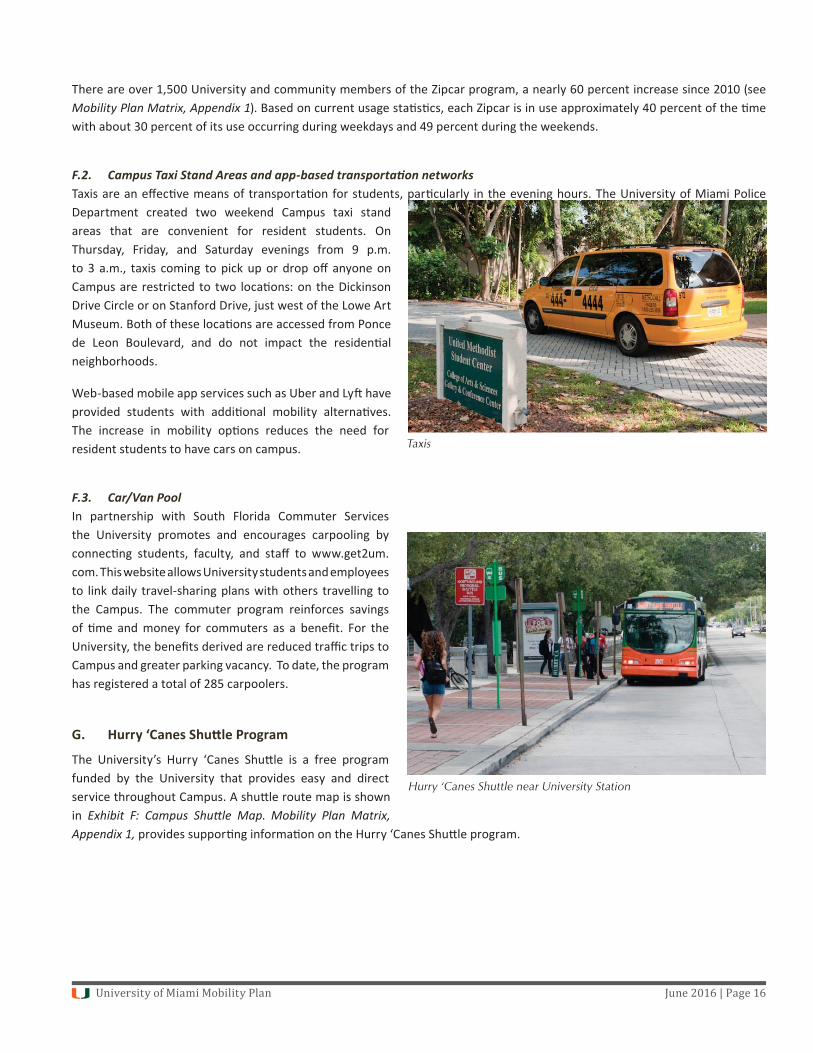
F.2. Campus Taxi Stand Areas and app-based transporta on networksTaxis are an eff ec ve means of transporta on for students, par cularly in the evening hours. The University of Miami Police Department created two weekend Campus taxi stand areas that are convenient for resident students. On Thursday, Friday, and Saturday evenings from 9 p.m. to 3 a.m., taxis coming to pick up or drop off anyone on Campus are restricted to two loca ons: on the Dickinson Drive Circle or on Stanford Drive, just west of the Lowe Art Museum. Both of these loca ons are accessed from Ponce de Leon Boulevard, and do not impact the residen al neighborhoods.
Web-based mobile app services such as Uber and Ly have provided students with addi onal mobility alterna ves. The increase in mobility op ons reduces the need for resident students to have cars on campus.
F.3. Car/Van Pool In partnership with South Florida Commuter Services the University promotes and encourages carpooling by connec ng students, faculty, and staff to www.get2um.com. This website allows University students and employees to link daily travel-sharing plans with others travelling to the Campus. The commuter program reinforces savings of me and money for commuters as a benefi t. For the University, the benefi ts derived are reduced traffi c trips to Campus and greater parking vacancy. To date, the program has registered a total of 285 carpoolers.
G. Hurry ‘Canes Shu le Program
The University’s Hurry ‘Canes Shu le is a free program funded by the University that provides easy and direct service throughout Campus. A shu le route map is shown in Exhibit F: Campus Shu le Map. Mobility Plan Matrix, Appendix 1, provides suppor ng informa on on the Hurry ‘Canes Shu le program.
Hurry ‘Canes Shuttle near University Station
Taxis
University of Miami Mobility Plan June 2016 | Page 17
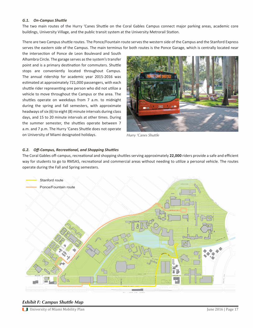
G.1. On-Campus Shu le The two main routes of the Hurry ‘Canes Shu le on the Coral Gables Campus connect major parking areas, academic core buildings, University Village, and the public transit system at the University Metrorail Sta on.
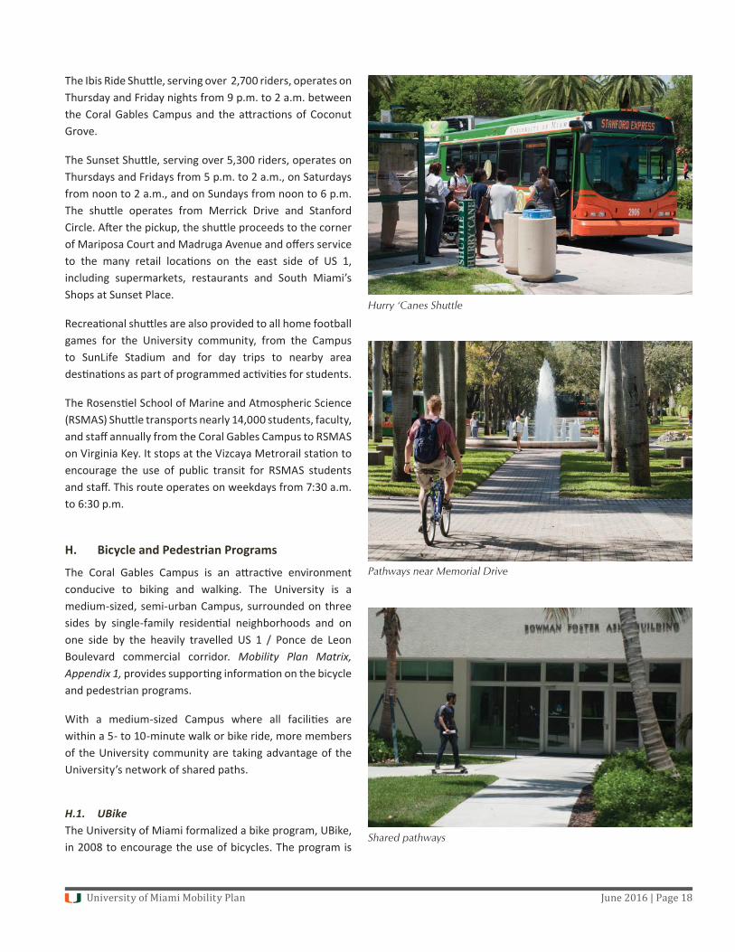
There are two Campus shu le routes. The Ponce/Fountain route serves the western side of the Campus and the Stanford Express serves the eastern side of the Campus. The main terminus for both routes is the Ponce Garage, which is centrally located near the intersec on of Ponce de Leon Boulevard and South Alhambra Circle. The garage serves as the system’s transfer point and is a primary des na on for commuters. Shu le stops are conveniently located throughout Campus. The annual ridership for academic year 2015-2016 was es mated at approximately 721,000 passengers, with each shu le rider represen ng one person who did not u lize a vehicle to move throughout the Campus or the area. The shu les operate on weekdays from 7 a.m. to midnight during the spring and fall semesters, with approximate headways of six (6) to eight (8) minute intervals during class days, and 15 to 20 minute intervals at other mes. During the summer semester, the shu les operate between 7 a.m. and 7 p.m. The Hurry ‘Canes Shu le does not operate on University of Miami designated holidays.
G.2. Off -Campus, Recrea onal, and Shopping Shu lesThe Coral Gables off -campus, recrea onal and shopping shu les serving approximately 22,000 riders provide a safe and effi cient way for students to go to RMSAS, recrea onal and commercial areas without needing to u lize a personal vehicle. The routes operate during the Fall and Spring semesters.
Exhibit F: Campus Shuttle Map
Hurry ‘Canes Shuttle
University of Miami Mobility Plan June 2016 | Page 18
The Ibis Ride Shu le, serving over 2,700 riders, operates on Thursday and Friday nights from 9 p.m. to 2 a.m. between the Coral Gables Campus and the a rac ons of Coconut Grove.
The Sunset Shu le, serving over 5,300 riders, operates on Thursdays and Fridays from 5 p.m. to 2 a.m., on Saturdays from noon to 2 a.m., and on Sundays from noon to 6 p.m. The shu le operates from Merrick Drive and Stanford Circle. A er the pickup, the shu le proceeds to the corner of Mariposa Court and Madruga Avenue and off ers service to the many retail loca ons on the east side of US 1, including supermarkets, restaurants and South Miami’s Shops at Sunset Place.
Recrea onal shu les are also provided to all home football games for the University community, from the Campus to SunLife Stadium and for day trips to nearby area des na ons as part of programmed ac vi es for students.
The Rosens el School of Marine and Atmospheric Science (RSMAS) Shu le transports nearly 14,000 students, faculty, and staff annually from the Coral Gables Campus to RSMAS on Virginia Key. It stops at the Vizcaya Metrorail sta on to encourage the use of public transit for RSMAS students and staff . This route operates on weekdays from 7:30 a.m. to 6:30 p.m.
H. Bicycle and Pedestrian Programs
The Coral Gables Campus is an a rac ve environment conducive to biking and walking. The University is a medium-sized, semi-urban Campus, surrounded on three sides by single-family residen al neighborhoods and on one side by the heavily travelled US 1 / Ponce de Leon Boulevard commercial corridor. Mobility Plan Matrix, Appendix 1, provides suppor ng informa on on the bicycle and pedestrian programs.
With a medium-sized Campus where all facili es are within a 5- to 10-minute walk or bike ride, more members of the University community are taking advantage of the University’s network of shared paths.
H.1. UBikeThe University of Miami formalized a bike program, UBike, in 2008 to encourage the use of bicycles. The program is
Hurry ‘Canes Shuttle
Pathways near Memorial Drive
Shared pathways

University of Miami Mobility Plan June 2016 | Page 19
managed by the Parking and Transporta on Department (PTD), with input and coordina on from other Campus departments. The UBike program ensures that concerns and needs represen ng all aspects of student and University life are considered to make the program accessible, enjoyable, and safe. In March 2012, the University of Miami was designated as a Bicycle Friendly University at the Bronze level by the League of American Bicyclists. This award is presented to colleges and universi es that demonstrate signifi cant commitments to bicycling.
The bike program includes the following components:
Bike sales on Campus by outside vendors;
Traffi c safety classes for bicyclists;
Bike registra on by the University Police Department. In the 2015-2016 academic year over 1,100 new bikes were registered;
Coordina on of construc on and repairs of exis ng and new bike paths by the Facili es and Construc on Department. Generally, paths on Campus are shared by pedestrians and bicyclists. New construc on projects are reviewed to ensure that adequate paths are provided and integrated into the Campus path system and bike racks are properly situated to encourage more bike usage;
Adequate bike parking at mul ple loca ons across the Campus and con nuous monitoring of bike usage pa erns and needs. There are over 300 bike racks throughout Campus, with current capacity for nearly 1,700 bikes. These eff orts ensure that bike riders will fi nd convenient and secure places to park their bicycles overnight and around Campus;
Air sta ons for bike res provided at three loca ons on Campus;
Shower access for students, faculty, and staff commu ng to the University by bicycle;
Support and funding to the UBike student group;
Yearly bike sweeps by the University of Miami Police and Facili es Department to ensure that abandoned bikes are removed from Campus and donated to local chari es;
Distribu on of informa on on local and regional bike events hosted by outside groups; and
Signage showing shared biking paths
UBike Program
Bike racks
University of Miami Mobility Plan June 2016 | Page 20
Easy access to the M-Path located along the southeast side of the Campus providing connec vity to Campus for bicyclists. The M-Path is a paved path that runs the length of the Metrorail guideway and is part of Miami Dade County’s Bicycle Plan. This path provides access north to the Vizcaya Metrorail sta on and south to the Metro busway. An proposed enhancement of the M-Path - The Underline - would provide a more ac ve and engaging linear park experience for pedestrians and bicyclists.
H.2. Pedestrian and Bike PathwaysWhen the UBike program was conceived, the University determined the requirements of the program, with a primary goal to establish shared paths that would allow a bicyclist to traverse the en re Campus.
As part of Campus infrastructure improvements, the University has developed an extensive system of paths that are used by bicycles and pedestrians and has improved and widened sidewalks to minimize areas of pedestrian and bicycle confl ict. Pathways will be incorporated into new Campus projects.
I. Enhanced Campus Life Programming
The University provides a number of facili es and programs that help keep students on Campus. More than 290 student clubs, organiza ons, fraterni es, and sorori es provide a comprehensive variety of ac vi es that engage and inspire students while connec ng them with colleagues involved in similar pursuits.
The Student Center Complex which includes the Donna E. Shalala Student Center and the Whi en University Center has quickly become a hub for Campus life ac vi es. With the addi on of Starbucks, Fresh Fusion, Jamba Juice and the new Rathskellar, there are now more dining op ons at the Student Center Complex likely leading to more people staying on Campus for meals.
The mul purpose room, with capacity of up to 1,000 persons, provides space for events that were previously held off Campus to be held on Campus. This has eliminated the back-and-forth traffi c to bring items off Campus and has kept resident students on Campus for the events.
Student Activity Center
Lowe Art Museum
BankUnited Center
University of Miami Mobility Plan June 2016 | Page 21
The addi on of lounge and study spaces (including the 24-Hour Kornspan Study Lounge) has encouraged commuter students to stay on Campus during breaks in their day.
Late Night Programming aimed at keeping students on Campus was ini ated recently. This includes a monthly “Canes A er Dark” event on Thursday or Friday evenings, Canes Night Live, and food truck events aimed towards keeping students on Campus. A full- me staff posi on was created in the Department of Student Ac vi es and Student Organiza ons to facilitate these types of events.
Commuter ini a ves by the Department of Orienta on and Commuter Student Involvement have also been developed. This includes “Good Morning Commuters” encouraging students to be on Campus in the morning, and remain on Campus. The Commuter Assistant Program creates events at specifi c mes to keep commuters on Campus. Addi onally, the Associa on of Commuter Students Offi ce is an area which members can use as a “home away from home” further encouraging students to remain on Campus.
The Wellness Center provides numerous new program off erings that complement the already successful recrea onal and Campus wellness programs.
In addi on to these aforemen oned, the Cosford Cinema, Lowe Art Museum, BankUnited Center, Ring Theater, dining areas, libraries, and a variety of outdoor Campus areas con nue to provide a host of community spaces that add value to Campus life. All of these facili es and programs support the Mobility Plan’s goals by encouraging and providing for students to remain on Campus.
J. Regional Traffi c Studies
The University of Miami performs a Regional Traffi c Study (RTS) every fi ve years and iden fi es mi ga on that is needed based on a measurement of future roadway and intersec on levels of service against the forecasted Campus development program through build-out in fi ve year increments. The mi ga on in the RTS ensures that the Mobility Plan can con nue to ameliorate reasonable traffi c impacts. The Mobility Plan and the RTS, both mandated by the Development Agreement between the City of Coral Gables and the University, share common goals and objec ves: they both document and quan fy local and regional trip reduc ons. In addi on, the RTS has a greater focus on traffi c impacts and mi ga on. The success of the Mobility Plan is monitored through a mandated annual report that advises of changes in the plan.
The Mobility Plan remains fl exible and capable of incorpora ng new and evolving strategies and technologies, as well as abandoning those that may prove to be unproduc ve. While the Mobility Plan reduces overall vehicle trip genera on on local and regional levels, the RTS measures the success of those reduc ons and the extent to which the goals of the Master Plan are being achieved through a defi ned methodology and process. The 2013 RTS documents and confi rms that the University’s Mobility strategies have been successful in mi ga ng traffi c impacts resul ng from Campus development.
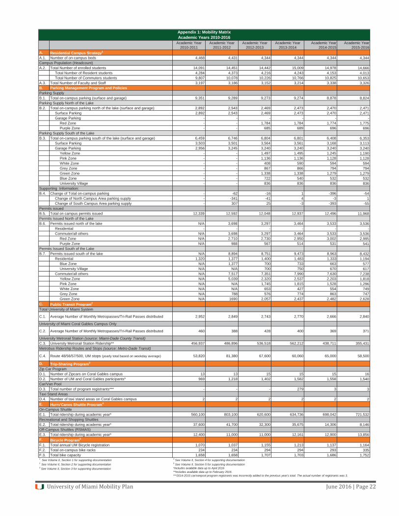
University of Miami Mobility Plan June 2016 | Page 22
Academic Year 2010-2011
Academic Year 2011-2012
Academic Year 2012-2013
Academic Year 2013-2014
Academic Year 2014-2015
Academic Year 2015-2016
A. Residential Campus Strategy1
A.1. Number of on-campus beds 4,468 4,431 4,344 4,344 4,344 4,344Campus Population (Headcount)A.2. Total Number of enrolled students 14,091 14,451 14,442 15,009 14,978 14,666
Total Number of Resident students 4,284 4,373 4,216 4,243 4,153 4,013Total Number of Commuters students 9,807 10,078 10,226 10,766 10,825 10,653
A.3. Total Number of Faculty and Staff 3,197 3,186 3,152 3,214 3,338 3,326B. Parking Management Program and PoliciesParking Supply B.1. Total on-campus parking (surface and garage) 9,351 9,289 9,273 9,274 8,878 8,824Parking Supply North of the LakeB.2. Total on-campus parking north of the lake (surface and garage) 2,892 2,543 2,469 2,473 2,470 2,471
Surface Parking 2,892 2,543 2,469 2,473 2,470 2,471Garage Parking - - - - - -
Red Zone - - 1,784 1,784 1,774 1,775Purple Zone - - 685 689 696 696
Parking Supply South of the LakeB.3. Total on-campus parking south of the lake (surface and garage) 6,459 6,746 6,804 6,801 6,408 6,353
Surface Parking 3,503 3,501 3,564 3,561 3,168 3,113Garage Parking 2,956 3,245 3,240 3,240 3,240 3,240
Yellow Zone - - 1,497 1,495 1,245 1,190Pink Zone - - 1,136 1,136 1,128 1,128White Zone - - 408 590 594 594Grey Zone - - 867 866 794 794Green Zone - - 1,338 1,338 1,279 1,279Blue Zone - - 722 540 532 532University Village - - 836 836 836 836
Supporting Information:B.4. Change of Total on-campus parking - -62 -16 1 -396 -54
Change of North Campus Area parking supply - -341 -41 4 -3 1Change of South Campus Area parking supply - 307 25 -3 -393 -55
Permits issuedB.5. Total on campus permits issued 12,339 12,592 12,048 12,937 12,496 11,968Permits Issued North of the LakeB.6. Permits issued north of the lake N/A 3,698 3,297 3,464 3,533 3,536
Residential - - - - - -Commuter/all others N/A 3,698 3,297 3,464 3,533 3,536
Red Zone N/A 2,710 2,730 2,950 3,002 2,995Purple Zone N/A 988 567 514 531 541
Permits Issued South of the LakeB.7. Permits issued south of the lake N/A 8,894 8,751 9,473 8,963 8,432
Residential 1,320 1,377 1,400 1,483 1,333 1,194Blue Zone N/A 1,377 700 733 663 577University Village N/A N/A 700 750 670 617
Commuter/all others N/A 7,517 7,351 7,990 7,630 7,238Yellow Zone N/A 5,039 2,320 2,537 2,203 1,818Pink Zone N/A N/A 1,745 1,815 1,528 1,296White Zone N/A N/A 653 427 554 749Grey Zone N/A 788 576 774 863 747Green Zone N/A 1690 2,057 2,437 2,482 2,628
C. Public Transit Program2
Total University of Miami System
C.1. Average Number of Monthly Metropasses/Tri-Rail Passes distributed 2,952 2,849 2,743 2,770 2,666 2,840
University of Miami Coral Gables Campus Only
C.2. Average Number of Monthly Metropasses/Tri-Rail Passes distributed 460 388 428 400 369 371
University Metrorail Station (source: Miami-Dade County Transit)C.3. University Metrorail Station Ridership** 456,937 486,896 536,518 562,212 438,711 355,431Metrobus Ridership Routes and Stops (source: Metro-Dade Transit)
C.4. Route 48/56/57/500, UM stops (yearly total based on weekday average) 53,820 81,380 67,600 60,060 65,000 58,500
D. Trip-Sharing Program3
Zip Car ProgramD.1. Number of Zipcars on Coral Gables campus 13 13 15 15 15 16D.2. Number of UM and Coral Gables participants* 969 1,218 1,402 1,582 1,558 1,540Car/Van PoolD.3. Total number of program registrants*** - - - 279 3 3Taxi Stand AreasD.4. Number of taxi stand areas on Coral Gables campus 2 2 2 2 2 2E. Hurry'Canes Shuttle Program4
On-Campus ShuttleE.1. Total ridership during academic year* 560,100 803,100 620,600 634,736 698,042 721,532Recreational and Shopping ShuttlesE.2. Total ridership during academic year* 37,600 41,700 32,300 35,675 14,306 8,146Off-Campus Shuttles (RSMAS)E.3. Total ridership during academic year* 12,400 11,000 11,000 12,161 12,900 13,856F. Bicycle Program5
F.1. Total annual UM Bicycle registration 1,070 1,037 1,155 1,213 1,137 1,164F.2. Total on-campus bike racks 234 234 294 294 293 335F.3. Total bike capacity 1,658 1,658 1,707 1,703 1,686 1,7521 See Volume II, Section 1 for supporting documentation 2 See Volume II, Section 2 for supporting documentation3 See Volume II, Section 3 for supporting documentation
Appendix 1: Mobility MatrixAcademic Years 2010-2016
4 See Volume II, Section 4 for supporting documentation5 See Volume II, Section 5 for supporting documentation *Includes available data up to April 2016 **Includes available data up to February 2016. ***2014-2015 car/vanpool program registrants was incorrectly added to the previous year's total. The actual number of registrants was 3.
University of Miami Mobility Plan June 2015 | Page 23
Appendix 2: Campus Parking Supply
Lot # LOT NAME TOTAL1-109 Art Department Wilder Auditorium 1651-109A Art Department Wilder Auditorium 72101 Unger Computer/Cox Science 205104 Cox Science 3
106 Physics 8105 McArthur Engineering 14107 Art Department Wilder Auditorium 52-109 Memorial Classroom/Cosford Cinema 418201,201A
204 Ashe 9
Lot # LOT NAME TOTAL
210 Panhellenic/Merrick 31212 Ring Theater 5
301 Merrick/School of Business 60302 Panhellenic 21303 Lowe Art Museum 20
306 Health Center 12
Lot # LOT NAME TOTAL
421,421A
422 Hughes House 25
431 Bank United 68433 Hurricane 100 95434 Bank United North 62435 LaGorce/Pentland Houses 49
Lot # LOT NAME TOTAL436 Foster House/Architecture 14437 Foster House 19441 Railey/Rhode Houses 56442 Railey/Rhode Houses 24443-4 Allen/Barker Houses 75446,446A
475 Scodella Garage 169- UV Townhomes 40501 Intramural Field 68504, 504A Gusman Hall/Ring Theater/Law 178
Lot # LOT NAME TOTAL
608 Ponce Garage 1046601 Fraser Building/Mark Light Stadium 34
604 Sports Complex 72604A Kearns Hall of Fame 16701 McKnight Building 35702 Newman Alumni Center 39705 Facility Planning 8705B Physical Plant 43
714 Founders Hall/Alumni House 86715 Studio Arts 87716 Brescia 66
Lot # LOT NAME TOTAL
721 Liguria 84TOTAL OWNED PARKING SPACES 8,645
Lot # LOT NAME TOTAL42 CG Municipal 42 18243 CG Municipal 43 51TOTAL LEASED PARKING SPACES 233
TOTAL OWNED PARKING SPACES 8,645TOTAL LEASED PARKING SPACES 233TOTAL UM SPACES (OWNED + LEASED) 8,878
University of Miami Mobility Plan June 2015 | Page 24
Appendix 3: Campus Parking Zones