Embed Size (px)
Citation preview
Modeling Altimetry Data Error for Ocean Data Assimilation
Alexey Kaplan and Mark A. Cane (LDEO)
Lamont-Doherty Earth Observatory of Columbia University
JCSDA Partners collaborators: David Behringer (NCEP), Michele Rienecker, Christian Keppenne, and Jossy Jacob (GMAO)
JCSDA 8th Workshop on Satellite Data Assimilation, May 4-5, 2010, UMBC
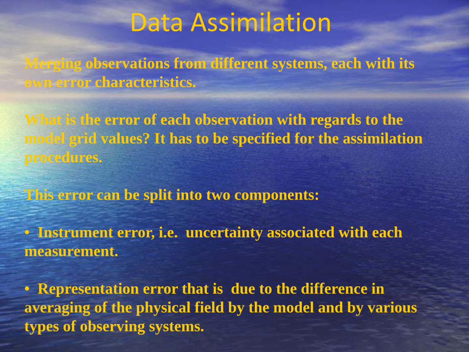
Data AssimilationMerging observations from different systems, each with its own error characteristics.
What is the error of each observation with regards to the model grid values? It has to be specified for the assimilation procedures.
This error can be split into two components:
• Instrument error, i.e. uncertainty associated with each measurement.
• Representation error that is due to the difference in averaging of the physical field by the model and by various types of observing systems.
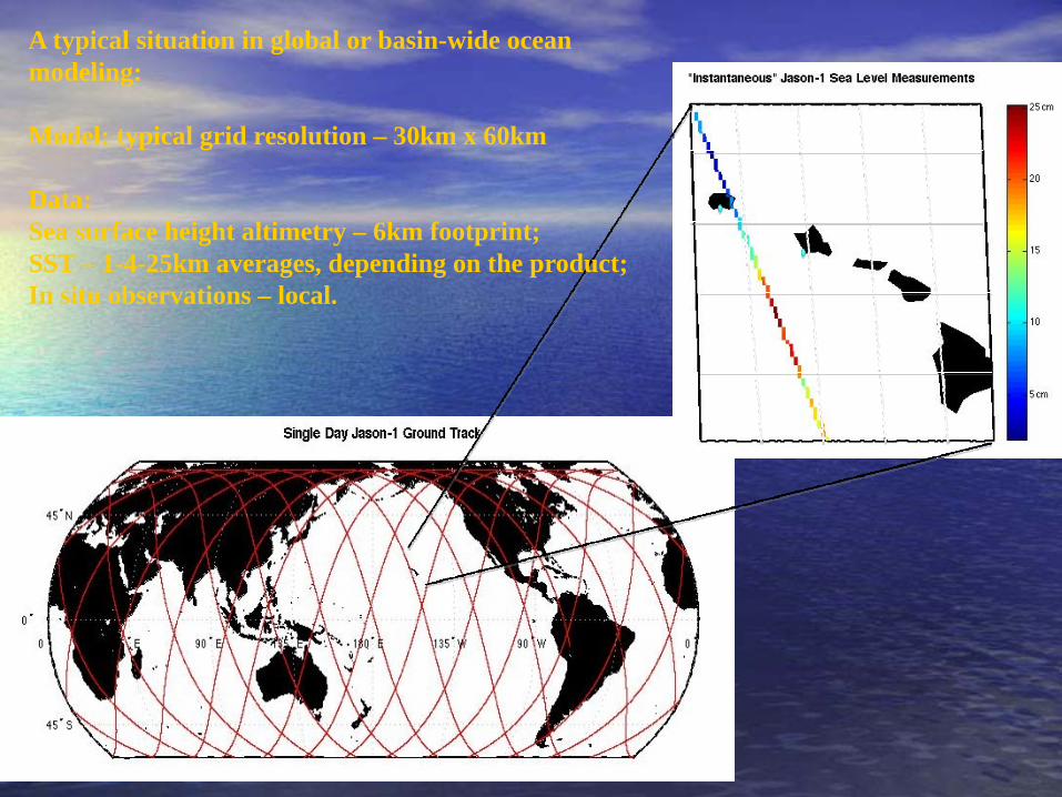
A typical situation in global or basin-wide ocean modeling:
Model: typical grid resolution – 30km x 60km
Data: Sea surface height altimetry – 6km footprint;SST – 1-4-25km averages, depending on the product;In situ observations – local.
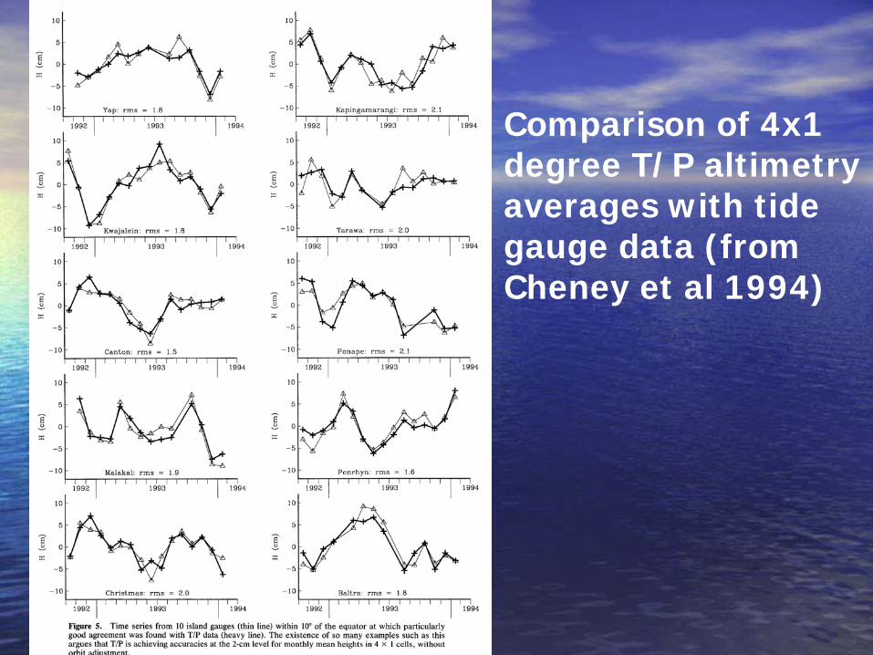
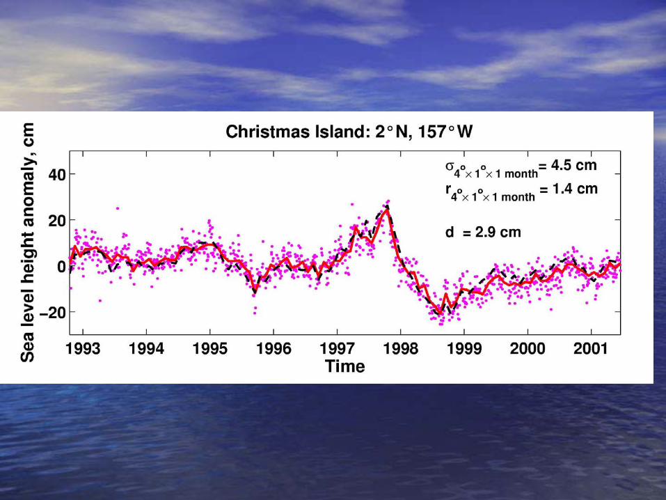
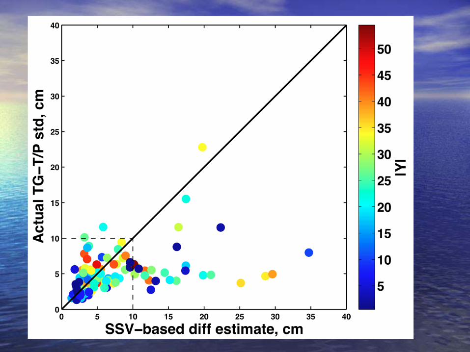
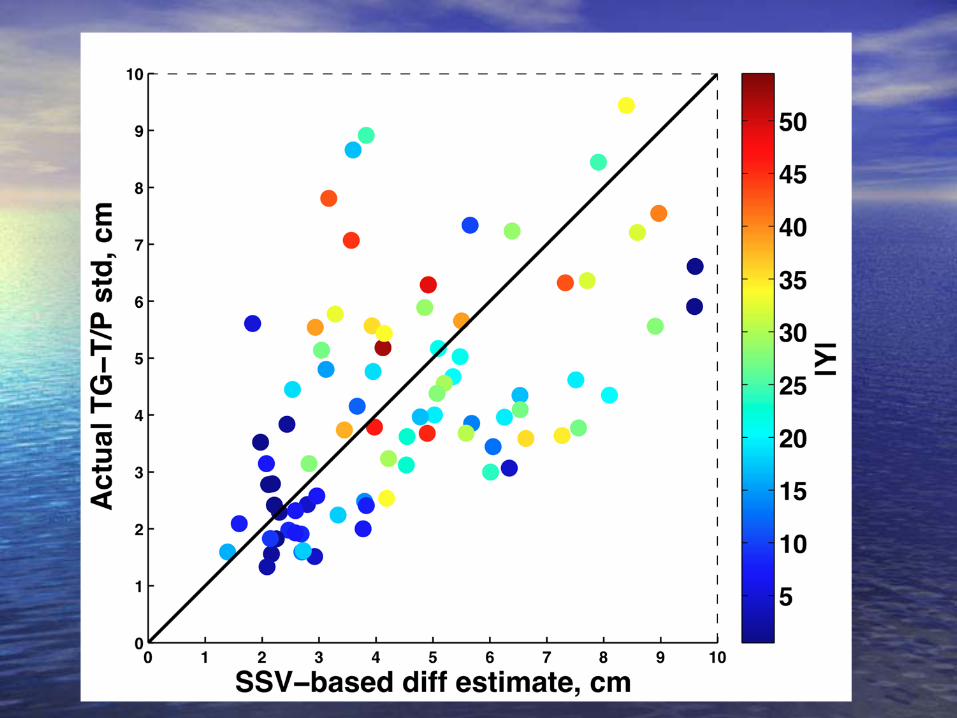
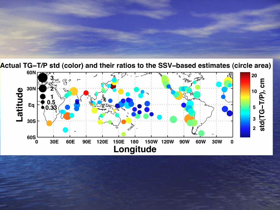
Comparison of 4x1 degree T/P altimetry averages with tide gauge data (from Cheney et al 1994)
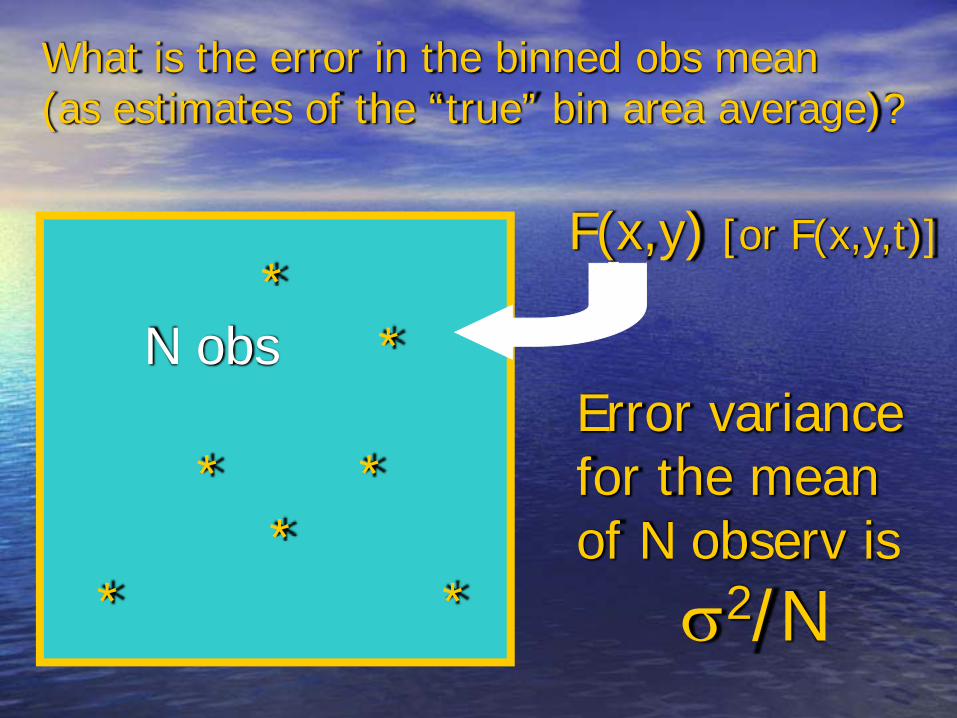
*N obs *
* **
* *
F(x,y) [or F(x,y,t)]
Error variancefor the meanof N observ is
σ2/N
What is the error in the binned obs mean (as estimates of the “true” bin area average)?
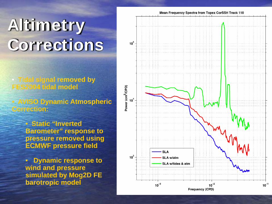
Altimetry Corrections
• Tidal signal removed by FES2004 tidal model
• AVISO Dynamic Atmospheric Correction:
• Static “Inverted Barometer” response to pressure removed using ECMWF pressure field
• Dynamic response to wind and pressure simulated by Mog2D FE barotropic model

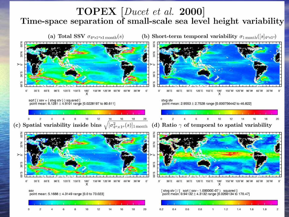
Total SS and ST variability in T/Pinside 4x1xmonth bins
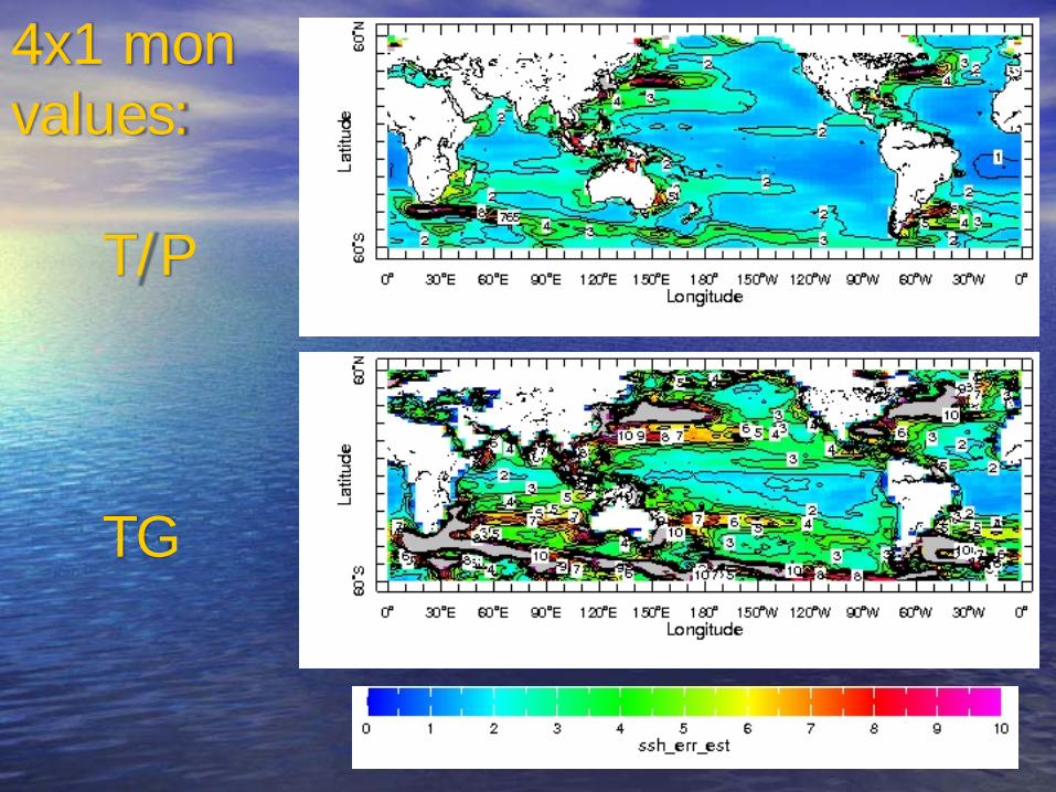
4x1 monvalues:
T/P
TG

Monthly correlation coefficient:GODAS SSH (D. Behringer et al) and
AVISO altimetry map
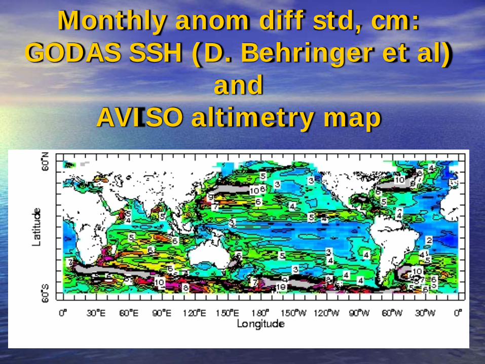
Monthly anom diff std, cm:GODAS SSH (D. Behringer et al)
and AVISO altimetry map

T/P error in representing bin 4x1x1mon means
T/P – (T/P+ERS1,2) [Ducet et al, 2000]
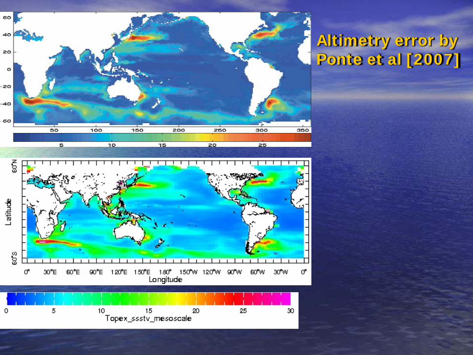
Altimetry error by Ponte et al [2007]
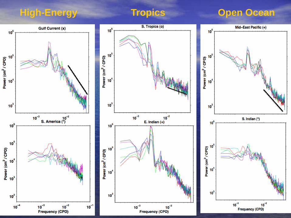
High-Energy Tropics Open Ocean
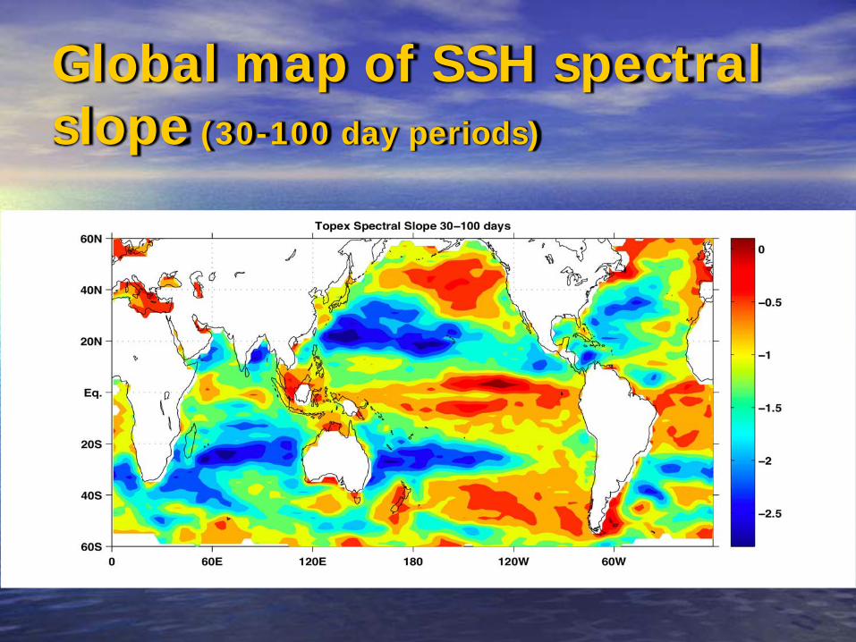
Global map of SSH spectral slope (30-100 day periods)
Conclusions and Outlook1. Sea surface height error parameterizations were presented in terms of sampling errors affecting the grid box averages and verified by comparisons with tide gauge records. The method provided the spatial error maps that can be physically interpreted in terms of small-scale and short-term (mesoscale) variability.
2. Error maps for the monthly gridded altimetry fields, for monthly tide gauge values, and for along-track 1o averages of T/P data were presented with regards to the "true" 4o longitude by 1o latitude monthly sea surface height means.
3. Assimilation into state-of-the-art ocean models with resolution below 1o
requires similar maps (under development) produced with regards to the true daily values of the model gridbox averages, i.e. based on variance estimates at the scales smaller than those currently resolved by the satellite altimetry; such estimates can be derived from power spectrum parameterizations of sea surface height variability.