Embed Size (px)
Citation preview

Modeling Rainfall Runoff and Snowmelt Modeling Rainfall Runoff and Snowmelt in the Pine Flat Watershedin the Pine Flat Watershed
ByBy
Rachael Hersh-BurdickRachael Hersh-Burdick
USACE Water Management Sacramento DistrictUSACE Water Management Sacramento District
UC Davis Civil and Environmental Engineering DepartmentUC Davis Civil and Environmental Engineering Department
[email protected]@us.army.mil

Goals of Pine Flat Modeling ProjectGoals of Pine Flat Modeling Project
Can HEC-HMS accurately model Can HEC-HMS accurately model snowmelt runoff volume?snowmelt runoff volume?
Inflow model for reservoir operators Inflow model for reservoir operators
Create comfort and familiarity with Create comfort and familiarity with HEC-HMS in Corps Sac District HEC-HMS in Corps Sac District

OverviewOverview
Characteristics of Pine FlatCharacteristics of Pine Flat
Model StructureModel Structure
Snow-Melt Modeling with HEC-HMS Snow-Melt Modeling with HEC-HMS
Why model Pine Flat?Why model Pine Flat?
Pine Flat ReservoirPine Flat ReservoirElev. 970 ft
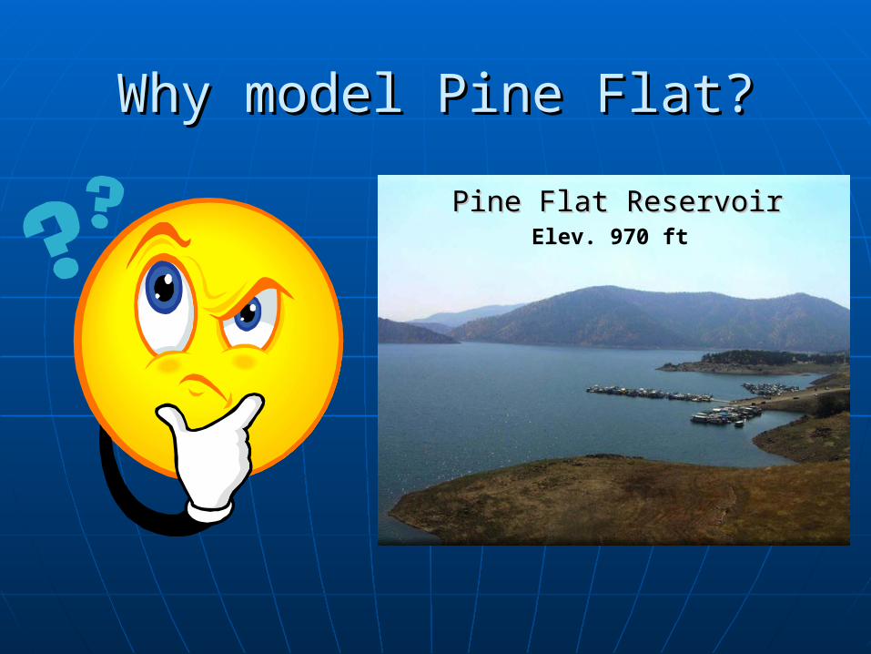
Central Valley Project WatershedsCentral Valley Project Watersheds
Pine Flat BasinPine Flat Basin• Mean elevation: Mean elevation:
7,635 ft7,635 ft
• Elevation Range: Elevation Range: 700 – 14,000 ft700 – 14,000 ft
• Area = 1,541 miArea = 1,541 mi22
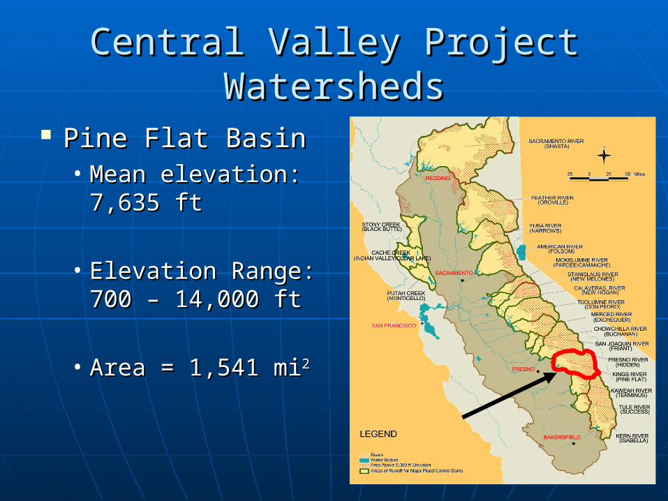
Why model snowmelt?Why model snowmelt? Average April 1 volume of water Average April 1 volume of water
stored in the snow pack = 1.8 MAFstored in the snow pack = 1.8 MAF Reservoir Storage = 1.0 MAFReservoir Storage = 1.0 MAF
2006 1997

Pine Flat DamPine Flat Dam
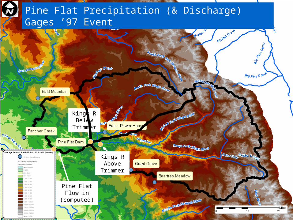
Pine Flat Precipitation (& Discharge) Gages ’97 Event
Kings R Above
Trimmer
Kings R Below
Trimmer
Pine Flat Flow in
(computed)

Temp
Groundmelt
Rain on snowvs
Sun on snow
Snow cold content
f(snow density, temp)
Wind
Basic Snowmelt Basic Snowmelt Modeling ConceptsModeling Concepts

Numerical Snow ModelsNumerical Snow Models
Energy BudgetEnergy Budget ComponentsComponents
• WindWind• TemperatureTemperature• Water VaporWater Vapor• Radiation (net)Radiation (net)• PrecipitationPrecipitation• Advection (rain)Advection (rain)• GroundmeltGroundmelt
Detailed (layered) Detailed (layered) snow packsnow pack
Temperature IndexTemperature Index ComponentsComponents
• TemperatureTemperature• PrecipitationPrecipitation
Single layer snowSingle layer snow Calibration of meltrate Calibration of meltrate
coefficient implicitly coefficient implicitly accounts for other accounts for other factors factors
(Dr. Steve Daly)

Temperature IndexTemperature Index Degree-day approach Degree-day approach
• Fixed amount of snowmelt for each degree Fixed amount of snowmelt for each degree above freezingabove freezing
Primary Equation:Primary Equation:• Snowmelt= (Air –Freezing Temp)*CSnowmelt= (Air –Freezing Temp)*C
C = time variant factor that includes:C = time variant factor that includes:• total heat transfer at snow surface (LW & SW total heat transfer at snow surface (LW & SW
radiation)radiation)• latent heatlatent heat• sensible heat sensible heat • wind speed, aspect, slope, vegetationwind speed, aspect, slope, vegetation• MeltrateMeltrate

Kings River Below North Fork Kings River Below North Fork ’97 Event’97 Event
Blue = Daily observed Flow; Red = Daily modeled flow
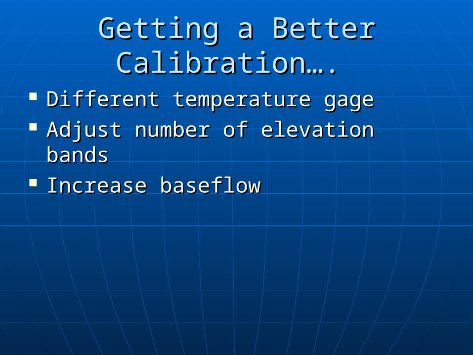
Getting a Better Calibration…. Getting a Better Calibration….
Different temperature gage Different temperature gage Adjust number of elevation bandsAdjust number of elevation bands Increase baseflowIncrease baseflow

Pine Flat SWE & Temperature Gages from ’97 Event

Snow Water Equivalent Snow Water Equivalent
Blue = Observed; Red= Modeled (in Reynold’s Creek Example)

Getting a Better Calibration…. Getting a Better Calibration….
Different temperature gage Different temperature gage Adjust number of elevation bandsAdjust number of elevation bands Increase baseflowIncrease baseflow Create more subbasinsCreate more subbasins

The EndThe End