Embed Size (px)
Citation preview
Park News & Guide National Park Service U.S. Department of the Interior
Mojave National PreserveIssue 12 / Spring 2008
3 Mojave’s RoadsJust getting around Mojave National Preserve, the third largest unit of the National Park System in the contiguous United States, can be a trial for some. But it need not be. Plan ahead and prioritize; familiarize yourself with Mojave’s paved and dirt roads and the major sites to see along the way. And re-member—you’ll never see it all in one day (but you can always come back)...
5 WildflowersIt’s that time again! Spring 2008 looks to be a great season for wildflowers in the Mojave Desert. Bring your friends, family, cameras, and
field guides, but also a sense of responsibility—such lush
plant growth might conceal hidden dangers...
6 CampgroundsMojave National Preserve is a camper’s para-dise. Developed campgrounds, roadside camp-ing, and backcountry camping offer oppor-tunities for individuals and groups of diverse ages, interests, and skills. Careful planning and knowledge of camping rules and regulations will help ensure an enjoyable and safe experi-ence for you, future visitors, and the fragile desert environment...
Essential Information…2
Faces & Places…4
Nature & Science…5
Camping…6
Hiking…7
Mojave National Preserve Map…8
A Fighting Chance: Saving the Mohave Tui Chub
NPS
/Ch
rISt
INe
SCh
leg
el
Ivanpah Valley as seen from the Ivanpah Mountains near Morning Star Mine.
Welcome to Mojave! As superintendent of Mojave National Preserve, I want to extend my personal welcome to you and my hope that your visit will be rewarding. Spring is always a great time to visit. rainstorms throughout the winter months have provided plenty of moisture—we expect an exceptional wildflower season. the dunes evening primrose is already blooming near Kelso Dunes, and the flower season will con-tinue moving up to higher elevations through May.
Mojave National Preserve encompasses a vast area of the Mojave Desert ecosystem, including sand dunes, Joshua tree forests, cactus gardens, lava flows, and cinder cones. here you will find opportunities for quiet canyon hikes, backcountry road trips, and visits to old mines and military outposts. Stay at one of the camp-grounds, or pick a backcountry campsite, and you will experience the dark night sky and see an amazing number of stars. Most of us don’t get to see this anymore, so enjoy it while you’re here.
Many adventures await you at Mojave National Preserve. I encourage you to ex-perience the desert by taking short walks in various habitats. Suggested hikes are listed on page 7. For trip-planning advice or to learn more about park resources and management activities, rangers are on duty at Kelso Depot and hole-in-the-Wall to assist you. You may also visit us online or contact park staff as indicated on the second page of this guide.
Dennis SchrammSuperintendent
T h e M o h av e T u i C h u b (Siphaletes bicolor mohavensis) i s T h e
only fish native to the Mojave River system. But it lives there no more.
Between the 1930s and 1960s, changes in the Mojave River ecosys-tem—many of them the result of human activity—ultimately led to the elimination of the Mohave tui chub from its ancestral home. Ex-otic fish species were introduced into the river. Some species preyed upon or out-competed Mohave tui chub. Another fish—the arroyo chub—hybridized with them. Increasing urbanization of the desert environment led to dramatic changes in river hydrology. Dam con-struction and over-drafting of groundwater resources significantly altered Mohave tui chub habitat—critical habitat to which it was uniquely adapted.
In 1970, thought to have vanished from the Mojave River, it was listed as an endangered species—one of the first animals protected by the Endangered Species Act. Given its history, the Mohave tui chub could have been extinct. Decades earlier, however, a small, isolated population was found along the shores of the dry Soda Lake, near the western border of Mojave National Preserve.
It is not known exactly when it happened. Nor, indeed, that it even happened in this way at all. Yet, it has been hypothesized that at some unspecified time in the past, the Mojave River flooded—just as it had for millennia—flushing a small population of fish downstream into the ephemeral Soda Lake. Eventually, the waters receded and the lake began to dry. As the water evaporated around them, the displaced Mohave tui chub became confined to a small spring near Zzyzx, California. By mere chance, it seems, the spring (today called “Mohave Chub Spring” or just “MC Spring”) became a natural refuge: the Mohave tui chub living within were sheltered from the deadly conditions faced by their river-dwelling relatives.
Curtis Howe Springer, operator of the Zzyzx Mineral Springs and Health Spa, discovered the fish-filled spring in the 1940s. He intro-duced the Mohave tui chub into Lake Tuendae, a lake he had con-structed nearby. Unknowingly, Springer had created—by chance—another, larger refuge. Since then, two more human-made refugia have been established. Today, all Mohave tui chub in existence are descendants of the fish Springer “saved” from MC Spring.
It is hoped that the Mohave tui chub might one day be safely reintro-duced into their wild homeland: the Mojave River. But researchers are not taking any chances. In cooperation with the Desert Discov-ery Center in Barstow, California, National Park Service biologists are investigating several characteristics of the Mohave tui chub to
Top: Lake Tuendae at historic Zzyzx, California (open to the public): one of three human-made refugia for the endangered Mohave tui chub.
Bottom: A researcher carefully handles a Mohave tui chub.
determine the viability of reintroduction. Visitors are encouraged to monitor the research for themselves. At the Desert Discovery Center several aquariums containing Mohave tui chub have been installed, offering a rare opportunity to view this living lucky charm:
Desert Discovery Center831 Barstow Road, Barstow, CA 92311 Hours: Tuesday–Saturday, 11 a.m. to 4 p.m.ph: 760-252-6060web: www.discoverytrails.org/welcome1.html
While research has only just begun, these pioneering fish might hold clues for the survival of their species. You’ve gotta like their chances!
Michael Glore, Park Ranger
©ro
B FU
lto
N
NPS ColleCtIoN
� Mojave National Preserve
Dates and Hours of Operationthe preserve is always open. Information centers (see below) maintain regular hours of operation.
Fees and Reservationsthere are currently no entrance fees for Mojave National Preserve. See page 6 for information on campground reservations and fees.
Information Centersthree information centers provide orientation, information, and trip-planning advice. Park rangers are on duty. Western National Parks Association (WNPA) bookstores offer books, maps, and other Mojave-related items.Kelso Depot Visitor Centerlocated 35 miles south of Baker, Calif. on Kelbaker road. open daily, 9 a.m.–5 p.m.Hole-in-the-Wall Information Centerlocated near hole-in-the-Wall Campground. Winter hours (october–April): Wednesday through Sunday, 9 a.m.–4 p.m. Summer hours (May–September): Friday through Sunday, 9 a.m.–4 p.m. Headquarters Information Center located at 2701 Barstow road, Barstow, Calif. open Monday through Friday, 8 a.m.–4:30 p.m.
Permits Permits are required for all organized events, group events (more than 15 individuals or 7 vehicles), and commercial activities such as filming. Fees apply. Proof of insurance and posting of a bond might also be required. Call 760-252-6107 or visit www.nps.gov/moja for more information.
Lodgingthere are no motels within Mojave National Preserve. lodging might be available in Barstow, Nip-ton, ludlow, Needles, Baker and twentynine Palms, Calif., and in Primm and Searchlight, Nev.
PetsPets are welcome. they must be confined to a leash no longer than six feet in length and never left unattended (including inside vehicles). Dogs used during hunting activities must be under the own-er’s control at all times. Pet excrement must be collected and disposed of in garbage receptacles.
Gasolinethere are no gasoline stations within Mojave National Preserve—be sure to fill your tank before entering. gasoline can be purchased along I–40 at Needles, Fenner and ludlow, Calif., along I–15 at Baker, Calif., the Cima road exit, and Primm, Nev., and along U.S. 95 at Searchlight, at the Nev. 163 junction south of Cal-Nev-Ari, Nev.
WaterDrinking water is available only at Kelso Depot Visitor Center, hole-in-the-Wall Information Center, hole-in-the-Wall and Black Canyon campgrounds, Mid-hills Campground, and the campground at Providence Mountains State recreation Area (Mitchell Caverns).
Hunting and Firearmshunting is permitted in accordance with state regulations. All hunting activities require a license; additional permits and tags may apply. Visit the California Department of Fish & game website at http://www.dfg.ca.gov/ for more information.
target shooting or “plinking” is prohibited. All firearms transported within the preserve must be un-loaded, cased, and broken down, except during lawful hunting activities. No shooting is permitted within 1/2 mile of campgrounds, information centers, Kelso Dunes, and Fort Piute.
Collecting and Vandalism Disturbing, defacing, or collecting plants, animals, rocks, historic or archeological objects is prohib-ited. Please leave these resources—all part of our national heritage—as you find them for everyone to enjoy. Metal detectors are not allowed.
Private PropertyPrivate inholdings are found throughout the preserve. Please respect the rights of our neighbors. It is your responsibility to obtain permission before hunting, hiking, or entering private property.
Cattle and FencesMost grazing within Mojave National Preserve occurs on public land. this land is open to you to explore, but please don’t disturb cattle, fences, or water tanks. leave gates as you find them.
Bicycles Bicycles are allowed on dirt and paved roads, but are not allowed on hiking trails unless they are former roads. Bicycles are not allowed in Wilderness Areas or for cross-country travel.
Firewood & CampfiresWood is scarce in the desert. Cutting or collecting any wood, including downed wood, is prohib-ited. All firewood, including kindling, must be brought in. Campfires are allowed in fire rings in campgrounds and other established sites. to minimize your impact, use a firepan and pack out the ashes. Please do not leave fires smoldering or unattended.
Essential Information
Mojave National Preserve
established in 1994, Mojave National Pre-serve encompasses 1.6 million acres rang-ing in elevation from 800 feet near Baker to 7,929 feet at Clark Mountain. here, three of the four major North American deserts meet. Although most of the park lies in the Mojave Desert, the southeast section grades into the Sonoran Desert, and ele-ments of the great Basin Desert are found at higher elevations east of the granite, Providence and New York mountains.
SuperintendentDennis Schramm
Deputy Superintendentlarry Whalon
Chief RangerDavid Ashe
Chief, Resource Interpretationlinda Slater
Mailing Address2701 Barstow roadBarstow, CA 92311
Web and E-mailwww.nps.gov/mojaFor e-mail, click “Contact Us”
Park Headquartersph: 760-252-6100 fax: 760-252-6174
the National Park Service cares for the spe-cial places saved by the American people so that all may experience our heritage.
National Park ServiceU.S. Department of the Interior
“Dry Heat:” Defining Desert Climatea s W i n T e R T u R n s To sp R i n g, v i s i To R s
seeking warmth in the desert might be surprised to encounter eager local residents, themselves anticipating a change to warmer times. While scorching summer tempera-tures are characteristic of most of the world’s deserts—the Mojave is no exception—win-ters can be downright chilly. Indeed, aca-demic definitions have little to do with heat.
Deserts are generally understood as dry places, where potential evaporation exceeds precipitation. But rainfall in the Mojave Desert varies by both time of year and eleva-tion. Most rain falls between November and April. Zzyzx, elevation 930 feet, averages only 3.37 inches of precipitation per year. At 4,200 feet in the Granite Mountains, the average is 8.5 inches.
As anyone who has visited Mojave National Preserve during July will testify, however, definitions can be a poor source of comfort. The desert is hot (the “World’s Tallest Ther-mometer” in nearby Baker, Calif. records summer temperatures exceeding 120°F). Fortunately, and much like precipitation, temperatures, too, vary across space and through time. At low elevations, tempera-tures above 100°F typically begin in May and can last into October. The mountains offer a considerably (and relatively) cooler “retreat,” averaging 90°F in July, the hottest month of the year.
Visitors should also expect bright, clear skies, seasonally strong winds, and wide fluctuations in day-night temperatures. At nightfall, Mojave’s clear skies allow the intense daytime heat to quickly radiate back towards the sky. As a result, summer tem-perature variations are routinely more than 30°F. Temperatures may even vary as much as 80°F in a single day.
In spring and summer, come to Mojave National Preserve prepared for any eventu-ality. Bring a variety of clothes that you can layer on and off as conditions change. Wear a hat and sunglasses and use sunblocking lo-tion liberally. Even if you only plan to drive through the park, be sure to carry plenty of water—at least one gallon per person per day. Carry twice as much for more strenuous activity. It is easy to become dehydrated in arid desert environments.
Granite MountainElevation 4,200 feet
ZzyzxElevation 930 feet
January 50°F / 36°F 61°F / 34°F
February 54°F / 38°F 69°F / 40°F
March 59°F / 41°F 74°F / 46°F
April 68°F / 48°F 83°F / 53°F
May 75°F / 54°F 93°F / 61°F
June 85°F / 63°F 103°F / 70°F
July 90°F / 67°F 109°F / 77°F
August 89°F / 66°F 107°F / 75°F
September 83°F / 61°F 100°F / 68°F
October 73°F / 52°F 77°F / 55°F
November 59°F / 41°F 73°F / 46°F
December 50°F / 34°F 62°F / 34°F
Average AnnualPrecipitation
8.5 inches 3.37 inches
Mojave Temperatures: Average High / Low
Remember that dryness—not heat—defines the desert. So, should you find yourself wandering the Soda Lake playa on a 110°F day in July (not recommended), drenched in your own sweat, and guzzling quart after quart of water (you came prepared, after all), take comfort in the mantra: “At least it’s a dry heat.”
Michael Glore, Park Ranger
Mojave National Preserve �
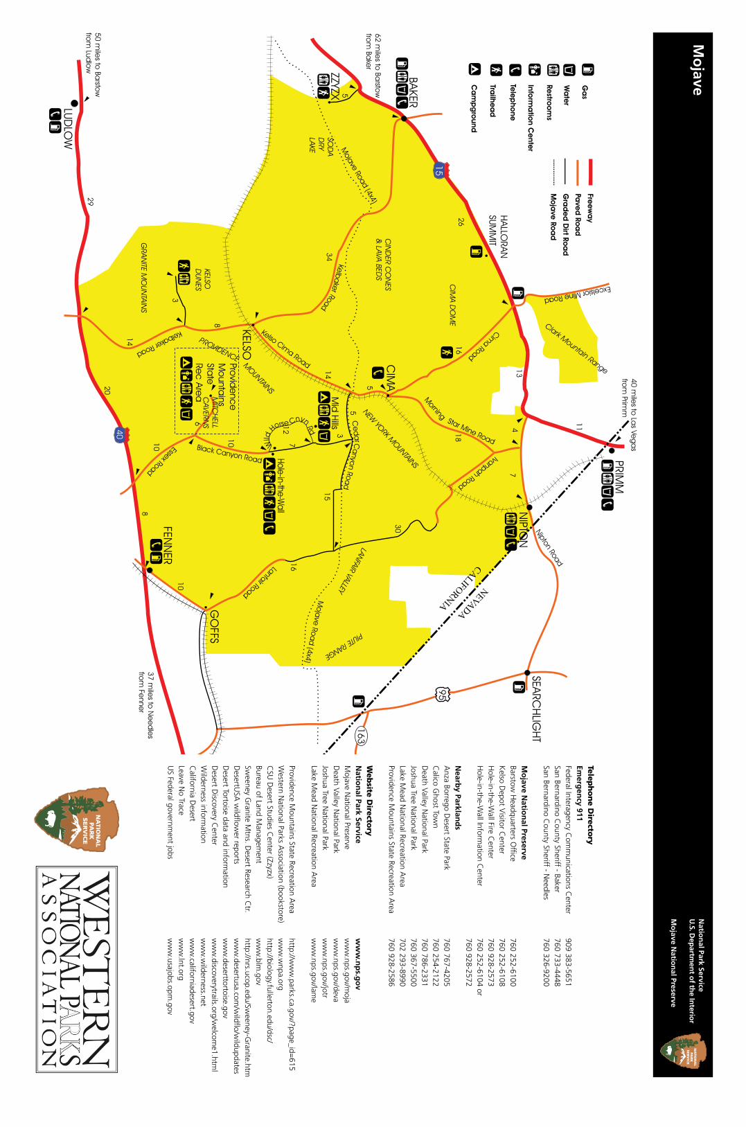
Kelbaker RoadA 56-mile paved road stretching from I-15 at Baker, Calif. in the north to I-40 east of ludlow, Calif. in the south, Kelbaker road winds past cinder cones, lava flows, Kelso Depot, Kelso Dunes, and the granite Mountains.
Cinder Cones & Lava Flows No signs or services. About 14 miles southeast of Baker, Kelbaker road traverses a 25,600-acre area of lava flows and volcanic cinder cones thought to range in age from 10,000 to 7 million years old. In 1973, the area was designated as Cinder Cones Na-tional Natural landmark due to its scenic beauty and exceptional geological value. Aiken Mine road (19.5 miles southeast of Baker, Calif.) of-fers an interesting side trip through the heart of the area and access to a lava tube. High clear-ance and four-wheel drive recommended.
Kelso Depot Visitor Center Information, exhibits, orientation film, art gal-lery, bookstore, restrooms, water, picnic area.located 34 miles southeast of Baker, Kelso De-pot began operation in 1924 and served as train station, restaurant, and employee housing on the los Angeles and Salt lake route of the Union Pacific railroad. Now Mojave National Preserve’s principal information center and museum, ex-tensive exhibits describe the cultural and natural history of the preserve. historically furnished rooms offer a glimpse into Kelso’s past.
Kelso Dunes Self-guiding trail, vault toilets, no water.About 42 miles southeast of Baker (7 miles south of Kelso Depot), then 3 miles west on a graded dirt road, Kelso Dunes were created by winds carrying sand grains from the dried Soda lake and Mojave river Sink located to the northwest. the Providence and granite moun-tains served as barriers that trapped the blowing sand. Created over the course of 25,000 years, the dunes are nearly 700 feet high and cover a 45-square-mile area. the Kelso Dunes produce a “booming” or “singing” sound when sand with the right moisture content slides down the steep slopes. try it for yourself—run down a dune slope (but don’t trample vegetation!) to initiate the sound.
Granite Mountains No signs or services. An imposing jumble of granite marks the south entrance to the preserve, 50 miles southeast of Baker on Kelbaker road. Portions of the granite Mountains lie within the University of Califor-nia’s Desert research Center; please respect the signs that marks the boundary. High clearance and four-wheel drive recommended.
Clark MountainNo signs or services.the only portion of Mojave National Preserve north of I-15 is also its highest point, at 7,929 feet. A relict white fir grove near the top is one of only three in the Mojave Desert. Check de-tailed maps or ask a ranger for access informa-tion. High clearance and four-wheel drive recommended.
Cima RoadAbout 26 miles east of Baker, Calif., the paved Cima road connects I-15 with Cima, Calif., 16 miles to the southeast.
Cima Dome & Joshua Tree Forest Self-guiding trail, no water.the near-perfect symmetry of Cima Dome rises 1,500 feet above the surrounding desert and provides ideal habitat for the world’s largest concentration of Joshua trees. Although the top of the dome is located west of Cima road near the teutonia Peak trailhead, this unusual geo-logic feature is best seen from a distance. try the view looking northwest from Cedar Canyon road, 2.5 miles east of Kelso Cima road.
Cedar Canyon & Black Canyon RoadsMostly unpaved, the 20-mile Cedar Canyon road connects Kelso Cima road in the west with Ivanpah road in the east, paralleling (and sometimes joining) the historic Mojave road. Black Canyon road (unpaved north of hole-in-the-Wall) connects Cedar Canyon road with essex road, 20 miles to the south.
Rock SpringsWayside exhibits, no services.A well-known waterhole for early travelers, rock Springs is located 5.2 miles east of Black Canyon road on Cedar Canyon road, then 1/4 mile south on a sandy, unmarked road (four-wheel drive recommended). Camp rock Springs, a military redoubt established in 1866, was one of the most isolated and comfortless army posts in the West.
Mid Hills Campground, trailhead, vault toilets, water. Not recommended for RVs. About 2 miles west of Black Canyon road at the north end of Wild horse Canyon road, Mid hills supports pinyon-juniper woodland habitat. the effects of a fire that swept through the area in June 2005 are still evident, although several campsites in the popular campground still con-tain shady stands of pinyon pine and juniper.
Hole-in-the-WallInformation center, bookstore, campgrounds, picnic area, trailhead, restroom, water, telephone. Just north of the junction of Black Canyon and the south end of Wild horse Canyon roads, rhyolite cliffs riddled with holes and hollows are the backdrop for hole-in-the-Wall.
Piute SpringAbout 7.4 miles west of U.S. 95 on the un-marked and unpaved Mojave road, then 3.1 miles west on an extremely rough unmarked dirt road. High clearance and four-wheel drive recommended.
Fort Piute and Piute Spring Trails, wayside exhibits, no signs or services. Willows, cottonwoods, and rushes thrive along a half-mile section of Piute Creek. Fort Piute (still visible) was one in a string of military outposts built along the Mojave road. Please don’t climb on the foundations or remove anything.
Zzyzx RoadSix miles southwest of Baker on I-15, Zzyzx road (gravel) leads 5 miles south into the preserve along the western shore of Soda lake (dry).
Zzyzx/Soda SpringsSelf-guiding trail, wayside exhibits, vault toilets, non-potable water, picnic area.historically known as Soda Springs and later renamed Zzyzx (pronounced Zye-zix), this oasis is home to the California State University Desert Studies Center. the buildings and pond were developed in the 1940s by Curtis Springer, who operated a health resort at the site. Zzyzx is open to the public—stroll around lake tuendae and along the shore of Soda Dry lake. If classes are in session, please be courteous and do not disturb participants.
Nipton, Ivanpah & Lanfair Roadseleven miles south of Primm, Nev., Nipton road begins at I-15 and passes through Nipton, Calif., 11 miles east. Ivanpah road (only the 10 north-ernmost miles paved) heads southeast of Nipton road, through the Ivanpah and lanfair valleys, eventually connecting with the paved lanfair road and the Fenner Valley. together stretching 46 miles, Ivanpah and lanfair roads connect the northern preserve boundary (bordering Nipton road) with the southern near goffs, Calif. Hotel NiptonPrivately operated hotel and store; call 760 856-2335 for information.Built in 1910, this charming hotel reflects the railroad, ranching, and mining history of the small community at Nipton.
Caruthers CanyonPrimitive camping, hiking, no signs or services. About 5.5 miles west of Ivanpah road on New York Mountains road, then 2.7 miles north on an unsigned road, Caruthers Canyon is located in the rugged New York Mountains. Surrounded by mountains rising over 7,500 feet, a botani-cal “island” of chaparral plants remains from wetter times of the past. High clearance and four-wheel drive recommended.
Lanfair ValleyNo signs or services.South of the New York Mountains along Ivan-pah and lanfair roads, this high valley shelters an impressive Joshua tree forest and was an early ranching and homesteading center. From 1893 until 1923, the Nevada Southern railway ran up the valley from goffs, providing services to homesteaders and ranchers in the valley and to miners in the mountains beyond. While little evidence remains of homesteads that once dotted the valley, tracts of private property still exist. Please respect the rights of landowners.
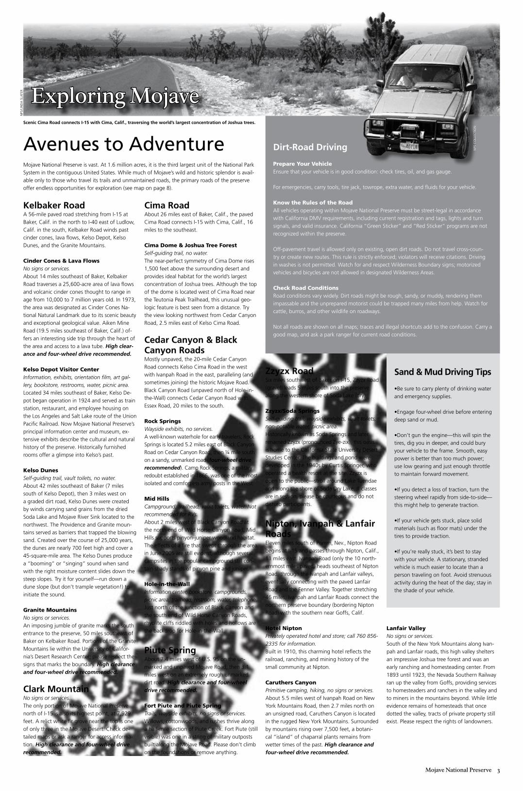
Mojave National Preserve is vast. At 1.6 million acres, it is the third largest unit of the National Park System in the contiguous United States. While much of Mojave’s wild and historic splendor is avail-able only to those who travel its trails and unmaintained roads, the primary roads of the preserve offer endless opportunities for exploration (see map on page 8).
Exploring Mojave
Avenues to Adventure
Sand & Mud Driving Tips
•Be sure to carry plenty of drinking water and emergency supplies. •engage four-wheel drive before entering deep sand or mud.
•Don’t gun the engine—this will spin the tires, dig you in deeper, and could bury your vehicle to the frame. Smooth, easy power is better than too much power; use low gearing and just enough throttle to maintain forward movement.
•If you detect a loss of traction, turn the steering wheel rapidly from side-to-side—this might help to generate traction.
•If your vehicle gets stuck, place solid materials (such as floor mats) under the tires to provide traction.
•If you’re really stuck, it’s best to stay with your vehicle. A stationary, stranded vehicle is much easier to locate than a person traveling on foot. Avoid strenuous activity during the heat of the day; stay in the shade of your vehicle.
Dirt-Road Driving
Prepare Your Vehicleensure that your vehicle is in good condition: check tires, oil, and gas gauge.
For emergencies, carry tools, tire jack, towrope, extra water, and fluids for your vehicle.
Know the Rules of the Road All vehicles operating within Mojave National Preserve must be street-legal in accordance with California DMV requirements, including current registration and tags, lights and turn signals, and valid insurance. California “green Sticker” and “red Sticker” programs are not recognized within the preserve.
off-pavement travel is allowed only on existing, open dirt roads. Do not travel cross-coun-try or create new routes. this rule is strictly enforced; violators will receive citations. Driving in washes is not permitted. Watch for and respect Wilderness Boundary signs; motorized vehicles and bicycles are not allowed in designated Wilderness Areas.
Check Road Conditionsroad conditions vary widely. Dirt roads might be rough, sandy, or muddy, rendering them impassable and the unprepared motorist could be trapped many miles from help. Watch for cattle, burros, and other wildlife on roadways.
Not all roads are shown on all maps; traces and illegal shortcuts add to the confusion. Carry a good map, and ask a park ranger for current road conditions.
Scenic Cima Road connects I-15 with Cima, Calif., traversing the world’s largest concentration of Joshua trees.
NPS
/lIN
DA
SlA
ter
NPS
Co
lleC
tIo
N
� Mojave National Preserve
Faces and Places
a s a C h i l d, d i d yo u e n j oy e x p lo R -
i n g the local woods or park, climbing rocks, getting dirty, and searching for hid-den treasure? Perhaps you still do, when time permits. If, today, you were offered a job that required spending 90% of your time outdoors in a remote desert environment, driving for long stretches of time over rough, rocky terrain, hiking five or more miles most days in diverse weather while searching for and meticulously documenting obvious and obscure signs of previous desert occupants, would you take it? Or, does the prospect of changing countless flat tires in a wilderness setting, avoiding rattlesnakes, and enduring year-round weather extremes make you better appreciate your own job?
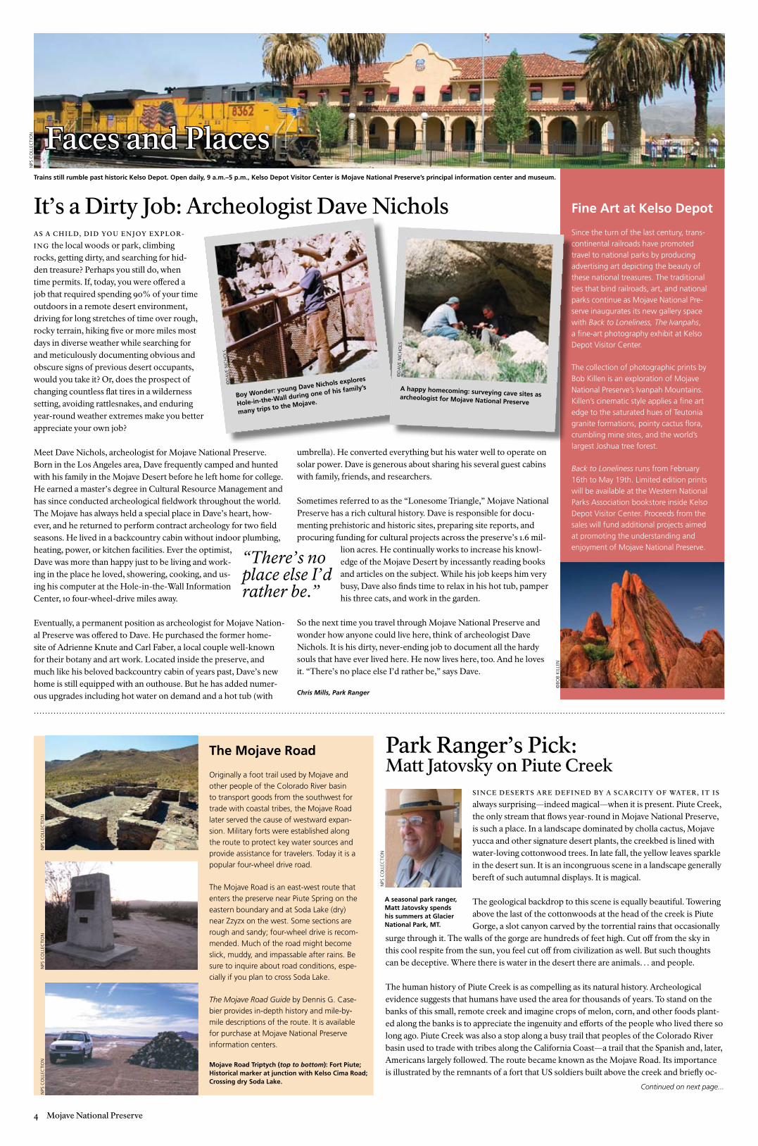
Meet Dave Nichols, archeologist for Mojave National Preserve. Born in the Los Angeles area, Dave frequently camped and hunted with his family in the Mojave Desert before he left home for college. He earned a master’s degree in Cultural Resource Management and has since conducted archeological fieldwork throughout the world. The Mojave has always held a special place in Dave’s heart, how-ever, and he returned to perform contract archeology for two field seasons. He lived in a backcountry cabin without indoor plumbing, heating, power, or kitchen facilities. Ever the optimist, Dave was more than happy just to be living and work-ing in the place he loved, showering, cooking, and us-ing his computer at the Hole-in-the-Wall Information Center, 10 four-wheel-drive miles away.
Eventually, a permanent position as archeologist for Mojave Nation-al Preserve was offered to Dave. He purchased the former home-site of Adrienne Knute and Carl Faber, a local couple well-known for their botany and art work. Located inside the preserve, and much like his beloved backcountry cabin of years past, Dave’s new home is still equipped with an outhouse. But he has added numer-ous upgrades including hot water on demand and a hot tub (with
umbrella). He converted everything but his water well to operate on solar power. Dave is generous about sharing his several guest cabins with family, friends, and researchers.
Sometimes referred to as the “Lonesome Triangle,” Mojave National Preserve has a rich cultural history. Dave is responsible for docu-menting prehistoric and historic sites, preparing site reports, and procuring funding for cultural projects across the preserve’s 1.6 mil-
lion acres. He continually works to increase his knowl-edge of the Mojave Desert by incessantly reading books and articles on the subject. While his job keeps him very busy, Dave also finds time to relax in his hot tub, pamper his three cats, and work in the garden.
So the next time you travel through Mojave National Preserve and wonder how anyone could live here, think of archeologist Dave Nichols. It is his dirty, never-ending job to document all the hardy souls that have ever lived here. He now lives here, too. And he loves it. “There’s no place else I’d rather be,” says Dave.
Chris Mills, Park Ranger
It’s a Dirty Job: Archeologist Dave NicholsTrains still rumble past historic Kelso Depot. Open daily, 9 a.m.–5 p.m., Kelso Depot Visitor Center is Mojave National Preserve’s principal information center and museum.
Fine Art at Kelso Depot
Since the turn of the last century, trans-continental railroads have promoted travel to national parks by producing advertising art depicting the beauty of these national treasures. the traditional ties that bind railroads, art, and national parks continue as Mojave National Pre-serve inaugurates its new gallery space with Back to Loneliness, The Ivanpahs, a fine-art photography exhibit at Kelso Depot Visitor Center.
the collection of photographic prints by Bob Killen is an exploration of Mojave National Preserve’s Ivanpah Mountains. Killen’s cinematic style applies a fine art edge to the saturated hues of teutonia granite formations, pointy cactus flora, crumbling mine sites, and the world’s largest Joshua tree forest.
Back to Loneliness runs from February 16th to May 19th. limited edition prints will be available at the Western National Parks Association bookstore inside Kelso Depot Visitor Center. Proceeds from the sales will fund additional projects aimed at promoting the understanding and enjoyment of Mojave National Preserve.
s i n C e d e s e RT s a R e d e f i n e d by a s C a RC i T y o f WaT e R , i T i s always surprising—indeed magical—when it is present. Piute Creek, the only stream that flows year-round in Mojave National Preserve, is such a place. In a landscape dominated by cholla cactus, Mojave yucca and other signature desert plants, the creekbed is lined with water-loving cottonwood trees. In late fall, the yellow leaves sparkle in the desert sun. It is an incongruous scene in a landscape generally bereft of such autumnal displays. It is magical.
The geological backdrop to this scene is equally beautiful. Towering above the last of the cottonwoods at the head of the creek is Piute Gorge, a slot canyon carved by the torrential rains that occasionally
surge through it. The walls of the gorge are hundreds of feet high. Cut off from the sky in this cool respite from the sun, you feel cut off from civilization as well. But such thoughts can be deceptive. Where there is water in the desert there are animals… and people.
The human history of Piute Creek is as compelling as its natural history. Archeological evidence suggests that humans have used the area for thousands of years. To stand on the banks of this small, remote creek and imagine crops of melon, corn, and other foods plant-ed along the banks is to appreciate the ingenuity and efforts of the people who lived there so long ago. Piute Creek was also a stop along a busy trail that peoples of the Colorado River basin used to trade with tribes along the California Coast—a trail that the Spanish and, later, Americans largely followed. The route became known as the Mojave Road. Its importance is illustrated by the remnants of a fort that US soldiers built above the creek and briefly oc-
Park Ranger’s Pick: Matt Jatovsky on Piute Creek
The Mojave Road
originally a foot trail used by Mojave and other people of the Colorado river basin to transport goods from the southwest for trade with coastal tribes, the Mojave road later served the cause of westward expan-sion. Military forts were established along the route to protect key water sources and provide assistance for travelers. today it is a popular four-wheel drive road.
the Mojave road is an east-west route that enters the preserve near Piute Spring on the eastern boundary and at Soda lake (dry) near Zzyzx on the west. Some sections are rough and sandy; four-wheel drive is recom-mended. Much of the road might become slick, muddy, and impassable after rains. Be sure to inquire about road conditions, espe-cially if you plan to cross Soda lake.
The Mojave Road Guide by Dennis g. Case-bier provides in-depth history and mile-by-mile descriptions of the route. It is available for purchase at Mojave National Preserve information centers.
Mojave Road Triptych (top to bottom): Fort Piute; Historical marker at junction with Kelso Cima Road; Crossing dry Soda Lake.
A seasonal park ranger, Matt Jatovsky spends his summers at Glacier National Park, MT.
“There’s no place else I’d rather be.”
Boy Wonder: young Dave Nichols explores
Hole-in-the-Wall during one of his family’s
many trips to the Mojave.
A happy homecoming: surveying cave sites as archeologist for Mojave National Preserve
Continued on next page...
©Bo
B K
Ille
N
©D
AV
e N
ICh
olS
©D
AV
e N
ICh
olS
NPS
Co
lleC
tIo
N
NPS
Co
lleC
tIo
N
NPS
Co
lleC
tIo
NN
PS C
oll
eCtI
oN
NPS
Co
lleC
tIo
N
Mojave National Preserve �
Nature and Science
T h i s sp R i n g, s T y l i s h Mu l e d e e R W i l l
be wearing colorful ear tags, complimented by beige tracking collars. Over the course of the year, more deer will become similarly, fashionably attired—all this to learn more about deer in Mojave National Preserve.
Spring Bling: Collars & Ear TagsThe National Park Service is working with the California Department of Fish & Game, the University of Nevada-Reno, and local hunting and wildlife conservation groups in an effort to monitor mule deer behavior throughout the preserve. In January 2008, the first eighteen deer were trapped and transported to a field site where research-ers and volunteers efficiently gathered data: blood samples were collected; does were checked for pregnancy using ultrasound; weight, temperature, and other tests were conducted as quickly and safely as possible to minimize trauma to the animals.
Then, bundled safely and securely, the mule deer were again taken away to be released into the wild, adorned with new accessories: two identifying ear tags and a VHF high-frequency radio collar. Some deer were also outfitted with an additional collar contain-ing a GPS unit. After 375 days, the GPS collars automatically fall off. Analysis of the device offers researchers “hoof-by-hoof” intelligence on where the deer roam.
Over the next several years, University of Nevada-Reno graduate students and National Park Service employees will moni-tor their movements several times a week. Cameras installed at springs throughout the preserve will also capture individual deer movement. When a doe stops for a drink, the camera should photograph an image of her numbered “earring.”
Protect Desert Tortoises
the threatened desert tortoise is a marvel of desert adaptation. Its continued sur-vival, however, is largely dependent on responsible human behavior.
Admire from Afar Do not harass or approach a tortoise too closely. When no water is available, tor-toises absorb water from their bladders. If frightened, they might release their blad-der and lose this vital water supply.
Mindful MotoringStay on established roads. Vehicles can crush burrows, killing the tortoises and eggs within. Check beneath your vehicle before driv-ing away. on hot days, tortoises enjoy the shade that cars provide.
observe posted speed limits, and be especially watchful during and after rain-storms. tortoises often enter roadways to drink from puddles.
Pet Smarts Do not release captive tortoises. they might carry diseases that can be transmit-ted to wild tortoises. Instead, turn them over to a licensed tortoise-rescue center. For information, call 760-252-6101.
cupied from 1866–1867. Fort Piute protected mail and emigrants traveling to the coast. With the arrival of railroads, however, the route became extraneous. Mail was carried by rail, wagons ceased to use the road, and the native peoples who first used these trails and lived along the banks of Piute Creek were settled on reservations. The last resi-dents of the area were George and Virginia Irwin who, in the 1940s and 1950s, operated a ranch east of the remains of Fort Piute.
Today the Mojave Road has been rerouted to protect the sensitive habitat that this miraculous desert stream supports, but one can still hike a small portion of the original route taken by so many. The human and natural drama of Piute Creek is truly inspi-rational. And it all begins, and ends, with that little stream on the eastern edge of the Mojave Desert that never dries up.
Before visiting, be sure to consult a reliable map and, as always, it’s a good idea to check with a park ranger for the latest information on weather and road conditions.
Park Ranger’s Pick (continued from page 4)
M a ny d e s e RT p l a n T s , pa RT i C u l a R ly a n n ua l W i l d f loW e R s
are adapted to long seed dormancy; their seeds lie in wait, some-times for years. During a wet winter they sprout, bursting forth in all their glory in the spring when their chances to survive and set seed are best. It makes for a phenomenal display of vibrant colors and forms, with so many species that the wildflower field guides can’t hold them all. Spring 2008 stands to be another spectacular season for wildflowers at Mojave National Preserve. Don’t miss this fleeting opportunity to “botanize,” or to simply enjoy the lush and colorful desert scenery.
Winter is one of two rainy seasons in the eastern Mojave. Though less reliable, the other comes in late summer when southeastern California catches the edge of the monsoonal flow that brings mois-ture in the form of thunderstorms from the Gulf of Mexico and the Gulf of California. In Mojave National Preserve, these storms occa-sionally bring rain and usually bring lightning—the primary ignition source for wildland fires in the eastern Mojave.
Wildfires occur frequently and have long shaped desert ecosystems. As a natural process, most are short-lived and small in size. This is particularly true of fires in the lower elevations, where creosote bushes and other plants are widely spaced, with bare soil in be-tween: fire cannot travel easily from plant to plant. But in years of abundant moisture, those bare spaces are filled in by small plants that dry out by summer. This carpet of small, fine, dry plants helps to carry fire over larger distances. While native plants play a minor role in carrying fire, the primary culprits are non-native grasses. Of primary concern are the cheatgrasses (Bromus spp.) and Mediter-ranean grasses (Schismus spp.). Both are annuals that grow vigor-
ously in the spring, then cure as standing dry stalks in the summer, creating the tinder for carrying wind-driven fires ignited by lightning or people.
While spring 2008 is looking good for wildflowers, this summer is likely to be a big fire season. Fire crews will be hard at work dealing with larger and longer fires, but we need your help to reduce hu-man-caused fires:
Obey posted fire restrictions in campgrounds. One out of every five human-caused fires was started by a campfire. Under dry condi-tions, even small embers can start a wildfire.
Dispose of cigarettes and matches properly. One out of every ten wildland fires is caused by a careless smoker.
Keep your vehicle in good condition. Every year, overheated engines lead to car fires that spread to the surrounding desert. To prevent overheating, turn off air conditioning when traveling up long grades. If you park on the roadside, be careful that the hot un-derside of your exhaust does not come into contact with vegetation. Dry grasses can be easily ignited.
Drive within posted speed limits. Fires can start when speeding ve-hicles leave the roadway and ignite surrounding vegetation. Travel-ing too fast along the rolls and dips of rural roadways can cause your vehicle to “bottom out,” striking metal to pavement, and sending sparks into the desert. When towing a trailer, make sure your safety chain does not drag against the road surface.
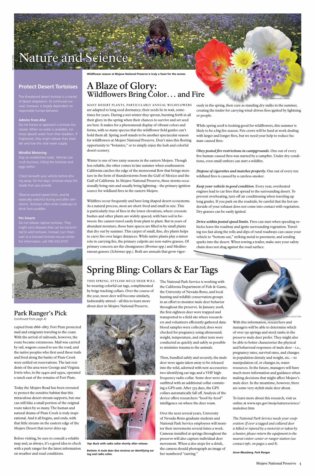
A Blaze of Glory: Wildflowers Bring Color… and Fire
Wildflower season at Mojave National Preserve is truly a feast for the senses.
With this information, researchers and managers will be able to determine which of over 150 springs and stock tanks in the preserve mule deer prefer. They might also be able to better characterize the physical and behavioral responses of mule deer—i.e., pregnancy rates, survival rates, and changes in population density and weight, etc.—to manipulation of, or changes in, water resources. In the future, managers will have much more information and guidance when making decisions that might affect Mojave’s mule deer. In the meantime, however, there are some very stylish mule deer about.
To learn more about this research, visit us online at www.nps.gov/moja/naturescience/muledeer.htm
The National Park Service needs your coop-eration: If ever a tagged and collared deer is killed or injured by a motorist or taken by a hunter, please return the equipment to the nearest visitor center or ranger station (see contact info. on pages 2 and 8).
Anne Maasberg, Park Ranger
Top: Buck with radio collar shortly after release.
Bottom: A mule deer doe receives an identifying ear tag and radio collar.
NPS
Co
lleC
tIo
NN
PS C
oll
eCtI
oN
NPS/BeNJAMIN CheMel
NPS
Co
lleC
tIo
NN
PS C
oll
eCtI
oN
NPS ColleCtIoN
� Mojave National Preserve
Nearby Camping Areas
Providence Mountains State Recreation Area (Mitchell Caverns) 16 miles north of I-40 on essex road, has six campsites with tables and fire rings available on a first-come basis for $12 per night. See page 7 for more information.
Afton Canyon 25 miles southwest of Baker on I-15, has a BlM campground with tables and fire rings for $6 per night.
Commercial camping is also available at Baker, Barstow, Needles, and Nipton, Calif.
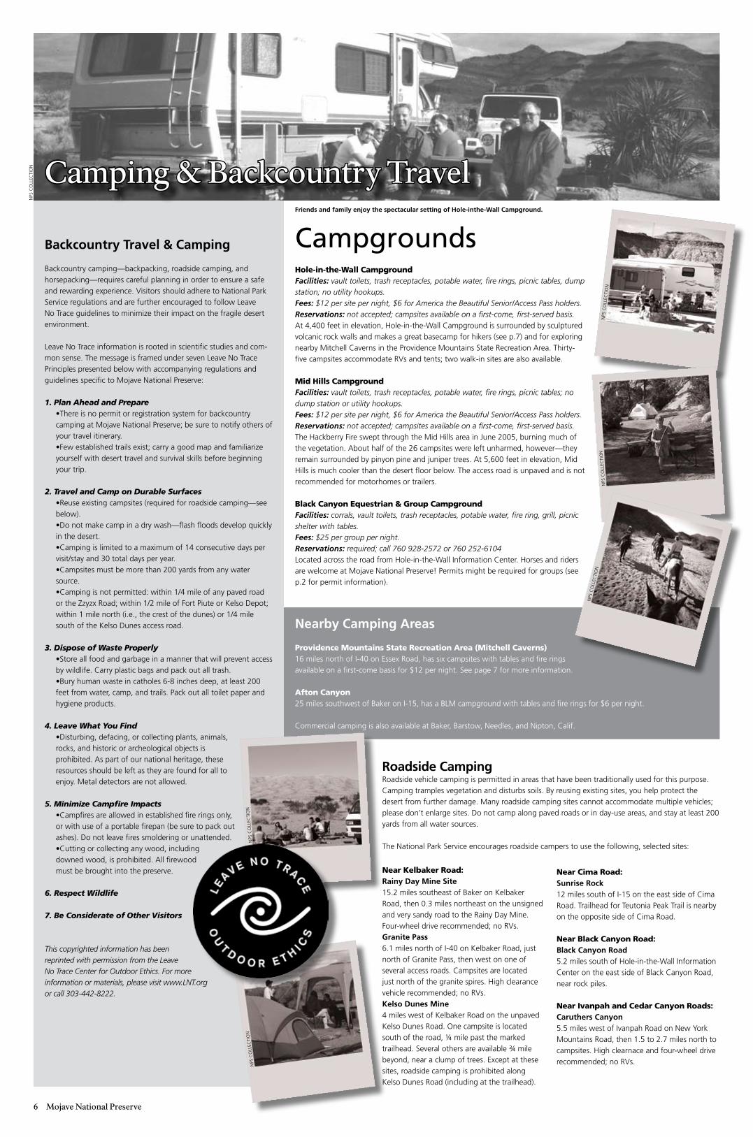
Hole-in-the-Wall CampgroundFacilities: vault toilets, trash receptacles, potable water, fire rings, picnic tables, dump station; no utility hookups.Fees: $12 per site per night, $6 for America the Beautiful Senior/Access Pass holders.Reservations: not accepted; campsites available on a first-come, first-served basis.At 4,400 feet in elevation, hole-in-the-Wall Campground is surrounded by sculptured volcanic rock walls and makes a great basecamp for hikers (see p.7) and for exploring nearby Mitchell Caverns in the Providence Mountains State recreation Area. thirty-five campsites accommodate rVs and tents; two walk-in sites are also available.
Mid Hills CampgroundFacilities: vault toilets, trash receptacles, potable water, fire rings, picnic tables; no dump station or utility hookups.Fees: $12 per site per night, $6 for America the Beautiful Senior/Access Pass holders.Reservations: not accepted; campsites available on a first-come, first-served basis.the hackberry Fire swept through the Mid hills area in June 2005, burning much of the vegetation. About half of the 26 campsites were left unharmed, however—they remain surrounded by pinyon pine and juniper trees. At 5,600 feet in elevation, Mid hills is much cooler than the desert floor below. the access road is unpaved and is not recommended for motorhomes or trailers.
Black Canyon Equestrian & Group CampgroundFacilities: corrals, vault toilets, trash receptacles, potable water, fire ring, grill, picnic shelter with tables.Fees: $25 per group per night.Reservations: required; call 760 928-2572 or 760 252-6104located across the road from hole-in-the-Wall Information Center. horses and riders are welcome at Mojave National Preserve! Permits might be required for groups (see p.2 for permit information).
Camping & Backcountry Travel
CampgroundsBackcountry Travel & Camping
Backcountry camping—backpacking, roadside camping, and horsepacking—requires careful planning in order to ensure a safe and rewarding experience. Visitors should adhere to National Park Service regulations and are further encouraged to follow leave No trace guidelines to minimize their impact on the fragile desert environment.
leave No trace information is rooted in scientific studies and com-mon sense. the message is framed under seven leave No trace Principles presented below with accompanying regulations and guidelines specific to Mojave National Preserve:
1. Plan Ahead and Prepare•there is no permit or registration system for backcountry camping at Mojave National Preserve; be sure to notify others of your travel itinerary.•Few established trails exist; carry a good map and familiarize yourself with desert travel and survival skills before beginning your trip.
2. Travel and Camp on Durable Surfaces•reuse existing campsites (required for roadside camping—see below).•Do not make camp in a dry wash—flash floods develop quickly in the desert.•Camping is limited to a maximum of 14 consecutive days per visit/stay and 30 total days per year.•Campsites must be more than 200 yards from any water source.•Camping is not permitted: within 1/4 mile of any paved road or the Zzyzx road; within 1/2 mile of Fort Piute or Kelso Depot; within 1 mile north (i.e., the crest of the dunes) or 1/4 mile south of the Kelso Dunes access road.
3. Dispose of Waste Properly•Store all food and garbage in a manner that will prevent access by wildlife. Carry plastic bags and pack out all trash.•Bury human waste in catholes 6-8 inches deep, at least 200 feet from water, camp, and trails. Pack out all toilet paper and hygiene products.
4. Leave What You Find•Disturbing, defacing, or collecting plants, animals, rocks, and historic or archeological objects is prohibited. As part of our national heritage, these resources should be left as they are found for all to enjoy. Metal detectors are not allowed.
5. Minimize Campfire Impacts•Campfires are allowed in established fire rings only, or with use of a portable firepan (be sure to pack out ashes). Do not leave fires smoldering or unattended.•Cutting or collecting any wood, including downed wood, is prohibited. All firewood must be brought into the preserve.
6. Respect Wildlife
7. Be Considerate of Other Visitors
This copyrighted information has been reprinted with permission from the Leave No Trace Center for Outdoor Ethics. For more information or materials, please visit www.LNT.org or call 303-442-8222.
Near Kelbaker Road:Rainy Day Mine Site15.2 miles southeast of Baker on Kelbaker road, then 0.3 miles northeast on the unsigned and very sandy road to the rainy Day Mine. Four-wheel drive recommended; no rVs. Granite Pass 6.1 miles north of I-40 on Kelbaker road, just north of granite Pass, then west on one of several access roads. Campsites are located just north of the granite spires. high clearance vehicle recommended; no rVs.Kelso Dunes Mine4 miles west of Kelbaker road on the unpaved Kelso Dunes road. one campsite is located south of the road, 1/4 mile past the marked trailhead. Several others are available 3/4 mile beyond, near a clump of trees. except at these sites, roadside camping is prohibited along Kelso Dunes road (including at the trailhead).
Near Cima Road:Sunrise Rock 12 miles south of I-15 on the east side of Cima road. trailhead for teutonia Peak trail is nearby on the opposite side of Cima road.
Near Black Canyon Road:Black Canyon Road5.2 miles south of hole-in-the-Wall Information Center on the east side of Black Canyon road, near rock piles.
Near Ivanpah and Cedar Canyon Roads:Caruthers Canyon5.5 miles west of Ivanpah road on New York Mountains road, then 1.5 to 2.7 miles north to campsites. high clearnace and four-wheel drive recommended; no rVs.
Roadside Campingroadside vehicle camping is permitted in areas that have been traditionally used for this purpose. Camping tramples vegetation and disturbs soils. By reusing existing sites, you help protect the desert from further damage. Many roadside camping sites cannot accommodate multiple vehicles; please don’t enlarge sites. Do not camp along paved roads or in day-use areas, and stay at least 200 yards from all water sources.
the National Park Service encourages roadside campers to use the following, selected sites:
Friends and family enjoy the spectacular setting of Hole-inthe-Wall Campground.
NPS
Co
lleC
tIo
N
NPS
Co
lleC
tIo
NN
PS C
oll
eCtI
oN
NPS
Co
lleC
tIo
NN
PS C
oll
eCtI
oN
NPS
Co
lleC
tIo
N
Mojave National Preserve �
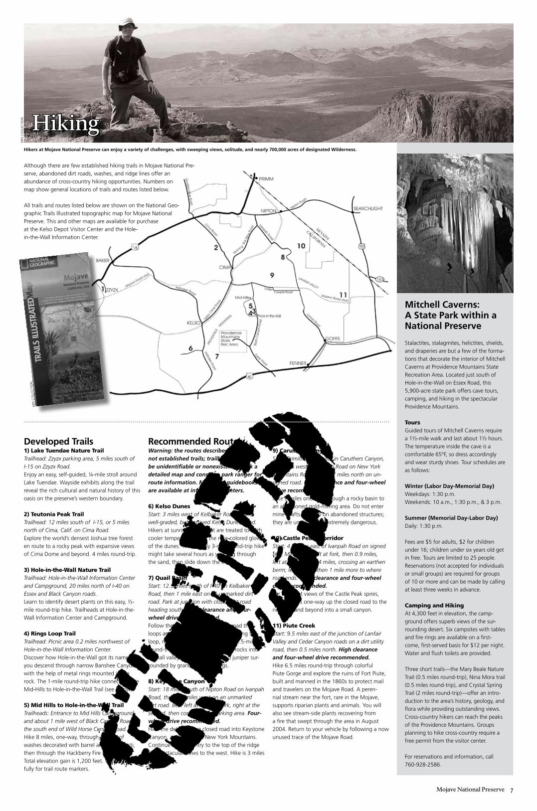
Although there are few established hiking trails in Mojave National Pre-serve, abandoned dirt roads, washes, and ridge lines offer an abundance of cross-country hiking opportunities. Numbers on map show general locations of trails and routes listed below.
All trails and routes listed below are shown on the National geo-graphic trails Illustrated topographic map for Mojave National Preserve. this and other maps are available for purchase at the Kelso Depot Visitor Center and the hole-in-the-Wall Information Center.
Recommended RoutesWarning: the routes described below are not established trails; trailheads might be unidentifiable or nonexistent. Check a detailed map and consult a park ranger for route information. Maps and guidebooks are available at information centers.
6) Kelso DunesStart: 3 miles west of Kelbaker Road on the well-graded, but unpaved Kelso Dunes Road.hikers at sunrise and sunset are treated to both cooler temperatures and the rose-colored glow of the dunes. the roughly 3-mile round-trip hike might take several hours as you slog through the sand, then slide down the slopes.
7) Quail BasinStart: 12.5 miles north of I-40 on Kelbaker Road, then 1 mile east on an unmarked dirt road. Park at junction with closed dirt road heading south. High clearance and four-wheel drive recommended.Follow the route to the south to a road that loops around a small valley. After walking the loop, return via the same route. the 6.5-mile round-trip route leads past jumbled rocks into a small valley of Mojave yucca and juniper sur-rounded by granite outcroppings.
8) Keystone CanyonStart: 18 miles south of Nipton Road on Ivanpah Road, then 2.5 miles west on an unmarked dirt road. Bear left at the first fork, right at the second, then continue to a parking area. Four-wheel drive recommended.hike the deteriorating closed road into Keystone Canyon, ascending the New York Mountains. Continue cross-country to the top of the ridge for spectacular views to the west. hike is 3 miles one-way.
Developed Trails1) Lake Tuendae Nature Trail Trailhead: Zzyzx parking area, 5 miles south of I-15 on Zzyzx Road.enjoy an easy, self-guided, 1/4-mile stroll around lake tuendae. Wayside exhibits along the trail reveal the rich cultural and natural history of this oasis on the preserve’s western boundary.
2) Teutonia Peak TrailTrailhead: 12 miles south of I-15, or 5 miles north of Cima, Calif. on Cima Road.explore the world’s densest Joshua tree forest en route to a rocky peak with expansive views of Cima Dome and beyond. 4 miles round-trip.
3) Hole-in-the-Wall Nature TrailTrailhead: Hole-in-the-Wall Information Center and Campground, 20 miles north of I-40 on Essex and Black Canyon roads.learn to identify desert plants on this easy, 1/2-mile round-trip hike. trailheads at hole-in-the-Wall Information Center and Campground.
4) Rings Loop TrailTrailhead: Picnic area 0.2 miles northwest of Hole-in-the-Wall Information Center.Discover how hole-in-the-Wall got its name as you descend through narrow Banshee Canyon with the help of metal rings mounted in the rock. the 1-mile round-trip hike connects to the Mid-hills to hole-in-the-Wall trail (see below).
5) Mid Hills to Hole-in-the-Wall TrailTrailheads: Entrance to Mid Hills Campground, and about 1 mile west of Black Canyon Road on the south end of Wild Horse Canyon Road.hike 8 miles, one-way, through a maze of washes decorated with barrel and cholla cacti, then through the hackberry Fire burned area. total elevation gain is 1,200 feet. Watch care-fully for trail route markers.
9) Caruthers CanyonStart: Primitive campsites in Caruthers Canyon, 5.5 miles west of Ivanpah Road on New York Mountains Road, then 2.7 miles north on un-signed road. High clearance and four-wheel drive recommended.hike 3 miles one-way through a rocky basin to an abandoned gold-mining area. Do not enter mine shafts or climb on abandoned structures; they are unstable and extremely dangerous.
10) Castle Peaks CorridorStart: 4.9 miles east of Ivanpah Road on signed Hart Mine Road; left at fork, then 0.9 miles, left at fork, then 3.4 miles, crossing an earthen berm; left at fork, then 1 mile more to where road ends. High clearance and four-wheel drive recommended.For excellent views of the Castle Peak spires, walk 4 miles one-way up the closed road to the ridgetop and beyond into a small canyon.
11) Piute CreekStart: 9.5 miles east of the junction of Lanfair Valley and Cedar Canyon roads on a dirt utility road, then 0.5 miles north. High clearance and four-wheel drive recommended.hike 6.5 miles round-trip through colorful Piute gorge and explore the ruins of Fort Piute, built and manned in the 1860s to protect mail and travelers on the Mojave road. A peren-nial stream near the fort, rare in the Mojave, supports riparian plants and animals. You will also see stream-side plants recovering from a fire that swept through the area in August 2004. return to your vehicle by following a now unused trace of the Mojave road.
Mitchell Caverns: A State Park within a National Preserve
Stalactites, stalagmites, helictites, shields, and draperies are but a few of the forma-tions that decorate the interior of Mitchell Caverns at Providence Mountains State recreation Area. located just south of hole-in-the-Wall on essex road, this 5,900-acre state park offers cave tours, camping, and hiking in the spectacular Providence Mountains.
Toursguided tours of Mitchell Caverns require a 11/2-mile walk and last about 11/2 hours. the temperature inside the cave is a comfortable 65°F, so dress accordingly and wear sturdy shoes. tour schedules are as follows:
Winter (Labor Day-Memorial Day) Weekdays: 1:30 p.m. Weekends: 10 a.m., 1:30 p.m., & 3 p.m.
Summer (Memorial Day-Labor Day)Daily: 1:30 p.m.
Fees are $5 for adults, $2 for children under 16; children under six years old get in free. tours are limited to 25 people. reservations (not accepted for individuals or small groups) are required for groups of 10 or more and can be made by calling at least three weeks in advance.
Camping and HikingAt 4,300 feet in elevation, the camp-ground offers superb views of the sur-rounding desert. Six campsites with tables and fire rings are available on a first-come, first-served basis for $12 per night. Water and flush toilets are provided. three short trails—the Mary Beale Nature trail (0.5 miles round-trip), Nina Mora trail (0.5 miles round-trip), and Crystal Spring trail (2 miles round-trip)—offer an intro-duction to the area’s history, geology, and flora while providing outstanding views. Cross-country hikers can reach the peaks of the Providence Mountains. groups planning to hike cross-country require a free permit from the visitor center.
For reservations and information, call 760-928-2586.
Hikers at Mojave National Preserve can enjoy a variety of challenges, with sweeping views, solitude, and nearly 700,000 acres of designated Wilderness.
Hiking
NPS
Co
lleC
tIo
N
NPS
Co
lleC
tIo
N
Mileag
es
Teleph
on
e Directo
ryEm
ergen
cy 911Federal Interagency C
omm
unications Center
San Bernardino County Sheriff - Baker
San Bernardino County Sheriff - N
eedles
Mo
jave Natio
nal Preserve
Barstow h
eadquarters office
Kelso D
epot Visitor C
enterh
ole-in-the-Wall Fire C
enterh
ole-in-the-Wall Inform
ation Center
Nearb
y Parkland
sA
nza Borrego Desert State Park
Calico g
host town
Death Valley N
ational ParkJoshua tree N
ational Parklake M
ead National recreation A
reaProvidence M
ountains State recreation Area
Web
site Directo
ryN
ation
al Park ServiceM
ojave National Preserve
Death Valley N
ational ParkJoshua tree N
ational Parklake M
ead National recreation A
rea
Providence Mountains State recreation A
reaW
estern National Parks A
ssociation (bookstore)C
SU D
esert Studies Center (Zzyzx)
Bureau of land Managem
entSw
eeney granite M
tns. Desert research C
tr.D
esertUSA
wildflow
er reportsD
esert tortoise data and information
Desert D
iscovery Center
Wilderness inform
ationC
alifornia Desert
leave No trace
US Federal governm
ent jobs
909 383-5651760 733-4448760 326-9200
760 252-6100760 252-6108760 928-2573760 252-6104 or 760 928-2572
760 767-4205760 254-2122760 786-2331760 367-5500702 293-8990760 928-2586
ww
w.n
ps.g
ov
ww
w.nps.gov/m
ojaw
ww
.nps.gov/devaw
ww
.nps.gov/jotrw
ww
.nps.gov/lame
http://ww
w.parks.ca.gov/?page_id=
615 w
ww
.wnpa.org
http://biology.fullerton.edu/dsc/w
ww
.blm.gov
http://nrs.ucop.edu/Sweeney-g
ranite.htmw
ww
.desertusa.com/w
ildflo/wildupdates
ww
w.deserttortoise.gov
ww
w.discoverytrails.org/w
elcome1.htm
lw
ww
.wilderness.net
ww
w.californiadesert.gov
ww
w.lnt.org
ww
w.usajobs.opm
.gov
Mo
javeN
ation
al Park Service U
.S. Dep
artmen
t of th
e Interio
r
Mo
jave Natio
nal Preserve
BAKER
ZZYZX
Hole-in-the-Wall
Mid
Hills
GO
FFS
FENN
ER
Kelbaker Road
Mojave Road (4x4)
Ca
nyon Road
Black Canyon Road
Essex Road
Provid
enc
e
Mo
untains
State
Rec
Area M
ITCH
ELL C
AVERNS
KELSOD
UNES
KELSO
CIN
DER C
ON
ES&
LAVA BEDS
Kelba
ker
CIM
A
NIPTO
NNipton Road
SEARCH
LIGH
T
Ce
da
r
LUDLO
W
15
40
Kelso Cima Road
Cima Road
Star Mine Road
Morning
Ivanpah Road
Moja
ve Road
(4x4)
Clark Mountain Range
PRIMM
95
NEVADACALIFORNIA
PROVIDENCE
GRAN
ITE MO
UNTAIN
S
NEW YORK M
OUNTAINS
5
3414
1618
30
5
5
15
7
3
12
1010
6
16
103
14
8
CIM
A DO
ME
SOD
AD
RYLAKE
PIUTE RANGE
62 mile
s to Ba
rstow
from
Bake
r
50 mile
s to Ba
rstow
fro
m Lud
low
40 mile
s to La
s Veg
as
from
Primm
37 mile
s to N
ee
dle
sfro
m Fe
nner
8
20
29
26
134
11
7
Road
MOUNTAINS
HALLO
RAN
SUMM
IT
163LAN
FAIR VALLEY
Wild
Horse Cnyn
Rd
Lanfair Road
Excelsior Mine Road
Free
wa
y
Pave
d Ro
ad
Gra
de
d D
irt Roa
d
Mo
jave
Roa
d
Ga
s
Wa
ter
Restro
om
s
Inform
atio
n Ce
nter
Tele
pho
ne
Trailhe
ad
Ca
mp
gro
und
NZ
J#
#N
ZO
NZ
J#
N
N
O
#
ZJ
#
FZ
OJ
FX
ZO
J#
FX
ZO
JO
Z
N
N
#N
F NJZX#O