Embed Size (px)
Citation preview

State Updates
Matt Sokol
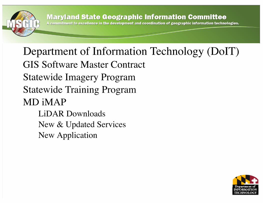
Department of Information Technology (DoIT)GIS Software Master ContractStatewide Imagery ProgramStatewide Training ProgramMD iMAP
LiDAR Downloads New & Updated Services New Application
GIS Software Master Contract
• Approved by Board of Public Works on 6/22• Effective 8/1• Five Year Contract with Two 2 Year Options• Five Vendors across Three Functional Areas
Vendors• 1Spatial• Esri• GeoComm• Hexagon Geospatial• Pitney Bowes
Functional Areas• FA I: Desktop/Server Software• FA II: Mobile Software• FA III: Manufacturer’s Software
Maintenance and Support
GIS Software Master Contract
• For use by both State and Local Government– State Agencies work through DoIT– Contracting vehicle for Local Government
• Not a Services or Training Contract• RFP can be found here: http://bit.ly/29X8tgi• Additional Details for Products and Procurement
coming to the MD iMAP Portal soon
Statewide Imagery Program
Eastern Shore Imagery Project 2016• Axis/AECOM Team• Currently in delivery and QA process
– QA of Block 1 (Cecil/Kent) completed– Edit calls for Block 1 provided to Axis Geospatial on 7/15– Delivery of Block 2 (Queen Anne’s/Talbot/Caroline) to AECOM for QA
next week• 6 inch (Eastern Shore + Howard) + Buy-ups
Western Shore Imagery Project 2017• For buy-ups – contact Lisa Lowe ([email protected])
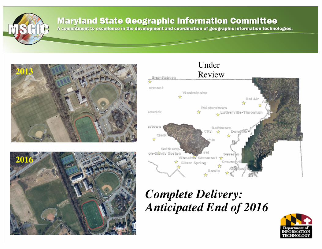
UnderReview2013
2016
Complete Delivery:Anticipated End of 2016
Statewide Training Program• In-Person Courses
– Thinking Spatially (formerly Intro to GIS, MD iMAP and ArcGIS Online)– Intro to ArcGIS Desktop and MD iMAP– Intermediate ArcGIS Online and MD iMAP
• Online Course – Thinking Spatially - Now Available!• Since program began in June 2015:
– 385 participants from 24 agencies– Thinking Spatially – 137 participants– Intro to ArcGIS Desktop and MD iMAP – 113 participants– Intermediate ArcGIS Online and MD iMAP – 135 participants
• Calendar of trainings and seats available on MD iMAP Portal• Limited seats may be available for non-State employees
– Contact Lisa Lowe (DoIT) – [email protected] for info
MD iMAP LiDAR Downloads• Pre-Defined DEMs
– Via Dropbox– Include metadata, overview pyramids, and bare earth DEMs– Downloads by County
• Pre-Defined Point Cloud– LAS files by county coming soon
• Focused Areas– Via LiDAR Download Tool - Coming Soon!
LiDAR – http://imap.maryland.gov/Pages/lidar-download.aspx
Local Businesses *NEW*Property Data *UPDATED*Tax Maps *IMAGE SERVICE*Canopy Height *NEW*Canopy Cover *NEW*
MD iMAP New & UpdatedServices
• Coastal Resiliency Assessment *NEW*• Transit *UPDATED*• Annual Average Daily Traffic *UPDATED*• Protected Lands
Acquisition *NEW*
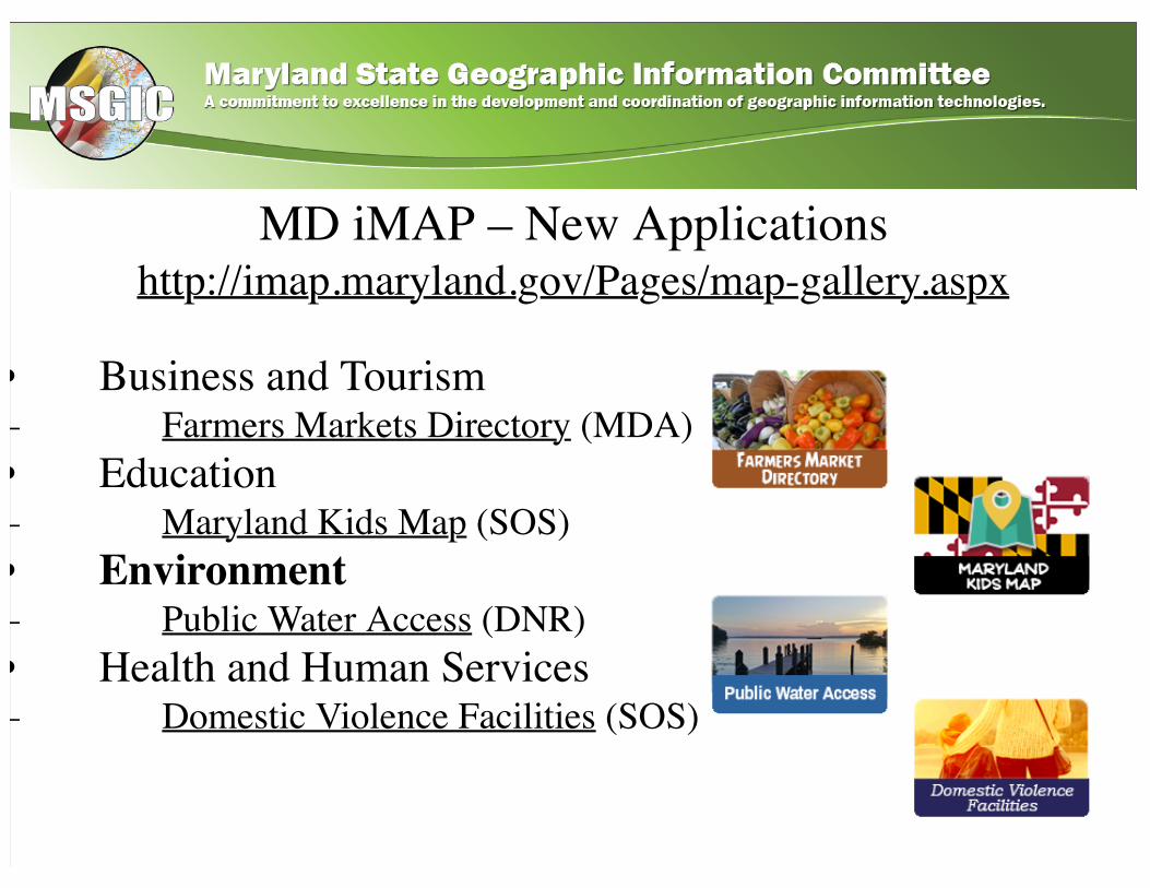
MD iMAP – New Applicationshttp://imap.maryland.gov/Pages/map-gallery.aspx
• Business and Tourism– Farmers Markets Directory (MDA)• Education– Maryland Kids Map (SOS)• Environment– Public Water Access (DNR)• Health and Human Services– Domestic Violence Facilities (SOS)
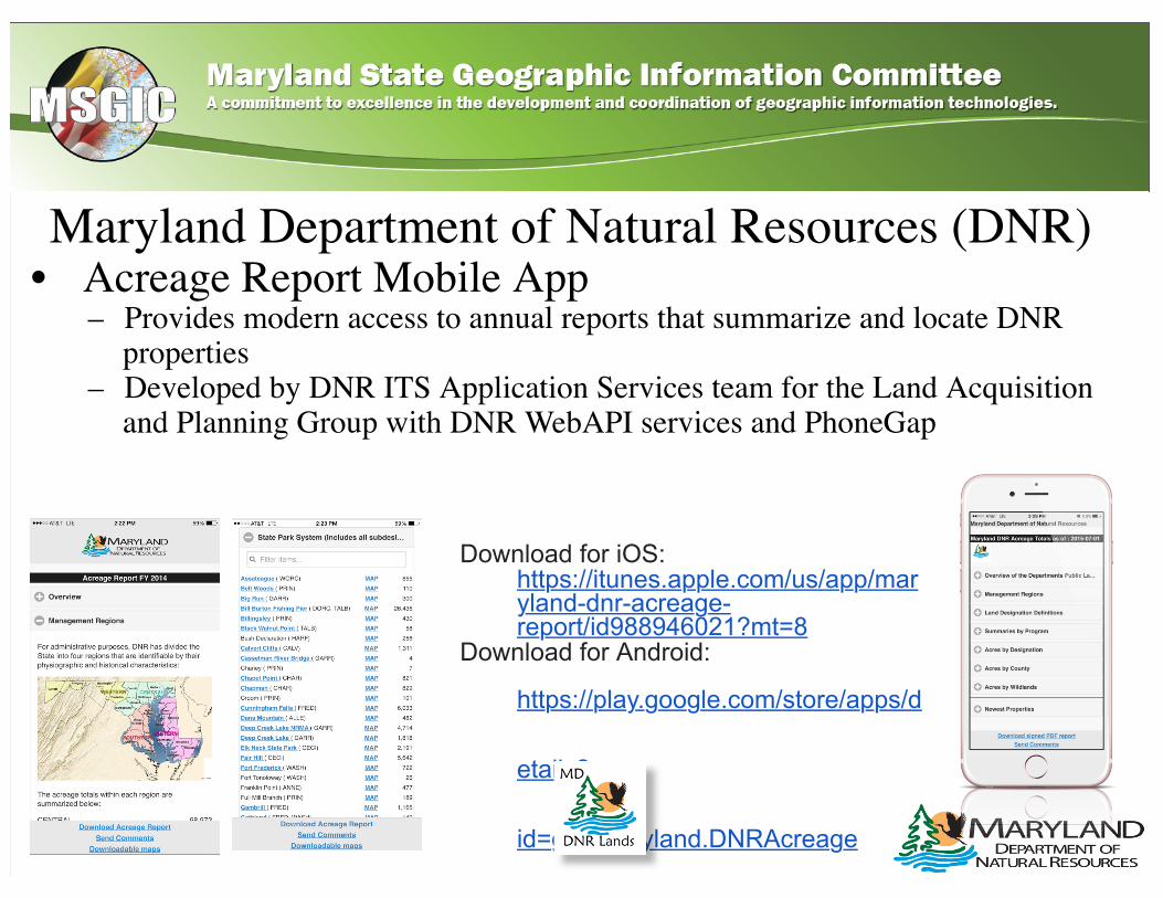
Maryland Department of Natural Resources (DNR)• Acreage Report Mobile App
– Provides modern access to annual reports that summarize and locate DNRproperties
– Developed by DNR ITS Application Services team for the Land Acquisitionand Planning Group with DNR WebAPI services and PhoneGap
Download for iOS: https://itunes.apple.com/us/app/maryland-dnr-acreage-report/id988946021?mt=8
Download for Android:
https://play.google.com/store/apps/d
etails?
id=gov.maryland.DNRAcreage
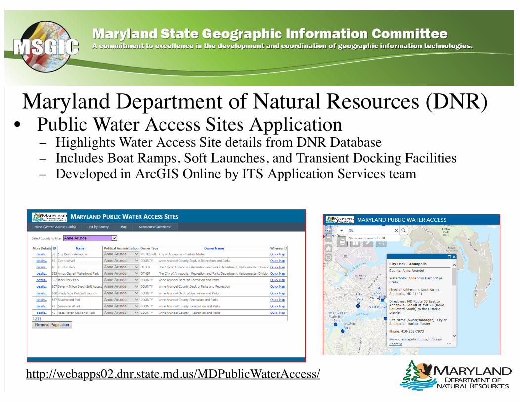
Maryland Department of Natural Resources (DNR)• Public Water Access Sites Application
– Highlights Water Access Site details from DNR Database– Includes Boat Ramps, Soft Launches, and Transient Docking Facilities– Developed in ArcGIS Online by ITS Application Services team
http://webapps02.dnr.state.md.us/MDPublicWaterAccess/
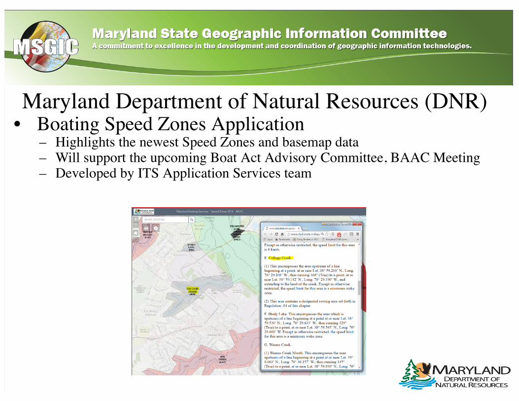
Maryland Department of Natural Resources (DNR)• Boating Speed Zones Application
– Highlights the newest Speed Zones and basemap data– Will support the upcoming Boat Act Advisory Committee, BAAC Meeting– Developed by ITS Application Services team
Maryland State Highway Administration (SHA)• Mobility & Economy Dashboard
– JavaScript/HTML5 App– Mobility is a key performance area (KPA) at SHA which aims to "Support
Maryland Economy and Communities with Reliable Movement of Peopleand Goods".
– This dashboard aims to identify successes, challenges, and strategies beingutilized to improve the transportation services SHA delivers to Marylandersand the traveling public.
– Aims to drive investment related decisions and make the best use oftransportation revenues using data driven performance based approaches.
– Soft Release slated for FY17 Q1
Maryland State Highway Administration (SHA)• ”Know Your Roads and Who to Call”
– Allows citizens to find out who is responsible for roadway maintenance ofall public roadways in the State
– Citizens have access to information on how to submit a maintenancerequest, e.g. plowing, potholes, etc.
– Application has been updated to include municipalities information on howto submit a maintenance request