Embed Size (px)
Citation preview
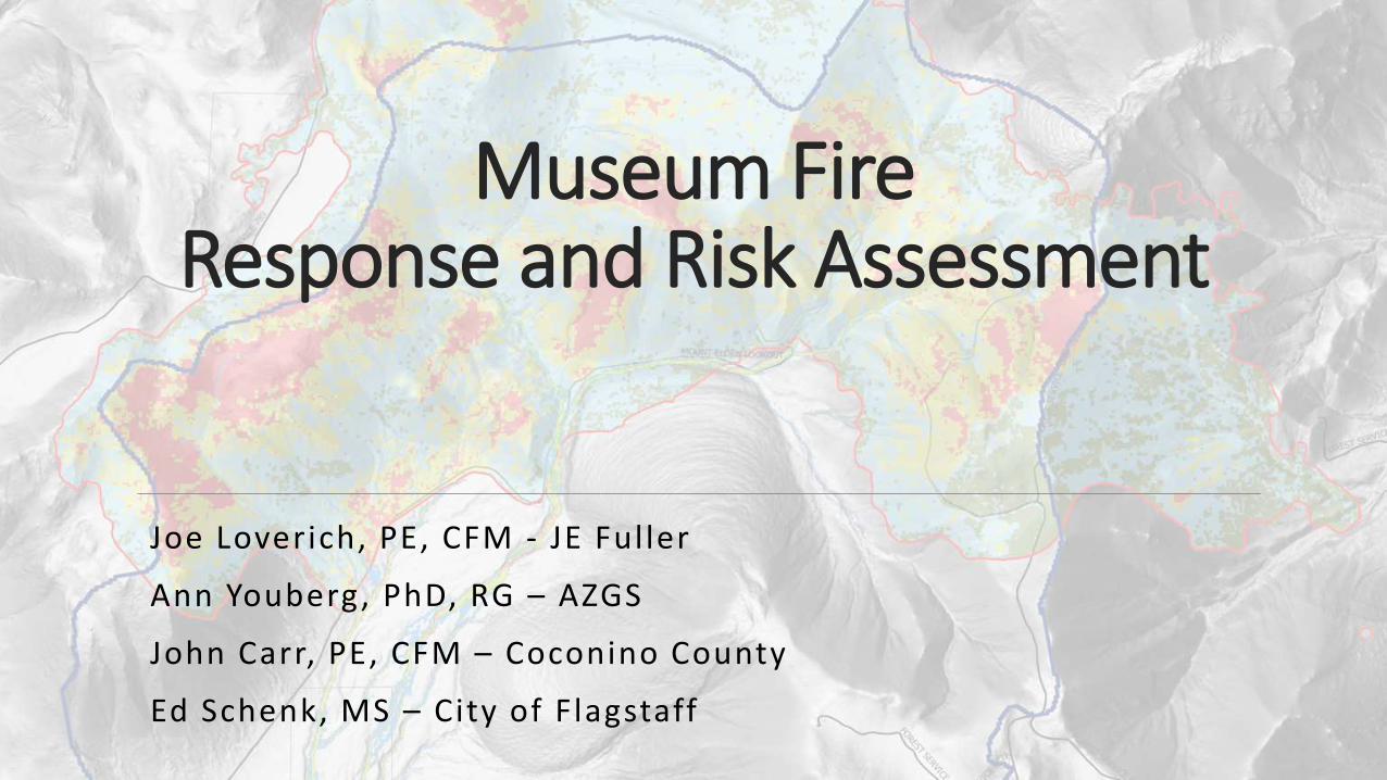
Museum Fire Response and Risk Assessment
Joe Loverich, PE, CFM - JE Fuller
Ann Youberg, PhD, RG – AZGS
John Carr, PE, CFM – Coconino County
Ed Schenk, MS – City of Flagstaff

November 7, 2019 MUSEUM FIRE RESPONSE AND RISK ASSESSMENT 2
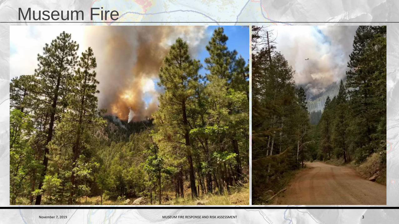
Museum Fire• Burned 1,961 acres
• Impacted the Spruce Avenue
Wash
• Watershed
• 52% of the watershed burned
• Of the total area burned, 53%
burned severely and
moderately = hydrophobic soils
• Much of the area is steep
slopes
•Potential flooding could affect over 400 homes and 50 businesses
•Total property valuation is
•$303,000,000
November 7, 2019 MUSEUM FIRE RESPONSE AND RISK ASSESSMENT 3
Museum Fire
November 7, 2019 MUSEUM FIRE RESPONSE AND RISK ASSESSMENT 4
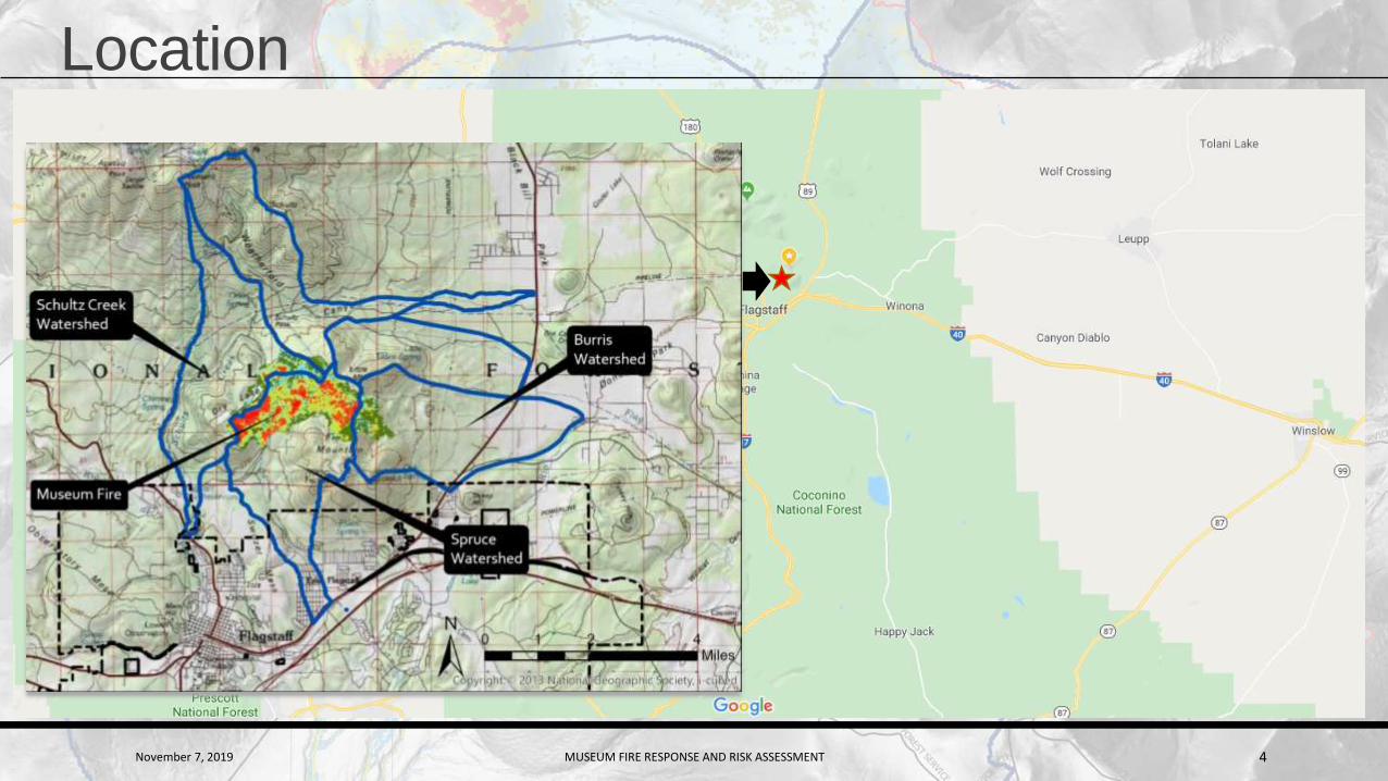
Location
November 7, 2019 MUSEUM FIRE RESPONSE AND RISK ASSESSMENT 5
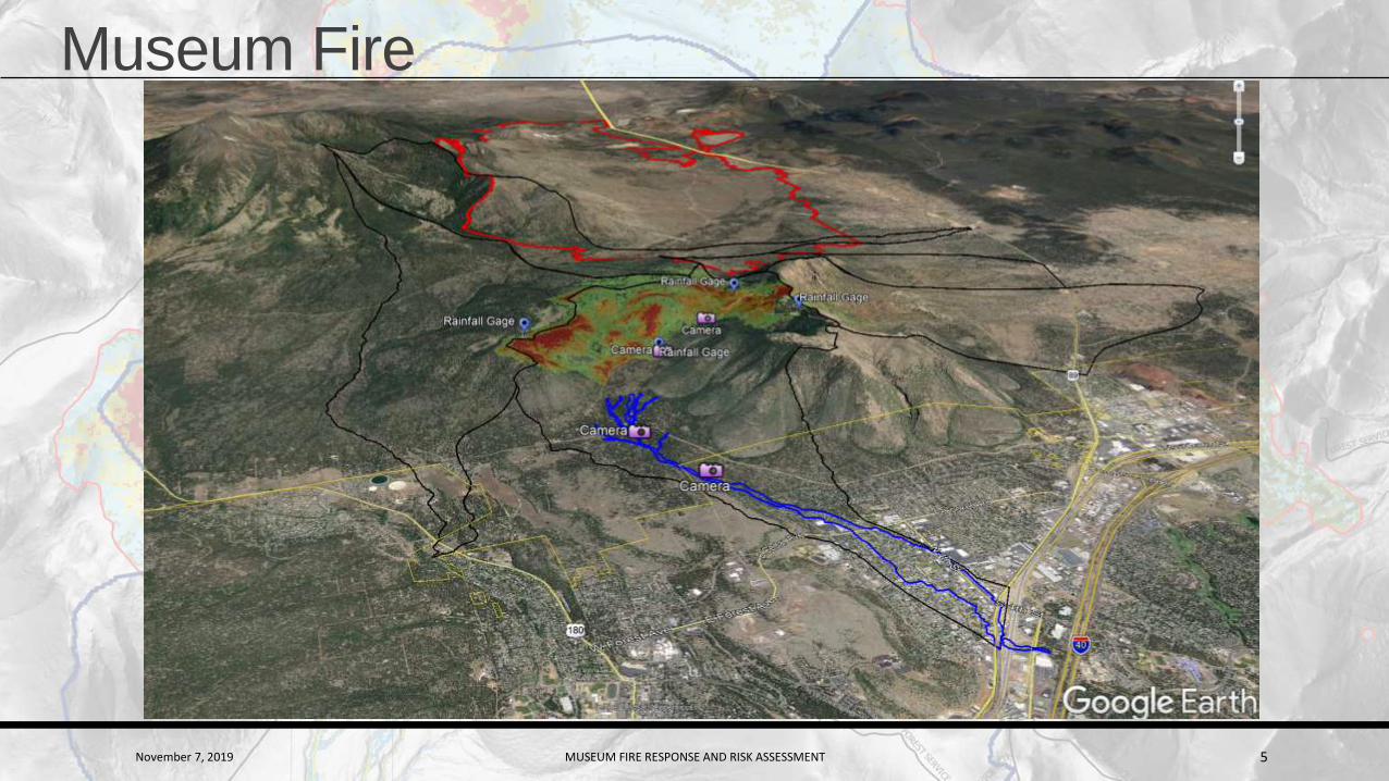
Museum Fire

November 7, 2019 MUSEUM FIRE RESPONSE AND RISK ASSESSMENT 6
Museum Fire

November 7, 2019 MUSEUM FIRE RESPONSE AND RISK ASSESSMENT 7
Timeline
JULY

November 7, 2019 MUSEUM FIRE RESPONSE AND RISK ASSESSMENT 8
August 28th Rain – 2.5” in 1 hour (south of burn scar)

November 7, 2019 MUSEUM FIRE RESPONSE AND RISK ASSESSMENT 9
Soil Burn Severity
November 7, 2019 MUSEUM FIRE RESPONSE AND RISK ASSESSMENT 10
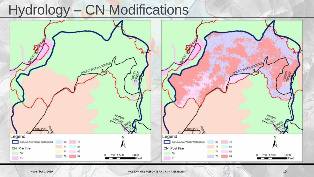
Hydrology – CN Modifications
November 7, 2019 MUSEUM FIRE RESPONSE AND RISK ASSESSMENT 11
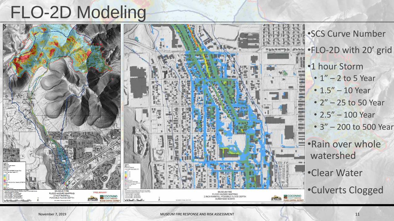
FLO-2D Modeling•SCS Curve Number
•FLO-2D with 20’ grid
•1 hour Storm• 1” – 2 to 5 Year
• 1.5” – 10 Year
• 2” – 25 to 50 Year
• 2.5” – 100 Year
• 3” – 200 to 500 Year
•Rain over whole watershed
•Clear Water
•Culverts Clogged
November 7, 2019 MUSEUM FIRE RESPONSE AND RISK ASSESSMENT 12
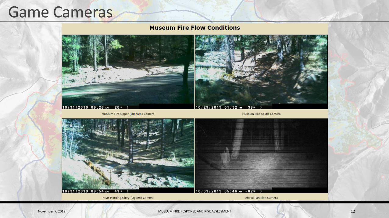
Game Cameras

November 7, 2019 MUSEUM FIRE RESPONSE AND RISK ASSESSMENT 13
Rainfall Gages
November 7, 2019 MUSEUM FIRE RESPONSE AND RISK ASSESSMENT 14
Ann Youberg – BAER/Debris-Flow • BAER Response
• Soil Burn Severity
• Debris Flow Hazard Assessment
November 7, 2019 MUSEUM FIRE RESPONSE AND RISK ASSESSMENT 15
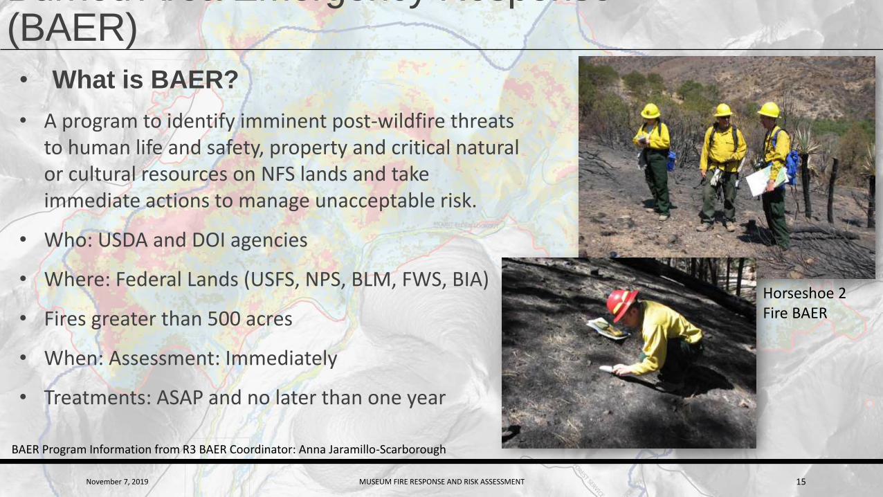
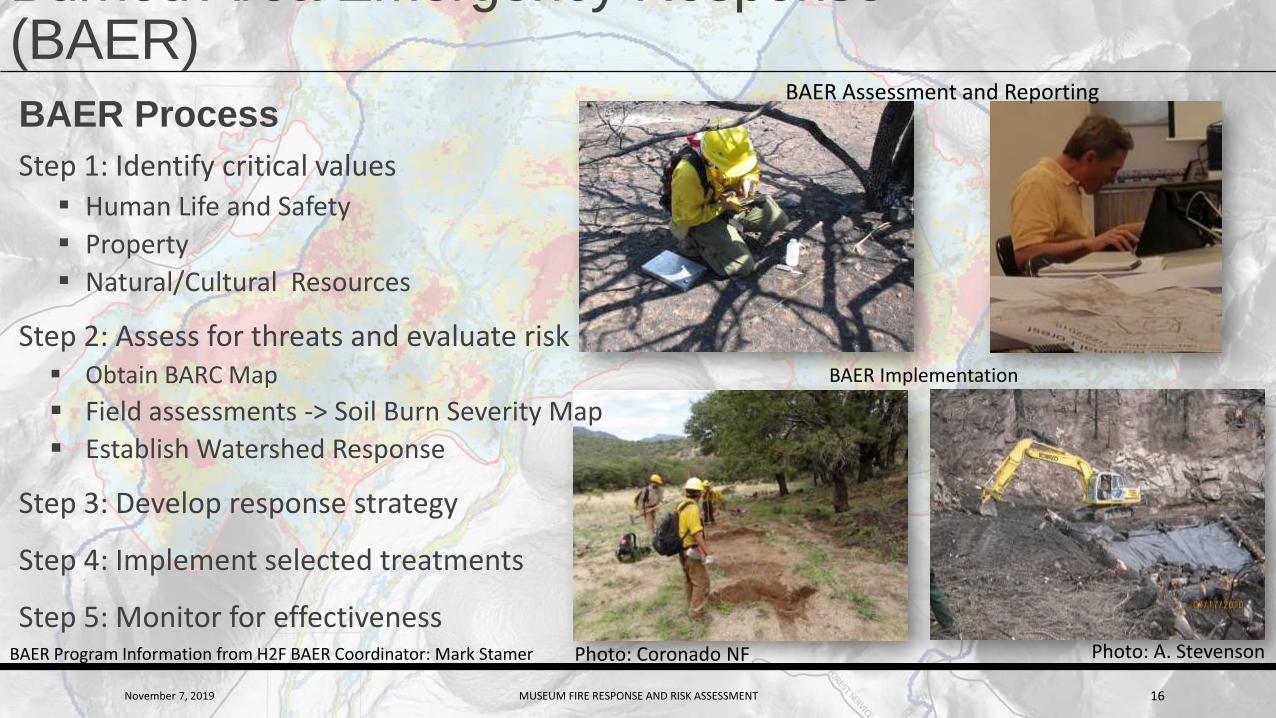
Burned Area Emergency Response (BAER)
• What is BAER?
• A program to identify imminent post-wildfire threats to human life and safety, property and critical natural or cultural resources on NFS lands and take immediate actions to manage unacceptable risk.
• Who: USDA and DOI agencies
• Where: Federal Lands (USFS, NPS, BLM, FWS, BIA)
• Fires greater than 500 acres
• When: Assessment: Immediately
• Treatments: ASAP and no later than one year
Horseshoe 2 Fire BAER
BAER Program Information from R3 BAER Coordinator: Anna Jaramillo-Scarborough
November 7, 2019 MUSEUM FIRE RESPONSE AND RISK ASSESSMENT 16
Burned Area Emergency Response (BAER)
BAER Program Information from H2F BAER Coordinator: Mark Stamer
BAER Implementation
Photo: A. Stevenson
BAER Assessment and Reporting
Photo: Coronado NF
BAER Process
Step 1: Identify critical values▪ Human Life and Safety
▪ Property
▪ Natural/Cultural Resources
Step 2: Assess for threats and evaluate risk Obtain BARC Map
Field assessments -> Soil Burn Severity Map
Establish Watershed Response
Step 3: Develop response strategy
Step 4: Implement selected treatments
Step 5: Monitor for effectiveness

November 7, 2019 MUSEUM FIRE RESPONSE AND RISK ASSESSMENT 17
Assessing Soil Burn Severity – Effects of heating on soil
USDA RMRS-GTR-243. 2010
Soil Structure OM/Roots
Lower strength
Higher strength
Nyman et al., 2013, JGR
Disaggregation of Soil => More Sediment Available
for Transport
LOWStructure and fine roots unchanged
Granular aggregates intact
MODERATEStructure slightly altered
Some consumption of OMFine roots charred near surface
HIGHStructure reduced or destroyedSingle-grained soil dominates
Many/most fine roots charred/consumed near surface
November 7, 2019 MUSEUM FIRE RESPONSE AND RISK ASSESSMENT 18
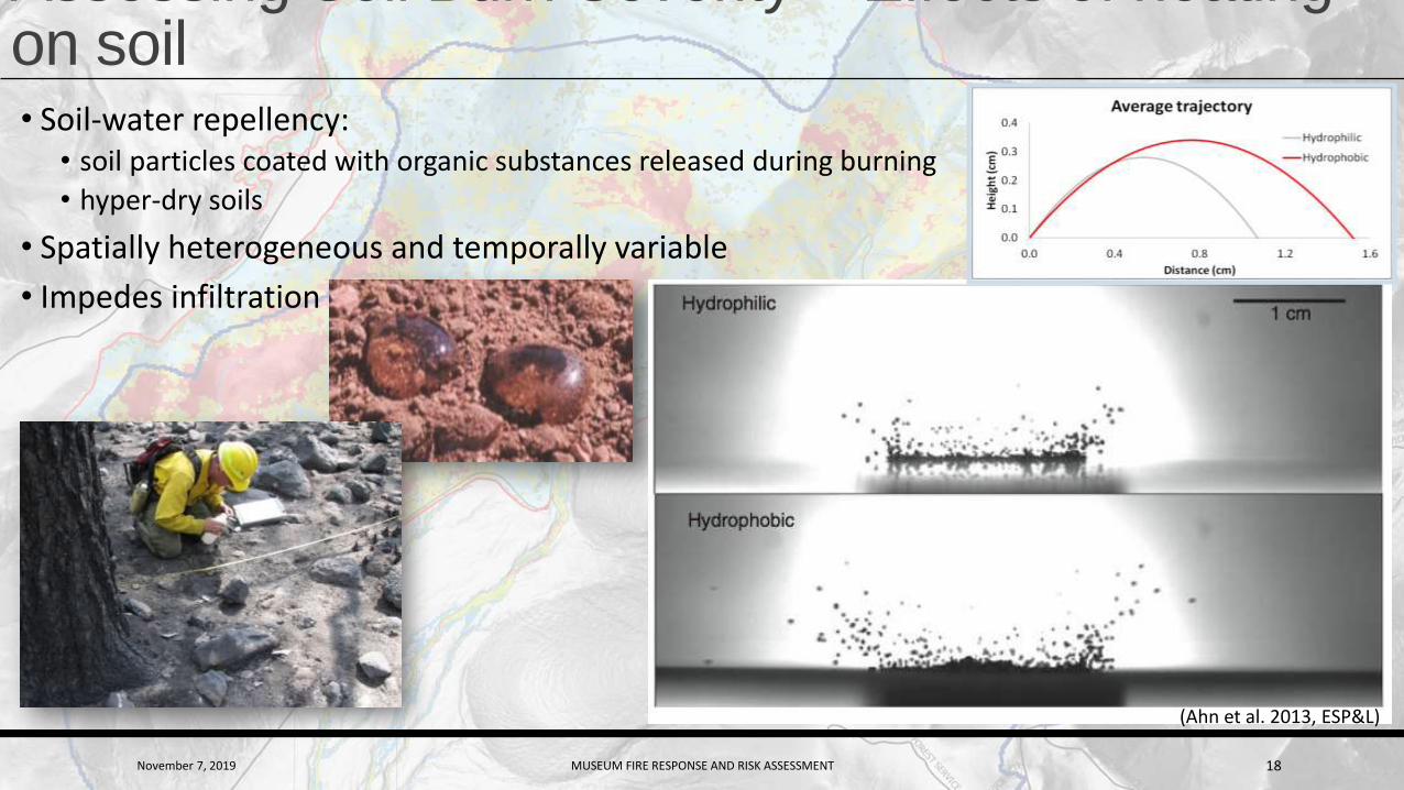
Assessing Soil Burn Severity – Effects of heating on soil• Soil-water repellency:
• soil particles coated with organic substances released during burning
• hyper-dry soils
• Spatially heterogeneous and temporally variable
• Impedes infiltration
(Ahn et al. 2013, ESP&L)
November 7, 2019 MUSEUM FIRE RESPONSE AND RISK ASSESSMENT 19
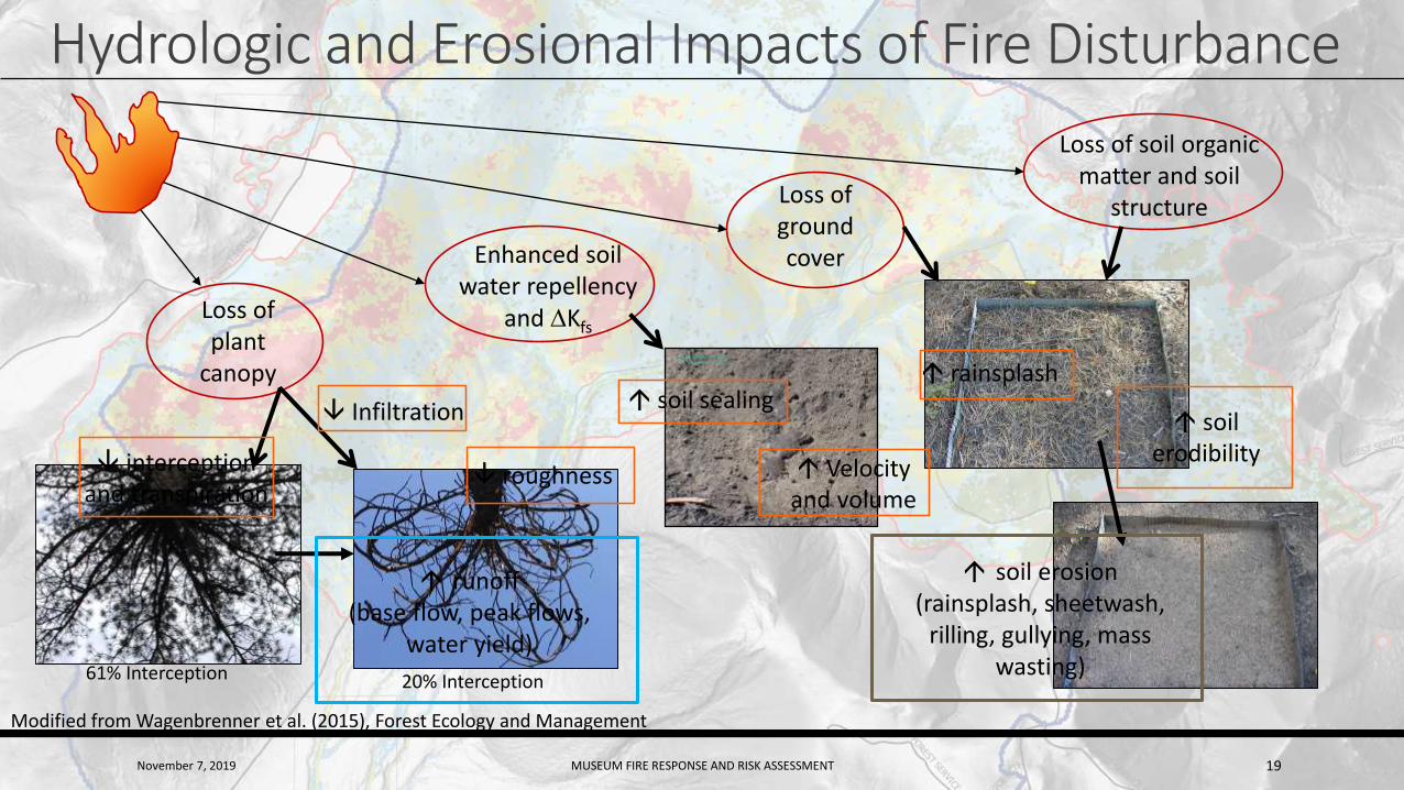
Hydrologic and Erosional Impacts of Fire Disturbance
Loss of plant
canopy
Enhanced soil water repellency
and DKfs
Loss of ground cover
Loss of soil organic matter and soil
structure
61% Interception 20% Interception
interception and transpiration
roughness Velocity and volume
soil sealing rainsplash
soil erodibility
runoff(base flow, peak flows,
water yield)
soil erosion(rainsplash, sheetwash,
rilling, gullying, mass wasting)
Infiltration
Modified from Wagenbrenner et al. (2015), Forest Ecology and Management
November 7, 2019 MUSEUM FIRE RESPONSE AND RISK ASSESSMENT 20
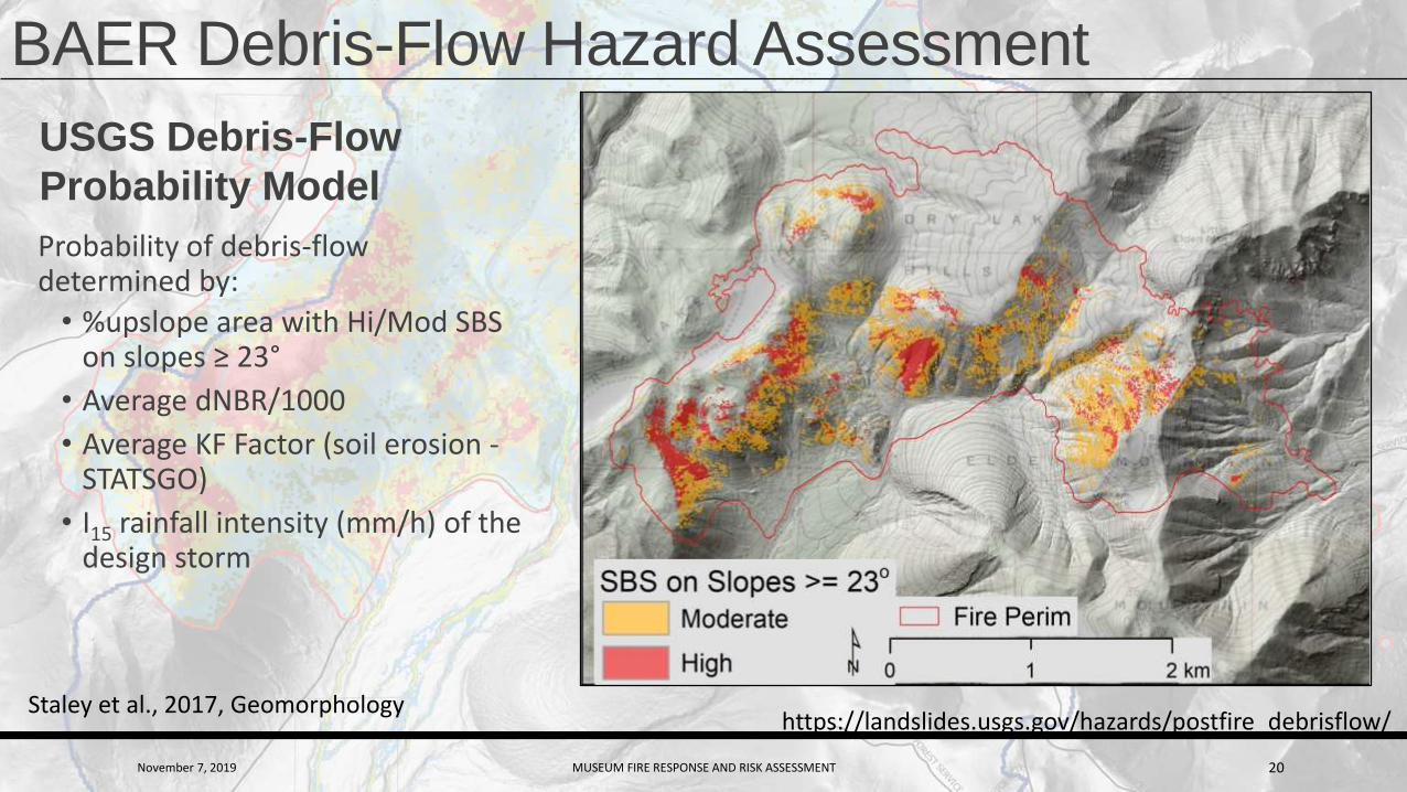
BAER Debris-Flow Hazard Assessment
USGS Debris-Flow
Probability Model
Probability of debris-flow determined by:
• %upslope area with Hi/Mod SBS on slopes ≥ 23°
• Average dNBR/1000
• Average KF Factor (soil erosion -STATSGO)
• I15 rainfall intensity (mm/h) of the design storm
Staley et al., 2017, Geomorphologyhttps://landslides.usgs.gov/hazards/postfire_debrisflow/
November 7, 2019 MUSEUM FIRE RESPONSE AND RISK ASSESSMENT 21
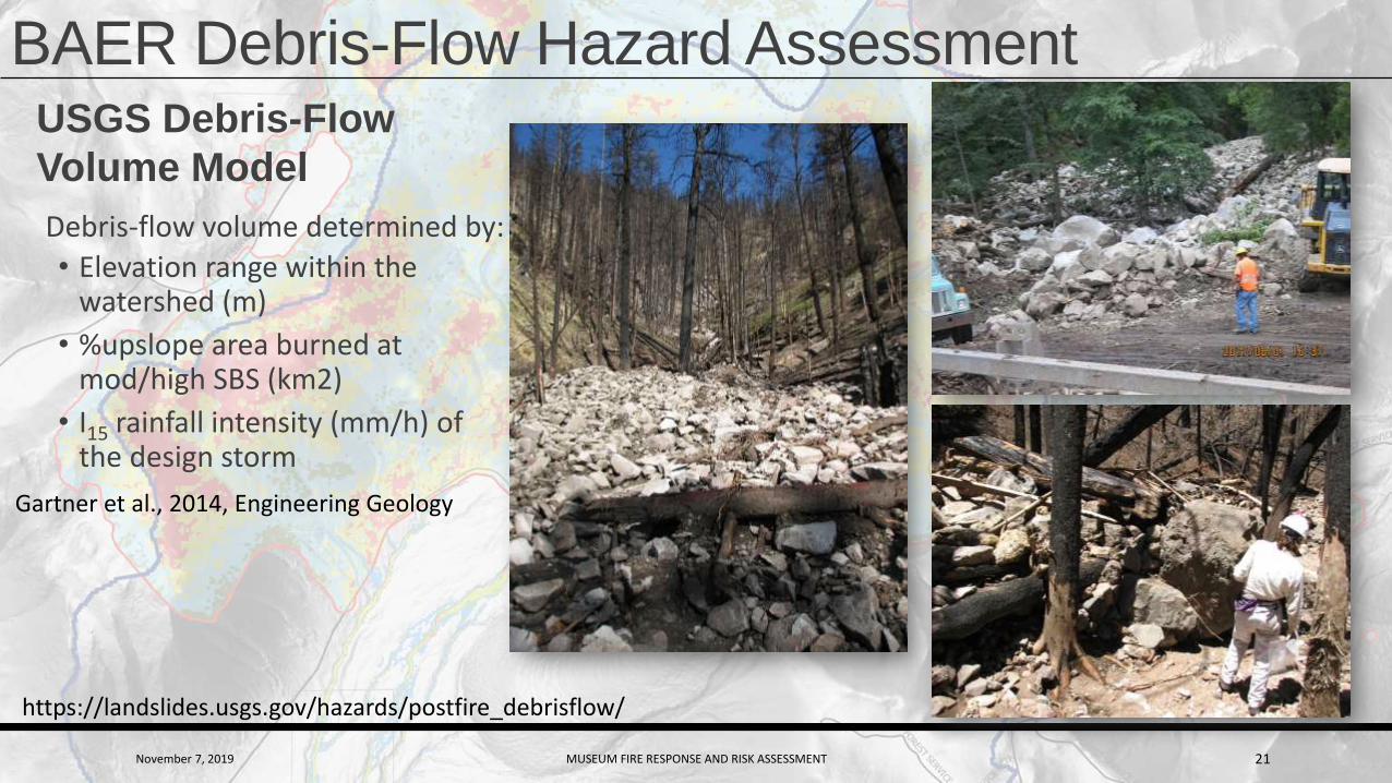
BAER Debris-Flow Hazard AssessmentUSGS Debris-Flow
Volume Model
Debris-flow volume determined by:
• Elevation range within the watershed (m)
• %upslope area burned at mod/high SBS (km2)
• I15 rainfall intensity (mm/h) of the design storm
Gartner et al., 2014, Engineering Geology
https://landslides.usgs.gov/hazards/postfire_debrisflow/

November 7, 2019 MUSEUM FIRE RESPONSE AND RISK ASSESSMENT 22
BAER Debris-Flow Hazard AssessmentDebris-Flow
Probability +
Volume =
Hazard Class
https://landslides.usgs.gov/hazards/postfire_debrisflow/
USGS model results
provides BAER teams
with helpful
information when
assessing threats to
critical values.
ProbabilityVolume
Hazard Class

November 7, 2019 MUSEUM FIRE RESPONSE AND RISK ASSESSMENT 23
Museum Fire BAER Debris-Flow Hazard Assessment• Due to cloud cover, BARC map based on
NDVI instead of dNBR so USGS couldn’t run
their models
• Debris-flow hazard assessment was based
on multiple assessments including:
• BAER field reconnaissance
November 7, 2019 MUSEUM FIRE RESPONSE AND RISK ASSESSMENT 24
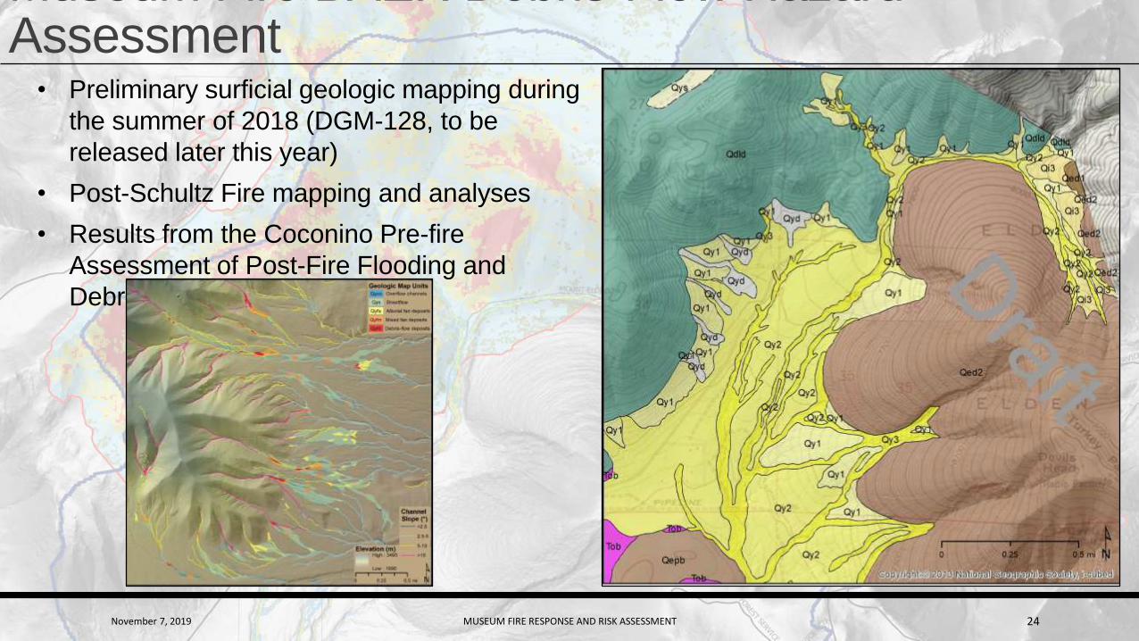
Museum Fire BAER Debris-Flow Hazard Assessment
• Preliminary surficial geologic mapping during
the summer of 2018 (DGM-128, to be
released later this year)
• Post-Schultz Fire mapping and analyses
• Results from the Coconino Pre-fire
Assessment of Post-Fire Flooding and
Debris-Flow Hazards

November 7, 2019 MUSEUM FIRE RESPONSE AND RISK ASSESSMENT 25
Museum Fire BAER Debris-Flow Hazard Assessment
• GIS analyses using lidar data (1 m
resolution)
• %Basin @ Mod/Hi SBS on slopes ≥23
• Channel gradients
• Concentrated flow paths
Mt Elden Rd
July 23 debris flow

November 7, 2019 MUSEUM FIRE RESPONSE AND RISK ASSESSMENT 26
Museum Fire BAER Debris-Flow Hazard Assessment

November 7, 2019 MUSEUM FIRE RESPONSE AND RISK ASSESSMENT 27
Museum Fire BAER Debris-Flow Hazard Assessment
• Debris-flows from the Museum Fire are likelyto be confined to forest lands.
• Debris flows could, however,• Release significant
amounts of sediment,• Cause channel avulsions, • Enhance magnitude of
hyperconcentrated and flood flows,
• Indirectly impact downstream areas.
November 7, 2019 MUSEUM FIRE RESPONSE AND RISK ASSESSMENT 28
John Carr - Museum Fire Response • Public Outreach
• Neighborhood flood mitigation efforts
• Utility Coordination

November 7, 2019 MUSEUM FIRE RESPONSE AND RISK ASSESSMENT 29
Public Outreach – Door-to-Door Assessments
◦ Is mitigation required?
◦ Is owner available and willing to sign Cooperative Agreement?
Cooperative Agreements
◦ Flood Control District (FCD) to install sandbags or concrete barriers
◦ Cooperator agrees to indemnify FCD & maintain flood mitigation devices
◦ Either party can terminate agreement no sooner than December 30, 2019
◦ The FCD strongly recommends that flood mitigation remain in place until September 30, 2020

November 7, 2019 MUSEUM FIRE RESPONSE AND RISK ASSESSMENT 30
Door-to-door Citizen Responses
•“Jeepers. I sure hope you know what you’re doing”
•“Why in the world are you doing this?”
•“Tell County Management to go to *&%$ [not a good place]
•“I’ve lived here __-years and I’ve never seen water in the street, and never near my home.”

November 7, 2019 MUSEUM FIRE RESPONSE AND RISK ASSESSMENT 31
Public Outreach – Public Meetings Community Meetings (15) were held

November 7, 2019 MUSEUM FIRE RESPONSE AND RISK ASSESSMENT 32
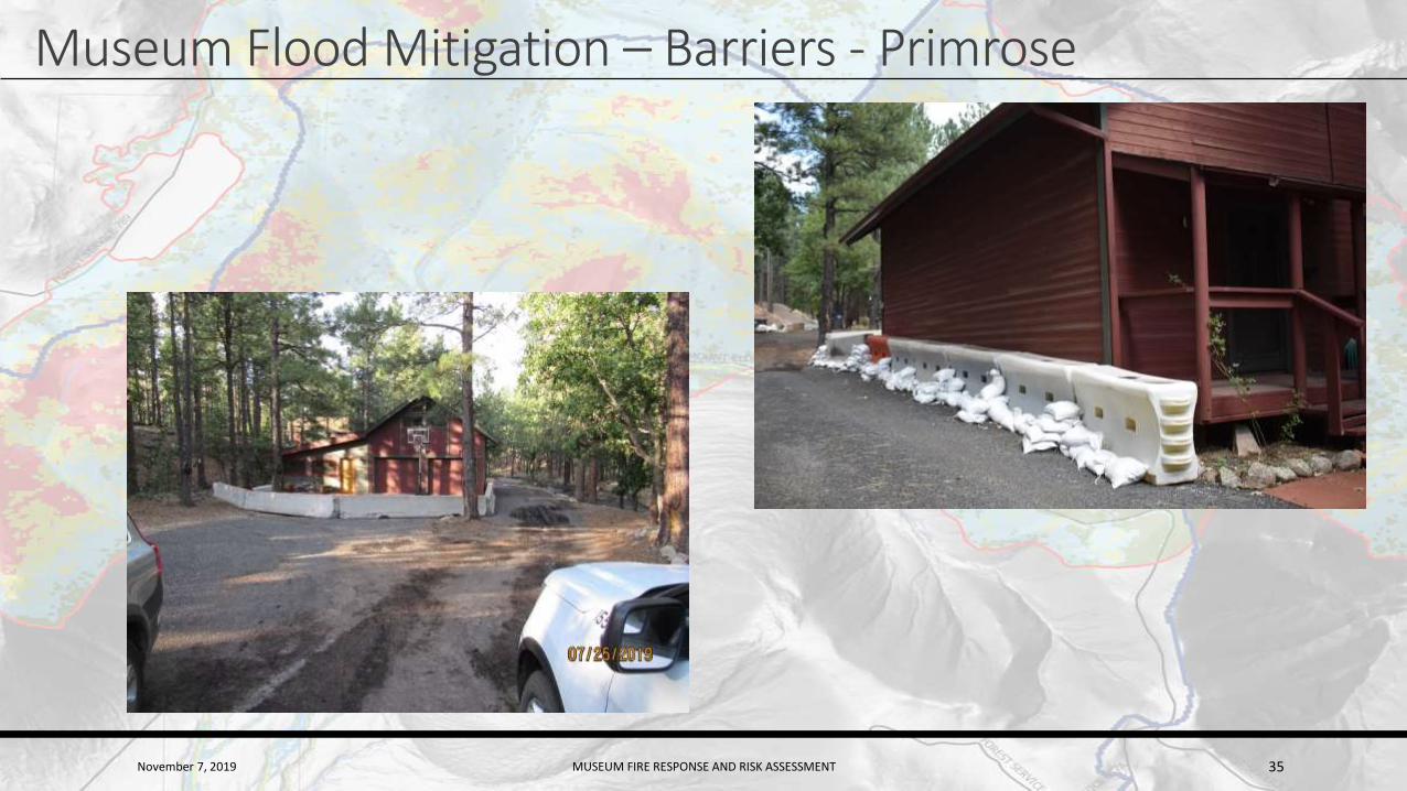
Museum Flood Mitigation - Barriers•Mitigated ~400 homes & ~35 businesses in ~2 weeks
• Concrete barrier placement
• Water barrier placement
• For high-hazard area
• Water barriers are used in lieu of concrete barriers where accessibility is an issue
November 7, 2019 MUSEUM FIRE RESPONSE AND RISK ASSESSMENT 33
Museum Flood Mitigation – Barriers (E. Park Way)
November 7, 2019 MUSEUM FIRE RESPONSE AND RISK ASSESSMENT 34
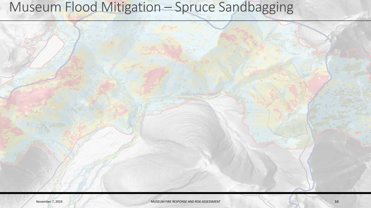
Museum Flood Mitigation – Spruce Sandbagging
November 7, 2019 MUSEUM FIRE RESPONSE AND RISK ASSESSMENT 35
Museum Flood Mitigation – Barriers - Primrose

November 7, 2019 MUSEUM FIRE RESPONSE AND RISK ASSESSMENT 36
Museum Flood Mitigation – Automated Sandbagging
•The Ultimate Bagger• 1200 Bags per hour w/four-person crew
• Two Cubic Yard Hopper

November 7, 2019 MUSEUM FIRE RESPONSE AND RISK ASSESSMENT 37
Museum Flood Mitigation – Manual Sandbagging
• Over 600,000 Polypropylene sandbags sand bags were deployed
• 2364 volunteer hours required to fill bags
• Sandbags are effective from 3 to 6 months under direct sunlight
November 7, 2019 MUSEUM FIRE RESPONSE AND RISK ASSESSMENT 38
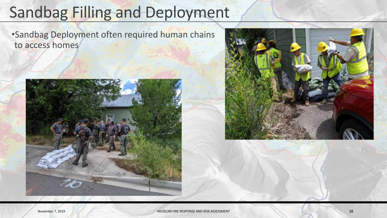
Sandbag Filling and Deployment•Sandbag Deployment often required human chains to access homes
November 7, 2019 MUSEUM FIRE RESPONSE AND RISK ASSESSMENT 39
Utility Coordination▪Gas
▪Unisource – local services
▪Kinder Morgan – major transmission lines
▪Electric – APS
▪Cable
▪CenturyLink
▪Suddenlink
▪Most of the Utility Companies required the FCD to sign a non-disclosure
agreement
November 7, 2019 MUSEUM FIRE RESPONSE AND RISK ASSESSMENT 40
Ed Schenk- Watershed Mitigation and Monitoring• Vegetation Removal
• Watershed Mitigation
• Watershed Monitoring
November 7, 2019 MUSEUM FIRE RESPONSE AND RISK ASSESSMENT 41
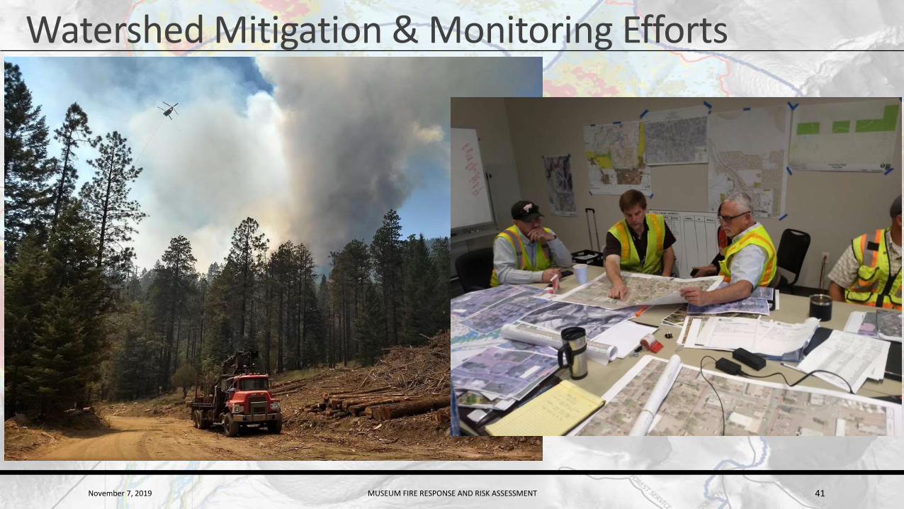
Watershed Mitigation & Monitoring Efforts
November 7, 2019 MUSEUM FIRE RESPONSE AND RISK ASSESSMENT 42
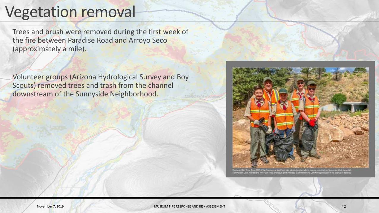
Vegetation removalTrees and brush were removed during the first week of the fire between Paradise Road and Arroyo Seco (approximately a mile).
Volunteer groups (Arizona Hydrological Survey and Boy Scouts) removed trees and trash from the channel downstream of the Sunnyside Neighborhood.
November 7, 2019 MUSEUM FIRE RESPONSE AND RISK ASSESSMENT 43
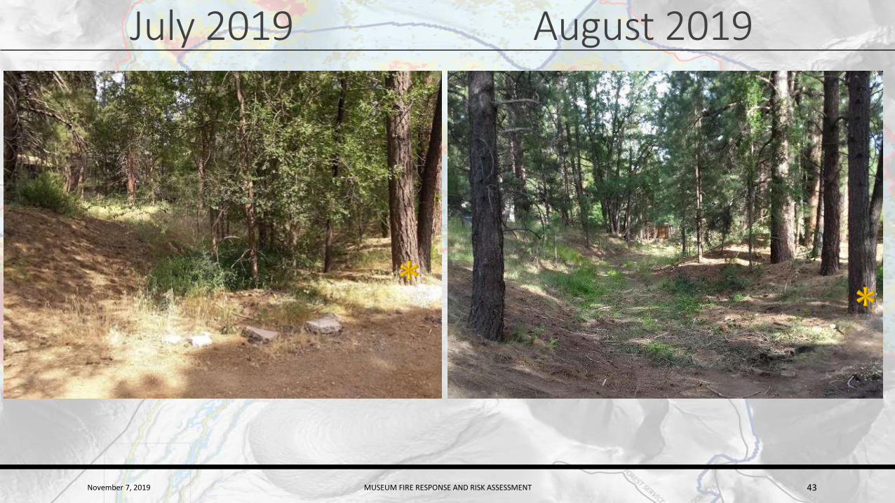
July 2019 August 2019
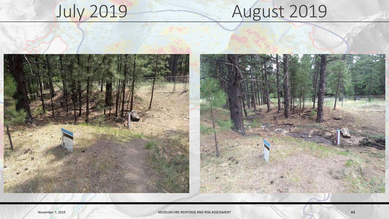
November 7, 2019 MUSEUM FIRE RESPONSE AND RISK ASSESSMENT 44
July 2019 August 2019
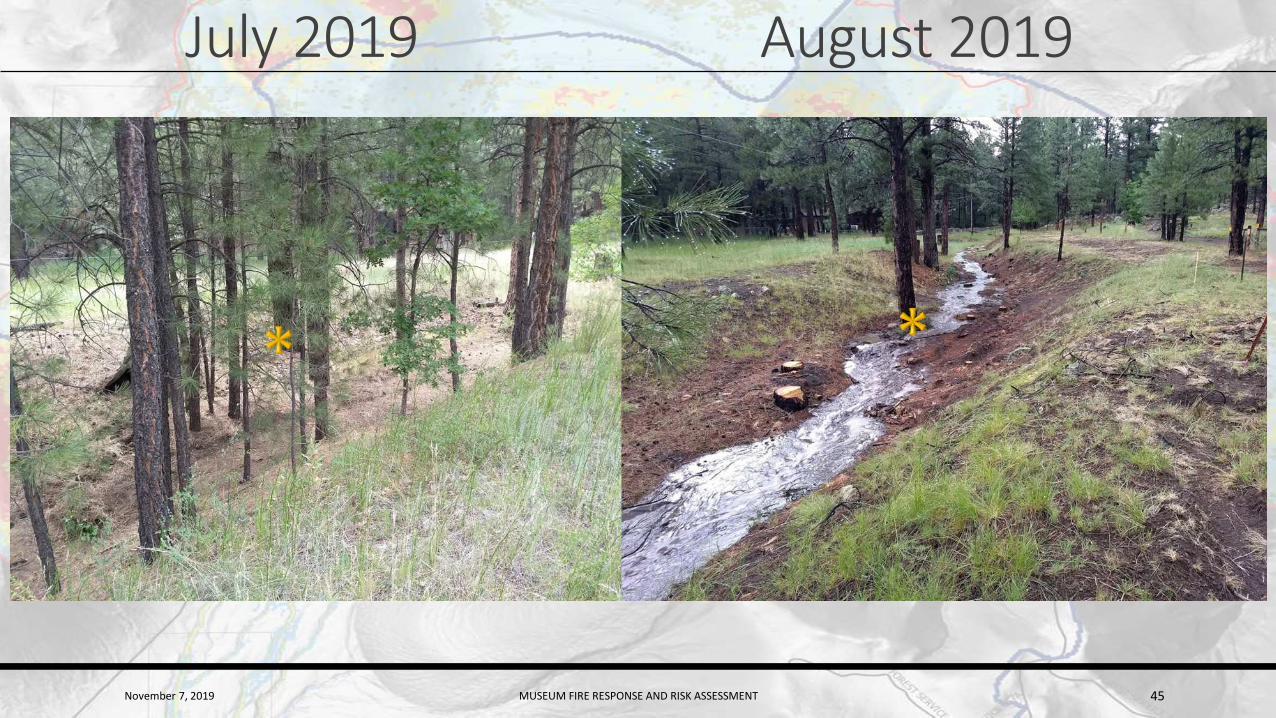
November 7, 2019 MUSEUM FIRE RESPONSE AND RISK ASSESSMENT 45
July 2019 August 2019
November 7, 2019 MUSEUM FIRE RESPONSE AND RISK ASSESSMENT 46
Watershed mitigation
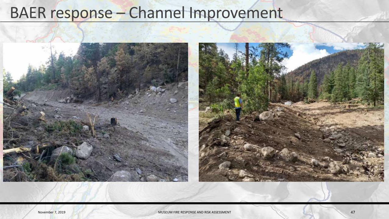
BAER – Channel improvements
BAER – mulching
Cross-vein weirs
Debris collection bollards at key intersections
November 7, 2019 MUSEUM FIRE RESPONSE AND RISK ASSESSMENT 47
BAER response – Channel Improvement

November 7, 2019 MUSEUM FIRE RESPONSE AND RISK ASSESSMENT 48
BAER response (Cont’d) - Mulching160 acres of mulch spread on severe burn steep slopes (September 2019)
November 7, 2019 MUSEUM FIRE RESPONSE AND RISK ASSESSMENT 49

November 7, 2019 MUSEUM FIRE RESPONSE AND RISK ASSESSMENT 50
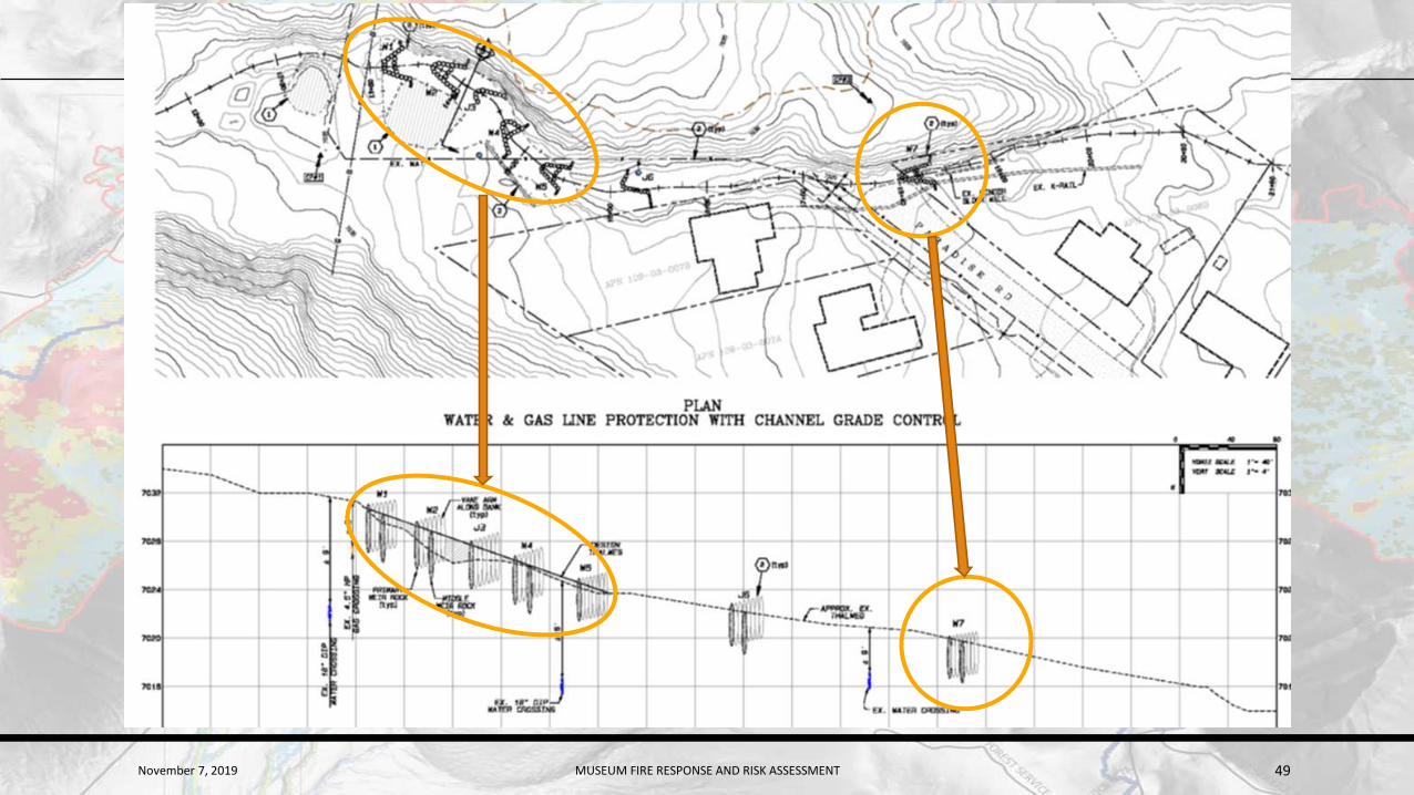
Cross Vein WeirsSeven cross-vein weirs with 4 foot keystone members to protect existing water main and natural gas pipeline
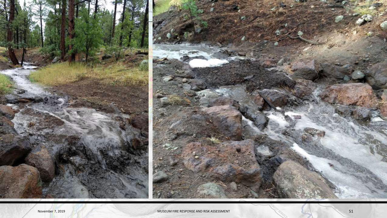
November 7, 2019 MUSEUM FIRE RESPONSE AND RISK ASSESSMENT 51
November 7, 2019 MUSEUM FIRE RESPONSE AND RISK ASSESSMENT 52
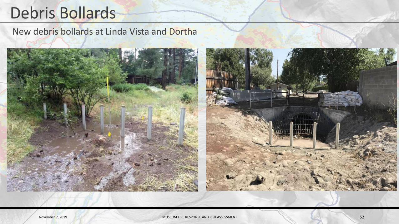
Debris BollardsNew debris bollards at Linda Vista and Dortha
November 7, 2019 MUSEUM FIRE RESPONSE AND RISK ASSESSMENT 53
Monitoring efforts
Seismic gauges (debris flow initiation)
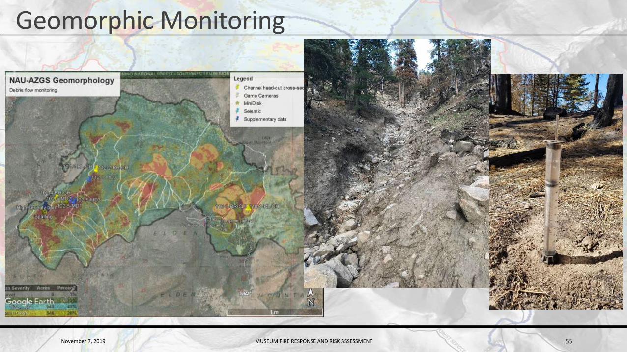
Geomorphic monitoring – headcut migration, erosion potential
Gauges (mostly covered earlier)
Repeat LiDAR (not covered in this presentation)

November 7, 2019 MUSEUM FIRE RESPONSE AND RISK ASSESSMENT 54
Seismic Monitoring
November 7, 2019 MUSEUM FIRE RESPONSE AND RISK ASSESSMENT 55
Geomorphic Monitoring

November 7, 2019 MUSEUM FIRE RESPONSE AND RISK ASSESSMENT 56
Cameras
November 7, 2019 MUSEUM FIRE RESPONSE AND RISK ASSESSMENT 57
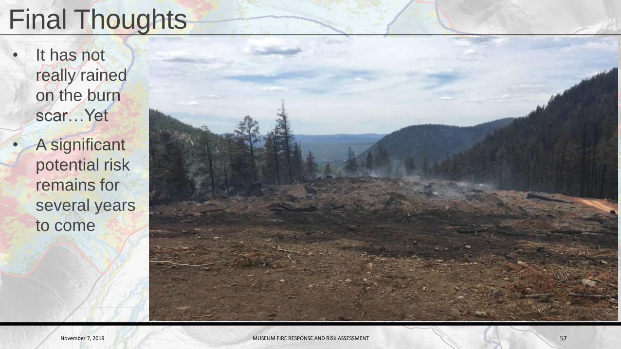
Final Thoughts• It has not
really rained
on the burn
scar…Yet
• A significant
potential risk
remains for
several years
to come