Embed Size (px)
Citation preview

Narrative Report of component2 (January – June 2017) NTFP, Banlung Office, Ratanakiri 1
Narrative Report
Community Forestry and Community Patrols for Gibbons protection at the Veun Sai Siem Pang Conservation Area.
01 January – 30 June 2017
The Community Wardens installed the signed boards in the gibbon forest ( Talae: June 2017)

Narrative Report of component2 (January – June 2017) NTFP, Banlung Office, Ratanakiri 2
Project Title: Community Networks for Gibbon Protection at Veun Sai Siem Pang Conservation Area.
Organization: NTFP / POH KAO
Application Code: 65944
Reporting period: 01 January – 30 June 2017
Funded by: Critical Ecosystem Partnership Fund (CEPF)
Overall objectives: Support to Veun Sai Siem Pang CA protection through community rights to create Community Protected Areas and and to
patrol the forest to mitigate biodiversity loss with a special focus on gibbon protection.
• Community Protected Areas are registered and recognized by MoE
• Community patrols are created and in place
• Monitoring of forest crimes and data base with quality information are created
• Veun Sai Siem Pang Network is created
• VSSPN initiate a collaboration with existing national network
1. Executive Summary of Project Performance:
Up to now, the component 1 of the project has been achieved around 60%-70%.

Narrative Report of component2 (January – June 2017) NTFP, Banlung Office, Ratanakiri 3
The application to be CPA membership were completed. Completed all relevant and legal documents which including statutes, internal rule and the preliminary mapping. The remained work is
only the official CPA map, which it needs to wait the Ministry's representative to check and verify. The CPA's documents for the local authorities' approval are being processed. The members of community warden could use the trained skill of basic SMART Book, to record and to report during forest patrol and
gibbon patrol. The project staff increased skill on SMART Book to coach and mentor the community warden. The technical SMART Book report system is set up for reporting and monitoring. The project had technically conducted the Satellite Imagery Ground-Truthing for baseline and forest/land covered changes.
Evergreen forest increased (because it spreads and covers on the areas of deciduous forest. See land use map 2016-2017 in the attached report)
Deciduous forest decreased (because it became as the Evergreen forest and covers on the areas.) Reduced a lot of snares during the period of report Jan-June 2017

Narrative Report of component2 (January – June 2017) NTFP, Banlung Office, Ratanakiri 4
2. Progress by activities
2.1: Component 1
Activity 1. 3: Orientation workshop on the CPA and gibbon conservation project at 5 villages.
1) On 13th June 2017, it was held at Itub village, Veun Sai commune, in Veun Sai district, participated by 30 community’s members with 7 females.
2) On14th-15th June 2017, , it was held at Backae village, Veun Sai commune, in Veun Sai district, participated by 40 community’s members with 24 females.
3) On 15th – 16th June 2017, it was held at Kiri Basskrom village, Santhipheap commune, in Seam Pang district, of Stung Treng province, participated by 56 community’s members with 21 females. The meeting was about the concept and process of the CPA creation.
Agenda: The DoE and national park officials of both provinces conducted
dissemination the concept and process of CPA for community’s members.
Result: The communities of Itub, Backae, and Kang Nuong villages, including village,
commune and district authorities understood the essence of Sub-Decree to create
Veun Sai- Seam Pang National Park and understood the methodology to establish the
CPA within the national park. The dissemination was a 2nd stage to increase the
knowledge of community by taking part in the process to prepare the CPA. It was
participated by 126 community’s members with 52 females. It is reminded that the dissemination session from the 1st stage, had joined
by 319 participants. Until now, the participants increased to 445 families, compared to the total 547 families, which mean that the
project has to educate for communities to understand up to 81%.
Activity 1.4: Consultation with MoE, DoE and National Park to create cooperation and collaboration

Narrative Report of component2 (January – June 2017) NTFP, Banlung Office, Ratanakiri 5
- On 10th Jan 2017, NTFP submitted the letter of agreement (LoA) for DoE Ratanakiri to check and sign. As result, the DoE had signed
the LoA.
- On 16th Feb 2017, two of NTFP staff (Director and Program Coordinator) had met with DoE at Stung Treng province in the purpose to
push him to sign the LoA. The meeting was also sought collaboration from the DoE to provide the DoE’s officials to support the project.
As result, the DoE Stung Treng province asked to delay signature, as he wants to check the document first. But he had provide 3 officers
to collaborate with NTFP, those are Mr. Huy Sokun, the Director of national park, who represent the DoE and two rangers to join the
forest patrol.
- On 27th Feb 2017, NTFP had submitted request to DoE Ratanakiri to consider the permission to hoist billboards within the Veun Sai
and Seam Pang districts. The billboard’s messages was to prohibit forest clearance and activities of wildlife poaching. It was approved
by DoE on 2nd March 2017.
- On 1st March 2017, NTFP had submitted request to DoE Ratanakiri to ask for two technical officials who expert on the CPA, to prepare
the Ou Kaseab CPA , which also include one ranger to take part in community forestry patrol. As result, the request was approved by
the DoE for their officials to take part in the project from 13th March 2017.
- On 9th March 2017, NTFP had submitted request to DoE Stung Treng province to ask for two technical officials, which experts on CPA,
so as to prepare the Ou Kapin CPA . As result, the request was approved by the DoE for their officials to take part in the project from
16th March 2017.
- On 31st May 2017, NTFP had submitted the project annual report of year 1 to MoE, DoEs, district and commune authorities of both
provinces.
- On 6th June 2017, NTFP had requested to DoE Ratanakiri to ask for technical support to put 2 sets of the camera trap in the Veun Sai-
Siem Pang national park. Until 31 June 2017. So far, no any information yet, given the DoE replied two times already that they are busy.
They are not able to assign the technical staff to set up the camera yet. The two cameras were donated by Poh Kao Organization for the
project.

Narrative Report of component2 (January – June 2017) NTFP, Banlung Office, Ratanakiri 6
Activity 1.5 Training and establish membership including selecting candidates for CPAMC vote.
1) On 13th June 2017, it was held at Itub village, Veun Sai commune, in Veun Sai district, participated by 30 community’s members with 7 females.
2) On14th-15th June 2017, , it was held at Backae village, Veun Sai commune, in Veun Sai district, participated by 40 community’s members with 24 females.
3) On 15th – 16th June 2017, it was held at Kiri Bass Krom village, Santhipheap commune, in Seam Pang district, of Stung Treng province, participated by 56 community’s members with 21 females. The meeting was about the concept and process of the CPA creation.
Agenda:
1) The DoE and the national park officials of both provinces verified the application of CPA membership and checked the CPA sketch maps.
2) Procedure to prepare CPA’s committee and the application to MoE. Result:
1) In Ratanakiri province, 121 families of Kang Nuok village, and 69 families of Backae village had filled the forms and dabbed their thumbprint on membership application. The other 107 families at Kiri Vonsa Krom village and 141 families of Kiri Bass Krom village in Stung Treng province had applied for community membership. The application forms were recognized by chiefs of village, commune, DoEs and the national park officials of Ratanakiri. They had checked and recognized that all forms were completed and correct. Except the Itub village didn’t apply to be membership, despite there was dissemination session conducted for the 3rd stage. They decided not to apply for the CPA’s members. For the sketch map, which is the guided points about the community’s needs and request to prepare the CPA, the DoEs and
officials of national park had studied and recommended that, they will physically have to check and clearly determine the GPS
points before requesting for final decision from Minister of Environment.
2) The meeting had verified the procedures to prepare committee and the application to be submitted to MoE. - It was planned to establish two CPA areas, one in Stung Treng, which is called Ou Kapin CPA. It has members from two villages,
those are Kiri Vongsa Krom and Kiri Bass Kro. Another is in Ratanakiri province, which is called Ou Kaseab CPA. It has members

Narrative Report of component2 (January – June 2017) NTFP, Banlung Office, Ratanakiri 7
from Kang Nuok and Backae villages. Each community has made their thumbprints as membership. The leadership groups was already created through community’s members participated 60% in Dec 2016.
- The commune authorities had recognized the minutes of meeting to create the CPA. They recognized the application to be the CPA’s membership. They recognized the community agreement of natural resources conservation of the 5 villages, those are Kiri Bass Krom (Talae), Kiri Vongsa Krom (Kapin), Backae, Itub and Kang Nuok.
- The meeting had produced the sketch map, determined the forest boundary, and requested to establish the Ou Kapin and Ou Kaseab CPAs. All were checked by the representatives from the DoE, national park and commune chiefs.
Activity 1.8 Training and establishing the CPA Sketch Map. To introduce the community warden and to select participants to give
input for producing map.
1) On 12th - 13th June 2017, it was held at Itub village, Veun Sai commune, in Veun Sai district, participated by 30 community’s members with 7 females.
2) On14th-15th June 2017, , it was held at Backae village, Veun Sai commune, in Veun Sai district, participated by 40 community’s members with 24 females.
3) On 15th – 16th June 2017, it was held at Kiri Basskrom village, Santhipheap commune, in Seam Pang district, of Stung Treng province, participated by 56 community’s members with 21 females.
Agenda: Orient the CPA’s committee and local authorities about the
process to make CPA map.
Result: Each community understood the process to make the CPA’s map. They had consulted to define the guided points of the areas
which community needs and use to show to the expert officials. They had discussed in groups to determine the forest boundary to be
place for CPA creation in the Veun Sai-Seam Pang national park. The group of community’s members from Kang Nuong, Backae and
Itub discussed at Ou Kaseab area. The community group from Kiri Vongsa Krom and Kiri Bass Krom discussed the Ou Kapin area. The
result from discussion was determined on the boundary of sketch map to make plan for the GPS points collection on the actual map.

Narrative Report of component2 (January – June 2017) NTFP, Banlung Office, Ratanakiri 8
The sketch map is the guided points to show the areas use and areas requested by the communities to prepare the CPA, it had been
examined and recommended by the DoEs and officials of national park. They will conduct physically study to determine for clear GPS
points before request to the Minister of Environment.
Activity 1.9 Provide training and conduct field work to collect data, to coordinates
and to produce the GPS Map (2 places)
- On 3rd to 6th April 2017, NTFP collaborated with DoE Ratanakiri to coordinate the working group to determine the forest boundary at Ou Kaseab CPA, which officiated by Mr. Cho Fot Ngeth, the first deputy of commune councilors of Veun Sai commune, and Mr. Hong Chhay, the official from DoE Ratanakiri. The Rangers, village chiefs, CPA’ s committee and community’s members had been joined in total 15 persons.
- On 25th to 27th April 2017, at Kiri Vongsa Krom and Kiri Bass Krom villages, Santhipheap commune, Seam Pang district of Stung Treng province, NTFP collaborated with DoE to coordinate the working group to determine the forest boundary at Ou Kapin CPA, which officiated by Mr. Lai Sivorn, the deputy of district governor of Seam Pang and Mr. Huy Sokun, the Director of National Park VSSPN of Stung Treng province. The Rangers, village chiefs, CPA’ s committee and community’s members had been joined in total 14 persons.
Result: The members of CPA, local authorities, village, and commune received training about knowledge to read map and GPS data
collection. They conducted physically to collect the GPS data 25 points at Ratanakiri province, and 35 points at Stung Treng province.
The UTM map for Stung Treng has 522.43 hectares of land and Ratanakiri province has 3742.97 hectares of land. The minutes had been
recorded about the participatory process to make map.
Activity 1.17 Training Law extension education to support the community and to connect CPA networking.
From 26th to 30th June 2017, NTFP had facilitated 25 members of communities from VSSP to study experience from Prey Long community protection area. The participants had learned experiences in terms of: 1) They had discussed to create the mechanism of communication between VSSP with Prey Long community protection area. The VSSP
proposed the core group of Prey Long network to share knowledge to VSSP’s community’s members. The core group of Prey Long

Narrative Report of component2 (January – June 2017) NTFP, Banlung Office, Ratanakiri 9
Network are happy with proposal. They agreed, but need to look for available schedule. Ms Khout Niwerk, Technical Advisor of Dan Mission said that we will look for opportunity to study with VSSP community in the near future.
2) The VSSP community exchanged the experiences in terms of their forest patrol with Prey Long Network. They had learned the experiences about the Prey Long Network’s communication with the local authorities, DoEs, and military forces to take part in forest patrol. The communities did the invitation by themselves. VSSP community’s committee had learned experiences about Prey Long Network’s activities which included: The Prey Long Network
functions by structure which has one Focal Person who stand at province to direct works, 1 core group per commune. The members or
activists are not volunteer group. This group is the village’s people which voluntarily join forest patrol. They had reported when having
seen the offenders. The network is strong thanks to their collective decision making. They fulfilled role, responsibility and adhere the
principles and initiate to make their activity plan by themselves.
3.2: Component 2:
Activity 2.1: Create five community-based organizations (CBO) to patrol and monitor the gibbon conservation areas
The team has conducted this session per village except I-tub village, and the selection was made based on communities in each village
made assessment to select key persons from each target village for the meeting. The participatory selection was used to form a five 5-
member CBO for the villages. The Creation of 2 Working groups+ 1CBO
Three village meetings were conducted at Kiri Vongsa Krom ( Kapin village), Kiri Bass Krom( Talae village) and Backae village to validate
the selected community warden members. On 21-23 December, a one-day village meeting per village was conducted and participated with
143 villagers (of which 67 were women) to consult the formed community wardens, to reflect the patrol techniques, collect monthly patrol
reports and provide awareness on CPA establishment process. As a result, the formed CBOs were collectively acknowledged with the
presence of village chief.
- The first meeting of CBO’s election was held in Kang Nork village on 21st July 2016, which attended by 53 participants ( 12 female).
- Second meeting of CBO’s election was held in Kiri Vongsa Krom village on 21st December 2016, which attended by 31 participants ( 6
female).
-Third meeting of CBO’s election was held in Kiri Bass Krom on 22nd December 2016, which attended by 71 participants ( 42 female)
- Fourth meeting of CBO’s election was held in Backae village on 23rd December 2016, which attended by 41 participants (which 19 female)

Narrative Report of component2 (January – June 2017) NTFP, Banlung Office, Ratanakiri 10
Results:
Four villages were conducted meeting. In total, 24 CBO members were selected, including village chief as advisor of CBOs at per village.
Roles and responsibilities of CBO were made.
The meetings were conducted at village levels to validate the formed community wardens.( Most of them were selected from members of Community Warden)
4 minutes were endorsed by the village chief.
The two working groups were created
One working group in Veun Sai district and the last one working group in Siem Pang district
The minute of meeting of working group was recorded.
The list of attendees of meeting.
Roles and responsibilities of working groups were determined.
The components of working groups were disclosed.
In Veun Sai, there were 70 participants (31 women) who joined the meeting. The meeting conducted by Mr. Ty Phally, a Veun Sai commune
chief and coordinated by Hong Chhay, a DoE representative in Ratanakiri province. They organized the structure of working group with its
position, as below:
N# Working Group’s Component Roles in the meeting ( Quarterly meeting)
1 Veun Sai Commune Authority, Mr. Ty Phally President of Working Group
2 Representative of DoE Ratanakiri, Mr. Hong Chhay Deputy of President of Working Group
3 Chief of Veunsai Ranger Station, Mr. Nut Toma Member of Working Group
4 Village Authorities ( Village chief per each village) Member of Working Group
5 Community Patrols ( From each village in Veunsai) Member of Working Group
6 NTFP Organization Member and Coordinator of the meeting

Narrative Report of component2 (January – June 2017) NTFP, Banlung Office, Ratanakiri 11
In Seam Pang, there were 56 participants (21 women) who joined the meeting. The meeting conducted by Bang Chresh, a Santipheap
commune chief and coordinated by Huy Kun, a DoE representative in Stung Treng province. They organized the structure of working group
with its position as below:
N# Working Group’s Component Roles in the meeting ( Quarterly meeting)
1 Authority in Siem Pang District President of Working Group
2 Santi Pheap Commune Authority, Mr. Bang Chresh President of Working Group
3 Representative of DoE and Chief of Ranger Station, Mr. Huy Kun Deputy of President of Working Group
4 Village Authorities ( Village chief per each village) Member of Working Group
5 Community Patrols ( From each village in Siem Pang) Member of Working Group
6 NTFP Organization Member and Coordinator of the meeting
Note: The meeting of Working Group is going to be conducted in quarterly basis to find difficulties, challenges and solutions in their target villages and supported by NTFP organization.
Activity 2.2: Identify and map the gibbon areas by using participatory commune land use planning tools. This activity is not only the key to
ensure important sites of the gibbon (Nomascus annammensis), but also determine the key habitat and other endangered wildlife within the in
five villages. Key village leaders, FA, local authorities and indigenous elders will be invited for group discussions to produce this map.
During the commune workshop which reported in Activity 2.1, villagers and commune councilors had drafted village land use maps by using the
participatory process. Five village’s forest use and gibbon patrolling areas were proposed, as integrated in a map (see Table 2 and Annex 4).
Based on this draft map, there are three areas: The gibbon conservation areas (31,332.85 ha), proposed CPAs in Backae 4,888.85 ha). The

Narrative Report of component2 (January – June 2017) NTFP, Banlung Office, Ratanakiri 12
CPA proposed in other four villages was 4,828.77, and the largest areas is the non-timber forest products (ntfps) collection area (9,438.09ha).
However, this map has been consulted with district and provincial level, so it is most likely subject to change in the future.
Table 2: Initial land use map for five target villages
Name Village Hectare
Gibbon area and patrol sector Kang Nuok, Itub and Talae, Kapin 31,332.85
CPA Propose & Gibbon areas and patrolling areas Backae 4,888.85
Proposed CPAs Kang Nuok, Itub and Talae, Kapin 4,828.77
Ntfps collection areas for the 5 villages 9,438.09
(These data got from the previous consultants_ Mr. Chun Pirom and Oum Sony)
A draft map was drawn through a participatory process by five villages.( The previous consultants had done in the past = 10% with list of minutes and
participants at the commune level.) So it was 60% completing the process (because we found gibbon locations by community wardens’ information
through sighting and sounds of gibbon.
As the results of activities implemented
To find gibbon location by CW's patrol to hear gibbon’s sounds:
Kang Nuok: there were 4 locations of gibbon are_ Tropaing Wat Mountain, Duclos area, Ou Kaseab area and Phnom Lung Mountain.
Kapin: there were 3 locations of gibbon are_ Okray area, Okror Neong area and Oharnaing area. . (Based on Smart book reported for each month)
Talae: there were 3 locations of gibbon are_ Okasing area, O arnhchorn area and Or sneong area. (Based on Smart book reported for each month)
Backae: there were 2 locations of gibbon are_ Okasieb and Otorn area.(Based on Smart book reported for each month)
I-tub: there were 2 locations of gibbon are_ Okasieb and Okasing area. (Based on Smart book reported for each month)
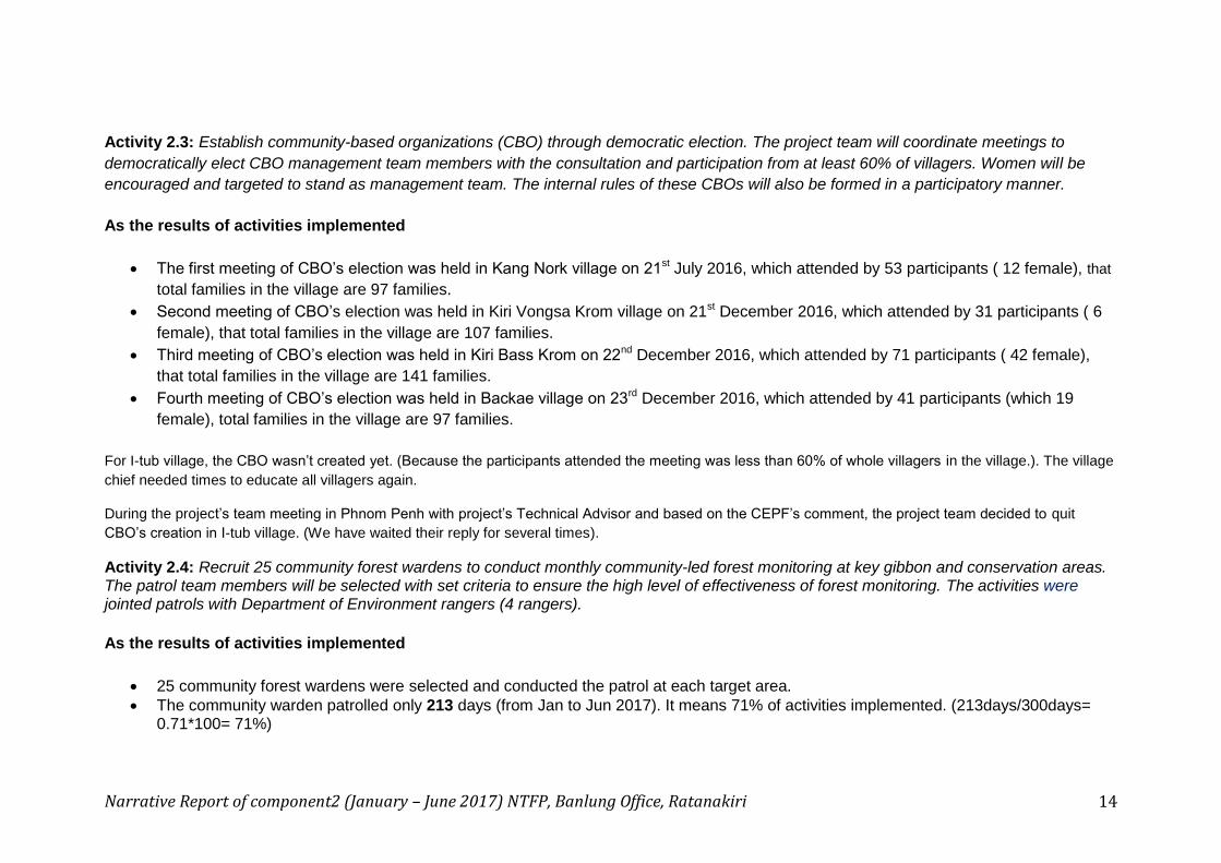
Figure 1: show us about gibbon records by community patrols (It produced by Technical consultant, Mr. Eam Sam Un) March 2017

Narrative Report of component2 (January – June 2017) NTFP, Banlung Office, Ratanakiri 13
Narrative Report of component2 (January – June 2017) NTFP, Banlung Office, Ratanakiri 14
Activity 2.3: Establish community-based organizations (CBO) through democratic election. The project team will coordinate meetings to
democratically elect CBO management team members with the consultation and participation from at least 60% of villagers. Women will be
encouraged and targeted to stand as management team. The internal rules of these CBOs will also be formed in a participatory manner.
As the results of activities implemented
The first meeting of CBO’s election was held in Kang Nork village on 21st July 2016, which attended by 53 participants ( 12 female), that
total families in the village are 97 families.
Second meeting of CBO’s election was held in Kiri Vongsa Krom village on 21st December 2016, which attended by 31 participants ( 6
female), that total families in the village are 107 families.
Third meeting of CBO’s election was held in Kiri Bass Krom on 22nd December 2016, which attended by 71 participants ( 42 female),
that total families in the village are 141 families.
Fourth meeting of CBO’s election was held in Backae village on 23rd December 2016, which attended by 41 participants (which 19
female), total families in the village are 97 families.
For I-tub village, the CBO wasn’t created yet. (Because the participants attended the meeting was less than 60% of whole villagers in the village.). The village
chief needed times to educate all villagers again.
During the project’s team meeting in Phnom Penh with project’s Technical Advisor and based on the CEPF’s comment, the project team decided to quit
CBO’s creation in I-tub village. (We have waited their reply for several times).
Activity 2.4: Recruit 25 community forest wardens to conduct monthly community-led forest monitoring at key gibbon and conservation areas. The patrol team members will be selected with set criteria to ensure the high level of effectiveness of forest monitoring. The activities were jointed patrols with Department of Environment rangers (4 rangers).
As the results of activities implemented
25 community forest wardens were selected and conducted the patrol at each target area.
The community warden patrolled only 213 days (from Jan to Jun 2017). It means 71% of activities implemented. (213days/300days= 0.71*100= 71%)

Narrative Report of component2 (January – June 2017) NTFP, Banlung Office, Ratanakiri 15
The numbers of community wardens patrolled were 208 people (from Jan to Jun 2017). It means 139% of increasingly activities implemented. As the plan 25 CWs multiplied by 6 months= 150 people (208people /150people = 1.39*100= 139%)
The rangers who joined patrols in March, there are two DoE rangers joined patrol with community warden of Talae village for three days. But, they didn’t give the report. They said no report form to record. In Veun Sai, a DoE ranger joined the patrol with community warden in the target areas. In May 2017, the project staff had a meeting with Mr. Nut Tomas, a chief of rangers in Vuen sai to discuss for additional rangers to take part the patrolling with community in 3 villages. He said he will send a request to Mr. Prin Sambo about this. Until now, we have no reply from him yet.
Summarized activities of patrols of community warden for each quarter and total for semester (Jan-Jun 2017)
Descriptions Jan-Mar 2017 Apr- Jun 2017 Total Percentage
#Number of Days patrol 128 days 85 days 213 days 71%
# Numbers of time patrol 29 times 19 times 48 times _
# Numbers of community wardens patrolled 120 people 88 people 208 people 139%
Note: the high numbers of community patrol are Kang Nuok, Talae and Kapin village. Beside these, there were lower numbers of patrol, such as Backae and I-tub villages.
Activity 2.5: Provide six capacity training sessions to the selected community wardens and patrol groups. This training session will consist of
community roles and responsibilities, community led forest monitoring techniques, relevant laws, using equipment, such as GPS using, map
reading, SMART-based data collection methods, administration and reporting, financial management, and conflict resolution. The pre- and
post-tests will be used to assess the skills and knowledge before and after the training sessions are provided.
Results:
It had not been conducted during these period of month. But, it has results from the last trainings.
The first training was conducted by Mr Phirom and Sony, the previous technical consultants. ( in May 11-13, 2016)
The second training was conducted by Mr. Eam Sam Un, the current technical consultant (in March 30-31, 2017) ( 2 trainings/6 trainings= 0.33= 33%)

Narrative Report of component2 (January – June 2017) NTFP, Banlung Office, Ratanakiri 16
In June 26-30, 2017, the project team, VSSP community wardens and Birdlife’s communities conducted exchange visit to learn experiences from the Prey
Lang community in Kaing Cham village, Kain Cham commune, Thalar Boravat district of Stung Treng province. There were 54 participants, with 6 female.
(Among the 54 participants, the 23 community wardens from VSSP.)
The project staff introduced the purpose of the Exchange Visits that the VSSP community wardens. NTFP staff had shared the VSSP works to PLN, mainly
on community forest patrols by using SMART Book, which reported by members of community warden. ( Additional information also report in Component 1,
at Act No.1.17)
Activity 2.6: Monthly patrols conducted, contravention delivered to offenders, snares removed. According the community-based patrol data,
noticeable results for the last two were documented and analyzed.
As the results of activities implemented during January to June 2017
According the community-based patrol data, noticeable results for the last two were documented and analyzed. (See Smart report of Mr. Sam
Un, a technical consultant)
- Total community patrol within the VSSP comprised of 116 members with total 31 patrol, and total 190 days. They camped to stay overnight in the forest for 130 nights. They conducted the forest patrol on foot, by motorbike, and motor mule in total are 795 km.

Narrative Report of component2 (January – June 2017) NTFP, Banlung Office, Ratanakiri 17
Patrol overnight camping & Coverage by all sites

Narrative Report of component2 (January – June 2017) NTFP, Banlung Office, Ratanakiri 18
- The investigation recorded by each CW tallied 176 cases, those were included 3 cases of poaching onto the fowls, and mammal, 1 case on chainsaw, illegal logging 48 cases ( 612 chunks, see 46 times, and reported 2 times). 8 cases of forest land infringement ( 3.9 hectares by direct sighting). Seeing people in the forest for 13 times ( 32 people, through direct sighting 10 times and direct warning 3 cases). The transportation means for 7 cases ( 17 motor-mules, direct sighting 06). Seeing and hearing gibbon’s sound for 17 times ( Approximately 54 populations), 47 cases wildlife investigation, 4 cases of wildlife perished demises ( It is gaur sp and pheasant, direct seeing 4 cases).
Location of forest clearing

Narrative Report of component2 (January – June 2017) NTFP, Banlung Office, Ratanakiri 19
Location of people directed observation

Narrative Report of component2 (January – June 2017) NTFP, Banlung Office, Ratanakiri 20
Location of gibbon sighting
Wildlife Sighting
Narrative Report of component2 (January – June 2017) NTFP, Banlung Office, Ratanakiri 21
- The key wildlife species: Gaur, Giant ibis, Land monitor lizard, Long tailed macaque, Macaque sp, Malayan Flying Lemur, Oriental pie hornbill, Pig tailed macaque, Red muntjac, Red
shanked-duoc langur, Silvered langur, Peacock, and wild pig.

Narrative Report of component2 (January – June 2017) NTFP, Banlung Office, Ratanakiri 22
Activity 2.7: Design and install 10 signboards/ demarcation for community rights to enforce community regulations on land and resource use.
The signboard will be designed based the community regulations in consultation with community members and local authorities in order to
ensure the appropriate use of the language or illustration.
Results:
At the beginning of April 2017, the project staff hoisted billboards at the entrance of the forest and the villages. But some billboards (in Kang Nuok, Talae and
I-tube) were suspended, thanks to the MoE commented on the billboard’s messages needed to be corrected. Moreover, it needs to be transported into the
forest at the gibbon zone.
Later, all the billboards were corrected in accordance with the MoE’s comment.
Activity 2.8: Monthly participatory reflection meetings with committees and forest wardens. This meeting is aimed to reflect on the community-
led monitoring results and provide mentoring services in analyzing the data for better informed decision making and planning.
Every month, the community wardens and village chief conducted the reflection meeting that coordinated by NTFP staffs. They showed the
results of patrolling activities and difficulties happened during the patrols for each month.
Results:
- In Jan 20 -26, 2017, at each village (21 Participants with 2 females)
- In Feb 20. 2017, at Kang Nuok.( 35 Participants with 1 female)
- In Mar 13-16 and 27-31, 2017, at each village ((126 Participants with 52 females)
- In April 24-28, 2017 in every target village, the participants were 34 villagers.
- In May 24-25, 2017 in every target village, the participants 55 villagers (4 females).
- In June 26 -30, 2017 in Stung Treng province (Exchange visit in Prey Lang), the participants 54 villagers (6 females).
During this semester (Jan – Jun 2017): The project team conducted the reflection meetings and training on the procedure of forest patrol and
monthly report writing. The session was held to review on the monthly report writing, GPS usage and patrol technique. The project staff also
assessed the community rangers’ skill, whether they are able to use GPS properly during the forest and gibbon patrol for tracking illegal
activities. Apart from that, the project staff checked on minute taking, and monthly reporting, whether they had recorded it correctly. Test was

Narrative Report of component2 (January – June 2017) NTFP, Banlung Office, Ratanakiri 23
used for community warden to fill the monthly community report and assessment of their accuracy. As result, most of the participants were able
to complete with reliable information, although continuous reflection meetings and data analysis for better patrol planning is still needed.
The difficulties which community warden found during these months:
- The difficulty to contact members to conduct forest patrol. (They stayed far away from the village and some were not active in the
patrol.), Kapin and Backae village)
- There are still logging offenders entered into the forest to cut trees. Mostly it was happened during night time. The community rangers
were afraid of them. They had no enough power to arrest them. Those perpetrators are from Backalann and Veunsai villages.
- The areas were far away from the Siem Pang District, it is difficult to report to commune, and district authorities. ( Kapin and Talae
village)
- The lacks of rangers to participate the community patrol in the target areas.
- If there are only community warden do the forest patrol, the perpetrators don’t scare.
- There were still villagers who clear the forest to expand farm’s lands in the areas (there were 13 hectares from 3 villages_ 4 families in
Kang Nuok (= 4 hectares), 6 families in Kapin (= 6 hectares) and 3 families in Backae village ( = 3 hectares)
Solutions:
- Strengthen the patrolling team’s communication by setting clear plan and dates of patrol. The community wardens organize next three-
month’s plans. (July – September 2017).
- Lack of patrolling equipment, NTFP staffs would coordinate to solve these issues.
- Community warden suggests commune authorities to prowl watching at the road in the villages at night time.
- Lack of DoE rangers to participate in patrol in the target areas, the community wardens still need the rangers to patrol with them. They
need more power to apprehend the perpetrators. (The CW requires some reasonable and evidential documents to show those
offenders that they had authority to confiscate and stop their illegal activities.
- They need DoE and FA officials to educate and to enforce the Forest Law for the villagers who clear forest land to expand new farm’s
land (new Chamkar) in the areas
- The community wardens in VSSP will use the experiences they had learned from the exchange visit of Prey Lang Network to confiscate
and arrest the perpetrators to send to commune authorities.
Product/Deliverable 2.9

Narrative Report of component2 (January – June 2017) NTFP, Banlung Office, Ratanakiri 24
Reduced land and resource conflict cases over the period of project implementation through collaborative work between the community members and the working groups._ Work with the community and local authorities to resolve conflicts relating to land and forestry issues. Work with the community and local authorities to resolve conflicts relating to land and forestry issues.
This activity involved the intervention mainly from the established working groups that composed of village chiefs, commune chiefs, rangers and district governors, who have authorities to handle the offenses’ cases. It could be raised for discussion or intervention in the quarterly meeting or in any separate extraordinary meeting. It had been planned once in June 2017, but has been put off to July 2017, because those working groups’ members could not participate in the meeting. They were busy in commune election’s campaigning. (Extraordinary meeting). On 14-15 March 2017, there was one case of gold mine exploration at Ou Kapin area occurred, by a group of 16 soldiers. (It has been acquainted that two of them were Vietnamese). This case is being investigating by the ranger chief of Stung Treng province and the commune chief of Santipheap.
Results:
The commune chief and Talae village chief with Mr. Huy Kun, a ranger chief in Seam Pang had intervened to solve the issue.
The group of soldiers which consisted 6 people left the zones as result of the intervention by the ranger. Since then they never come again. However, there is no any minute or report about the solution has been shared.
Activity 2.10: Trainings and mentoring will be improved to better track and document the forest and gibbon crimes. Each community warden group will be provided a smartphone or GPS-tracked camera to picture offenses and share with other forest protection networks (e.g. Prey Lang Network) _ Share with other forest protection networks (e.g. Prey Lang Network)
Results:
The community warden were refreshed how to record the field data more accuracy and properly,
Additional information has been reminded/mentioned to make a record in order to provide the better efforts to the SMART
Database includes; accurate waypoint of START and END Patrol, daily record of each patrol and clearly dates, number of observation
(e.g # of traps, # of log (m3 or piece) action taken of the observations are strictly mentioned.

Narrative Report of component2 (January – June 2017) NTFP, Banlung Office, Ratanakiri 25
Activity 2.11: Use satellite imagery and ground-truthing to verify and assess the extent of forest change. This activity is to monitoring
vegetation changes over the life space of the project. The baseline will be prepared through desk and ground truthing methods to ensure the
accuracy of the collected data. The forest type will then be analyzed and documented for a comparison.
In May 2017, Mr. Mean Ratanak, the technical consultant on Satellite Imagery conducted the field mission with project staff in the target areas to do the survey and analyzes the land use and forest type.
The results:
1) The baseline land use map 2016 was produced with data analysis
Table1 : Baseline of land use/land cover of Vernsai Siempang National Park 2016
No. Type of Forest AREA (Ha) Percentage ( %)
1 Evergreen forest 45168.75 78.60%
2 Deciduous forest 9436.50 16.42%
3 Swidden agriculture 2420.96 4.21%
4 Paddy rice fields 177.77 0.31%
5 Sandy fields 265.73 0.46%
Village areas
Rivers and lakes
TOTAL 57,469.70 100%
Source: the baseline bases on the database of land use/land cover analysis
Figure 1 Map of land use/land cover of Veunsai Siempang National Park 2016
Narrative Report of component2 (January – June 2017) NTFP, Banlung Office, Ratanakiri 26
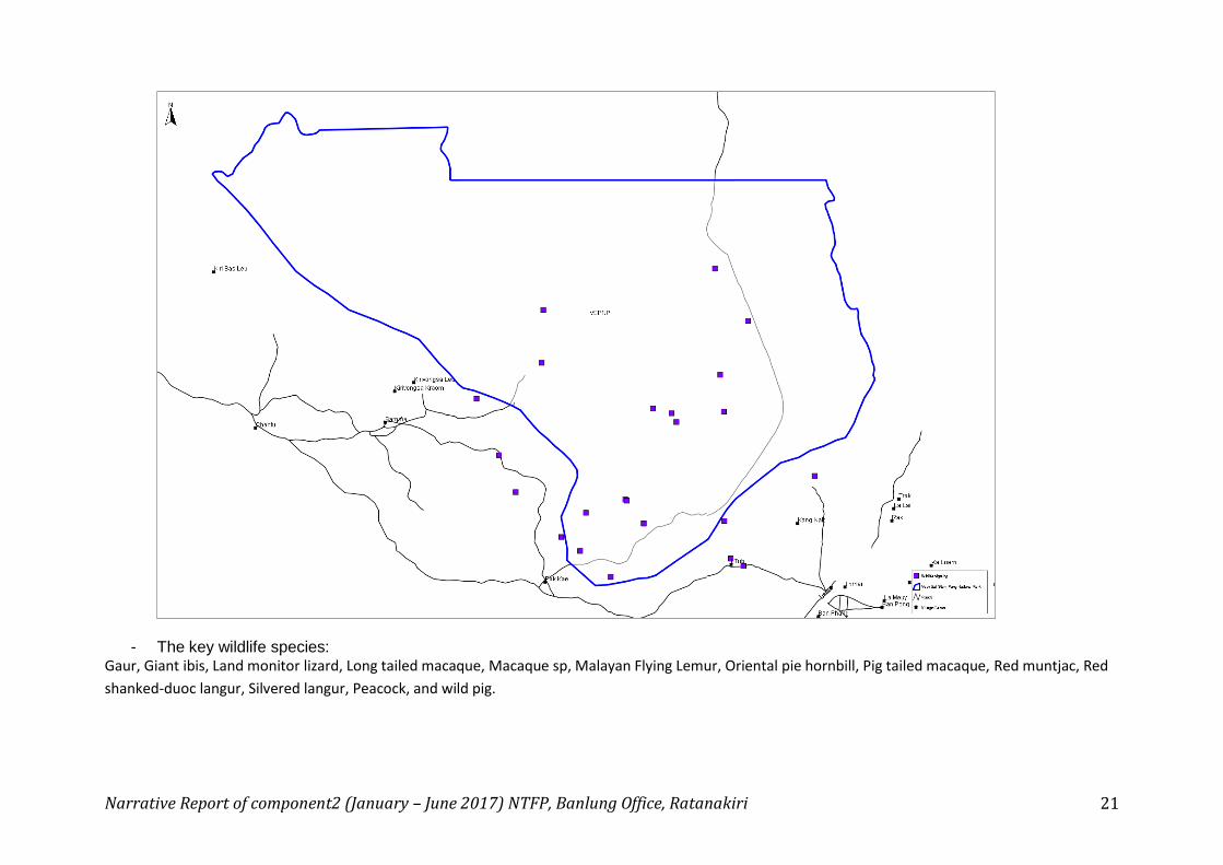
2) The land use map 2017 was produced with data analysis (please see: Figure 1 Map of Land use/land cover 2016-2017)
Evergreen forest increased (because it spreads and covers on the areas of deciduous forest. See land use map 2016-2017 by Mr. Mean Ratanak)
Deciduous forest decreased (because it became as the Evergreen forest and covers on the areas.)
Swidden agriculture decreased (because some of Chamkars was grown by cashew nut trees. They didn’t grow rice like in the past.)
Paddy rice fields increased
Sandy fields decreased
Table 2 : Land use/land cover of Vernsai Siempang National Park 2017

Narrative Report of component2 (January – June 2017) NTFP, Banlung Office, Ratanakiri 27
No. Type of Forest AREA (Ha) Percentage ( %)
1 Evergreen forest 48449.48 84.30%
2 Deciduous forest 7490.25 13.03%
3 Swidden agriculture 1090.24 1.90%
4 Paddy rice fields 241.00 0.42%
5 Sandy fields 198.56 0.35%
Village areas
Rivers and lakes
TOTAL 57,469.70 100%
Figure 2 Map of land use/land cover of Vernsai Siempang National Park 2017

Narrative Report of component2 (January – June 2017) NTFP, Banlung Office, Ratanakiri 28

Narrative Report of component2 (January – June 2017) NTFP, Banlung Office, Ratanakiri 29
Table1: land use types, land use in hectares and extent of change in 2016-2017
Land use types Areas in Hectares (Ha) Percentage Change from (%) 2016-2017
Year 2016
Year
2017
%
2016
%
2017 Hectares (Ha)
1.Evergreen forest 45168.75 48449.48 78.60% 84.30% 3280.73
2.Deciduous forest 9436.50 7490.25 16.42% 13.03% -1946.25
3.Swidden agriculture 2420.96 1090.24 4.21% 1.90% -1330.72
4.Paddy rice fields 177.77 241.00 0.31% 0.42% 63.23
5.Sandy fields 265.73 198.56 0.46% 0.35% -67.16
6.Rivers and lakes 0.00 0.00 0.00 0.00 0.00
7.Village areas 0.00 0.00 0.00 0.00 0.00
Total : 57469.70 57469. 70 100. % 100. %

Narrative Report of component2 (January – June 2017) NTFP, Banlung Office, Ratanakiri 30
Figure 1 Map of Land use/land cover of Vernsai Siempang National Park for 2016-2017
Narrative Report of component2 (January – June 2017) NTFP, Banlung Office, Ratanakiri 31
Activity 2.12: Submit regulation of Gibbon conservation area to provincial governor for approval. The ICCA map and reviewed land use map
will be submitted to the provincial governor.
We will conduct these activities after CPA's recognition
Activity 2.13: Create a network with the 5 CBOs: VSSP Network, recognized by local authorities. The five CBOs of the five villages will be
formed with an overall objective and internal regulation to enhance their support in protecting forest and biodiversity as well as tracking down
illegal activities collectively. Conduct two consultation meetings to develop overall rules and management structure of five CBOs.
As the results of activities implemented during this semester 2017
In June 26-30, 2017, the project team, VSSP community wardens and Birdlife’s communities conducted exchange visit to learn experiences
from the Prey Lang community in Kaing Cham village, Kain Cham commune, Thalar Boravat district of Stung Treng province. There were 54
participants, with 6 female. (Among the 54 participants, the 23 community wardens from VSSP.) ( More information is written 2.15)
After the exchange visited, the VSSP communities began to come up idea and are able to create a VSSP network in order to strengthen their
strong voice for the wildlife and forest protection.
Activity 2.14: Hold regular quarter network meetings to reflect patrol findings and seek solutions to better protect the forest and biodiversity
within the target community areas.
This activity involved the intervention mainly from the established working groups that composed of village chiefs, commune chiefs, rangers and district governors, who have authorities to handle the offenses’ cases.. It had been planned once in June 2017, but has been put off to July 2017, because those working groups’ members could not participate in the meeting. They were busy in commune election’s campaigning.
Activity 2.15: Initiate collaborative approach between VSSP Network and Prey Lang network (PLN). Select 12 key community representatives
/ wardens to join a 3-day field exchange visit with Prey Lang network.
From 26th to 30th June 2017, NTFP had facilitated 25 members of communities from VSSP to study experience from Prey Long community protection area. The participants had learned experiences in terms of:

Narrative Report of component2 (January – June 2017) NTFP, Banlung Office, Ratanakiri 32
3) They had discussed to create the mechanism of communication between VSSP with Prey Long community protection area. The VSSP proposed the core group of Prey Long network to share knowledge to VSSP’s community’s members. The core group of Prey Long Network are happy with proposal. They agreed, but need to look for available schedule. Ms Khout Niwerk, Technical Advisor of Dan Mission said that we will look for opportunity to study with VSSP community in the near future.
4) The VSSP community exchanged the experiences in terms of their forest patrol with Prey Long Network. They had learned the experiences about the Prey Long Network’s communication with the local authorities, DoEs, and military forces to take part in forest patrol. The communities did the invitation by themselves.
Activity 2.16: Strengthened organizational capacity of NTFP to plan and implement conservation projects, as demonstrated by
increased civil society tracking tool scores over the project period”
Results:
1) NTFP project’s staffs learned about SMART Conservation Model
After the technical consultant of SMART BOOK trained and coached the project staff
- The conservation model (SMART) was installed for NTFP. The project staff can entry SMART data from the community patrols,
- The project staff can download GPS file (GPX) from community GPS data to view on the map and loading into SMART.
- The project staff check and monitor the data from community work by using few software; Easy GPS, Basecamp, and Google earth.
2) From 26th to 30th June 2017, NTFP had facilitated 25 members of communities from VSSP to study experience from Prey Long
community protection area. The participants had learned experiences in terms of: - They had discussed to create the mechanism of communication between VSSP with Prey Long community protection area. The VSSP
proposed the core group of Prey Long network to share knowledge to VSSP’s community’s members. The core group of Prey Long Network are happy with proposal. They agreed, but need to look for available schedule. Ms Khout Niwerk, Technical Advisor of Dan Mission said that we will look for opportunity to study with VSSP community in the near future.
- The VSSP community exchanged the experiences in terms of their forest patrol with Prey Long Network. They had learned the experiences about the Prey Long Network’s communication with the local authorities, DoEs, and military forces to take part in forest patrol. The communities did the invitation by themselves.
- VSSP community’s committee had learned experiences about Prey Long Network’s activities which included: The Prey Long Network functions by structure which has one Focal Person who stand at province to direct works, 1 core group per commune. The members or activists are not volunteer group. This group is the village’s people which voluntarily join forest patrol. They had reported when having

Narrative Report of component2 (January – June 2017) NTFP, Banlung Office, Ratanakiri 33
seen the offenders. The network is strong thanks to their collective decision making. They fulfilled role, responsibility and adhere the principles and initiate to make their activity plan by themselves.
- In May 2017, the Project staff, the project manager, was trained on learn the GIS use which including the technique to upload the UTM points collected from the field to make soft file into the Arch. MAP. The project staff has skill to read map such as location, sizes of forest, signs on the map of the forest deciduous, evergreen, land use, and can tell the variances on maps of land use.
Lesson Learns Component 2
Working with Lao people to protect forest and wildlife are not quite successful, given they often embroil in illegal logging. Mostly, they contravene the laws. They always destroy forest through illegal logging and infringed land to expand their farm. Base on this lesson learnt, the project had focused strengthening some of their knowledge, through dissemination of related laws such as wildlife protection law, forest law, land laws and CPA law etc. Another lesson learnt with Lao ethnicity, while they were punished by local authorities through law enforcement, they are afraid.
Conversely, working with the indigenous people such as Kawet ethnicity in protection the forest and wildlife is quite successful. The Kawet people have good traditional knowledge about forest and wildlife’s stewards. They were interested in forest and wildlife protections and taking care of the environment issues.
Annex 1.
10, the three-month-patrolling schedule of Community wardens were produced (July – September 2017)
Village’s names three-month-patrolling schedule of Community wardens(July – September 2017)
Kirivong Sa Krom village (
Kapin)
- July 2017: First from 10-14 July 2017, Second from 19-23 July 2017.
- August 2017: First from 03-07 August 2017, Second from 12-16 August 2017
- September 2017: First from 05-09 September 2017, Second from 13-17 September 2017

Narrative Report of component2 (January – June 2017) NTFP, Banlung Office, Ratanakiri 34
Kiribas Krom village ( Talae)
- July 2017: First from 10-14 July 2017, Second from 19-23 July 2017.
- August 2017: First from 05-09 August 2017, Second from 15-19 August 2017
- September 2017: First from 05-09 September 2017, Second from 13-17 September 2017
Backae village - July 2017: First from 13-16 July 2017, second from 19-23 July 2017 and third from 28-29 July 2017.
- August 2017: First from 06-09 August 2017, second from 13-16 August 2017 and third from 25-26 August 2017.
- September 2017: First 05-08 September 2017, second 11-14 September 2017 and third 26-27 September 2017
I-tub village
- July 2017: First from 06-10 July 2017, Second from 18-22 July 2017.
- August 2017: First from 02-06 August 2017, Second from 09-13 August 2017
- September 2017: First from 06-10 September 2017, Second from 19-23 September 2017
Kang Nork village - July 2017: First from 05-09 July 2017, Second from 13-17 July 2017.
- August 2017: First from 02-06 August 2017, Second from 10-14 August 2017
- September 2017: First from 03-07 September 2017, Second from 11-15 September 2017
Annex 2. Photos of community warden and activities conducted.
Narrative Report of component2 (January – June 2017) NTFP, Banlung Office, Ratanakiri 35
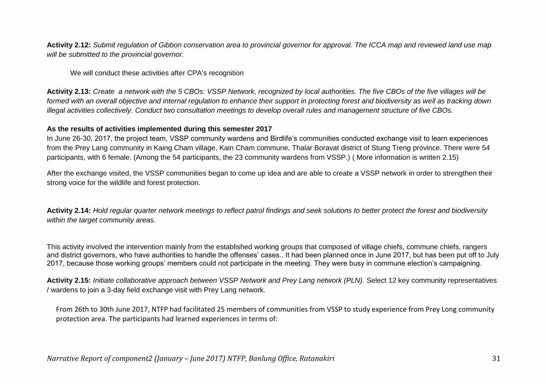
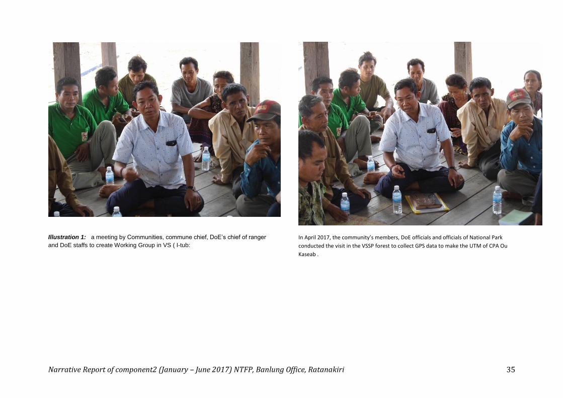
Illustration 1: a meeting by Communities, commune chief, DoE’s chief of ranger
and DoE staffs to create Working Group in VS ( I-tub:
In April 2017, the community’s members, DoE officials and officials of National Park
conducted the visit in the VSSP forest to collect GPS data to make the UTM of CPA Ou
Kaseab .

Narrative Report of component2 (January – June 2017) NTFP, Banlung Office, Ratanakiri 36
Illustration3: a meeting by Communities, commune chief, DoE’s chief of ranger and
DoE staffs to create Working Group in VS ( Backae village : March 2017 )
Illustration 4: a meeting by Communities, commune chief, DoE’s chief of
ranger and DoE staffs to create Working Group in Siem Pang ( Talae :
March 2017 )

Narrative Report of component2 (January – June 2017) NTFP, Banlung Office, Ratanakiri 37
Illustration 5: DoE’s chief of ranger, Mr. Huy Kun explained components of
Working Group in Siem Pang ( Talae : March 2017 )
Illustration 6: a meeting by Communities, commune chief, DoE’s chief of ranger
and DoE staffs to create Working Group in Siem Pang ( Talae : March 2017 )

Narrative Report of component2 (January – June 2017) NTFP, Banlung Office, Ratanakiri 38
Illustration 7: Community wardens in Backae patrolled the forest in May 2017.
(February : 2017)
Illustration 8: Community wardens in Backae and DoE ranger patrolled
the forest in May 2017. (: May 2017)

Narrative Report of component2 (January – June 2017) NTFP, Banlung Office, Ratanakiri 39
Illustration 9: Community wardens in Kang Nork village and DoE ranger
patrolled the forest in May 2017. (: May 2017)
Illustration 10: Community warden team in Kapin slept in the forest. ( Kapin:
April 2017)

Narrative Report of component2 (January – June 2017) NTFP, Banlung Office, Ratanakiri 40
Illustration 11 Community warden team in Talae patrolled in the forest (Talae:
April 2017)
Illustration 12 Community warden team in I-tub village patrolled in the
forest (I-tub: April 2017)

Narrative Report of component2 (January – June 2017) NTFP, Banlung Office, Ratanakiri 41
Illustration 13 Community wardens were trained by Mr. Eam Sam Un, a technical
consultant about Smart and GPS usage ( Kang Nork: March 2017)
Illustration 14: Community wardens were trained by Mr. Eam Sam
Un, a technical consultant about Smart and GPS usage ( Kang Nork:
March 2017)
Narrative Report of component2 (January – June 2017) NTFP, Banlung Office, Ratanakiri 42
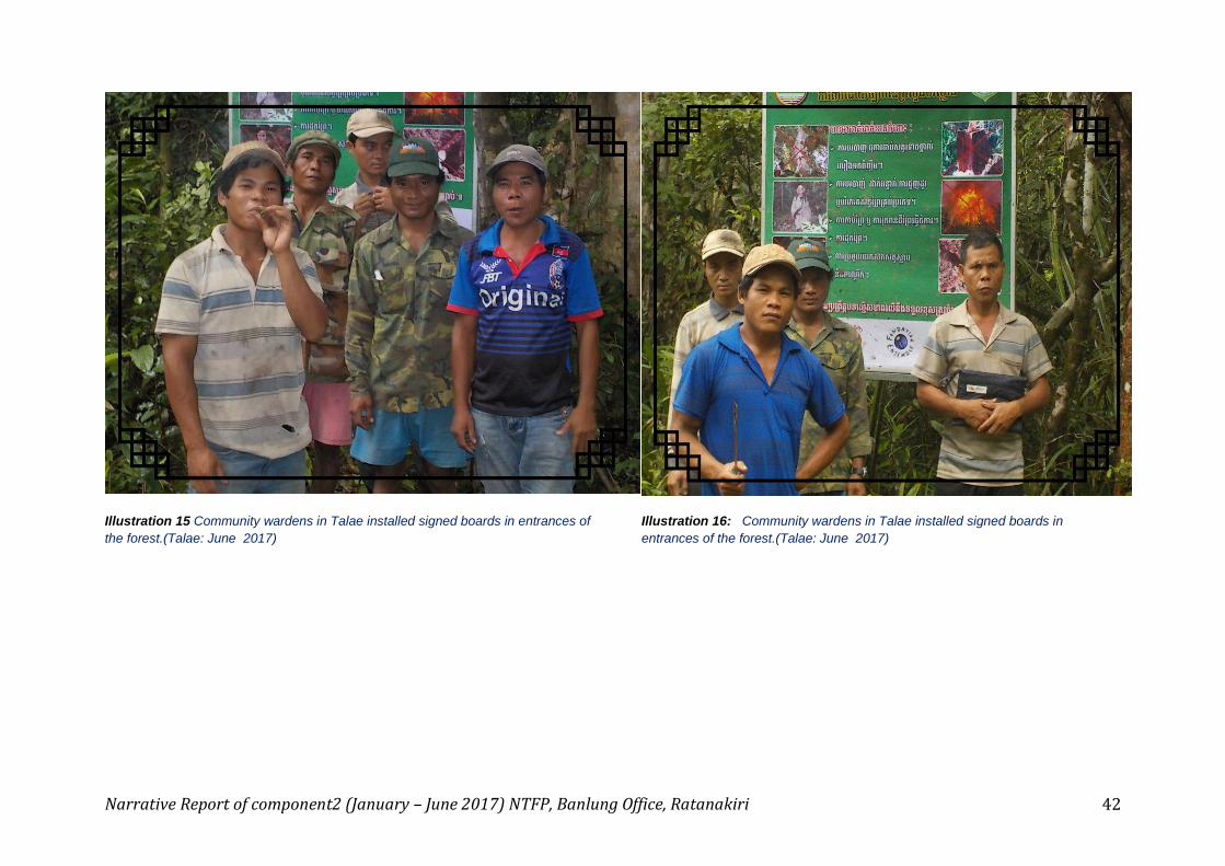
Illustration 15 Community wardens in Talae installed signed boards in entrances of
the forest.(Talae: June 2017)
Illustration 16: Community wardens in Talae installed signed boards in
entrances of the forest.(Talae: June 2017)

Narrative Report of component2 (January – June 2017) NTFP, Banlung Office, Ratanakiri 43
Illustration 17: Mr. Mean Ratanak, a project consultant conducted the field
mission about forest and land use of communities (Talae: May 2017)
Illustration 18: Mr. Mean Ratanak, a project consultant conducted the
field mission about forest and land use of communities (Talae: May 2017)

Narrative Report of component2 (January – June 2017) NTFP, Banlung Office, Ratanakiri 44
Illustration 19: Community Wardens in VSSP joined the forest patrols with Prey
Lang Community Wardens( Kaing Cham, Stung Treng: June 27, 2017)
Illustration 20: Community Wardens in VSSP joined the forest patrols
with Prey Lang Community Wardens( Kaing Cham, Stung Treng: June 27,
2017)