Embed Size (px)
Citation preview
National Environmental Research Institute, Aarhus University, Denmark
Use of models for Maritime spatial
planning
Output from the data modelling workshop in Hamburg
by
Christian Mohn and Karsten Dahl
National Environmental Research Institute, Aarhus University, Denmark
Wri
te t
itle
on
th
e m
as
terp
ag
e
Introduction• What is the goals we would like to reach with regard
to use of models within the framework of BaltSeaPlan
– Can we get a common understanding of the potential and limitations of use of models in MSP
– What output would we (the whole project) like to produce ?
• How to structure the work done at this meeting ?
• Examples of BaltSeaPlan model results
National Environmental Research Institute, Aarhus University, Denmark
Wri
te t
itle
on
th
e m
as
terp
ag
e
Models – what is it good for ?
• Fill gaps between actual measurements• Study specific processes• Scenarios (what if ...?)• Setting ecological targets
– Specific case– Favourable conservation status (sensus Hab- Dir.)– Good environmental status (sensus VFD)– Targets for descriptors (sensus the Marine
Strategy Dir.)
National Environmental Research Institute, Aarhus University, Denmark
Wri
te t
itle
on
th
e m
as
terp
ag
e
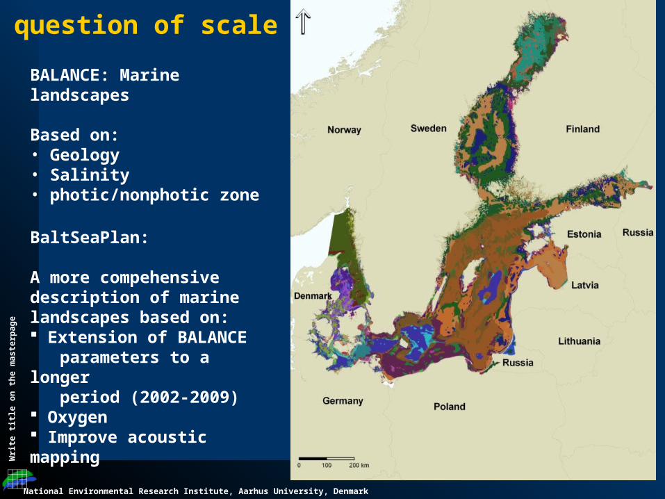
BALANCE: Marine landscapes
Based on:• Geology• Salinity• photic/nonphotic zone
BaltSeaPlan:
A more compehensive description of marine landscapes based on: Extension of BALANCE parameters to a longer period (2002-2009) Oxygen Improve acoustic mapping
A question of scale
National Environmental Research Institute, Aarhus University, Denmark
Wri
te t
itle
on
th
e m
as
terp
ag
e
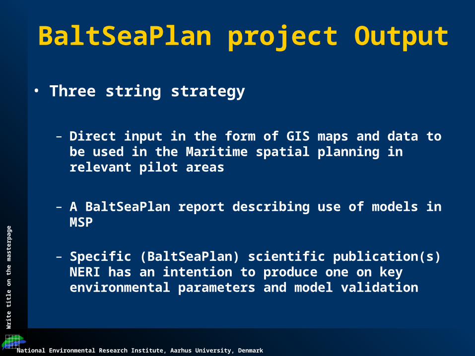
BaltSeaPlan project Output
• Three string strategy
– Direct input in the form of GIS maps and data to be used in the Maritime spatial planning in relevant pilot areas
– A BaltSeaPlan report describing use of models in MSP
– Specific (BaltSeaPlan) scientific publication(s) NERI has an intention to produce one on key environmental parameters and model validation
National Environmental Research Institute, Aarhus University, Denmark
Wri
te t
itle
on
th
e m
as
terp
ag
e
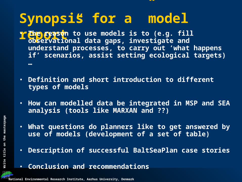
Synopsis for a ”model report”• The reason to use models is to (e.g. fill observational data gaps,
investigate and understand processes, to carry out ‘what happens if’ scenarios, assist setting ecological targets) …
• Definition and short introduction to different types of models
• How can modelled data be integrated in MSP and SEA analysis (tools like MARXAN and ??)
• What questions do planners like to get answered by use of models (development of a set of table)
• Description of successful BaltSeaPlan case stories
• Conclusion and recommendations
National Environmental Research Institute, Aarhus University, Denmark
Wri
te t
itle
on
th
e m
as
terp
ag
e
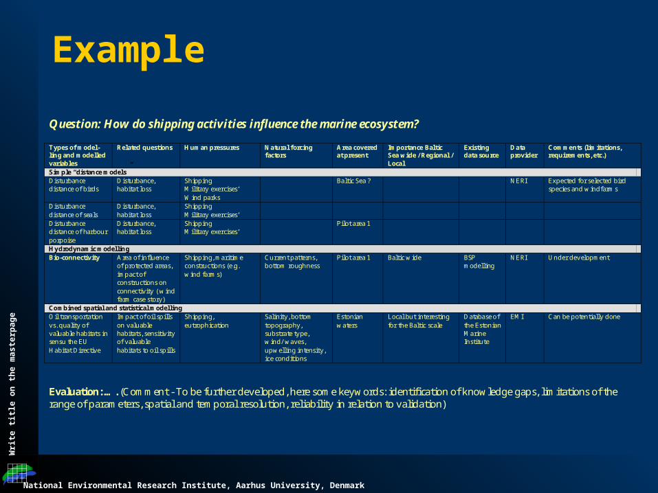
Example
Question: How do shipping activities influence the marine ecosystem?
Types of model-ling and modelled variables
Related questions Human pressures Natural forcing factors
Area covered at present
Importance Baltic Sea wide / Regional / Local
Existing data source
Data provider
Comments (limitations, requirements, etc.)
Simple “distance models” Disturbance distance of birds
Disturbance, habitat loss
Shipping Military exercises’ Wind parks
Baltic Sea ? NERI Expected for selected bird species and windfarms
Disturbance distance of seals
Disturbance, habitat loss
Shipping Military exercises’
Disturbance distance of harbour porpoise
Disturbance, habitat loss
Shipping Military exercises’
Pilot area 1
Hydrodynamic modelling Bio-connectivity Area of influence
of protected areas, impact of constructions on connectivity ( wind farm case story)
Shipping, maritime constructions (e.g. wind farms)
Current patterns, bottom roughness
Pilot area 1 Baltic wide BSP modelling
NERI Under development
Combined spatial and statistical modelling Oil transportation vs. quality of valuable habitats in sensu the EU Habitat Directive
Impact of oil spills on valuable habitats, sensitivity of valuable habitats to oil spills
Shipping, eutrophication
Salinity, bottom topography, substrate type, wind/ waves, upwelling intensity, ice conditions
Estonian waters
Local but interesting for the Baltic scale
Database of the Estonian Marine Institute
EMI Can be potentially done
Evaluation: …. (Comment - To be further developed, here some keywords: identification of knowledge gaps, limitations of the range of parameters, spatial and temporal resolution, reliability in relation to validation)
National Environmental Research Institute, Aarhus University, Denmark
Wri
te t
itle
on
th
e m
as
terp
ag
e
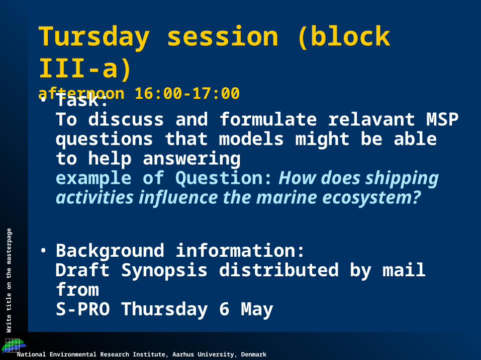
Tursday session (block III-a) afternoon 16:00-17:00
• Task:To discuss and formulate relavant MSP questions that models might be able to help answeringexample of Question: How does shipping activities influence the marine ecosystem?
• Background information:Draft Synopsis distributed by mail from S-PRO Thursday 6 May
National Environmental Research Institute, Aarhus University, Denmark
Wri
te t
itle
on
th
e m
as
terp
ag
e
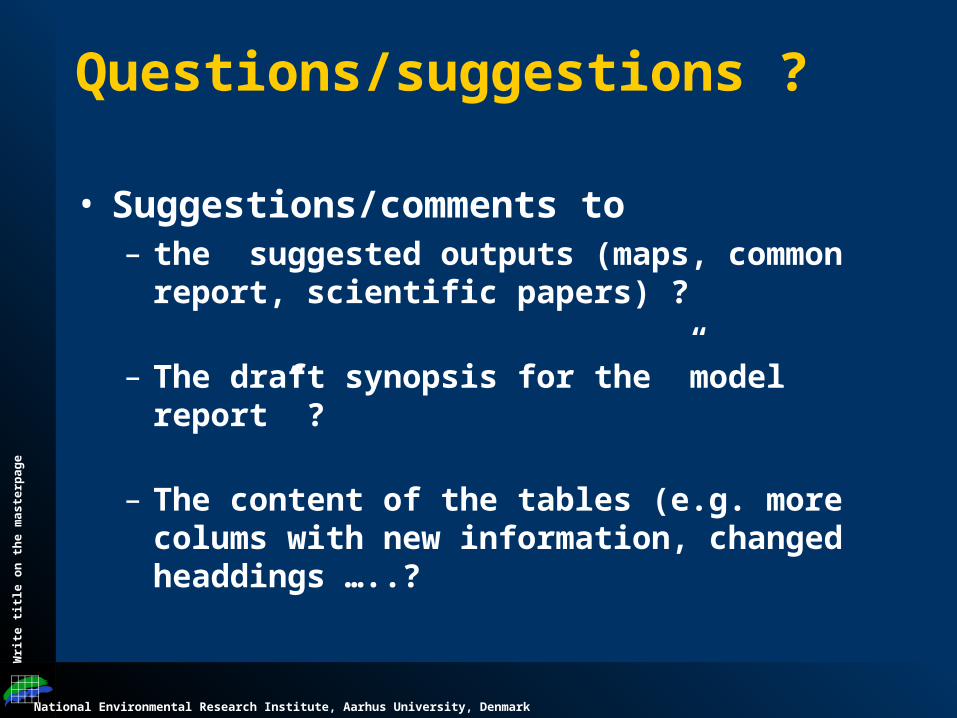
Questions/suggestions ?
• Suggestions/comments to – the suggested outputs (maps, common report,
scientific papers) ?
– The draft synopsis for the ”model report” ?
– The content of the tables (e.g. more colums with new information, changed headdings …..?
National Environmental Research Institute, Aarhus University, Denmark
Wri
te t
itle
on
th
e m
as
terp
ag
e
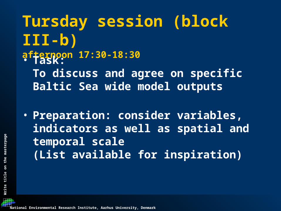
Tursday session (block III-b) afternoon 17:30-18:30
• Task:To discuss and agree on specific Baltic Sea wide model outputs
• Preparation: consider variables, indicators as well as spatial and temporal scale(List available for inspiration)
National Environmental Research Institute, Aarhus University, Denmark
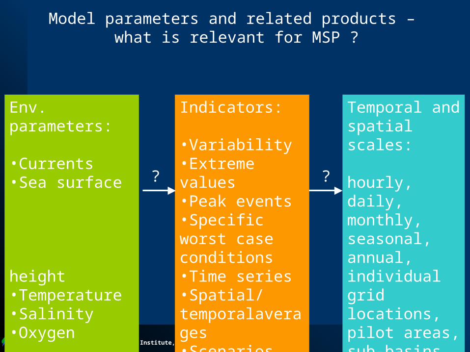
Env. parameters:
•Currents•Sea surface height•Temperature•Salinity•Oxygen…
Indicators:
•Variability•Extreme values•Peak events•Specific worst case conditions•Time series•Spatial/temporalaverages•Scenarios…
Temporal and spatial scales:
hourly, daily, monthly, seasonal, annual,individual grid locations, pilot areas, sub-basins, Baltic wide,…
? ?
Model parameters and related products – what is relevant for MSP ?
National Environmental Research Institute, Aarhus University, Denmark
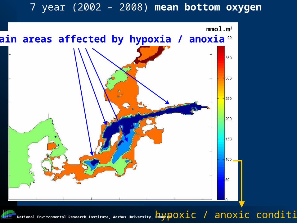
7 year (2002 – 2008) mean bottom oxygen
mmol.m3
hypoxic / anoxic conditions
Main areas affected by hypoxia / anoxia
National Environmental Research Institute, Aarhus University, Denmark
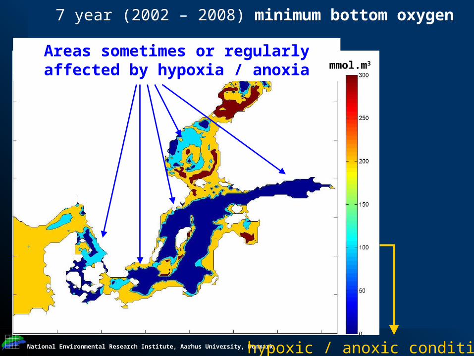
7 year (2002 – 2008) minimum bottom oxygen
hypoxic / anoxic conditions
Areas sometimes or regularly affected by hypoxia / anoxia mmol.m3

National Environmental Research Institute, Aarhus University, Denmark
Wri
te t
itle
on
th
e m
as
terp
ag
e
Awareness of model limitations
• List of model parameters + spatial, temporal coverage + their relevance for MSP and SEA (which questions can be answered with models – Model table as the baseline information)
• Strategies for model validation (repository of observational data)
• Spatial maps to identify areas where models provide reliable and robust information (model skill, distance to observational data)