Embed Size (px)
Citation preview
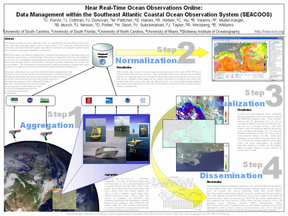
Near Real-Time Near Real-Time Ocean Ocean
Observations Observations OnlineOnlineData Management within theData Management within the
Southeast Atlantic Coastal Ocean Southeast Atlantic Coastal Ocean Observation SystemObservation System
(SEACOOS)(SEACOOS)Charlton Purvis, University of South Carolina, a Charlton Purvis, University of South Carolina, a
SEACOOS partnerSEACOOS partner
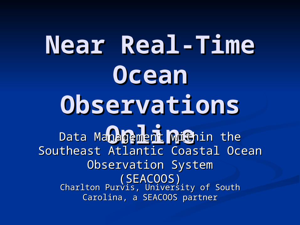
SEACOOS was initiated in 2002 with ONR funding
to develop a coastal ocean information system
for FL, GA, SC and NC.
SEACOOS Over-Arching Goal: To significantly increase the quantity and quality of environmental information from the coastal ocean of the SE U.S. and facilitate its use in a wide range of societal, scientific, and educational applications.
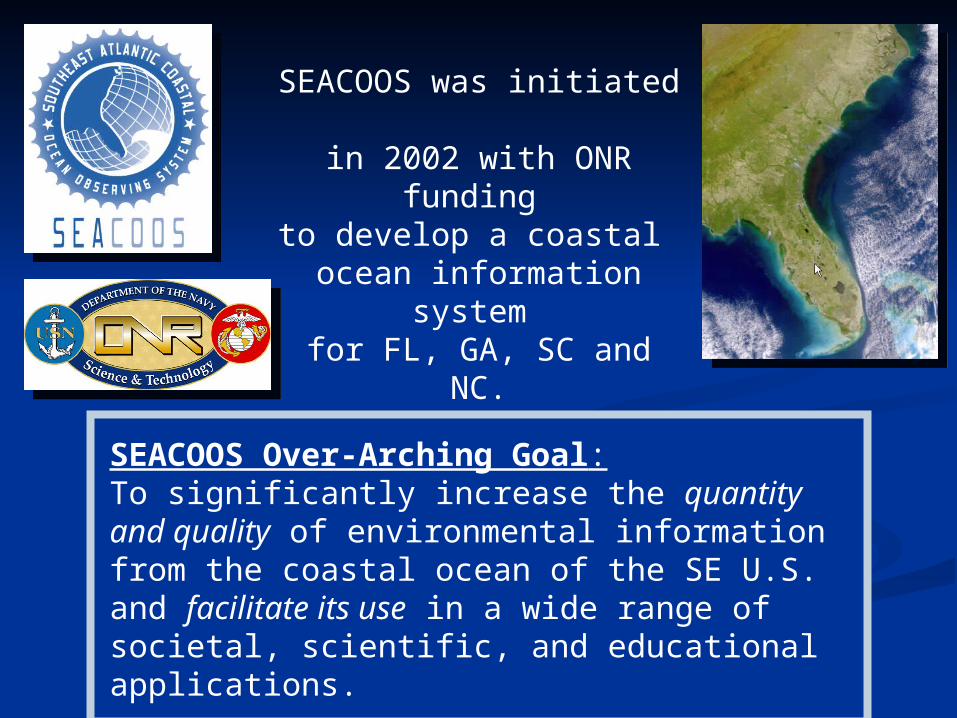
Observational platforms contributed by SEACOOSpartners
Observational platforms contributed by SEACOOSpartners
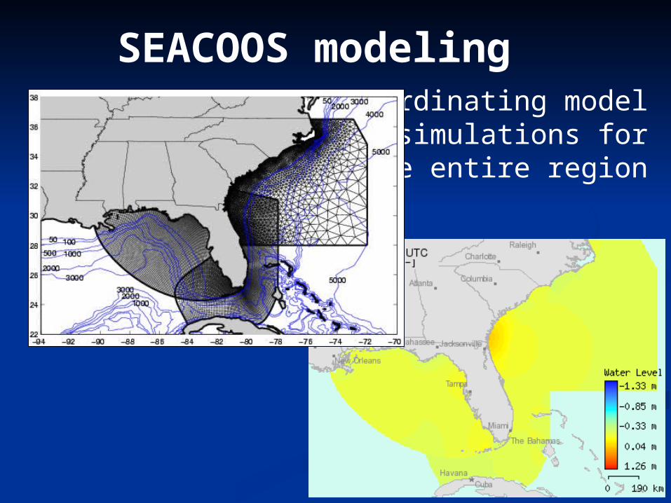
SEACOOS modeling Coordinating model
simulations forthe entire region
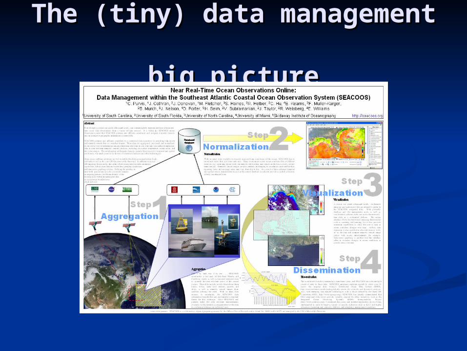
The (tiny) data The (tiny) data management management
big picturebig picture
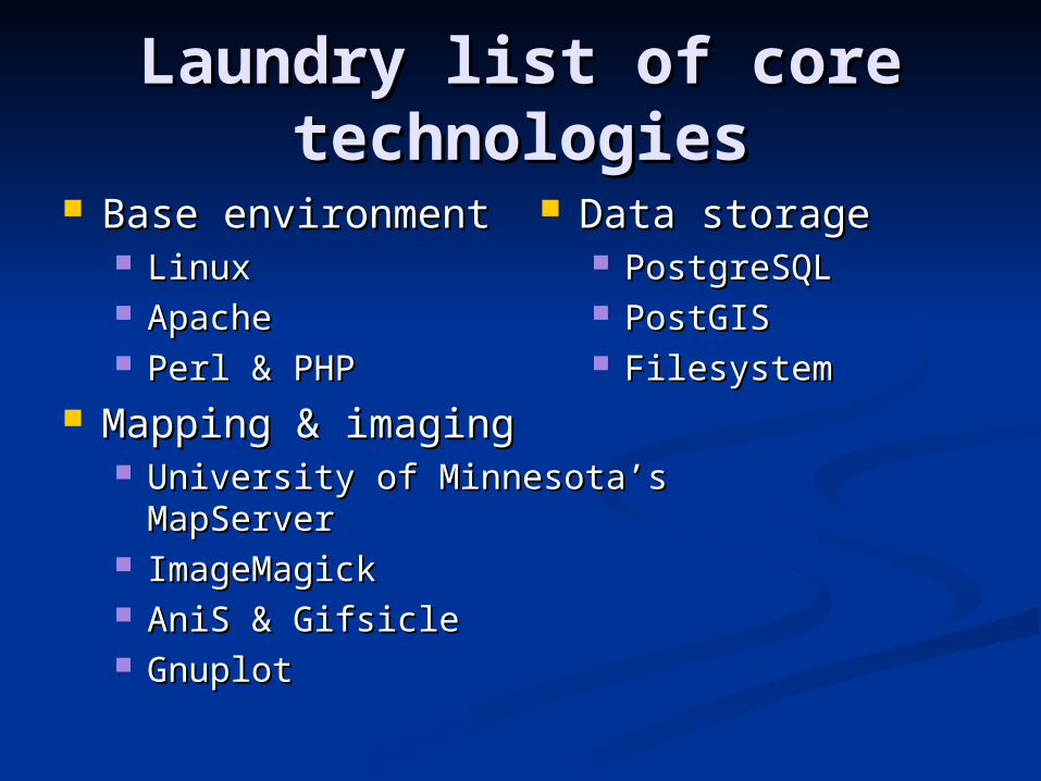
Laundry list of core Laundry list of core technologiestechnologies
Base environmentBase environment LinuxLinux ApacheApache Perl & PHPPerl & PHP
Mapping & imagingMapping & imaging University of Minnesota’s University of Minnesota’s
MapServerMapServer ImageMagickImageMagick AniS & GifsicleAniS & Gifsicle GnuplotGnuplot
Data storageData storage PostgreSQLPostgreSQL PostGISPostGIS FilesystemFilesystem
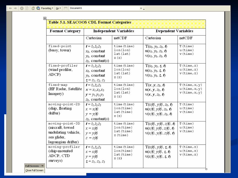
Data aggregation & Data aggregation & storagestorage
Aggregation format Aggregation format flavorsflavors netCDF (in situ and netCDF (in situ and
remotely-sensed remotely-sensed data)data)SEACOOS CDLSEACOOS CDL
PNG (RS imagery)PNG (RS imagery)
StorageStorage Relational Relational
database (in situ, database (in situ, model output, model output, some RS)some RS)
Files (RS imagery)Files (RS imagery) TechnologyTechnology
PerlPerl PostgreSQLPostgreSQL
& PostGIS& PostGIS
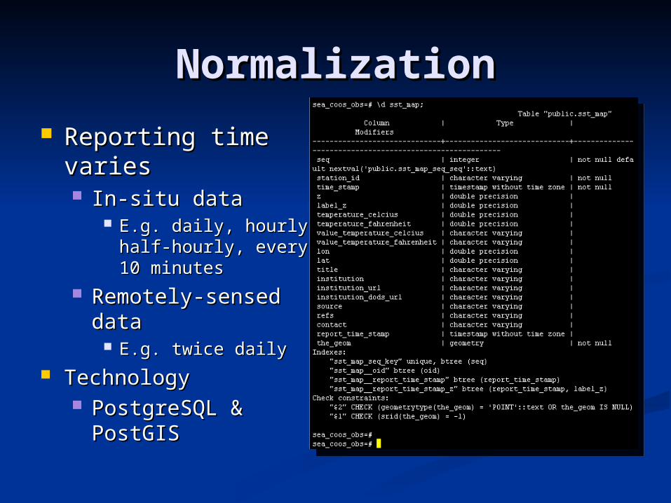
NormalizationNormalization
Reporting time Reporting time variesvaries In-situ dataIn-situ data
E.g. daily, hourly, E.g. daily, hourly, half-hourly, every 10 half-hourly, every 10 minutesminutes
Remotely-sensed Remotely-sensed datadata
E.g. twice dailyE.g. twice daily TechnologyTechnology
PostgreSQL & PostgreSQL & PostGISPostGIS
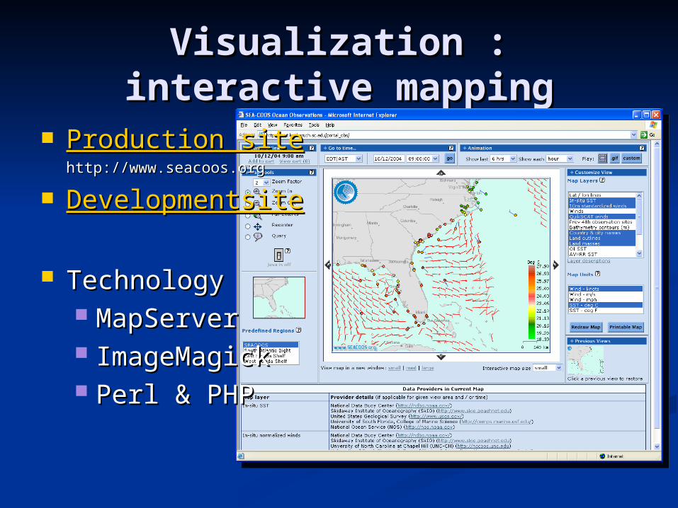
Visualization : interactive Visualization : interactive mappingmapping
Production siteProduction sitehttp://www.seacoos.orghttp://www.seacoos.org
DevelopmentsiteDevelopmentsite
TechnologyTechnology MapServerMapServer ImageMagickImageMagick Perl & PHPPerl & PHP
In-situ sea surface temperature and winds
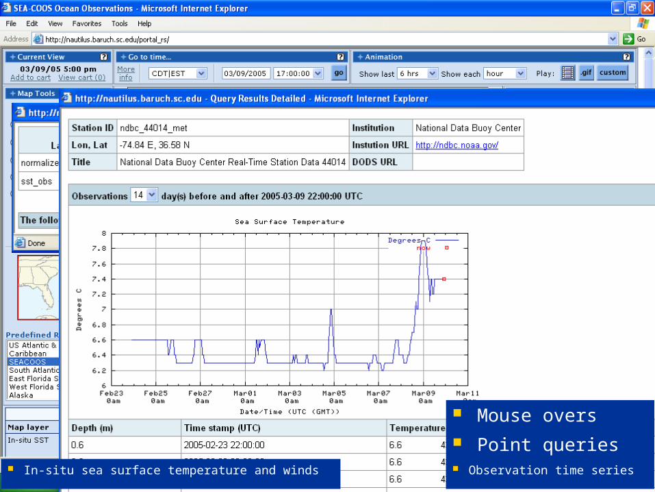
Mouse overs
Observation time series
Point queries
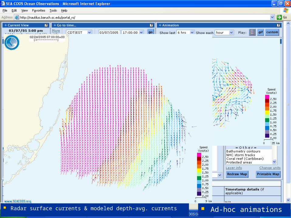
Radar surface currents & modeled depth-avg. currents Ad-hoc animations
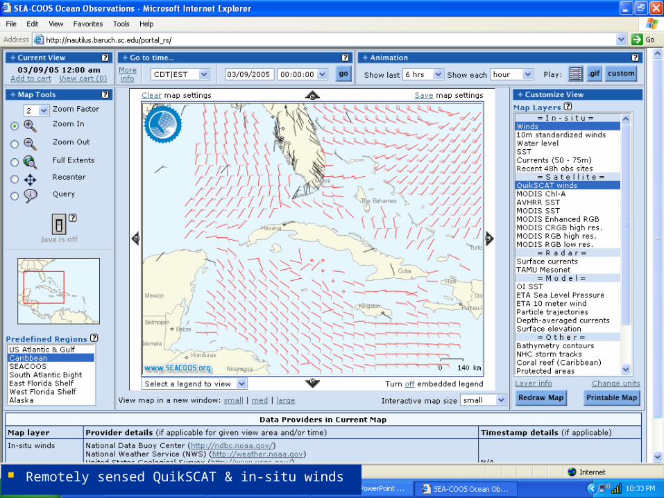
Remotely sensed QuikSCAT & in-situ winds
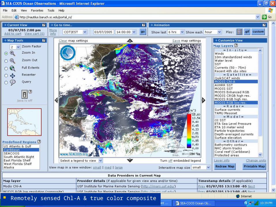
Remotely sensed Chl-A & true color composite
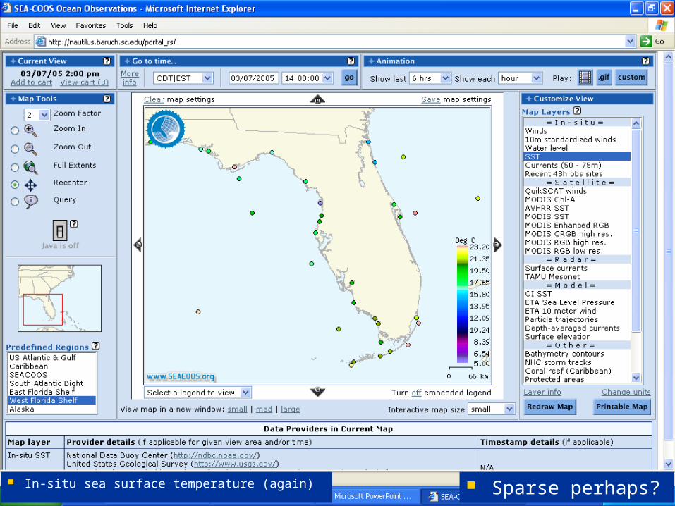
In-situ sea surface temperature (again) Sparse perhaps?
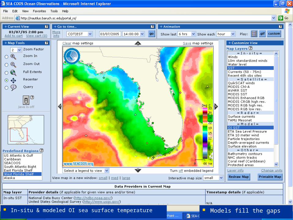
In-situ & modeled OI sea surface temperature Models fill the gaps
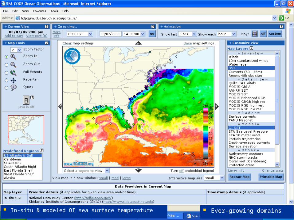
In-situ & modeled OI sea surface temperature Ever-growing domains
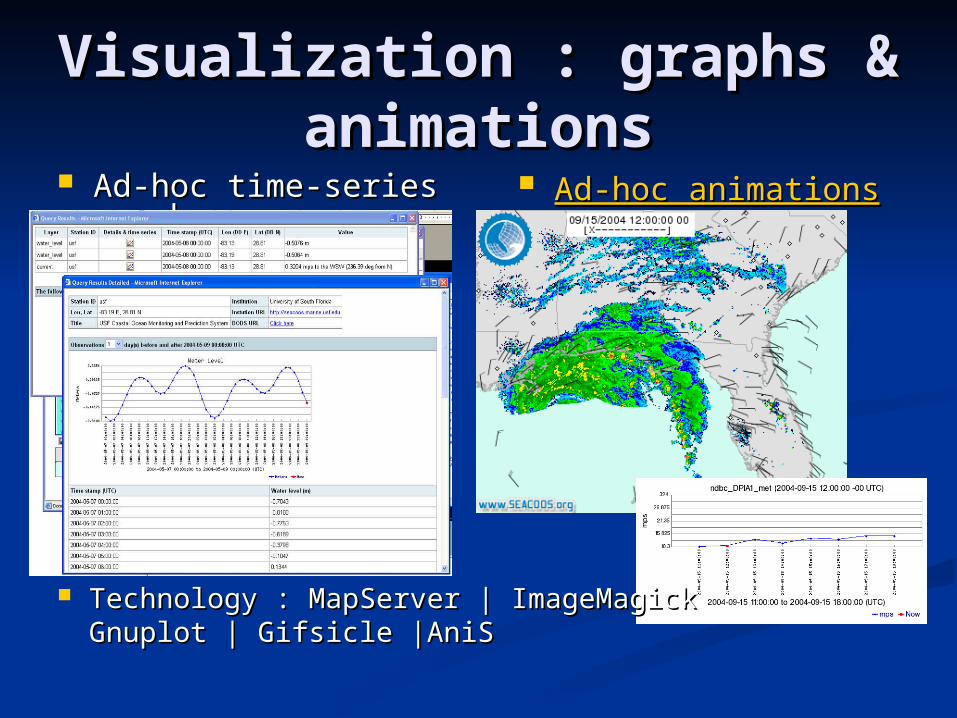
Visualization : graphs & Visualization : graphs & animationsanimations
Ad-hoc time-series Ad-hoc time-series graphsgraphs
Ad-hoc animationsAd-hoc animations
Technology : MapServer | ImageMagickTechnology : MapServer | ImageMagickGnuplot | Gifsicle |AniSGnuplot | Gifsicle |AniS
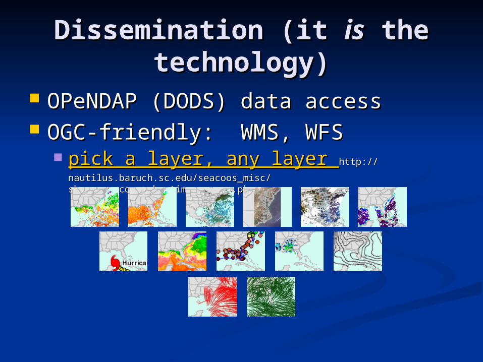
Dissemination (it Dissemination (it isis the the technology)technology)
OPeNDAP (DODS) data accessOPeNDAP (DODS) data access OGC-friendly: WMS, WFSOGC-friendly: WMS, WFS
pick a layer, any layer pick a layer, any layer http://nautilus.baruch.sc.edu/http://nautilus.baruch.sc.edu/seacoos_misc/show_sea_coos_obs_time_ranges.phpseacoos_misc/show_sea_coos_obs_time_ranges.php
Dissemination : example Dissemination : example 11
IntegratedOceanObservingSystemhuIntegratedOceanObservingSystemhurricanedemo rricanedemo
http://www.openioos.orghttp://www.openioos.org
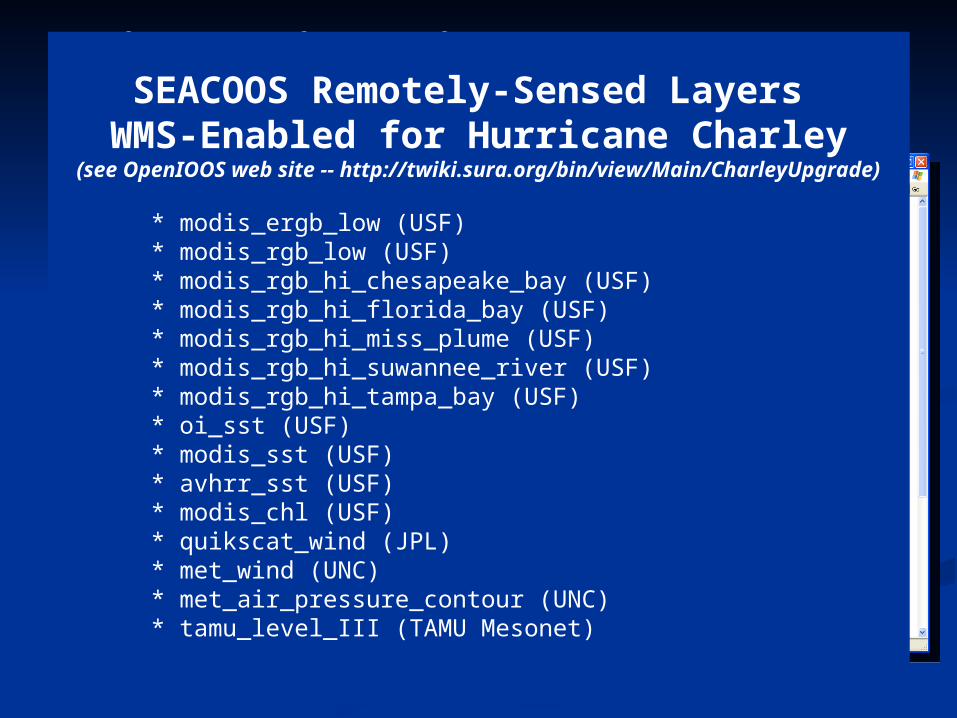
SEACOOS Remotely-Sensed Layers WMS-Enabled for Hurricane Charley
(see OpenIOOS web site -- http://twiki.sura.org/bin/view/Main/CharleyUpgrade)
* modis_ergb_low (USF) * modis_rgb_low (USF) * modis_rgb_hi_chesapeake_bay (USF) * modis_rgb_hi_florida_bay (USF) * modis_rgb_hi_miss_plume (USF) * modis_rgb_hi_suwannee_river (USF) * modis_rgb_hi_tampa_bay (USF) * oi_sst (USF) * modis_sst (USF) * avhrr_sst (USF) * modis_chl (USF) * quikscat_wind (JPL) * met_wind (UNC) * met_air_pressure_contour (UNC) * tamu_level_III (TAMU Mesonet)
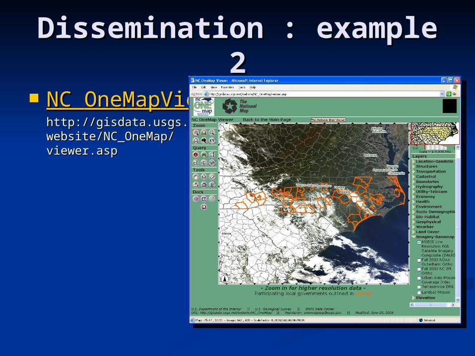
Dissemination : example Dissemination : example 22
NC NC OneMapOneMapViewer Viewer http://gisdata.usgs.net/http://gisdata.usgs.net/website/NC_OneMap/website/NC_OneMap/viewer.aspviewer.asp
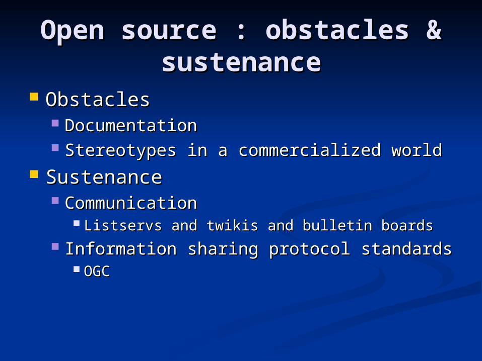
Open source : obstacles & Open source : obstacles & sustenancesustenance
ObstaclesObstacles DocumentationDocumentation Stereotypes in a commercialized worldStereotypes in a commercialized world
SustenanceSustenance CommunicationCommunication
Listservs and twikis and bulletin boardsListservs and twikis and bulletin boards Information sharing protocol standardsInformation sharing protocol standards
OGCOGC
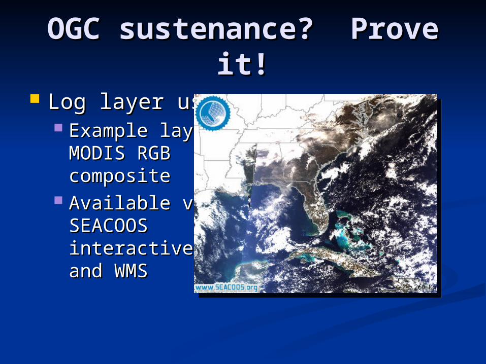
OGC sustenance? Prove OGC sustenance? Prove it!it!
Log layer usageLog layer usage Example layer : Example layer :
MODIS RGB MODIS RGB compositecomposite
Available viaAvailable viaSEACOOSSEACOOSinteractive mapsinteractive mapsand WMSand WMS
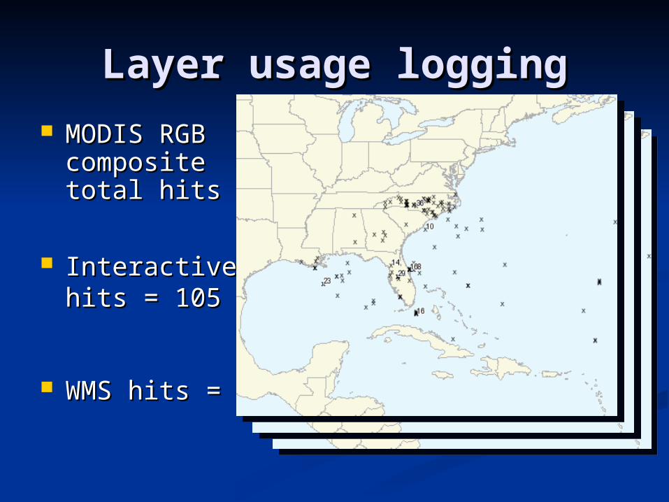
Layer usage loggingLayer usage logging MODIS RGB MODIS RGB
compositecompositetotal hits = 652total hits = 652
Interactive mapInteractive maphits = 105hits = 105
WMS hits = 547WMS hits = 547
An open source attitudeAn open source attitude
SEACOOS data managementSEACOOS data management Direct result of combined effort from academia, Direct result of combined effort from academia,
government, and the private sectorgovernment, and the private sector Providing a foundation for other ocean observing Providing a foundation for other ocean observing
systems to possibly adapt and build uponsystems to possibly adapt and build upon Plenty of miles to go with more room to grow!Plenty of miles to go with more room to grow!
Who am I?Who am I? Charlton Purvis, University of South Carolina, Charlton Purvis, University of South Carolina,
SEACOOSSEACOOS [email protected]@sc.edu Happy to help and share.Happy to help and share.