Embed Size (px)
Citation preview
1
New York State
Winter Weather Awareness Week
November 2nd to 8th, 2014
David J. Nicosia
Warning Coordination Meteorologist
NOAA’s National Weather Service
Binghamton, NY
2
Why do we need to be prepared
for the upcoming winter?
New York State is known for its cold, snowy and icy winters. Winter weather can be dangerous if you are not prepared.
Fatalities
Over the past 30 years, 42 people are directly killed nationwide from winter storms and cold.
Last winter, New York State had the most direct fatalities from winter storms in the nation with 7 people perishing.
Nationwide, thousands more are killed in winter-related motor vehicle accidents. Many more are injured.
Motor vehicle accidents continue to be the number one way people die during wintry weather.
3
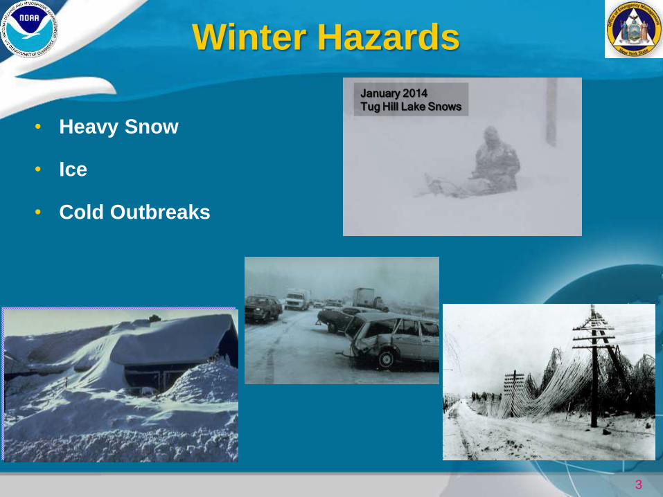
Winter Hazards
• Heavy Snow
• Ice
• Cold Outbreaks
January 2014
Tug Hill Lake Snows
4
Snowstorm Definitions
• Heavy Snow: 7 inches of snow or more in 12 hours or less; or 9 inches of snow or more in 24 hours or less.
• Blizzard: the most severe winter storm. Wind or wind gusts exceeding 35 mph for 3 hours or more combined with blowing and/or falling snow. Visibilities near zero. Widespread whiteout conditions.
Blizzards are a serious life-threatening weather hazard!!!!!
• Snow Squall: intense periods of snow with near blizzard or blizzard conditions lasting less than 3 hours, usually 20 to 30 minutes in duration.
• Snow Shower: intermittent accumulating snow.
• Snow Flurries: very light snow with little or no accumulation.
5
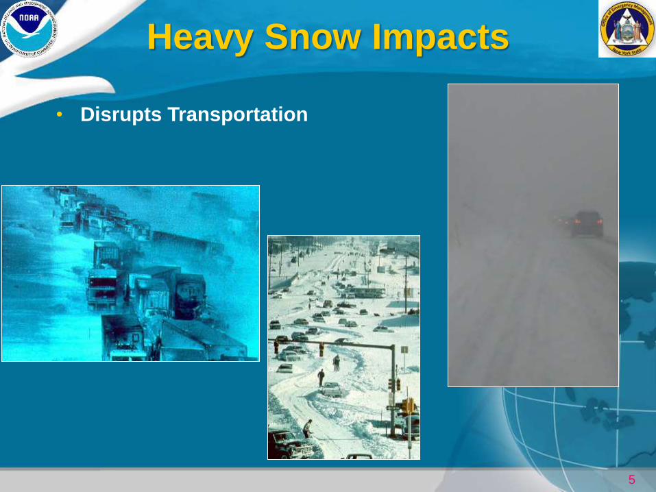
Heavy Snow Impacts
• Disrupts Transportation
6
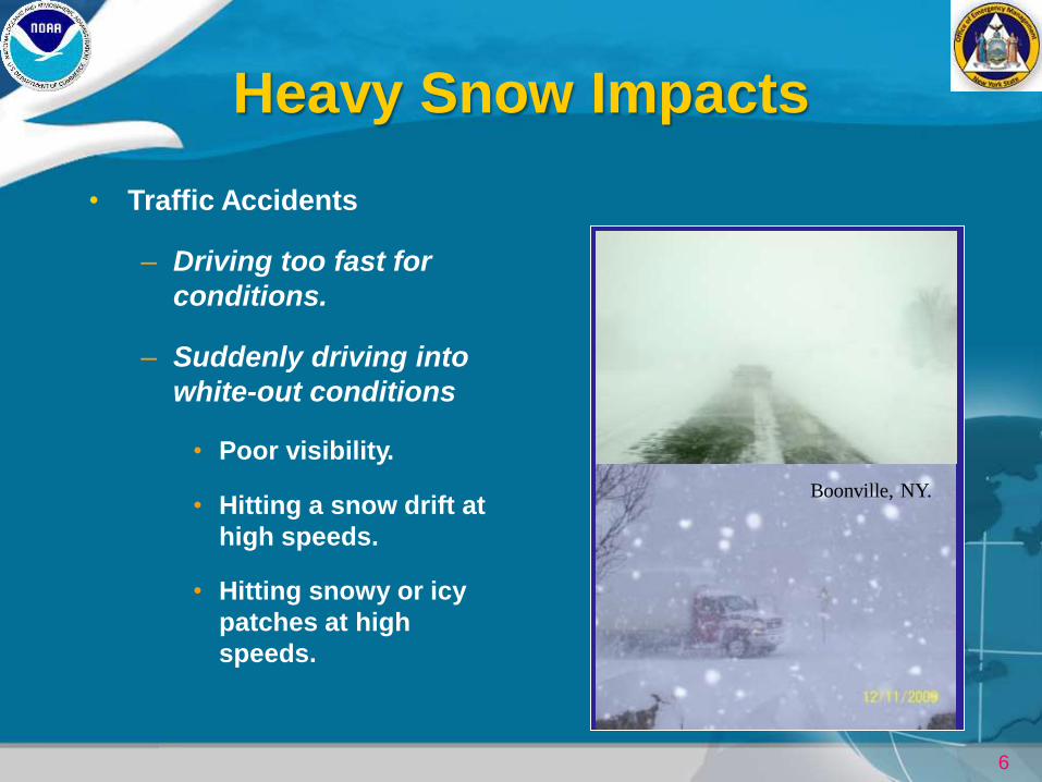
Heavy Snow Impacts
• Traffic Accidents
– Driving too fast for
conditions.
– Suddenly driving into
white-out conditions
• Poor visibility.
• Hitting a snow drift at
high speeds.
• Hitting snowy or icy
patches at high
speeds.
Beltway - 1996
Boonville, NY.
7
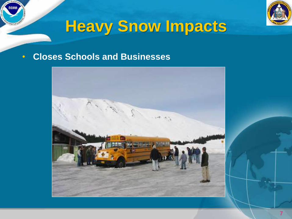
Heavy Snow Impacts
• Closes Schools and Businesses
8
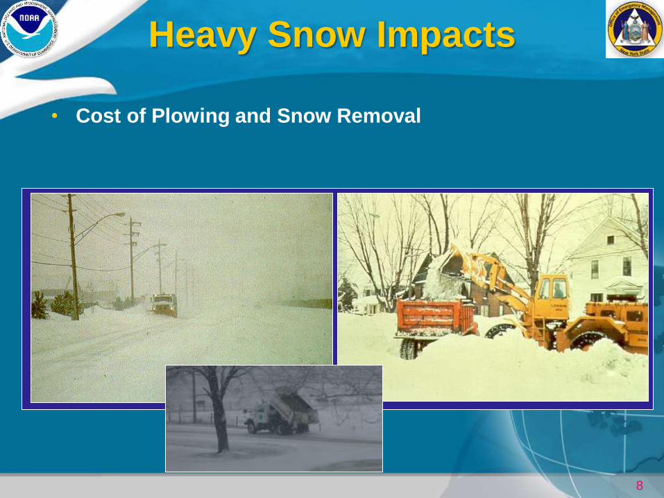
Heavy Snow Impacts
• Cost of Plowing and Snow Removal
9
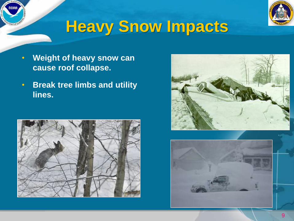
Heavy Snow Impacts
• Weight of heavy snow can
cause roof collapse.
• Break tree limbs and utility
lines.
10
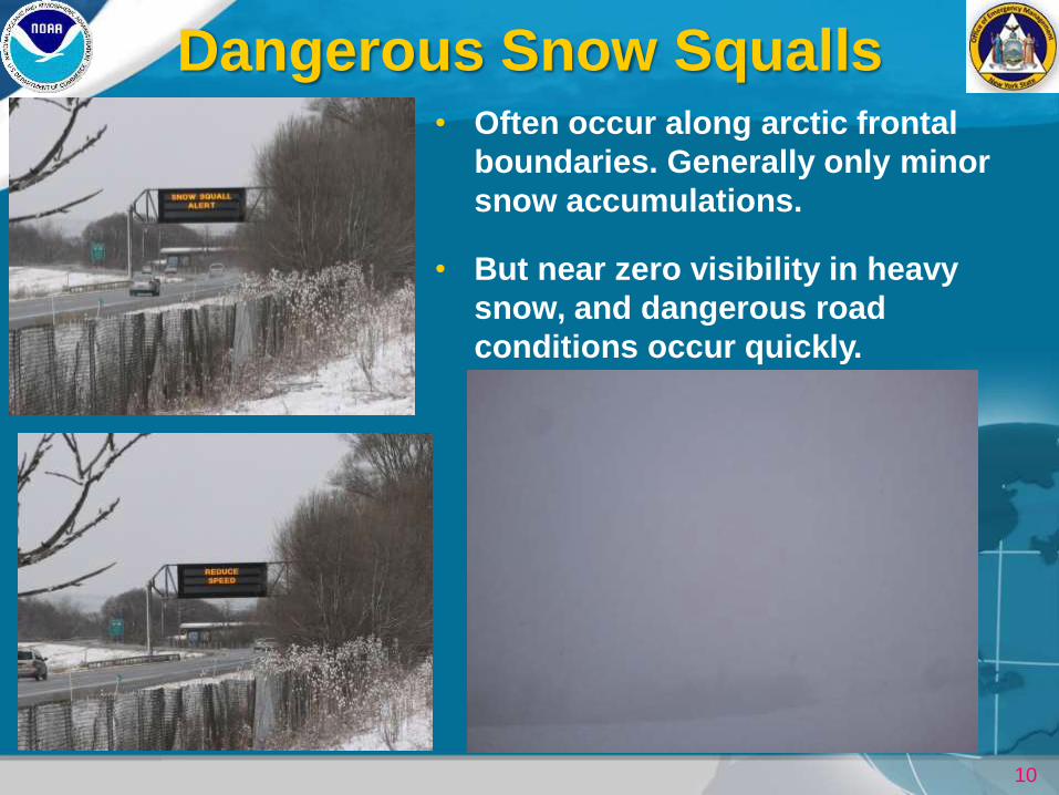
Dangerous Snow Squalls • Often occur along arctic frontal
boundaries. Generally only minor
snow accumulations.
• But near zero visibility in heavy
snow, and dangerous road
conditions occur quickly.
11
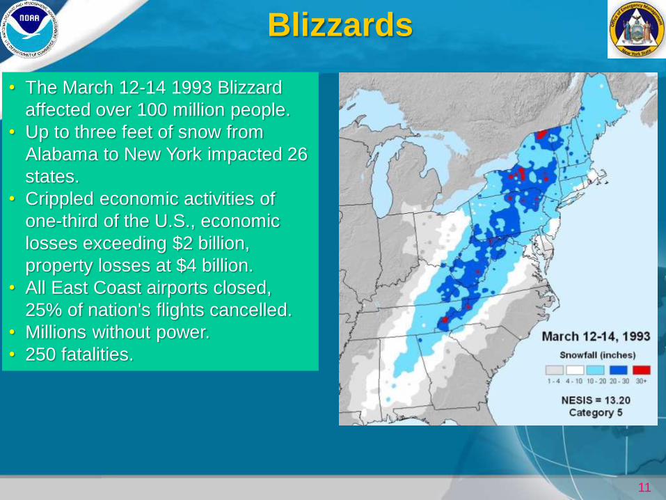
Blizzards
• The March 12-14 1993 Blizzard
affected over 100 million people.
• Up to three feet of snow from
Alabama to New York impacted 26
states.
• Crippled economic activities of
one-third of the U.S., economic
losses exceeding $2 billion,
property losses at $4 billion.
• All East Coast airports closed,
25% of nation's flights cancelled.
• Millions without power.
• 250 fatalities.
12
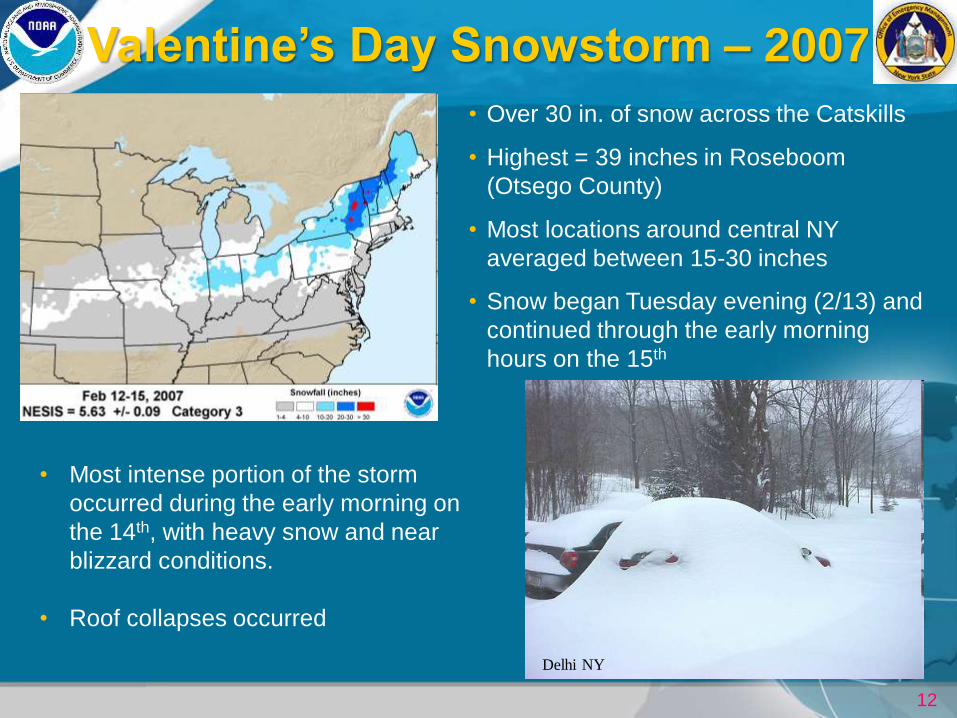
Valentine’s Day Snowstorm – 2007
Delhi NY
• Over 30 in. of snow across the Catskills
• Highest = 39 inches in Roseboom
(Otsego County)
• Most locations around central NY
averaged between 15-30 inches
• Snow began Tuesday evening (2/13) and
continued through the early morning
hours on the 15th
• Most intense portion of the storm
occurred during the early morning on
the 14th, with heavy snow and near
blizzard conditions.
• Roof collapses occurred
13
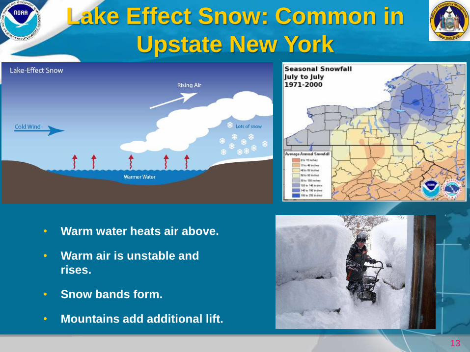
Lake Effect Snow: Common in
Upstate New York
• Warm water heats air above.
• Warm air is unstable and
rises.
• Snow bands form.
• Mountains add additional lift.
14
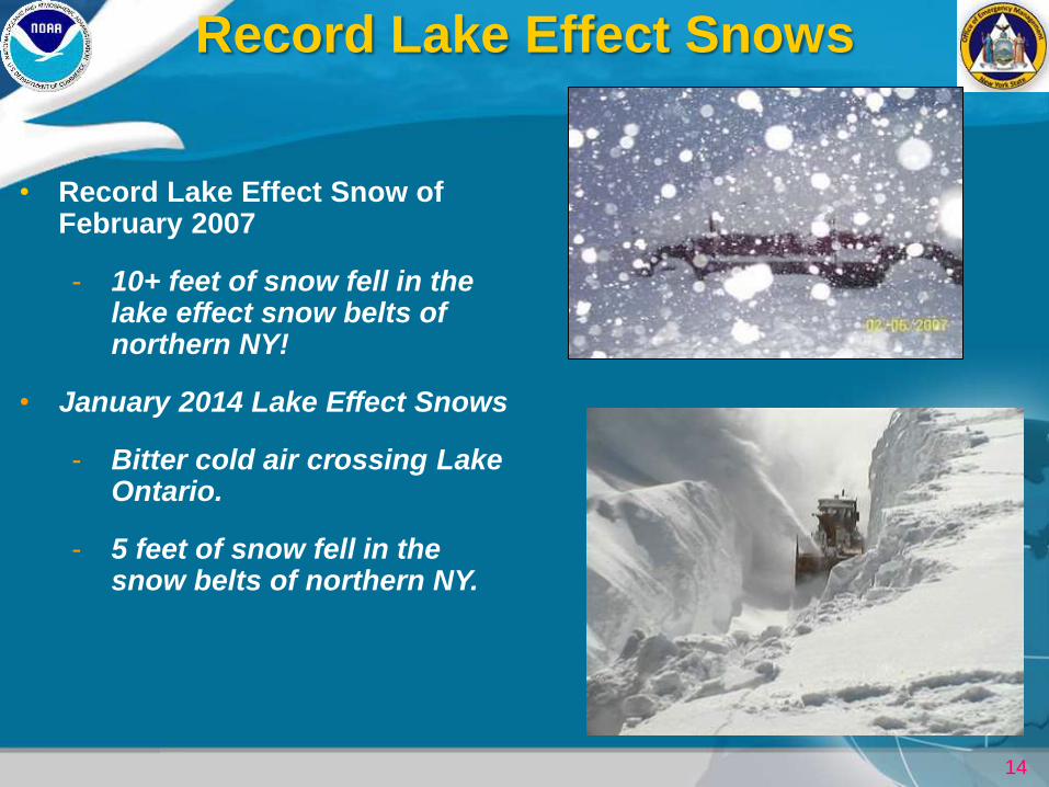
Record Lake Effect Snows
• Record Lake Effect Snow of February 2007
- 10+ feet of snow fell in the lake effect snow belts of northern NY!
• January 2014 Lake Effect Snows
- Bitter cold air crossing Lake Ontario.
- 5 feet of snow fell in the snow belts of northern NY.
15
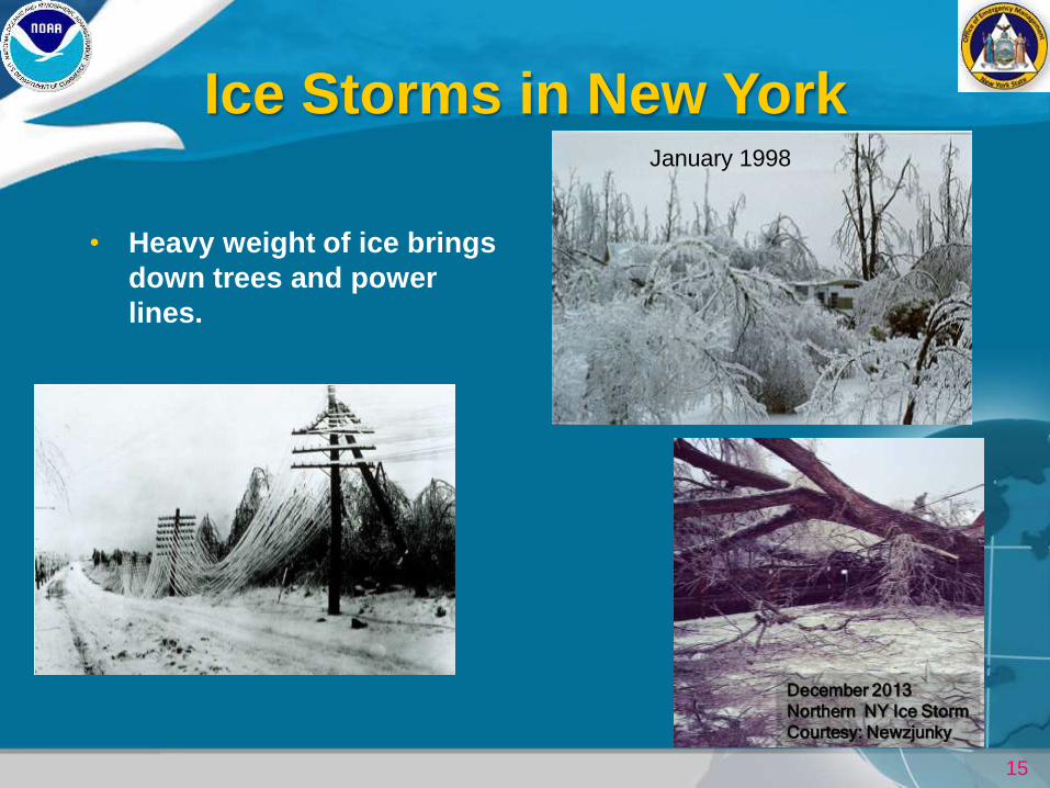
Ice Storms in New York
• Heavy weight of ice brings
down trees and power
lines.
January 1998
December 2013
Northern NY Ice Storm
Courtesy: Newzjunky
16
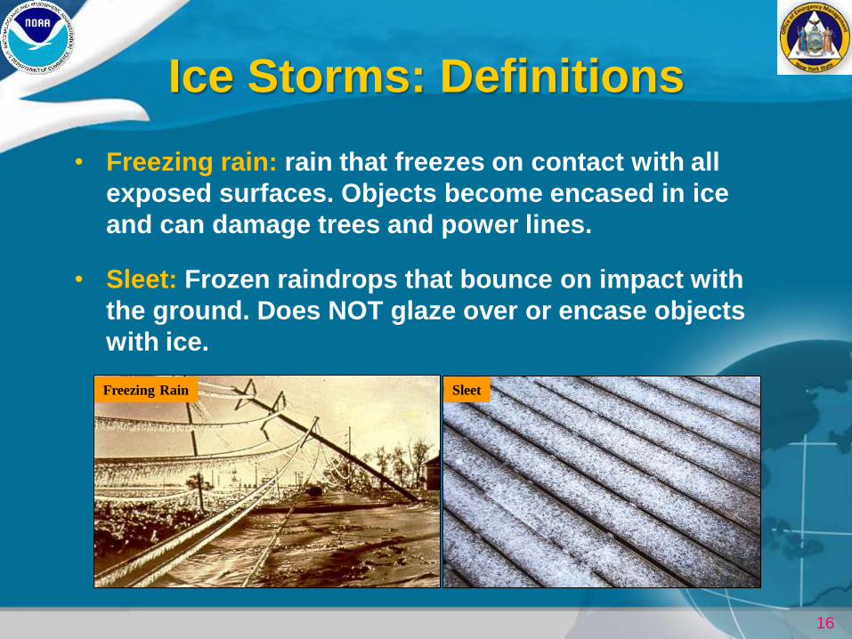
Ice Storms: Definitions
• Freezing rain: rain that freezes on contact with all
exposed surfaces. Objects become encased in ice
and can damage trees and power lines.
• Sleet: Frozen raindrops that bounce on impact with
the ground. Does NOT glaze over or encase objects
with ice.
Freezing Rain Sleet
17
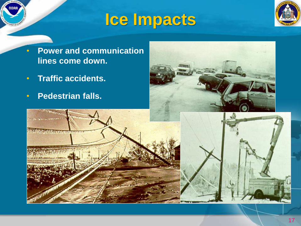
Ice Impacts
• Power and communication
lines come down.
• Traffic accidents.
• Pedestrian falls.
18
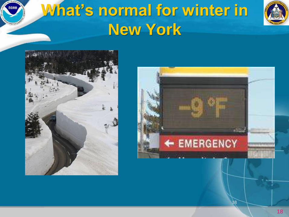
What’s normal for winter in
New York
18
19
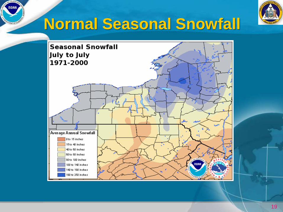
Normal Seasonal Snowfall
20
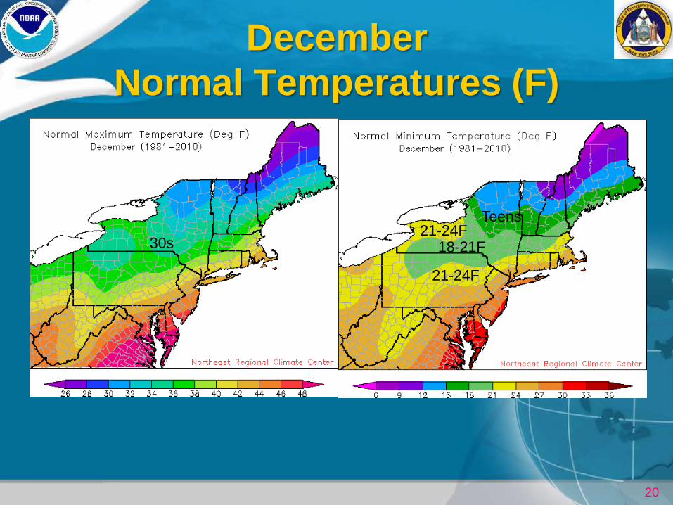
December
Normal Temperatures (F)
30s 18-21F
21-24F
21-24F Teens
21
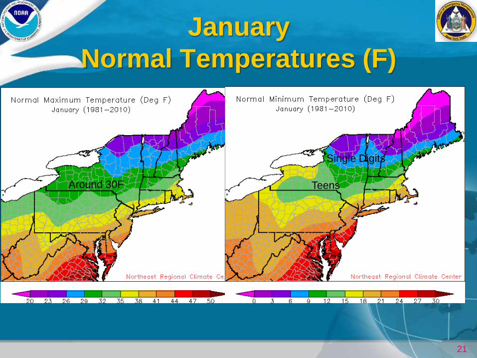
January
Normal Temperatures (F)
Around 30F
Single Digits
Teens
22
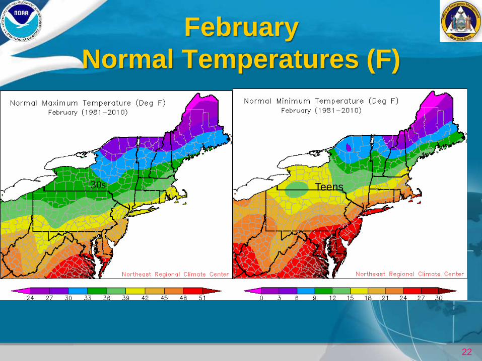
February
Normal Temperatures (F)
30s Teens
23
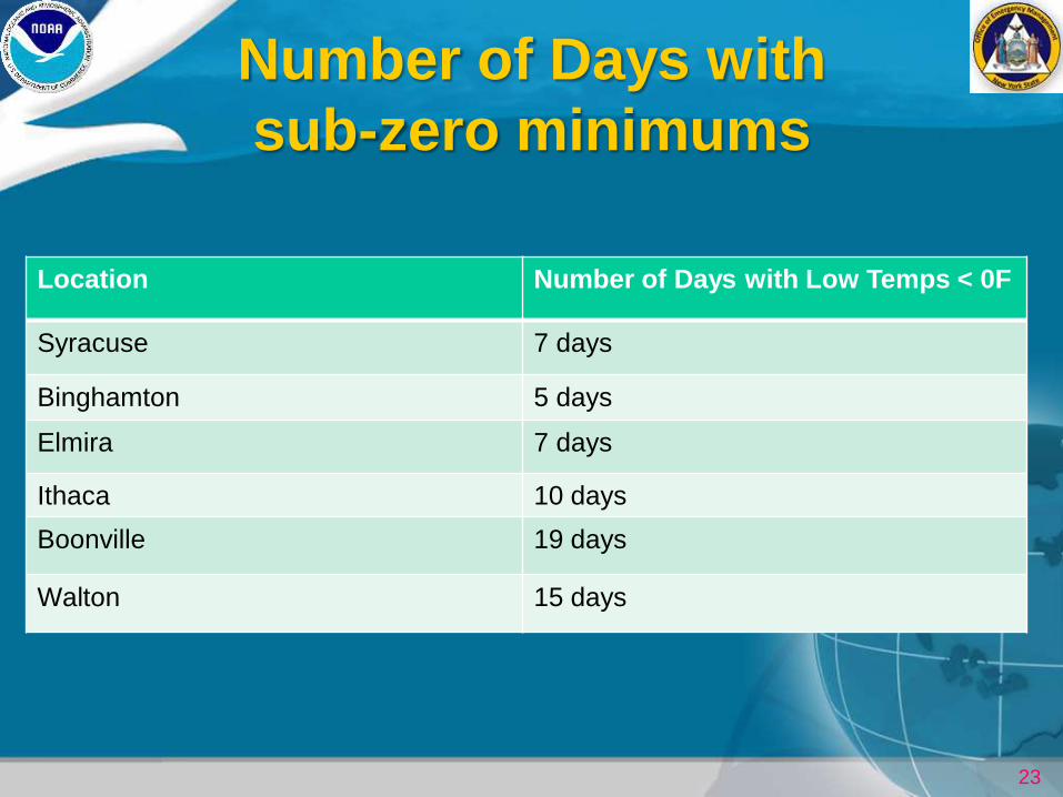
Number of Days with
sub-zero minimums
Location Number of Days with Low Temps < 0F
Syracuse 7 days
Binghamton 5 days
Elmira 7 days
Ithaca 10 days
Boonville 19 days
Walton 15 days
24
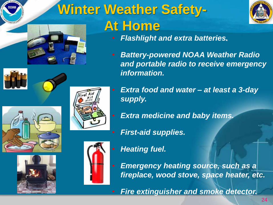
Winter Weather Safety-
At Home • Flashlight and extra batteries.
• Battery-powered NOAA Weather Radio
and portable radio to receive emergency
information.
• Extra food and water – at least a 3-day
supply.
• Extra medicine and baby items.
• First-aid supplies.
• Heating fuel.
• Emergency heating source, such as a
fireplace, wood stove, space heater, etc.
• Fire extinguisher and smoke detector.
25
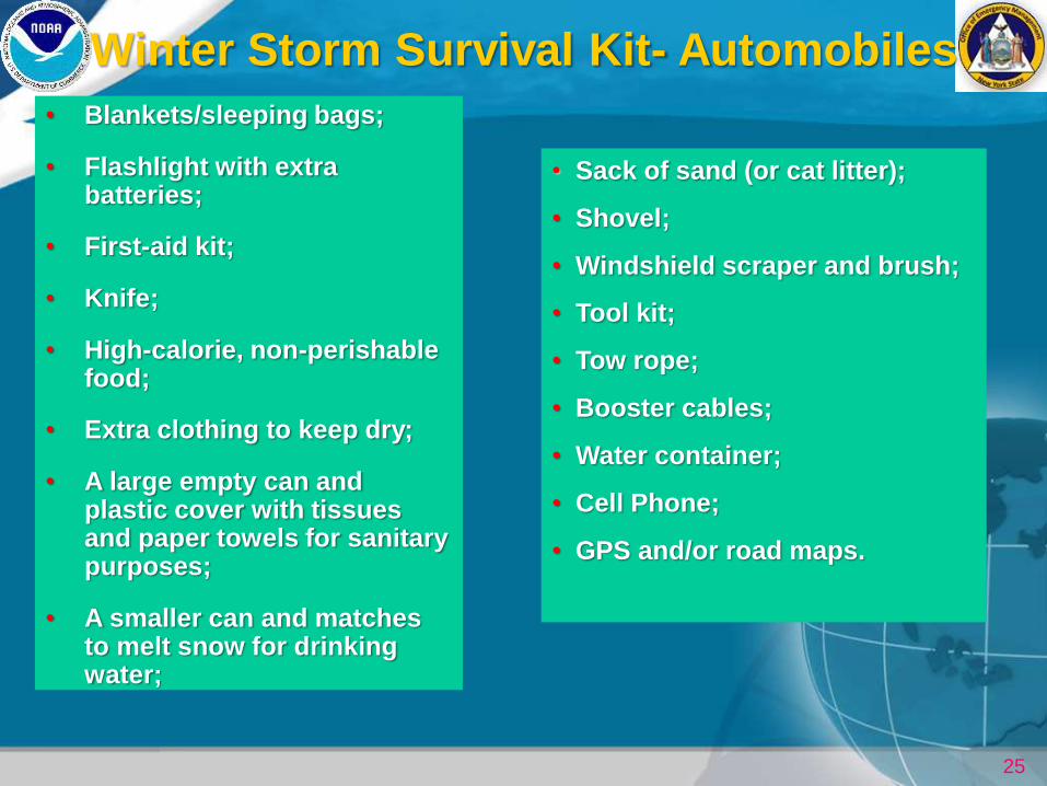
Winter Storm Survival Kit- Automobiles
• Sack of sand (or cat litter);
• Shovel;
• Windshield scraper and brush;
• Tool kit;
• Tow rope;
• Booster cables;
• Water container;
• Cell Phone;
• GPS and/or road maps.
• Blankets/sleeping bags;
• Flashlight with extra batteries;
• First-aid kit;
• Knife;
• High-calorie, non-perishable food;
• Extra clothing to keep dry;
• A large empty can and plastic cover with tissues and paper towels for sanitary purposes;
• A smaller can and matches to melt snow for drinking water;
26
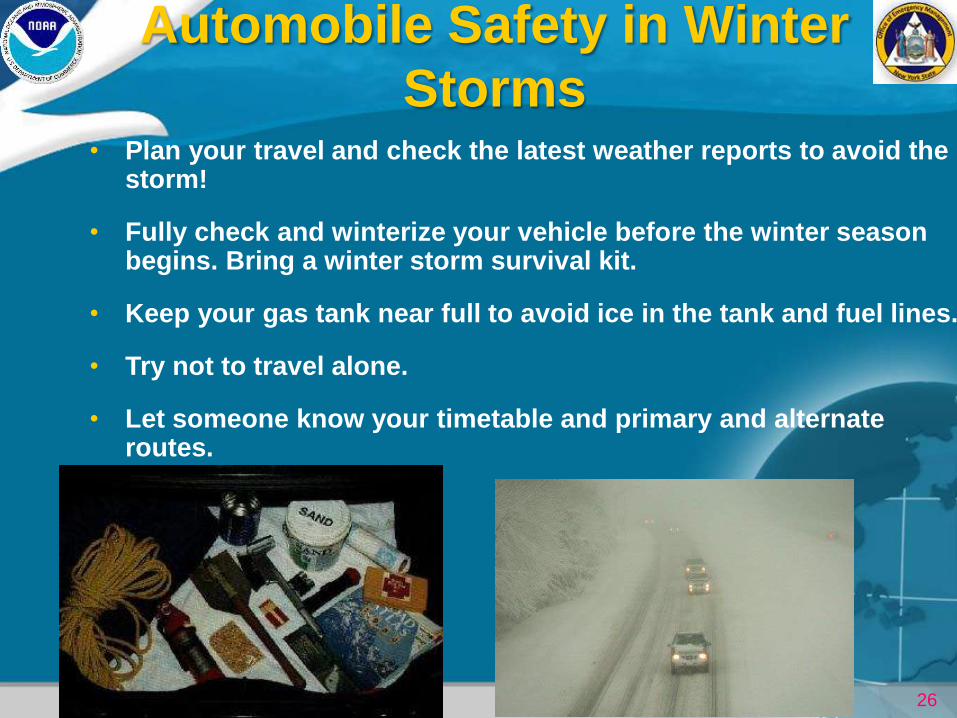
Automobile Safety in Winter
Storms • Plan your travel and check the latest weather reports to avoid the
storm!
• Fully check and winterize your vehicle before the winter season begins. Bring a winter storm survival kit.
• Keep your gas tank near full to avoid ice in the tank and fuel lines.
• Try not to travel alone.
• Let someone know your timetable and primary and alternate routes.

27
What is the difference between
Winter Watches and Warnings?
Winter Warnings are issued when there is an
80% chance or greater that a dangerous winter
storm will impact our region. Winter Warnings
are usually issued 1 to 2 days in advance. The
likelihood that our area will get hit by the winter
storm is much more certain when a warning is
issued.
Winter Watches are issued when there is
at least a 50% chance that a dangerous
winter storm will occur. The winter storm
is a possibility, not a certainty. The winter
storm could still miss or just graze our area.
Winter Watches are usually issued
2 to 3 days in advance.
28
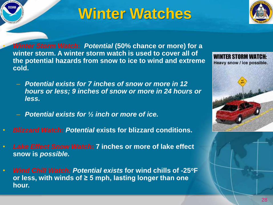
Winter Watches
• Winter Storm Watch: Potential (50% chance or more) for a winter storm. A winter storm watch is used to cover all of the potential hazards from snow to ice to wind and extreme cold.
– Potential exists for 7 inches of snow or more in 12 hours or less; 9 inches of snow or more in 24 hours or less.
– Potential exists for ½ inch or more of ice.
• Blizzard Watch: Potential exists for blizzard conditions.
• Lake Effect Snow Watch: 7 inches or more of lake effect snow is possible.
• Wind Chill Watch: Potential exists for wind chills of -25oF or less, with winds of ≥ 5 mph, lasting longer than one hour.
29
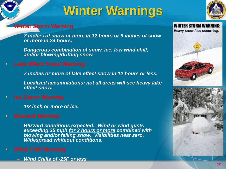
Winter Warnings • Winter Storm Warning
– 7 inches of snow or more in 12 hours or 9 inches of snow or more in 24 hours.
– Dangerous combination of snow, ice, low wind chill, and/or blowing/drifting snow.
• Lake Effect Snow Warning
– 7 inches or more of lake effect snow in 12 hours or less.
– Localized accumulations; not all areas will see heavy lake effect snow.
• Ice Storm Warning
– 1/2 inch or more of ice.
• Blizzard Warning
– Blizzard conditions expected: Wind or wind gusts exceeding 35 mph for 3 hours or more combined with blowing and/or falling snow. Visibilities near zero. Widespread whiteout conditions.
• Wind Chill Warning
– Wind Chills of -25F or less
30
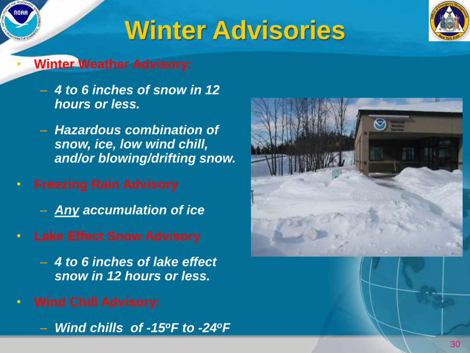
Winter Advisories • Winter Weather Advisory:
– 4 to 6 inches of snow in 12 hours or less.
– Hazardous combination of snow, ice, low wind chill, and/or blowing/drifting snow.
• Freezing Rain Advisory
– Any accumulation of ice
• Lake Effect Snow Advisory
– 4 to 6 inches of lake effect snow in 12 hours or less.
• Wind Chill Advisory:
– Wind chills of -15oF to -24oF
31
Advisories vs. Warnings
• Advisories are issued for significant winter weather
events that could be life-threatening if proper
precautions are not taken.
• Warnings are issued when the event can be life-
threatening even with precautions.
32
33
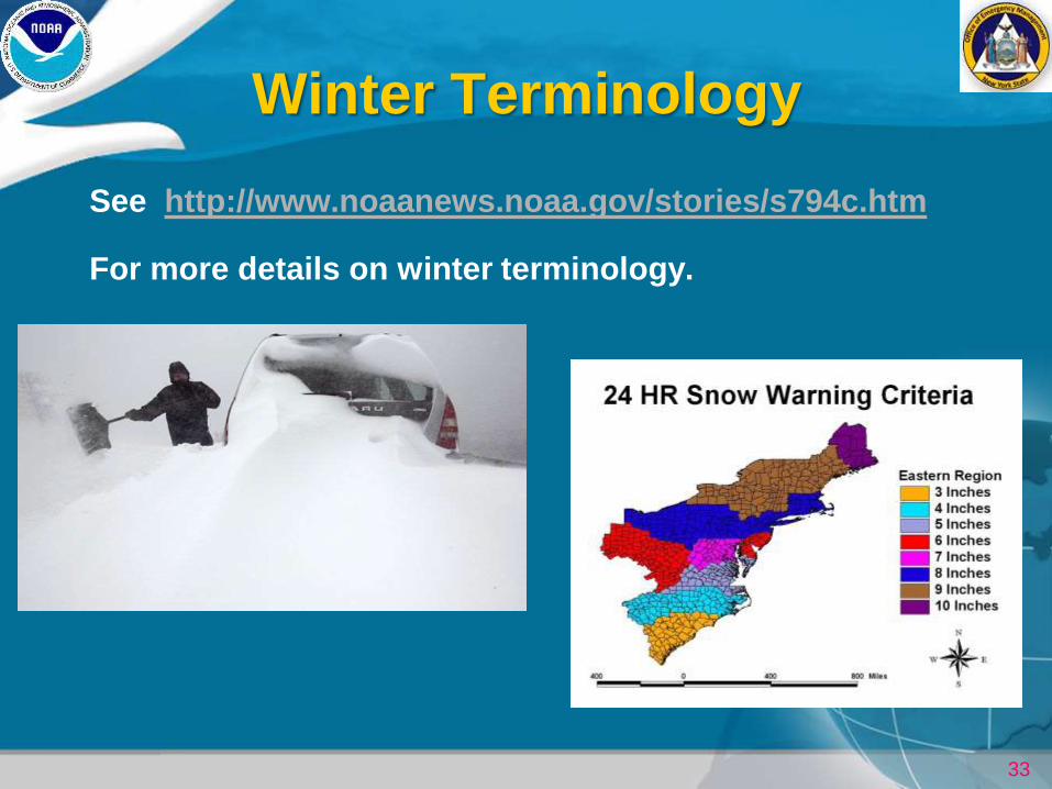
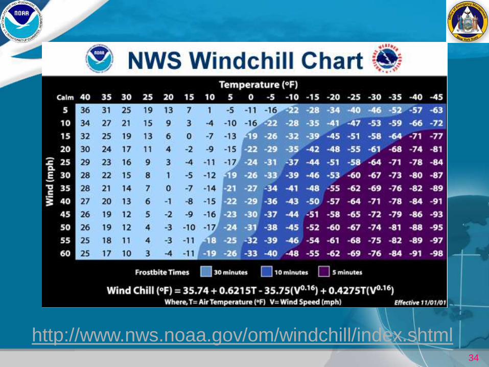
Winter Terminology
See http://www.noaanews.noaa.gov/stories/s794c.htm
For more details on winter terminology.
34
http://www.nws.noaa.gov/om/windchill/index.shtml
35
Keeping Informed This Winter
36
Hazardous Weather Outlook
1 to 7 Day Outlook
Text Product
Issued daily at 5 am, 4 pm and updated as needed
37
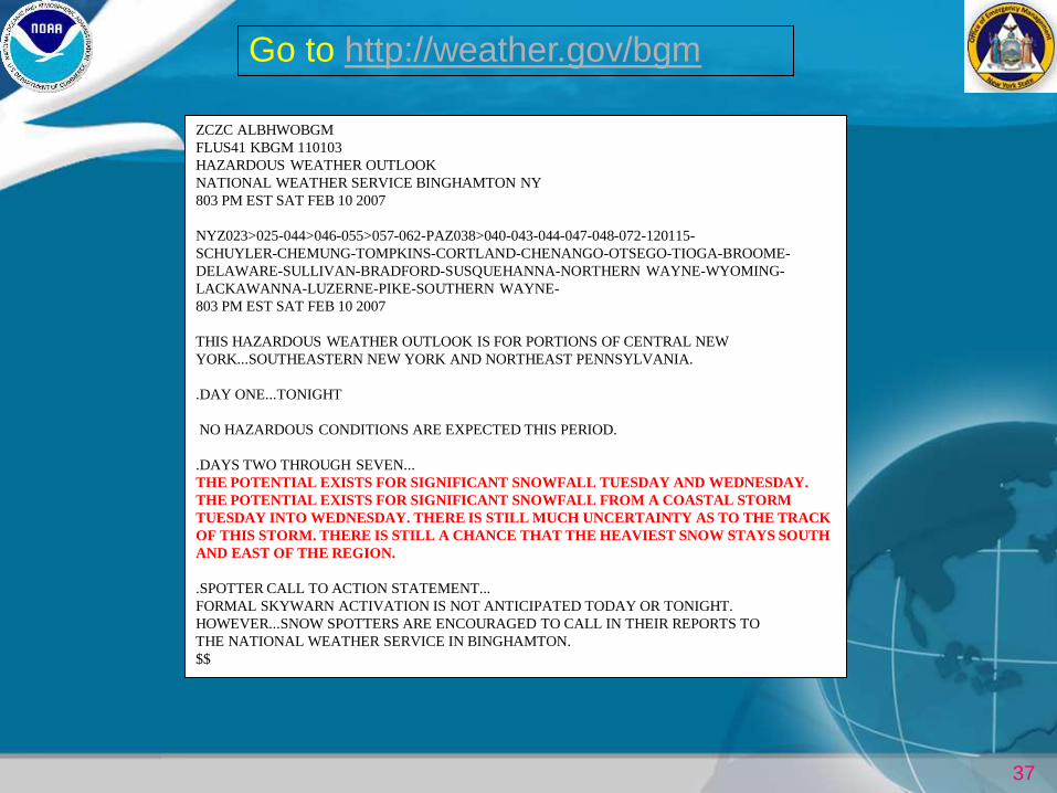
ZCZC ALBHWOBGM
FLUS41 KBGM 110103
HAZARDOUS WEATHER OUTLOOK
NATIONAL WEATHER SERVICE BINGHAMTON NY
803 PM EST SAT FEB 10 2007
NYZ023>025-044>046-055>057-062-PAZ038>040-043-044-047-048-072-120115-
SCHUYLER-CHEMUNG-TOMPKINS-CORTLAND-CHENANGO-OTSEGO-TIOGA-BROOME-
DELAWARE-SULLIVAN-BRADFORD-SUSQUEHANNA-NORTHERN WAYNE-WYOMING-
LACKAWANNA-LUZERNE-PIKE-SOUTHERN WAYNE-
803 PM EST SAT FEB 10 2007
THIS HAZARDOUS WEATHER OUTLOOK IS FOR PORTIONS OF CENTRAL NEW
YORK...SOUTHEASTERN NEW YORK AND NORTHEAST PENNSYLVANIA.
.DAY ONE...TONIGHT
NO HAZARDOUS CONDITIONS ARE EXPECTED THIS PERIOD.
.DAYS TWO THROUGH SEVEN...
THE POTENTIAL EXISTS FOR SIGNIFICANT SNOWFALL TUESDAY AND WEDNESDAY.
THE POTENTIAL EXISTS FOR SIGNIFICANT SNOWFALL FROM A COASTAL STORM
TUESDAY INTO WEDNESDAY. THERE IS STILL MUCH UNCERTAINTY AS TO THE TRACK
OF THIS STORM. THERE IS STILL A CHANCE THAT THE HEAVIEST SNOW STAYS SOUTH
AND EAST OF THE REGION.
.SPOTTER CALL TO ACTION STATEMENT...
FORMAL SKYWARN ACTIVATION IS NOT ANTICIPATED TODAY OR TONIGHT.
HOWEVER...SNOW SPOTTERS ARE ENCOURAGED TO CALL IN THEIR REPORTS TO
THE NATIONAL WEATHER SERVICE IN BINGHAMTON.
$$
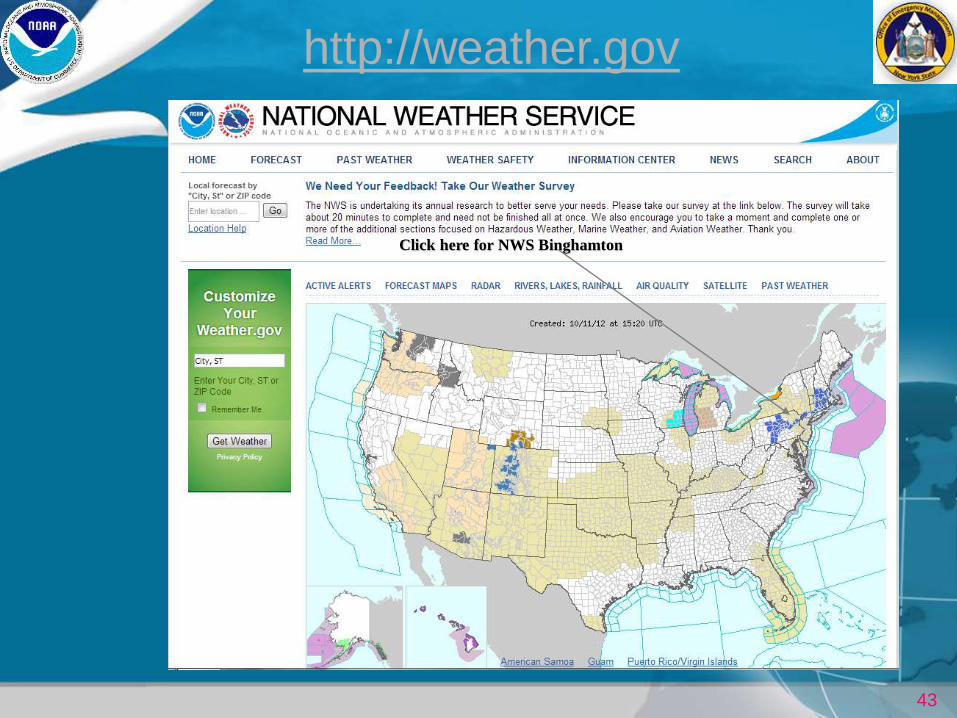
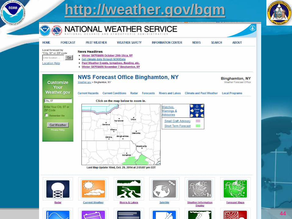
Go to http://weather.gov/bgm
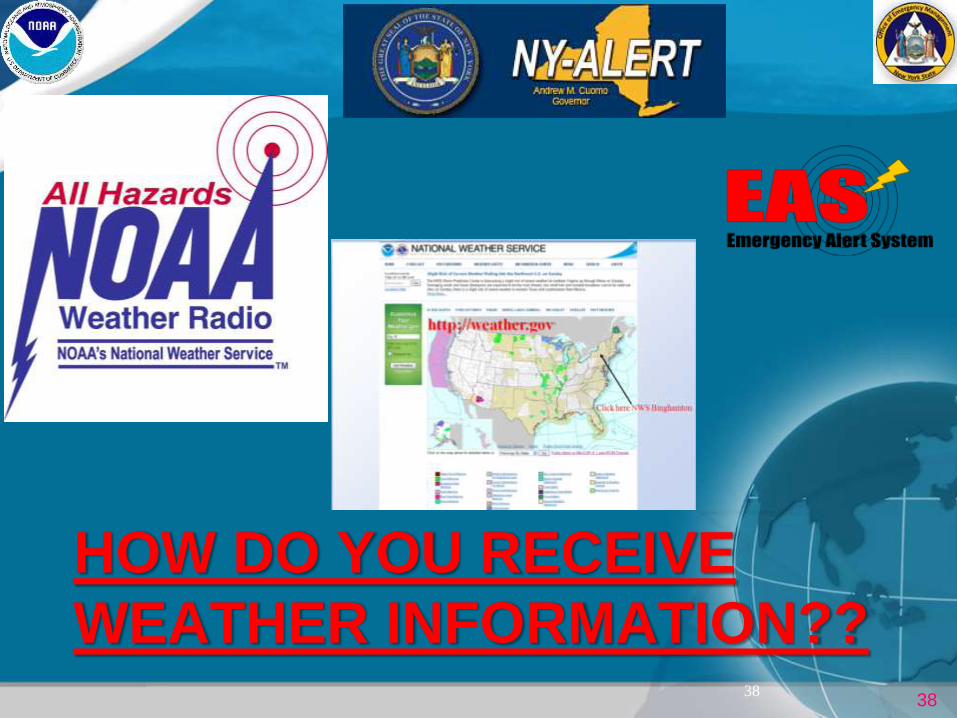
38
HOW DO YOU RECEIVE
WEATHER INFORMATION?? 38
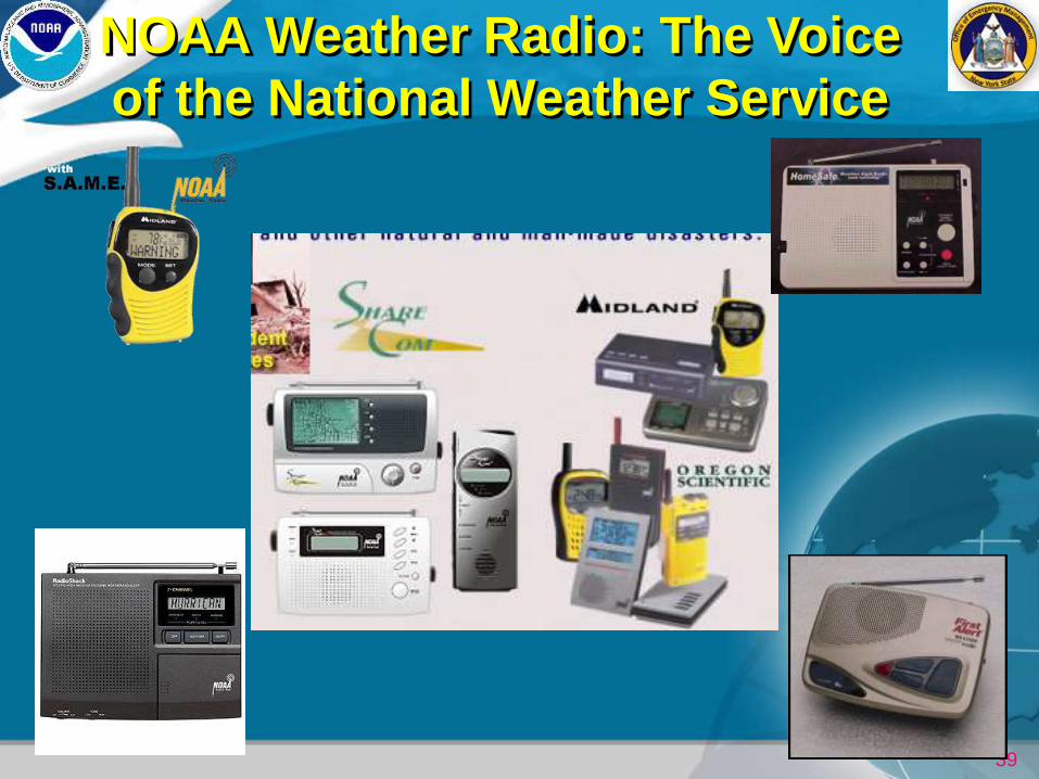
39
NOAA Weather Radio: The Voice
of the National Weather Service
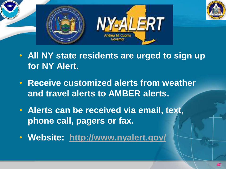
40
• All NY state residents are urged to sign up
for NY Alert.
• Receive customized alerts from weather
and travel alerts to AMBER alerts.
• Alerts can be received via email, text,
phone call, pagers or fax.
• Website: http://www.nyalert.gov/
41
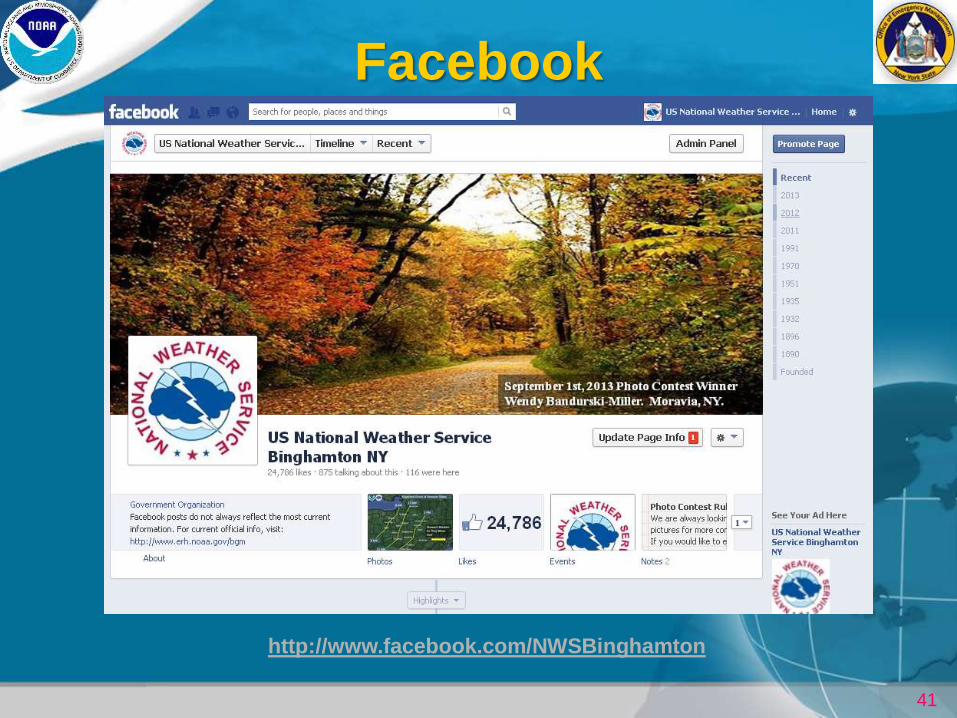
http://www.facebook.com/NWSBinghamton
42
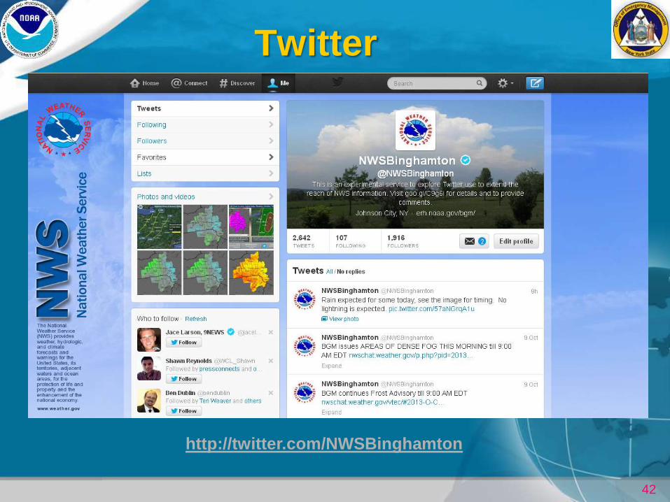
http://twitter.com/NWSBinghamton
45
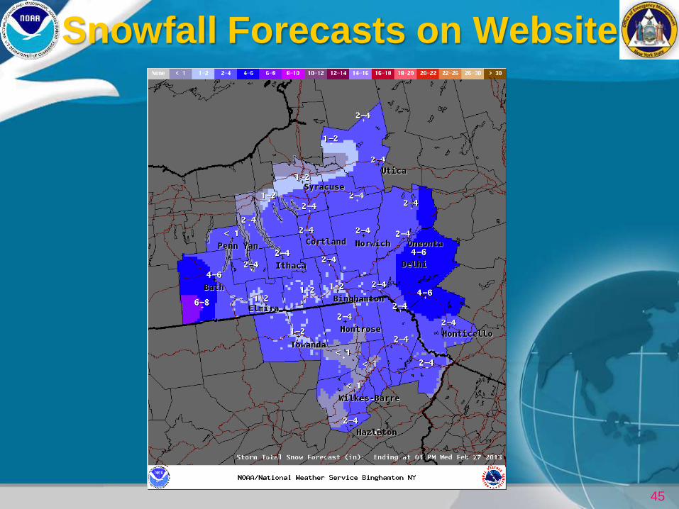
Snowfall Forecasts on Website
46
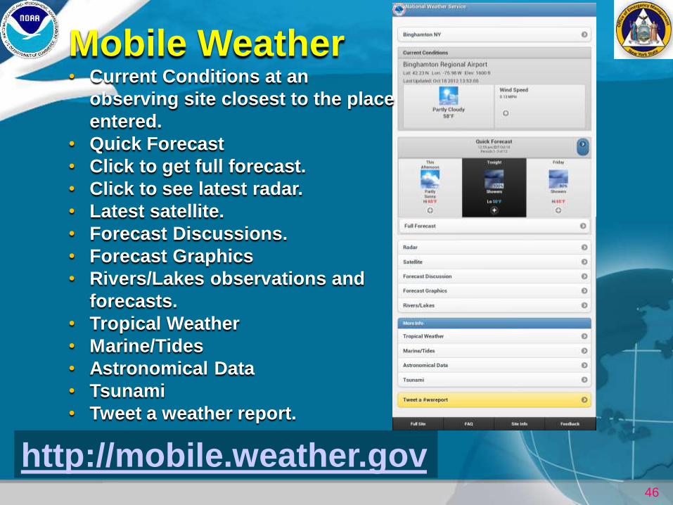
http://mobile.weather.gov
Mobile Weather • Current Conditions at an
observing site closest to the place
entered.
• Quick Forecast
• Click to get full forecast.
• Click to see latest radar.
• Latest satellite.
• Forecast Discussions.
• Forecast Graphics
• Rivers/Lakes observations and
forecasts.
• Tropical Weather
• Marine/Tides
• Astronomical Data
• Tsunami
• Tweet a weather report.
47
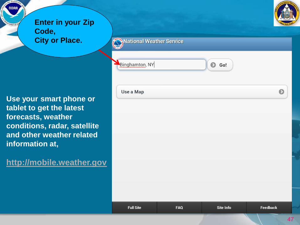
Enter in your Zip
Code,
City or Place.
Use your smart phone or
tablet to get the latest
forecasts, weather
conditions, radar, satellite
and other weather related
information at,
http://mobile.weather.gov
48
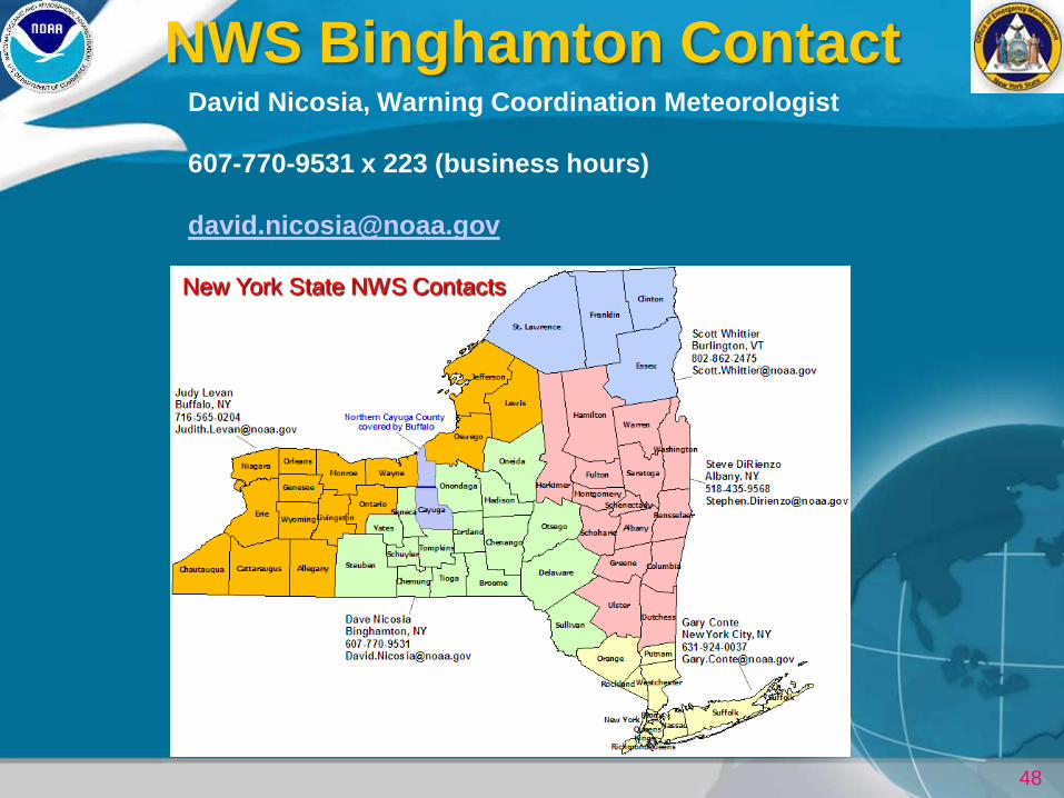
NWS Binghamton Contact David Nicosia, Warning Coordination Meteorologist
607-770-9531 x 223 (business hours)
New York State NWS Contacts
49
More on Winter Weather
Preparedness
http://www.nws.noaa.gov/om/winter/index.shtml