Embed Size (px)
Citation preview
New Zealand Volcanic Ash Advisory System
(NZVAAS) June 2004
Peter LechnerHead of Business Planning and Reporting
Meteorological Authority and Technical Specialist
Civil Aviation Authority of New Zealand
Volcanic Ash & Aviation
The Risk and the RealityBackground and DevelopmentOur VolcanoesSystem ResponsibilitiesAlert levels and Volcanic Hazard AreasExperience
An Increasing Risk
Enhanced jet engine technology Growth of air traffic volumes Increasing risk of volcanic activity
over time
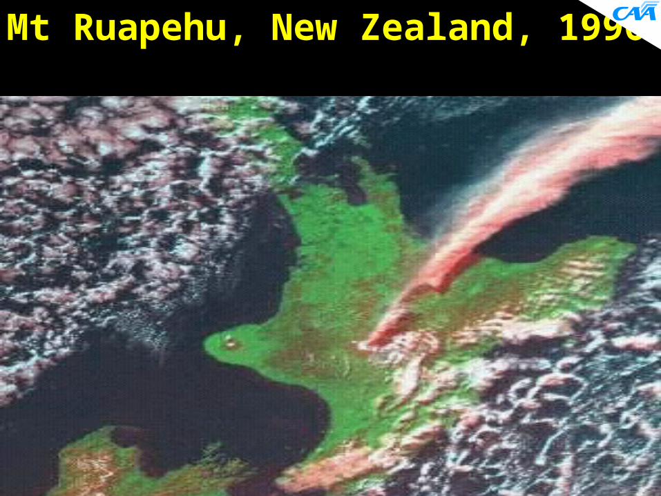
Mt Ruapehu, New Zealand, 1996
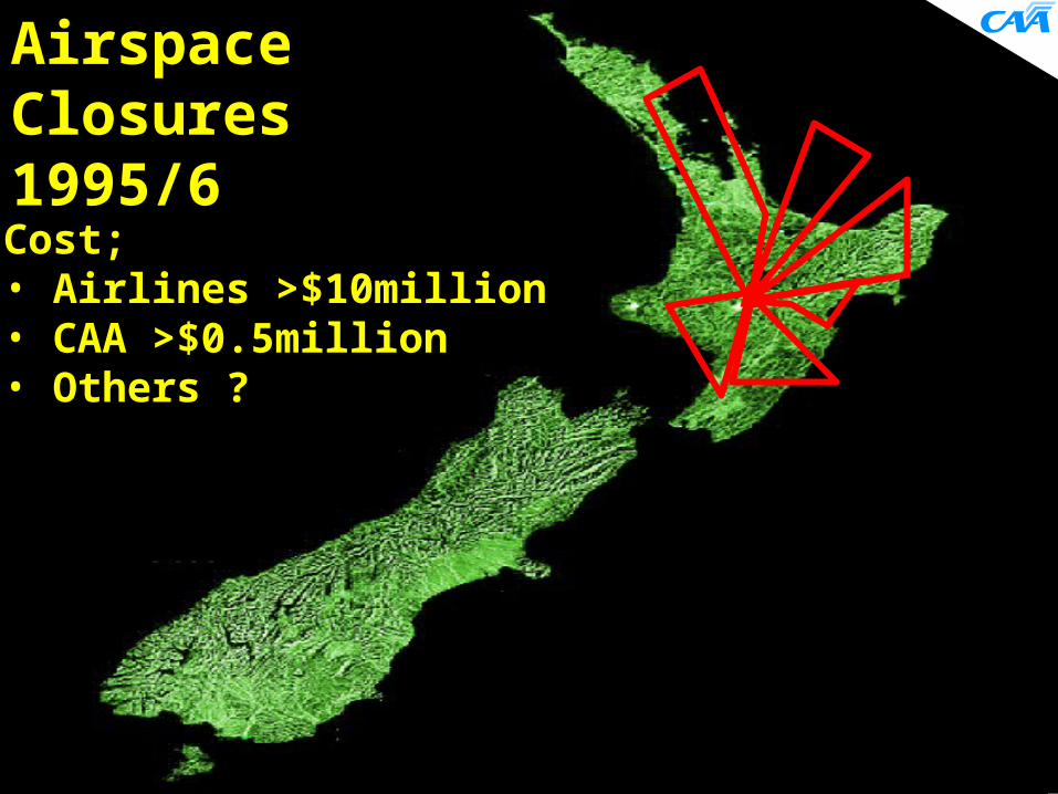
AirspaceClosures 1995/6
Cost;• Airlines >$10million• CAA >$0.5million• Others ?
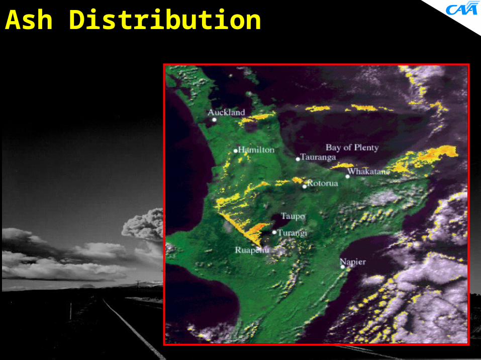
Ash Distribution
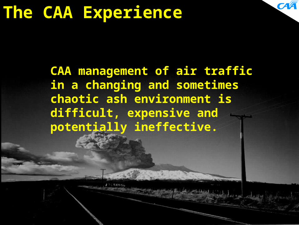
The CAA Experience
CAA management of air traffic in a changing and sometimes chaotic ash environment is difficult, expensive and potentially ineffective.
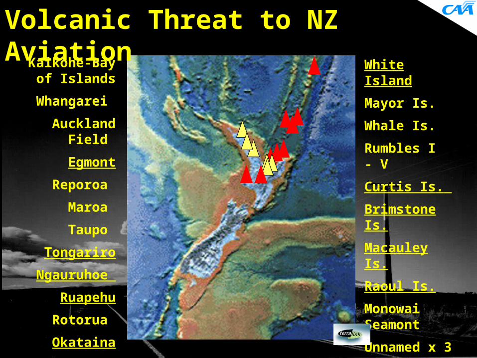
White Island
Mayor Is.
Whale Is.
Rumbles I - V
Curtis Is.
Brimstone Is.
Macauley Is.
Raoul Is.
Monowai Seamont
Unnamed x 3
Kaikohe-Bay of Islands
Whangarei
Auckland Field
Egmont
Reporoa
Maroa
Taupo
Tongariro
Ngauruhoe
Ruapehu
Rotorua
Okataina
Volcanic Threat to NZ Aviation
Alerts and observations of eruptions
Tracking and drift prediction Information flow Air space management Airline discretion Education System ownership and funding
Volcanic Ash Issues
Collaborative Development
Aircraft operators MetService Airways Corporation Civil Aviation Authority Institute Geological & Nuclear Sciences

MetServiceACNZ IGNS
Aircraft Operators
Volcano
VAR feedback
SIGMET (RTF etc)
VAR by
RTF
VAR by fax (post flight)
SIGMET (AFTN)
VARs
Alert level & eruption information
Satellite orother eruption
Information
Electronic &visual eruption & status information
Confirm or denyinformation Independent
observationsor liaison
Other people
NOTAM Request(& confirmation)
NOTAM
Normal pre-flight Met.information
VAR feedback
NZVAAS - 1
NZVAAS - 2
1. To ensure a satisfactory means exists whereby civil aviation aircraft operations can be safely carried out near volcanic ash.
2. The CAA is not responsible for providing any service to airlines to directly assist them with such operations.
CAA Responsibility:
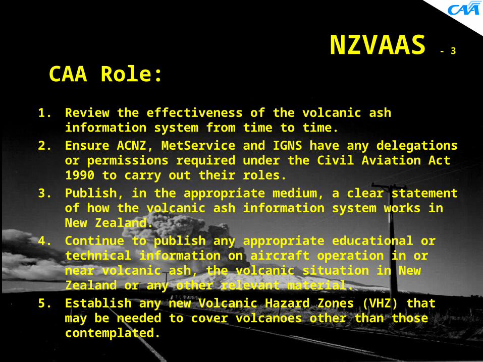
NZVAAS - 3
1. Review the effectiveness of the volcanic ash information system from time to time.
2. Ensure ACNZ, MetService and IGNS have any delegations or permissions required under the Civil Aviation Act 1990 to carry out their roles.
3. Publish, in the appropriate medium, a clear statement of how the volcanic ash information system works in New Zealand.
4. Continue to publish any appropriate educational or technical information on aircraft operation in or near volcanic ash, the volcanic situation in New Zealand or any other relevant material.
5. Establish any new Volcanic Hazard Zones (VHZ) that may be needed to cover volcanoes other than those contemplated.
CAA Role:

MetServiceACNZ IGNS
Aircraft Operators
Volcano
VAR feedback
SIGMET (RTF etc)
VAR by
RTF
VAR by fax (post flight)
SIGMET (AFTN)
VARs
Alert level & eruption information
Satellite orother eruption
Information
Electronic &visual eruption & status information
Confirm or denyinformation Independent
observationsor liaison
Other people
NOTAM Request(& confirmation)
NOTAM
Normal pre-flight Met.information
VAR feedback
NZVAAS - 4

ACNZ IGNS
Aircraft Operators
Volcano
VAR feedback
SIGMET (RTF etc)
VAR by
RTF
VAR by fax (post flight)
SIGMET (AFTN)
VARs
Alert level & eruption information
Satellite orother eruption
Information
Electronic &visual eruption & status information
Confirm or denyinformation Independent
observationsor liaison
Other people
NOTAM Request(& confirmation)
NOTAM
Normal pre-flight Met.information
VAR feedback
NZVAAS - 5
MetService
MetServiceACNZ IGNS
Aircraft Operators
Volcano
VAR feedback
SIGMET (RTF etc)
VAR by
RTF
VAR by fax (post flight)
SIGMET (AFTN)
VARs
Alert level & eruption information
Satellite orother eruption
Information
Electronic &visual eruption & status information
Confirm or denyinformation Independent
observationsor liaison
Other people
NOTAM Request(& confirmation)
NOTAM
Normal pre-flight Met.information
VAR feedback
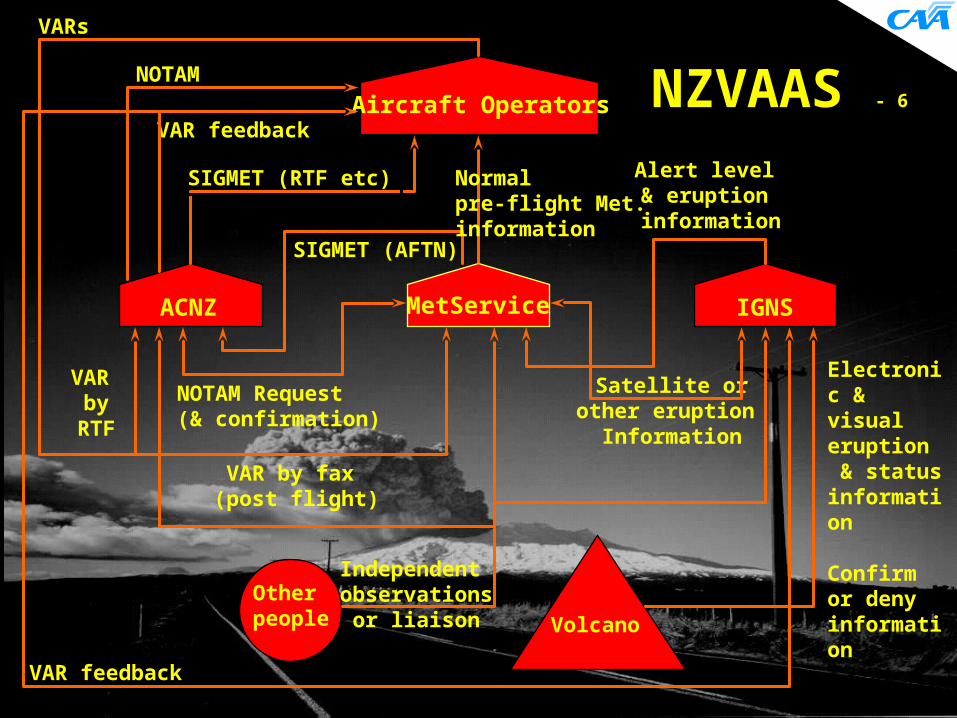
NZVAAS - 6
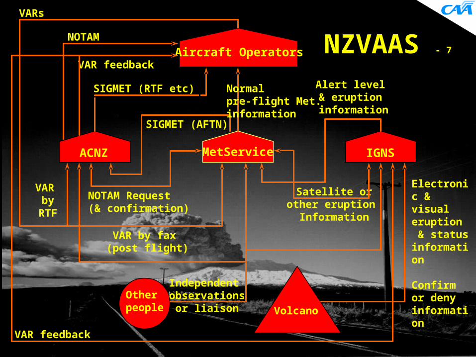
MetServiceACNZ IGNS
Aircraft Operators
Volcano
VAR feedback
SIGMET (RTF etc)
VAR by
RTF
VAR by fax (post flight)
SIGMET (AFTN)
VARs
Alert level & eruption information
Satellite orother eruption
Information
Electronic &visual eruption & status information
Confirm or denyinformation Independent
observationsor liaison
Other people
NOTAM Request(& confirmation)
NOTAM
Normal pre-flight Met.information
VAR feedback
NZVAAS - 7
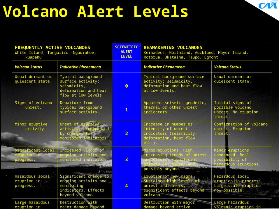
Volcano Alert Levels
FREQUENTLY ACTIVE VOLCANOESWhite Island, Tongariro -Ngauruhoe, Ruapehu
SCIENTIFIC ALERT LEVEL
REAWAKENING VOLCANOES Kermadecs, Northland, Auckland, Mayor Island, Rotorua, Okataina, Taupo, Egmont
Volcano Status Indicative Phenomena Indicative Phenomena Volcano Status
Usual dormant or quiescent state.
Typical background surface activity; seismicity, deformation and heat flow at low levels.
0
Typical background surface activity; seismicity, deformation and heat flow at low levels.
Usual dormant or quiescent state.
Signs of volcano unrest.
Departure from typical background surface activity.
1Apparent seismic, geodetic, thermal or other unrest indicators
Initial signs of possible volcano unrest. No eruption threat.
Minor eruptive activity.
Onset of eruptive activity, accompanied by changes to monitored indicators.
2
Increase in number or intensity of unrest indicators (seismicity, deformation, heat flow etc.).
Confirmation of volcano unrest. Eruption threat.
Significant local eruption in progress.
Increased vigour of ongoing activity and monitored indicators. 3
Minor eruptions. High increasing trends of unrest indicators, significant effects on volcano and possibly beyond.
Minor eruptions commenced. Real possibility of hazardous eruptions.
Hazardous local eruption in progress.
Significant change to ongoing activity and monitoring indicators. Effects beyond volcano.
4
Eruption of new magma. Sustained high levels of unrest indicators, significant effects beyond volcano.
Hazardous local eruption in progress. Large scale eruption now possible.
Large hazardous eruption in progress.
Destruction with major damage beyond volcano. Significant risk over wider areas.
5
Destruction with major damage beyond active volcano. Significant risk over wider areas.
Large hazardous volcanic eruption in progress.
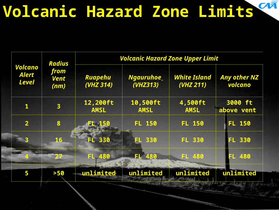
Volcanic Hazard Zone Limits
Volcano Alert Level
Radius from Vent (nm)
Volcanic Hazard Zone Upper Limit
Ruapehu (VHZ 314)
Ngauruhoe (VHZ313)
White Island
(VHZ 211)
Any other NZ volcano
1 312,200ft
AMSL10,500ft
AMSL4,500ft AMSL
3000 ft above vent
2 8 FL 150 FL 150 FL 150 FL 150
3 16 FL 330 FL 330 FL 330 FL 330
4 27 FL 480 FL 480 FL 480 FL 480
5 >50 unlimited unlimited unlimited unlimited
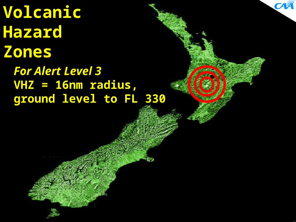
Volcanic Hazard Zones
For Alert Level 3VHZ = 16nm radius, ground level to FL 330
Operator Discretion
Airlines now decide where and when they can safely operate during a volcanic event
Only possible through the conjoint and co-operative provision of NZVAAS
Summary
Threat of volcanic ash in aviation is increasing
NZVAAS implemented to mitigate that risk at a local level
NZVAAS supplements ICAO IAVW A high level of good information is
available NZVAAS permits aircraft operations to
safely continue in proximity to ash It is a low cost scalable operation
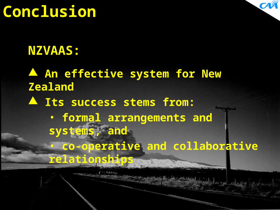
Conclusion
NZVAAS:
An effective system for New Zealand Its success stems from:
• formal arrangements and systems, and • co-operative and collaborative relationships


![Monthly Volcanic Activ ity Report (May, 2011) Volcanic Activ ity Report (May, 2011) Japan Meteorological Agency Nikko-Shiranesan [Warnings around the crater] After "The 2011 off the](https://img.pdfslide.net/doc/110x75/5ad66a657f8b9a1a028e668e/monthly-volcanic-activ-ity-report-may-2011-volcanic-activ-ity-report-may-2011.jpg)