Embed Size (px)
Citation preview

JCSDA Quarterly No. 37, December 2011
Joint Center for Satellite Data Assimilation • 5200 Auth Road • Camp Springs • MD • 20746 Editor: George Ohring NOAA…………….NASA…………US Navy…………US Air Force Web-site: www.jcsda.noaa.gov
News in This Quarter Science Update
Ongoing Improvements in Spectroscopy for Satellite Data Assimilation
Among the factors affecting the positive impact of satellite
data on numerical weather prediction is the accuracy of the
fast radiative transfer (RT) models used in radiance
assimilation systems. These fast models, such as the
Community Radiative Transfer Model (CRTM), rely on
accurate line-by-line calculations as a reference in their
training. In turn, the accuracy of the reference microwave
and infrared line-by-line models used by weather centers
across the world is limited mainly by uncertainties in our
knowledge of spectroscopic line parameters and continua.
Improvements in the quality and consistency of the
spectroscopic input to the models will ultimately enable
more effective utilization of the wealth of potentially
available information from satellite measurements.
Refinements in spectroscopy for line-by-line models
Improvements in consistency between CO2 spectral regions since 2006. The upper two panels show averaged AIRS measured brightness temperatures (K) in the 15 µm (650-850 cm
-1) and 4 µm (2200-2400 cm
-1) CO2 regions
for 36 cases for which temperature and humidity profiles are well known. The lower two panels show the spectral residuals (LBLRTM-AIRS) – the differences between the brightness temperatures calculated with the line-by-line model and those observed by AIRS – in 2006 (blue) and 2011 (red).
JCSDA Quarterly No. 37, December 2011
2
therefore have important implications for the impact of
satellite data on forecasts.
Since 2006, the Joint Center has been providing support for
ongoing improvements to the spectroscopic input used by
line-by-line models. The reference models used to train the
CRTM are the Line-By-Line Radiative Transfer Model
(LBLRTM) and the Monochromatic Radiative Transfer
Model (MonoRTM), developed at Atmospheric and
Environmental Research (AER). Significant improvements
in the line-by-line models for the microwave and infrared
regions have been implemented under JCSDA support
(Cadeddu et al., 2007; Payne et al., 2008; Shephard et al.,
2009; Payne et al., 2011; Mlawer et al., 2011). A key goal of
this work is consistency of spectroscopic information across
spectral regions. One example – the modeling of CO2
absorption in the infrared – is illustrated in the
accompanying figure.
The infrared CO2 bands at 4.3 µm and 15 µm are sensitive
to atmospheric temperature, and measurements from
hyperspectral sounders such as AIRS, IASI and CrIS can
provide detailed information on the vertical structure of the
temperature field. However, uncertainties in the
spectroscopic parameters have so far resulted in
inconsistency between the modeling of CO2 absorption in
these two spectral regions, making it impractical to
assimilate all possible temperature channels from the
hyperspectral instruments.
The figure shows the improvement in consistency in the
modeling of the CO2 15 and 4.3 µm bands between 2006
and 2011. Comparisons were made between LBLRTM
simulations and AIRS measurements for a number of cases
for which the atmospheric and surface state were well
characterized by independent measurements from
radiosondes and surface instruments at a Department of
Energy Atmospheric Radiation Measurement (ARM) site in
the tropics. Spectroscopic improvements between 2006 and
2011 that impact these spectral regions include the
implementation of improved CO2 line coupling, updated
CO2 line positions and strengths, and improvements to the
CO2 and H2O continua.
The latest versions of the AER line-by-line models, as well
as references for the sources of spectroscopic improvements,
are publicly available at http://rtweb.aer.com.
(Vivienne Payne, Matthew Alvarado, Eli Mlawer and Jean-
Luc Moncet, AER)
NPP Update
The National Polar-orbiting Operational Environmental
Satellite System (NPOESS) Preparatory Project (NPP)
mission, the first in a series of next generation weather
satellites, was successfully launched into orbit on October
28, 2011. The NASA-NOAA NPP satellite is the pathfinder
for NOAA’s operational Joint Polar Satellite System (JPSS),
which will provide operational continuity of satellite-based
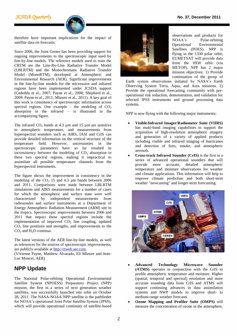
observations and products for
NOAA’s Polar-orbiting
Operational Environmental
Satellites (POES). NPP is
flying in the 1330 polar orbit;
EUMETSAT will provide data
from the 0930 orbit (via
METOP). NPP has 2 major
mission objectives: 1) Provide
continuation of the group of
Earth system observations initiated by NASA’s Earth
Observing System Terra, Aqua, and Aura missions. 2)
Provide the operational forecasting community with pre-
operational risk reduction, demonstration, and validation for
selected JPSS instruments and ground processing data
systems.
NPP is now flying with the following major instruments:
Visible/Infrared Imager/Radiometer Suite (VIIRS) has multi-band imaging capabilities to support the
acquisition of high-resolution atmospheric imagery
and generation of a variety of applied products
including visible and infrared imaging of hurricanes
and detection of fires, smoke, and atmospheric
aerosols.
Cross-track Infrared Sounder (CrIS) is the first in a
series of advanced operational sounders that will
provide more accurate, detailed atmospheric
temperature and moisture observations for weather
and climate applications. This information will help to
improve climate prediction and both short-term
weather "nowcasting" and longer-term forecasting.
Advanced Technology Microwave Sounder
(ATMS) operates in conjunction with the CrIS to
profile atmospheric temperature and moisture. Higher
(spatial, temporal and spectral) resolution and more
accurate sounding data from CrIS and ATMS will
support continuing advances in data assimilation
systems and NWP models to improve short- to
medium-range weather forecasts
Ozone Mapping and Profiler Suite (OMPS) will
measure the concentration of ozone in the atmosphere,

JCSDA Quarterly No. 37, December 2011
3
providing information on how ozone concentration
varies with altitude. Data from OMPS will continue
three decades of climate measurements of this
important parameter used in global climate models.
The OMPS measurements also fulfill the U.S. treaty
obligation to monitor global ozone concentrations
with no gaps in coverage.
Cloud and Earth Radiant Energy System (CERES) provides measurements of the space and time
distribution of the Earth's Radiation Budget
components. The observations from CERES are
essential for monitoring and understanding climate
change, in particular the role of clouds and the energy
cycle in global warming, one of the largest sources of
uncertainty in our modeling of the climate.
NPP instruments are now undergoing a period of intensive
cal/val. The Joint Center and its partner agencies are
preparing to assimilate the observations. NOAA/NCEP is
working on bias characterization of the ATMS data.
NOAA/STAR is monitoring several instruments. ATMS
noise and bias are being assessed using Global Forecast
System 6-hour guess and analysis fields. The VIIRS visible
channels display some anomalies, and the solar diffuser,
which is used for visible channel calibration, indicates a
relatively rapid degradation of the I2 and M7 bands (0.84 to
0.88 microns). STAR is also developing a CrIS bias
monitoring and noise trending online system for community
access. The Center is preparing to conduct forecast impact
experiments with CrIS data. The OMPS and CERES
instruments await opening of their nadir doors.
(Fuzhong Weng, NOAA/STAR)
Differences Between Global Analyses Using
the Thorpex TIGGE Data Set
TIGGE, the THORPEX Interactive Grand Global Ensemble,
is an archive of analyses and ensemble forecasts from the
major operational centers (NCEP, ECMWF, UK Met Office
(UKMO), Meteo France, Canadian Meteorological Centre
(CMC), China Meteorological Agency (CMA), Korea
Meteorological Agency, Japan Meteorological Agency,
Bureau of Meteorology/Australia, and the Center for
Weather Forecast and Climatic Studies (CPTEC) from
Brazil). In a small pilot study, differences in the analyses
between NCEP, the UK Met Office, ECMWF, CMA, and
CMC were considered. A year of global analyses and
forecasts were downloaded at 2.5 degree resolution and
compared. A more complete analysis of results to date is
available at
http://www.esrl.noaa.gov/psd/people/tom.hamill/analysis-
errors-wgne-hamill.pdf.
The accompanying figure shows a time series of the
analyses of the 250 hPa u component from the four centers,
with a smoothing using +/- 15 days. This grid point is along
the equator in the eastern Indian Ocean, and as shown,
The accompanying figure shows a time series of the
analyses of the 250 hPa u component from the four centers,
with a smoothing using +/- 15 days. This grid point is along
the equator in the eastern Indian Ocean, and as shown, the
various analyses disagree on the time-averaged analysis
state. Early in the period, for example, CMC and NCEP
have time-averaged analyses with more westerly winds than
the others. The average u-component over the time period at
this grid point ranges from -4.0 m/s for the CMC analysis to
-9.2 m/s for the CMA analysis (see box in upper right of
figure)
For many agencies, verification against analyses is a rather
standard practice. The results shown here suggest that in
many regions the analyses can be radically different from
one another. This may render it difficult to evaluate one
model forecast against another, for the analyses may differ
widely from one another. The presentation linked to above
provides several other illustrations of how TIGGE analyses
and short-range forecasts may be used to illuminate
characteristics of analyses, short-range forecasts, and
ensemble initialization characteristics. These data sets may
be useful to others in the data assimilation community,
illustrating where the multi-agency analyses agree and
where they disagree. This may be useful in determining
which aspects of the assimilation/forecast system may be
targeted for more intensive examination.
For more information, contact Tom Hamill
Time series of the u component of the wind at 250 hPa at the location 60°E, 0°N from analyses of ECMWF, China Meteorological Administration (CMA), Canadian Meteorological Centre (CMC), NCEP, and UKMO.
JCSDA Quarterly No. 37, December 2011
4
(Tom Hamill, NOAA/OAR)
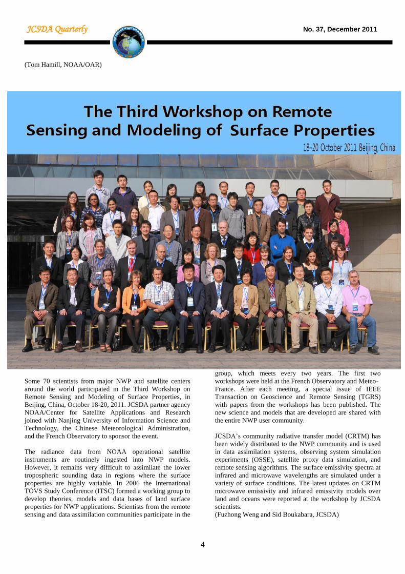
Some 70 scientists from major NWP and satellite centers
around the world participated in the Third Workshop on
Remote Sensing and Modeling of Surface Properties, in
Beijing, China, October 18-20, 2011. JCSDA partner agency
NOAA/Center for Satellite Applications and Research
joined with Nanjing University of Information Science and
Technology, the Chinese Meteorological Administration,
and the French Observatory to sponsor the event.
The radiance data from NOAA operational satellite
instruments are routinely ingested into NWP models.
However, it remains very difficult to assimilate the lower
tropospheric sounding data in regions where the surface
properties are highly variable. In 2006 the International
TOVS Study Conference (ITSC) formed a working group to
develop theories, models and data bases of land surface
properties for NWP applications. Scientists from the remote
sensing and data assimilation communities participate in the
group, which meets every two years. The first two
workshops were held at the French Observatory and Meteo-
France. After each meeting, a special issue of IEEE
Transaction on Geoscience and Remote Sensing (TGRS)
with papers from the workshops has been published. The
new science and models that are developed are shared with
the entire NWP user community.
JCSDA’s community radiative transfer model (CRTM) has
been widely distributed to the NWP community and is used
in data assimilation systems, observing system simulation
experiments (OSSE), satellite proxy data simulation, and
remote sensing algorithms. The surface emissivity spectra at
infrared and microwave wavelengths are simulated under a
variety of surface conditions. The latest updates on CRTM
microwave emissivity and infrared emissivity models over
land and oceans were reported at the workshop by JCSDA
scientists.
(Fuzhong Weng and Sid Boukabara, JCSDA)
JCSDA Quarterly No. 37, December 2011
5
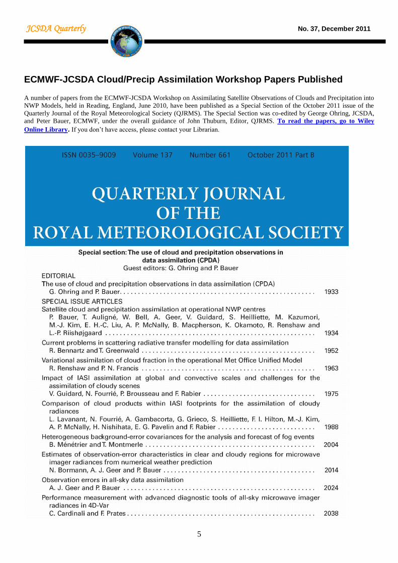
ECMWF-JCSDA Cloud/Precip Assimilation Workshop Papers Published
A number of papers from the ECMWF-JCSDA Workshop on Assimilating Satellite Observations of Clouds and Precipitation into
NWP Models, held in Reading, England, June 2010, have been published as a Special Section of the October 2011 issue of the
Quarterly Journal of the Royal Meteorological Society (QJRMS). The Special Section was co-edited by George Ohring, JCSDA,
and Peter Bauer, ECMWF, under the overall guidance of John Thuburn, Editor, QJRMS. To read the papers, go to Wiley
Online Library. If you don’t have access, please contact your Librarian.

JCSDA Quarterly No. 37, December 2011
6
Cosmic Corner:
As some readers may already know, NOAA
was unsuccessful in obtaining funding for
COSMIC-2 – the follow-on to COSMIC – in
its FY2012 budget. Additional options to finance the project
are currently being explored, including support from other
U.S. agencies. Updates on the status of this U.S.-Taiwan
follow-up GPS RO constellation will be provided in the next
JCSDA quarterly newsletter.
NOAA is examining possibilities to process GPS RO data
from missions of opportunity – that is, satellite missions
which are designed for other objectives but which carry GPS
RO receivers – in real time for operational NWP
applications. Aside from data processing systems, antenna
support to down-link the data from the satellites is required.
With the degradation of the COSMIC system, these
missions of opportunity are critical to maintain GPS RO as
part of the global observing system. But they will not
provide the same quality and number of observations that a
COSMIC-2 constellation would produce. Without
replacement of the current COSMIC satellites, much of the
positive impact of GPS RO on NWP could be lost.
On a more technical matter, with the operational
implementation of the Hybrid variational-ensemble data
assimilation system (Hybrid GSI) at NCEP scheduled for
April 2012, the GPS RO system will assimilate bending
angle profiles rather than refractivity profiles. This change
in the treatment of the GPS RO observations includes major
modifications to the forward operator, updated quality
control, and optimized observation errors. It also extends the
top of the profiles from 30 to 50 km. A technical report
describing all the changes in the GPS RO algorithms is
under preparation and will be available to the community in
the near future. For more information, please contact Lidia
Cucurull ([email protected]).
(Lidia Cucurull, JCSDA)
People
Meet Xiaoyan Zhang
Xiaoyan Zhang recently
joined the JCSDA as a
member of ERT, Inc. As a
data assimilation scientist,
she will work on preparing
the NOAA NWP global data
assimilation and forecast
system (GDAS) for the
assimilation of the NPP CrIS
data into numerical weather
prediction models, within
the JCSDA and/or NESDIS/STAR infrastructure. Her effort
will focus on testing the impact of assimilating the real data
from NPP CrIS and performing data denial experiments.
Before joining JCSDA, Xiaoyan was an Associate Scientist
at the National Center for Atmospheric Research (NCAR) in
Boulder, Colorado, where she worked with the Data
Assimilation team in the Mesoscale & Microscale
Meteorology (MMM) division for seven years. Her research
centered on 3D- & 4D-Variational Data Assimilation –
including development and testing for the Weather Research
and Forecasting (WRF) model data assimilation system –
studies of satellite radiance and radar data assimilation,
forecast sensitivity to the observations (FSO), and hurricane
initialization.
Xiaoyan received her Bachelor of Atmospheric Science
Degree from the Lanzhou University, Lanzhou, China, in
July 1999. She was awarded a M.S. Degree in Meteorology
in July 2002 from the Chinese Academy of Sciences,
Beijing, China.
Welcome aboard, Xiaoyan.
Summer Colloquium Sponsored by the Joint Center for Satellite Data Assimilation
Santa Fe, New Mexico, USA, July 24-August 3, 2012
Program Announcement
The NASA/NOAA/Department of Defense Joint Center for
Satellite Data Assimilation (JCSDA) is pleased to
announce a Summer Colloquium on Data Assimilation in
2012. The Colloquium will engage graduate students and
researchers with early postdoctoral appointments in the
science of satellite data assimilation for the atmosphere,
land, and oceans. The program will include lectures by
internationally recognized experts in data assimilation and
provide an extended opportunity for students to interact
with the lecturers in an informal setting. The objective of
the program is to foster the development of the next
generation of data assimilation scientists to support
environmental modeling.
Colloquium Topics
Data assimilation fundamentals including
variational and ensemble techniques
Satellite data applications including infrared and
microwave
Overview of atmospheric, ocean, and land data
assimilation
Overview of the global observing system

JCSDA Quarterly No. 37, December 2011
7
Career Opportunities – Research and Operational;
Agency/Academic/Private
Eligibility
Graduate students who expect to be awarded their PhD in
the physical, environmental, atmospheric, or related sciences
prior to June 2013 are invited to apply, as well as
individuals with no more than two years of postdoctoral
experience at the time of the Colloquium. Applicants of all
nationalities are eligible. However, in case the number of
qualified applicants exceeds capacity, preference will be
given to those who are either employed in the United States
or who are actively pursuing a relevant graduate degree at a
U.S. university.
Application Process
There is no application form. Qualified applicants are
encouraged to apply by sending the following materials via
email to the Chair of the Organizing Committee, Dr. James
G. Yoe ([email protected]) by February 29, 2012:
Curriculum Vita
Statement of interest (no more than one page) with
a summary of the applicant’s doctoral research
Three supporting letters from faculty members
Candidates will be selected competitively based on the
documentation they provide, and will be notified of the
disposition of their applications by April 18, 2012.
Financial Support
Travel support to and from the Colloquium, lodging
expenses, and per diem will be provided for the program to
approximately 15 participants. Additional applicants may be
invited to participate, but they will need to provide their own
financial support. Priority for financial support will be given
to U.S. citizens and permanent residents, and to those
employed or actively pursuing a graduate degree in the
United States.
Venue
The Colloquium will be held in Santa Fe, New Mexico, in
the southwestern United States. Arrangements for the
facility are being completed at the time of this
announcement, and will be made available as soon as
possible. Detailed logistical information for the Colloquium
will be provided to the individuals invited to participate at
the time they are notified of their selection.
A Note from the Director Happy New Year to all our partners and collaborators! We have now completed the initial porting efforts to jibb, the Joint Center computer at
the Goddard Space Flight Center, and to its sister platform, the S4 machine operated by the University of Wisconsin for NESDIS/STAR. The ports include the CRTM, the JCSDA radiative transfer model, the GFS, the NCEP operational forecast system, as well as several WRF versions. The GFS validation experiments have been completed, and we are now in production mode on a number of JCSDA projects. One of the major efforts on jibb right now is a comprehensive suite of data denial experiments with the NCEP GFS. These experiments will be featured at the “Fifth WMO Workshop on the Impact of Various Observing System on NWP” to be hosted by the Joint Center in Sedona, AZ, in May this year. This workshop series has become the premier venue for these types of comparative data impact studies, and we look forward to having it here in the U.S. for the first time. You can read more about the meeting on the JCSDA website. As you will see elsewhere in this newsletter, we are also gearing up for the 2012 installation of the “JCSDA Summer Colloquium”, our major training event. This year’s colloquium will take place in Santa Fe, NM in late July and early August. The program builds on the experience from the very successful 2009 event in Stevenson, WA. We are once again assembling a roster of outstanding lecturers, and we look forward to providing the opportunity to learn from them and interact with them to a new generation of graduate students and post-docs with an interest in satellite data assimilation. Unfortunately, we still have no definitive news on the FY 2012 External Research announcement. The good news is that it still looks like we will have funding available, but we are not yet done working through the challenges of executing the program. Finally, we would like to congratulate NASA and the NPP team on a successful launch in October. We have taken a good look at the data from ATMS, and we have been pleased with what we have seen so far. We hope that any remaining issues with VIIRS will be resolved soon, so that we can resume data reception for this sensor and hopefully from CrIS soon thereafter. As many of you know, one of the goals when the Joint Center was formed was to have new satellite data

JCSDA Quarterly No. 37, December 2011
8
implemented in operations within a year from launch. We are now on a very aggressive schedule to try to meet this goal for NPP. This includes significant contributions from all partners as well as a major role for our new computer. Wish us luck! Lars Peter Riishojgaard, Director, JCSDA
Outlook for Next Quarter Upcoming Events
Seminars
JCSDA seminars are generally held on
the third Wednesday of each month in
Room 707 of the World Weather
Building. Presentations are posted at
http://www.jcsda.noaa.gov/JCSDASemi
nars.php prior to each seminar. Off-site
personnel may view and listen to the
seminars via webcast and conference
call. Audio recordings of the seminars are posted at the
website the day after the seminar.
Check http://www.jcsda.noaa.gov/JCSDASeminars.php for
updates.
Upcoming Seminars
Date Speaker Affiliation Title
Jan.
18,
2012
Kazumasa
Aonashi
Japan
Meteorological
Agency
Ensemble-Based
Variational
Assimilation
Method to
Incorporate
Microwave Imager
Data into a Cloud-
Resolving Model
March
21,
2012
John
Derber
NOAA/NCEP Progress and Plans
for the
Environmental
Modeling Center’s
(EMC) Gridpoint
Statistical
Interpolation (GSI)
Development
April
3,
2012
William
Bell
ECMWF The Assimilation
of Microwave
Imager Data at
ECMWF
April
18,
2012
Peter
Bauer
ECMWF Recent and
Planned
Development of
Data Assimilation
and Modeling
Systems at
ECMWF
Editor’s Note: Unsolicited articles for the JCSDA Quarterly
Newsletter are encouraged as are suggestions for seminar
speakers or topics. Please send them to