Embed Size (px)
Citation preview

© Mouchel 2015 i
Newton-le-Willows Park &
Ride/Bus Interchange
Proposed expanded park and ride/bus scheme and bus interchange development by Merseytravel.
Planning Statement
Prepared for
Prepared by Mouchel
209-215 Blackfriars Road
London
SE1 8NL
T +44 (0) 207 803 2624

© Mouchel 2015 ii
Document Control Sheet
Project Title Proposed park and ride scheme and bus interchange development by
Merseytravel incorporating an expanded car park for 440 spaces with
enhanced provision for disabled parking, enhanced cycle parking
provision and a new Pick-up/Drop-off point and facility for taxis.
Report Title Planning Statement
Status Final
Report Date June 2015
Record of Issue
Versio
n
Status Author Date Checked by Date Approved
by
Date
1.0 Draft M. Shingler N
Kretschmer
N Venema 17 06 15
Distribution
Date Organisation Contact Format Copies
E 1

Newton-le-Willows Interchange
Planning Statement
© Mouchel 2015 1
Limitations
This report is presented to St Helen’s Borough Council in respect of proposals at Newton-le-Willows Rail Interchange, Mill Lane, Newton-le-Willows and may not be used or relied on by any other person.
Notwithstanding anything to the contrary contained in the report, Mouchel Limited is obliged to exercise reasonable skill, care and diligence in the performance of the services required by Merseytravel and Mouchel Limited shall not be liable except to the extent that it has failed to exercise reasonable skill, care and diligence, and this report shall be read and construed accordingly.
This report has been prepared by Mouchel Limited. No individual is personally liable in connection with the preparation of this report. By receiving this report and acting on it, the client or any other person accepts that no individual is personally liable whether in contract, tort, for breach of statutory duty or otherwise.

Newton-le-Willows Interchange
Planning Statement
© Mouchel 2015 2
Contents
Document Control Sheet ........................................................................................ ii
Limitations ............................................................................................................... 1
Contents .................................................................................................................. 2
Table of figures ....................................................................................................... 3
Tables ....................................................................................................................... 4
Documents and plans submitted with this planning application ......................... 6
1 Introduction .................................................................................................... 7
2 Proposed Development ............................................................................... 16
3 Environmental Considerations ................................................................... 19
4 Planning Policy Review ............................................................................... 24
5 Other Material Considerations .................................................................... 39
6 Planning Assessment .................................................................................. 40
7 Summary ....................................................................................................... 43
8 List of Background Papers .......................................................................... 44
9 Appendix 1 – Site Photographs................................................................... 45
10 Appendix 2 – Pre-Application Meeting Notes (PDF separately attached)

Newton-le-Willows Interchange
Planning Statement
© Mouchel 2015 3
Table of figures
Figure 1-1 - Site Location ........................................................................................ 13

Newton-le-Willows Interchange
Planning Statement
© Mouchel 2015 4
Tables
Table 4-1 - Compliance of proposals with the National Planning Policy Framework 26
Table 4-2 - Compliance of proposals with policies of the adopted Core Strategy ..... 30
Table 4-3 - Compliance of proposals with the saved policies of the St Helens Unitary
Development Plan ............................................................................................ 33

Newton-le-Willows Interchange
Planning Statement
© Mouchel 2015 5
Documents and plans submitted with this planning application
Application forms
Design and Access Statement
Phase 1 Habitat Assessment Report
Flood Risk Assessment
Heritage Assessment
Planning Statement
Transport Assessment
Landscaping Strategy
Tree Survey
Contaminated Land Assessment
Air Quality Assessment
Noise Assessment
Proposed/existing levels Survey
Construction Management Plan

Newton-le-Willows Interchange
Planning Statement
© Mouchel 2015 6
Plans
Title Drawing number
Location Plan 1067582-0100-P-0100 Rev B
Proposed Site Plan 1067582-0100-P-0102 Rev B
Proposed Development 1067582-0100-P-0103 Rev A
General Arrangement Plan 1067582-0100-P-0402 Rev C
External lighting 1067582-0100-P-1300 P1
Landscape General Arrangements 1067582-0100-P-3000D
CCTV details 1067582-0100-P-1301 P1
Cross Section 1067582-0700-P-0700
Proposed and Existing Levels 1067582-0700-P-0701
Hard Landscape Palette -
Soft Landscape Palette -
Illustrative Sections -

Newton-le-Willows Interchange
Planning Statement
© Mouchel 2015 7
1 Introduction
Mouchel has been appointed by Merseytravel to prepare a Planning Statement to
support the planning application for the development of a new Park & Ride scheme
for Newton-le-Willows rail interchange. This scheme will form Phase 1 of a 2 phase
scheme of improvements. The key features of this proposed scheme include:
A new bus interchange;
An expanded car park for 440 spaces with provision for 21 disabled bays and
22 larger speces;
Enhanced cycle parking provision:
Pick-up/Drop-off point and facility for taxis; and
Other facility improvements are also anticipated as part of Phase 2, to be undertaken
by Network Rail, but these do not form part of this current application. These
additional works relate to
An improved subway underneath the railway line;
Lift and staircases to subway and platform level to provide DDA compliant
access throughout the station;
A new ticket office provided on the south of the railway line;
Enhanced waiting facilities on both platforms
Merseytravel, has confirmed that funding to carry out these works is already in place
and approval of the Full Business Case for the provision of all elements of the
proposals has been agreed by the Liverpool City Region Combined Authority.
1.1 EIA Screening Opinion
An application in respect of an Environmental Impact Assessment Screening has
been submitted and is under consideration with St Helens MBC under reference 15..
1.2 Site History
The overall site is a combination of 3 sites and there is no history specific to the
wider site but elements of the sites have history as set out below.
Reference number
Site location Decision Applicant details
Proposed development
P/1996/0840
Mill Green Special School Mill Lane Newton-le-Willows
FPGC Acting Director Of Education, Rivington Centre, Rivington Road, St Helens,
Provision of car parking facilities and associated highway improvements

Newton-le-Willows Interchange
Planning Statement
© Mouchel 2015 8
St Helens Council WA12 8BG
P/1997/0456
Mill Green Special School Mill Lane Newton-le-Willows St Helens Council WA12 8BG
FPG Director Of Education St Helens MBC, Rivington House, Rivington Road, St Helens,
Enclosure of a covered link between blocks b and c
P/2002/1193
Mill Green Special School Mill Lane Newton-le-Willows St Helens Council WA12 8BG
FPGC K Barber Director Of Education And Leisure Services Rivington Centre, Rivington Road, St.Helens, Merseyside
Siting of mobile classroom for temporary period of 5yrs
P/2002/1264
Mill Green Special School Mill Lane Newton-le-Willows St Helens Council WA12 8BG
FPGC Director Of Community Education And Leisure Rivington Centre, Rivington Road, St Helens,
Recladding and extension of leavers unit and creation of ramped access corridor to main building.
P/2007/1458
Specialist Block Mill Green
FPW Mrs Susan Richardson St Helenc
Extension to existing mobile classroom.

Newton-le-Willows Interchange
Planning Statement
© Mouchel 2015 9
School Mill Lane Newton-le-Willows St Helens
Council C&YPS Rivington Road, St Helens, Merseyside, WA10 4ND
P/2007/1451
Specialist Block Mill Green School Mill Lane Newton-le- Willows St Helens
FPGC Mrs Susan Richardson St Helens Council C&YPS Rivington Road, St Helens, Merseyside, WA10 4ND
Siting of mobile classroom for a temporary period of 5 years.
P/2008/0392
Mill Green Special School Mill Lane Newton-le- Willows Merseyside WA12 8BG
FPGC Mrs Susan Richardson St Helens Council Education Department Rivington Road, St Helens, WA10 4ND
The erection of canopy to south and east elevation of leavers unit.
P/2009/0110
Mill Green Special School Mill Lane Newton-le- Willows St Helens WA12 8BG
FPGC Mrs Susan Richardson Cyps Corporation Street, St Helens, Merseyside, WA9 1LD
Erection of concrete garage for storage purposes.
P/2009/0792
Mill Green Special
FPGC Mr Colin Myers Mill Lane,
Erection of a canopy to gable end of classroom.

Newton-le-Willows Interchange
Planning Statement
© Mouchel 2015 10
School Mill Lane Newton-le- Willows St Helens WA12 8BG
Newton-le- Willows, St Helens, WA12 8BG
P/2010/0279
Mill Green Special School Mill Lane Newton-le- Willows St Helens WA12 8BG
ACGC Mr Clive Myers Mill Lane, Newton-le- Willows, St Helens, Wa12 8bg
Consent to display 1no. flag to be displayed on a 5m high flag pole.
P/2010/0286
Mill Green Special School Mill Lane Newton-le- Willows St Helens WA12 8BG
FPGC Mr Clive Myers Mill Lane, Newton-le- Willows, St Helens, Wa12 8bg
Erection of a 5m high flag pole.
P/2010/0296
Mill Green Special School Mill Lane Newton-le- Willows St Helens WA12 8BG
FPGC Mr Clive Myers Mill Lane, Newton-le- Willows, St Helens, Wa12 8bg
Creation of an outdoor recreation and learning area on existing grassed area comprising of octagonal timber shelter with planting beds and benches, timber frame polycarbonate roof pergola, pathway pergola with planters on each post and associated bitmac pathways and surfacing.
P/2010/1101
Mill Green Special School Mill Lane
ACW Mr Peter Holker St Helens Council Corporation Street,
Consent to erect a 6.0m high flag pole with flag.

Newton-le-Willows Interchange
Planning Statement
© Mouchel 2015 11
Newton-le- Willows St Helens WA12 8BG
St Helens, WA9 1LD
P/2011/0136
Mill Green Special School Mill Lane Newton-le- Willows St Helens WA12 8BG
ACGC Mr Peter Holker St Helens Council Corporation Street, St Helens, WA9 1LD
Consent to display 1no. flag to be displayed on a 6m high flag pole.
P/2011/0154
Mill Green Special School Mill Lane Newton-le-Willows St Helens
FPGC Mr Peter Holker St Helens Council Atlas House, Corporation Street , St Helens, WA9 1LD
Installation of a 6.0m flagpole adjacent to the school.
P/2000/0825
Newton-le- Willows Railway Station, Mill Lane Newton-le- Willows St Helens Council WA12 9SF
PNOR One 2 One Personal Comm. Ltd Imperial Place, Maxwell Road, Borehamwood, WD6 1EA.
Erection of a 15m high telecommunications mast equipment cabin and associated works

Newton-le-Willows Interchange
Planning Statement
© Mouchel 2015 12
1.3 Consultation
The application has been the subject of pre-application discussions as set out below.
Other consultations carried out are set out in the Statement of Community
Involvement below.
1.4 Pre-application Meetings
The applicants have engaged positively with stakeholders and two pre-application
meetings have been held in respect of the proposed development. At the pre-
application meetings, St Helens Borough Council (SHBC) indicated that in principle
the proposed park and ride facility/bus terminal is likely to be acceptable (Summary
of Meeting notes by Senior Planning Officer Johndaniel Jaques) subject to caveats in
respect of noise assessment, air quality assessment and a transport assessment.
Detailed assessments in respect of these issues are submitted to support the
application and are summarised further in this planning statement. The notes of the
pre-application meetings are appended to this statement (Appendix 2).
1.5 Statement of Community Involvement
In addition to the pre-application consultations carried out both the appropriate Ward
Ciouncillors and the Chair of Planning Committee and the Employment, Planning
and Growth Portfolio holder have been consulted. We are fully committed to
engagement with the public as part of the formal consultation on the planning
application and through further consultations on future phases of the development.

Newton-le-Willows Interchange
Planning Statement
© Mouchel 2015 13
1.6 Site Location
Figure 1-1 - Site Location
1.7 Existing Site
Newton-le-Willows station is located on the Chat Moss, Liverpool to Manchester
railway line to the west of its namesake’s local centre and is approximately 6 miles
from St Helens town centre adjacent to the A49 which connects the area with both
the M62 motorway and Warrington. The development site is located immediately
south of the existing railway station and comprises an existing car park to the north
western corner, an area of industrial commercial units and associated car parking to
the north eastern section, whilst the former Mill Green Special School forms the
remainder of the site. The school buildings currently remain present on site. There
are two access points currently, comprising the access to the former school from Mill
Lane and a more northerly access point on to Albert St that currently serves an area
of parking and the industrial/commercial units.
The site boundary runs to the rear of a car showroom (Prestige Motors), the public
house known as The Millstone, both of which front on to Mill Lane, and the

Newton-le-Willows Interchange
Planning Statement
© Mouchel 2015 14
residential property at 69 Mill Lane. To the west across Mill Lane and the south and
east of the site, the predominant form of development is residential in character.
The site is adjacent to Newton Brook which is a small watercourse and a minimal
amount of the site is located in a Flood Zone 2 area, with the rest being in Flood
Zone 1. Newton-le-Willows High Street lies approximately 360m to the northwest and
the M6 Motorway is approximately 570m northwest of the proposed development.
Newton-le-Willows is the most easterly railway station in Merseyside on the Chat
Moss line, situated roughly mid-way between Liverpool and Manchester. The station
is located 15.8 miles from Liverpool Lime Street and 15.9 miles from Manchester
Victoria. The station serves not only the eastern areas of Newton-le-Willows, but it is
also an attractor for adjacent towns and villages lying outside of the borough of St
Helens; such as Golborne and Lowton areas (both within Wigan, Greater
Manchester) to the north east, and Winwick to the south (in Warrington). Newton-le-
Willows has a population of circa 11,200 (Census 2011).
The catchment area for Newton-le-Willows station is large. Current usage levels
suggest that as well as local use there is also high levels of demand from people
further afield who access the existing car park or who park on roads around the
station. Recent surveys of roads surrounding the station indicate that over 100
vehicles parked on-street are as a result of people using the station in addition to
those vehicles utilising the current station car park (87 spaces). The station is the
most well-used on the line between Liverpool and Manchester with the exception of
Huyton which is served by two lines (Liverpool to Manchester and Liverpool to
Wigan).
The current designated parking provision at the station is inadequate for the current
demand and leads to use of surrounding residential roads. With the electrification of
the Chat Moss line and the associated line-speed and capacity improvements as
well additional services within Northern Hub plans, the demand at the station, and
the consequent demand for parking, is projected to rise by 50,000 single journeys
per annum. The overall scheme is being designed to facilitate this growth (and
increased demand generated by the Parkside SRFI development), but will be, by its
very nature, a stimulus of further increased growth. Making reference to TAG Unit
A5.3 Rail Appraisal the increased demand at the station attributable to the
improvement in facilities at it is projected as being 48,000 single journeys per
annum, with the enhanced park and ride provision and bus interchange bring still
further growth.
The current station environment is considered to be of poor quality, with the
platforms accessed by an existing unevenly paved subway. Steps are provided to
both existing eastbound and westbound platforms and there is no step-free access
provided at present. Integration with local bus services is also far from ideal with bus
stops provided some 150m from the station entrance. TheAn 87-space car park is
provided to the south of the station at present and this requires a walk underneath
the railway viaduct and on a narrow footway alongside a main road to access the

Newton-le-Willows Interchange
Planning Statement
© Mouchel 2015 15
station. The only access to the station is currently on the north side of the railway
line.
1.8 Planning Designations
Policy CAS3.1 identifies the Newton-le-Willows station as a location for improved
Park and Ride facilities and station improvements. The station itself and the adjacent
Newton Viaduct are both designated heritage assets and listed at grade II. The
listing descriptions are set out below:-
Newton-le-Willows Station
Station for the Liverpool and Manchester Railway. 1840s. Brick with stone dressings,
slate roof. 2 storeys, 6 bays. 1st 3 bays recessed with C20 canopy, 4th bay gabled.
4th, 5th and 6th bays have ground floor of rock-faced stone. 3rd bay has re-entrant
porch with parapet and entrances to return. Ground floor 2;2;3;6-light stone
mullioned windows, those to 3rd and 4th bays with high transoms. 1st floor
3;4;3;4;2;2-light windows with 4-centred heads to lights. Left return has 4-light
window with transom. 2 brick stacks. Platform side of one storey has canopy
(possibly later) on cast-iron columns. 5 bays, 3rd bay projects under gable. 2;2;2;4;3-
light windows with 4-centred heads. 4 Tudor-arched entrances, to left end, to left of
projecting bay, to projecting bay and to its right; one has doors with linenfold
panelling.
Newton Viaduct
Viaduct for Liverpool and Manchester Railway. 1828. Stephenson. Brick with stone
dressings. 4 round-headed arches with rusticated voussoirs. Battered rusticated
pilasters and cornice, parapet with stone pilasters and coping. Curved retaining walls
at ends are terminated by rusticated stone piers. To the west of the arches, a low
elliptical-arched tunnel for a stream.
(see photographs at Appendix 1)

Newton-le-Willows Interchange
Planning Statement
© Mouchel 2015 16
2 Proposed Development
The details of the proposed development, which is the subject of this Application and
forms Phase 1 of the overall project, are set out below.
The development will feature:
A new bus interchange;
An expanded car park for up to 440 spaces with provision for blue badge
holders;
Enhanced cycle parking provision;
Pick-up/Drop-off point and facility for taxis.
Other facility improvements are also anticipated to be undertaken by Network Rail
but these do not form part of this current application but will form phase 2 of the
project. These additional works relate to
An improved subway underneath the railway line;
Lift and staircases to subway and platform level to provide Disability
Discrimination Act compliant access throughout the station;
A new ticket office provided on the south of the railway line;
Enhanced waiting facilities on both platforms.
The proposal is to construct circa a 440 space car park to Park Mark1 standard on land bounded by the Newton-le-Willows station embankment to the north; residential development to the east; The Millstone public house and further private residential development to the south; and Prestige Motors, 69 Mill Lane and Mill Lane itself to the west. Access to the interchange for the buses and taxi rank is from Mill Lane via Alfred Street. It is proposed to provide a bus interchange capable of accommodating a minimum of three bus stands and two bus lay-over spaces with access/egress onto/from Mill Lane via Alfred Street and a new traffic signal layout. A fully accessible drop-off and pick-up is to be provided within the interchange area as close to the new southern entrance to the station as practicable, vehicle
1 Park Mark standard is part of the Safer Parking Scheme, which is a national standard for
UK car parks that have low crime and measures in place to ensure the safety of people and
vehicles. A Park Mark is awarded to each car park that achieves the challenging standards.

Newton-le-Willows Interchange
Planning Statement
© Mouchel 2015 17
access/egress will be via Alfred Street. The main access/egress for the car park will be via Alfred Street with an additional access point with egress via the former Mill Green School access.
A prior notification application under the Town and Country Planning (General
Permitted Development) (England) Order 2015 Schedule 2, Part 11 will also shortly
be submitted to demolish the school and other redundant buildings. Below is an
indicative work programme for this development subject to securing planning
permission:
Part 1 – Demolition of Mill Green School
Part 2 – construction of a section of the final car park (approx100 spaces) on the
southern section of the school site with temporary two-way vehicular access via the
former school entrance adjacent to The Millstone public house.
Part 3 – closure of the existing car park adjacent to Alfred Street with car parking for
the station provided by the section of the final car park completed as Part 2. Existing
car park site to be utilised for construction activity related to the rail elements of the
overall scheme.
Part 4 – construction of final car park on the remainder of former school site (nb due
to access constraints and lack of pavement width along Mill Lane, only the portion of
the car park completed as Part 2 will be in use prior to completion of Part 8
Part 5 – demolition of former commercial units on land accessed from Alfred Street
Part 6 - final construction of the remaining area for park and ride including final
finishes and landscaping
Part 7 - construction of the bus interchange primarily on site of existing station car
park. Access improvements will be required at the junction between Alfred Street
and Mill Lane (with a new traffic signal installation) and Traffic Regulation Orders on
Alfred Street will need to be revised to amend the permitted on-street parking to
reflect introduction of new short-term parking lay-by to north of Street and the
introduction of 24/7 restrictions prohibiting all parking and loading on the southern
side of the Street.
–Part 8 - footway connections to the new ticket office and station access ways etc.
Final finishes and landscaping within ticket office locale and bus interchange
Part 9 – car park and bus interchange come into use. Temporary two-way vehicle
usage of entrance to former school ended, modified to be additional vehicular entry
point to finished car park. In addition, to coincide with the opening of the car park, the
Borough Council may require further TRO’s to restrict parking on Southworth Road
to be introduced as part of this scheme.

Newton-le-Willows Interchange
Planning Statement
© Mouchel 2015 18
2.1 Access
The wider station re-development will provide step-free access at the station which
removes barriers for those who are mobility impaired. Additionally, step-free access
at the station together with a public transport interchange allows access for all –
improving journey opportunities to a wider employment market.
The improved Interchange will act as a public transport hub for the local area, and as
the transport gateway to the Parkside Strategic Railfreight Initiative (SRFI)
development, which accounts for a large proportion of future development in the St
Helens Borough and potentially up to 8000 new jobs. A developer-provided shuttle
bus will run between Parkside and Newton-le-Willows station and in order to
encourage public transport trips it is important that a cross-mode interchange is
provided for at the railway station.
2.2 Trees and Landscape Proposals
It is proposed to retain all significant trees on site and to enhance the landscape
buffer to the southern and eastern boundaries of the site. This not only serves to
improve the scheme from the visual context but also aid as landscape buffers
between the car parking area and adjacent residential development. Please refer to
drawing no. xxxx for the landscape proposals.

Newton-le-Willows Interchange
Planning Statement
© Mouchel 2015 19
3 Environmental Considerations
3.1 Visual Impact and Design
The accompanying Design and Access Statement sets out the detailed design
parameters. The development largely comprises a significantly expanded car parking
area but care has been taken to limit the visual intrusion with careful use of
mitigating landscaping provision, most noticeably towards the southern and eastern
boundaries of the site. One benefit from the development will be the removal of the
existing school and commercial buildings, which do not contribute positively to the
character of the locality.
The bus interchange will be the most visible element of the scheme, certainly from
Mill Lane, but as it is a public transport facility a good degree of visibility is required.
The structures, such as bus shelters, are functional and need to reflect also the
corporate identity of the Client. The structures are not considered to impact
adversely on the setting of the listed station building or viaduct and are considered to
be an improvement over and above the existing situation. The co-ordinated
approach to design with the station related elements of the overall scheme has
resulted in only the southernmost bus stop requiring its own shelter, waiting area
being provided within the design of the new station ticket office building adjacent to
the bus interchange. Higher quality materials are proposed for the bus interchange
area, which fits with and reflects the upgrade works proposed for the station itself.
3.2 Residential Amenity
3.2.1 Light and Outlook
The nearest properties to the development are those to the east of the former school
on Banastre Drive and that to the west of the school at 69 Mill Lane. It is not
considered that the development would give rise to any significant impact on light or
outlook to neighbouring properties. Indeed removal of the school and commercial
buildings will result in some improvement certainly in respect of outlook to the
nearest properties on Banastre Drive. Additionally there will be no structures as part
of the development that will impact on sunlight or daylight to any significant degree
given the separation distances involved.
3.2.2 Air quality
An Air Quality Assessment has been submitted with this application. The closest Air
Quality Management Area is along Newton-le-Willows High Street, 360m to the
northwest (St Helens Council AQMA 2), and a second area, the M6 Motorway (St
Helens Council AQMA 1), is 570m northwest of the proposed development.
It is considered that dust generation and deposition could occur during the
construction phase. Road traffic emissions would arise from the operational phase
due to the increased capacity car park and bus facilities. However, the impact of
these emissions is anticipated to be largely off-set by the consequent reduction of
emissions associated with a greater number of people being able to utilise public
transport for onward journeys.

Newton-le-Willows Interchange
Planning Statement
© Mouchel 2015 20
The Air Quality Assessment concludes that an appropriate implementation of best
practice mitigation techniques is expected to result in a negligible local air quality
impact associated with the construction phase of the proposed development
Overall, the significance of operation phase impacts on local air quality is considered
to be negligible to slight adverse. Therefore, no specific mitigation measures are
considered necessary for the operation phase of the proposed development.
3.2.3 Noise and disturbance
The nearest properties on Banastre Drive are approximately 10-11m from the
boundary of what will be the car park. This may give potential for some noise and
disturbance to these properties and those on Roscoe Avenue to the south and has
been considered in the submitted Noise Assessment which recommends appropriate
mitigation measures be undertaken to limit the impact on residential amenity..
3.2.4 Privacy
There will be no new buildings or structures in close proximity to the existing
residential development and no adverse impacts will accrue in respect of privacy to
neighbouring properties.
3.2.5 Construction Impacts
Impacts during construction will include:
• Noise
• Dust
• Disruption on the highway network
However these impacts will be ameliorated by the provision of a robust and effective
construction management plan which can be secured by condition.
The construction management plan will ensure that any nearby sensitive receptors
are not unduly affected during the relatively short construction period.
3.3 Cultural Heritage and Archaeology
There are no heritage assets within the application site but the adjacent Newton-le-
Willows railway station and the adjacent Newton Viaduct are listed
buildings/structures at Grade II. The listing descriptions are set out above.
A Heritage Statement accompanies this application which identifies the historic and
archaeological background of the location and sets out recommendations within it.

Newton-le-Willows Interchange
Planning Statement
© Mouchel 2015 21
3.4 Flood Risk Assessment
The proposed scheme is adjacent to Newton Brook which is a small watercourse,
and a minimal amount of the site is located in a Flood Zone 2 area. This is not a
significant risk and can be mitigated through scheme design.
The presence on site of polluting substances during construction could lead to
surface water or groundwater pollution. However, good site management practices
would aim to avoid this. Polluting substances from run-off during operation will be
mitigated following established standards and industry best practice.
There is potential for the proposed scheme to impact on drainage through the
increase in the area of impermeable surfaces
Please refer to the Flood Risk Assessment (FRA) that accompanies this planning
application. The drainage scheme will incorporate SuDS and details of how this is
managed and maintained have been set out in the FRA.
3.5 Ecology
In respect of ecology please see our submitted Extended Phase 1 Habitat Survey
accompanying this application. A study area extending to 1km around the proposed
development scheme was surveyed in order to appraise the ecological value of the
study area and identify likely ecological constraints to the development.
The habitats within the accessible parts of the site are dominated by buildings and
hard standing, which are largely of negligible ecological value. Small areas of
amenity grassland and amenity planting are scattered throughout the site, although
these habitats are of low ecological value at best.
3.5.1 Habitats
The extended phase 1 Habitat Survey submitted with this application considers that
the habitats present within the parts of the site surveyed are dominated by buildings
and hard standing and are of negligible ecological value. The parts of the site that
remained inaccessible at the time of the survey (the commercial element) also
appear to comprise a number of buildings and areas of hard standing and are thus
unlikely to be of significant value.
A number of Cotoneaster plants were recorded within the areas of amenity planting
present in the former school site. These plants are listed as invasive species and it is
therefore recommended that these plants are suitably disposed of in accordance
with recommended methods to avoid risk of their spread into the wild.
3.5.2 Protected Species
3.5.3 Bats
The majority of the buildings surveyed are of negligible roost potential and therefore
no further survey work at these locations is required.

Newton-le-Willows Interchange
Planning Statement
© Mouchel 2015 22
The two-storey brick-built boiler house on the western aspect of the main school
building is of low-moderate roost potential and it is therefore recommended that
presence/absence surveys for bats are undertaken to confirm whether or not it is
used by bats. BCT guidelines recommend that two dusk emergence and/or pre-dawn
re-entry surveys are appropriate and should be undertaken during May-September.
Should bats be present, further survey work may be necessary to obtain sufficient
information on the level of use of the building by bats. Should the building be in use
by roosting bats, it is likely that a Natural England licence would be required before
works to this building could be permitted to proceed.
3.5.4 Birds
In order to minimise the risk of disturbing breeding birds, removal of any woody
vegetation such as tree felling or vegetation clearance should be undertaken outside
of the typical breeding bird season of March to July inclusive. If tree and vegetation
removal is unavoidable during this period, the vegetation should be checked for the
presence of nests by an appropriately experienced ecologist prior to removal. If
active nests are found, it may be necessary to delay work within 10m of the nest until
the young have fledged. Specific recommendations would be provided by the site
ecologist as appropriate.
3.6 Transport
Please refer to the Transport Assessment which accompanies this Planning
Application. The scheme has been subject to detailed pre-application discussions
involving the Council’s Principal Transport Officer and the applicants are happy to
engage in any further discussions as may be necessary during the application. If
there is further work required then our client would be grateful if you could draw this
to our attention at your earliest opportunity in order to ensure smooth and timely
progress of the application.
The Transport Assessment concludes that the proposals will conform to the national
and local policies which set out the support sustainable development by improving
accessibility to the wider regions through a viable and sustainable alternative to car
travel.
Capacity assessments were carried out for the Mill Lane/Alfred Street and Mill
Lane/Southworth Road/Church Street junctions for the base year 2015, opening year
2016 and a future year of 2021, for AM and PM peaks.
The proposed Mill Lane/Alfred Street signal-controlled junction is seen to operate
within capacity for the opening and design years during the morning and evening
peak hours.
The Mill Lane/Southworth Road/Church Street junction is currently operating at
capacity however, by amending how junction operates (by upgrading to MOVA
control), the junction will operate better in the opening year of 2016 and the future
year of 2021

Newton-le-Willows Interchange
Planning Statement
© Mouchel 2015 23
As there were only 5 accidents over the last 5 years that appear to be as a result of
human error, there is not considered to be an accident problem in the local area.
3.6.1 Parking
In total the scheme will provide for a total of 440 car parking spaces overall and an
increase in provision of circa 353 spaces. Of this overall total, 26 spaces are for blue
badge holders and a further 14 spaces are provided for parents with children.
3.7 External Lighting
The details regarding external lighting are set out in the accompanying Lighting Plan
(drawing no. 1067582-0100-P-1300-P1)
3.8 CCTV
CCTV is incorporated within the development and the details are set out in drawing
no: 1067582-0100-P-1301-P1.
3.9 Renewable Energy
A Sustainability Statement has been submitted to accompany this application. It
concludes that….
3.10 Contaminated Land – Preliminary Risk Assessment An Interpretative Environmental Desk Study has been prepared The Conceptual site
model has highlighted the presence of a number of potential contaminant linkages,
which could pose a potential risk to the environment. These are likely to require
further assessment through a ground investigation including soil and water sampling,
chemical testing and gas and water monitoring. It is likely that any planning
conditions will include the need for an intrusive ground investigation. Two open
ponds were identified within Area C, this may pose significant risk to any
trespassers or site users. Therefore, it is recommended that they are either covered
or fenced off urgently.

Newton-le-Willows Interchange
Planning Statement
© Mouchel 2015 24
4 Planning Policy Review
4.1 Introduction
This section of the Planning Statement seeks to determine whether the application
complies with planning policy. Under the plan-led approach of the planning system,
proposals should accord with the development plan, unless material considerations
indicate otherwise. This Planning Statement considers the National Planning Policy
Framework and Planning Practice Guidance, the adopted St Helens Borough Core
Strategy (October 2012), the saved policies of the Unitary Development Plan
(adopted 1998) and the Merseyside Joint Waste Local Plan.
4.2 National Policy
The National Planning Policy Framework (NPPF) came into force in March 2012 and
sets out the Government’s planning policies and how these are expected to be
applied. The NPPF replaces the majority of PPSs and PPGs, except for PPS10
relating to Waste. The onus of the NPPF is to achieve sustainable development,
indeed it states that “development that is sustainable should go ahead, without delay
– a presumption in favour of sustainable development that is the basis for every plan,
and every decision”.
4.2.1 Building a strong, competitive economy
Paragraphs 18-22 of the NPPF set out the Government’s commitment to securing
economic growth in “order to create jobs and prosperity, building on the country’s
inherent strengths, and to meeting the twin challenges of global competition and of a
low carbon future”.
Paragraph 19 states “the Government is committed to ensuring that the planning
system does everything it can to support sustainable economic growth. Planning
should operate to encourage and not act as an impediment to sustainable growth.
Therefore significant weight should be placed on the need to support economic
growth through the planning system”.
4.2.2 Promoting sustainable transport
Paragraph 29 of the NPPF states that the transport system needs to be balanced in
favour of sustainable transport modes but acknowledges that opportunities to
maximise sustainable transport modes will vary from urban to rural areas. It
encourages solutions which support reductions in greenhouse gas emissions and
reduce congestion. Further to this paragraph 32 states that Local Plans and
decisions should take account of whether opportunities to provide sustainable
transport modes have been taken up, safe and suitable access to the site can be
achieved for all people and improvements can be undertaken that limit the impact of
development. Development should only be refused on transport grounds where the
residual cumulative impacts are severe.
The NPPF further at paragraph 34 states that decisions should ensure that
development that generates significant movement should be located where the need
to travel is minimised and the use of sustainable transport can be maximised.

Newton-le-Willows Interchange
Planning Statement
© Mouchel 2015 25
Development should be located and designed to give priority to pedestrians and
cyclists and have access to high quality public transport facilities as well as creating
safe and secure layouts which minimise conflicts between traffic modes and consider
the needs of people with disabilities. Paragraph 40 of the NPPF states that local
authorities should also seek to improve the quality of parking in town centres so that
it is convenient, safe and secure.
4.2.3 Requiring Good Design
Paragraph 56 of the NPPF emphasizes the Government attaches great importance
to design and that good design is a key aspect of sustainable development. Policies
and decisions should aim to ensure that developments function well and add to the
overall quality of an area, establish a strong sense of place, optimise the potential of
sites to accommodate development, respond to local character and history, create
safe and accessible environments and are visually attractive as a result of good
architecture. However, policies and decisions should not attempt to impose
architectural styles or stifle innovation or originality.
4.2.4 Promoting Healthy Communities
Paragraph 69 of the NPPF states that the planning system can play an important
role in creating healthy, inclusive communities. Planning policies and decisions
should promote opportunities for meetings for members of the community who might
not otherwise come into contact, safe and accessible environments and
developments, where crime and disorder do not undermine quality of life and contain
high quality public space. To deliver this policies and decisions should plan positively
for the provision and use of shared space, including local shops, guard against
unnecessary loss of such facilities and services, ensure that shops, facilities and
services are able to develop and modernise in a way that is sustainable and also
ensure an integrated approach to consider the location of housing, economic uses
and community facilities and services. Paragraph 70 states that to deliver social,
recreational and cultural facilities that meets community need, policies and decisions
should plan positively for the provision of local services that enhance the
sustainability of communities.
4.2.5 Meeting the challenge of climate change, flooding and coastal change
Paragraph 93 of the NPPF states that planning plays a key role in helping shape
places and securing radical reductions in greenhouse gas emissions, minimising
vulnerability to climate change and supporting the delivery of renewable and low
carbon energy. Local planning authorities should plan for new development in
locations and ways that reduce greenhouse gas emissions and when considering
planning applications should take account of any local plan policies for decentralised
energy supply and of landform, layout, building orientation, massing and landscaping
to minimise energy consumption.
4.2.6 Conserving and enhancing the historic environment Paragraph 128 of the NPPF states that “in determining applications, local planning authorities should require an applicant to describe the significance of any heritage assets affected, including any contribution made by their setting”. Further to this local

Newton-le-Willows Interchange
Planning Statement
© Mouchel 2015 26
planning authorities should take account of the desirability of sustaining and enhancing the significance of heritage assets and the positive contribution that heritage assets can make to sustainable communities. They should also take account of the desirability of new development making a positive contribution to local character and distinctiveness.
4.2.7 Conserving and Enhancing the Natural Environment The NPPF seeks development that minimise impacts on biodiversity and provide net gains in biodiversity where possible, contributing to the Government’s commitment to halt the overall decline in biodiversity, including by establishing coherent ecological networks that are more resilient to current and future pressures.
Table 4-1 demonstrates how the proposals accord with the relevant parts of the
NPPF in terms of delivering sustainable development.
Table 4-1 - Compliance of proposals with the National Planning Policy Framework
NPPF Guidance Policy Summary How Proposal Accords
Presumption in favour
of sustainable
development
Proposed development that
accords with an up-to-date
Local Plan should be
approved, and proposed
development that conflicts
should be refused unless
other material considerations
indicate otherwise.
An explanation is given of
sustainable development,
which seeks to attain a
balance between economic,
social and environmental
roles.
The proposed park and
ride and new bus
interchange promotes
more sustainable modes
of travel via use of
cycling, bus and train
services
Building a strong,
competitive economy
The Government seeks to
secure economic growth in
“order to create jobs and
prosperity, building on the
country’s inherent strengths,
and to meeting the twin
challenges of global
competition and of a low
carbon future”.
The development will
provide a boost to the
local economy and
promote sustainable
forms of transport that will
aid towards the
promotion of a low
carbon future. The
development will link wo
a wider scheme by
Network Rail aimed at
providing step-free
access at the station
together with a public

Newton-le-Willows Interchange
Planning Statement
© Mouchel 2015 27
transport interchange
allows access for all –
improving journey
opportunities to wider
employment market.
The Interchange would
act as a public transport
hub for local area, and
the transport gateway to
the Parkside Strategic
Rail Freight Initiative
development, which
accounts for a large
proportion of future
development in the St
Helens Borough.
Promoting sustainable
transport
Development should be
located and designed to give
priority to pedestrians and
cyclists and have access to
high quality public transport
facilities as well as creating
safe and secure layouts
which minimise conflicts
between traffic modes and
consider the needs of people
with disabilities.
The development will
facilitate improvement to
the existing bus and rail
interchange and will add
significant capacity to the
Park and Ride facility and
will also further improve
access for pedestrians,
cyclists and people with
disabilities.
Requiring Good
Design
The Government attaches
great importance to the
design of the built
environment, and considers
that good design is a key
aspect of sustainable
development, is indivisible
from good planning, and
should contribute positively
to making places better for
people.
The development will
provide an excellent
standard of design that
will complement the
character of the area and
conserve and enhance
the existing nearby
heritage assets. The
development will result in
the removal of a number
of unattractive
commercial and school
buildings that do not
contribute positively to
the character of the area.

Newton-le-Willows Interchange
Planning Statement
© Mouchel 2015 28
Promoting Healthy
Communities
The NPPF identifies that the
planning system can play an
important role in facilitating
social interaction and creating
healthy, inclusive
communities.
The development will
promote greater use of
Park and Ride facilities
and thus promotes social
interaction through
shared work and leisure
journeys.
Meeting the
Challenge of Climate
Change, Flooding and
Coastal Change
Planning plays a key role in
helping shape places to
secure significant reductions
in greenhouse gas emissions,
minimising vulnerability and
providing resilience to the
impacts of climate change,
and supporting the delivery of
renewable and low carbon
energy and associated
infrastructure.
The proposed
development will provide
for a significantly
expanded Park and Ride
facility along with
improvements to the bus
and rail interchange that
will result in
improvements in
accessibility of all aspects
of the public transport
network. This will help to
reduce greenhouse gas
emissions and will
support the delivery of
renewable and low
carbon energy sources.
Conserving and
enhancing the historic
environment
The Government states that
local planning authorities
should take account of the
desirability of sustaining and
enhancing the significance of
heritage assets and the
positive contribution that
heritage assets can make to
sustainable communities.
They should also take
account of the desirability of
new development making a
positive contribution to local
character and distinctiveness.
The development takes
account of its setting
adjacent to the Willows
Park Conservation Area
and the grade II listed
station building and
viaduct. The scheme will
preserve the architectural
and historical features of
the locality through its
use of materials in key
locations, and will remove
a number of unattractive
commercial and school
buildings that do not
contribute positively to
the character and
appearance of the
locality.

Newton-le-Willows Interchange
Planning Statement
© Mouchel 2015 29
Conserving and
enhancing the natural
environment
Minimising impacts on
biodiversity and providing net
gains in biodiversity where
possible, contributing to the
Government’s commitment to
halt the overall decline in
biodiversity, including by
establishing coherent
ecological networks that are
more resilient to current and
future pressures.
The impact on nature
conservation is negligible.
The site has very low
ecological value. It
should be noted that
developing an alternative
site might lead to greater
damage to nature
conservation features.
4.2.8 Planning Practice Guidance
The Planning Practice Guidance sets out that the Government is keen to ensure that
there is adequate parking provision both in new residential developments and
around town centres and high streets. It states that “Local Planning authorities
should only impose local parking standards for residential and non-residential
development where there is clear and compelling justification that it is necessary to
manage their local road network.”
Planning Practice Guidance further sets out the Governments approach to
renewable and low carbon energy supply. It states that increasing the amount of
energy from renewable and low carbon technologies will help to make sure the UK
has a secure energy supply, reduce greenhouse gas emissions to slow down climate
change and stimulate investment in new jobs and businesses. It further states that
planning has an important role in the delivery of new renewable and low carbon
energy infrastructure in locations where the local environmental impact is
acceptable.
The Planning Practice Guidance also provides information on noise considerations
and transport assessments the principles of which have been accorded with in this
planning submission.
4.3 Council Development Plan Documents
The adopted development plan comprises the adopted Core Strategy (October
2012), the saved policies of the Unitary Development Plan (UDP) which was adopted
in 1998 with policies saved by direction of September 2007 and the Merseyside Joint
Waste Local Plan. The Core Strategy, sets out the Council’s vision for its area, so
applicants can check to see if the principle of their proposals accords with that vision.
It is supported by those policies of the St Helens Unitary Development Plan,
originally adopted in 1998, that are regarded by the Secretary of State as being
appropriate and have thus been “saved” and remain in use to provide detailed
consideration of planning applications. The saved policies are supported by a series
of Supplementary Planning Documents (SPDs): of these, those related to Ensuring a
Choice of Travel, Trees and Development; Design; and Local Economy are relevant

Newton-le-Willows Interchange
Planning Statement
© Mouchel 2015 30
to this application. Indeed, the Local Economy SPD is in draft form only, and so it
has limited weight.
4.3.1 St Helens Adopted Core Strategy. 2012
Relevant policies, applicable to this application, are set out in Table 4-2.
Table 4-2 - Compliance of proposals with policies of the adopted Core Strategy
Policy How Proposal Accords
Vision for St Helens in 2027 - To make St Helens a modern, distinctive, economically prosperous and vibrant Borough”
The development promotes sustainability and helps the economy through improved transport infrastructure provision.
Strategic Objective for Sustainable Growth - To secure the regeneration of the Borough by: sustainable population growth; reducing deprivation through directing development and investment where it is most needed; and by giving priority to development of derelict and vacant sites.
The development will promote transport choice and regeneration through increased connectivity and linkage to the Parkside SRFI development, creating up to 8000 new jobs.
Strategic Objective for Design - To ensure that new development is of a high quality.
Considerable thought has been given to ensure the design is of high quality and is appropriate for the site, taking account of advice from relevant staff at St Helens Council.
Impact on nearby properties is minimised by careful design and taking advantage of tree screening.
Strategic Objective on sustainable transport - To improve access for all by facilitating sustainable transport choices, development in accessible locations, an integrated public transport network, and targeted improvements to the transport network.
The park and ride scheme and new bus interchange further promotes and enhances sustainable modes of transport.
Strategic Objective for the environment - To safeguard the quality of the environment, protecting and enhancing local character and distinctiveness, together with biodiversity and geodiversity'
There is little habitat of value on the site, whose development will help protect other, more important sites.
Local landscape character will not be damaged by the proposals.
CSS1 Overall Spatial Strategy - The regeneration of St.Helens to 2027 will be delivered through distributing development
Newton-le-Willows is identified as a local centre and the development will help regenerate the rail interchange

Newton-le-Willows Interchange
Planning Statement
© Mouchel 2015 31
Policy How Proposal Accords
across the Borough and supporting regeneration activity.
and promote sustainable forms of transport.
Policy CIN 1 - Meeting St.Helens’
Infrastructure Needs
Policy CSD 1 - National Planning Policy
Framework - Presumption in Favour of
Sustainable Development
The development will contribute
significantly to improved and
sustainable infrastructure provision
within the Borough.
The development will facilitate
improved park and ride facilities and
will contribute significantly to
sustainable development.
The development fully accords with
the policy and will deliver and
improved park and ride facility along
with improved bus and taxi rank
facilities.
Policy CAS 3.1 - Newton-le-Willows and
Earlestown Strategy - Support will be
maintained for the following accessibility
objectives and development will be
prevented from prejudicing their delivery
wherever possible:
i. Provision of park and ride, bus/rail
facilities and station improvements at
Newton-le-Willows Station,
Policy CP 1 - Ensuring Quality
Development in St. Helens
The development will enhance the
overall character and appearance of
the local environment and be
sympathetic to surrounding land uses
and occupiers, avoiding detrimental
impact on the amenities of the local
area, in particular residential amenity.
It will seek to minimise opportunities
from crime and disorder and will
provide landscaping as an integral
part of the development. The
development will also secure a better
interchange facility for special needs
groups such as the elderly and
disabled.
Policy CP 2 - Creating an Accessible St.
Helens -
The development will help to ensure a
choice in mode of travel by providing
better facilities at the existing rail
interchange and thus securing better
public transport provision. The car
park will also provide better facilities
for disabled users by way of further
provision of adequate spaces.

Newton-le-Willows Interchange
Planning Statement
© Mouchel 2015 32
Policy How Proposal Accords
Policy CE 1 - A Strong and Sustainable
Economy The development will provide a boost
to the local economy, helping and
improving accessibility to a range of
travel to work and social travel options
and will promote sustainable forms of
transport that will aid towards the
promotion of a low carbon future
Policy CQL 2
Trees and Woodlands - The multi-purpose
value of trees, woodlands and hedgerows
will be protected and enhanced
The development incorporates the
retention of important existing trees
and vegetation with significant
additional planting forming part of the
overall landscape strategy.
Policy CQL 3 - Biodiversity and Geological
Conservation
The Council will protect and manage
species and habitats, as well as enhancing
and creating habitats and linkages between
them
The development will not raise any
significant issues that would harm
biodiversity and will enhance
opportunity for habitat creation.
Policy CQL 4 - Heritage and Landscape
The Council will protect, conserve, preserve
and enhance St.Helens historic built
environment and landscape character
including designated and undesignated
heritage assets such as Listed Buildings,
Conservation Areas, Registered Parks and
Gardens, Scheduled Ancient Monuments,
archaeological sites and buildings and
structures of local interest.
The development has been carefully
designed to help preserve and
enhance the setting of the grade II
listed railway station and viaduct and
the adjacent Willow Park Conservation
Area to fully accord with this policy.
4.3.2 St Helens Council Unitary Development Plan,
Relevant saved policies, applicable to this application, are set out in Table 4-3.

Newton-le-Willows Interchange
Planning Statement
© Mouchel 2015 33
Table 4-3 - Compliance of proposals with the saved policies of the St Helens Unitary
Development Plan
Policy How Proposal Accords
TRA4 - The Council will support a policy
of providing park-and-ride facilities at
suitable locations. Sites are allocated
for park-and-ride at
- land west of Marshalls Cross
Road/south of Eltonhead Road
(Area 1) and
- land north of Newton Station (Area
5).:
This policy is out of date as the
existing facility has been provided
south of the station and land to the
north has an under construction
planning permission for residential
development (Council ref: 2013/0148)
ENV11 - Tree Surveys
Where a proposal affects a site containing
existing trees or woodlands, the Council will
normally require applications to be
accompanied by a tree survey, to enable
the effect of the development on the trees
to be properly assessed.
A tree survey and landscaping
plan have been submitted with this
application
ENV12A – Development Affecting Existing
Trees
Proposals affecting existing trees and
woodlands will not normally be permitted if
they:
- would result in significant loss of
trees;
- do not incorporate measures for
then successful retention of existing
trees;
- do not make adequate provision for
replacement planting to compensate
for any losses as a result of
development.
The development will not result in a
significant loss of trees and will
incorporate measures for the
successful retention of trees.
Significant additional planting is also
proposed.
ENV12B - Where planning permission is
granted the Council may impose conditions
requiring trees to be replaced on a 2:1
basis, adequate spacing between trees and
buildings, retained trees to be protected
during and after construction and any lost
The development incorporates the
retention of significant trees and an
additional amount of new tree
planting. The applicants are content
that appropriate conditions may be
imposed in this respect.

Newton-le-Willows Interchange
Planning Statement
© Mouchel 2015 34
Policy How Proposal Accords
as a result of failure or damage to be
replaced.
ENV13 – New tree planting on
Development Sites
The Council will normally require the
planting of trees on development sites, and,
in particular, will require planting to be an
integral part of proposals for sites which
are:
- adjacent to roads or other public
frontages;
Significant new planting is envisaged
as part of the development as set out
in the submitted landscaping plan.
ENV21 - Environmental Improvements
within Transport Corridors
Within Transport Corridors the Council will
require new development to be of a high
design standard.
The proposed development design is
of a high standard and replaces a
number of commercial and school
buildings which do not contribute
positively to the character of the area.
The car park itself is designed to meet
the Park Mark quality standard (see
note above) and the bus interchange
improvements will result in a much
more accessible design solution.
ENV23 – Archaeology - In considering
development proposals affecting
archaeological sites or remains the Council
will:
require developers, landowners and other
interested parties to take full account of
known or anticipated archaeological
remains in their proposals;
An archaeological assessment has
been submitted to accompany this
application. The assessment has
identified no known archaeological
remains within the area of the
proposed development, and there is
low potential for previously known
below ground remains to survive given
the amount of disturbance that has
taken place in the recent past.
ENV25 – Listed Buildings - The Council
will seek to protect Listed Buildings, and
their settings from harmful development
and in considering applications for Listed
Building Consent the Council will:
The development does not require
listed building consent but full account
has been taken in respect of the
adjacent listed building at the station
and the Newton viaduct and it is
considered the development will not

Newton-le-Willows Interchange
Planning Statement
© Mouchel 2015 35
Policy How Proposal Accords
impact adversely on their setting or on
the adjacent Willow Park Conservation
Area.
ENV26 – Contaminated Land
On contaminated sites or sites suspected of
being either contaminated or affected by
contamination, the Council will require
developers to carry out investigations to
assess the nature and extent of
contamination and to prepare programmes
or schemes of works to treat or minimise
the problems. Planning permission will
normally only be granted subject to
conditions requiring appropriate remedial
works to be undertaken.
A Contaminated Land Assessment
has been submitted with this
application. The applicant accepts the
recommendations contained therein.
ENV30 – Drainage
Planning permission will not be granted for
those forms of development which:
- are in areas liable to flooding;
- give rise to substantial changes in
the characteristics of surface water
run-off unless adequate off site
works can be provided;
- incorporate drainage or other works
which would have a detrimental
effect on the conservation of the
water environment including its
present value or potential for wildlife
and recreation.
A Flood Risk Assessment has been
submitted with this application. It
concludes that the development would
not give rise to additional flood risk.

Newton-le-Willows Interchange
Planning Statement
© Mouchel 2015 36
Table 4-2- Compliance of proposals with policies of the Merseyside Joint Waste
Local Plan
Policy How Proposal Accords
Policy WM 8 - Waste Prevention and
Resource Management
Any development involving demolition
and/or construction must implement
measures to achieve the efficient use of
resources, taking particular account of:
Construction and demolition methods that
minimise waste production and encourage
re-use and recycling materials, as far as
practicable on-site;
Designing out waste by using design
principles and construction methods that
prevent and minimise the use of resources
and make provision for the use of high-
quality building materials made from
recycled and secondary sources;
Use of waste audits or site waste
management plans (SWMP), where
applicable, to monitor waste minimisation,
recycling, management and disposal.
Evidence demonstrating how this will be
achieved must be submitted with
development proposals of this type.
The development will incorporate in so far as practicable to minimise waste production and encourage re-use and recycling of materials. A Construction Management Plan can be utilised to incorporate such details.
Policy WM 9 - Sustainable Waste
Management Design and Layout for New
Development
The design and layout of new built
developments and uses must, where
relevant, provide measures as part of their
design strategy to address the following:
1. Facilitation of collection and storage of
waste, including separated recyclable
materials;
The development will incorporate
appropriate facilities that will link to
existing provision. Details of such
additional facilities as may be required
can be secured by appropriate
condition.

Newton-le-Willows Interchange
Planning Statement
© Mouchel 2015 37
Policy How Proposal Accords
2. Provide sufficient access to enable waste
and recyclable materials to be easily
collected and transported for treatment;
3. Accommodation of home composting in
dwellings with individual gardens;
4. Facilitate small scale, low carbon
combined heat and power in major new
employment and residential schemes,
where appropriate
4.3.3 Supplementary Planning Documents (SPD)
The relevant SPDs are mentioned above. The Ensuring a Choice of Travel SPD
seeks to ensure a reasonable choice of access by all modes of transport, to reduce
the environmental impact of travel, to provide a framework for investment in the
strategic road and rail network and to reduce traffic growth on the strategic and local
road network. The Design Guidance SPD explains the benefits of good design, sets
out how principles to guide design might evolve, and sets out the purpose of Design
and Access Statements. The evolution of the design for Newton-le-Willows
Interchange accords with these principles, as summarised in the accompanying
Design and Access Statement. That SPD does not set out its own policies, but does
draw attention to relevant policies of the UDP, some of which have been saved.
Whether the proposals accord with these policies has been reviewed above. The
SPD provides a very helpful checklist of factors to consider in designing new
buildings and their setting, and these have been considered fully in this case.
The Trees and Development SPD similarly does not set out new policies, but seeks
to support relevant policies of the UDP. It also provides a checklist for developers of
proposals on sites which include trees. A strong reference is made to recognising
that development can affect not only those parts of trees above ground, but also to
their roots. The importance of retaining root protection areas is clearly set out. In
this case, the Arboricultural Report has recognised this fact and identified clear root
protection areas. Measures will be taken, during construction, to avoid placing plant
or undertaking activities in such areas. Construction operations will accord with the
good practice to protect trees, as set out in the UDP. Moreover, very few trees of
significance will be lost to development.
The Local Economy SPD’s aim “is to facilitate this by helping businesses already
located in the Borough to grow or relocate in the Borough, and attract new
businesses into the Borough.” The SPD provides information and good advice on
establishing and building businesses in the area that goes outside the normal remit
of planning.

Newton-le-Willows Interchange
Planning Statement
© Mouchel 2015 38
Although not forming part of the development plan Merseyside Local Transport Plan
is of relevance. The third Local Transport Plan (LTP3) for Merseyside, active from
1st April 2011, is set within the wider context of the Liverpool City Region. LTP3
vision is as follows:
'A city region committed to a low carbon future, which has a transport network and
mobility culture that positively contributes to a thriving economy and the health and
wellbeing of its citizens and where sustainable travel is the option of choice'.
The LTP3 identifies 6 main goals:
1. Help create the right conditions for sustainable economic growth by
supporting the priorities of the Liverpool City Region, the Local Enterprise
Partnership and the Local Strategic Partnerships.
2. Provide and promote a clean, low emission transport system which is resilient
to changes to climate and oil availability.
3. Ensure the transport system promotes and enables improved health and
wellbeing and road safety.
4. Ensure equality of travel opportunity for all, through a transport system that
allows people to connect easily with employment, education, healthcare, other
essential services and leisure and recreational opportunities.
5. Ensure the transport network supports the economic success of the city
region by the efficient movement of people and goods.
6. Maintain our assets to a high standard.
The proposals for the park and ride facility at Newton-le-Willows rail station are in the
context of the LTP3. The proposals aim to provide greater accessibility to rail
services to encourage and support economic growth across the wider Liverpool
Region, whilst promoting sustainable travel in a bid to reduce car use by
encouraging modal shift for part of the journey which is currently made by car.
4.4 Summary of Policy Analysis
The proposed works are required to provide improved Park and Ride Interchange
facilities for Newton-le-Willows. The proposals address an identified local need and
are supported in principle by policy CAS 3.1 of the Core Strategy along with other
national and local policy objectives. It has been designed to fit within the local
context and to create minimum impact whilst being sensitive to the wider issues
around environment and climate change. It will support greater connectivity through
better public transport which will benefit the local and regional economy. Accordingly,
there are no overriding policy reasons to refuse this application.

Newton-le-Willows Interchange
Planning Statement
© Mouchel 2015 39
5 Other Material Considerations
Wider Linked Benefits
The Government commissioned a report in 2014 on behalf of HS2 Ltd entitled
“Transport Constraints and Opportunities in the North of England” – compiled by
Steer Davies Gleave. It commented:-
“Transport investments can, and generally do, affect the economy. They secure
connectivity between different parts of the country as well as to the rest of the world:
they link people to jobs; allow products to be delivered to market; underpin supply
chains and logistics; and support domestic and international trade. In doing so,
transport networks affect the location and pattern of economic activity and, by
extension, support growth at a local, regional and national level.
Understanding the links between the availability of good transport infrastructure and
services, and the performance of the wider economy has been the subject of
numerous studies over several decades. What this work tells us is that transport
connectivity supports economic growth through:
Improved labour market efficiency, enabling firms to access a larger labour
supply, and wider employment opportunities for workers and those seeking
work;
Improved business efficiency, notably by travel time savings, improving
journey time reliability and travel quality;
Stimulating business investment and innovation by supporting economies of
scale and new ways of working;
Agglomeration economies which bring firms closer (in space or time) to other
firms or workers in the same sector;
Increasing competition by opening access to new markets, principally by
integration of world markets;
Attracting globally mobile activity to the UK, by providing an attractive
business environment and good quality of life; and
Increasing domestic and international trade by reducing trading costs.
It is clear in this case that the proposed development sits within a much wider
context of investment in transport infrastructure in the North of England to promote
better inter connectivity between the major conurbations and cities and to stimulate
economic growth.
The development site at Newton-le-Willows lies almost centrally between Liverpool
to the west and Manchester to the east. The assets contained within this wider
geography include nationally significant concentrations of commercial activity,
university and scientific institutions, cultural and sporting institutions as well as
heritage and visitor attractions.

Newton-le-Willows Interchange
Planning Statement
© Mouchel 2015 40
The City Regions Transport Plan for Growth sets out the wider context for the
provision of investment in transport infrastructure for the coming years. It states that
“Collaborating around transport, housing, land-use and infrastructure planning will
encourage investment to be targeted at establishing a globally connected City
Region
• Maximise Development opportunities to create an economically prosperous
City Region with sustainable communities which provide a sense of place and
community and a healthy environment and population
• The built environment, if designed effectively, can encourage physical activity
and economic growth”.
Further shared benefits include but are not limited to:-
• “Forward planning – Pipeline schemes which can be brought forward to meet
development demands;
• Using accessibility planning tools to help with identification of sufficient
suitable land to meet demand for housing and infrastructure
• Delivering priority transport schemes within the Growth Plan that support
strategic housing and employment sites
• Collaborative working achieves significant results identifying access issues
arising from proposed development and ensuring transport solutions are
identified and implementation secured
• Developing housing strategies, that acknowledge the importance of good
transport links
• Delivering the Spatial Investment Plan 2014 – 2017
• Working with the City Region Housing and Spatial Planning Board to identify
accessible pipeline sites for affordable housing”.
It is clear that there are a significant number of benefits that flow from the proposed
development. The improvements are designed to maximise the benefits envisaged
from improvements to the train service through Newton-le-Willows as a result of
electrification of the line and the Network Rail Northern Hub project, which is a
programme of targeted upgrades to the railway in the North of England that will allow
up to 700 more trains to run each day and provide space for 44 million more
passengers a year. It also provides a public transport hub for the local area, and
specifically for the proposed Parkside Strategic Railfreight Interchange development
to the south of Newton-le-Willows.
Other benefits include journey time savings, resulting from reduced walking distance
to the new station entrance from the car park and from the local area south of the
railway line, demand and revenue increases associated with station facility
improvements, the expansion of park and ride, a new bus interchange and reduced
journey times for walk-up demand.
The wider station re-development will provide step-free access at the station which
removes barriers for those who are mobility impaired. Additionally, step-free access

Newton-le-Willows Interchange
Planning Statement
© Mouchel 2015 41
at the station together with a public transport interchange allows access for all –
improving journey opportunities to a wider employment market.
The Local Transport Plan seeks to improve public transport access to local
developments and provide for an integrated public transport network. The
Interchange will act as a public transport hub for the local area, and as the transport
gateway to the Parkside SRFI development, which accounts for a large proportion of
future development in the St Helens Borough and up to 8000 new jobs. A developer-
provided shuttle bus will run between Parkside and Newton station and in order to
encourage public transport trips it is important that a cross-mode interchange is
provided for at the railway station.
There is to be increased capacity by 2018 on the route as part of the City Region
Transport Plan for Growth and the proposed service changes show an increase in
frequency at Newton-le-Willows, with the result that following implementation of the
Northern Hub, there will be three trains per hour operating to Liverpool and five trains
per hour operating to Manchester. The introduction of electric trains (class 319’s) will
also increase capacity by over 3000 seats overall in the North West.
The greater connectivity of the City Region will have wider economic benefits both in
terms of increased jobs and access to jobs but also will encourage and facilitate
greater tourism opportunities in the region, which of itself can generate new jobs.

Newton-le-Willows Interchange
Planning Statement
© Mouchel 2015 42
6 Planning Assessment
Planning law requires that applications for planning permission shall be determined
in accordance with the development plan unless material considerations indicate
otherwise. The Government introduced the National Planning Policy Framework
(NPPF) in 2012. The onus of the NPPF is to achieve sustainable development,
indeed it states that “development that is sustainable should go ahead, without delay
– a presumption in favour of sustainable development that is the basis for every plan,
and every decision”.
In this instance the development plan for the borough of St.Helens comprises the
St.Helens Core Strategy, the St.Helens Unitary Development Plan Saved Policies
and the Merseyside Joint Waste Local Plan. As set out above it is considered that
the development fully accords with policy CAS 3.1 of the Core Strategy in that it will
provide for an improved Park and Ride service and an improved interchange facility
at Newton-le-Willows. It is clear also in our view that the development fully accords
with national and other local planning policies.
Submitted with this application are a raft of assessments and information including
the following:
Design & Access Statement
Heritage and Archaeological Assessment
Extended Phase 1 Habitat Survey
Flood Risk Assessment and Drainage Strategy
Lighting Assessment
Contaminated Land Assessment
Transport Assessment
Tree Survey/Landscaper Plan
Air Quality Assessment
Noise Assessment
Sustainability Statement
There is nothing contained within these assessments that would indicate that the
development should not be considered favourably. Further the development has
been carefully assessed and there are not considered to be any material
considerations that would indicate permission should not be granted.
The local planning authority is thus respectfully requested to grant planning
permission subject to conditions as may be appropriate.

Newton-le-Willows Interchange
Planning Statement
© Mouchel 2015 43
7 Summary
The proposed works are required to provide improved Park and Ride Interchange
facilities for Newton-le-Willows. The proposals address an identified local need and
are supported in principle by policy CAS 3.1 of the Core Strategy along with other
national and local policy objectives. It has been designed to fit within the local
context and to create minimum impact whilst being sensitive to the wider issues
around environment and climate change. It will support greater connectivity through
better public transport which will benefit the local and regional economy
The proposals accord with policy and there are no material considerations that
render the development unacceptable and it is therefore requested that full planning
permission is granted, subject to reasonable conditions.

Newton-le-Willows Interchange
Planning Statement
© Mouchel 2015 44
8 List of Background Papers
National Planning Policy Framework.
Planning Practice Guidance.
St Helen’s Metropolitan Borough Council Adopted Core Strategy 2012.
St Helen’s Metropolitan Borough Council Saved Policies of the Unitary Development
Plan.
Merseytravel Paper – “Newton-le-Willows Interchange Full Business Case”
Liverpool City Region Combined Authority – “A Transport Plan for Growth”
Liverpool City Region Long Term Rail Strategy - “Converting Strength to Lasting
Long Term Economic Growth”
Spatial Investment Plan Liverpool City Region 2014-2017
Network Rail – The Northern Hub
Transport Constraints and Opportunities in the North of England – A report by Steer
Davies Gleave (commissioned by Secretary of State for Transport/HS2 Ltd)
Office for National Statistics Census 2011

Newton-le-Willows Interchange
Planning Statement
© Mouchel 2015 45
9 Appendix 1 – Site Photographs
SP1 – Newton-le-Willows Station entrance (view south)

Newton-le-Willows Interchange
Planning Statement
© Mouchel 2015 46
SP2 Access to station from Mill Lane to the west.
SP3 The grade II listed Newton viaduct (view south)

Newton-le-Willows Interchange
Planning Statement
© Mouchel 2015 47
SP4 – Residential development west of Mill Lane
SP5 Existing station car park (Alfred Street).

Newton-le-Willows Interchange
Planning Statement
© Mouchel 2015 48
SP6 Car dealership at Mill Lane/Alfred Street.
SP7 Commercial development and car dealership overspill to eastern end of Alfred
Street

Newton-le-Willows Interchange
Planning Statement
© Mouchel 2015 49
SP8 The Millstone PH on Mill Lane.
SP9 Entrance to former Mill Green School
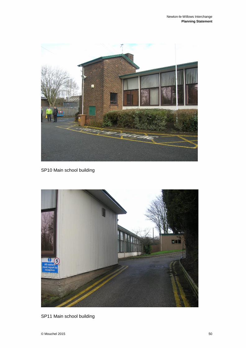
Newton-le-Willows Interchange
Planning Statement
© Mouchel 2015 50
SP10 Main school building
SP11 Main school building

Newton-le-Willows Interchange
Planning Statement
© Mouchel 2015 51
SP12 School outbuilding
SP13 School outbuilding 2

Newton-le-Willows Interchange
Planning Statement
© Mouchel 2015 52
SP14 View north east from Mill Lane (69 Mill Lane in foreground)
SP15 Newton Brook adjacent to viaduct and west of car park.

Newton-le-Willows Interchange
Planning Statement
© Mouchel 2015 53
10 Appendix 2 – Pre-Application Meeting Notes