Embed Size (px)
Citation preview
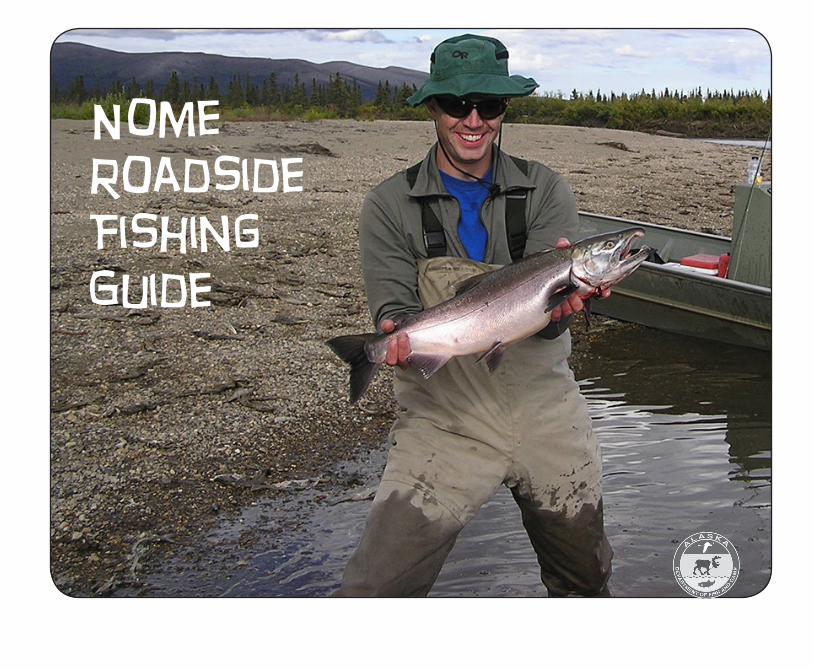
Nome Roadside Fishing Guide
Contents
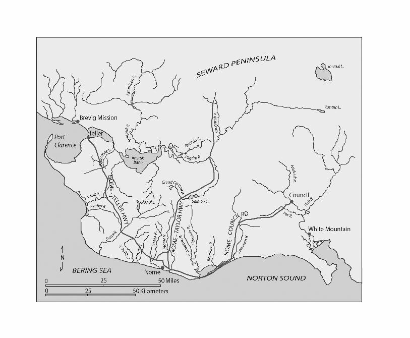
Sport Fishing Along the Nome Road System..................................................1Fishes of the Nome Area.................................................................................3Bob Blodgett Nome-Teller Highway...............................................................8Nome-Taylor Road.........................................................................................10Nome-Council Road......................................................................................12Management..................................................................................................14Map..............................................................................................................Back cover
Please note:Before Sport fishing in Nome area waters, please be sure to consult the current year’s
“Region III: Arctic-Yukon-Kuskokwim & Upper Copper/Upper Susitna RiverFishing Regulations Summary.”
You will find fishing regulations for the Nome area in the“Northwestern Drainages”
section of the regulation booklet.
RemembeR:Just because a fish is listed as present in a particular Nome area
waterway in this booklet does not mean it is legal to fish for that species.
always Consult CuRRent Regulations
1
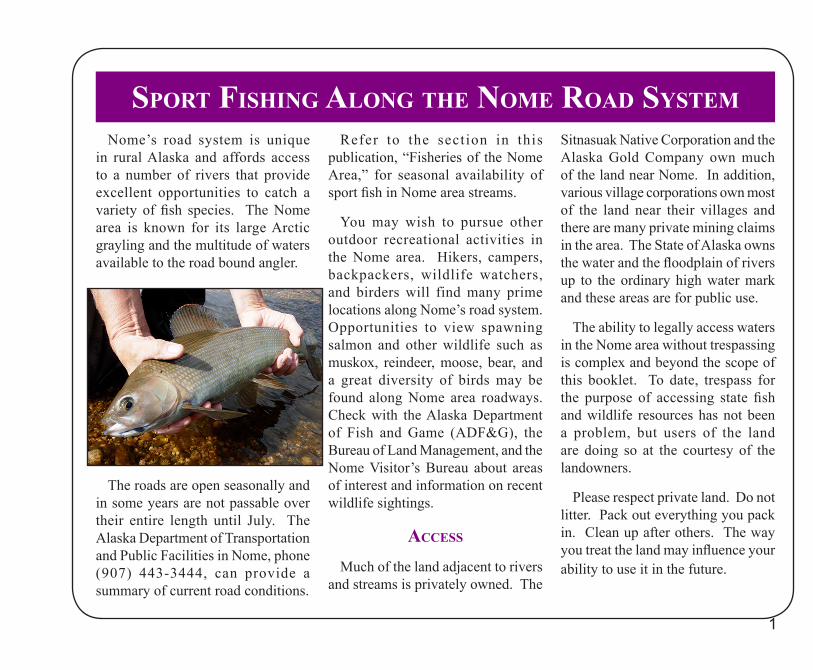
Nome’s road system is unique in rural Alaska and affords access to a number of rivers that provide excellent opportunities to catch a variety of fish species. The Nome area is known for its large Arctic grayling and the multitude of waters available to the road bound angler.
The roads are open seasonally and in some years are not passable over their entire length until July. The Alaska Department of Transportation and Public Facilities in Nome, phone (907) 443-3444, can provide a summary of current road conditions.
Refer to the section in this publication, “Fisheries of the Nome Area,” for seasonal availability of sport fish in Nome area streams.
You may wish to pursue other outdoor recreational activities in the Nome area. Hikers, campers, backpackers, wildlife watchers, and birders will find many prime locations along Nome’s road system. Opportunities to view spawning salmon and other wildlife such as muskox, reindeer, moose, bear, and a great diversity of birds may be found along Nome area roadways. Check with the Alaska Department of Fish and Game (ADF&G), the Bureau of Land Management, and the Nome Visitor’s Bureau about areas of interest and information on recent wildlife sightings.
aCCess
Much of the land adjacent to rivers and streams is privately owned. The
Sitnasuak Native Corporation and the Alaska Gold Company own much of the land near Nome. In addition, various village corporations own most of the land near their villages and there are many private mining claims in the area. The State of Alaska owns the water and the floodplain of rivers up to the ordinary high water mark and these areas are for public use.
The ability to legally access waters in the Nome area without trespassing is complex and beyond the scope of this booklet. To date, trespass for the purpose of accessing state fish and wildlife resources has not been a problem, but users of the land are doing so at the courtesy of the landowners.
Please respect private land. Do not litter. Pack out everything you pack in. Clean up after others. The way you treat the land may influence your ability to use it in the future.
sPoRt Fishing along the nome Road system
2
VehiCles in stReams
It is illegal to drive a motorized land vehicle (4X4 truck, ATV, etc.) in a salmon spawning stream. This includes all the streams on the Nome road system. There are, however, a number of “traditional fords” in the Nome area where it is legal to cross a stream with a vehicle. An example of a legal ford is the Niukluk River at Council. For a complete list of
traditional ford locations, contact ADF&G at (907) 459-7284.
season and bag limits
Currently, sport fishing is open year round. Seasons and bag limits are subject to change, so check the current regulations before you start sport fishing.
Regulations and fishing licenses are available at Eagle Quality Center, the
Alaska Commercial Store, the Nome ADF&G office, and online at:http://www.ADF&G.alaska.gov/index.cfm?ADF&G=fishingSportFishingInfo.eonr
For changes to regulations or for current emergency orders that may be in effect, check with ADF&G or visit:http://www.ADF&G.alaska.gov/index.cfm?ADF&G=SportByAreaInterior.main
3
Fishes oF the nome aRea
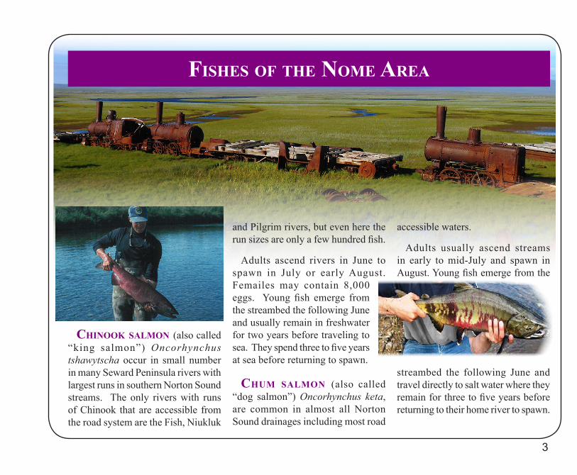
Chinook salmon (also called “king salmon”) Oncorhynchus tshawytscha occur in small number in many Seward Peninsula rivers with largest runs in southern Norton Sound streams. The only rivers with runs of Chinook that are accessible from the road system are the Fish, Niukluk
and Pilgrim rivers, but even here the run sizes are only a few hundred fish.
Adults ascend rivers in June to spawn in July or early August. Femailes may contain 8,000 eggs. Young fish emerge from the streambed the following June and usually remain in freshwater for two years before traveling to sea. They spend three to five years at sea before returning to spawn.
Chum salmon (also called “dog salmon”) Oncorhynchus keta, are common in almost all Norton Sound drainages including most road
accessible waters.
Adults usually ascend streams in early to mid-July and spawn in August. Young fish emerge from the
streambed the following June and travel directly to salt water where they remain for three to five years before returning to their home river to spawn.
4
Fishes oF the nome aRea Continued...
soCkeye salmon (also called “red salmon”) Oncorhynchus nerka, occur on the Seward Peninsula in sizable numbers only in the Pilgrim and Sinuk rivers, where they spawn in Salmon Lake and Glacial Lake.
They ascend to the lakes during late June through early August and spawn during July and August. Young fish emerge the following spring and usually spend one or two years rearing in the lake before migrating to sea. They remain at sea for two to three years before returning to their home river or lake to spawn. Small numbers of sockeye occur in most Seward Peninsula rivers.
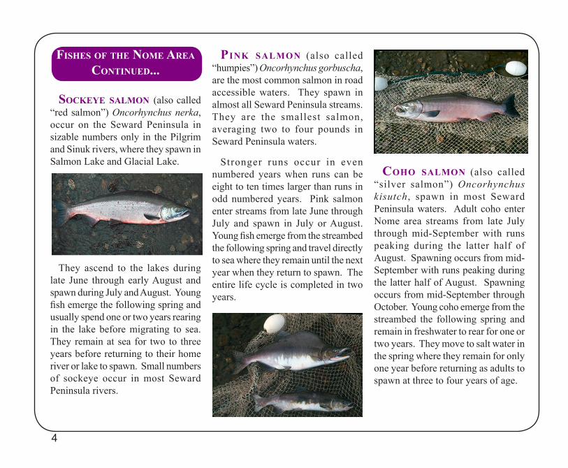
Pink salmon (also called “humpies”) Oncorhynchus gorbuscha, are the most common salmon in road accessible waters. They spawn in almost all Seward Peninsula streams. They are the smallest salmon, averaging two to four pounds in Seward Peninsula waters.
Stronger runs occur in even numbered years when runs can be eight to ten times larger than runs in odd numbered years. Pink salmon enter streams from late June through July and spawn in July or August. Young fish emerge from the streambed the following spring and travel directly to sea where they remain until the next year when they return to spawn. The entire life cycle is completed in two years.
Coho salmon (also called “silver salmon”) Oncorhynchus kisutch, spawn in most Seward Peninsula waters. Adult coho enter Nome area streams from late July through mid-September with runs peaking during the latter half of August. Spawning occurs from mid-September with runs peaking during the latter half of August. Spawning occurs from mid-September through October. Young coho emerge from the streambed the following spring and remain in freshwater to rear for one or two years. They move to salt water in the spring where they remain for only one year before returning as adults to spawn at three to four years of age.
5
Fishes oF the nome aRea Continued...
aRCtiC gRayling Thymallus arcticus, occur in most Seward Peninsula rivers. They are a freshwater species although they are sometimes found in brackish water lagoons. Grayling spawn in the spring and young emerge from the streambed after two to four weeks, depending on water temperature. Fish live in the stream for five to seven years before maturing to spawn for the
first time and usually spawn annually thereafter. Arctic grayling feed primarily on drifting stream insects and sometimes eat small fish, eggs of other fish, and even small mammals.
In the Nome area, Arctic grayling grow rapidly until becoming mature and may reach 17 inches in length by age seven or eight. Nome area grayling may live for 30 years and reach a large size. Because most populations are composed of a high proportion of old, large fish, they can easily be over-fished, and do not recover quickly. This is why the bag limits restrict the harvest of large (spawning-sized) grayling in all easily accessible waters.
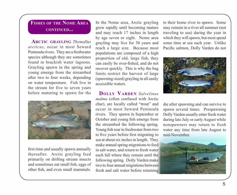
dolly VaRden Salvelinus malma (often confused with Arctic char), are locally called “trout” and occur in most Seward Peninsula rivers. They spawn in September or October and young fish emerge from the streambed the following spring. Young fish rear in freshwater from two to five years before first migrating to sea at about six inches in length. They make annual spring migrations to feed in salt water, and return to fresh water each fall where they remain until the following spring. Dolly Varden make two to four annual migrations between fresh and salt water before returning
to their home river to spawn. Some may remain in a river all summer (not traveling to sea) during the year in which they will spawn, but most spend some time at sea each year. Unlike Pacific salmon, Dolly Varden do not
die after spawning and can survive to spawn several times. Prespawning Dolly Varden usually enter fresh water during late July or early August while nonspawners may return to fresh water any time from late August to mid-November.
6
Fishes oF the nome aRea Continued...
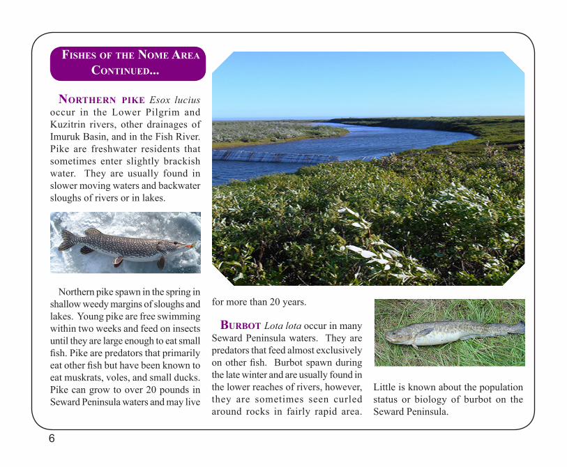
noRtheRn Pike Esox lucius occur in the Lower Pilgrim and Kuzitrin rivers, other drainages of Imuruk Basin, and in the Fish River. Pike are freshwater residents that sometimes enter slightly brackish water. They are usually found in slower moving waters and backwater sloughs of rivers or in lakes.
Northern pike spawn in the spring in shallow weedy margins of sloughs and lakes. Young pike are free swimming within two weeks and feed on insects until they are large enough to eat small fish. Pike are predators that primarily eat other fish but have been known to eat muskrats, voles, and small ducks. Pike can grow to over 20 pounds in Seward Peninsula waters and may live
for more than 20 years.
buRbot Lota lota occur in many Seward Peninsula waters. They are predators that feed almost exclusively on other fish. Burbot spawn during the late winter and are usually found in the lower reaches of rivers, however, they are sometimes seen curled around rocks in fairly rapid area.
Little is known about the population status or biology of burbot on the Seward Peninsula.
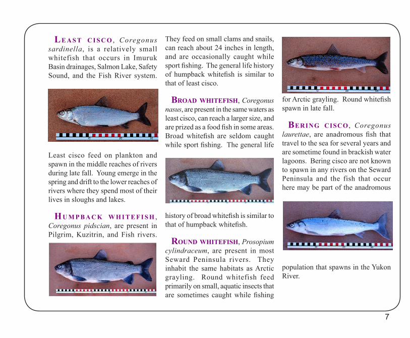
le a s t C i s C o , Coregonus sardinella, is a relatively small whitefish that occurs in Imuruk Basin drainages, Salmon Lake, Safety Sound, and the Fish River system.
Least cisco feed on plankton and spawn in the middle reaches of rivers during late fall. Young emerge in the spring and drift to the lower reaches of rivers where they spend most of their lives in sloughs and lakes.
hu m P b a C k w h i t e F i s h , Coregonus pidscian, are present in Pilgrim, Kuzitrin, and Fish rivers.
They feed on small clams and snails, can reach about 24 inches in length, and are occasionally caught while sport fishing. The general life history of humpback whitefish is similar to that of least cisco.
bRoad whiteFish, Coregonus nasus, are present in the same waters as least cisco, can reach a larger size, and are prized as a food fish in some areas. Broad whitefish are seldom caught while sport fishing. The general life
history of broad whitefish is similar to that of humpback whitefish.
Round whiteFish, Prosopium cylindraceum, are present in most Seward Peninsula rivers. They inhabit the same habitats as Arctic grayling. Round whitefish feed primarily on small, aquatic insects that are sometimes caught while fishing
for Arctic grayling. Round whitefish spawn in late fall.
beRing CisCo , Coregonus laurettae, are anadromous fish that travel to the sea for several years and are sometime found in brackish water lagoons. Bering cisco are not known to spawn in any rivers on the Seward Peninsula and the fish that occur here may be part of the anadromous
population that spawns in the Yukon River.
7
bob blodgett nome-telleR highway
the bob blodgett nome-telleR highway, also known as the Nome-Teller Road or the Teller Road, begins in Nome and roughly parallels the southern coastline of the Seward Peninsula for 72 miles to Teller. It crosses a number of rivers that drain the south side of the Kigluaik Mountains and enter directly into the Bering Sea.
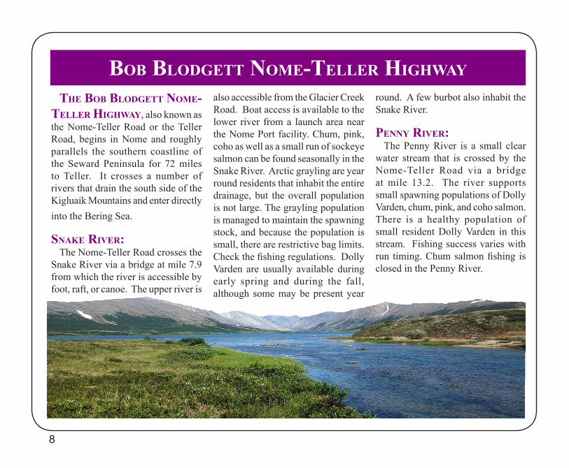
snake RiVeR:The Nome-Teller Road crosses the
Snake River via a bridge at mile 7.9 from which the river is accessible by foot, raft, or canoe. The upper river is
also accessible from the Glacier Creek Road. Boat access is available to the lower river from a launch area near the Nome Port facility. Chum, pink, coho as well as a small run of sockeye salmon can be found seasonally in the Snake River. Arctic grayling are year round residents that inhabit the entire drainage, but the overall population is not large. The grayling population is managed to maintain the spawning stock, and because the population is small, there are restrictive bag limits. Check the fishing regulations. Dolly Varden are usually available during early spring and during the fall, although some may be present year
round. A few burbot also inhabit the Snake River.
Penny RiVeR:The Penny River is a small clear
water stream that is crossed by the Nome-Teller Road via a bridge at mile 13.2. The river supports small spawning populations of Dolly Varden, chum, pink, and coho salmon. There is a healthy population of small resident Dolly Varden in this stream. Fishing success varies with run timing. Chum salmon fishing is closed in the Penny River.
8
9
bob blodgett nome-telleR hwy Continued...
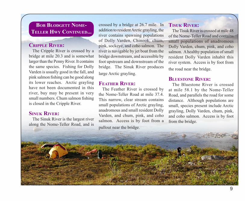
CRiPPle RiVeR:The Cripple River is crossed by a
bridge at mile 20.3 and is somewhat larger than the Penny River. It contains the same species. Fishing for Dolly Varden is usually good in the fall, and pink salmon fishing can be good along its lower reaches. Arctic grayling have not been documented in this river, buy may be present in very small numbers. Chum salmon fishing is closed in the Cripple River.
sinuk RiVeR:The Sinuk River is the largest river
along the Nome-Teller Road, and is
crossed by a bridge at 26.7 mile. In addition to resident Arctic grayling, the river contains spawning populations of Dolly Varden, Chinook, chum, pink, sockeye, and coho salmon. The river is navigable by jet boat from the bridge downstream, and accessible by foot upstream and downstream of the bridge. The Sinuk River produces large Arctic grayling.
FeatheR RiVeR:The Feather River is crossed by
the Nome-Teller Road at mile 37.4. This narrow, clear stream contains small populations of Arctic grayling, anadromous and small resident Dolly Varden, and chum, pink, and coho salmon. Access is by foot from a pullout near the bridge.
tisuk RiVeR:The Tisuk River is crossed at mile 48
of the Nome-Teller Road and contains small populations of anadromous Dolly Varden, chum, pink, and coho salmon. A healthy population of small resident Dolly Varden inhabit this river system. Access is by foot from the road near the bridge.
bluestone RiVeR:The Bluestone River is crossed
at mile 58.1 by the Nome-Teller Road, and parallels the road for some distance. Although populations are small, species present include Arctic grayling, Dolly Varden, chum, pink, and coho salmon. Access is by foot from the bridge.
the nome-tayloR Road, also known as the Kougarok Road, begins in Nome via either the Beam Road or the Anvil Mountain Bypass. Both meet near Dexter about eight miles from Nome and continue north along the Nome River upstream to its source. The road then crosses a low pass to Salmon Lake. A campground courtesy of the Bureau of Land Management is located at the outlet of Salmon Lake at the source of the Pilgrim River. The road parallels the Upper Pilgrim River, which is visible at various distances from the road. After crossing the Pilgrim River at mile 65, it continues for about three miles to the Kuzitrin River. The road extends another 18 miles and crosses the Kougarok River which is the limit of travel for two wheel drive vehicles.
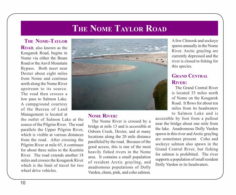
nome RiVeR:The Nome River is crossed by a
bridge at mile 13 and is accessible at Osborn Creek, Dexter, and at many locations along the 20 mile distance paralleled by the road. Because of the good access, this is one of the most heavily fished rivers in the Nome area. It contains a small population of resident Arctic grayling, and anadromous populations of Dolly Varden, chum, pink, and coho salmon.
A few Chinook and sockeye spawn annually in the Nome River. Arctic grayling are currently depressed and the river is closed to fishing for this species.
gRand CentRal RiVeR:
The Grand Central River is located 35 miles north of Nome on the Kougarok Road. It flows for about ten miles from its headwaters to Salmon Lake and is
accessible by foot from a pullout near the bridge about one mile from the lake. Anadromous Dolly Varden spawn in this river and Arctic grayling are sometimes present. Coho and sockeye salmon also spawn in the Grand Central River, but fishing for salmon is prohibited. The river supports a population of small resident Dolly Varden in its headwaters.
10
the nome tayloR Road
the nome-tayloR Road Continued...
salmon lake:The Kougarok Road parallels
Salmon Lake’s northwestern shore for about 8 miles with small spur roads providing lake access. The best access is at the lake outlet, the source of the Pilgrim River, where the Bureau of Land Management maintains a campground picnic area. The lake contains Arctic grayling, anadromous Dolly Varden, least cisco, round whitefish, and a few burbot. Sockeye salmon spawn in the lake, however, sport fishing for all salmon is prohibited in Salmon Lake.
PilgRim RiVeR:The Kougarok Road parallels the
Pilgrim River for 19 miles from Salmon Lake to the bridge at mile 65. The road is usually some distance from the river, and access is available only in a few locations. You can access the source of the river at the BLM campground at the outlet of Salmon Lake. Rafts or canoes may be launched for a float of the upper river
from the outlet of Salmon Lake to the road crossing. Boats may be launched just downstream from the bridge, and the river is navigable from the bridge downstream to Imruk Basin (about 34 river miles). The Lower Pilgrim River has numerous sloughs and lakes that provide fishing for northern pike.
Access is also possible by foot upstream and downstream from the bridge. Fish species present in the Pilgrim River include year-round resident Arctic grayling, whitefish, burbot, and northern pike, anadromous Dolly Varden, Chinook, sockeye, chum, pink, and coho salmon. Fishing varies with the run timing of various species. Sockeye abundance has increased in recent years, however the abundance of Arctic graying is relatively low, and a more restrictive bag limit of two per day with only one over 15 inches is in place on the Pilgrim River.
kuzitRin RiVeR:The Kuzitrin River is crossed by the
road at mile 68 and is navigable by jet boat both upstream and downstream from the bridge. The river is about the
same size as the Pilgrim River but is very shallow and contains the same species. Northern pike are present upstream and downstream from the bridge. Northern pike are present upstream and downstream from the bridge, and large numbers of whitefish and longnose suckers reside in this slower moving river.
kougaRok RiVeR:Past the bridge over the Kuzitrin
River, the Kougarok Road parallels the Kougarok River eventually crossing it via a bridge at mile 86. This is the functional limit of travel on this road, although 4-wheel drive vehicles may travel farther. The Kougarok River contains populations of resident Arctic grayling and anadromous Dolly Varden. This river may be floated from the bridge downstream to the Kuzitrin River road crossing, but the river is shallow and slow moving.
11
12
the nome-CounCil Road
the nome-CounCil Road, also known as the Council Road, begins at Nome and stretches for about 73 miles to the old mining town of Council located on the north bank of the Niukluk River. The road parallels about 35 miles of Norton Sound coastline along the beach berm separating Safety Sound from the sea. The road then turns inland along the Solomon River and follows the East Fork of the Solomon River over Skookum Pass down into the Fox River drainage before ending on the south bank of the Niukluk River at Council.
nome RiVeR mouth:The Nome-Council Road crosses
the Nome River just upstream from the lagoon about three miles east of Nome. There is access to the mouth of the river about one half miles west of the bridge, and also through Fort Davis, a historic military outpost located on the Bering Sea coast just
east of the Nome River mouth. Fishing near the mouth of the river is primarily for anadromous salmon and Dolly Varden, although starry flounder can also be taken there. A pull out near the bridge provides access to the immediate vicinity, and a small road about 1/8-mile past the bridge provides access to a popular upriver pool. This gated road also leads to the VOR aircraft navigational aid and is sometimes closed. The Nome River is closed to sport fishing for Arctic grayling.
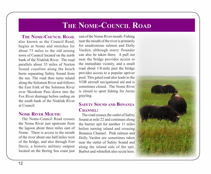
saFety sound and bonanza Channel:
The road crosses the outlet of Safety Sound at mile 22 and continues along the barrier spit for another 11 miles before turning inland and crossing Bonanza Channel. Pink salmon and Dolly Varden are sometimes taken near the outlet of Safety Sound and along the inland side of the spit. Burbot and whitefish also occur here.
the nome-CounCil Road Continued...
In the fall this is a popular fishing area for saffron cod. Boats may be launched in Safety Sound and Bonanza Channel to access the Bonanza, Flambeau, and Eldorado rivers.
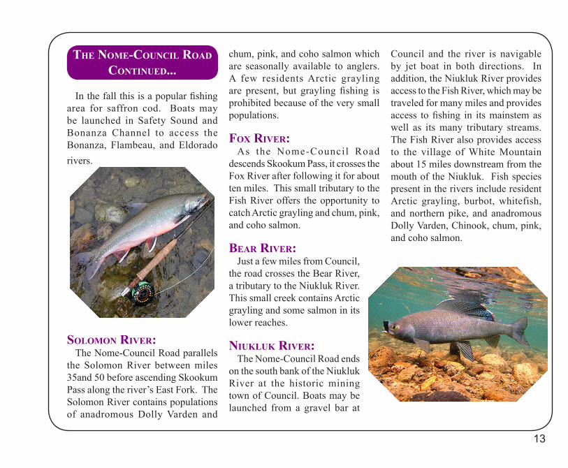
solomon RiVeR:The Nome-Council Road parallels
the Solomon River between miles 35and 50 before ascending Skookum Pass along the river’s East Fork. The Solomon River contains populations of anadromous Dolly Varden and
chum, pink, and coho salmon which are seasonally available to anglers. A few residents Arctic grayling are present, but grayling fishing is prohibited because of the very small populations.
Fox RiVeR:As the Nome-Council Road
descends Skookum Pass, it crosses the Fox River after following it for about ten miles. This small tributary to the Fish River offers the opportunity to catch Arctic grayling and chum, pink, and coho salmon.
beaR RiVeR:Just a few miles from Council,
the road crosses the Bear River, a tributary to the Niukluk River. This small creek contains Arctic grayling and some salmon in its lower reaches.
niukluk RiVeR:The Nome-Council Road ends
on the south bank of the Niukluk River at the historic mining town of Council. Boats may be launched from a gravel bar at
Council and the river is navigable by jet boat in both directions. In addition, the Niukluk River provides access to the Fish River, which may be traveled for many miles and provides access to fishing in its mainstem as well as its many tributary streams. The Fish River also provides access to the village of White Mountain about 15 miles downstream from the mouth of the Niukluk. Fish species present in the rivers include resident Arctic grayling, burbot, whitefish, and northern pike, and anadromous Dolly Varden, Chinook, chum, pink, and coho salmon.
13
Sport fisheries in Alaska are primarily managed with daily bag and possession limits. A daily bag limit is the number of a given species that can be harvested in a calendar day. A possession limit is the number of a given species that can be possessed in an unpreserved state. A fish is considered “preserved” if, in a given state of preservation, it is fit for human consumptions after a 15-day period and does not include unfrozen fish temporarily stored in coolers that contain ice, dry ice, or fish that is lightly salted.
salmon: Salmon populations are managed to achieve a given level of spawners in each stream. The number of salmon that escape commercial, sport, and subsistence fisheries to spawn in rivers is called “escapement.” Escapement goals by species and river are calculated by the Department using historic spawner, harvest, and return data, and reviewed
by the Alaska Board of Fisheries.
Escapement goals have not yet been established and approved for all species and rivers in the Nome area. In cases where there is not a formal escapement goal, the Department uses an average of historic escapements as target numbers. Salmon are counted at towers and weirs on the major spawning streams throughout Norton Sound. These numbers are compared to historical passage and to the escapement goal for that species on a daily basis as the runs progress. If it appears that a goal in a particular stream will not be met, the Department has the ability to adjust harvests from various fisheries by emergency order.
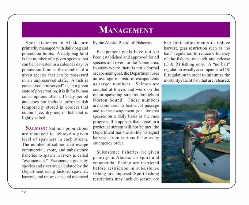
Subsistence fisheries are given priority in Alaska, so sport and commercial fishing are restricted before restriction in subsistence fishing are imposed. Sport fishing restrictions may include season ore
bag limit adjustments to reduce harvest, gear restriction such as “no bait” regulation to reduce efficiency of the fishery, or catch and release (C & R) fishing only. A “no bait” regulation usually accompanies a C & R regulation in order to minimize the mortality rate of fish that are released.
14
management

aRCtiC gRayling:Arctic grayling populations are
managed to maintain a given number of spawning-size fish (over 15 inches) in each river. Mark-recapture techniques have been used to estimate the number and size composition of Arctic grayling in the major streams near Nome since the early 1990s. The results of several estimates from each river were used to establish a baseline population in terms of abundance and size that the Department would like to maintain in each stream.
Streams are currently assessed every f ive or six years and the results are compared to this baseline. Should abundance fall below the desired level for a given stream, the Department will amend the bag limit for that stream to reduce harvests until the population recovers to baseline levels. The results of this work has been
different harvest regulations for different streams. Thus far, this approach to management is working in the Nome area.
Arctic grayling are resident in Nome area streams and this area produces large grayling, but they
do not reach large sizes quickly. However, grayling in this area grow rapidly and reach maturity at 16 or 17 inches in seven to eight years. After reaching maturity, growth slows averaging only about 1/4 inch
per year. The result is that it takes many years for fish to reach 20 inches in length. Once reaching maturity grayling experience very low levels of annual natural mortality. They may live for 30 years and are typically sustained with low levels of annual recruitment of small fish.
S u c h p o p u l a t i o n s cannot to lera te h igh levels of exploitations, and when overharvested it takes many years for a population to recover.
An example of this i s t h e N o m e R i v e r grayling population that was reduced prior to our first mark-recapture estimates in 1990 to 1991. Knowledge of the low number of fish in the river
resulted in a complete closure to Arctic grayling fishing. Continuing studies have found that the population had not recovered as of 2010. It will likely take many years for the population to rebuild to a level where fishing will be allowed.
15
CatCh and Release:Some fisheries are managed with
catch & release (C&R) regulations. In other fisheries, anglers choose to practice C&R fishing. In some fisheries the practice of C&R has improved catch rates and the average size of fish.
Most Arctic grayling populations in the Nome area have sustained a limited harvest over the years. Anglers
wishing to harvest a legal bag limit of Arctic grayling may either fish for a short time and harvest the first fish captured, or selectively harvest fish from their catch by practicing C&R. Other anglers may choose not to harvest any fish, but practice C&R.
Most anglers are concerned about the fish populations and the effects of their angling practices on those fish landed and released. Most scientific studies of C&R on trout, grayling, and char have found that almost all of those fish released will survive. Nevertheless, C&R can result in fish dying if they are hooked in the gills or stomach as is sometimes the case while fishing with bait.
Extensive or rough handling decreases the chance of a fish surviving and the longer that a fish is held out of the water, the poorer its chances of survival. Fish become more stressed and exhausted when water temperatures are high. The more
quickly a fish is landed, the greater its chances of surviving when released, especially if the water is warm.
C&R is sometimes used as a management measure when harvest must be minimized to preserve the opportunity to fish in a particular water. In most Alaskan situations C&R is a voluntary measure that anglers take as they move away from harvest as the primary motivation
for fishing. Those that do harvest, sometimes practice C&R during their angling experience. In either case, anglers should be aware of methods that minimize the impact of C&R on the fish they release.
16
Reach us on the web at:http://www.ADF&G.alaska.gov/index.cfm?ADF&G=SportByAreaInterior.main
Nome area fishing regulations are posted on the web and can be viewed by clicking the link for “Regulations” on the above website.
Emergency orders are also posted and updated daily on our website.
ADF&G administers all programs and activities in compliance with state and federal civil rights and equal opportunity laws. Obtain the full ADF&G and Americans with Disabilities Act and Office of Equal Opportunity statement online at www.ADF&G.state.ak.us or from the ADF&G Public Communications Section at 907-465-6166.
Regional Office:Alaska Department of Fish & Game1300 College Rd.Fairbanks, AK 99701
Nome Field Office:103 Front StreetPouch 1148Nome, Alaska 99762
This brochure was produced by the Alaska Department of Fish & GameDivision of Sport Fish, Region III
(Includes the Arctic-Yukon-Kuskokwim and Upper Copper/Upper Susitna River areas)
©2013. Alaska Department of Fish & Game. All rights reserved. Photographs in this brochure are the property of ADF&G