Embed Size (px)
Citation preview
NORFES Co. Capt. Victor Y. Vanyukov
MARITIME SAFETY SYSTEMS on Russian Pacific Coast
General director
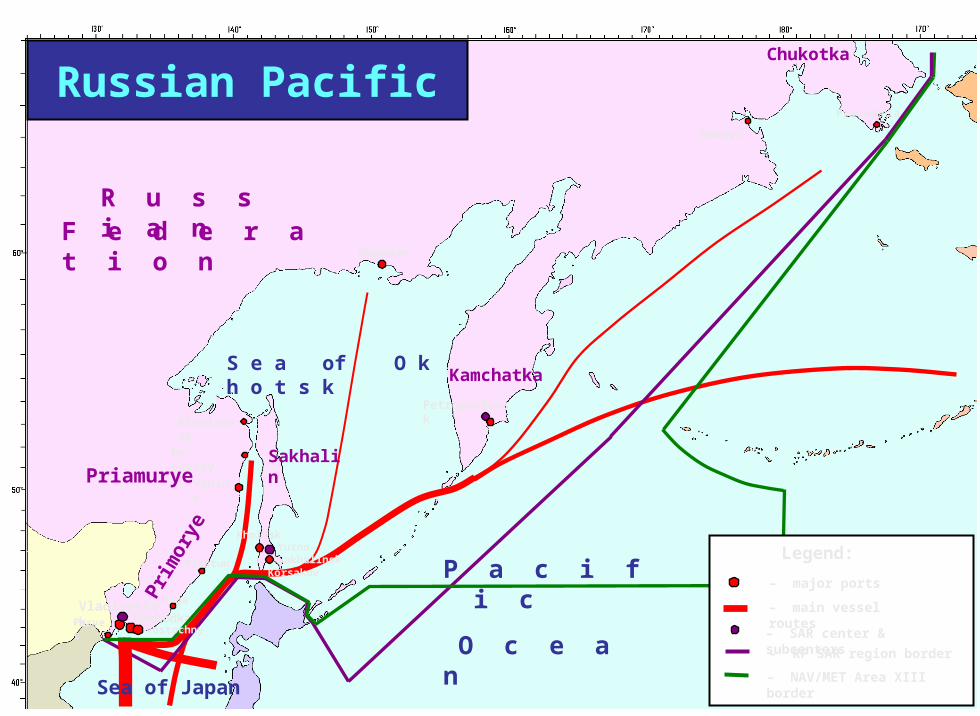
Magadan
VladivostokNakhodka
Vanino
De-Castry
Olga
Plastun
Posyet
Anadyr
Nikolaevsk
Providenia
B e r i n g S e a
Sakhalin
Kamchatka
P a c i f i c
O c e a n
S e a of O k h o t s k
Sea of Japan
Chukotka
Pri
mor
ye
Vostochny
Petropavlovsk
Priamurye
Korsakov
KholmskYuzno-Sakhalinsk
– SAR center & subcenters
– major ports
– main vessel routes
– NAV/MET Area XIII border
Legend:
– RF SAR region border
Russian Pacific
R u s s i a nF e d e r a t i o n
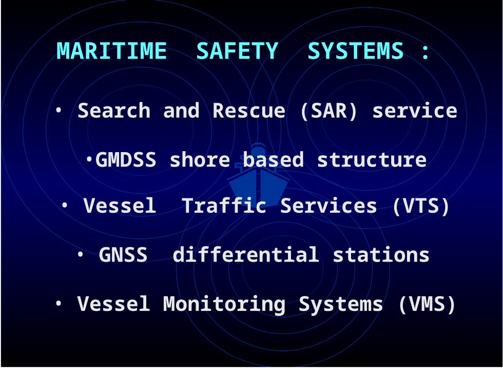
•GMDSS shore based structure
• GNSS differential stations
• Search and Rescue (SAR) service
• Vessel Monitoring Systems (VMS)
• Vessel Traffic Services (VTS)
MARITIME SAFETY SYSTEMS :
Magadan
VladivostokNakhodka
Vanino
De-Castry
Kholmsk
Olga
Plastun
Posyet
Yuzno-Sakhalinsk
Anadyr
Nikolaevsk
Providenia
– SAR center & subcenters
– RF SAR region border
B e r i n g S e a
Sakhalin
Kamchatka
P a c i f i c
O c e a n
S e a o f O k h o t s k
Sea of Japan
Chukotka
Pri
mor
yeR u s s i a n
F e d e r a t i o n
Vostochny
Petropavlovsk
Priamurye
Korsakov
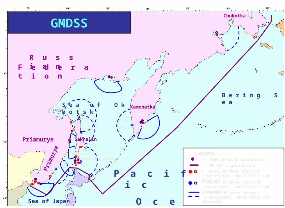
Legend:
Nevelsk
Poronaisk
Nogliki
Okha
Oktiabrsky
– GMDSS A1 Base stations (operational, under trial and planned)
– GMDSS A2 Base stations (operational, under trial and planned)
– GMDSS A2 Area borders (operational, under trial and planned)
GMDSS
Magadan
VladivostokNakhodka
Vanino
De-Castry
Kholmsk
Olga
Plastun
Posyet
Anadyr
Nikolaevsk
Providenia
B e r i n g S e a
Sakhalin
Kamchatka
P a c i f i c
O c e a n
S e a of O k h o t s k
Sea of Japan
Chukotka
Pri
mor
ye
Vostochny
Petropavlovsk
Priamurye
Korsakov
Okhotsk
Nogliki
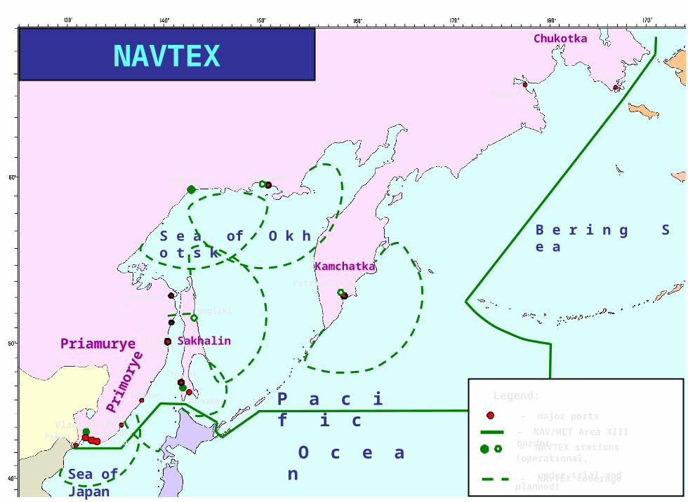
NAVTEX
– major ports
– NAV/MET Area XIII border
Legend:
– NAVTEX stations (operational,
under trial and planned)
– NAVTEX coverage
Magadan
VladivostokNakhodka
Vanino
De-Castry
Kholmsk
Olga
Plastun
Posyet
Anadyr
Nikolaevsk
Providenia
B e r i n g S e a
Sakhalin
Kamchatka
P a c i f i c O c e a n
S e a of O k h o t s k
Sea of Japan
Chukotka
Pri
mor
ye
Vostochny
Petropavlovsk
Priamurye
Korsakov
Zarubino
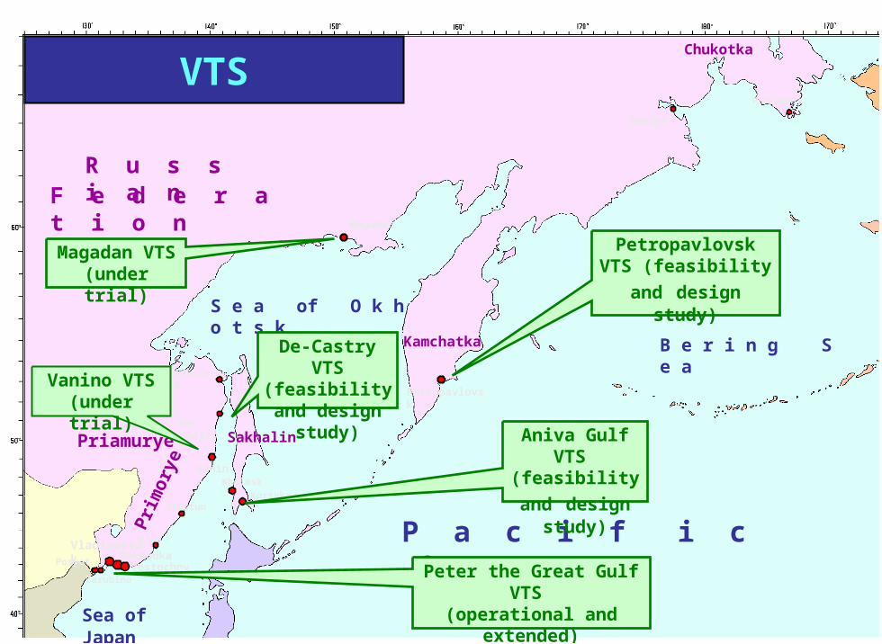
Magadan VTS(under trial)
Vanino VTS(under trial)
De-Castry VTS(feasibility and design study)
Peter the Great Gulf VTS (operational and
extended)
Aniva Gulf VTS
(feasibility and design study)
Petropavlovsk VTS
(feasibility and design study)
R u s s i a nF e d e r a t i o n
VTS
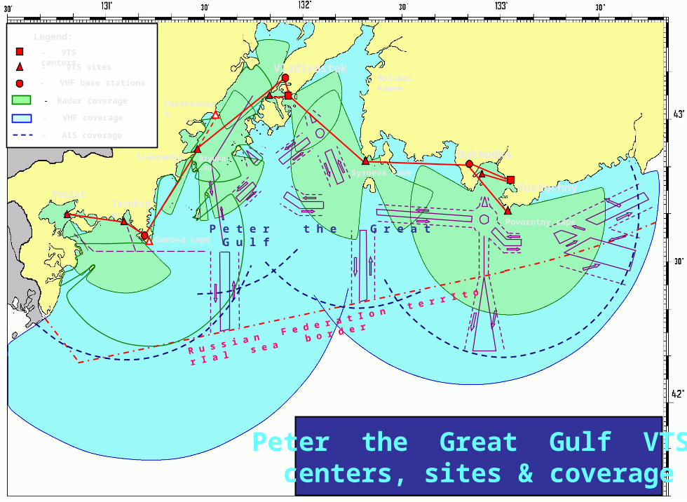
P e t e r t h e G r e a t G u l f
Vladivostok
Nakhodka
Vostochny
Gamova cape
Povorotny cape
Sysoeva cape
Bolshoi Kamen
Slavyanka
ZarubinoPosiet
Bryusa cape
R u s s i a n F e d e r a t I o n t e r r I t o r I a l s e a b o r d e r
Perevoznaya
Legend:
- VTS centers
- VHF base stations
- Radar coverage
- VHF coverage
- VTS sites
- AIS coverage
Peter the Great Gulf VTS:centers, sites & coverage
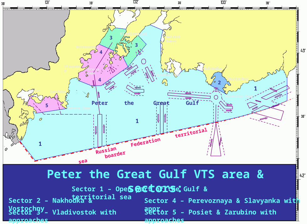
Peter the Great Gulf
Vladivostok
Nakhodka
Vostochny
Gamova Cape
Povorotny Cape
Sysoeva Cape
Bolshoi Kamen
Slavyanka
ZarubinoPosiet
Bryusa Cape
Russian Federation territorial sea boarder
1
1
1
2
3
3
4
4
5
Perevoznaya
Sector 1 – Open part of the Gulf & territorial sea
Sector 3 – Vladivostok with approaches Sector 5 – Posiet & Zarubino with approaches
Sector 4 – Perevoznaya & Slavyanka with appr.
Peter the Great Gulf VTS area & sectors:
Sector 2 – Nakhodka & Vostochny
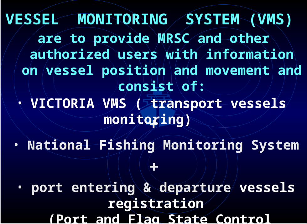
+
+
• VICTORIA VMS ( transport vessels monitoring)
• port entering & departure vessels registration (Port and Flag State Control function)
• National Fishing Monitoring System
VESSEL MONITORING SYSTEM (VMS) are to provide MRSC and other authorized
users with information on vessel position and movement and consist of:
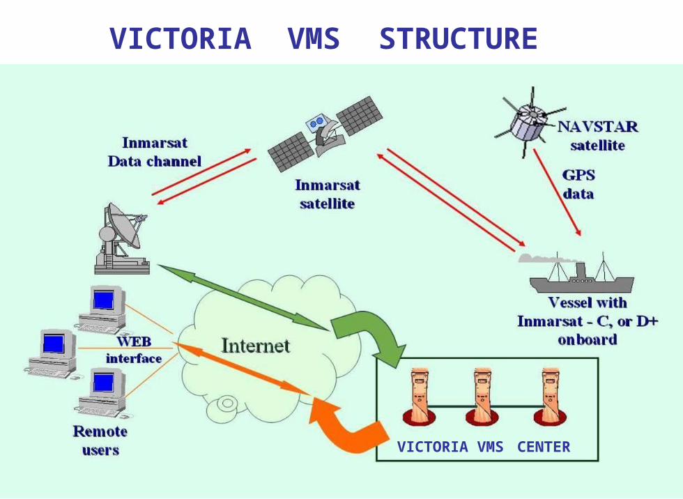
VICTORIA VMS STRUCTURE
VICTORIA VMS CENTER
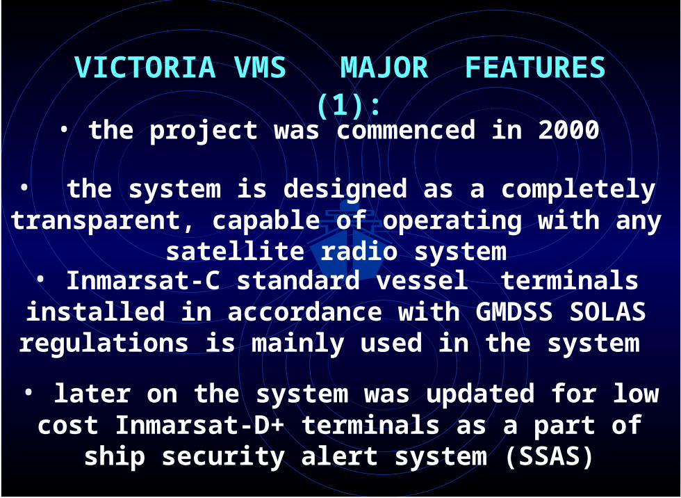
• the system is designed as a completely transparent, capable of operating with any satellite radio system
• later on the system was updated for low cost Inmarsat-D+ terminals as a part of ship security alert
system (SSAS)
• the project was commenced in 2000
• Inmarsat-C standard vessel terminals installed in accordance with GMDSS SOLAS regulations is mainly
used in the system
VICTORIA VMS MAJOR FEATURES (1):
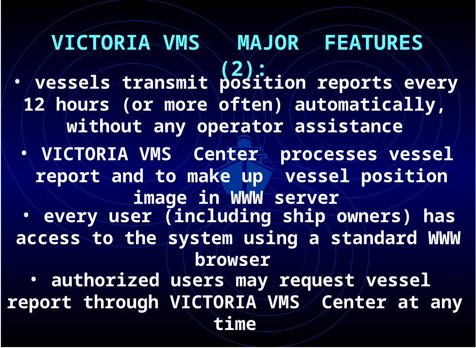
• vessels transmit position reports every 12 hours (or more often) automatically, without any operator
assistance
VICTORIA VMS MAJOR FEATURES (2):
• VICTORIA VMS Center processes vessel report and to make up vessel position image in WWW server
• every user (including ship owners) has access to the system using a standard WWW browser
• authorized users may request vessel report through VICTORIA VMS Center at any time
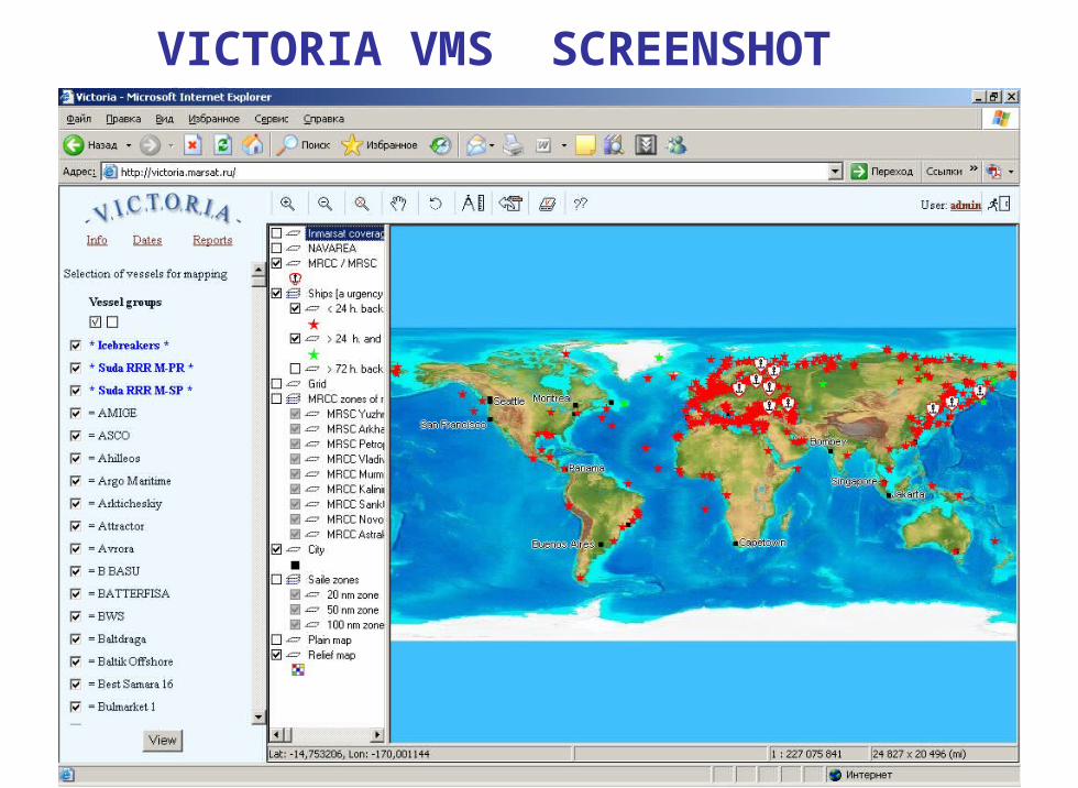
VICTORIA VMS SCREENSHOT (1)
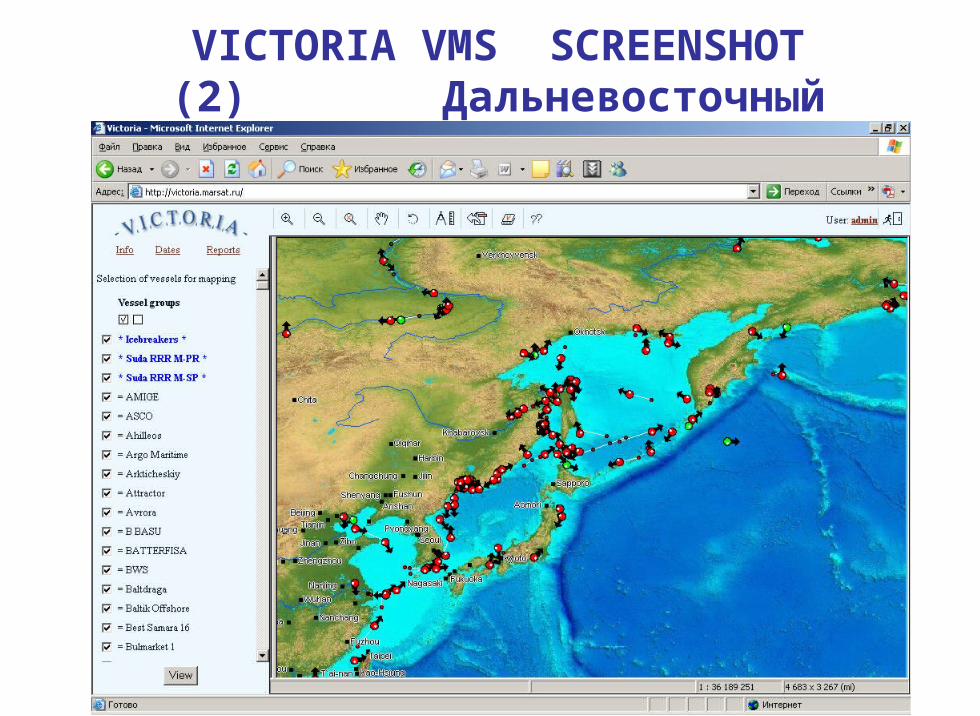
VICTORIA VMS SCREENSHOT (2)
Дальневосточный бассейн
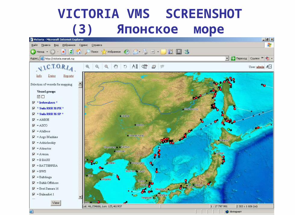
VICTORIA VMS SCREENSHOT (3) Японское море
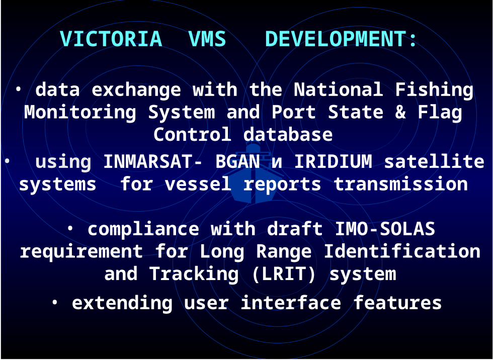
• using INMARSAT- BGAN и IRIDIUM satellite systems for vessel reports transmission
• extending user interface features
• data exchange with the National Fishing Monitoring System and Port State & Flag Control database
• compliance with draft IMO-SOLAS requirement for Long Range Identification and Tracking (LRIT) system
VICTORIA VMS DEVELOPMENT:
NORFES Co. Capt. Victor Y. Vanyukov
MARITIME SAFETY SYSTEMS on Russian Pacific Coast
General director
THANK YOU