Embed Size (px)
Citation preview
NORTHERN IRELAND COUNTRYSIDE SURVEY AND HNV FARMLAND
Richard Weyl and Mark WrightBiodiversity Unit Northern Ireland Environment Agency
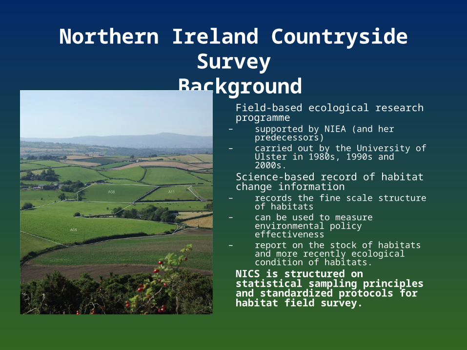
Northern Ireland Countryside Survey Background
• Field-based ecological research programme
– supported by NIEA (and her predecessors)
– carried out by the University of Ulster in 1980s, 1990s and 2000s.
• Science-based record of habitat change information
– records the fine scale structure of habitats – can be used to measure environmental
policy effectiveness– report on the stock of habitats and more
recently ecological condition of habitats.• NICS is structured on statistical
sampling principles and standardized protocols for habitat field survey.
NICS Methods
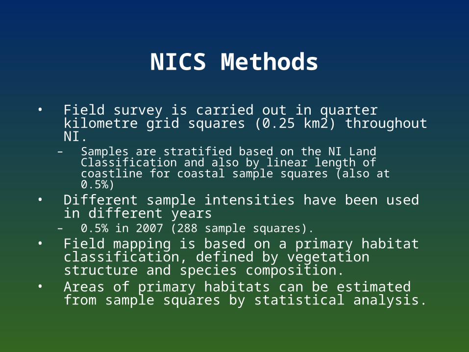
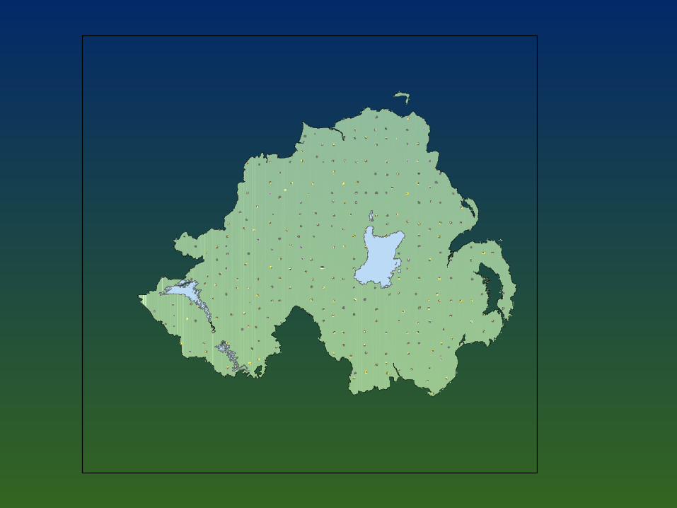
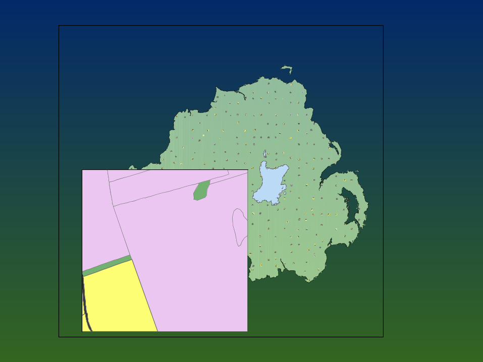
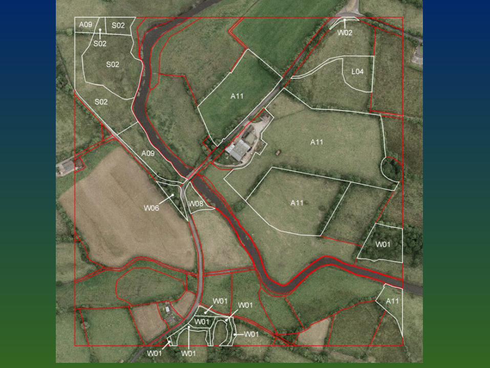
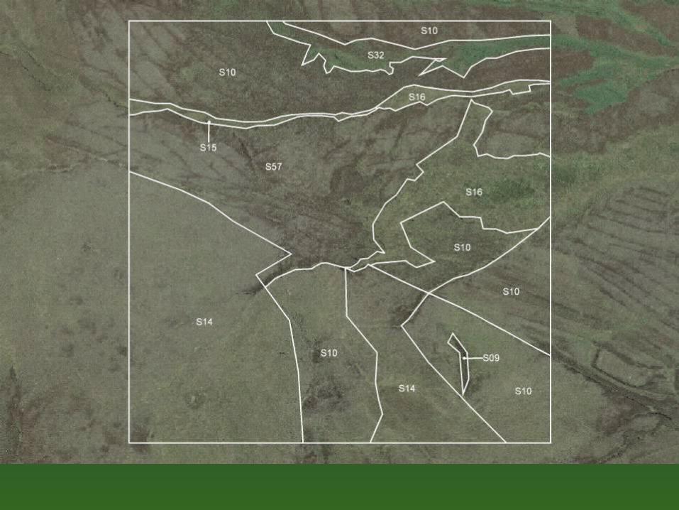
• Field survey is carried out in quarter kilometre grid squares (0.25 km2) throughout NI.
– Samples are stratified based on the NI Land Classification and also by linear length of coastline for coastal sample squares (also at 0.5%)
• Different sample intensities have been used in different years
– 0.5% in 2007 (288 sample squares). • Field mapping is based on a primary habitat
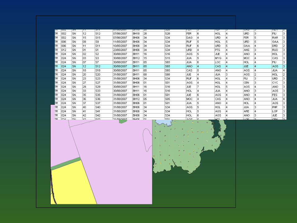
classification, defined by vegetation structure and species composition.
• Areas of primary habitats can be estimated from sample squares by statistical analysis.
Results
• Only a part of the data has been analysed• Publications
– NICS 2007: Broad habitat change 1998-2007– NICS 2007: Field boundaries summary 1998-2007– Semi-natural habitat analysis (in house)– NI State of Biodiversity Report 2010 (in prep)
• Website– http://www.doeni.gov.uk/niea/index/publications.htm
Status of HNV farmlandBroad habitats
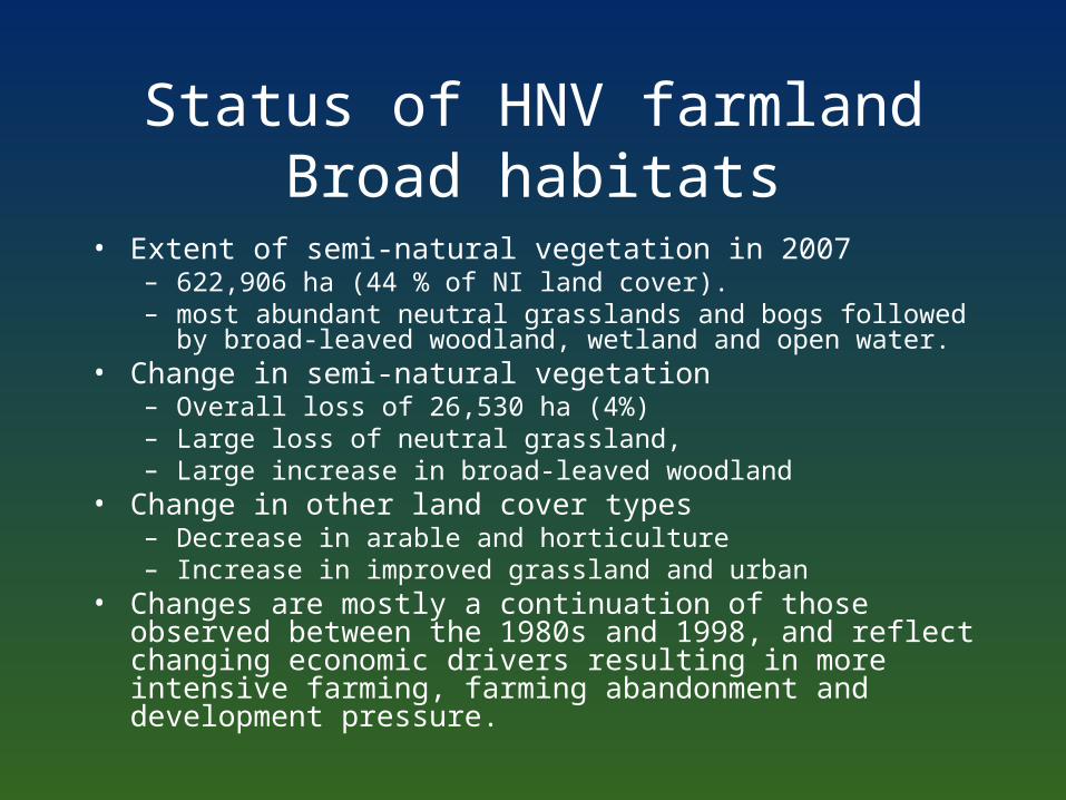
• Extent of semi-natural vegetation in 2007– 622,906 ha (44 % of NI land cover). – most abundant neutral grasslands and bogs followed by broad-
leaved woodland, wetland and open water. • Change in semi-natural vegetation
– Overall loss of 26,530 ha (4%)– Large loss of neutral grassland, – Large increase in broad-leaved woodland
• Change in other land cover types– Decrease in arable and horticulture – Increase in improved grassland and urban
• Changes are mostly a continuation of those observed between the 1980s and 1998, and reflect changing economic drivers resulting in more intensive farming, farming abandonment and development pressure.
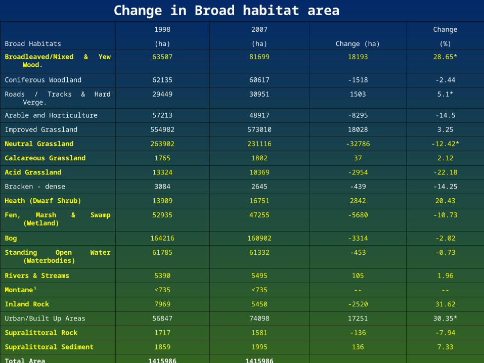
Change in Broad habitat area
Broad Habitats
1998 2007
Change (ha)
Change
(ha) (ha) (%)
Broadleaved/Mixed & Yew Wood. 63507 81699 18193 28.65*
Coniferous Woodland 62135 60617 -1518 -2.44
Roads / Tracks & Hard Verge. 29449 30951 1503 5.1*
Arable and Horticulture 57213 48917 -8295 -14.5
Improved Grassland 554982 573010 18028 3.25
Neutral Grassland 263902 231116 -32786 -12.42*
Calcareous Grassland 1765 1802 37 2.12
Acid Grassland 13324 10369 -2954 -22.18
Bracken - dense 3084 2645 -439 -14.25
Heath (Dwarf Shrub) 13909 16751 2842 20.43
Fen, Marsh & Swamp (Wetland) 52935 47255 -5680 -10.73
Bog 164216 160902 -3314 -2.02
Standing Open Water (Waterbodies)
61785 61332 -453 -0.73
Rivers & Streams 5390 5495 105 1.96
Montane¹ <735 <735 -- --
Inland Rock 7969 5450 -2520 31.62
Urban/Built Up Areas 56847 74098 17251 30.35*
Supralittoral Rock 1717 1581 -136 -7.94
Supralittoral Sediment 1859 1995 136 7.33
Total Area 1415986 1415986
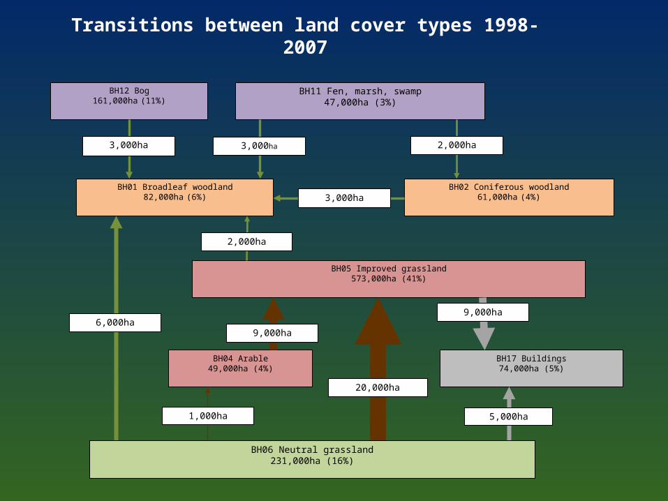
BH02 Coniferous woodland61,000ha (4%)
BH01 Broadleaf woodland82,000ha (6%)
BH11 Fen, marsh, swamp47,000ha (3%)
BH12 Bog161,000ha (11%)
BH05 Improved grassland573,000ha (41%)
BH04 Arable49,000ha (4%)
BH17 Buildings74,000ha (5%)
3,000ha
3,000ha
3,000ha
2,000ha
2,000ha
9,000ha
9,000ha
20,000ha
5,000ha1,000ha
6,000ha
BH06 Neutral grassland231,000ha (16%)
Transitions between land cover types 1998-2007
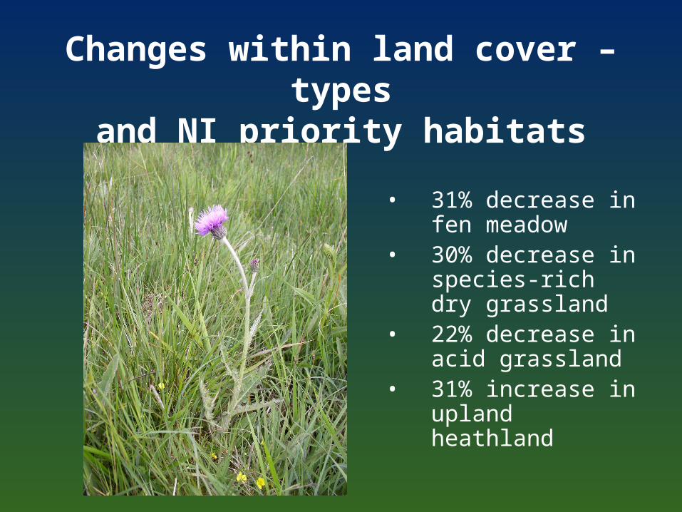
Changes within land cover –typesand NI priority habitats
• 31% decrease in fen meadow
• 30% decrease in species-rich dry grassland
• 22% decrease in acid grassland
• 31% increase in upland heathland
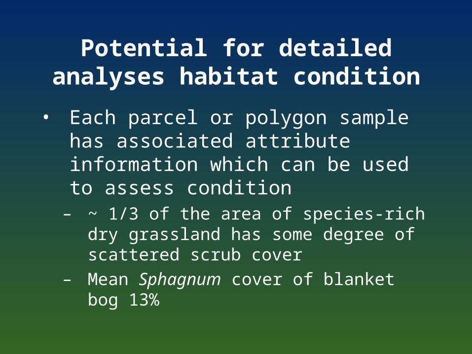
Potential for detailed analyses habitat condition
• Each parcel or polygon sample has associated attribute information which can be used to assess condition
– ~ 1/3 of the area of species-rich dry grassland has some degree of scattered scrub cover
– Mean Sphagnum cover of blanket bog 13%
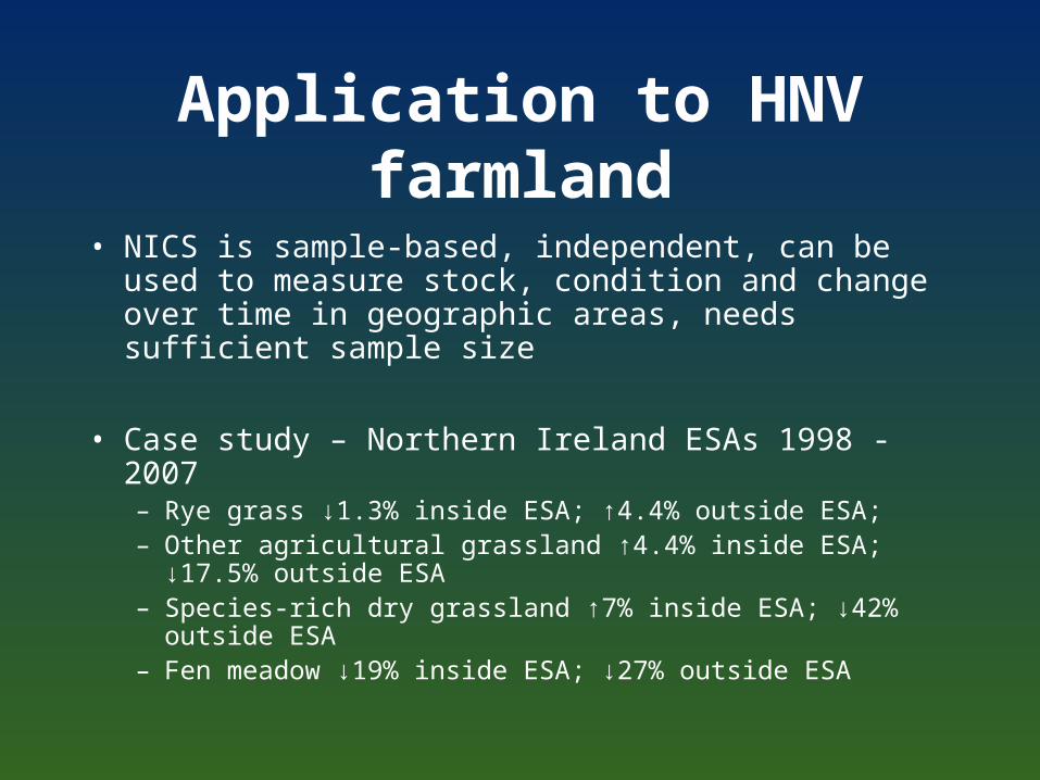
Application to HNV farmland
• NICS is sample-based, independent, can be used to measure stock, condition and change over time in geographic areas, needs sufficient sample size
• Case study – Northern Ireland ESAs 1998 - 2007– Rye grass ↓1.3% inside ESA; ↑4.4% outside ESA; – Other agricultural grassland ↑4.4% inside ESA; ↓17.5%
outside ESA– Species-rich dry grassland ↑7% inside ESA; ↓42% outside
ESA– Fen meadow ↓19% inside ESA; ↓27% outside ESA
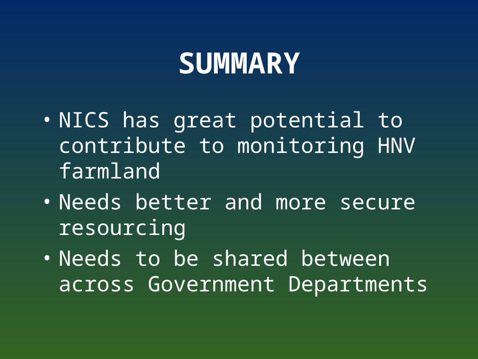
SUMMARY
• NICS has great potential to contribute to monitoring HNV farmland
• Needs better and more secure resourcing
• Needs to be shared between across Government Departments

thank you!