Embed Size (px)
Citation preview
Northern Sea Route Handbook
The Japan Association of Marine Safety
- 1 -
Northern Sea Route Handbook
Contents
Preface ....................................................................................................... 1
【Part I】 Basic Knowledge about the Northern Sea Route.......................... 3
Introduction ................................................................................................ 3
1. History of the Northern Sea Route ........................................................ 7
2. The Geography of the Arctic Ocean ...................................................... 11
3. Weather in the Arctic Ocean ................................................................ 15
4. Oceanographic Phenomena in the Arctic Ocean .................................. 19
5. Ice in the Arctic Ocean ......................................................................... 26
6. The Arctic Ocean Ecosystem ................................................................ 32
7. Geographical Features of the Northern Sea Route .............................. 40
8. Conditions for Navigating the Northern Sea Route ............................. 43
9. Ice Classes ............................................................................................ 45
10. Facts about Northern Sea Route Navigation ................................... 51
【Part II】 Diary of an Arctic Ocean Voyage .............................................. 61
Introduction .............................................................................................. 61
Commentary 01: Navigation on the NSR in Practice [Principles of
Navigation] ............................................................................................... 63
First Day of the Voyage (Departing the Port of Murmansk – Barents Sea)
.................................................................................................................. 65
Commentary 02: Navigation on the NSR in Practice [Principles of
Watchkeeping] .......................................................................................... 67
Day 2 of the Voyage (Barents Sea) ........................................................... 69
Commentary 03: Navigation on the NSR in Practice [Effective Use of
- 2 -
Radar] ................................................................................................... 71
Day 3 of the Voyage (Novaya Zemlya – Kara Sea) ................................... 73
Commentary 04: Navigation on the NSR in Practice [Signs of Ice
Appearing] ................................................................................................ 75
Day 4 of the Voyage (Kara Sea) ................................................................ 81
Commentary 05: Navigation on the NSR in Practice [Navigational
Watchkeeping Teams] ............................................................................... 83
Day 5 of the Voyage (Laptev Sea) ............................................................. 89
Commentary 06: Navigation on the NSR in Practice [Nautical Charts
and Pilot Books] ....................................................................................... 91
Commentary 07: Navigation on the NSR in Practice [Passage Planning]
.................................................................................................................. 94
Commentary 08: Navigation on the NSR in Practice [Course Selection,
etc.] ........................................................................................................... 96
Day 6 of the Voyage (Laptev Sea) ........................................................... 100
Commentary 09: Basic Knowledge about Icebreakers and Ice-
strengthened Ships [Differences between Icebreakers and Ice-
strengthened Ships] ............................................................................... 102
Commentary 10: Basic Knowledge about Icebreakers and Ice-
strengthened Ships [Characteristics of Icebreakers and Ice-strengthened
Ships] ...................................................................................................... 104
Commentary 11: Basic Knowledge about Icebreakers and Ice-
strengthened Ships [Ice Pressure] ......................................................... 106
Commentary 12: Basic Knowledge about Icebreakers and Ice-
strengthened Ships [Icebreaking Methods] ........................................... 108
Day 7 of the Voyage (Sannikov Strait – East Siberian Sea) .................. 112
Commentary 13: Basic Knowledge about Ice [Ice Formation and
- 3 -
Development] .......................................................................................... 114
Day 8 of the Voyage (East Siberian Sea) ................................................ 123
Commentary 14: Basic Knowledge about Ice [Ice Concentration] ......... 125
Day 9 of the Voyage (East Siberian Sea) ................................................ 130
Commentary 15: Basic Knowledge about Ice [Ice Terminology] ............ 132
Commentary 16: Ship Handling on the NSR in Practice [Principles of
Ship Handling] ....................................................................................... 142
Day 10 of the Voyage (De Long Strait) ................................................... 146
Commentary 17: Ship Handling on the NSR in Practice [General Ship
Handling Methods] ................................................................................. 148
Day 11 of the Voyage (Chukchi Sea) ....................................................... 161
Commentary 18: Ship Handling on the NSR in Practice [Other Ship
Handling Methods] ................................................................................. 163
Day 12 of the Voyage (Chukchi Sea) ...................................................... 165
Commentary 19: Maintenance on the NSR in Practice [Overview] ....... 167
Day 13 of the Voyage (Bering Strait) ..................................................... 177
Commentary 20: Engine Operation on the NSR in Practice [Overview]
................................................................................................................ 179
Commentary 21: Communication on the NSR in Practice [Overview] .. 183
Commentary 22: Staying Healthy and Preventing Disaster on the NSR
[Overview] .............................................................................................. 187
Final Day of the Voyage ......................................................................... 193
Commentary 23: NSR-related Rules, etc. [Overview] ............................ 196
Commentary 24: Emergency Response on the NSR [Overview] ............ 203
【Column】
- 4 -
Column 01: What are Arctic Ocean Drift Stations? ......................... 5
Column 02: Which Arctic Ocean Explorer was Awarded the Nobel Peace
Prize? ................................................................................................ 9
Column 03: Which is a More Comfortable Place to Be: The Arctic or the
Antarctic? ....................................................................................... 13
Column 04: What is the Springtime Arctic Phenomenon Called “Arctic
Haze”? ............................................................................................. 17
Column 05: Is the Arctic an Area of Heavy Snowfall? ................... 24
Column 06: What is “Black Carbon” and How Does it Cause Global
Warming? ........................................................................................ 29
Column 07: What Was the True Nature of the Legendary Unicorn’s
Horn? .............................................................................................. 34
Column 08: Do Penguins Live in the Arctic? ................................. 36
Column 09: What are Bear Guards? .............................................. 38
Column 10: Can You See Auroras on the NSR?.............................. 49
Column 11: Can You See the Future from a Headland in the U.S.A ?
........................................................................................................ 55
Column 12: What Color is Your Breath When You Exhale in the
Arctic Ocean? .................................................................................. 57
Column 13: What Unexpected Role Does the Arctic Ocean Play?
........................................................................................................ 59
Column 14: What is the Mystery of the Disappearing Lighthouses ?
........................................................................................................ 79
Column 15: Which Icebreaker Applies Archimedes' Principle? ..... 87
Column 16: Is Ice Removal Really an Unavoidable Task When Sailing
in Extreme Cold? .......................................................................... 121
Column 17: What is the Threat Posed by the “Sherbet” That Can Cause

- 5 -
Emergency Shutdown on a Ship? ................................................. 128
Column 18: Are Icebreakers Really Luxury Liners? .................... 144
Column 19: Are the Ice and Fog in the Arctic Ocean Good Friends ?
...................................................................................................... 159
Column 20: What is the Risk of Collision with an Iceberg on the NSR?
...................................................................................................... 175
Column 21: What is the Secret to Boosting Your Success Rate in
Catching Food to Survive in the Arctic Ocean? ........................... 191
Column 22: Survival in the Arctic Ocean: Can You Really Drown in a
Life Raft? ...................................................................................... 201
Column 23: Survival in the Arctic Ocean: Is Getting onto the Ice Really
Dangerous? ................................................................................... 208
Column 24: What is the Surprising Reason for Low Mood in the Arctic
Ocean? .......................................................................................... 210
Column 25: Why Do You Need to Take Care with Metal Products When
Carrying out Tasks Outdoors in the Arctic Ocean? ..................... 212
Column 26: What is the Secret to Avoiding Becoming a “Sleep Refugee”
in the Arctic Ocean? ..................................................................... 214
Column 27: What Healthy Foods Can You Eat on the NSR to Keep
Warm? ........................................................................................... 216
Column 28: What Handy Techniques Can You Use on the NSR to Keep
Warm? ........................................................................................... 218
Column 29: What traditional Asian remedies are used to combat the
cold on the NSR? .......................................................................... 220
Column 30: Food is the Source of Sailors’ Strength. Which Dishes are
Best on the Northern Sea Route? ................................................. 222

- 6 -
1
Northern Sea Route Handbook
Preface
The Northern Sea Route is the shortest sea route linking Europe to Asia.
However, until the last century, due to its harsh icebound environment, the only
ships that used it (other than the merchant ships of nations along the coast)
were oceanographic ships conducting surveys. In recent years, though, it has
begun to attract global attention because the reduction in the quantity of ice in
the Arctic Ocean has brought about an increase in the number of foreign
merchant ships using the Northern Sea Route to sail between Europe and Asia.
Special skills and expertise are needed to sail safely through the Arctic Ocean
and other seas where ice might be encountered. These include early detection
of ice by means of appropriate watchkeeping, estimation of the direction and
speed of ice movement, and visual determination of the hardness and thickness
of ice. Even a slight error in the response could lead to a collision with the ice,
causing a major accident.
This Handbook explains in simple terms the basic knowledge that is essential
for navigation safety, environmental conservation, and daily life when using the
Northern Sea Route. We hope that it will be useful to a wide range of people,
both as an introductory primer for students aiming to become seafarers or to
work at sea, who are learning about the Northern Sea Route for the first time,
and as an accessible fact book for the general public.
In closing, we would like to take this opportunity to express our sincere
gratitude to the members of the Northern Sea Route Handbook Advisory

2
Committee and everyone else who has assisted in the writing and editing of this
publication.
March 2015
The Japan Association of Marine Safety
3
[Part I] Basic Knowledge about the Northern Sea
Route
Introduction
The sea route from the Atlantic to the Pacific Ocean via the Arctic Ocean
(hereinafter referred to as the Northern Sea Route, or NSR) has long been
regarded as the shortest route between Europe and Asia. As such, it has been
the subject of repeated exploratory voyages over the centuries, with a view to
opening it up to maritime transport. However, until the Vega Expedition
succeeded in navigating the NSR at the end of the 19th century, these
expeditions repeatedly ran into difficulty, due to the harsh Arctic environment
and the inadequacy of nautical instruments and naval architecture.
In the early 20th century, an increasing number of merchant ships began to
navigate the Arctic Ocean, but these were confined to ships from Russia and
other countries along the coast. However, in recent years, the reduction in the
quantity of ice in the Arctic Ocean has helped to increase the number of
foreign merchant ships using the NSR to sail along the Eurasian continent
between Europe and Asia, following the Russian coast.
In Europe, this shipping route has traditionally been known as the Northeast
Passage (in Russia, it is known as the Severnii Morskoi Put, which translates
as “Northern Sea Route”). There is also a shipping route called the Northwest
Passage, which runs through the Arctic Ocean along the North American
continent, following the Canadian coast. However, few merchant ships use
this at present, partly because it involves passing through a body of water that
is tricky to navigate due to the presence of a cluster of islands known as the
Canadian Arctic Archipelago, and partly because the ice on this route is even
more severe than on the Northeast Passage. Accordingly, the term “Northern
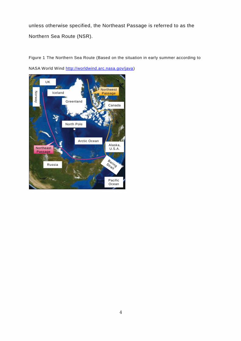
Sea Route” generally only refers to the Northeast Passage. In this publication ,
4
unless otherwise specified, the Northeast Passage is referred to as the
Northern Sea Route (NSR).
Figure 1 The Northern Sea Route (Based on the situation in early summer according to
NASA World Wind http://worldwind.arc.nasa.gov/java)
Greenland
Canada
Northeast Passage
Pacific Ocean
UK
No
rwa
y
Iceland
North Pole
Northwest Passage
Arctic Ocean
Alaska, U.S.A.
Russia
5
Column 01: What are Arctic Ocean Drift Stations?
Drift stations are meteorological stations constructed on natural ice floating
in the Arctic Ocean. A number of drift stations were set up in the Arctic Ocean
in years gone by, with people stationed on them to carry out meteorologica l
observations wherever the wind and waves took them.
The first drift station was North Pole-1, which was established by Russia (in
its previous incarnation as the Soviet Union). From 1937 into the following year,
Ivan Papanin and another three researchers spent nine months living in tents
while carrying out meteorological observations in the Arctic Ocean. One cannot
begin to imagine what hardships they endured as they carried out scientific
observations every day while living on the ice in such a harsh environment.
Papanin and his team made it safely back home, where they were warmly
received by the people and each member was awarded the title “Hero of the
Soviet Union,” the state’s highest honor.
This style of meteorological observation continued until 2004, when the
number of drift stations reached 32. In 1955, the U.S.A. began conducting
meteorological observations using the drift station Iceberg T-3. By the time
Iceberg T-3 was forced out of the Arctic Ocean in 1979, entering the Atlantic
Ocean, it had made four clockwise circuits of the Arctic waters off Canada.
6
A drifting station
7
1. History of the Northern Sea Route
Humankind has a long history of exploring the Arctic Ocean, dating back
either to the 9th century, when the Vikings sought to expand the territory that
they controlled, or to the 14th century, when the Basques were seeking whaling
grounds. In the 16th-century Age of Discovery, believing that the Arctic Ocean
offered the shortest route between Europe and Asia, countries such as Britain,
the Netherlands, and Russia began to undertake expeditions to see whether
there was a navigable route through the ice that sealed off the Arctic Ocean so
tightly, with a view to opening up a new shipping route.
The first person to successfully navigate the NSR in full was the Finnish
explorer Adolf Erik Nordenskiöld. In 1878, he left Stockholm in Sweden on the
Vega and began to sail east on the Arctic Ocean, along the Russian coast of
the Eurasian continent. Although the Vega became frozen in, he eventually
reached the Port of Yokohama safely a year later. This triggered a succession
of voyages aimed at using the NSR for commercial purposes. However, these
voyages repeatedly ran into difficulty amid the harsh natural environment, and
it was not unusual for ships to be wrecked as a result.
Eventually, technological innovation progressed enough to make navigation
easier, with the development of icebreakers and radio communications.
However, the Soviet Union, which had emerged as a result of the 1917 Russian
Revolution, pursued exclusive use of the NSR, so the merchant ships of other
countries remained unable to use it for decades. In the route’s 1980s heyday,
the Soviet Union transported more than 6 million tons of cargo by sea via the
NSR.
In 1987, as the Cold War was coming to an end and the NSR’s strategic value
was declining, the Soviet Union announced that it would permit merchant ships
from other countries to use the route. However, the Soviet Union collapsed
8
immediately afterward and the new Russia that emerged in its wake was beset
by economic turbulence for quite some time, so not only did the NSR’s use by
foreign merchant ships not progress, but its use for transport within Russia also
declined sharply, with cargo volumes remaining at around 2 million tons
annually from 2000 onward.
Subsequently, as the quantity of ice in the Arctic Ocean gradually decreased,
Russia made preparations to enable foreign vessels to use the NSR. As a result,
in 2009, a German merchant ship became the first merchant ship from a country
other than Russia to make an international voyage via the NSR. Since then, the
number of international voyages via the NSR has continued to grow.
9
Column 02: Which Arctic Ocean Explorer was Awarded the Nobel
Peace Prize?
There is one other person who ranks alongside Nordenskiöld of the Vega in
the history of the exploration of the NSR: Fridtjof Nansen, the Norwegian
explorer who set out for the North Pole on the ship Fram (which means “Forward”
in Norwegian) in 1893.
In his youth, Nansen diligently researched the types of driftwood that washed
up on the coast of Greenland and discovered that most of it had come not from
the coast of the North American continent, but from the Siberian coast of Russia.
Moreover, having read a newspaper article stating that the wreckage of the USS
Jeanette (an American ship that had gone to the rescue of the Vega when it had
become trapped in the ice, but was wrecked in the Arctic Ocean off the Russian
coast) had been discovered as far away as the northwestern coast of Greenland,
he was convinced that there must be a viable shipping route straight through
the Arctic Ocean from Siberia to Greenland, via the North Pole. This was the
catalyst for his subsequent voyage of exploration across the Arctic Ocean on
the Fram. The findings from this expedition revealed not only the mechanism of
the Arctic Ocean current, but also that of the general circulation of the world’s
oceans. The Fram was later used for Amundsen’s Antarctic expedition,
becoming a rare example of a ship that voyaged to and explored both the Arctic
and Antarctic.
After completing his voyage of exploration, Nansen became a university
professor and diplomat before being appointed as the first High Commissioner
for Refugees of the League of Nations. In 1922, Nansen was awarded the Nobel
Peace Prize, in recognition of his relief efforts to assist refugees in the aftermath
of World War I.

10
Nansen and the Fram
11
2. The Geography of the Arctic Ocean
Encircled by the Eurasian continent, the North American continent,
Greenland and numerous other islands, the Arctic Ocean covers a total area of
around 12 million square kilometers (around 31.5 times the size of the total land
area of Japan) and is one of the seven oceans that are together known as the
“Seven Seas.” The Arctic Ocean accounts for just 3% or so of the total area of
the planet covered by sea. However, around 10% of the river water flowing into
the sea worldwide is discharged into the Arctic Ocean. Accordingly, the average
salinity of the water in the Arctic Ocean is much lower than that of the water in
other oceans. This distinguishing characteristic is the main reason why its sea
ice does not melt, even in summer.
On the other side of the world, Antarctica is about the same size, with a total
land area of approximately 14 million square kilometers. The Southern Ocean,
which surrounds Antarctica, has an area of around 20 million square kilometers.
No river water flows into the Southern Ocean, so it has a higher level of salinity
than the Arctic Ocean and the sea ice that forms in winter melts away almost
entirely in the summer.
The Arctic Ocean is almost completely surrounded by land, so the ice does
not move as far as it does in the Southern Ocean and it is hard for the ice to
flow out into neighboring seas (the Atlantic and Pacific Oceans). In the center
of the Arctic Ocean, an abyssal plain stretches out over the seabed at a depth
of around 4,000 meters, reaching 5,440 meters at its deepest point. About 70%
of the Arctic Ocean is comparatively deep, with a depth of 1,000 meters or more,
while the remaining 30% consists of relatively shallow waters, with a depth of
less than 1,000 meters.
If a ship can pass through the deep offshore waters, it is perfectly safe, with
little risk of running aground, but there is a greater likelihood of ice remaining
12
the closer one gets to the center of the Arctic Ocean, even in summer, so it is
difficult for merchant ships to navigate. Accordingly, the NSR generally used by
merchant ships runs over the continental shelf, following the coast of the
Eurasian continent, where there is little or no ice in summer. Although the
conditions are favorable in terms of ice, the route runs quite close to the
continent and islands, so the water reaches a depth of only 200 meters at its
deepest, and less than 20 meters at the shallowest points. There are many
shallows with a depth of less than 10 meters and ships have to pass through a
number of straits, either between an island and the continent or between two
islands.
13
Column 03: Which is a More Comfortable Place to Be: The Arctic or
the Antarctic?
Both the Arctic and the Antarctic are polar regions covered in ice, but there
is one big difference between them. Most of the Arctic consists of the sea called
the Arctic Ocean, whereas most of the Antarctic consists of the continent called
Antarctica.
Antarctica is covered in an ice sheet with an average thickness of more than
2,000 meters and consists of highlands at an average altitude of 2,300 meters
above sea level. Consequently, temperatures in the Antarctic fall to very low
levels. Astonishingly, temperatures as low as -89.2°C (in July 1983) and -93.2°C
(in August 2010) have been measured in the Antarctic.
On the other hand, the Arctic Ocean is sea, so it has an altitude of 0m (sea
level). The ice covering the sea is around 2 meters thick on average, rising to
3-4 meters at its thickest. Moreover, there is a large volume of seawater under
the ice. Seawater never gets colder than -2°C. In other words, there is
comparatively warm seawater under the ice, which acts like underfloor heating,
so the temperature in the Arctic is not that low. Even in the middle of the Arctic
Ocean, the average temperature in January, during the winter, is -30-35°C,
rising to an average of +5°C in July, during the summer.
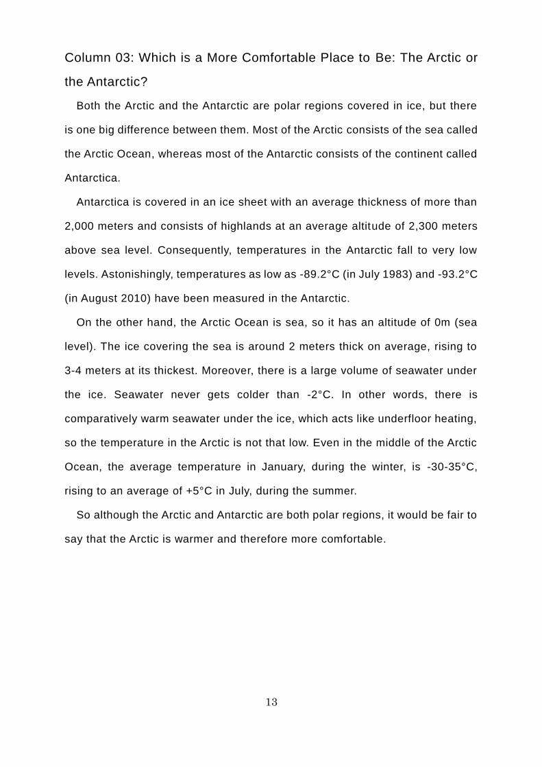
So although the Arctic and Antarctic are both polar regions, it would be fair to
say that the Arctic is warmer and therefore more comfortable.

14
The Arctic is warmer and more comfortable?!
15
3. Weather in the Arctic Ocean
The temperatures around the NSR are coldest in winter, in January and
February, falling to around -30-40°C. On the other hand, they are warmest in
summer, in July and August (which is when most merchant ships use the NSR),
rising to around +5-10°C. If the weather is mild, the temperature can even rise
above +20°C.
In winter (from the autumn equinox to the spring equinox), there are days
when the sun does not come up at all (polar nights) and days when the night is
much longer than the daytime. On the other hand, in summer (from the spring
equinox to the autumn equinox), there are days when the sun does not set at
all (polar days, or white nights) and days when the daytime is much longer than
the night. Polar nights and polar days are phenomena that occur because the
earth’s axis is tilted at an angle of around 23° from the orbital plane of the sun.
They do not occur anywhere other than within the Arctic Circle (the area within
a circle drawn at latitude 66° 33′ north) and the Antarctic Circle (the area within
a circle drawn at latitude 66° 33′ south).
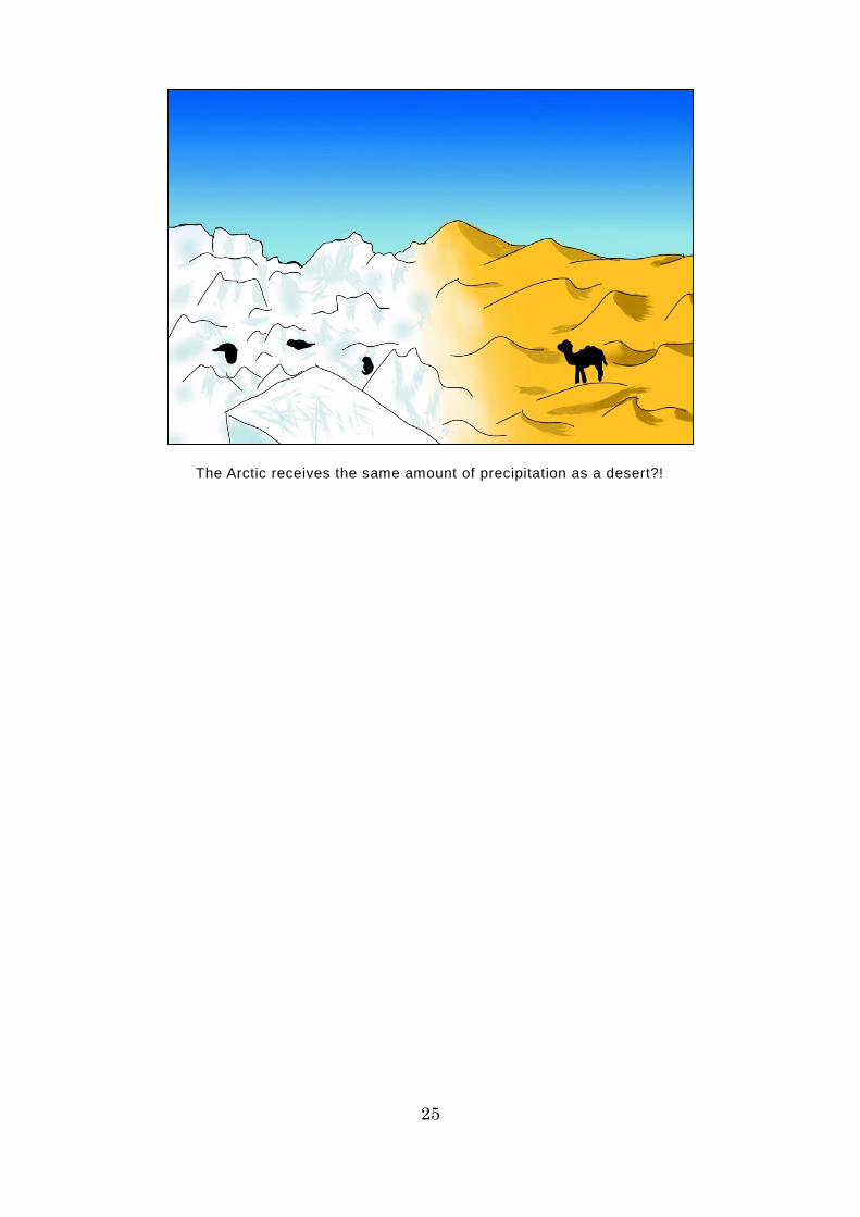
At just 100-400 millimeters annually, the level of precipitation around the NSR
is similar to that in deserts and Middle Eastern countries. One notable feature
is that the level of precipitation is higher in summer than in winter. Moreover, in
summer, when the temperature is comparatively high, this precipitation takes
the form of rain, rather than snow.
The area around the NSR is also prone to low cloud and fog. In particular,
there are hardly any fine, clear days in summer. The probability of low cloud
and fog is around 70-80% and it is generally overcast. On the other hand, in
winter, the probability of fog, etc. falls to just 20-40%. Moreover, in early spring,
a type of smog called “Arctic haze” frequently occurs.
These days, vertical clouds often form as a result of the temperature

16
difference between the cold ice and the warm ocean surface that has resulted
from the reduced quantity of ice, making the area more prone to low pressure.
Low pressure activity is more intense in summers when the reduction in ice is
particularly pronounced, sometimes reaching levels similar to those seen during
typhoons. Vessels using the NSR need to take adequate care in this regard.
This low pressure is said to be reducing the quantity of ice in the Arctic Ocean
by pushing the ice out of it.
17
Column 04: What is the Springtime Arctic Phenomenon Called “Arctic
Haze”?
Filled with drifting ice, the Arctic Ocean is renowned as a place that is prone
to dense fog. Low cloud and fog are particularly common in the summer months,
when warm air from the south enters the Arctic Ocean and comes into contact
with the ice there. Fog hinders watchkeeping, impeding the safe operation of
ships, so it can be a factor contributing to collisions and other marine accidents.
Moreover, in early spring, the Arctic Ocean frequently suffers from smog (a
mixture of smoke and fog), which restricts visibility in the same way as fog.
Caused by atmospheric pollutants floating in the air, smog has been a frequent
occurrence in Chinese cities of late. During Japan’s postwar period of high
economic growth, smog occurred in areas where industry was densely
concentrated, damaging people’s health and becoming a major social problem.
So it seems a little strange that you would find smog in the Arctic Ocean, where
there are few people and hardly any socioeconomic activities.
In fact, the smog in the Arctic Ocean is caused by exhaust gases, soot and
smoke emitted in the Northern Hemisphere. People burn fossil fuels and the
resulting atmospheric pollutants drift all the way to the Arctic Ocean, forming a
layer of pollution.
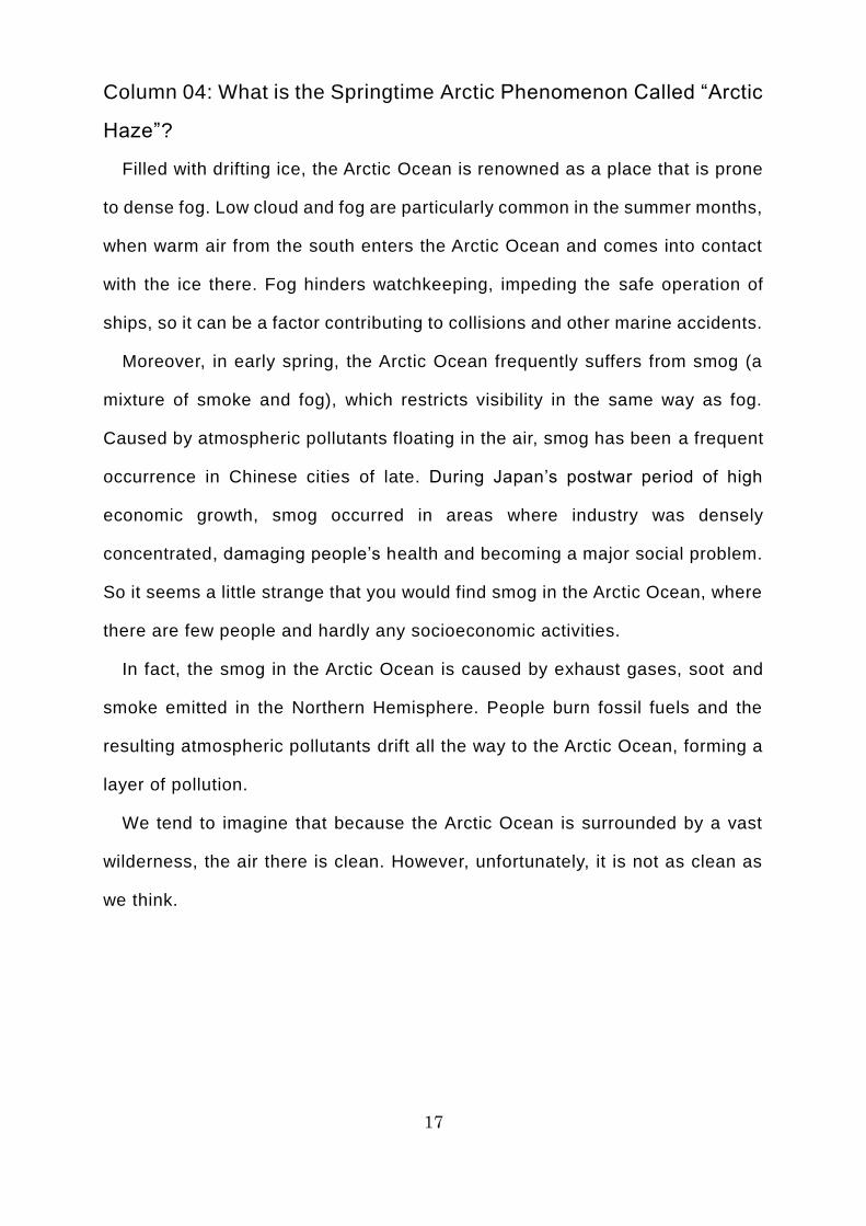
We tend to imagine that because the Arctic Ocean is surrounded by a vast
wilderness, the air there is clean. However, unfortunately, it is not as clean as
we think.

18
The Arctic air is polluted?!
19
4. Oceanographic Phenomena in the Arctic Ocean
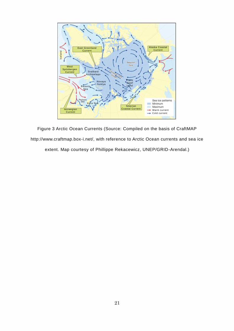
There are two main flows of ice in the Arctic Ocean. The first is the Beaufort
Gyre, a clockwise circulation seen in the Canada Basin in the waters off the
North American continent. The second is the Transpolar Drift, a linear current
flowing northward toward the North Pole from the Laptev Sea and East Siberian
Sea off the coast of Russia, and emerging near the Fram Strait off northeastern
Greenland.
The Arctic Ocean’s currents can be classified into longshore currents driven
by the two major flows of sea ice, and coastal currents, which flow parallel to
the coastline or continental shelf. The ocean currents driven by the movement
of ice demonstrate a similar pattern to the flow of ice. Major longshore currents
include the Norwegian Current, a warm current that flows north from the North
Atlantic along the Scandinavian Peninsula, into the Barents Sea; the West
Spitsbergen Current, which flows north away from the Scandinavian Peninsula
into the Arctic Ocean through the east side of the Fram Strait; the East
Greenland Current, which flows from the Arctic Ocean, down the east coast of
Greenland and into the Greenland Sea; the Alaska Coastal Current, in which
warm water from the Pacific Ocean flows north along the Alaskan coast of the
Chukchi Sea; and the Siberian Coastal Current, which flows along the Siberian
coast of the Chukchi Sea toward the Bering Strait.
When sailing east along the NSR from Europe, ships mostly follow the flow
of ocean currents from the Barents Sea to the Kara Sea, Laptev Sea, and East
Siberian Sea. However, as the NSR goes over the comparatively shallow
continental shelf stretching along the Eurasian continent, complex changes in
the currents can be expected to occur in this area, varying according to the
season and wind direction, among other factors. Ships need to take great care.
Apart from when low pressure develops in summer, which is the peak period
20
for NSR use, the area around this sea lane is prone to low cloud and fog and
the sea is comparatively calm. Even in the event of a low pressure system with
strong northerly winds, the fetch of the wind is quite short because offshore ice
acts as a windbreak, so large swells do not form.
The temperature of the seawater around the NSR in summer is usually at
least +5°C and never drops below zero in this season, even at its coldest.
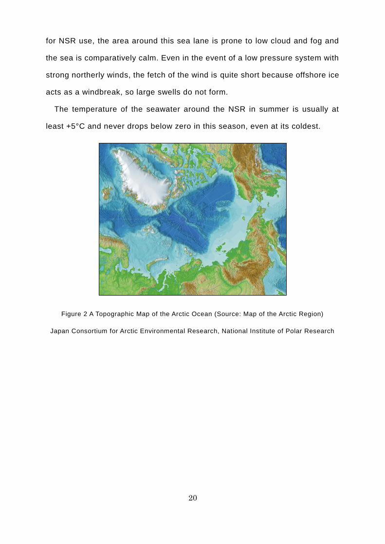
Figure 2 A Topographic Map of the Arctic Ocean (Source: Map of the Arctic Region)
Japan Consortium for Arctic Environmental Research, National Institute of Polar Research
21
Figure 3 Arctic Ocean Currents (Source: Compiled on the basis of CraftMAP
http://www.craftmap.box-i.net/, with reference to Arctic Ocean currents and sea ice
extent. Map courtesy of Phillippe Rekacewicz, UNEP/GRID-Arendal.)
Alaska Coastal Current
Ice
lan
d
Cold current
East Greenland Current
West Spitsbergen
Current
Norwegian Current
Siberian Coastal Current
Svalbard Archipelago
Franz Josef Land Barents
Sea
Novaya Zemlya
Kara Sea
Warm current
22
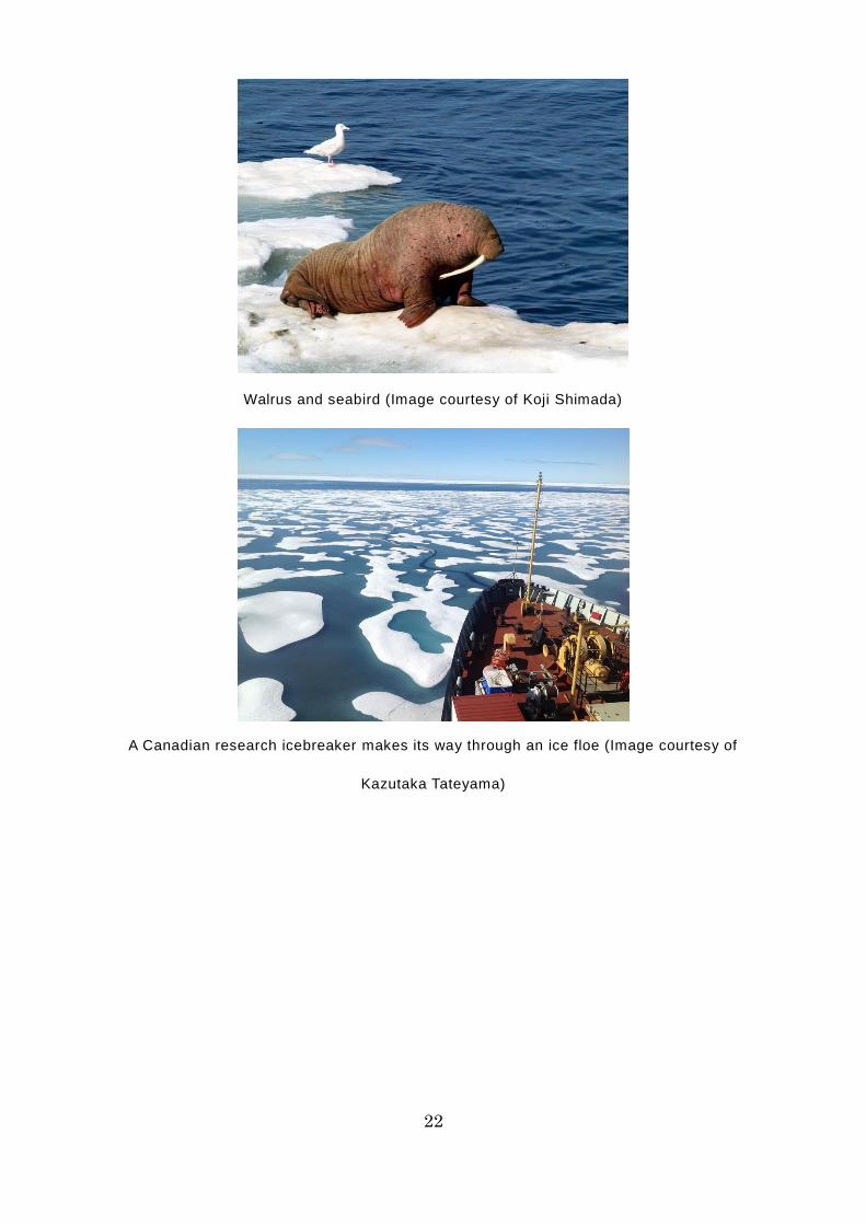
Walrus and seabird (Image courtesy of Koji Shimada)
A Canadian research icebreaker makes its way through an ice floe (Image courtesy of
Kazutaka Tateyama)

23
A South Korean research icebreaker lying at anchor amid frozen waters (Image courtesy of
Koji Shimada)
24
Column 05: Is the Arctic an Area of Heavy Snowfall?
Blizzards – windstorms that blow up snow from the ground – frequently occur
in the Antarctic. Movies often show scenes of people who have become
stranded because everything in their field of view is white, due to a severe
blizzard. People working at research stations in Antarctica are banned from
going outside at all in the event of a severe blizzard, even if it is just to go to
the building next door. This is because you can lose your sense of direction
within just a few meters and, in a worst-case scenario, you could become lost.
Because of these images of severe blizzards, we tend to think that a lot of
snow falls in both the Arctic and the Antarctic. However, in fact, the Arctic and
the Antarctic receive as little precipitation as a desert. One major reason for
this is that there is little saturated water vapor, because the temperature is so
low. In most cases, the snow blown up by a blizzard is simply snow that has
already accumulated.
The temperature in the Arctic is higher than that in the Antarctic, so i t has a
higher level of precipitation, but this is still only 100-400 millimeters annually.
The Arctic receives the equivalent of 7-26% of Tokyo’s total annual precipitation
(1,500 millimeters). It is said that because the Arctic Ocean receives so little
precipitation, exhaust gas, soot and smoke from Europe do not fall into the
Arctic Ocean along with snow and rain, so the air pollution travels all the way
to Alaska.
25
The Arctic receives the same amount of precipitation as a desert?!
26
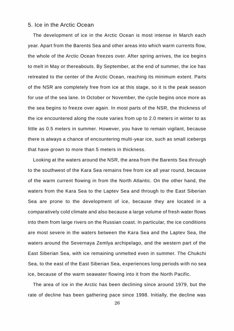
5. Ice in the Arctic Ocean
The development of ice in the Arctic Ocean is most intense in March each
year. Apart from the Barents Sea and other areas into which warm currents flow,
the whole of the Arctic Ocean freezes over. After spring arrives, the ice begins
to melt in May or thereabouts. By September, at the end of summer, the ice has
retreated to the center of the Arctic Ocean, reaching its minimum extent. Parts
of the NSR are completely free from ice at this stage, so it is the peak season
for use of the sea lane. In October or November, the cycle begins once more as
the sea begins to freeze over again. In most parts of the NSR, the thickness of
the ice encountered along the route varies from up to 2.0 meters in winter to as
little as 0.5 meters in summer. However, you have to remain vigilant, because
there is always a chance of encountering multi-year ice, such as small icebergs
that have grown to more than 5 meters in thickness.
Looking at the waters around the NSR, the area from the Barents Sea through
to the southwest of the Kara Sea remains free from ice all year round, because
of the warm current flowing in from the North Atlantic. On the other hand, the
waters from the Kara Sea to the Laptev Sea and through to the East Siberian
Sea are prone to the development of ice, because they are located in a
comparatively cold climate and also because a large volume of fresh water flows
into them from large rivers on the Russian coast. In particular, the ice conditions
are most severe in the waters between the Kara Sea and the Laptev Sea, the
waters around the Severnaya Zemlya archipelago, and the western part of the
East Siberian Sea, with ice remaining unmelted even in summer. The Chukchi
Sea, to the east of the East Siberian Sea, experiences long periods with no sea
ice, because of the warm seawater flowing into it from the North Pacific.
The area of ice in the Arctic has been declining since around 1979, but the
rate of decline has been gathering pace since 1998. Initially, the decline was
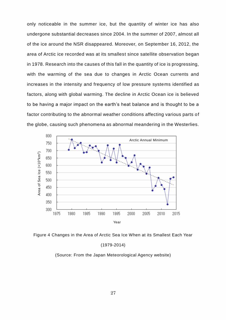
27
only noticeable in the summer ice, but the quantity of winter ice has also
undergone substantial decreases since 2004. In the summer of 2007, almost all
of the ice around the NSR disappeared. Moreover, on September 16, 2012, the
area of Arctic ice recorded was at its smallest since satellite observation began
in 1978. Research into the causes of this fall in the quantity of ice is progressing,
with the warming of the sea due to changes in Arctic Ocean currents and
increases in the intensity and frequency of low pressure systems identified as
factors, along with global warming. The decline in Arctic Ocean ice is believed
to be having a major impact on the earth’s heat balance and is thought to be a
factor contributing to the abnormal weather conditions affecting various parts o f
the globe, causing such phenomena as abnormal meandering in the Westerlies.
Figure 4 Changes in the Area of Arctic Sea Ice When at its Smallest Each Year
(1979-2014)
(Source: From the Japan Meteorological Agency website)
Are
a o
f S
ea
Ic
e (
×1
04k
m2)
Arctic Annual Minimum
Year
28
※ The area of sea ice is the area of sea where the concentration of sea ice is at
least 15%. The solid blue line indicates the changes each year in the area of
Arctic sea ice when at its annual minimum. The dotted line indicates the overall
trend in the change.
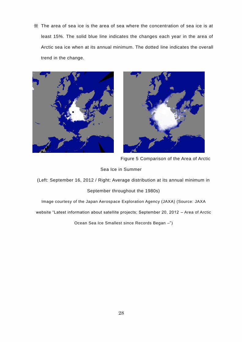
Figure 5 Comparison of the Area of Arctic
Sea Ice in Summer
(Left: September 16, 2012 / Right: Average distribution at its annual minimum in
September throughout the 1980s)
Image courtesy of the Japan Aerospace Exploration Agency (JAXA) (Source: JAXA
website “Latest information about satellite projects; September 20, 2012 – Area of Arctic
Ocean Sea Ice Smallest since Records Began –”)
29
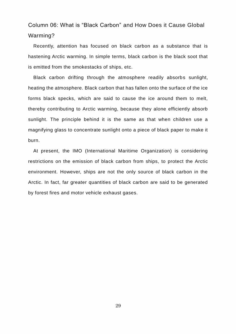
Column 06: What is “Black Carbon” and How Does it Cause Global
Warming?
Recently, attention has focused on black carbon as a substance that is
hastening Arctic warming. In simple terms, black carbon is the black soot that
is emitted from the smokestacks of ships, etc.
Black carbon drifting through the atmosphere readily absorbs sunlight,
heating the atmosphere. Black carbon that has fallen onto the surface of the ice
forms black specks, which are said to cause the ice around them to melt,
thereby contributing to Arctic warming, because they alone efficiently absorb
sunlight. The principle behind it is the same as that when children use a
magnifying glass to concentrate sunlight onto a piece of black paper to make it
burn.
At present, the IMO (International Maritime Organization) is considering
restrictions on the emission of black carbon from ships, to protect the Arctic
environment. However, ships are not the only source of black carbon in the
Arctic. In fact, far greater quantities of black carbon are said to be generated
by forest fires and motor vehicle exhaust gases.
30
Black carbon melts ice!
31
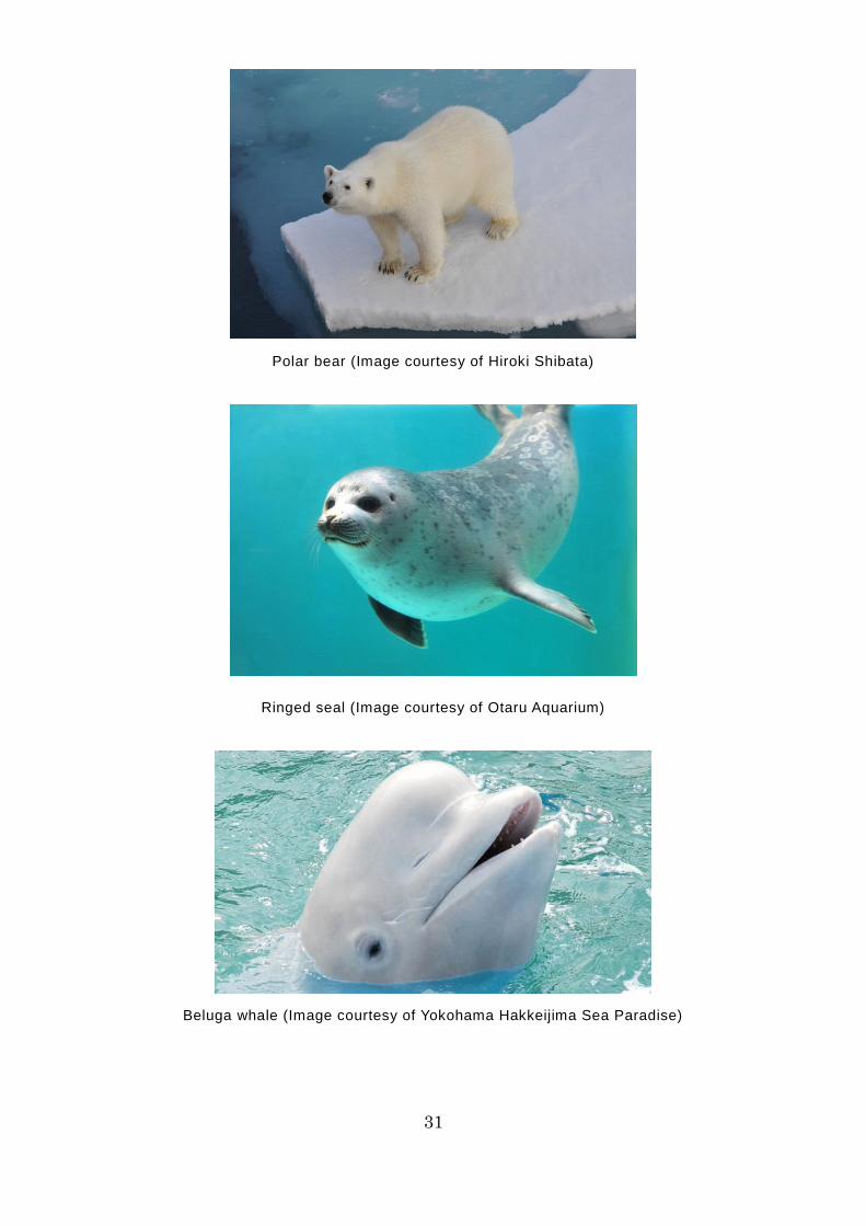
Polar bear (Image courtesy of Hiroki Shibata)
Ringed seal (Image courtesy of Otaru Aquarium)
Beluga whale (Image courtesy of Yokohama Hakkeijima Sea Paradise)
32
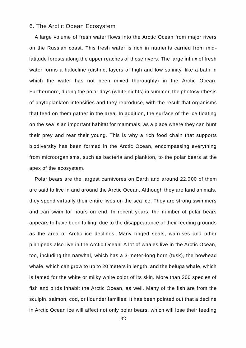
6. The Arctic Ocean Ecosystem
A large volume of fresh water flows into the Arctic Ocean from major rivers
on the Russian coast. This fresh water is rich in nutrients carried from mid -
latitude forests along the upper reaches of those rivers. The large influx of fresh
water forms a halocline (distinct layers of high and low salinity, like a bath in
which the water has not been mixed thoroughly) in the Arctic Ocean.
Furthermore, during the polar days (white nights) in summer, the photosynthesis
of phytoplankton intensifies and they reproduce, with the result that organisms
that feed on them gather in the area. In addition, the surface of the ice floating
on the sea is an important habitat for mammals, as a place where they can hunt
their prey and rear their young. This is why a rich food chain that supports
biodiversity has been formed in the Arctic Ocean, encompassing everything
from microorganisms, such as bacteria and plankton, to the polar bears at the
apex of the ecosystem.
Polar bears are the largest carnivores on Earth and around 22,000 of them
are said to live in and around the Arctic Ocean. Although they are land animals,
they spend virtually their entire lives on the sea ice. They are strong swimmers
and can swim for hours on end. In recent years, the number of polar bears
appears to have been falling, due to the disappearance of their feeding grounds
as the area of Arctic ice declines. Many ringed seals, walruses and other
pinnipeds also live in the Arctic Ocean. A lot of whales live in the Arctic Ocean,
too, including the narwhal, which has a 3-meter-long horn (tusk), the bowhead
whale, which can grow to up to 20 meters in length, and the beluga whale, which
is famed for the white or milky white color of its skin. More than 200 species of
fish and birds inhabit the Arctic Ocean, as well. Many of the fish are from the
sculpin, salmon, cod, or flounder families. It has been pointed out that a decline
in Arctic Ocean ice will affect not only polar bears, which will lose their feeding
33
grounds, but also pinnipeds and whales, as there will be less of the algae that
lives under the ice for them to feed on.
Incidentally, the water temperature in the Arctic Ocean is lower than that in
the seas surrounding Japan, so the microorganisms called oil -degrading
bacteria are not very active in the Arctic. Accordingly, if a ship suffers a spillage
of fuel oil or similar substances, the environment will take longer to recover, as
it will be much harder to clear it up via evaporation into the atmosphere or
bacterial decomposition. The environmental destruction that could occur in that
time is immeasurable. That is why ships must take great care to make certain
that they do not cause oil spills and the like.
34
Column 07: What Was the True Nature of the Legendary Unicorn’s
Horn?
The unicorn is a beast that features in European legend and frequently
appears in tales and paintings. The word “unicorn” means “single horn” and it
was named after the single sharp horn growing in the center of its forehead. In
European paintings from the Middle Ages, it is depicted as an animal that looks
just like a strong, beautiful horse.
In those days, the unicorn’s horn was believed to have mysterious powers,
such as acting as an antidote to poisons, so many people were willing to pay
large sums of money to buy unicorn horn. However, unicorn horns did not really
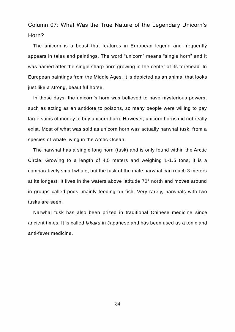
exist. Most of what was sold as unicorn horn was actually narwhal tusk, from a
species of whale living in the Arctic Ocean.
The narwhal has a single long horn (tusk) and is only found within the Arctic
Circle. Growing to a length of 4.5 meters and weighing 1-1.5 tons, it is a
comparatively small whale, but the tusk of the male narwhal can reach 3 meters
at its longest. It lives in the waters above latitude 70° north and moves around
in groups called pods, mainly feeding on fish. Very rarely, narwhals with two
tusks are seen.
Narwhal tusk has also been prized in traditional Chinese medicine since
ancient times. It is called Ikkaku in Japanese and has been used as a tonic and
anti-fever medicine.

35
Unicorns and narwhals
36
Column 08: Do Penguins Live in the Arctic?
Penguins are birds that mainly live in the Southern Hemisphere, with species
such as the emperor penguin found in the Antarctic. We say that they “mainly”
live in the Southern Hemisphere, because the habitat of the Galapagos penguin,
which lives immediately below the Equator on the Galapagos Islands, extends
very slightly into the Northern Hemisphere. Penguins have few natural
predators in their habitat and they were free to pursue their prey in the sea, so
their wings evolved into flippers. Accordingly, although penguins are birds, they
cannot fly through the sky. With their friendly manner and waddling gait, they
are very popular with children visiting aquariums and zoos.
It seems that many people think that because there are penguins in the
Antarctic, there must be penguins in the Arctic, since it too is a polar region.
However, there are no penguins in the Arctic. Well, it would probably be more
accurate to say that no penguins live there now.
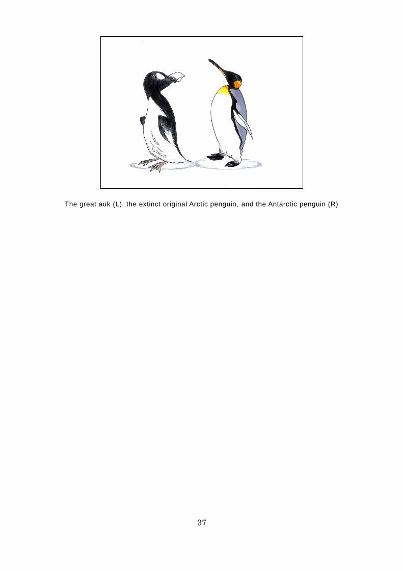
A long time ago, the Arctic was home to a bird called the great auk, which
was called a penguin. Later, when birds very similar to the great auk were found
in the Southern Hemisphere, they were initially referred to as Antarctic penguins.
However, by the mid-19th century, it became extinct as a result of overhunting
by humans for its plumage and meat. As a result, the birds we know today as
penguins gained the monopoly on the name “penguin.”
37
The great auk (L), the extinct original Arctic penguin, and the Antarctic penguin (R)
38
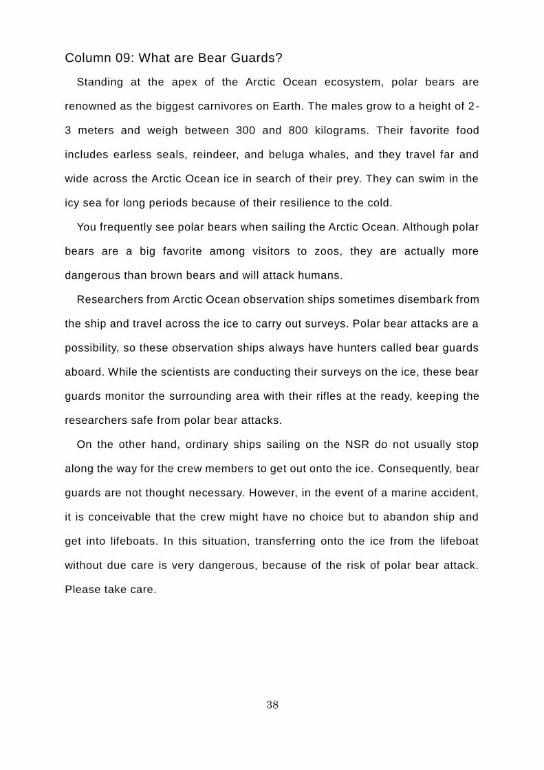
Column 09: What are Bear Guards?
Standing at the apex of the Arctic Ocean ecosystem, polar bears are
renowned as the biggest carnivores on Earth. The males grow to a height of 2 -
3 meters and weigh between 300 and 800 kilograms. Their favorite food
includes earless seals, reindeer, and beluga whales, and they travel far and
wide across the Arctic Ocean ice in search of their prey. They can swim in the
icy sea for long periods because of their resilience to the cold.
You frequently see polar bears when sailing the Arctic Ocean. Although polar
bears are a big favorite among visitors to zoos, they are actually more
dangerous than brown bears and will attack humans.
Researchers from Arctic Ocean observation ships sometimes disembark from
the ship and travel across the ice to carry out surveys. Polar bear attacks are a
possibility, so these observation ships always have hunters called bear guards
aboard. While the scientists are conducting their surveys on the ice, these bear
guards monitor the surrounding area with their rifles at the ready, keeping the
researchers safe from polar bear attacks.
On the other hand, ordinary ships sailing on the NSR do not usually stop
along the way for the crew members to get out onto the ice. Consequently, bear
guards are not thought necessary. However, in the event of a marine accident,
it is conceivable that the crew might have no choice but to abandon ship and
get into lifeboats. In this situation, transferring onto the ice from the lifeboat
without due care is very dangerous, because of the risk of polar bear attack.
Please take care.
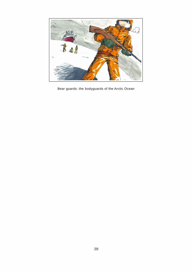
39
Bear guards: the bodyguards of the Arctic Ocean
40
7. Geographical Features of the Northern Sea Route
The NSR runs east from Europe to the Bering Strait, passing through the
Barents Sea, the Kara Sea, the Laptev Sea, the East Siberian Sea, and the
Chukchi Sea along the way.
As one heads east from Europe, there are many islands along the NSR,
including the Svalbard archipelago, Novaya Zemlya, Franz Josef Land,
Severnaya Zemlya, the New Siberian Islands, and Wrangel Island.
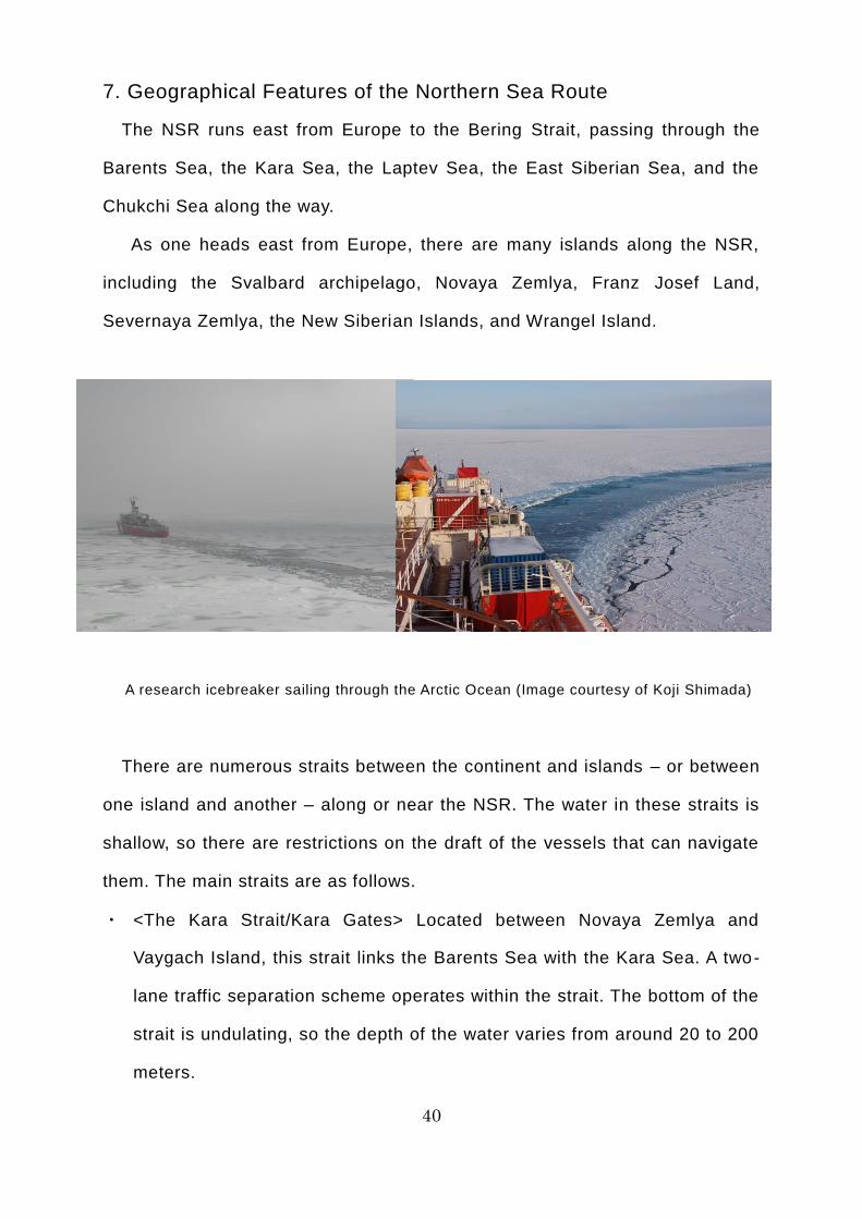
A research icebreaker sailing through the Arctic Ocean (Image courtesy of Koji Shimada)
There are numerous straits between the continent and islands – or between
one island and another – along or near the NSR. The water in these straits is
shallow, so there are restrictions on the draft of the vessels that can navigate
them. The main straits are as follows.
・ <The Kara Strait/Kara Gates> Located between Novaya Zemlya and
Vaygach Island, this strait links the Barents Sea with the Kara Sea. A two-
lane traffic separation scheme operates within the strait. The bottom of the
strait is undulating, so the depth of the water varies from around 20 to 200
meters.
41
・ <The Yugorsky Strait> Located between Vaygach Island and the continent,
this strait links the Barents Sea with the Kara Sea. The water is just 13-17
meters deep, so there are restrictions on the draft of the vessels that can
navigate it.
・ <The Vilkitsky Strait> Located between the continent and Bolshevik Island
in the Severnaya Zemlya archipelago, this strait links the Kara Sea with the
Laptev Sea. The water mostly varies from 20-200 meters deep, but there
are a number of shallows where the water is less than 10 meters deep and
the strait is just 4.5 miles (8 kilometers) wide at its narrowest point. The tidal
current is fast, so it is the hardest part of the NSR to navigate.
・ <The Dmitry Laptev Strait> Located between the New Siberian Islands and
the continent, this strait links the Laptev Sea with the East Siberian Sea.
The water has an average depth of just 12-15 meters and there are shallows
where the water is less than 10 meters deep, so there are restrictions on
the draft of the vessels that can navigate it.
・ <The Sannikov Strait> Located in the New Siberian Islands, this strait links
the Laptev Sea with the East Siberian Sea. The water is generally shallow,
with some shallows just 13 meters deep, so there are restrictions on the
draft of the vessels that can navigate it.
・ <The De Long Strait> Located between Wrangel Island and the continent,
this strait links the East Siberian Sea with the Chukchi Sea.
The sea lanes within the NSR can be broadly divided into northern and
southern sea lanes. The northern sea lane follows a route that runs from the
Barents Sea to the Bering Strait via the waters north of Novaya Zemlya, the
waters north of Severnaya Zemlya, the waters north of the New Siberian Islands,
and the De Long Strait. The southern sea lane follows a route that runs from
the Barents Sea to the Bering Strait via the Kara Strait south of Novaya Zemlya,
42
the Vilkitsky Strait south of Severnaya Zemlya, the Sannikov Strait south of the
New Siberian Islands, and the De Long Strait. The northern sea lane is 230
miles (425 kilometers) shorter than the southern sea lane, but ice tends to
remain in the northern sea lane even in summer, so it cannot necessarily be
used at all times. Depending on the ice conditions, ships may take a route that
uses an appropriate combination of the northern and southern sea lanes.
There are few ports near the NSR; the main ones are as follows.
・ <The Port of Kirkenes> Located on the Barents Sea coast at Norway’s
northernmost point, this port is ice-free throughout the year. It is close to
the Russian border and cargoes such as marine produce and iron ore are
shipped from here.
・ <The Port of Murmansk> This is the largest port near the NSR. Located on
the Barents Sea, it is ice-free throughout the year. Cargoes such as coal,
phosphorite, gas condensate (a lightweight petroleum collected along with
natural gas), and iron ore are shipped from here.
・ <The Port of Arkhangelsk> This port is located on the White Sea, which
joins up with the Barents Sea. Cargoes such as pulp, timber, and coal are
shipped from here.
43
8. Conditions for Navigating the Northern Sea Route
To use the NSR, you must apply in advance for permission from the Russian
government’s Northern Sea Route Administration (NSRA), in accordance with
Russian domestic law. As of December 2014, the main conditions for navigating
the NSR are as follows.
[Application]
Applications must be made between four months and two weeks before the
planned date of sailing. You must fill out the designated form in Russian or
English, providing all of the information requested (vessel name; port of
departure; navigation route; date of the beginning and end of navigation of the
NSR; whether or not the captain has experience of navigating the NSR and, if
so, the length of this experience; ice class (official classification certifying the
vessel’s icebreaking/ice-resistance ability. The ice classes stipulated by the
International Maritime Organization (IMO) for ships operating in polar waters
run from PC1 to PC7, while those stipulated by the Russian Maritime Register
of Shipping run from Arc 9 to Arc 4 and from Ice 3 to Ice 1), etc.) and e-mail it
as an attachment to the e-mail address specified by the NSRA, along with
copies of the requisite documents (insurance certificate, etc.) The application
and supporting documents are examined and the results are published on the
NSRA website within two weeks.
[Criteria for Permission to Navigate]
Based on the ice class of the ship sailing along the route and the ice
conditions announced by the Hydrometeorological Centre of Russia (three
categories: heavy, medium, and light), the criteria for permission are prescribed
in detail for each period of the voyage and each of the seven marine areas along
the NSR (the southwestern Kara Sea, the northeastern Kara Sea, the western
Laptev Sea, the eastern Laptev Sea, the southwestern East Siberian Sea, the
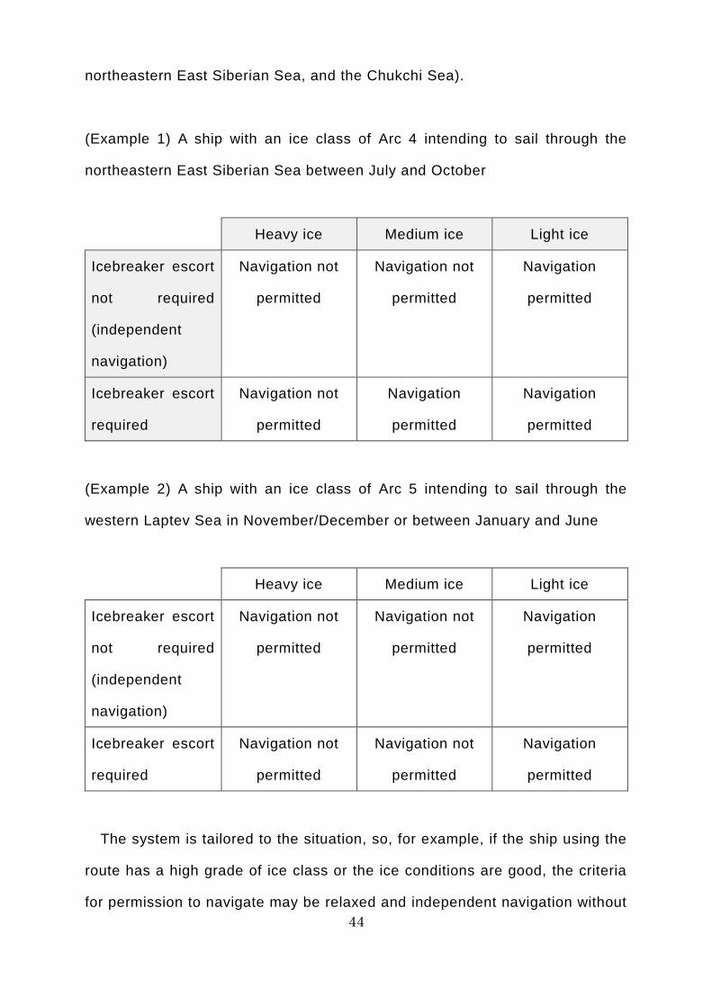
44
northeastern East Siberian Sea, and the Chukchi Sea).
(Example 1) A ship with an ice class of Arc 4 intending to sail through the
northeastern East Siberian Sea between July and October
Heavy ice Medium ice Light ice
Icebreaker escort
not required
(independent
navigation)
Navigation not
permitted
Navigation not
permitted
Navigation
permitted
Icebreaker escort
required
Navigation not
permitted
Navigation
permitted
Navigation
permitted
(Example 2) A ship with an ice class of Arc 5 intending to sail through the
western Laptev Sea in November/December or between January and June
Heavy ice Medium ice Light ice
Icebreaker escort
not required
(independent
navigation)
Navigation not
permitted
Navigation not
permitted
Navigation
permitted
Icebreaker escort
required
Navigation not
permitted
Navigation not
permitted
Navigation
permitted
The system is tailored to the situation, so, for example, if the ship using the
route has a high grade of ice class or the ice conditions are good, the criteria
for permission to navigate may be relaxed and independent navigation without
45
an icebreaker escort may be permitted.
If the ship’s captain does not have enough experience of navigating the NSR
to meet the criteria, the regulations stipulate that ice pilots must be aboard to
assist the captain. An ice pilot is a Russian citizen who has completed the
necessary program of education and training to become an NSR pilot certified
by the Russian government. Once aboard a ship traveling the NSR, ice pilots
provide the captain with recommendations and advice regarding navigation
safety and ship handling on the NSR, as well as handling radio communications
with the NSRA and icebreakers.
[Marine Traffic Control]
Under Russian domestic law, ships underway on the NSR are under the
control of the NSRA and must comply with its instructions. Ships using the NSR
must make radio contact with the NSRA at predetermined locations and times,
using the designated method.
9. Ice Classes
To enable a ship to sail safely through icy seas, its hull must be reinforced so
that it will not be damaged if it comes into contact with ice of a certain thickness.
Moreover, the bow needs to be of a shape suited to crushing ice and pushing
forward through it, while the stern needs to be of a shape that will quickly push
the crushed ice back to the surface. Furthermore, the ship needs a more
powerful main engine than ships of the same size operating in ordinary waters,
as well as equipment to protect the propeller and rudder from the ice, and
apparatus to protect the instruments against low temperatures and freezing.
An ice class could be described as an official classification attesting to the
icebreaking or ice-resistance ability of a ship that meets certain standards in
regard to the reinforcement of its hull, as well as its equipment and apparatus.
46
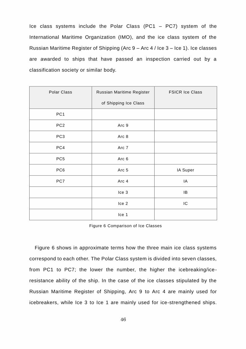
Ice class systems include the Polar Class (PC1 – PC7) system of the
International Maritime Organization (IMO), and the ice class system of the
Russian Maritime Register of Shipping (Arc 9 – Arc 4 / Ice 3 – Ice 1). Ice classes
are awarded to ships that have passed an inspection carried out by a
classification society or similar body.
Polar Class Russian Maritime Register
of Shipping Ice Class
FSICR Ice Class
PC1
PC2 Arc 9
PC3 Arc 8
PC4 Arc 7
PC5 Arc 6
PC6 Arc 5 IA Super
PC7 Arc 4 IA
Ice 3 IB
Ice 2 IC
Ice 1
Figure 6 Comparison of Ice Classes
Figure 6 shows in approximate terms how the three main ice class systems
correspond to each other. The Polar Class system is divided into seven classes,
from PC1 to PC7; the lower the number, the higher the icebreaking/ice-
resistance ability of the ship. In the case of the ice classes stipulated by the
Russian Maritime Register of Shipping, Arc 9 to Arc 4 are mainly used for
icebreakers, while Ice 3 to Ice 1 are mainly used for ice-strengthened ships.
47
The higher the number, the higher the icebreaking/ice-resistance ability of the
ship. The FSICR (Finnish-Swedish Ice Class Rules) is an ice class system
based on rules prescribed by both Finland and Sweden. Originally, this
classification system was used to certify the ice-resistance ability of ships
navigating the Baltic Sea, but it has become the world’s most popular ice class
system for ice-strengthened ships.
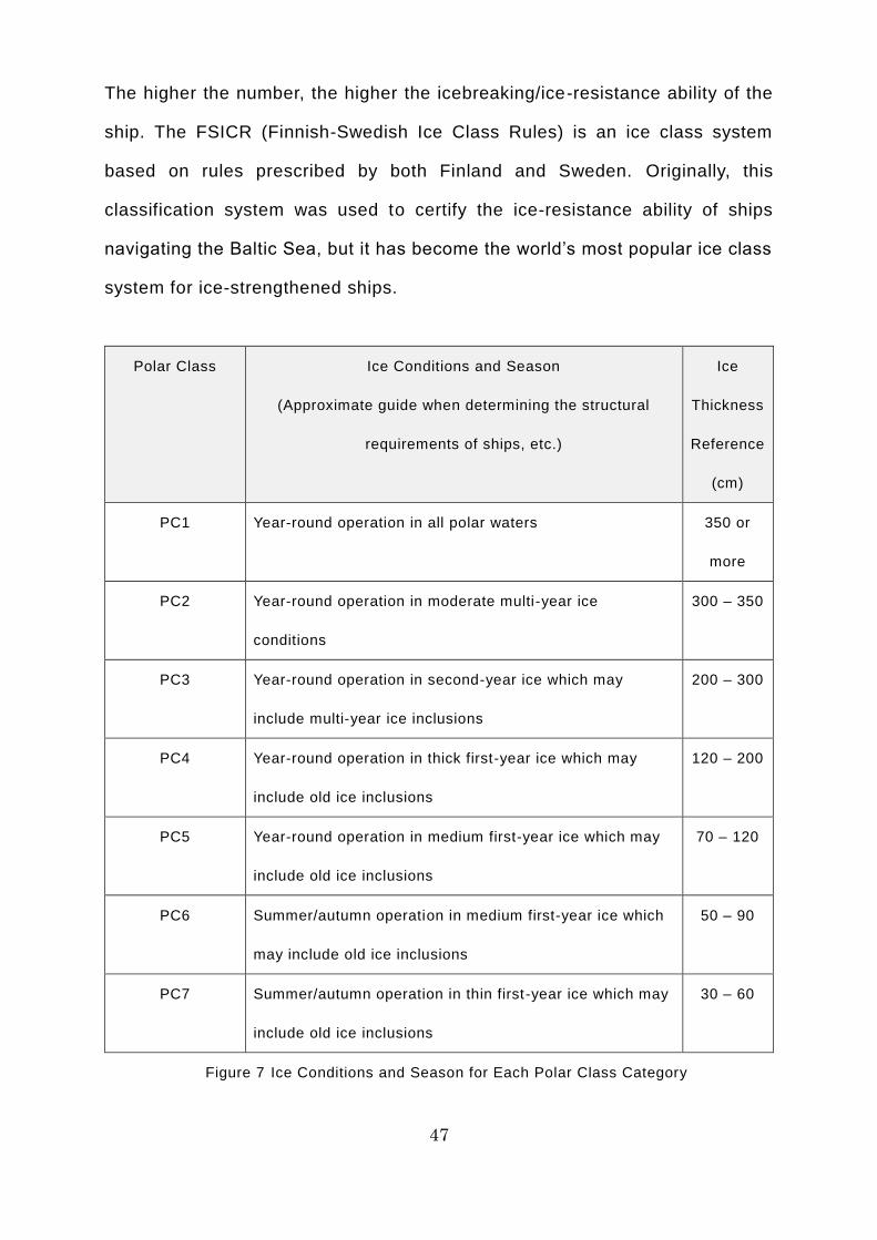
Polar Class
Ice Conditions and Season
(Approximate guide when determining the structural
requirements of ships, etc.)
Ice
Thickness
Reference
(cm)
PC1 Year-round operation in all polar waters 350 or
more
PC2 Year-round operation in moderate multi-year ice
conditions
300 – 350
PC3 Year-round operation in second-year ice which may
include multi-year ice inclusions
200 – 300
PC4 Year-round operation in thick first-year ice which may
include old ice inclusions
120 – 200
PC5 Year-round operation in medium first-year ice which may
include old ice inclusions
70 – 120
PC6 Summer/autumn operation in medium first-year ice which
may include old ice inclusions
50 – 90
PC7 Summer/autumn operation in thin first-year ice which may
include old ice inclusions
30 – 60
Figure 7 Ice Conditions and Season for Each Polar Class Category
48
Figure 7 shows the ice conditions and season for each polar class category.
These serve as a rough guide for determining structural requirements, etc.
when building ships that are compliant with each class.
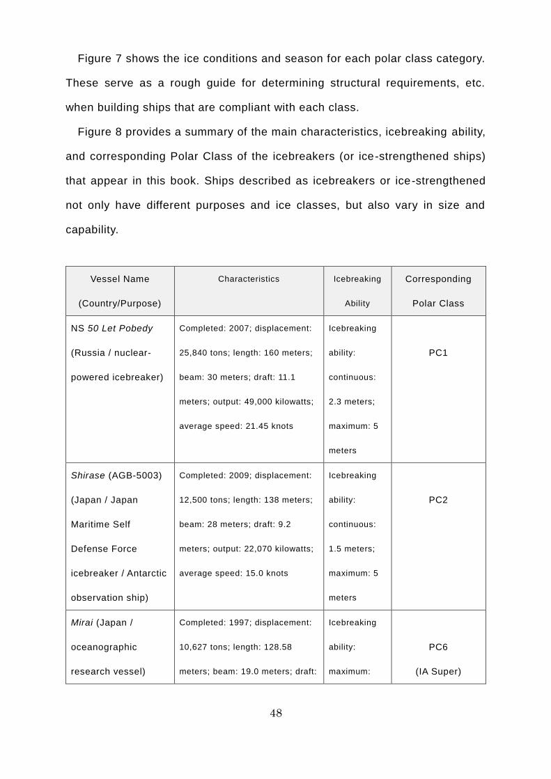
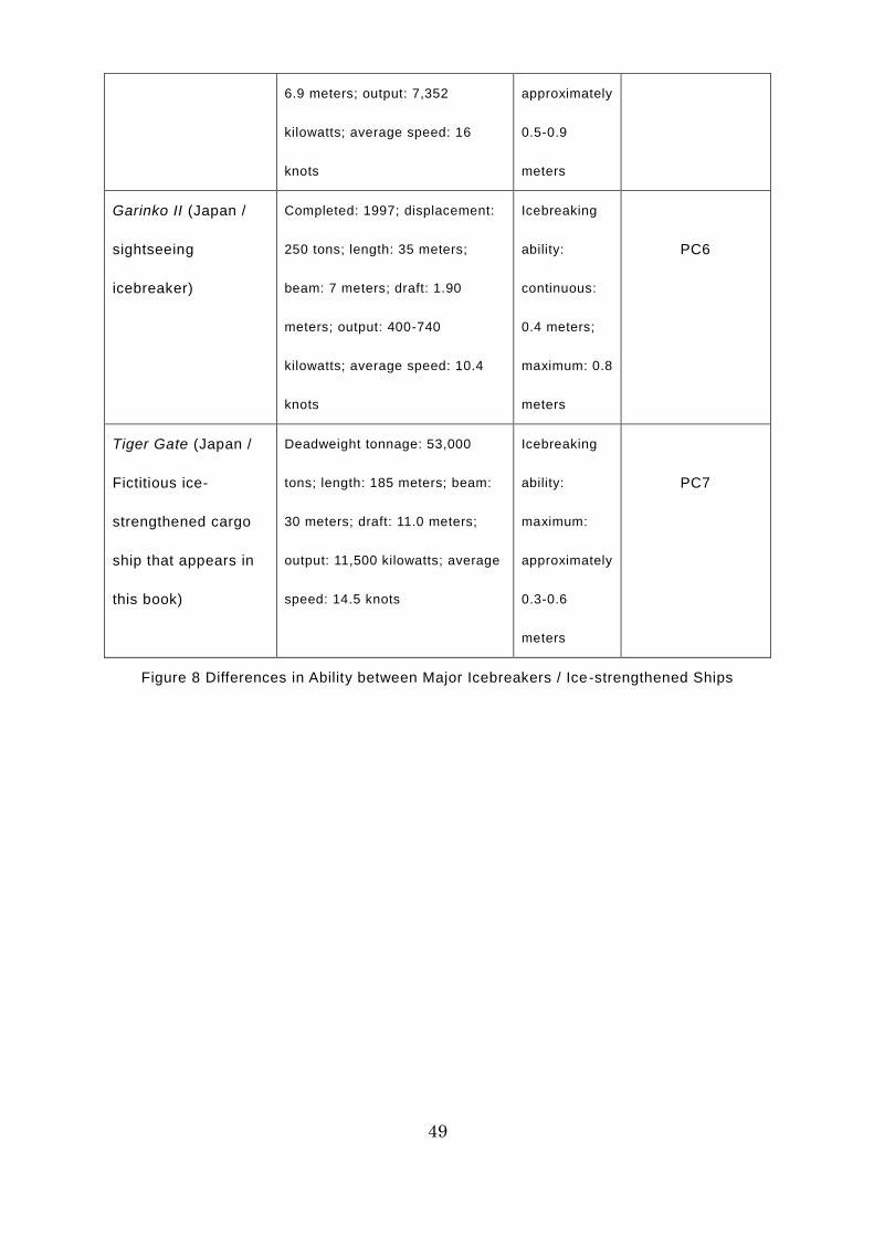
Figure 8 provides a summary of the main characteristics, icebreaking ability,
and corresponding Polar Class of the icebreakers (or ice-strengthened ships)
that appear in this book. Ships described as icebreakers or ice-strengthened
not only have different purposes and ice classes, but also vary in size and
capability.
Vessel Name
(Country/Purpose)
Characteristics Icebreaking
Ability
Corresponding
Polar Class
NS 50 Let Pobedy
(Russia / nuclear-
powered icebreaker)
Completed: 2007; displacement:
25,840 tons; length: 160 meters;
beam: 30 meters; draft: 11.1
meters; output: 49,000 kilowatts;
average speed: 21.45 knots
Icebreaking
ability:
continuous:
2.3 meters;
maximum: 5
meters
PC1
Shirase (AGB-5003)
(Japan / Japan
Maritime Self
Defense Force
icebreaker / Antarctic
observation ship)
Completed: 2009; displacement:
12,500 tons; length: 138 meters;
beam: 28 meters; draft: 9.2
meters; output: 22,070 kilowatts;
average speed: 15.0 knots
Icebreaking
ability:
continuous:
1.5 meters;
maximum: 5
meters
PC2
Mirai (Japan /
oceanographic
research vessel)
Completed: 1997; displacement:
10,627 tons; length: 128.58
meters; beam: 19.0 meters; draft:
Icebreaking
ability:
maximum:
PC6
(IA Super)
49
6.9 meters; output: 7,352
kilowatts; average speed: 16
knots
approximately
0.5-0.9
meters
Garinko II (Japan /
sightseeing
icebreaker)
Completed: 1997; displacement:
250 tons; length: 35 meters;
beam: 7 meters; draft: 1.90
meters; output: 400-740
kilowatts; average speed: 10.4
knots
Icebreaking
ability:
continuous:
0.4 meters;
maximum: 0.8
meters
PC6
Tiger Gate (Japan /
Fictitious ice-
strengthened cargo
ship that appears in
this book)
Deadweight tonnage: 53,000
tons; length: 185 meters; beam:
30 meters; draft: 11.0 meters;
output: 11,500 kilowatts; average
speed: 14.5 knots
Icebreaking
ability:
maximum:
approximately
0.3-0.6
meters
PC7
Figure 8 Differences in Ability between Major Icebreakers / Ice-strengthened Ships
50
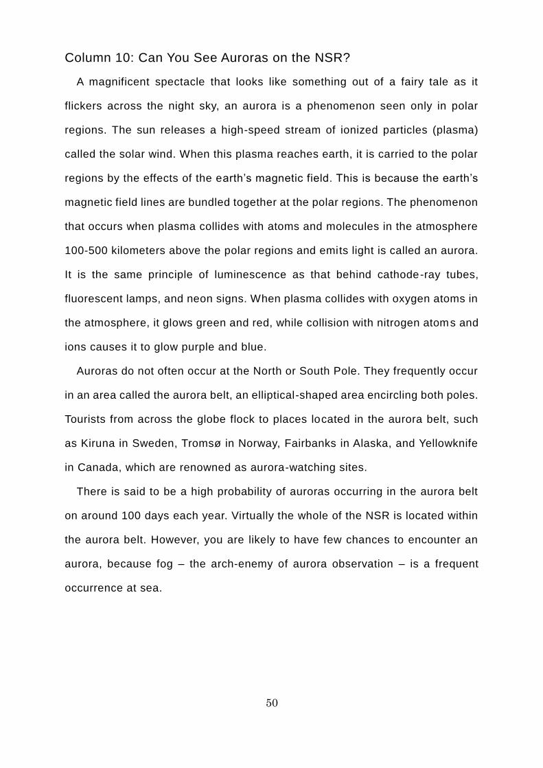
Column 10: Can You See Auroras on the NSR?
A magnificent spectacle that looks like something out of a fairy tale as it
flickers across the night sky, an aurora is a phenomenon seen only in polar
regions. The sun releases a high-speed stream of ionized particles (plasma)
called the solar wind. When this plasma reaches earth, it is carried to the polar
regions by the effects of the earth’s magnetic field. This is because the earth’s
magnetic field lines are bundled together at the polar regions. The phenomenon
that occurs when plasma collides with atoms and molecules in the atmosphere
100-500 kilometers above the polar regions and emits light is called an aurora.
It is the same principle of luminescence as that behind cathode-ray tubes,
fluorescent lamps, and neon signs. When plasma collides with oxygen atoms in
the atmosphere, it glows green and red, while collision with nitrogen atoms and
ions causes it to glow purple and blue.
Auroras do not often occur at the North or South Pole. They frequently occur
in an area called the aurora belt, an elliptical-shaped area encircling both poles.
Tourists from across the globe flock to places located in the aurora belt, such
as Kiruna in Sweden, Tromsø in Norway, Fairbanks in Alaska, and Yellowknife
in Canada, which are renowned as aurora-watching sites.
There is said to be a high probability of auroras occurring in the aurora belt
on around 100 days each year. Virtually the whole of the NSR is located within
the aurora belt. However, you are likely to have few chances to encounter an
aurora, because fog – the arch-enemy of aurora observation – is a frequent
occurrence at sea.
51
Aurora and the NSR
10. Facts about Northern Sea Route Navigation
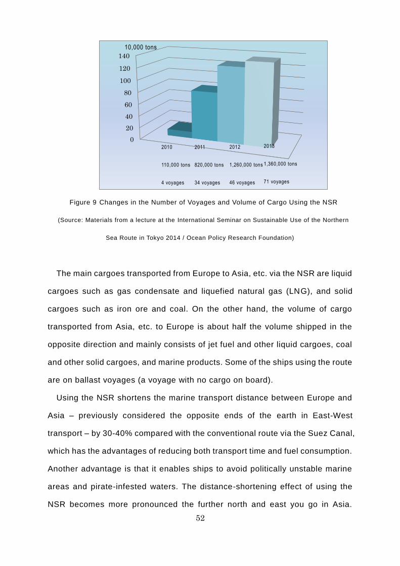
It was in 2009 that foreign merchant ships registered outside Russia first
made international voyages using the NSR. Two ice-strengthened German
cargo ships were loaded with power plant components at the Port of Ulsan in
South Korea and carried them to a Russian port on the Arctic Ocean coast via
the Bering Strait and the NSR. This triggered increasing use of the NSR for
international voyages, with four voyages taking place in 2010, transporting
110,000 tons of cargo by sea. Thereafter, the number of voyages and the
volume of cargo rose, to 820,000 tons over 34 voyages in 2011, 1.26 million
tons over 46 voyages in 2012, and 1.36 million tons over 71 voyages in 2013.
52
Figure 9 Changes in the Number of Voyages and Volume of Cargo Using the NSR
(Source: Materials from a lecture at the International Seminar on Sustainable Use of the Northern
Sea Route in Tokyo 2014 / Ocean Policy Research Foundation)
The main cargoes transported from Europe to Asia, etc. via the NSR are liquid
cargoes such as gas condensate and liquefied natural gas (LNG), and solid
cargoes such as iron ore and coal. On the other hand, the volume of cargo
transported from Asia, etc. to Europe is about half the volume shipped in the
opposite direction and mainly consists of jet fuel and other liquid cargoes, coal
and other solid cargoes, and marine products. Some of the ships using the route
are on ballast voyages (a voyage with no cargo on board).
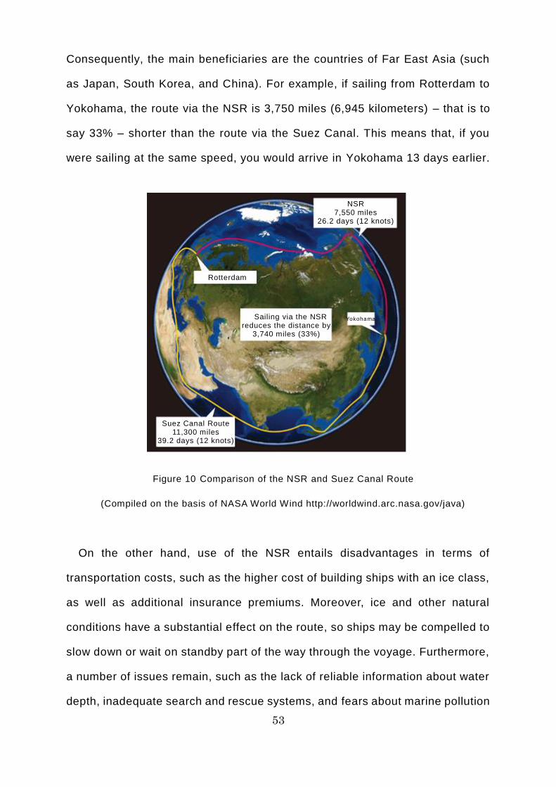
Using the NSR shortens the marine transport distance between Europe and
Asia – previously considered the opposite ends of the earth in East-West
transport – by 30-40% compared with the conventional route via the Suez Canal,
which has the advantages of reducing both transport time and fuel consumption.
Another advantage is that it enables ships to avoid politically unstable marine
areas and pirate-infested waters. The distance-shortening effect of using the
NSR becomes more pronounced the further north and east you go in Asia.
0
20
40
60
80
100
120
140
2010
110,000 tons
4 voyages
2011
820,000 tons
34 voyages
2012
1,260,000 tons
46 voyages
10,000 tons
2013
1,360,000 tons
71 voyages
53
Consequently, the main beneficiaries are the countries of Far East Asia (such
as Japan, South Korea, and China). For example, if sailing from Rotterdam to
Yokohama, the route via the NSR is 3,750 miles (6,945 kilometers) – that is to
say 33% – shorter than the route via the Suez Canal. This means that, if you
were sailing at the same speed, you would arrive in Yokohama 13 days earlier.
Figure 10 Comparison of the NSR and Suez Canal Route
(Compiled on the basis of NASA World Wind http://worldwind.arc.nasa.gov/java)
On the other hand, use of the NSR entails disadvantages in terms of
transportation costs, such as the higher cost of building ships with an ice class,
as well as additional insurance premiums. Moreover, ice and other natural
conditions have a substantial effect on the route, so ships may be compelled to
slow down or wait on standby part of the way through the voyage. Furthermore,
a number of issues remain, such as the lack of reliable information about water
depth, inadequate search and rescue systems, and fears about marine pollution
Suez Canal Route 11,300 miles
39.2 days (12 knots)
Sailing via the NSR reduces the distance by
3,740 miles (33%)
Rotterdam
Yokohama
NSR 7,550 miles
26.2 days (12 knots)

54
of the Arctic Ocean as a result of marine accidents.
55
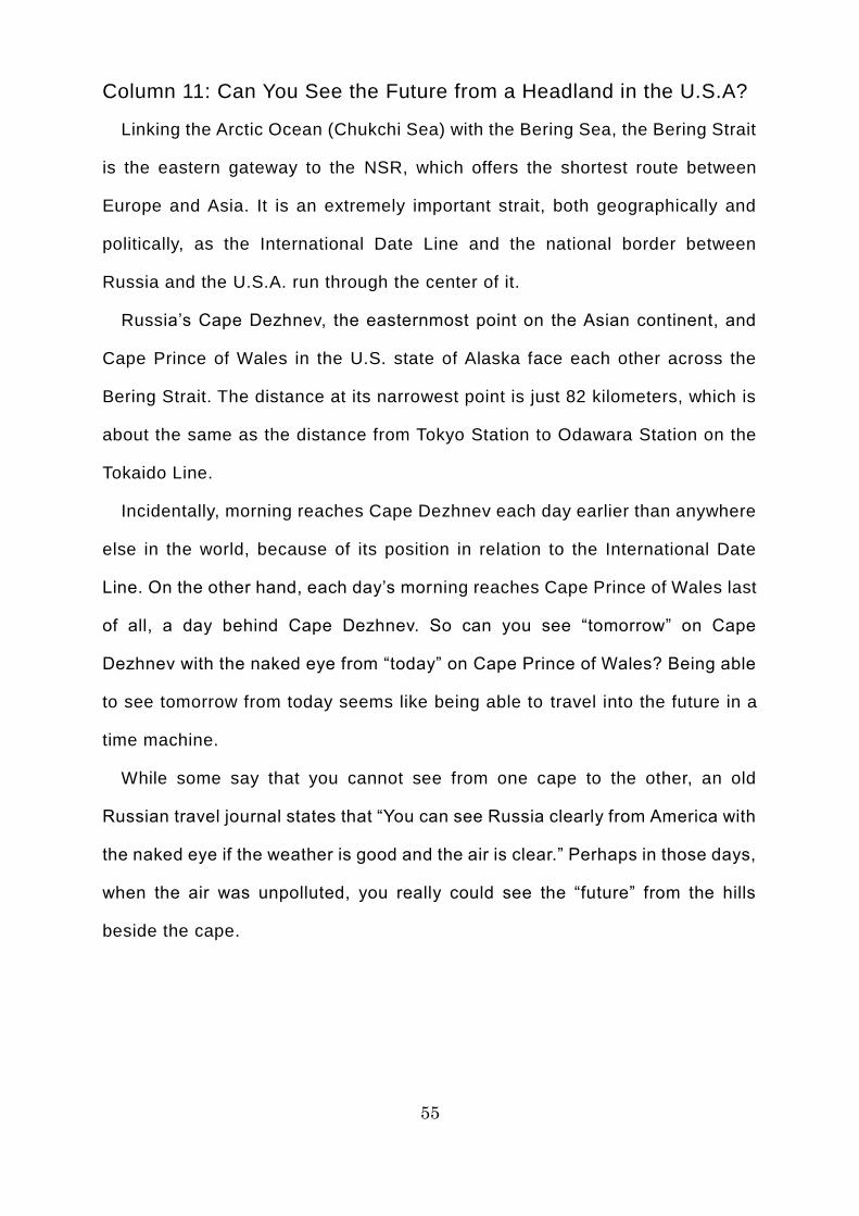
Column 11: Can You See the Future from a Headland in the U.S.A?
Linking the Arctic Ocean (Chukchi Sea) with the Bering Sea, the Bering Strait
is the eastern gateway to the NSR, which offers the shortest route between
Europe and Asia. It is an extremely important strait, both geographically and
politically, as the International Date Line and the national border between
Russia and the U.S.A. run through the center of it.
Russia’s Cape Dezhnev, the easternmost point on the Asian continent, and
Cape Prince of Wales in the U.S. state of Alaska face each other across the
Bering Strait. The distance at its narrowest point is just 82 kilometers, which is
about the same as the distance from Tokyo Station to Odawara Station on the
Tokaido Line.
Incidentally, morning reaches Cape Dezhnev each day earlier than anywhere
else in the world, because of its position in relation to the International Date
Line. On the other hand, each day’s morning reaches Cape Prince of Wales last
of all, a day behind Cape Dezhnev. So can you see “tomorrow” on Cape
Dezhnev with the naked eye from “today” on Cape Prince of Wales? Being able
to see tomorrow from today seems like being able to travel into the future in a
time machine.
While some say that you cannot see from one cape to the other, an old
Russian travel journal states that “You can see Russia clearly from America with
the naked eye if the weather is good and the air is clear.” Perhaps in those days,
when the air was unpolluted, you really could see the “future” from the hills
beside the cape.

56
Can you really see the future in Russia from a cape in the U.S.A?!
57
Column 12: What Color is Your Breath When You Exhale in the Arctic
Ocean?
When you go outside on a cold morning, your breath looks white when you
exhale. The air that humans breathe out contains a lot of warm water vapor,
which forms very fine water droplets when it suddenly comes into contact with
the cold air outside. This is what causes it to look white.
However, your breath does not look white when you exhale in the Antarctic.
An aerosol (suspended particulate matter) that serves as the core is required
in order for water vapor to form fine water droplets. The air in the Antarcti c is
clear and very pure, so there are hardly any aerosols drifting in the air there.
Accordingly, water vapor does not form water droplets and so your breath does
not look white when you exhale.
On the other hand, your breath looks white when you exhale in the Arctic.
This is because there are aerosols (suspended particulate matter) in the Arctic
that serve as the core of the droplets. This proves that the air in the Arctic is
less pure than that in the Antarctic.
White breath freezes in your mouth once the temperature drops to -50°C.
Apparently, when this happens, you can hear a faint noise, like the hissing
sound you get when you open the cap of a carbonated drink or the rustling
sound of two things coming into contact with each other. In the Russian region
of Siberia, this sound is called “the whisper of the stars.” Regardless of whether
or not you can actually hear this sound, it is certainly a romantic expression.

58
The whisper of the stars above the Arctic Ocean....
59
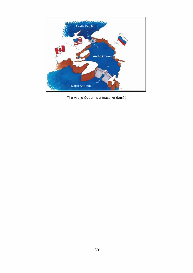
Column 13: What Unexpected Role Does the Arctic Ocean Play?
The Arctic Ocean is surrounded by the Eurasian continent, the North
American continent, and numerous islands, so it is almost entirely closed off.
The eastern side of the Arctic Ocean is connected to the North Pacific via the
Bering Strait, while the western side is connected to the North Atlantic via the
Fram Strait, among others. Incidentally, there is a slight difference between the
North Pacific and the North Atlantic in terms of the height of sea level, with sea
level as much as half a meter higher on the North Pacific side. This is because
the amount of water evaporating from the Atlantic is greater than the amount
provided by precipitation, with water from the Atlantic being carried to the
Pacific via the wind and rivers. The quantity of seawater from the North Pacific
flowing into the Arctic Ocean via the Bering Strait because of this difference in
sea level is said to range between approximately 600,000 tons per second
(winter) and 1.2 million tons per second (summer). This means that in summer,
enough seawater to fill the whole of Tokyo Dome flows from the North Pacific
into the Arctic Ocean every second.
The seawater that flows into the Arctic Ocean moves toward the North Atlantic
over a long period, with gradual circulations caused by the differences in the
temperature and salinity of the seawater. For example, low-salinity seawater in
the surface layer takes around 3-10 years to reach the North Atlantic. At the
same time, warm, high-salinity seawater also flows into the Arctic Ocean from
the North Atlantic. Thus, the Arctic Ocean serves as a massive dam for the
movement of seawater between the North Pacific and the North Atlantic.
60
The Arctic Ocean is a massive dam?!
North Pacific
Arctic Ocean
North Atlantic
61
[Part II] Diary of an Arctic Ocean Voyage
Introduction
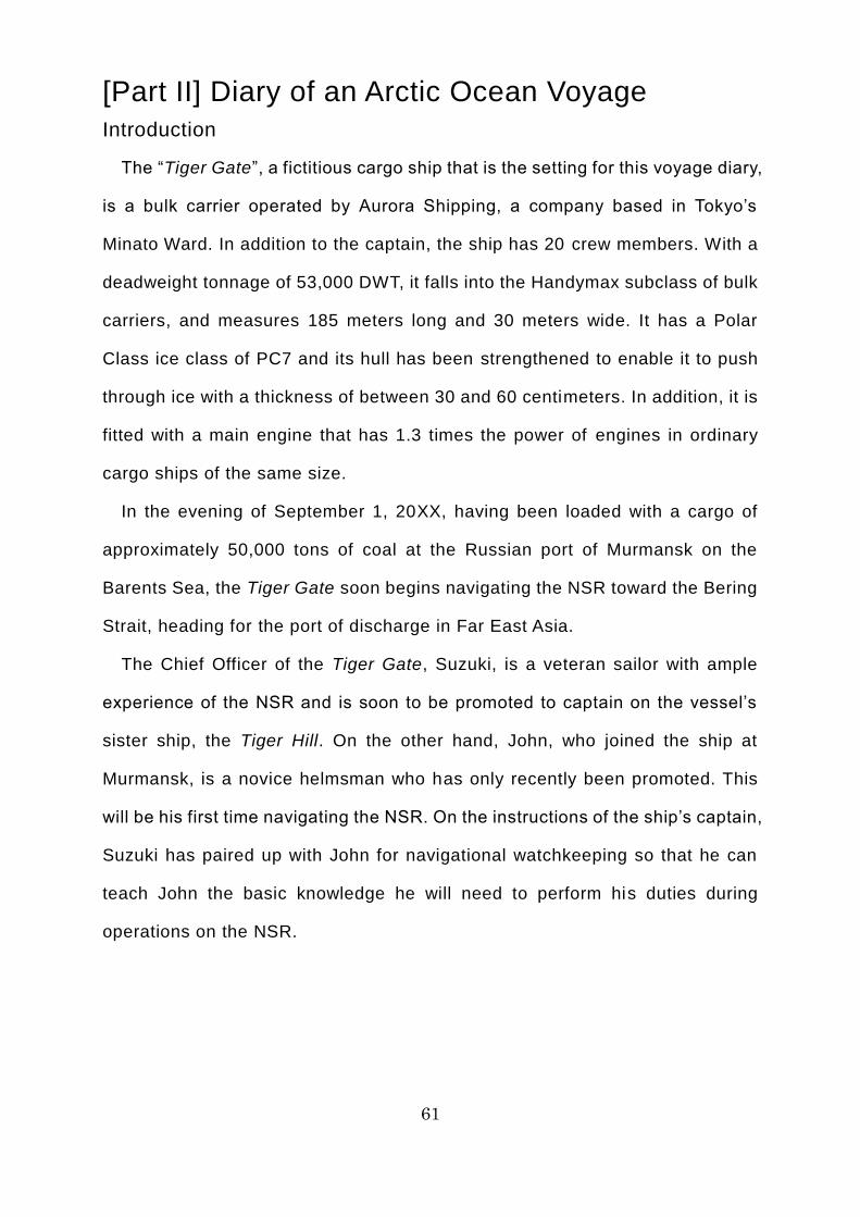
The “Tiger Gate”, a fictitious cargo ship that is the setting for this voyage diary,
is a bulk carrier operated by Aurora Shipping, a company based in Tokyo’s
Minato Ward. In addition to the captain, the ship has 20 crew members. With a
deadweight tonnage of 53,000 DWT, it falls into the Handymax subclass of bulk
carriers, and measures 185 meters long and 30 meters wide. It has a Polar
Class ice class of PC7 and its hull has been strengthened to enable it to push
through ice with a thickness of between 30 and 60 centimeters. In addition, it is
fitted with a main engine that has 1.3 times the power of engines in ordinary
cargo ships of the same size.
In the evening of September 1, 20XX, having been loaded with a cargo of
approximately 50,000 tons of coal at the Russian port of Murmansk on the
Barents Sea, the Tiger Gate soon begins navigating the NSR toward the Bering
Strait, heading for the port of discharge in Far East Asia.
The Chief Officer of the Tiger Gate, Suzuki, is a veteran sailor with ample
experience of the NSR and is soon to be promoted to captain on the vessel’s
sister ship, the Tiger Hill. On the other hand, John, who joined the ship at
Murmansk, is a novice helmsman who has only recently been promoted. This
will be his first time navigating the NSR. On the instructions of the ship’s captain,
Suzuki has paired up with John for navigational watchkeeping so that he can
teach John the basic knowledge he will need to perform his duties during
operations on the NSR.
62
(John)
It’s my first time, so I’m a
bit nervous.
(Chief Officer Suzuki)
Don’t be silly! You’ll be fine!
63
Commentary 01: Navigation on the NSR in Practice [Principles of
Navigation]
The basic principle of operations on the NSR is that ships must pass through
waters with as little ice as possible, at the direction of the NSRA and the marine
traffic control centers to which the NSRA has entrusted marine traffic control.
Unless the ship is under escort by an icebreaker, the basic principle when
approaching waters with a lot of ice is to divert around the ice as soon as
possible, staying away from it, while seeking instructions from the marine traffic
control center or icebreaker and/or advice from the ice pilot, taking into account
any information about the ice.
Most merchant ships using the NSR have an ice class, which means their
hulls have been reinforced to enable them to sail through ice of a certain
thickness. However, recklessly entering frozen waters without an icebreaker
escort, just because the ship has an ice class, runs the risk of damage to the
propeller or rudder, which could leave the ship unable to proceed, even if the
hull is undamaged. This is not advisable, as the mission of a merchant ship is
the safe transport of its cargo. A key principle of navigation on the NSR is to
avoid any avoidable risks, whenever possible.
If you enter waters with a lot of ice because you could not find an appropriate
diversion and the icebreaker escort did not arrive in time, the fundamental
principle is that you should seek instructions from the marine traffic control
center or icebreaker, or advice from the ice pilot, while determining the ice
conditions (concentration, thickness, and hardness of the ice), as we ll as your
own hull performance and operating capabilities. You should then slow down to
a safe speed and sail through the part where the ice is sparsest or thinnest,
aiming to reach open water as quickly as possible. Trying to force your way
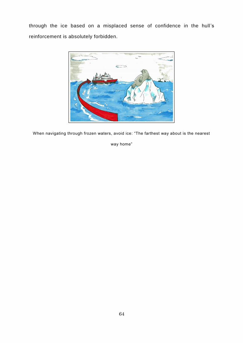
64
through the ice based on a misplaced sense of confidence in the hull ’s
reinforcement is absolutely forbidden.
When navigating through frozen waters, avoid ice: “The farthest way about is the nearest
way home”
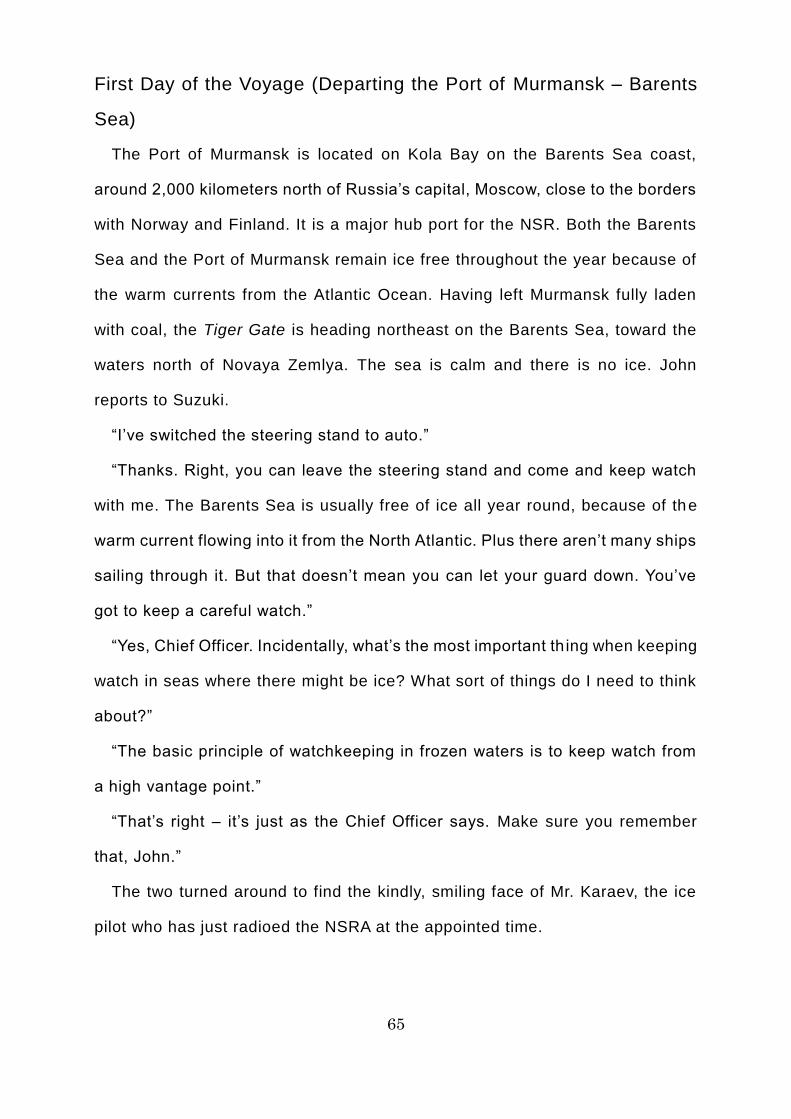
65
First Day of the Voyage (Departing the Port of Murmansk – Barents
Sea)
The Port of Murmansk is located on Kola Bay on the Barents Sea coast,
around 2,000 kilometers north of Russia’s capital, Moscow, close to the borders
with Norway and Finland. It is a major hub port for the NSR. Both the Barents
Sea and the Port of Murmansk remain ice free throughout the year because of
the warm currents from the Atlantic Ocean. Having left Murmansk fully laden
with coal, the Tiger Gate is heading northeast on the Barents Sea, toward the
waters north of Novaya Zemlya. The sea is calm and there is no ice. John
reports to Suzuki.
“I’ve switched the steering stand to auto.”
“Thanks. Right, you can leave the steering stand and come and keep watch
with me. The Barents Sea is usually free of ice all year round, because of the
warm current flowing into it from the North Atlantic. Plus there aren’t many ships
sailing through it. But that doesn’t mean you can let your guard down. You’ve
got to keep a careful watch.”
“Yes, Chief Officer. Incidentally, what’s the most important th ing when keeping
watch in seas where there might be ice? What sort of things do I need to think
about?”
“The basic principle of watchkeeping in frozen waters is to keep watch from
a high vantage point.”
“That’s right – it’s just as the Chief Officer says. Make sure you remember
that, John.”
The two turned around to find the kindly, smiling face of Mr. Karaev, the ice
pilot who has just radioed the NSRA at the appointed time.
66
I’ve spotted some ice!
(Mr. Karaev, the ice pilot)
It’s vital to keep watch from a high
vantage point!
67
Commentary 02: Navigation on the NSR in Practice [Principles of
Watchkeeping]
In seas where ice is or might be present, like those along the NSR, it is vital
to keep watch from a high vantage point, so that any ice can be spotted as soon
as possible. There are real-life examples in which, having found their ship
entirely surrounded by ice, the watchkeeper kept their calm, raised their eye
level slightly, and identified a patch of sea with little ice, enabling the ship to get
out of difficulty. Conversely, too low a vantage point will not only delay discovery
of any ice, but could also lead to incorrect ship handling, as darker areas at the
rear of the ice could look like sea.
The most effective ways of raising one’s eye level are to ascend to the flying
bridge (a deck on the roof of the wheelhouse) or climb the mast. However, it is
dangerous to keep watch in high places in very low temperatures or strong
winds, or to spend long periods keeping watch in places exposed to the open
air or wind. In that situation, it is advisable to move to a high vantage point
intermittently, as appropriate, rather than spending the whole watch there.
When keeping watch in frozen waters, it is also vital to use sunglasses. This
is because sunlight reflects off frozen waters in fine weather, hindering
watchkeeping. Moreover, they are necessary to protect your eyes from
ultraviolet rays, which are particularly strong in the polar regions. At night, you
should use searchlights.
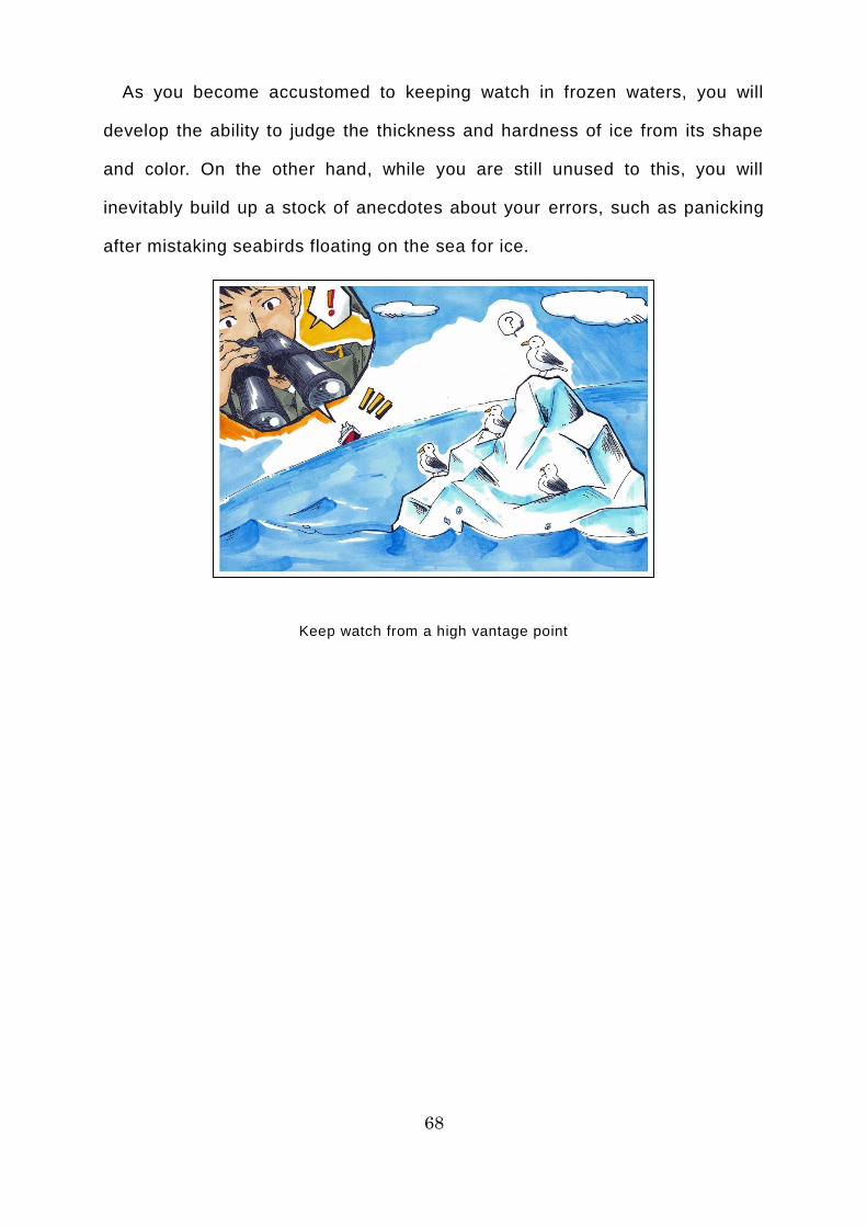
68
As you become accustomed to keeping watch in frozen waters, you will
develop the ability to judge the thickness and hardness of ice from its shape
and color. On the other hand, while you are still unused to this, you will
inevitably build up a stock of anecdotes about your errors, such as panicking
after mistaking seabirds floating on the sea for ice.
Keep watch from a high vantage point
69
Day 2 of the Voyage (Barents Sea)
On the second day after leaving Murmansk, the Tiger Gate is sailing northeast
on the Barents Sea, toward the waters north of Novaya Zemlya. The sea
remains calm and there is no ice. John reports to Suzuki.
“Chief Officer, I’ve completed my watch on the flying bridge and all is well.”
“Great, thanks. You seem to have completely mastered the principles of
watchkeeping. It’s cloudy, but the temperature is plus seven degrees and the
wind is low. So I suppose it wasn’t that cold outside.”
“That's right. I’d been preparing myself for much harsher climate conditions
in the Arctic Ocean. But it’s surprisingly warm in summer. What’s tomorrow’s
weather going to be like?”
“According to our information from the NSRA, it’s going to be just as cloudy
tomorrow as today, but the temperature is due to rise to ten degrees.”
“That’s quite warm. By the way, Chief Officer, are there any other important
points to remember about watchkeeping?”
“OK, I’ll go into it in a bit more detail. The next thing for you to learn about is
radar.”
“Thank you very much, Chief Officer.”
The ice pilot Mr. Karaev, who had been peering at the radar screen, smiled
slightly and beckoned John over.
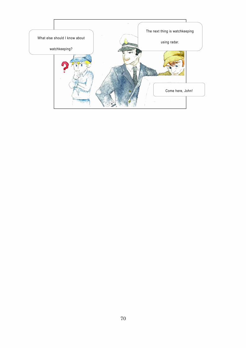
70
Come here, John!
The next thing is watchkeeping
using radar. What else should I know about
watchkeeping?
71
Commentary 03: Navigation on the NSR in Practice [Effective Use
of Radar]
The NSR is prone to fog in summer, which frequently hinders watchkeeping
with the naked eye. In addition, ice tends to be located close to fog, and fog
tends to occur near ice, so it is vital to use radar as a means of bolstering
watchkeeping with the naked eye in seas where ice is or might be present.
When using radar, you must first correctly adjust the various switches,
including tuning, gain, anti-sea clutter control (STC), anti-rain clutter control
(FTC), and display brilliance, and then check the performance of the equipment.
In addition, you need to choose the appropriate range scale (6 miles, 3 miles,
1.5 miles, etc.) according to the visibility conditions.
Ice will not be displayed clearly unless you properly adjust the radar and make
full use of its capabilities. Ice tends to be displayed more clearly when it is more
concentrated. The images on X-band radar, which uses the 9,000 megahertz
band, are clearer than on S-band radar, which uses the 3,000 megahertz band,
so you can observe ice conditions in greater detail. You need to use each
appropriately according to the purpose of its use, such as checking for land or
keeping watch for ice. As you become proficient in radar operation, you will
develop the ability to predict the ice concentration and the situation on the other
side of the ice (such as whether or not there is open water), to some extent.
However, there are times when ice does not show up on radar, such as large
ice floes with a flat surface or small ice shards. In addition, the effects of rainfall,
snowfall, fog, and waves can result in ice not showing up on radar. That is why
you should make watchkeeping with the naked eye a priority, rather than over -
relying on radar.

72
Utilizing radar is important, but you must not over -rely on it!
73
Day 3 of the Voyage (Novaya Zemlya – Kara Sea)
On the third day after leaving Murmansk, the Tiger Gate has just passed the
snow- and ice-covered Cape Zhelaniya, at the northern tip of Novaya Zemlya.
At present, the Tiger Gate is heading east on the Kara Sea, following a course
toward the Vilkitsky Strait, to the south of Severnaya Zemlya, in accordance
with the instructions of the marine traffic control center. The sky outside remains
cloudy and overcast, while the temperature is +10°C. The wind has
strengthened slightly and the waves here and there are flecked with white.
There is no ice.
“Chief Officer, I’ve switched the steering stand to auto. Course one zero one
(101°), sir.”
“Thanks. Now I’d like you to keep a good watch, as usual.”
“Yes, sir. Incidentally, Chief Officer, I’ve heard that a seasoned watchkeeper
not only identifies ice at an early stage, but also has even more amazing skills.
Is that true?”
“Yes, that’s right. Once you become proficient, you develop various skills; for
example, the ability to detect the presence of ice just from looking at the sky in
the distance and the ability to determine the hardness of ice just from its color.
You mustn’t be impatient; it’s important for you to get used to it gradually.”
“Yes, sir!”
“I wonder where you heard that, about seasoned watchkeepers? Well, I can
probably guess....”
The ice pilot Mr. Karaev, who was listening to the pair’s conversation, winks
at John while holding his index finger to his lips.
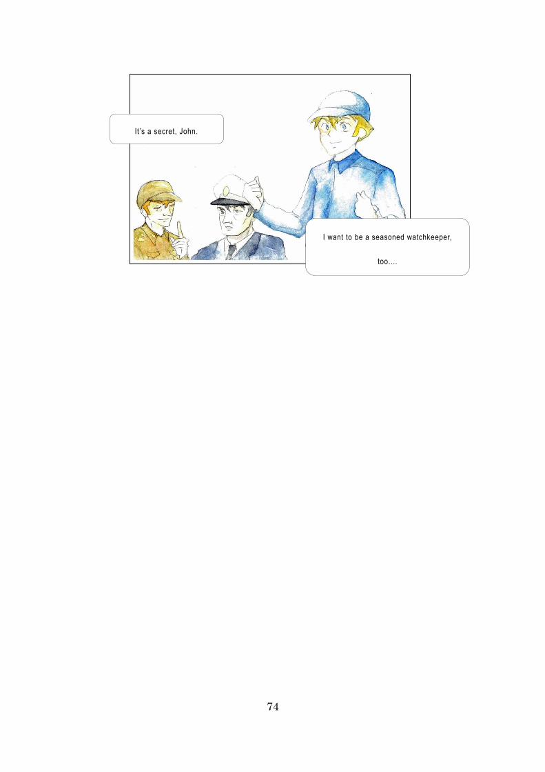
74
It’s a secret, John.
I want to be a seasoned watchkeeper,
too....
75
Commentary 04: Navigation on the NSR in Practice [Signs of Ice
Appearing]
A seasoned watchkeeper keeps watch based on a good understanding of
the various signs of ice appearing. The main signs are as follows.
[Encountering fog]
Ice tends to be present in the vicinity of fog and fog tends to occur near ice.
It would be fair to say that you invariably encounter dense fog when navigating
frozen waters.
[Fall in temperature]
Air and water temperatures plummet as you get closer to ice. A fall of at least
2-4°C in the air temperature or of at least 2°C in the water temperature within a
short time indicates that there might be ice nearby. There have been cases of
the water temperature instantly dropping by as much as 15°C near icebergs in
the Atlantic Ocean.
[Changes in clouds or sky]
A phenomenon called ice blink occurs in the sky over waters where ice is
present. Ice blink is a phenomenon in which light reflected off the surface of ice
is reflected in the sky, making the underside of clouds near the horizon glow
white or yellow-white. If snow has built up on the ice, the underside of the clouds
will look bright white, whereas it will look a faint yellow-white if there is ice alone.
On the other hand, the underside of clouds in the sky over waters where no ice
is present has dark gray streaks.
Even if there are no clouds in the sky over ice, you can still detect the
presence of ice if you pay close attention, because the reflection of light off the
surface of the ice causes the sky to look bluer.

76
Keep an eye out for ice blink when keeping watch for ice!
77
[Changes in the ocean surface]
Ice serves as a windbreak and a wave break, so wind can abruptly drop and
the sea suddenly become calm as you get closer to ice. You might also see
fragments of ice flowing past. Furthermore, the direction of waves and swells
might fluctuate, due to being reflected irregularly when they hit the ice.
[Encounters with animals]
As you near the ice, you may encounter ringed seals, walruses and other
pinnipeds. This is because pinnipeds live on the ice, giving birth and rearing
their young there. In addition, you might be approaching ice if seabirds that you
do not normally see start appearing or the number of seabirds increases sharply.
[Sounds]
The sound of ice “creaking” or waves breaking can alert you to the presence
of ice. In addition, whistles and engine sounds can echo because they are
reflected off the ice.
As you become accustomed to operating in frozen waters, you will develop
the ability to make an approximate judgment on the thickness and hardness of
ice based on its color and shape. There are theories that, in general, white, gray,
or leaden white ice is thin, while blue or green-blue ice is thick, and that in ice
hummocks formed from multiple layers of ice, the ice at the top is harder.
However, these theories are often not borne out: an area thought to be hard
might turn out to be unexpectedly fragile, or ice that seems thin might turn out
to be too thick to be broken.

78
Keep an eye out for animals when keeping watch for ice!
79
Column 14: What is the Mystery of the Disappearing Lighthouses?
Lighthouses and buoys – generally referred to as navigational aids – are
installed at strategic points and dangerous spots along the coast of the Arctic
Ocean, helping to ensure navigational safety. Most of these navigational aids
were installed before the Soviet Union’s collapse in 1991. Recently, some
seafarers have commented that some of the lighthouses have become hard to
spot from on board ship. What on earth could be the reason for this?
At the risk of spoiling a good mystery, the reason for this is that some
lighthouses have become obscured by encroaching forests. Back when these
lighthouses were built, during the Soviet era, the land along the Arctic coast
was tundra (permafrost), where hardly any vegetation grew. However, as a
result of the progressive warming of Siberia, the taiga – a coniferous forest belt
originally located to the south of the tundra – has gradually moved north toward
the Arctic coast.
Some of the areas where lighthouses were constructed have turned from
tundra into taiga and the coniferous forest belt now blocks the view of the light.
Who would have imagined that global warming would even affect lighthouses?
Moreover, there are hardly any roads or towns along the Arctic coast, so it would
cost a huge amount of money to redevelop the lighthouses. In the tundra, where
there are no power lines, atomic batteries (which contain radioactive material)
were used to supply power to light navigational aids.

80
Global warming is blocking the view of lighthouses?
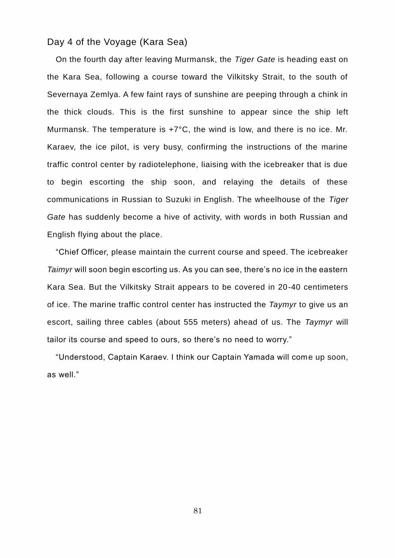
81
Day 4 of the Voyage (Kara Sea)
On the fourth day after leaving Murmansk, the Tiger Gate is heading east on
the Kara Sea, following a course toward the Vilkitsky Strait, to the south of
Severnaya Zemlya. A few faint rays of sunshine are peeping through a chink in
the thick clouds. This is the first sunshine to appear since the ship left
Murmansk. The temperature is +7°C, the wind is low, and there is no ice. Mr.
Karaev, the ice pilot, is very busy, confirming the instructions of the marine
traffic control center by radiotelephone, liaising with the icebreaker that is due
to begin escorting the ship soon, and relaying the details of these
communications in Russian to Suzuki in English. The wheelhouse of the Tiger
Gate has suddenly become a hive of activity, with words in both Russian and
English flying about the place.
“Chief Officer, please maintain the current course and speed. The icebreaker
Taimyr will soon begin escorting us. As you can see, there’s no ice in the eastern
Kara Sea. But the Vilkitsky Strait appears to be covered in 20-40 centimeters
of ice. The marine traffic control center has instructed the Taymyr to give us an
escort, sailing three cables (about 555 meters) ahead of us. The Taymyr will
tailor its course and speed to ours, so there’s no need to worry.”
“Understood, Captain Karaev. I think our Captain Yamada will come up soon,
as well.”

82
The icebreaker’s going
to arrive shortly.
(Captain Yamada)
Situation report,
please.
83
Commentary 05: Navigation on the NSR in Practice [Navigational
Watchkeeping Teams]
When sailing the NSR, crews must form bridge teams (navigational
watchkeeping teams) appropriate to the situation at the time. Sailing the NSR
involves special navigational tasks not found in other bodies of water, such as
the navigation of frozen waters and icebreaker escorts. To ensure that the
burden does not fall entirely on a limited number of crew members, you must
always keep an eye on changes in the surrounding environment while
maintaining an appropriate navigational watchkeeping team to facilitate safe
operation. For example, the number of team members should be increased
according to the degree of difficulty involved in navigational tasks in each area.
Some examples of the configuration of bridge teams according to the degree of
difficulty involved in navigational tasks are provided below. The ice pilot is not
counted as a member of the team.
・ <Sailing through wide open seas with no ice> 1 mate, 1 helmsman
・ <Sailing through wide open seas with a possibility of ice> 1 mate, 1
helmsman, 1 deck hand (bridge watchkeeper)
・ <Sailing through narrow waters, etc. with shallows> Captain, 1 mate, 1
helmsman, 1 deck hand (bridge watchkeeper)
・ <Sailing through wide open seas with no ice with an icebreaker escort>
1 mate, 1 helmsman
・ <Sailing through wide open seas with a possibility of ice with an icebreaker
escort> Captain, 1 mate, 1 helmsman, 1 deck hand (bridge watchkeeper)
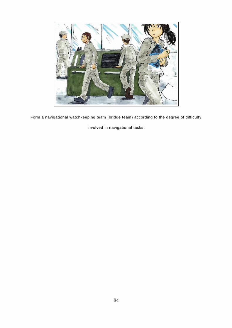
84
Form a navigational watchkeeping team (bridge team) according to the degree of difficulty
involved in navigational tasks!
85
・ <Sailing through narrow waters, etc. with ice or shallows with an icebreaker
escort / Sailing in a single file pair with an icebreaker> Captain, 2 mates, 1
helmsman, 1 deck hand (bridge watchkeeper)
・ <Sailing through narrow waters, etc. with ice or shallows with an icebreaker
escort / Sailing in a convoy with several other merchant ships other than an
icebreaker> Captain, 2 mates, 1 helmsman, 1 deck hand (bridge
watchkeeper), 1 deck hand (stern watchkeeper)
It was in 2009 that ships from countries other than Russia began using the
NSR for international voyages. As it does not have a long history, there are
likely to be many crew members who are unaccustomed to the special
navigational tasks required. To achieve safe operation, watchkeeping must be
facilitated not only by increasing the skill level of indiv idual members, but also
by increasing the skill level of the team as a whole via team members’ ability to
work together. As such, it is vital to hold briefings attended by all team members
and the ice pilot before navigational watchkeeping begins, in order to share
information about passage planning, watchkeeping guidelines, seamarks, and
anticipated weather and oceanographic phenomena, as well as clarifying the
division of roles among the team members.
Navigating the NSR is a collaborative endeavor that involves not only the
members of the bridge team, but also many other people, including the ice pilots,
the marine traffic control center, and the icebreaker (and its operating company).
Moreover, communication is complex, because it involves Russian as well as
English. To prevent accidents due to human error, you must take care to
exchange accurate information and communicate clearly.
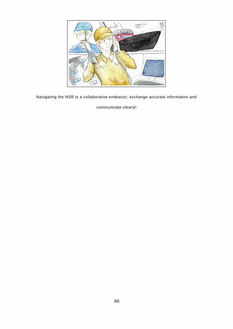
86
Navigating the NSR is a collaborative endeavor; exchange accurate information and
communicate clearly!
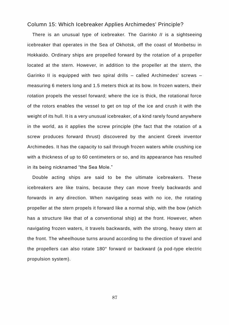
87
Column 15: Which Icebreaker Applies Archimedes' Principle?
There is an unusual type of icebreaker. The Garinko II is a sightseeing
icebreaker that operates in the Sea of Okhotsk, off the coast of Monbetsu in
Hokkaido. Ordinary ships are propelled forward by the rotat ion of a propeller
located at the stern. However, in addition to the propeller at the stern, the
Garinko II is equipped with two spiral drills – called Archimedes' screws –
measuring 6 meters long and 1.5 meters thick at its bow. In frozen waters, their
rotation propels the vessel forward; where the ice is thick, the rotational force
of the rotors enables the vessel to get on top of the ice and crush it with the
weight of its hull. It is a very unusual icebreaker, of a kind rarely found anywhere
in the world, as it applies the screw principle (the fact that the rotation of a
screw produces forward thrust) discovered by the ancient Greek inventor
Archimedes. It has the capacity to sail through frozen waters while crushing ice
with a thickness of up to 60 centimeters or so, and its appearance has resulted
in its being nicknamed “the Sea Mole.”
Double acting ships are said to be the ultimate icebreakers. These
icebreakers are like trains, because they can move freely backwards and
forwards in any direction. When navigating seas with no ice, the rotating
propeller at the stern propels it forward like a normal ship, with the bow (which
has a structure like that of a conventional ship) at the front. However, when
navigating frozen waters, it travels backwards, with the strong, heavy stern at
the front. The wheelhouse turns around according to the direction of travel and
the propellers can also rotate 180° forward or backward (a pod-type electric
propulsion system).
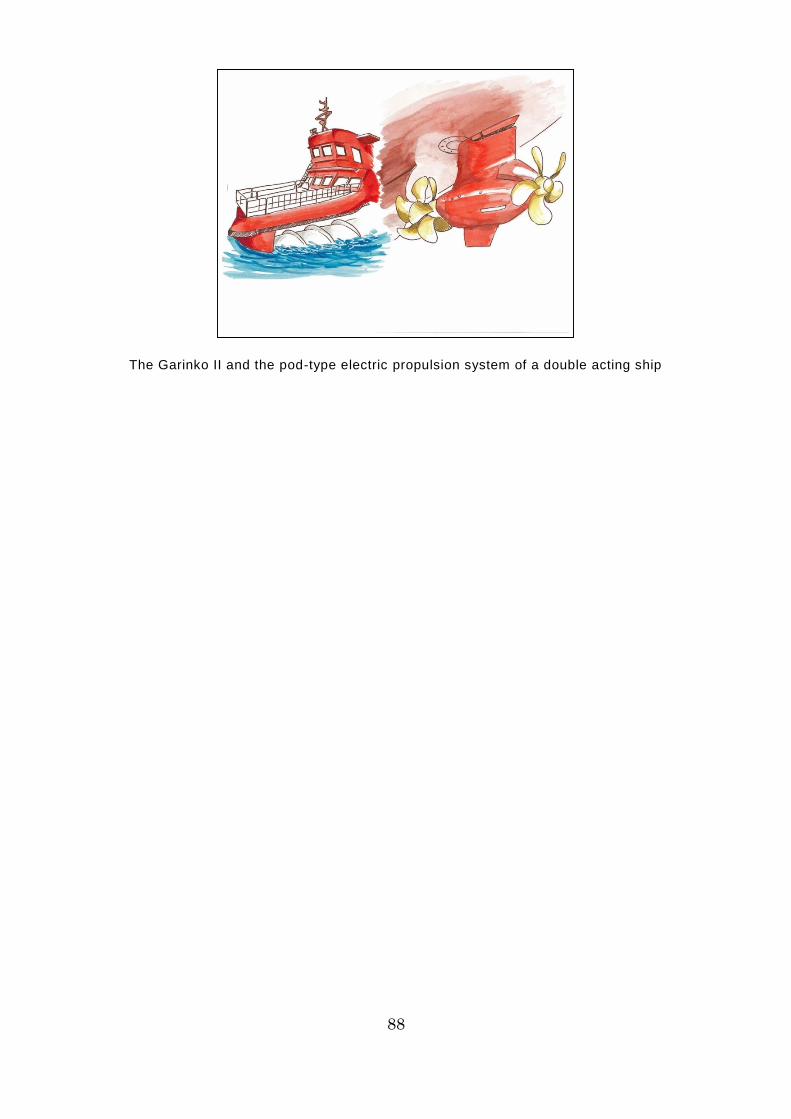
88
The Garinko II and the pod-type electric propulsion system of a double acting ship
89
Day 5 of the Voyage (Laptev Sea)
On the fifth day after leaving Murmansk, the Tiger Gate is heading southeast
on the Laptev Sea, toward the Sannikov Strait in the New Siberian Islands. The
Vilkitsky Strait, which the ship has just passed through, was narrow, with
shallow points here and there, and was covered in thin ice. On the Tiger Gate,
a bridge team (navigational watchkeeping team) consisting of 2 mates, 1
helmsman, and 1 deck hand (bridge watchkeeper) was formed under the
captain; the main engine was put on standby, so that it could be used at any
time, and the crew tackled the most perilous point on the NSR, escorted by the
icebreaker Taymyr. Visibility was not very good and, as expected, there was a
strong tidal current of 4 knots (7.4 kilometers per hour) from the rear, so the
rudder wavered from side to side, making it a little difficult to maintain the course,
but all of the crew worked together to make it through. Looking back once out
of this tense situation, Suzuki noticed that visibility toward the continent had
cleared and spotted a magnificent blue-green glacier extending out from a white
mountain peak.
“Look, John. You really get a sense of the timeless grandeur of nature when
you see that glacier, don’t you think?”
“Yes, Chief Officer. I’ve never seen a glacier before. It’s really magical, isn’t
it?”
“According to the information from the marine traffic control center, there
seems to be thick ice clustered in the northern Laptev Sea, so I’ve decided to
head toward the Sannikov Strait, taking the most southerly course that I can.
The basic principle on the NSR is to avoid any avoidable risks, whenever
possible.”
“Yes, sir. I’ll do my best on watch. By the way, Chief Officer, the nautical chart
you’re looking at now is in Russian, isn’t it? I can't read Russian.”

90
“I’m not great at Russian either, so let’s talk about nautical charts today.”
It’s a Russian nautical chart. I can't
read Russian.
Let’s talk about nautical
charts.
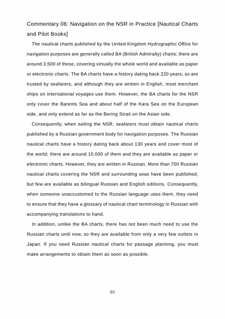
91
Commentary 06: Navigation on the NSR in Practice [Nautical Charts
and Pilot Books]
The nautical charts published by the United Kingdom Hydrographic Office for
navigation purposes are generally called BA (British Admiralty) charts; there are
around 3,500 of these, covering virtually the whole world and available as paper
or electronic charts. The BA charts have a history dating back 220 years, so are
trusted by seafarers, and although they are written in English, most merchant
ships on international voyages use them. However, the BA charts for the NSR
only cover the Barents Sea and about half of the Kara Sea on the European
side, and only extend as far as the Bering Strait on the Asian side.
Consequently, when sailing the NSR, seafarers must obtain nautical charts
published by a Russian government body for navigation purposes. The Russian
nautical charts have a history dating back about 130 years and cover most of
the world; there are around 10,000 of them and they are available as paper or
electronic charts. However, they are written in Russian. More than 700 Russian
nautical charts covering the NSR and surrounding seas have been published,
but few are available as bilingual Russian and English editions. Consequently,
when someone unaccustomed to the Russian language uses them, they need
to ensure that they have a glossary of nautical chart terminology in Russian with
accompanying translations to hand.
In addition, unlike the BA charts, there has not been much need to use the
Russian charts until now, so they are available from only a very few outlets in
Japan. If you need Russian nautical charts for passage planning, you must
make arrangements to obtain them as soon as possible.
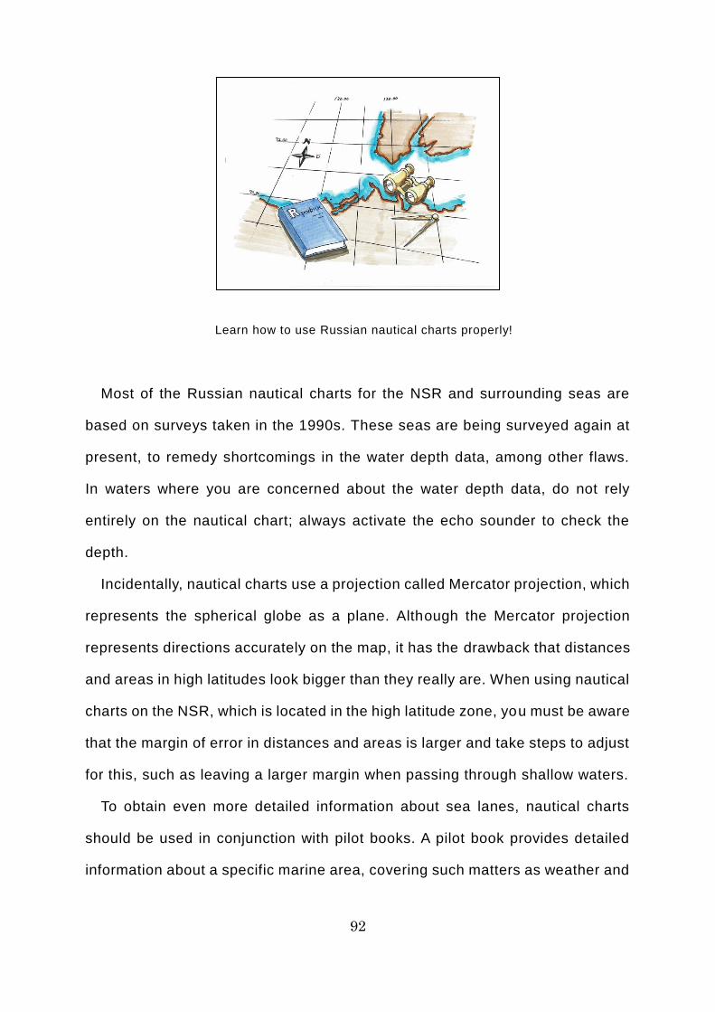
92
Learn how to use Russian nautical charts properly!
Most of the Russian nautical charts for the NSR and surrounding seas are
based on surveys taken in the 1990s. These seas are being surveyed again at
present, to remedy shortcomings in the water depth data, among other flaws.
In waters where you are concerned about the water depth data, do not rely
entirely on the nautical chart; always activate the echo sounder to check the
depth.
Incidentally, nautical charts use a projection called Mercator projection, which
represents the spherical globe as a plane. Although the Mercator projection
represents directions accurately on the map, it has the drawback that distances
and areas in high latitudes look bigger than they really are. When using nautical
charts on the NSR, which is located in the high latitude zone, you must be aware
that the margin of error in distances and areas is larger and take steps to adjust
for this, such as leaving a larger margin when passing through shallow waters.
To obtain even more detailed information about sea lanes, nautical charts
should be used in conjunction with pilot books. A pilot book provides detailed
information about a specific marine area, covering such matters as weather and
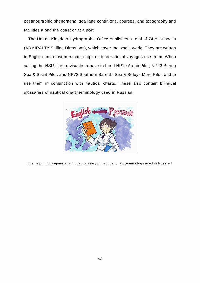
93
oceanographic phenomena, sea lane conditions, courses, and topography and
facilities along the coast or at a port.
The United Kingdom Hydrographic Office publishes a total of 74 pilot books
(ADMIRALTY Sailing Directions), which cover the whole world. They are written
in English and most merchant ships on international voyages use them. When
sailing the NSR, it is advisable to have to hand NP10 Arctic Pilot, NP23 Bering
Sea & Strait Pilot, and NP72 Southern Barents Sea & Beloye More Pilot, and to
use them in conjunction with nautical charts. These also contain bilingual
glossaries of nautical chart terminology used in Russian.
It is helpful to prepare a bilingual glossary of nautical chart terminology used in Russian!
94
Commentary 07: Navigation on the NSR in Practice [Passage
Planning]
If you plan to navigate the NSR, you must first apply to the NSRA for a
navigation permit, in accordance with Russian domestic law. The NSRA
imposes certain conditions in the navigation permit, such as requiring an
icebreaker escort, depending on the ice class of the ship that is to make the
voyage and the ice conditions on the route. It may also oblige the ship to carry
ice pilots on board, depending on the captain’s experience of navigating the
NSR. A ship may not sail the NSR unless it complies with these conditions and
obligations. In addition, if the NSRA issues an instruction about the route that a
ship should take via a marine traffic control center, the ship must comply with
that instruction. Based on experience, the NSRA has set standard sea lanes
(the northern and southern sea lanes) for navigating the NSR. Depending on
the ice conditions, ships may be instructed to take a route that uses an
appropriate combination of the northern and southern sea lanes. Those making
the voyage must themselves analyze the ice conditions and weather to gain a
clear insight into the NSRA’s intentions in giving the instruction to sail a certain
route.
As such, passage plans for the NSR must use the route specified by the
NSRA. The content of passage plans must reflect the NSR’s specific
environmental conditions, in compliance with the Polar Code prescribed by the
IMO (International Maritime Organization), and must be prepared with reference
to general guidelines such as the IMO Guidelines for Voyage Planning.
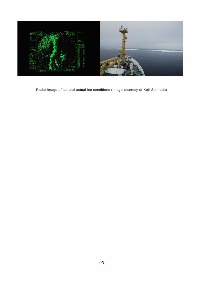
95
Radar image of ice and actual ice conditions (Image courtesy of Koji Shimada)
96
Commentary 08: Navigation on the NSR in Practice [Course
Selection, etc.]
When a ship is sailing the NSR, the marine traffic control center or escorting
icebreaker may give the ship making the voyage instructions about its sea lane,
course, and speed, taking into account the situation in the vicinity. It is vital for
the ship making the voyage to understand the purpose of these instructions.
Moreover, irrespective of whether or not any instructions have been given, you
must comply with the following to ensure safe operation when sailing the NSR.
・ Select a course that will avoid ice as far as possible, to avert the risk of hull
damage and fog. Maintain an adequate margin when diverting to avoid ice,
taking into account the fact that dense fog tends to occur near ice and the
fact that ice moves.
・ Maintain a safe distance from shore, taking into account the ship’s draft,
size, speed, whether it is daytime or nighttime, visibility, ice conditions,
weather and oceanographic phenomena, experience of navigating the NSR,
and the position of shallows and sunken rocks.
・ When passing through straits, use nautical charts to check the water depth
near the course and the position of shallows and sunken rocks, then set the
clearing lines and make absolutely sure that the ship does not cross them.
The margin of error for distance and area is quite large on nautical charts
for high latitudes, so it is advisable to set clearing lines on the basis of
distance from the head mark or target.
・ Use pilot books to check in advance the approach to straits, etc., the course
that should be taken, and precautions when passing through them.
・ Maintain a safe under-keel clearance, taking into account the ship’s draft,
size, speed, tides, weather and oceanographic phenomena, and the
reliability of depth data.

97
Maintain an adequate margin when diverting around ice!
98
・ The IMO (International Maritime Organization) has prescribed a traffic
separation scheme in the Kara Strait (Kara Gates); under this scheme, ships
must pass any oncoming ship, with such ship on their left .
・ The water in the Sannikov Strait (a strait in the New Siberian Islands) is
shallow throughout, reaching just 13 meters in places, so only ships with a
draft of 11 meters or less are permitted to pass through it.
・ The water in the Dmitry Laptev Strait (a strait between the New Siberian
Islands and the continent) has an average depth of just 12-15 meters and
there are shallows where the water is less than 10 meters deep, so only
ships with a draft of 6.7 meters or less are permitted to pass through it.
・ Avoid shortcuts and changing course by a large angle at capes, etc. as far
as possible. If unavoidable, undertake a series of course changes at small
angles.
・ When sailing through waters where ice is present, waters where the depth
data is questionable, or waters where unpredictable tidal currents are
anticipated, set a substantial margin from any shallows and sunken rocks.
・ In waters where you are concerned about the water depth data, etc., do not
rely entirely on the nautical chart; always activate the echo sounder and
proceed while measuring and checking the depth.
It is also a good idea to use a weather routing service (a paid-for service
provided by meteorology companies, which put together routes that meet the
needs of shipping companies (e.g. the route involving the least fuel
consumption or the route that will make it easiest to get up speed) based on
forecasts for weather and oceanographic phenomena) to ensure that operation
is economical.
Until you have built up experience, it is wise to consult the ice pilot, etc. and
seek their advice. In any case, do not forget that navigating the NSR is a
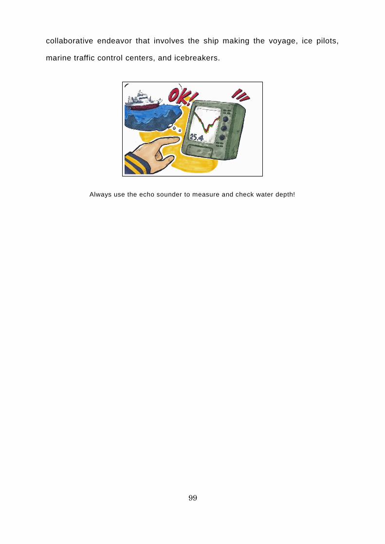
99
collaborative endeavor that involves the ship making the voyage, ice pilots,
marine traffic control centers, and icebreakers.
Always use the echo sounder to measure and check water depth!
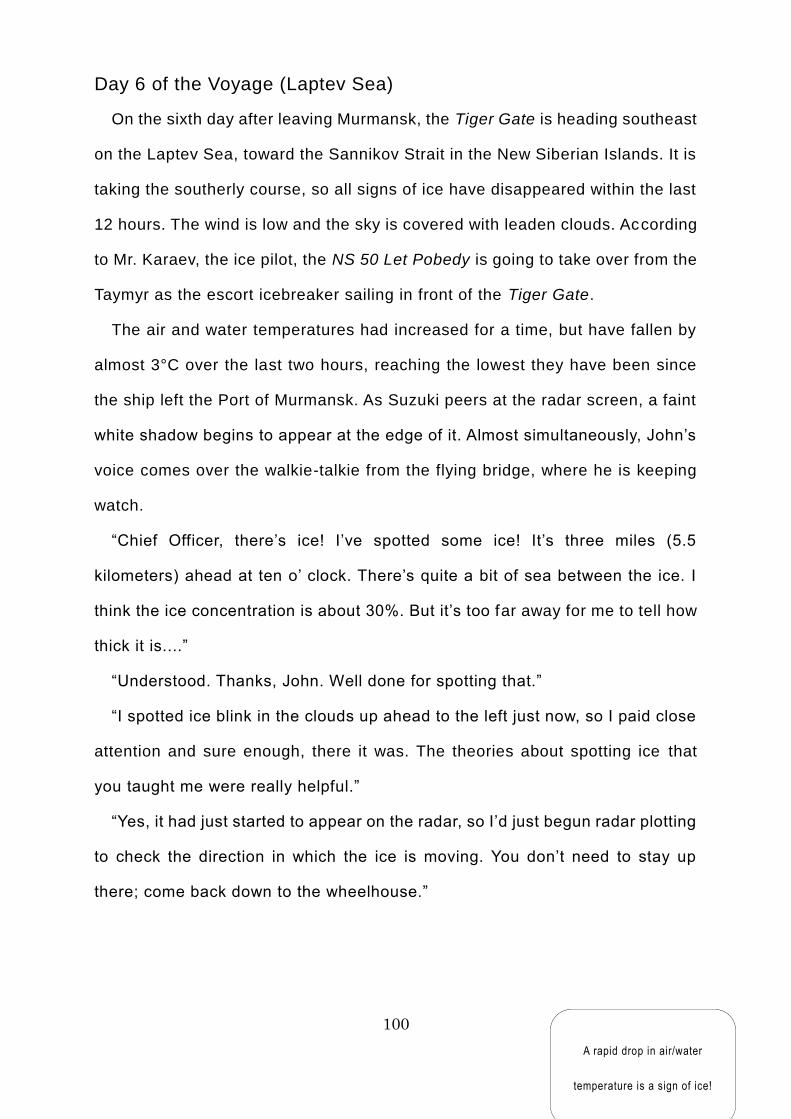
100
Day 6 of the Voyage (Laptev Sea)
On the sixth day after leaving Murmansk, the Tiger Gate is heading southeast
on the Laptev Sea, toward the Sannikov Strait in the New Siberian Islands. It is
taking the southerly course, so all signs of ice have disappeared within the last
12 hours. The wind is low and the sky is covered with leaden clouds. According
to Mr. Karaev, the ice pilot, the NS 50 Let Pobedy is going to take over from the
Taymyr as the escort icebreaker sailing in front of the Tiger Gate.
The air and water temperatures had increased for a time, but have fallen by
almost 3°C over the last two hours, reaching the lowest they have been since
the ship left the Port of Murmansk. As Suzuki peers at the radar screen, a faint
white shadow begins to appear at the edge of it. Almost simultaneously, John’s
voice comes over the walkie-talkie from the flying bridge, where he is keeping
watch.
“Chief Officer, there’s ice! I’ve spotted some ice! It’s three miles (5.5
kilometers) ahead at ten o’ clock. There’s quite a bit of sea between the ice. I
think the ice concentration is about 30%. But it’s too far away for me to tell how
thick it is....”
“Understood. Thanks, John. Well done for spotting that.”
“I spotted ice blink in the clouds up ahead to the left just now, so I paid close
attention and sure enough, there it was. The theories about spotting ice that
you taught me were really helpful.”
“Yes, it had just started to appear on the radar, so I’d just begun radar plotting
to check the direction in which the ice is moving. You don’t need to stay up
there; come back down to the wheelhouse.”
A rapid drop in air/water
temperature is a sign of ice!
101
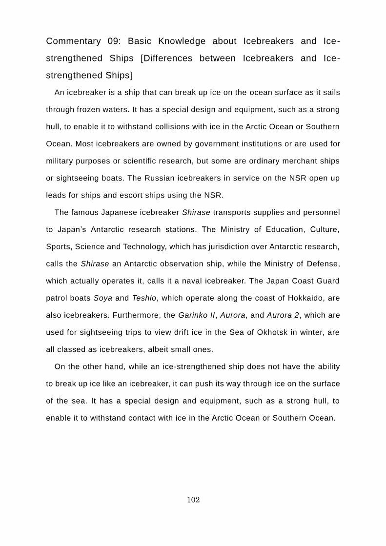
102
Commentary 09: Basic Knowledge about Icebreakers and Ice-
strengthened Ships [Differences between Icebreakers and Ice-
strengthened Ships]
An icebreaker is a ship that can break up ice on the ocean surface as it sails
through frozen waters. It has a special design and equipment, such as a strong
hull, to enable it to withstand collisions with ice in the Arctic Ocean or Southern
Ocean. Most icebreakers are owned by government institutions or are used for
military purposes or scientific research, but some are ordinary merchant ships
or sightseeing boats. The Russian icebreakers in service on the NSR open up
leads for ships and escort ships using the NSR.
The famous Japanese icebreaker Shirase transports supplies and personnel
to Japan’s Antarctic research stations. The Ministry of Education, Culture,
Sports, Science and Technology, which has jurisdiction over Antarctic research,
calls the Shirase an Antarctic observation ship, while the Ministry of Defense,
which actually operates it, calls it a naval icebreaker. The Japan Coast Guard
patrol boats Soya and Teshio, which operate along the coast of Hokkaido, are
also icebreakers. Furthermore, the Garinko II, Aurora, and Aurora 2, which are
used for sightseeing trips to view drift ice in the Sea of Okhotsk in winter, are
all classed as icebreakers, albeit small ones.
On the other hand, while an ice-strengthened ship does not have the ability
to break up ice like an icebreaker, it can push its way through ice on the surface
of the sea. It has a special design and equipment, such as a strong hull, to
enable it to withstand contact with ice in the Arctic Ocean or Southern Ocean.
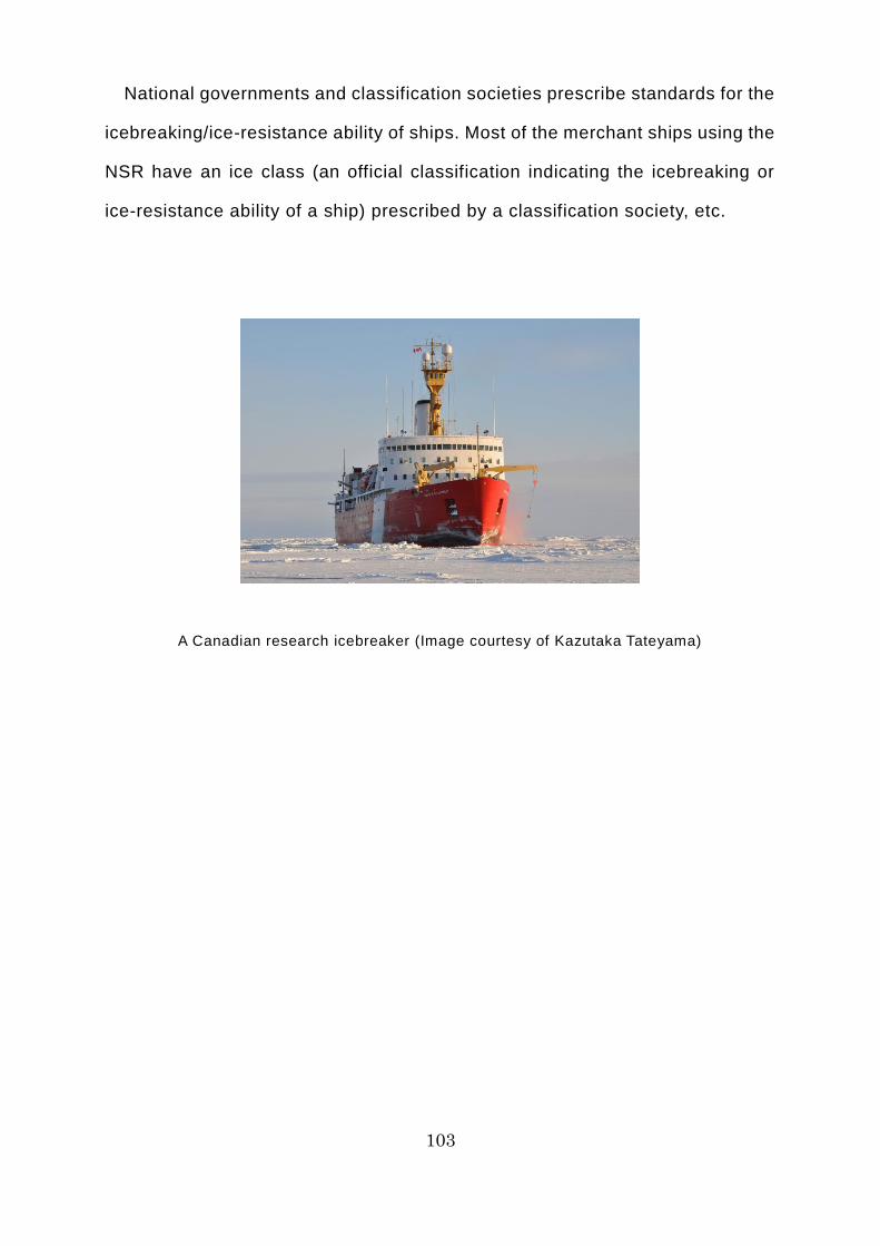
103
National governments and classification societies prescribe standards for the
icebreaking/ice-resistance ability of ships. Most of the merchant ships using the
NSR have an ice class (an official classification indicating the icebreaking or
ice-resistance ability of a ship) prescribed by a classification society, etc.
A Canadian research icebreaker (Image courtesy of Kazutaka Tateyama)
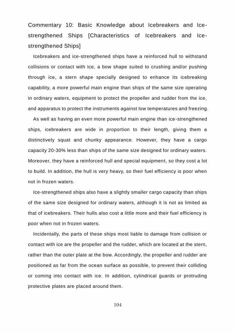
104
Commentary 10: Basic Knowledge about Icebreakers and Ice-
strengthened Ships [Characteristics of Icebreakers and Ice-
strengthened Ships]
Icebreakers and ice-strengthened ships have a reinforced hull to withstand
collisions or contact with ice, a bow shape suited to crushing and/or pushing
through ice, a stern shape specially designed to enhance its icebreaking
capability, a more powerful main engine than ships of the same size operating
in ordinary waters, equipment to protect the propeller and rudder from the ice,
and apparatus to protect the instruments against low temperatures and freezing.
As well as having an even more powerful main engine than ice-strengthened
ships, icebreakers are wide in proportion to their length, giving them a
distinctively squat and chunky appearance. However, they have a cargo
capacity 20-30% less than ships of the same size designed for ordinary waters.
Moreover, they have a reinforced hull and special equipment, so they cost a lot
to build. In addition, the hull is very heavy, so their fuel efficiency is poor when
not in frozen waters.
Ice-strengthened ships also have a slightly smaller cargo capacity than ships
of the same size designed for ordinary waters, although it is not as limited as
that of icebreakers. Their hulls also cost a little more and their fuel efficiency is
poor when not in frozen waters.
Incidentally, the parts of these ships most liable to damage from collision or
contact with ice are the propeller and the rudder, which are located at the stern,
rather than the outer plate at the bow. Accordingly, the propeller and rudder are
positioned as far from the ocean surface as possible, to prevent their colliding
or coming into contact with ice. In addition, cylindrical guards or protruding
protective plates are placed around them.
105
The distinctively squat and chunky shape of an icebreaker (Image courtesy of Jin Saijo)
106
Commentary 11: Basic Knowledge about Icebreakers and Ice-
strengthened Ships [Ice Pressure]
When crushing or pushing through ice, icebreakers and ice-strengthened
ships are affected by the strength of the ice, which is called “ice pressure.”
Accordingly, their hulls are reinforced to withstand ice pressure or are specially
designed with a shape that alleviates ice pressure. If an ordinary ship without a
reinforced hull is subject to excessive ice pressure, the hull, propeller, and
rudder can sustain serious damage and, in a worst-case scenario, the ship
could even sink.
When an icebreaker sails through frozen waters, its hull is subject to
continuous ice pressure, but it will usually ascertain the ice conditions and its
own capability to withstand them before proceeding cautiously at a safe speed,
so it will not sustain any serious damage. On the other hand, the damage tends
to be severe if an ice-strengthened ship being escorted by an icebreaker
chooses the wrong course or collides with the edge of thick ice beside the lead,
or if crew members fail to notice a huge piece of drifting ice due to inadequate
watchkeeping and the ship collides with it at its original speed.
When a ship has become trapped in the ice, unable to move, it is said to be
“beset.” If a ship without adequate hull reinforcement becomes beset, in a
worst-case scenario it could be crushed by the pressure of the surrounding ice.
It must break free from the ice or be rescued by an icebreaker as soon as
possible.
Before icebreakers were built, many ships were crushed by the ice in the
Arctic Ocean and quite a few of their crew members lost their lives. Most
icebreakers are able to disperse ice pressure well, even when surrounded by
ice, or have a hull shape specially designed to make it easy for the ship to get
onto the ice.

107
Many ships fell victim to ice pressure in the Arctic Ocean in days gone by!
108
Commentary 12: Basic Knowledge about Icebreakers and Ice-
strengthened Ships [Icebreaking Methods]
Most of the merchant ships that navigate the NSR are what are referred to as
ice-strengthened ships. It is likely that few would be able to push their own way
through the ice without an icebreaker escort. However, you should have a basic
knowledge of icebreaking methods used by icebreakers.
The basic principle to follow in frozen waters is that all ships, no matter what
kind they might be, should avoid ice wherever possible, finding the part where
there is least ice, where the ice is thinnest, or where there are cracks in the ice.
The basic principle that avoidable dangers should be avoided wherever possible
also applies to icebreakers. Icebreakers use the following methods when sailing
through frozen waters.
[Continuous icebreaking]
Continuous icebreaking involves the icebreaker maintaining a constant
speed of 2-3 knots (3.7-5.6 kilometers per hour), breaking up the ice as it goes.
The maximum thickness of ice that an icebreaker can break through in
continuous mode is called its continuous icebreaking ability. The greater the
thrust generated by the propeller, the greater the ship’s continuous icebreaking
ability. Its icebreaking ability is also influenced by such factors as how easy the
shape of the hull makes it for the ship to break through the ice, and how far the
broken ice can be kept from the hull, without being caught up in the propeller.
The continuous icebreaking ability of the Antarctic observation ship Shirase is
1.5 meters, while that of the patrol boat Teshio is 0.55 meters.
If a ship encounters ice beyond its continuous icebreaking ability, it can use
a technique called ramming icebreaking.
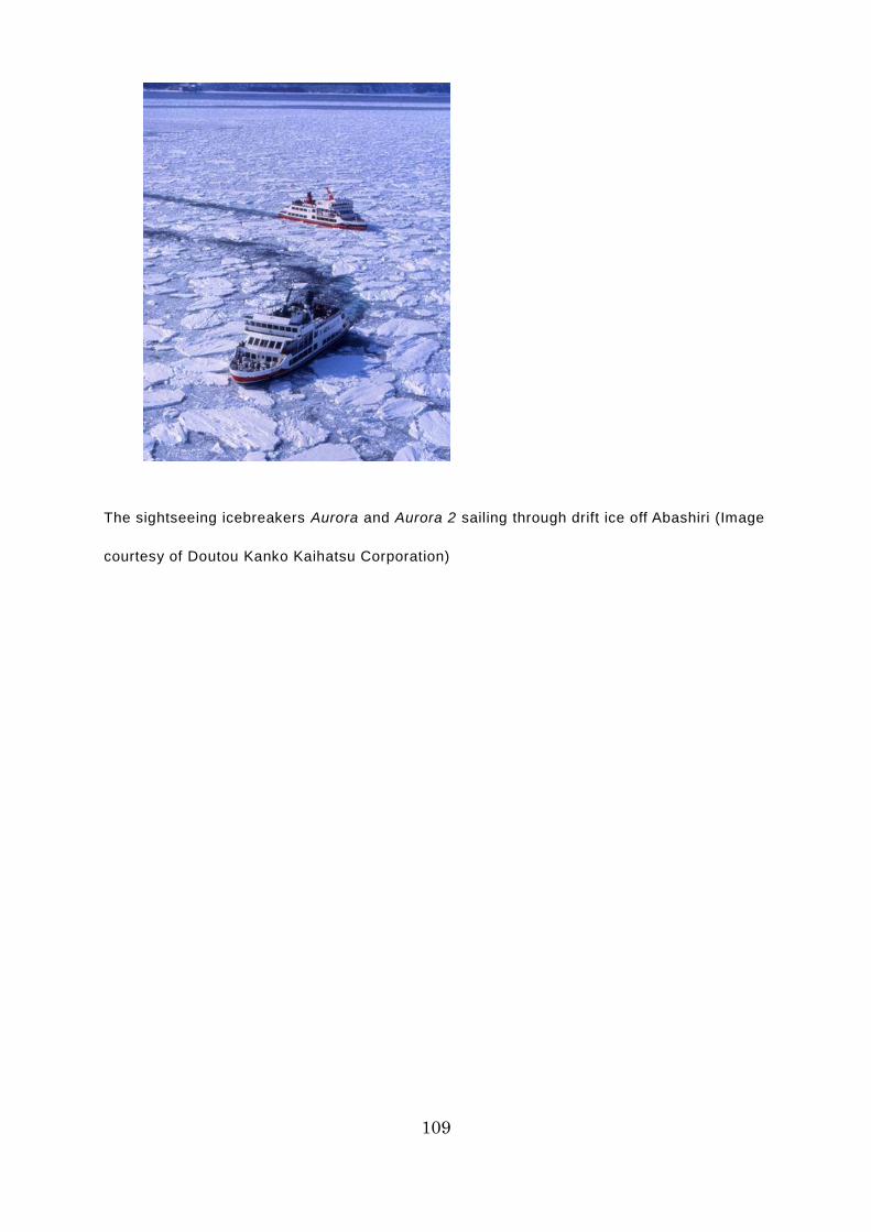
109
The sightseeing icebreakers Aurora and Aurora 2 sailing through drift ice off Abashiri (Image
courtesy of Doutou Kanko Kaihatsu Corporation)
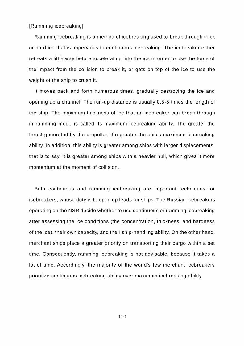
110
[Ramming icebreaking]
Ramming icebreaking is a method of icebreaking used to break through thick
or hard ice that is impervious to continuous icebreaking. The icebreaker either
retreats a little way before accelerating into the ice in order to use the force of
the impact from the collision to break it, or gets on top of the ice to use the
weight of the ship to crush it.
It moves back and forth numerous times, gradually destroying the ice and
opening up a channel. The run-up distance is usually 0.5-5 times the length of
the ship. The maximum thickness of ice that an icebreaker can break through
in ramming mode is called its maximum icebreaking ability. The greater the
thrust generated by the propeller, the greater the ship’s maximum icebreaking
ability. In addition, this ability is greater among ships with larger displacements;
that is to say, it is greater among ships with a heavier hull, which gives it more
momentum at the moment of collision.
Both continuous and ramming icebreaking are important techniques for
icebreakers, whose duty is to open up leads for ships. The Russian icebreakers
operating on the NSR decide whether to use continuous or ramming icebreaking
after assessing the ice conditions (the concentration, thickness, and hardness
of the ice), their own capacity, and their ship-handling ability. On the other hand,
merchant ships place a greater priority on transporting their cargo within a set
time. Consequently, ramming icebreaking is not advisable, because it takes a
lot of time. Accordingly, the majority of the world’s few merchant icebreakers
prioritize continuous icebreaking ability over maximum icebreaking ability.
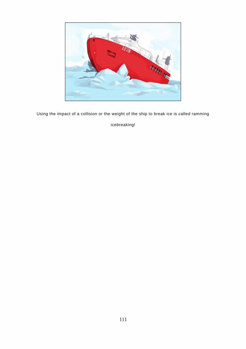
111
Using the impact of a collision or the weight of the ship to break ice is called ramming
icebreaking!
112
Day 7 of the Voyage (Sannikov Strait – East Siberian Sea)
On the seventh day after leaving Murmansk, the Tiger Gate has – guided by
the icebreaker NS 50 Let Pobedy – just passed through the Sannikov Strait,
which was covered in ice 30 centimeters thick, and is now navigating the East
Siberian Sea. There are light clouds, the air and water temperature have risen
by 2°C, and the wind has strengthened a little. The Tiger Gate is cautiously
following the NS 50 Let Pobedy at a distance of 3 cables (about 555 meters),
at a speed of 7 knots (13.0 kilometers per hour). There is a lot less ice since
entering the East Siberian Sea. According to the ice pilot Mr. Karaev, the ice in
the northern East Siberian Sea is quite concentrated, so they will soon change
to a more southerly course than usual, at the instruction of the marine traffic
control center.
“Chief Officer, the NS 50 Let Pobedy is instructing us to change to a more
southerly course than our current one. Set course one one zero (110°), please.”
“Understood, Captain Karaev. John, starboard five (steer 5° to the right )!”
“Starboard five (steering 5° to the right), sir!”
The NS 50 Let Pobedy expertly crushes the ice and pushes its way through
it. The crew of the Tiger Gate handle the ship cautiously, because if it goes off
course, it might miss the lead opened up by the icebreaker and collide with the
edge of the ice alongside the lead. The most effective strategy for following the
icebreaker exactly is to use its wake as a guide. Suzuki takes care to position
the hull between the air bubbles emitted in the wake of the icebreaker and
instructs John to make minute course adjustments of just a degree or two.
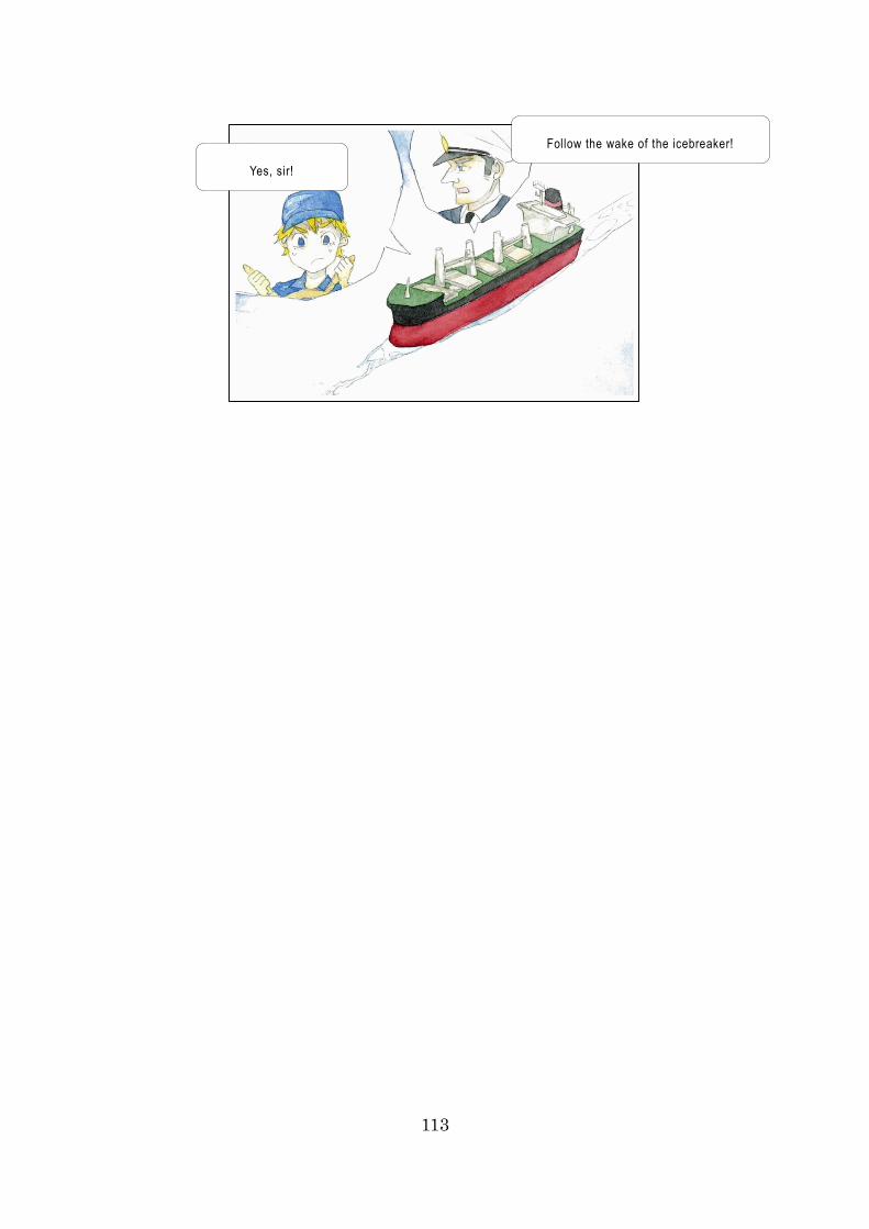
113
Follow the wake of the icebreaker!
Yes, sir!
114
Commentary 13: Basic Knowledge about Ice [Ice Formation and
Development]
There are several stages in the development of Arctic Ocean ice. Make sure
that you memorize the terminology below, as it is used in communications with
icebreakers and marine traffic control centers.
[New Ice]
This is the generic term for newly formed ice. Although this type of ice is
frozen, it consists of only a very small number of ice crystals, so it only
maintains its shape when afloat. It includes the following types of ice.
・ <Frazil ice> Fine needles or plates of ice suspended in water.
・ <Grease ice> A later stage of freezing than frazil ice; the ice crystals
clump together to form a soupy layer on the surface. It reflects little light,
giving the water a matte appearance.
・ <Slush> Snow that is saturated and mixed with water on land or ice
surfaces, or as a viscous floating mass in water after a heavy snowfall.
・ <Shuga> An accumulation of spongy white ice lumps with a
diameter of a few centimeters across. They are formed from grease ice
or slush, among other forms of ice, which rises to the surface.
[Nilas]
Firm and elastic on the surface, this is no more than 10 centimeters thick.
The surface is matte, so it looks gray. It can easily be reshaped by the action
of waves or swell. If it is subject to strong lateral pressure, it undergoes what is
called “finger rafting,” so called because of its resemblance to interlocking
fingers. Its brightness varies according to its thickness.
・ <Dark nilas> This has a thickness of less than 5 centimeters.
・ <Light nilas> This has a thickness of 5 centimeters or more.
[Ice Rind]

115
This is formed either by direct freezing of the calm ocean surface or from
grease ice. The surface is hard and shiny, so it looks bright. It is around 5
centimeters thick and is easily broken by wind or swell, commonly breaking into
rectangular pieces. It is formed from seawater with a low level of salinity.
116
[Pancake Ice]
This mainly consists of circular pieces of ice, with raised rims like those of
lotus leaves; this is caused by the pieces of ice colliding with each other. It
varies from 30 centimeters to 3 meters in diameter, and is around 10
centimeters thick. It is white or gray in color. It may form on a slight swell from
grease ice, slush, or shuga, or as a result of the breaking of ice rind, nilas, or,
under severe conditions of swell or waves, of gray ice. It also sometimes forms
at some depth at an interface between water bodies of different physical
characteristics where it floats to the surface. It may rapidly form over wide areas
of water.
[Young Ice]
This is ice in the transition stage between nilas to first -year ice, 10-30
centimeters in thickness. As pieces of pancake ice rub against each other and
the edges turn up like lotus leaves, they pile up on each other and grow in
thickness. They can be divided into two categories, according to their thickness.
・ <Gray ice> This is young ice 10-15 centimeters thick and gray in color.
It is less elastic than nilas and breaks on swell. It usually piles up (rafts)
as a result of lateral pressure.
・ <Gray-white ice> This is young ice 15-30 centimeters thick and
gray-white in color. Rather than rafting as a result of lateral pressure, it is
often forced upward to form ridges (a line or wall of broken ice forced up
by pressure).
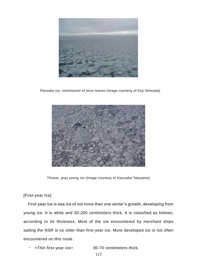
117
Pancake ice, reminiscent of lotus leaves (Image courtesy of Koji Shimada)
Thicker, gray young ice (Image courtesy of Kazutaka Tateyama)
[First-year Ice]
First-year ice is sea ice of not more than one winter’s growth, developing from
young ice. It is white and 30-200 centimeters thick. It is classified as follows,
according to its thickness. Most of the ice encountered by merchant ships
sailing the NSR is no older than first-year ice. More developed ice is not often
encountered on this route.
・ <Thin first-year ice> 30-70 centimeters thick.
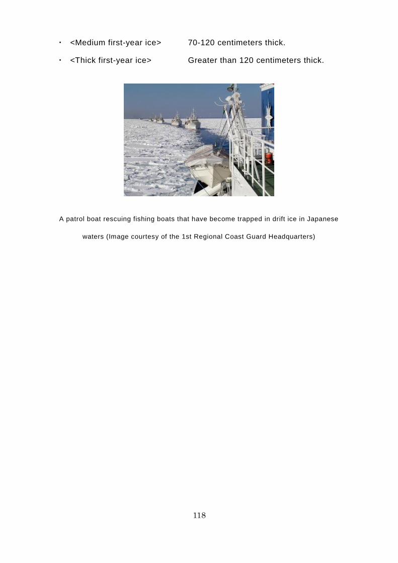
118
・ <Medium first-year ice> 70-120 centimeters thick.
・ <Thick first-year ice> Greater than 120 centimeters thick.
A patrol boat rescuing fishing boats that have become trapped in drift ice in Japanese
waters (Image courtesy of the 1st Regional Coast Guard Headquarters)
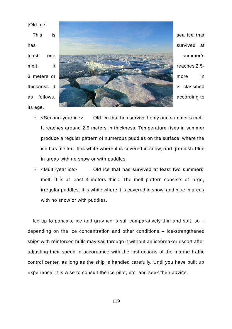
119
[Old Ice]
This is sea ice that
has survived at
least one summer’s
melt. It reaches 2.5-
3 meters or more in
thickness. It is classified
as follows, according to
its age.
・ <Second-year ice> Old ice that has survived only one summer’s melt.
It reaches around 2.5 meters in thickness. Temperature rises in summer
produce a regular pattern of numerous puddles on the surface, where the
ice has melted. It is white where it is covered in snow, and greenish-blue
in areas with no snow or with puddles.
・ <Multi-year ice> Old ice that has survived at least two summers’
melt. It is at least 3 meters thick. The melt pattern consists of large,
irregular puddles. It is white where it is covered in snow, and blue in areas
with no snow or with puddles.
Ice up to pancake ice and gray ice is still comparatively thin and soft, so –
depending on the ice concentration and other conditions – ice-strengthened
ships with reinforced hulls may sail through it without an icebreaker escort after
adjusting their speed in accordance with the instructions of the marine traffic
control center, as long as the ship is handled carefully. Until you have built up
experience, it is wise to consult the ice pilot, etc. and seek their advice.

120
Old ice that has found its way into first -year ice (Image courtesy of Kazutaka Tateyama)
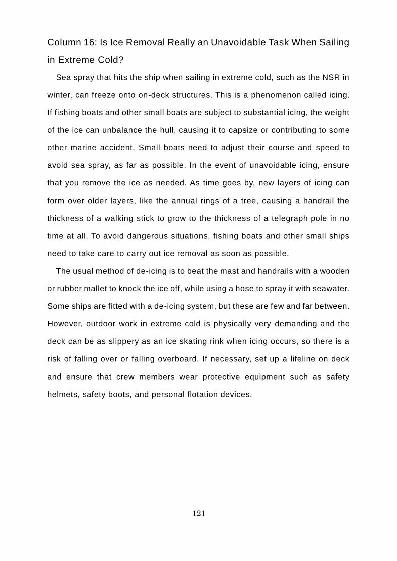
121
Column 16: Is Ice Removal Really an Unavoidable Task When Sailing
in Extreme Cold?
Sea spray that hits the ship when sailing in extreme cold, such as the NSR in
winter, can freeze onto on-deck structures. This is a phenomenon called icing.
If fishing boats and other small boats are subject to substantial icing, the weight
of the ice can unbalance the hull, causing it to capsize or contributing to some
other marine accident. Small boats need to adjust their course and speed to
avoid sea spray, as far as possible. In the event of unavoidable icing, ensure
that you remove the ice as needed. As time goes by, new layers of icing can
form over older layers, like the annual rings of a tree, causing a handrail the
thickness of a walking stick to grow to the thickness of a telegraph pole in no
time at all. To avoid dangerous situations, fishing boats and other small ships
need to take care to carry out ice removal as soon as possible.
The usual method of de-icing is to beat the mast and handrails with a wooden
or rubber mallet to knock the ice off, while using a hose to spray it with seawater.
Some ships are fitted with a de-icing system, but these are few and far between.
However, outdoor work in extreme cold is physically very demanding and the
deck can be as slippery as an ice skating rink when icing occurs, so there is a
risk of falling over or falling overboard. If necessary, set up a lifeline on deck
and ensure that crew members wear protective equipment such as safety
helmets, safety boots, and personal flotation devices.
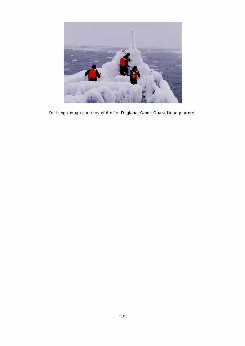
122
De-icing (Image courtesy of the 1st Regional Coast Guard Headquarters)
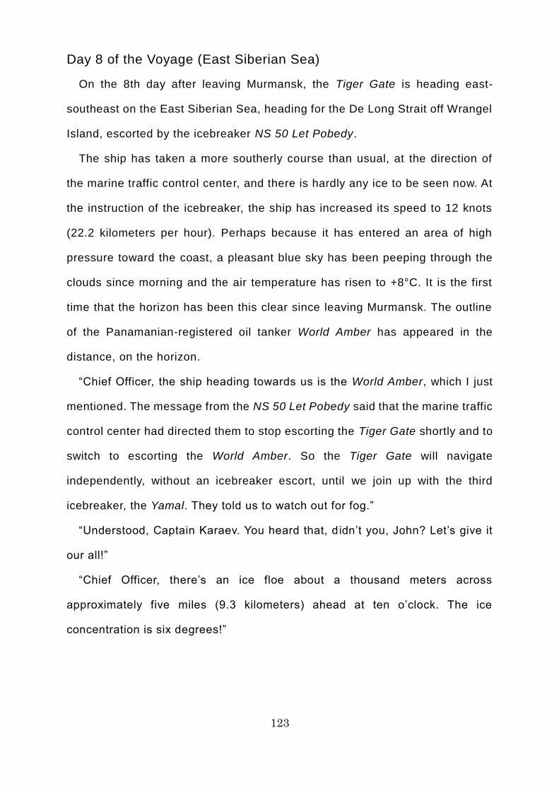
123
Day 8 of the Voyage (East Siberian Sea)
On the 8th day after leaving Murmansk, the Tiger Gate is heading east-
southeast on the East Siberian Sea, heading for the De Long Strait off Wrangel
Island, escorted by the icebreaker NS 50 Let Pobedy.
The ship has taken a more southerly course than usual, at the direction of
the marine traffic control center, and there is hardly any ice to be seen now. At
the instruction of the icebreaker, the ship has increased its speed to 12 knots
(22.2 kilometers per hour). Perhaps because it has entered an area of high
pressure toward the coast, a pleasant blue sky has been peeping through the
clouds since morning and the air temperature has risen to +8°C. It is the first
time that the horizon has been this clear since leaving Murmansk. The outline
of the Panamanian-registered oil tanker World Amber has appeared in the
distance, on the horizon.
“Chief Officer, the ship heading towards us is the World Amber, which I just
mentioned. The message from the NS 50 Let Pobedy said that the marine traffic
control center had directed them to stop escorting the Tiger Gate shortly and to
switch to escorting the World Amber. So the Tiger Gate will navigate
independently, without an icebreaker escort, until we join up with the third
icebreaker, the Yamal. They told us to watch out for fog.”
“Understood, Captain Karaev. You heard that, didn’t you, John? Let’s give it
our all!”
“Chief Officer, there’s an ice floe about a thousand meters across
approximately five miles (9.3 kilometers) ahead at ten o’clock. The ice
concentration is six degrees!”
124
Yes, sir!
We’l l be navigating
independently, without an
escort!
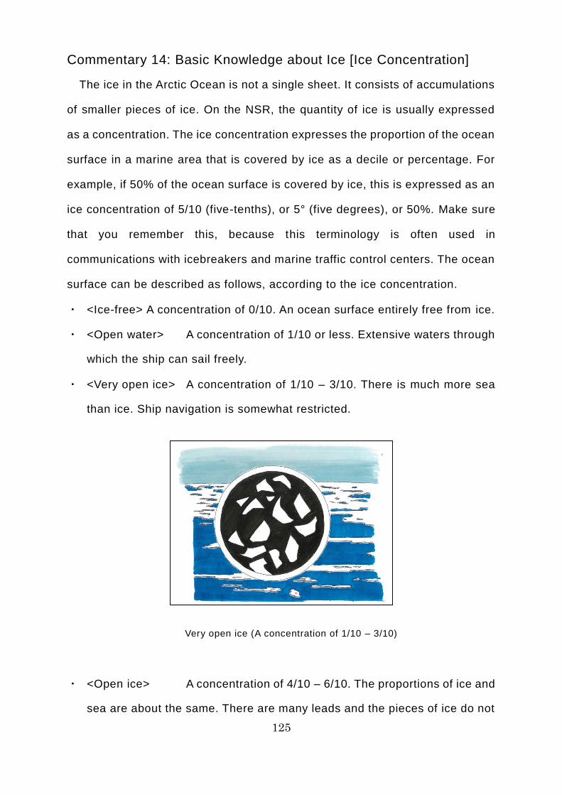
125
Commentary 14: Basic Knowledge about Ice [Ice Concentration]
The ice in the Arctic Ocean is not a single sheet. It consists of accumulations
of smaller pieces of ice. On the NSR, the quantity of ice is usually expressed
as a concentration. The ice concentration expresses the proportion of the ocean
surface in a marine area that is covered by ice as a decile or percentage. For
example, if 50% of the ocean surface is covered by ice, this is expressed as an
ice concentration of 5/10 (five-tenths), or 5° (five degrees), or 50%. Make sure
that you remember this, because this terminology is often used in
communications with icebreakers and marine traffic control centers. The ocean
surface can be described as follows, according to the ice concentration.
・ <Ice-free> A concentration of 0/10. An ocean surface entirely free from ice.
・ <Open water> A concentration of 1/10 or less. Extensive waters through
which the ship can sail freely.
・ <Very open ice> A concentration of 1/10 – 3/10. There is much more sea
than ice. Ship navigation is somewhat restricted.
Very open ice (A concentration of 1/10 – 3/10)
・ <Open ice> A concentration of 4/10 – 6/10. The proportions of ice and
sea are about the same. There are many leads and the pieces of ice do not
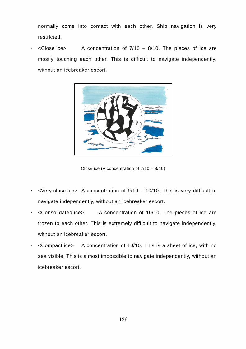
126
normally come into contact with each other. Ship navigation is very
restricted.
・ <Close ice> A concentration of 7/10 – 8/10. The pieces of ice are
mostly touching each other. This is difficult to navigate independently,
without an icebreaker escort.
Close ice (A concentration of 7/10 – 8/10)
・ <Very close ice> A concentration of 9/10 – 10/10. This is very difficult to
navigate independently, without an icebreaker escort.
・ <Consolidated ice> A concentration of 10/10. The pieces of ice are
frozen to each other. This is extremely difficult to navigate independently,
without an icebreaker escort.
・ <Compact ice> A concentration of 10/10. This is a sheet of ice, with no
sea visible. This is almost impossible to navigate independently, without an
icebreaker escort.
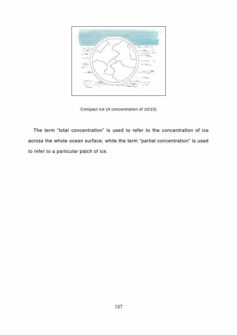
127
Compact ice (A concentration of 10/10)
The term “total concentration” is used to refer to the concentration of ice
across the whole ocean surface, while the term “partial concentration” is used
to refer to a particular patch of ice.
128
Column 17: What is the Threat Posed by the “Sherbet” That Can
Cause Emergency Shutdown on a Ship?
For most people, the word “sherbet” makes them think of a refreshing ice
dessert with a flavor that is both sweet and sour. However, in frozen waters, the
word “sherbet” indicates a troublesome presence that has the potential to cause
emergency shutdown on a ship.
On most ships, the main engine is a water-cooled internal combustion engine.
The parts that heat up as a result of the combustion process are cooled using
freshwater. The freshwater that has warmed up in the cooling process is not
discarded. It is cooled again in a heat exchanger called a freshwater cooler,
using seawater collected from outside the ship, and is then re-used after being
returned to the proper temperature. Freshwater is a precious, limited resource
for ships, so they make use of the seawater available in unlimited quantities
around the ship to cool the main engine indirectly.
In frozen waters like the Arctic Ocean, there is a risk that sherbet -like
seawater and fragments of ice could enter via the seawater inlet on the bottom
of the ship, through which water for cooling the main engine is brought in. If
sherbet-like seawater and fragments of ice reach the freshwater cooler, they
could clog the cooler, preventing it from cooling adequately, which could cause
the main engine to overheat and go into emergency shutdown. The seawater
inlet on ships sailing the Arctic Ocean usually has a structure and position that
makes it hard for sherbet-like seawater to get in. Another way of dealing with it
is to store sherbet-like seawater in small tanks on board the ship and melt it
using warm seawater, etc. before use.

129
Take great care to avoid sherbet!
130
Day 9 of the Voyage (East Siberian Sea)
On the 9th day after leaving Murmansk, the Tiger Gate is heading east on the
East Siberian Sea, without an icebreaker escort. Sometimes, lumps of ice
measuring 500-2,000 meters across appear, but they are detected early on via
watchkeeping from a high vantage point, enabling the ship to detour around
them, while maintaining an adequate margin based on a forecast of the direction
in which the ice is traveling. A key principle of navigation on the NSR is to avoid
any avoidable risks, whenever possible. Mr. Karaev has returned from checking
the instructions from the marine traffic control center over the radio.
“Chief Officer, the marine traffic control center has just issued an instruction
to us and the Yamal, our third icebreaker escort. They’ve instructed the Yamal
to go ahead through the De Long Strait, followed by the Tiger Gate, and then
the Kommuna, sailing in single-file convoy.”
“Ah, a convoy. Understood, Captain Karaev. I’ll tell Captain Yamada. John,
contact the Captain!”
“Understood, sir!”
"The Kommuna is a Russian-registered refrigeration carrier heading for
Petropavlovsk on the Kamchatka Peninsula from Pevek on the East Siberian
Sea. The meeting point for the three ships is near the western entrance to the
De Long Strait, eight miles (about 15 kilometers) north of Cape Shelagsky.
“Understood, Captain Karaev. I’ve been in a convoy twice. Captain Yamada’s
coming up.”

131
It’s a convoy! I’ve done this before!

132
Commentary 15: Basic Knowledge about Ice [Ice Terminology]
There is a lot of specialist terminology concerning ice. It could potentially be
used in communications with icebreakers or marine traffic control centers when
sailing the NSR.
[Terminology concerning ice formations]
Ice formations are classified as follows, according to the size or breadth of
the ice.
・ <Small ice cake> A relatively flat piece of floating ice measuring
less than 2 meters across.
A small ice cake is a piece of floating ice about the size of a table tennis table
・ <Ice cake> A relatively flat piece of floating ice measuring 2-20
meters across.
An ice cake is a piece of floating ice about the size of a tennis court

133
・ <Small ice floe> A piece of floating ice with a flat surface
measuring from 20 to less than 100 meters across.
A small ice floe is a piece of floating ice about the size of a soccer pitch
・ <Medium ice floe> A piece of floating ice with a flat surface
measuring from 100 to less than 500 meters across.
A medium ice floe is a piece of floating ice about the size of Tokyo University of Marine
Science and Technology’s Shinagawa Campus
・ <Big ice floe> A piece of floating ice with a flat surface measuring from
500 to less than 2,000 meters across.
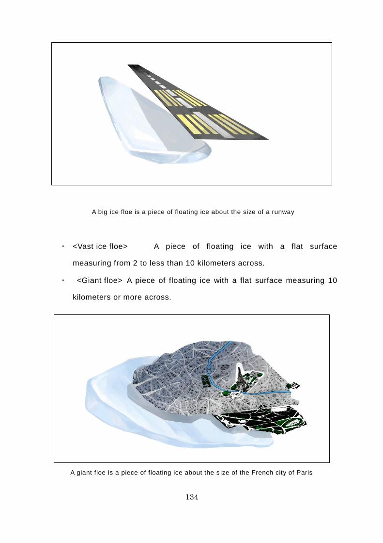
134
A big ice floe is a piece of floating ice about the size of a runway
・ <Vast ice floe> A piece of floating ice with a flat surface
measuring from 2 to less than 10 kilometers across.
・ <Giant floe> A piece of floating ice with a flat surface measuring 10
kilometers or more across.
A giant floe is a piece of floating ice about the s ize of the French city of Paris
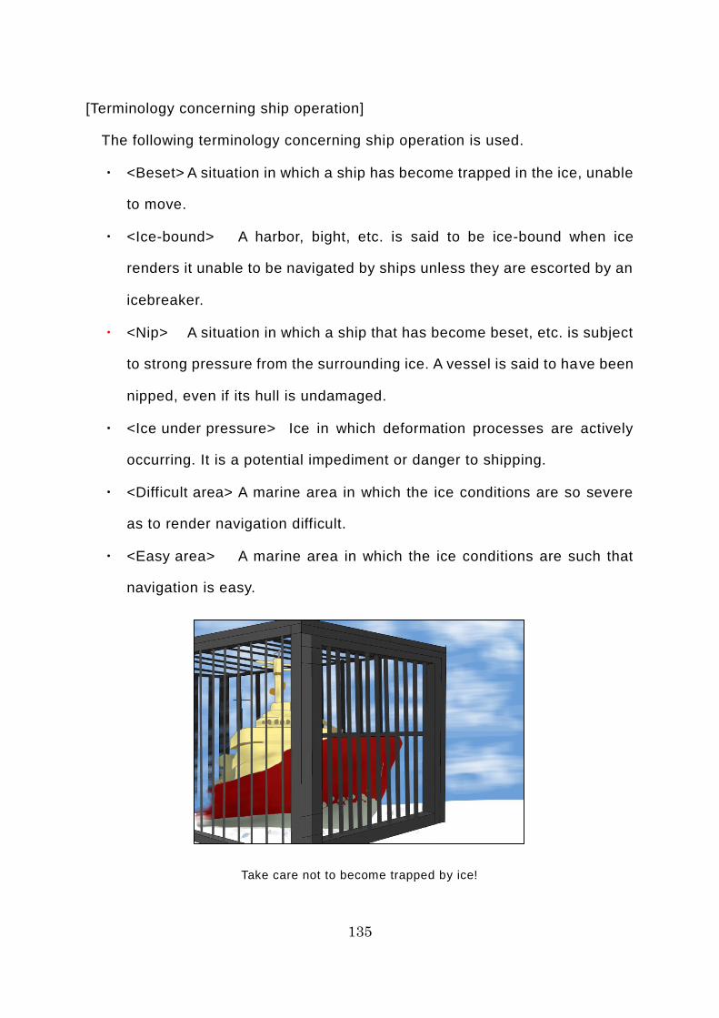
135
[Terminology concerning ship operation]
The following terminology concerning ship operation is used.
・ <Beset> A situation in which a ship has become trapped in the ice, unable
to move.
・ <Ice-bound> A harbor, bight, etc. is said to be ice-bound when ice
renders it unable to be navigated by ships unless they are escorted by an
icebreaker.
・ <Nip> A situation in which a ship that has become beset, etc. is subject
to strong pressure from the surrounding ice. A vessel is said to have been
nipped, even if its hull is undamaged.
・ <Ice under pressure> Ice in which deformation processes are actively
occurring. It is a potential impediment or danger to shipping.
・ <Difficult area> A marine area in which the ice conditions are so severe
as to render navigation difficult.
・ <Easy area> A marine area in which the ice conditions are such that
navigation is easy.
Take care not to become trapped by ice!

136
[Terminology concerning ice melt]
The following terminology concerning ice melt is used.
・ <Puddle or melt pond> An accumulation of water on ice. This is mainly
caused by snow that has accumulated on top of the ice melting when the
air temperature rises in summer, but it may also be due to the melting of
the ice itself in the more advanced stages.
・ <Thaw holes> Vertical holes in ice formed when surface puddles melt
through to the underlying seawater.
・ <Dried ice> Ice surface from which the meltwater that had previously
accumulated on it has disappeared after the formation of cracks and thaw
holes. During the period of drying, the surface whitens.
・ <Rotten ice> Ice which has become honeycombed and is in an
advanced stage of disintegration.
・ <Flooded ice> Ice which has been flooded and is heavily loaded by water
and/or wet snow.
An aerial view of a puddle or melt pond (Image courtesy of Koji Shimada)
[Terminology concerning characteristics of the surface of ice]
The following terminology is used with respect to ship operation.
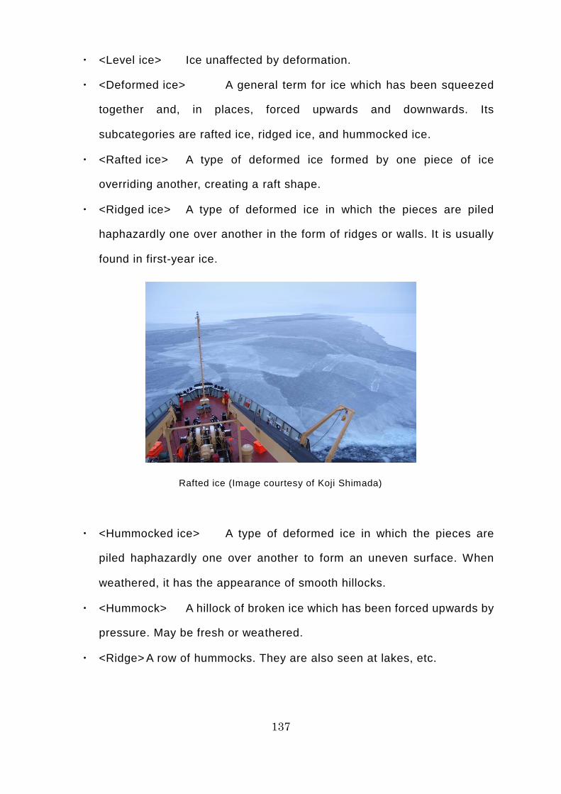
137
・ <Level ice> Ice unaffected by deformation.
・ <Deformed ice> A general term for ice which has been squeezed
together and, in places, forced upwards and downwards. Its
subcategories are rafted ice, ridged ice, and hummocked ice.
・ <Rafted ice> A type of deformed ice formed by one piece of ice
overriding another, creating a raft shape.
・ <Ridged ice> A type of deformed ice in which the pieces are piled
haphazardly one over another in the form of ridges or walls. It is usually
found in first-year ice.
Rafted ice (Image courtesy of Koji Shimada)
・ <Hummocked ice> A type of deformed ice in which the pieces are
piled haphazardly one over another to form an uneven surface. When
weathered, it has the appearance of smooth hillocks.
・ <Hummock> A hillock of broken ice which has been forced upwards by
pressure. May be fresh or weathered.
・ <Ridge> A row of hummocks. They are also seen at lakes, etc.
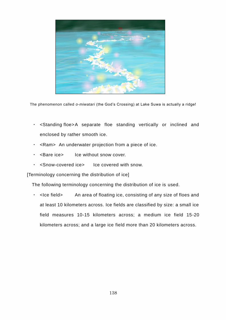
138
The phenomenon called o-miwatari (the God’s Crossing) at Lake Suwa is actually a ridge!
・ <Standing floe> A separate floe standing vertically or inclined and
enclosed by rather smooth ice.
・ <Ram> An underwater projection from a piece of ice.
・ <Bare ice> Ice without snow cover.
・ <Snow-covered ice> Ice covered with snow.
[Terminology concerning the distribution of ice]
The following terminology concerning the distribution of ice is used.
・ <Ice field> An area of floating ice, consisting of any size of floes and
at least 10 kilometers across. Ice fields are classified by size: a small ice
field measures 10-15 kilometers across; a medium ice field 15-20
kilometers across; and a large ice field more than 20 kilometers across.
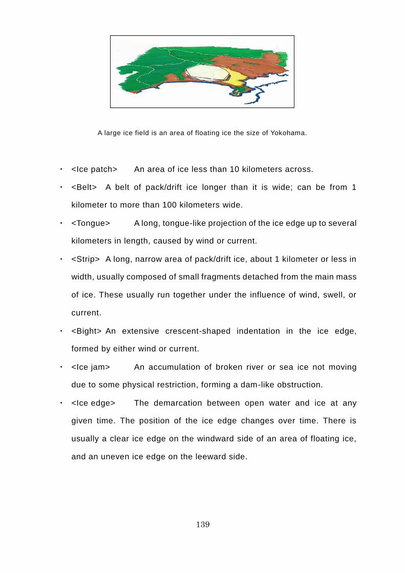
139
A large ice field is an area of floating ice the size of Yokohama.
・ <Ice patch> An area of ice less than 10 kilometers across.
・ <Belt> A belt of pack/drift ice longer than it is wide; can be from 1
kilometer to more than 100 kilometers wide.
・ <Tongue> A long, tongue-like projection of the ice edge up to several
kilometers in length, caused by wind or current.
・ <Strip> A long, narrow area of pack/drift ice, about 1 kilometer or less in
width, usually composed of small fragments detached from the main mass
of ice. These usually run together under the influence of wind, swell, or
current.
・ <Bight> An extensive crescent-shaped indentation in the ice edge,
formed by either wind or current.
・ <Ice jam> An accumulation of broken river or sea ice not moving
due to some physical restriction, forming a dam-like obstruction.
・ <Ice edge> The demarcation between open water and ice at any
given time. The position of the ice edge changes over time. There is
usually a clear ice edge on the windward side of an area of floating ice,
and an uneven ice edge on the leeward side.
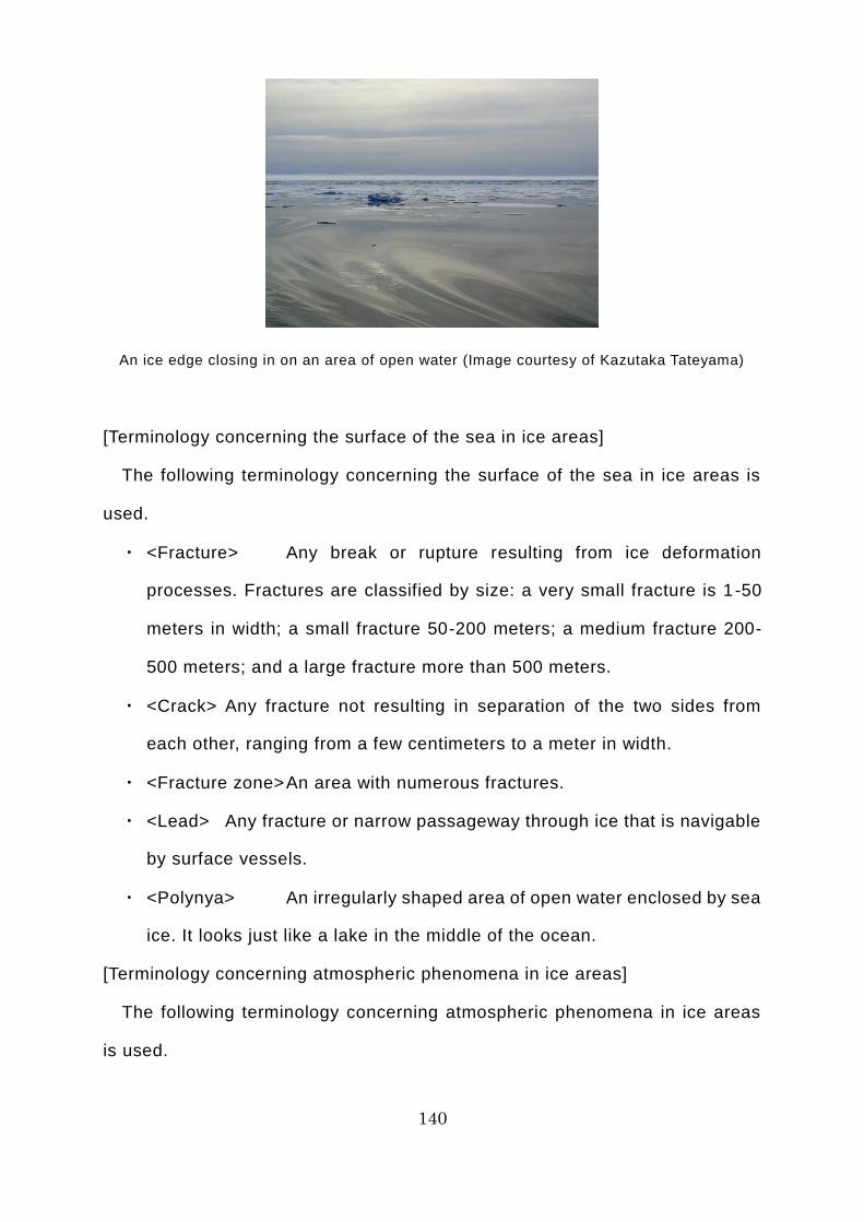
140
An ice edge closing in on an area of open water (Image courtesy of Kazutaka Tateyama)
[Terminology concerning the surface of the sea in ice areas]
The following terminology concerning the surface of the sea in ice areas is
used.
・ <Fracture> Any break or rupture resulting from ice deformation
processes. Fractures are classified by size: a very small fracture is 1 -50
meters in width; a small fracture 50-200 meters; a medium fracture 200-
500 meters; and a large fracture more than 500 meters.
・ <Crack> Any fracture not resulting in separation of the two sides from
each other, ranging from a few centimeters to a meter in width.
・ <Fracture zone> An area with numerous fractures.
・ <Lead> Any fracture or narrow passageway through ice that is navigable
by surface vessels.
・ <Polynya> An irregularly shaped area of open water enclosed by sea
ice. It looks just like a lake in the middle of the ocean.
[Terminology concerning atmospheric phenomena in ice areas]
The following terminology concerning atmospheric phenomena in ice areas
is used.
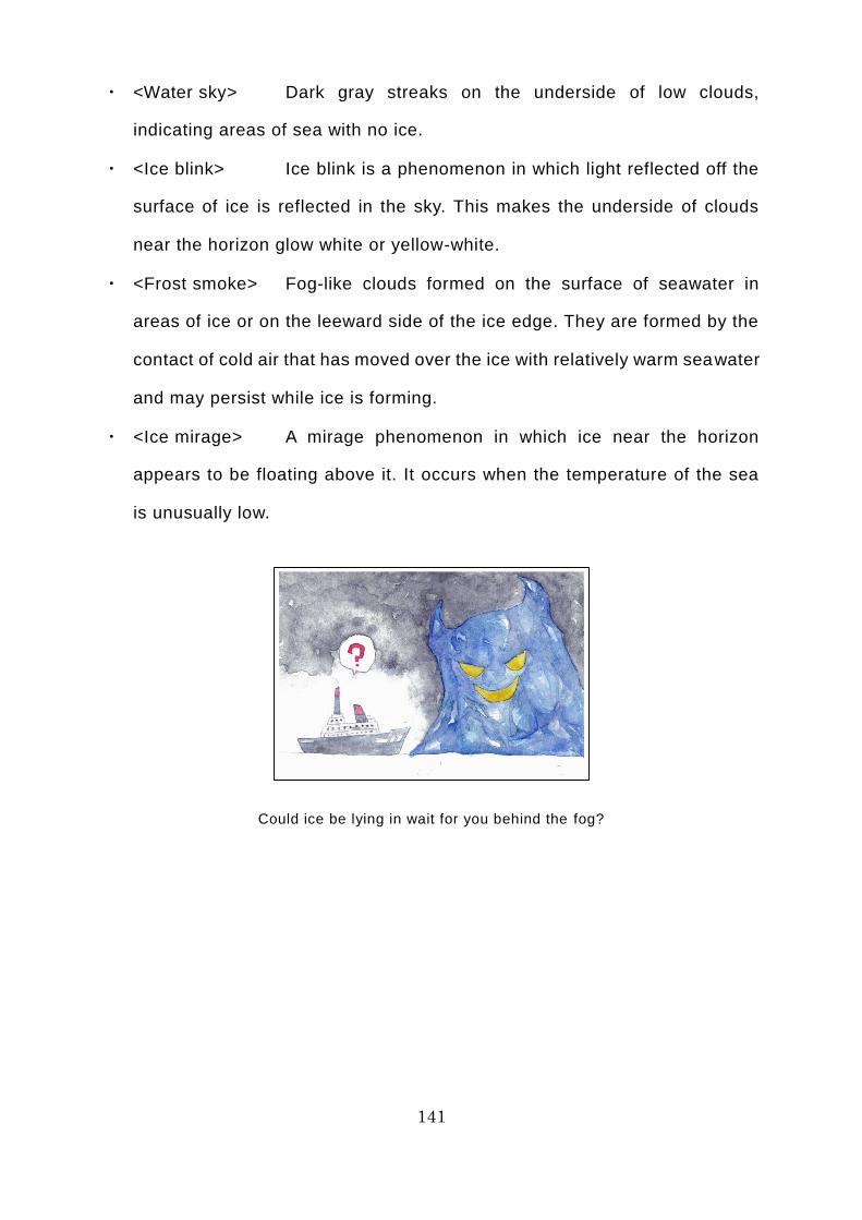
141
・ <Water sky> Dark gray streaks on the underside of low clouds,
indicating areas of sea with no ice.
・ <Ice blink> Ice blink is a phenomenon in which light reflected off the
surface of ice is reflected in the sky. This makes the underside of clouds
near the horizon glow white or yellow-white.
・ <Frost smoke> Fog-like clouds formed on the surface of seawater in
areas of ice or on the leeward side of the ice edge. They are formed by the
contact of cold air that has moved over the ice with relatively warm seawater
and may persist while ice is forming.
・ <Ice mirage> A mirage phenomenon in which ice near the horizon
appears to be floating above it. It occurs when the temperature of the sea
is unusually low.
Could ice be lying in wait for you behind the fog?
142
Commentary 16: Ship Handling on the NSR in Practice [Principles of
Ship Handling]
Understanding the way and extent to which the power of nature – wind, waves,
and tidal current, among others – and the geographical environment, such as
shallows and narrow waterways, affect ship performance is crucial to ensuring
the safe maneuvering of a ship. The act of appropriately adjusting a ship’s
course and speed and properly controlling it based on an understanding of
these matters is a ship maneuvering technique called ship handling. In other
words, the first step toward safe ship handling is gaining a precise
understanding of the external forces and environmental conditions that can
impede ship performance. When sailing the NSR, ice is one of the external
forces to which you must be most alert in the context of ship handling. Ice affects
ships in the following ways.
・ If it touches the ship, it can increase drag on the hull when the ship is
sailing or turning.
・ If it collides with the ship, it can inflict serious damage on the hull,
propeller, and rudder, among others.
・ It can trap the ship, leaving it unable to move (beset). In the worst -case
scenario, ice pressure can crush the hull.
A key principle of navigation on the NSR is to avoid any avoidable risks,
whenever possible. The same applies to ship handling. Unless otherwise
directed by the marine traffic control center, the basic principle of ship handling
is to avoid ice as far as possible. If you are unable to find an appropriate route
around it and enter seas with harsh ice conditions unaccompanied, ship-
handling techniques that will enable you to find a route to open water are vital.
However, if you anticipate becoming beset, evacuating the area takes priority;
you must not hesitate to make a 180° turn and sail back the way you came. In
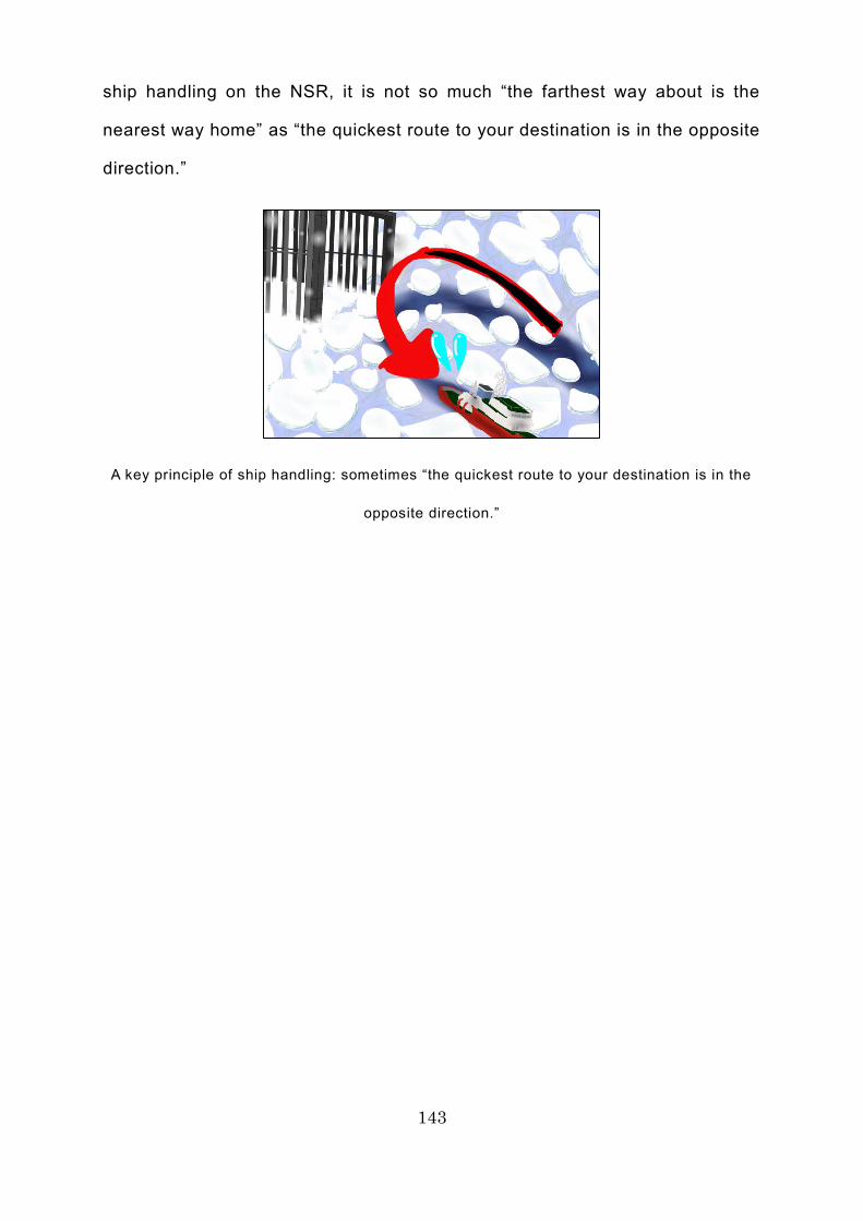
143
ship handling on the NSR, it is not so much “the farthest way about is the
nearest way home” as “the quickest route to your destination is in the opposite
direction.”
A key principle of ship handling: sometimes “the quickest route to your destination is in the
opposite direction.”
144
Column 18: Are Icebreakers Really Luxury Liners?
Russian icebreakers are owned by the government, so there is a tendency to
imagine that they are rather drab. However, although they are owned by the
government, some Russian icebreakers are just like cruise ships, equipped with
cabins as luxurious as those of a high-class hotel, as well as indoor swimming
pools and saunas, gyms, libraries, bars, massage facilities, and gift shops. In
fact, these icebreakers are special ships that were originally constructed on the
understanding that they would be used as small cruise ships, as well as being
used for their primary mission of opening up leads and escorting ships along
them. Thus, their imposingly squat and chunky external appearance quite belies
the grandeur inside. In summer, they escort ships through frozen waters, while
in winter they are rented out to private-sector companies, which use them for
passenger cruises in the Arctic Ocean.
Apparently, these cruises are so popular that they are almost always sold out,
due to the unique activities that only icebreakers and their specially trained crew
members can offer, such as sightseeing flights in the on-board helicopter;
voyages through the polar region proper, heading for the North Pole at latitude
90° north; searching for wildlife such as polar bears and walruses; and exploring
frozen waters on an inflatable boat. However, as use of the NSR by merchant
ships has taken off in recent years, these icebreakers have increasingly been
dedicated entirely to their primary duty of escorting ships, so they will not be
used as Arctic Ocean cruise ships for much longer.

145
An icebreaker reaches the North Pole at latitude 90° north
146
Day 10 of the Voyage (De Long Strait)
On the 10th day after leaving Murmansk, the Tiger Gate is sailing through the
ice-covered De Long Strait in a single-file convoy. In this convoy, the icebreaker
Yamal is at the front, followed by the Tiger Gate, while the Kommuna brings up
the rear. The ships are traveling at 7 knots (13.0 kilometers per hour),
maintaining a distance of 2 cables (approximately 370 meters) from each other.
A convoy involves teamwork with other ships. The most important thing is for
all of the ships to work together, exchanging accurate information and ensuring
clear communication. If the ships behind the one at the head of the convoy go
even slightly off course, they might veer outside the lead, which could result in
an accident, such as a collision with the ice edge. Moreover, if one of the ships
in the convoy fails to control its speed, a collision with another ship might ensue.
Suzuki is holding a pre-watch briefing with the members of the navigational
watchkeeping team and the ice pilot.
“As well as giving Captain Yamada advice about ship handling, Captain
Karaev will be in charge of radio communication with the icebreaker Yamal.”
“I will be keeping watch on our surroundings and also using the radar and
Doppler speed log to measure our speed and distance from the other ships.
Third Officer Manuel, please measure ship position and water depth, as well as
keeping watch on our surroundings. Also, please operate the engine telegraph
and adjust our speed, in accordance with Captain Yamada’s instructions. John,
please follow the icebreaker accurately, in accordance with Captain Yamada’s
instructions. Richard, as deck hand, you’ll be keeping watch on the stern.”

147
Pre-watch briefings are vital!
I see....
148
Commentary 17: Ship Handling on the NSR in Practice [General Ship
Handling Methods]
Most of the merchant ships that sail the NSR are what are referred to as ice-
strengthened ships, which have no icebreaking ability. An ice-strengthened ship
has a special design and equipment to enable it to withstand contact with ice,
so that it can push its way through ice on the ocean surface, albeit not to the
same extent as an icebreaker. However, you must not over-rely on the hull
reinforcement, etc. A key principle of ship handling on the NSR is to avoid ice,
whenever possible. Depending on the situation, you might have to think about
not merely a diversion, but even making a 180° turn. In ship handling, it is vital
to ensure that you always err on the side of safety. If there is no icebreaker
escort, it ultimately takes less time and money to find a diversion into open
water or to turn back the way you came, rather than trying to force your way
through the ice.
In frozen waters, the key principle is to determine how to handle the ship on
the basis of the ice conditions (ice concentration, thickness, hardness, etc.),
the ship’s capabilities, and your ship-handling ability, following the instructions
of the marine traffic control center or icebreaker, and taking on board advice
from the ice pilot. The basic ship-handling methods used in frozen waters are
as follows.
[General precautions]
・ Slow down to a safe speed, find the place where there is as little ice as
possible, or where it is at its thinnest, and then concentrate on
maneuvering the ship into open water. In most cases, damage to ships in
frozen waters is caused by excessive speed. On the other hand, you must
be careful not to slow down too much, as this will make the ship hard to
steer and the hull impossible to control, which is also dangerous.

149
An approaching ice floe from the side of the bridge (Image courtesy of Jin Saijo)
150
・ Avoid sailing at night, as far as possible.
・ Keep the engine in standby mode, to facilitate an emergency stop at any
time.
・ Keep watch to ascertain the surrounding ice conditions and reflect these
in ship handling.
・ Analyze any information you receive from elsewhere about ice conditions
and reflect this in ship handling.
・ If there is a risk that you will sail close to frozen waters that exceed the
ship’s capabilities and your ship-handling ability, request the support of an
icebreaker as soon as possible.
・ If you are concerned about damage to the hull, propeller, rudder, etc. due
to severe ice conditions with the potential for the ship to become trapped
in the ice, divert around it as soon as possible or make a 180° turn, without
any hesitation.
・ Pay attention not only to the thickness of the ice, but also to its
concentration and hardness. Remember that even if the ice is thinner than
your ship’s ice-resistance capacity, it might be too concentrated or too hard
for your ship to push through it.
・ To protect the propeller and rudder from damage due to contact with ice,
ensure that your ship’s draft is as deep as possible and adjust it to trim by
stern (place it on an incline so that the draft at the stern is deeper).
However, avoid an incline so great that the bow breaks the surface, as this
will reduce the ship’s performance and leave the bottom of the bow
vulnerable to the ice.
・ If necessary, post a watchkeeper at the stern when maneuvering the ship,
to prevent damage to the propeller, rudder, etc. as a result of contact with
the ice.
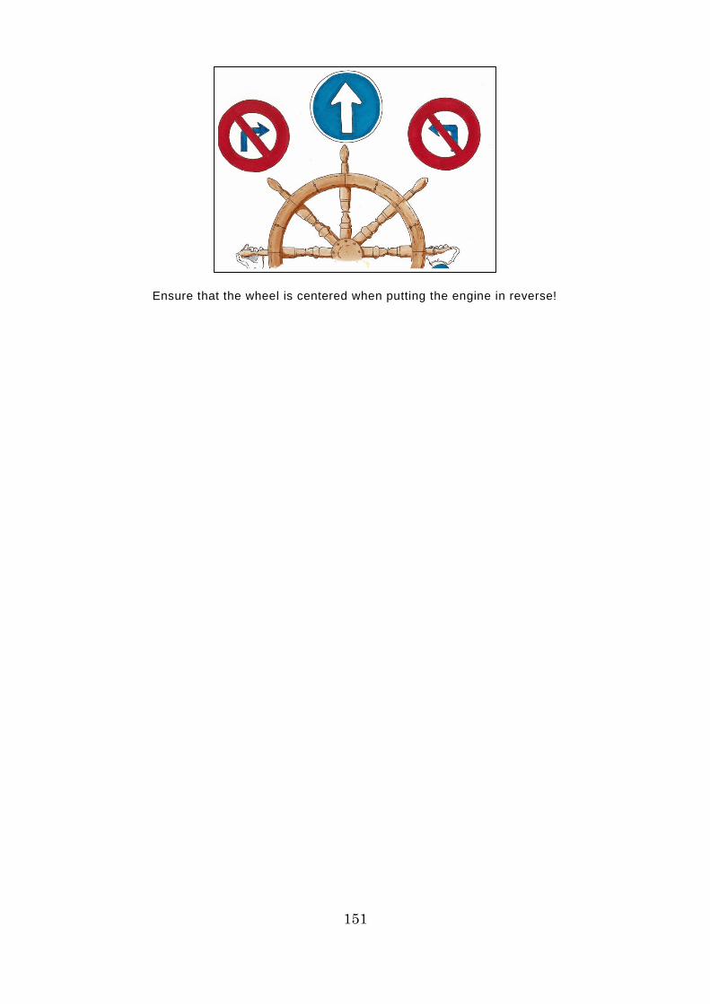
151
Ensure that the wheel is centered when putting the engine in reverse!
152
[Precautions when avoiding ice]
・ Keep watch from a high vantage point and look for a way out via a lead
through the ice floe (a fracture or passage navigable by the ship), or a point
where there is little ice or the ice is thin.
・ The basic maneuver to use when avoiding the ice while heading for a way
out into open water is beating (sailing on a zig-zag course).
・ Ice that has drifted to the leeward side is often hard, consisting of layers
of ice, so avoid approaching it, where possible. Approach ice floes from
the windward side and look for a way out.
・ Ice moves constantly, in response to external forces (tidal currents and
winds). Carry out radar plotting to ascertain the direction and speed of ice
floe movement and make a precise judgment about whether the ice floe is
tending to open or close up.
・ If the ice is moving quickly, wait until it slows down.
・ The speed of ice movement varies with its size and shape. Find ice that is
moving at a relatively low speed and sail near it.
・ Maintain an adequate margin when avoiding ice.
・ When maneuvering the ship, avoid sailing against the direction of
movement of the ice, as far as possible.
・ Sailing along the ice edge (the boundary between ice and open water) can
result in finding a lead. However, remember that the ice edge is prone to
fog, as well as being a place where collisions with the ice can occur.

153
Find the slower ice and sail near it!
154
・ There are often multiple fractures within an ice floe that could serve as
leads. Examine several options and choose the most suitable one that
could serve as a way out. Bear in mind that the positional relationship
between pieces of ice changes over time, so the fracture that you have
discovered might possibly disappear.
・ Sailing through waters where the waves are rough and pieces of ice are
scraping against each other is dangerous. Avoid such waters.
[Ship handling in frozen waters: when under icebreaker escort]
・ The icebreaker will determine the appropriate distance between ships,
course, and speed, based on a comprehensive assessment of the
surrounding ice conditions, visibility, weather conditions, and the
capabilities and ship-handling ability of the ship being escorted. Comply
with its instructions.
・ The distance between ships required to follow the icebreaker’s movements
exactly and get through the lead opened up by the icebreaker before it
closes up again, while also maintaining enough of a distance to avoid a
rear-end collision is usually around three times the length of the icebreaker,
which is about 2.5 cables (approximately 460 meters) or more, up to a
maximum of a mile (1,852 meters).
・ If the ship goes off course, there is a risk that it could veer off the lead
opened up by the icebreaker and collide with the ice edge beside the lead.
Use the icebreaker’s wake as a guide so that you can follow its stern
exactly, without veering off course.
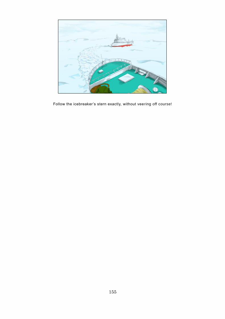
155
Follow the icebreaker’s stern exactly, without vee ring off course!
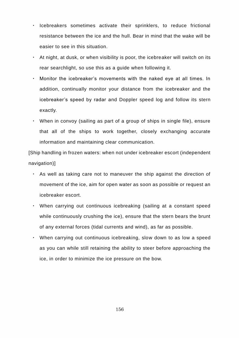
156
・ Icebreakers sometimes activate their sprinklers, to reduce frictional
resistance between the ice and the hull. Bear in mind that the wake will be
easier to see in this situation.
・ At night, at dusk, or when visibility is poor, the icebreaker will switch on its
rear searchlight, so use this as a guide when following it.
・ Monitor the icebreaker’s movements with the naked eye at all times. In
addition, continually monitor your distance from the icebreaker and the
icebreaker’s speed by radar and Doppler speed log and follow its stern
exactly.
・ When in convoy (sailing as part of a group of ships in single file), ensure
that all of the ships to work together, closely exchanging accurate
information and maintaining clear communication.
[Ship handling in frozen waters: when not under icebreaker escort (independent
navigation)]
・ As well as taking care not to maneuver the ship against the direction of
movement of the ice, aim for open water as soon as possible or request an
icebreaker escort.
・ When carrying out continuous icebreaking (sailing at a constant speed
while continuously crushing the ice), ensure that the stern bears the brunt
of any external forces (tidal currents and wind), as far as possible.
・ When carrying out continuous icebreaking, slow down to as low a speed
as you can while still retaining the ability to steer before approaching the
ice, in order to minimize the ice pressure on the bow.
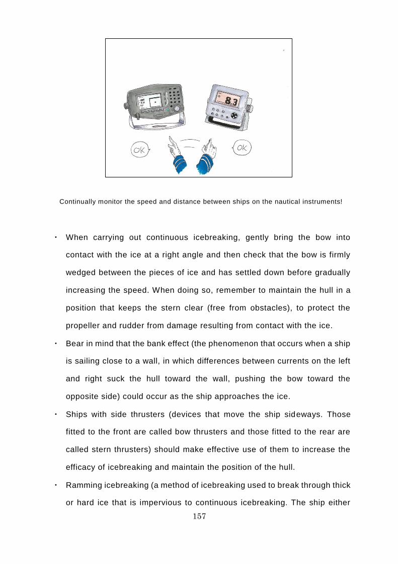
157
Continually monitor the speed and distance between ships on the nautical instruments!
・ When carrying out continuous icebreaking, gently bring the bow into
contact with the ice at a right angle and then check that the bow is firmly
wedged between the pieces of ice and has settled down before gradually
increasing the speed. When doing so, remember to maintain the hull in a
position that keeps the stern clear (free from obstacles), to protect the
propeller and rudder from damage resulting from contact with the ice.
・ Bear in mind that the bank effect (the phenomenon that occurs when a ship
is sailing close to a wall, in which differences between currents on the left
and right suck the hull toward the wall, pushing the bow toward the
opposite side) could occur as the ship approaches the ice.
・ Ships with side thrusters (devices that move the ship sideways. Those
fitted to the front are called bow thrusters and those fitted to the rear are
called stern thrusters) should make effective use of them to increase the
efficacy of icebreaking and maintain the position of the hull.
・ Ramming icebreaking (a method of icebreaking used to break through thick
or hard ice that is impervious to continuous icebreaking. The ship either
158
retreats a little way before accelerating into the ice in order to use the force
of the impact from the collision to break it, or gets on top of the ice to use
the weight of the ship to crush it) should not be used unless absolutely
unavoidable.
・ When carrying out ramming icebreaking, do so only after gaining an
adequate understanding of the ice conditions, your ship’s capabilities, and
your ship-handling ability.
・ When carrying out ramming icebreaking, move back 0.5-5 times the length
of your ship before moving forward. Be careful, because the water behind
you will be sealed off very quickly.
・ When putting the engine into reverse to carry out ramming icebreaking,
first put the engine into forward to ensure that any ice suspended near the
stern in the discharge current from the propeller is completely eliminated.
・ When the engine is in reverse, ensure that the wheel is centered so that
the rudder is mid-ship, without fail. If the wheel swings back and forth too
much while reversing, the propeller or rudder could come into contact with
ice, leading to damage. Damage to the propeller or rudder from contact
with ice can easily occur when the engine is in reverse.
159
Column 19: Are the Ice and Fog in the Arctic Ocean Good Friends?
The Arctic Ocean is renowned for being prone to dense fog. Foggy seas
conjure up a rather magical, romantic image. However, fog hinders
watchkeeping, impeding the safe operation of ships, so it is one of the most
troublesome things for people working at sea, as it can contribute to collisions
and other marine accidents. In Japan, the waters off the Sanriku coast are
renowned for being foggy from spring until the rainy season. A cold current
called the Kuril Current (or Oyashio Current) flows through the waters off the
Sanriku coast. Fog tends to occur when warm, moist air from high pressure
systems over the Pacific Ocean enters the area and comes into contact with the
cold ocean current. Collisions frequently occur off the Sanriku coast between
ships whose visibility has been impaired by fog. Fog also often occurs in the
Seto Inland Sea in early spring, when warm, moist air from onshore comes into
contact with the cold surface of the sea.
On the other hand, fog is particularly common in the summer months, when
warm air from the south enters the Arctic Ocean and comes into contact with
the ice there. It would be fair to say that you always encounter fog when sailing
close to ice on the NSR in summer. In other words, there is a correlation
between ice and fog: ice is found in the vicinity of fog and fog occurs near ice.
Thus, in the Arctic Ocean, ice and fog are good friends, so to speak. If, seeking
a shorter route, you change course and carelessly get too close to the ice, you
may unexpectedly encounter dense fog. If you do not wish to encounter fog, it
is best to stay away from ice.

160
If you encounter fog, ice will not be far away!

161
Day 11 of the Voyage (Chukchi Sea)
On the 11th day after leaving Murmansk, the Tiger Gate is heading southeast
on the Chukchi Sea toward the Bering Strait, still sailing with the Kommuna in
a three-vessel convoy led by the icebreaker Yamal. As soon as they passed
through the De Long Strait, the amount of ice swiftly decreased and now there
is hardly any to be seen. At the instruction of the icebreaker, the ships have
increased the distance between them to 1 mile (1,852 meters) and their speed
to 12 knots (22.2 kilometers per hour). The leaden skies have been transformed,
with clear skies beginning to peek through the clouds, and the air temperature
is rising. The horizon ahead has begun to come into clear focus and visibility
has also cleared on the right, toward the continent. A magnificent v iew of white
mountain peaks stretching out against a clear blue sky catches the eye. Mr.
Karaev has begun to speak softly while looking at the scenery.
“Chief Officer, I’ll have to bid you all farewell tomorrow.”
“Thank you very much for your assistance, Captain Karaev. I’m very grateful
for all of your advice.”
“It looks like you’ve started to get used to the NSR, John. Keep up the good
work in future. I’m sure you’ll have come on by leaps and bounds by the time
we next meet. I have high hopes of you.”
“Thank you very much, Captain Karaev!”

162
We’ll be saying
goodbye tomorrow.
Thanks for everything.
163
Commentary 18: Ship Handling on the NSR in Practice [Other Ship
Handling Methods]
Other ship-handling methods used in frozen waters are as follows.
[Ice mooring]
Ice mooring can be dangerous, so avoid doing so if at all possible. If you are
unable to avoid mooring the ship, you will need a mooring tool to connect the
hawser (mooring rope) to the ice floe.
Usually, if the ship does not have a special anchor for use with ice floes, you
will need to use an alternative tool called a deadman. Carve out a rectangular
depression in the surface of the ice and embed the deadman (a long, sturdy
piece of wood with a rope wound around the center) in it, then fill it with water
and allow it to freeze. Once it has frozen completely, connect the hawser to the
rope extending from the deadman.
[Dropping anchor in frozen waters]
Dropping anchor in frozen waters can be dangerous, so avoid doing so if at
all possible. If you are unable to avoid dropping anchor, choose as safe and
shallow a place as possible, avoiding places where there is a risk of becoming
trapped in the ice. To ensure that you can evacuate immediately if you sense
danger, keep the anchor chain quite short and the main engine on standby, so
that it can be operated at any time. To ensure that the windlass will move without
fail whenever you need it, keep it warmed up (keep each part warm by
continually running it at a low speed, rather than stopping it completely).
[Ship handling in severe weather in frozen waters]
If you encounter severe weather in frozen waters, evacuate along the ice
edge to safer waters or find open water and heave to there. “Heave to” refers
to the method of dealing with severe weather by reducing the ship’s speed to
the lowest it can go without losing the ability to steer and waiting at a particular
164
point until the weather passes, maneuvering the ship so that the waves hit the
bow diagonally from the front. When doing so, it is vital to forecast the direction
in which the ice is moving at all times and maintain an adequate margin from
the ice. In addition, if the ship is showered in sea spray during severe weather,
icing of the hull could occur, depending on the temperature and wind speed.
Small boats need to adjust their course and speed to avoid sea spray, as far as
possible, because a large build-up of icing could cause a marine accident, such
as capsizing. As well as being used in severe weather, heaving to is a ship-
handling technique that can also be used when the visibility is too poor for the
ship to keep sailing.
165
Day 12 of the Voyage (Chukchi Sea)
On the 12th day after leaving Murmansk, the icebreaker Yamal stopped in the
waters to the north of Cape Dezhnev, on the Chukchi Peninsula, so the Tiger
Gate and Kommuna also stopped. Soon after, the icebreaker Yamal turned
around and came back to a point 1 cable (approximately 185 meters) in front of
the Tiger Gate and began to lower a boat from the stern deck, using a crane.
This boat is coming to collect the ice pilots, who have completed their duties.
With a picture of a red mouth baring its teeth painted on the bow and an
imposing-looking black hull topped by an immense orange structure, the Yamal
is an intimidating presence that looks just like a huge shark dominating the
Arctic Ocean.
Soon, the boat leaves the Yamal and a ladder is slowly (carefully judging the
timing of the boat’s approach) lowered from the upper deck of the Tiger Gate to
enable the ice pilots to disembark.
“Captain Yamada and crew members of the Tiger Gate. Thank you for your
help.”
“Not at all. I’d like to thank all of you ice pilots for your assistance. I look
forward to meeting you again.”
“I hope that the Tiger Gate will have a safe voyage from here. Goodbye and
take care.”
“Goodbye and take care.”
The boat carrying Mr. Karaev and the others sped off toward the Kommuna,
to collect the next team of ice pilots. Blinking back tears, John continued waving
them off until the boat was well out of sight. Suddenly, he noticed a magnificent,
magical aurora flickering in the sky over the Tiger Gate. It was the first time that
John had seen this mystical sight.

166
Thanks for your help. Goodbye. Take care.
167
Commentary 19: Maintenance on the NSR in Practice [Overview]
It goes without saying that the two environmental conditions to which you
must be most alert when sailing the NSR are ice and low temperatures. Summer
is the peak season for use of the NSR, so the air temperature can be as high
as +5-10°C. However, the air temperature can fall below zero when the weather
is cold, even in summer, and the hull can suffer icing if the wind is high.
Consequently, you need to take care regarding ice and low temperatures all
year round when carrying out hull or engine equipment maintenance on the NSR.
Most of the merchant ships using the NSR have special equipment for
combating the adverse effects of ice and low temperatures. When carrying out
maintenance of the hull or engine equipment, you must take into account these
special maintenance activities, in addition to the general precautions required
in ordinary waters.
[Maintenance of hull equipment]
On merchant ships using the NSR, special materials are sometimes used for
lifesaving equipment, firefighting equipment, deck machinery (windlasses and
cranes), and other equipment (power lines, pipes, valves, wipers, nautical
instruments, etc.) installed in locations where they could freeze or be exposed
to low temperatures. In addition, some have special devices (heating cables or
coils, space heaters, etc.). In light of this, pay attention to the following when
carrying out maintenance on hull equipment.

168
Be alert to the risks of ice and low temperatures!
169
・ The special materials used to prevent freezing and combat low
temperatures are used to safeguard not only metal, but also rubber and
plastics. Take care when replacing components in the course of
maintenance work.
・ Keep mobile instruments and equipment in storerooms as much as
possible, to prevent their failure. A durable cover should be placed over
items that cannot be moved, to insulate them.
・ To prevent freezing and combat low temperatures, items equipped with
heating cables or space heaters, etc. (pipes, motors, windlasses, cranes,
etc.) should be warmed up with these before use.
・ Switch off heating cables, space heaters, etc. when the air temperature is
high. Otherwise they could fail due to overheating.
・ To prevent freezing, avoid the use of seawater or freshwater lines on
exposed decks in low temperatures, wherever possible. If their use is
unavoidable, ensure that you drain any water inside them, without fail.
・ If deck structures suffer icing due to sea spray in low temperatures, remove
the ice as needed.
・ Do not neglect routine maintenance of equipment that is essential when
operating in frozen waters, such as searchlights and windlasses.
・ Do not neglect routine maintenance that can assist in combating freezing,
such as applying anti-slip paint to exposed decks.
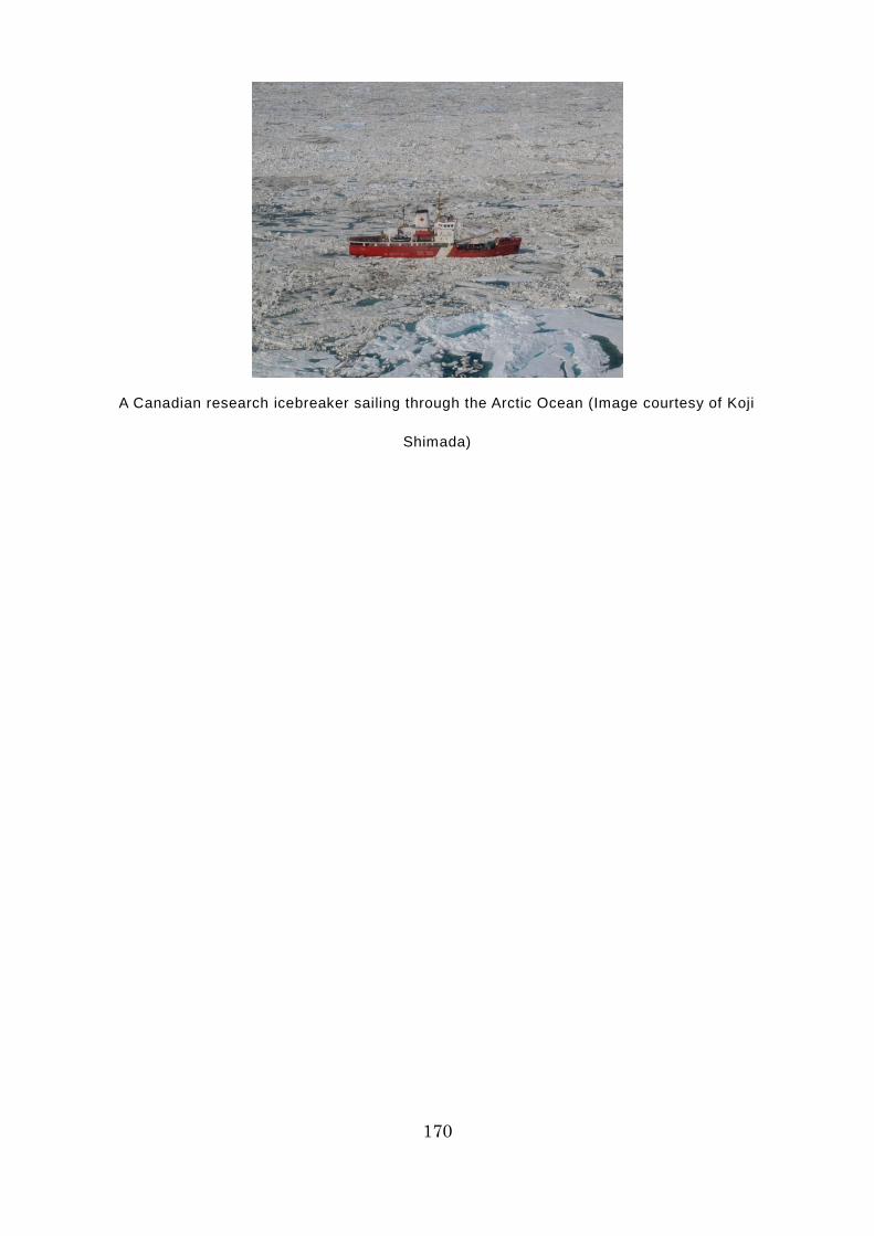
170
A Canadian research icebreaker sailing through the Arctic Ocean (Image courtesy of Koji
Shimada)
171
[Maintenance of engine equipment]
On merchant ships using the NSR, special materials are sometimes used for
engine equipment (seawater inlets, hydraulic equipment, motors,
freshwater/seawater pipes/valves/tanks, etc.) that could be affected by ice or
low temperatures. In addition, some of them have special devices (heating
cables, space heaters, etc.) or special structures (seawater inlets, rudders, etc.)
When carrying out maintenance of engine equipment, take particular care
regarding the following, in addition to the general precautions required in
ordinary waters.
・ When sailing through frozen waters or straits, an order will be issued to
keep the main engine on standby, so that it can be used at any time. In
addition, an emergency stop order may be given without warning, in order
to avoid any ice that has suddenly appeared. When sailing the NSR,
concentrate on engineering watchkeeping. Do not carry out maintenance
work on engine equipment, especially crucial instruments, unless
absolutely necessary.
・ When sailing at a reduced speed while being escorted through frozen
waters by an icebreaker, for example, the main engine operates in low-
load mode for long periods. Depending on the nature of the main engine,
non-combusted fuel oil or lubricant oil could accumulate in the exhaust
manifold and ignite. Do not neglect such routine maintenance tasks as
inspecting and cleaning the exhaust manifold.
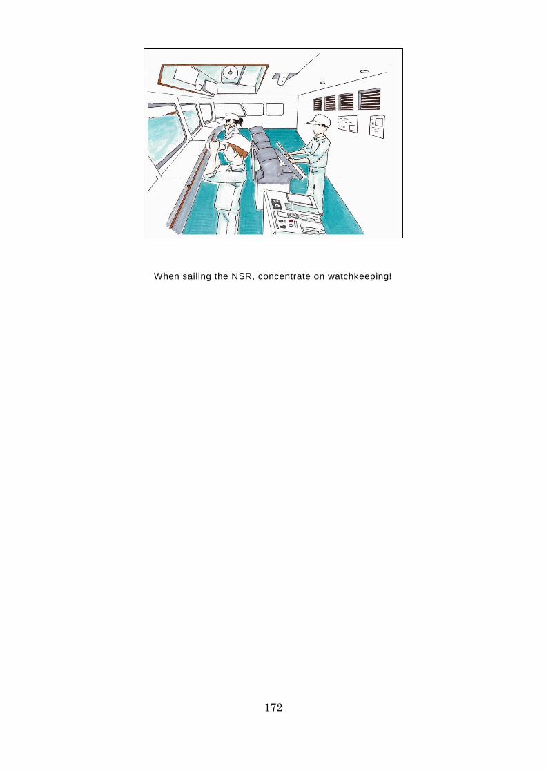
172
When sailing the NSR, concentrate on watchkeeping!
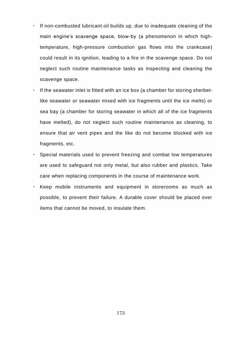
173
・ If non-combusted lubricant oil builds up, due to inadequate cleaning of the
main engine’s scavenge space, blow-by (a phenomenon in which high-
temperature, high-pressure combustion gas flows into the crankcase)
could result in its ignition, leading to a fire in the scavenge space. Do not
neglect such routine maintenance tasks as inspecting and cleaning the
scavenge space.
・ If the seawater inlet is fitted with an ice box (a chamber for storing sherbet-
like seawater or seawater mixed with ice fragments until the ice melts) or
sea bay (a chamber for storing seawater in which all of the ice fragments
have melted), do not neglect such routine maintenance as cleaning, to
ensure that air vent pipes and the like do not become blocked with ice
fragments, etc.
・ Special materials used to prevent freezing and combat low temperatures
are used to safeguard not only metal, but also rubber and plastics. Take
care when replacing components in the course of maintenance work.
・ Keep mobile instruments and equipment in storerooms as much as
possible, to prevent their failure. A durable cover should be placed over
items that cannot be moved, to insulate them.
174
A Canadian research icebreaker advancing in the process of ramming icebreaking (Image
courtesy of Koji Shimada)
175
Column 20: What is the Risk of Collision with an Iceberg on the NSR?
For most people, mention of an accident in frozen waters calls to mind an
image of the Titanic, which is familiar to them from the movies. The Titanic
(46,358 gross tonnage) was a luxury liner that collided with a huge iceberg in
the North Atlantic, off Newfoundland, late at night on April 14, 1912, during a
voyage from Southampton, UK to New York, U.S.A., and sank before dawn on
April 15. Around 1,500 of the approximately 2,200 passengers and crew lost
their lives in what was one of the world’s worst marine accidents, which shook
the world. Factors contributing to the large number of fatalities included lim ited
lifeboat capacity and the fact that the air and water temperatures at the scene
were extremely low.
So is there a possibility of a collision with an iceberg like the Titanic’s when
sailing the NSR? Icebergs are huge lumps of ice that have split off from onshore
glaciers or ice shelves overhanging the sea and have then drifted out to sea.
Most of the icebergs seen in the Northern Hemisphere have drifted into the
Atlantic after splitting off from glaciers near the east coast of Greenland. You
hardly ever see icebergs off the Russian coast, near the NSR. Consequently, a
collision with an iceberg on the NSR is unlikely. However, thick, hard multi -year
ice that has grown to the size of a small iceberg can be found floating in the
Arctic Ocean. Most of the merchant ships that sail the NSR appear to be what
are referred to as ice-strengthened ships, which do not have a substantial
icebreaking ability. Making the wrong move in an inadvertent collision with multi -
year ice could result in serious damage to the hul l. You cannot let down your
guard just because there are no icebergs.

176
Watch out for multi-year ice rather than icebergs!
177
Day 13 of the Voyage (Bering Strait)
On the 13th day after leaving Murmansk, the Tiger Gate has passed through
the Bering Strait and is now sailing through the waters off St. Lawrence Island.
A fresh, blue sky has been peeking through the clouds since morning, the sea
is calm, and visibility is excellent. The Kommuna, which had been in convoy
with them until the night before, is visible 3 miles (5.6 kilometers) behind them
to the right. Soon, the outline of a ship sailing towards them appeared on the
horizon ahead and to the left. It is probably the Young Soldier, the Liberian-
registered bulk carrier that Mr. Karaev had mentioned. It is the ship that Mr.
Karaev will shortly board to provide assistance during its journey to the Port of
Kirkenes in Norway.
The Tiger Gate took 12.9 days to complete the voyage through the sector
designated by the NSRA as the NSR (from Cape Zhelaniya on Novaya Zemlya
to Cape Dezhnev on the Chukchi Peninsula). Its average speed was 10.5 knots
(19.4 kilometers per hour). It was a tolerably good voyage, considering that
there was still a comparatively large amount of ice.
“So, John, how did you find the NSR? There wasn’t anything to worry about,
was there?”
“No, not at all. But now that it’s over, those thirteen days seem to have gone
in a flash. I’m really grateful to everyone for teaching me so much.”
“Well, you worked hard, too. Incidentally, we’re having a feast tonight to
celebrate the fact that we made it through the NSR, and the chief cook’s going
to make his special chicken adobo.”
“Wow, I love chicken adobo! I'm looking forward to it!”
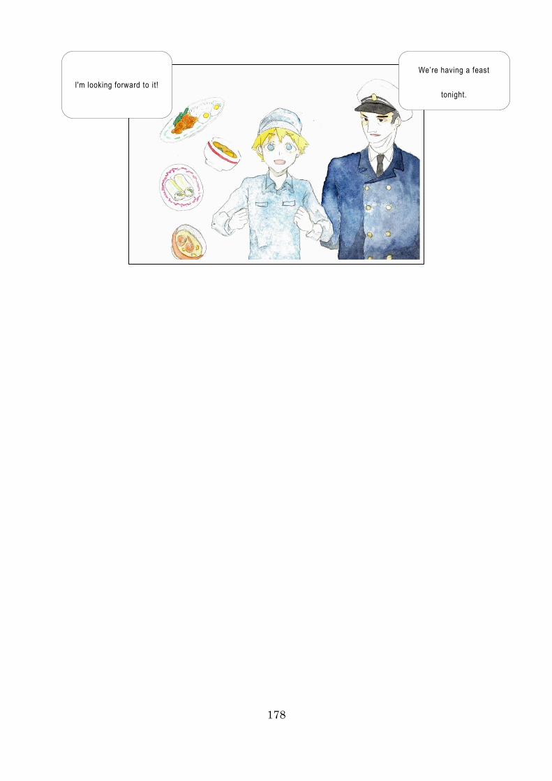
178
We’re having a feast
tonight. I'm looking forward to it!
179
Commentary 20: Engine Operation on the NSR in Practice [Overview]
You need to take care regarding ice and low temperatures all year round when
operating engines while on the NSR. Take particular care regarding the
following, in addition to the general precautions required in ordinary waters.
・ In low temperatures, ensure that you warm the main engine up carefully
before operating it.
・ Give adequate prior consideration to the specific method that you will use
to warm the main engine up (for example, it is usual to heat the lubricant
oil and the freshwater used for cooling the main engine before use.
Warming up can be carried out by first using a heating unit to heat the
freshwater and lubricant oil to the appropriate temperature, then starting
up the cooling freshwater pump and lubricant oil pump to circulate the
warm freshwater and lubricant oil through the main engine before starting
it up).
・ When sailing the NSR, do not use monitoring equipment to keep watch
on the engine room remotely. Maintain manned watches in the engine
room at all times and concentrate on engineering watchkeeping duties.
・ When sailing through frozen waters, the propeller and rudder could be
damaged by contact with ice. During engineering watchkeeping, be on the
alert for abnormalities not only in the equipment in the engine room, but
also equipment on the outside of the ship, such as the propeller and
rudder.
・ To prevent freezing and combat low temperatures, items equipped with
heating cables or space heaters, etc. (pipes, motors, windlasses, cranes,
seawater inlets, etc.) should be warmed up with these before use.
・ To prevent freezing and combat low temperatures, air bubbling apparatus
(apparatus that prevents freezing by generating air bubbles) on anything

180
fitted with this apparatus (ballast tank, freshwater tank, etc.) should be
switched on before use of the equipment concerned.
・ Switch off heating cables, space heaters, etc. when the air temperature
is high. Otherwise they could fail due to overheating.
181
・ If the engine room has a heating system, make effective use of the warm
air from the vents by directing it toward equipment (hydraulic equipment
and motors) to warm it up or keep it warm, in order to combat low
temperatures.
・ Take great care to ensure that sherbet-like seawater and fragments of ice
do not enter via the seawater inlet that brings in water for cooling the main
engine. If they do get in, they could impede cooling, potentially causing
the main engine to overheat and go into emergency shutdown.
・ When sailing at a reduced speed while being escorted through frozen
waters by an icebreaker, for example, the main engine operates in low-
load mode for long periods. Depending on the nature of the main engine,
non-combusted fuel oil or lubricant oil could accumulate in the exhaust
manifold and ignite, so caution is required. Moreover, if non-combusted
lubricant oil builds up, due to inadequate cleaning of the main engine’s
scavenge space, blow-by could result in its ignition, leading to a f ire in
the scavenge space, so caution is required.
・ In turbine engines, caution is required because the engine will go into
emergency shutdown if its cooling ability is reduced by sherbet -like
seawater entering the condenser.
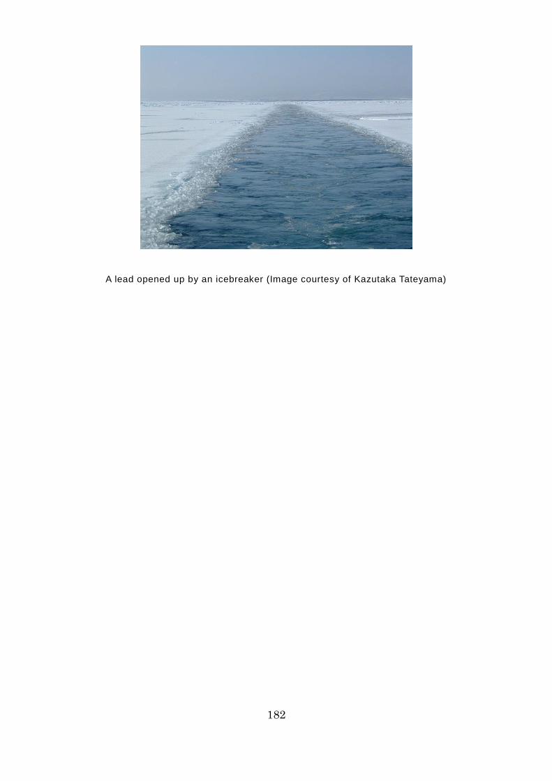
182
A lead opened up by an icebreaker (Image courtesy of Kazutaka Tateyama)
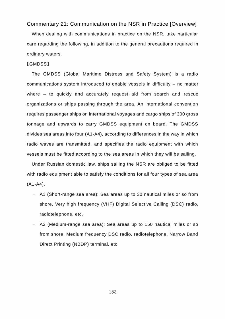
183
Commentary 21: Communication on the NSR in Practice [Overview]
When dealing with communications in practice on the NSR, take particular
care regarding the following, in addition to the general precautions required in
ordinary waters.
【GMDSS】
The GMDSS (Global Maritime Distress and Safety System) is a radio
communications system introduced to enable vessels in difficulty – no matter
where – to quickly and accurately request aid from search and rescue
organizations or ships passing through the area. An international convention
requires passenger ships on international voyages and cargo ships of 300 gross
tonnage and upwards to carry GMDSS equipment on board. The GMDSS
divides sea areas into four (A1-A4), according to differences in the way in which
radio waves are transmitted, and specifies the radio equipment with which
vessels must be fitted according to the sea areas in which they will be sailing.
Under Russian domestic law, ships sailing the NSR are obliged to be fitted
with radio equipment able to satisfy the conditions for all four types of sea area
(A1-A4).
・ A1 (Short-range sea area): Sea areas up to 30 nautical miles or so from
shore. Very high frequency (VHF) Digital Selective Calling (DSC) radio,
radiotelephone, etc.
・ A2 (Medium-range sea area): Sea areas up to 150 nautical miles or so
from shore. Medium frequency DSC radio, radiotelephone, Narrow Band
Direct Printing (NBDP) terminal, etc.

184
Inmarsat geostationary satellites cannot be used on some parts of the NSR
185
・ A3 (Long-range sea area / Sea areas other than A1 and A2, where
Inmarsat communications are available): Inmarsat (a private-sector
telephony, facsimile, data transmission, and internet connection service
provided via a four-satellite constellation of geostationary satellites)
terminal, etc.
・ A4 (Long-range sea area / Sea areas other than A1, A2, and A3. Polar
regions at a latitude beyond 70° or so, where Inmarsat is not available):
High frequency DSC radio, radiotelephone and NBDP, etc.
In fact, Inmarsat cannot be used on a section of the NSR that stretches from
the Kara Sea to the Laptev Sea. When undertaking independent navigation in
waters at or beyond latitude 75° north, you must contact the NSRA and seek
guidance concerning contact methods using intermediary vessels. Some ships
that use the NSR are equipped with an Iridium system (a private-sector
telephony and data transmission service provided via a constellation of 66
orbiting satellites), which can be used even in polar regions.
[Radio contact]
Russian domestic law requires ships sailing the NSR to make radio contact
with the NSRA every day at noon Moscow time, to inform the NSRA of the ship’s
position, ice conditions, and other relevant information about the ship and its
surroundings. In addition, ships must make radio contact when passing through
pre-determined gates or points. Under Russian domestic law, ships underway
on the NSR are under the control of the NSRA and must comply with its
instructions. These instructions are issued by radio via marine traffic control
centers. In addition, icebreakers escorting a ship may radio instructions about
meeting points or the route, course, and speed of the ship.
If ice pilots are on board a ship sailing the NSR, the ice pi lot on duty will
usually take charge of radio contact.

186
[Information about weather, oceanographic phenomena, and ice conditions]
The NSRA provides information about weather, oceanographic phenomena,
and ice conditions. In addition, some ships sailing the NSR obtain information
from private-sector meteorology companies and research institutes. Seafarers
require experience in order to be able to build up a precise image of the actual
ice conditions in the relevant marine area based on the information provided.
187
Commentary 22: Staying Healthy and Preventing Disaster on the
NSR [Overview]
To stay healthy and prevent disaster on the NSR, take particular care
regarding the following, in addition to the general precautions required in
ordinary waters.
[Precautions for staying healthy]
Air conditioning equipment usually keeps the interior of the ship at a pleasant
temperature. In summer, which is the peak season for use of the NSR, the air
temperature can be as high as +5-10°C. However, the weather can still turn
cold, even in summer, so caution is required. Take care regarding the following
throughout the year, in order to stay healthy on the NSR.
・ You must be aware of and take steps to prevent diseases and injuries to
which the human body is prone in low temperatures and snowy/icy
environments. These include frostbite, chilblains, hypothermia, sunburn
from UV rays reflected off the snow, snow blindness (photokeratitis), the
common cold, bronchitis, heart disease, and brain disease.
・ Take care to adjust the air conditioning as needed to maintain an
appropriate temperature and humidity level inside the ship. In addition, all
crew members must take their own steps to keep out the cold and
maintain the right level of humidity according to the apparent temperature
and their own physical condition. Furthermore, crew members must
ensure that they get sufficient sleep and take adequate breaks in order to
maintain a well-balanced lifestyle.
・ Even people who do not normally feel the cold or suffer from stress may
experience them in low temperatures. Think about using ingredients that
help to warm the body and providing meals that offer a good balance of
nutrients. All crew members must find their own ways to ward off the cold
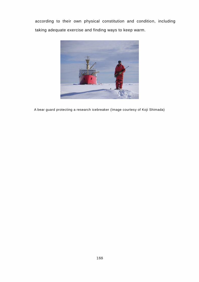
188
according to their own physical constitution and condition, including
taking adequate exercise and finding ways to keep warm.
A bear guard protecting a research icebreaker (Image courtesy of Koji Shimada)
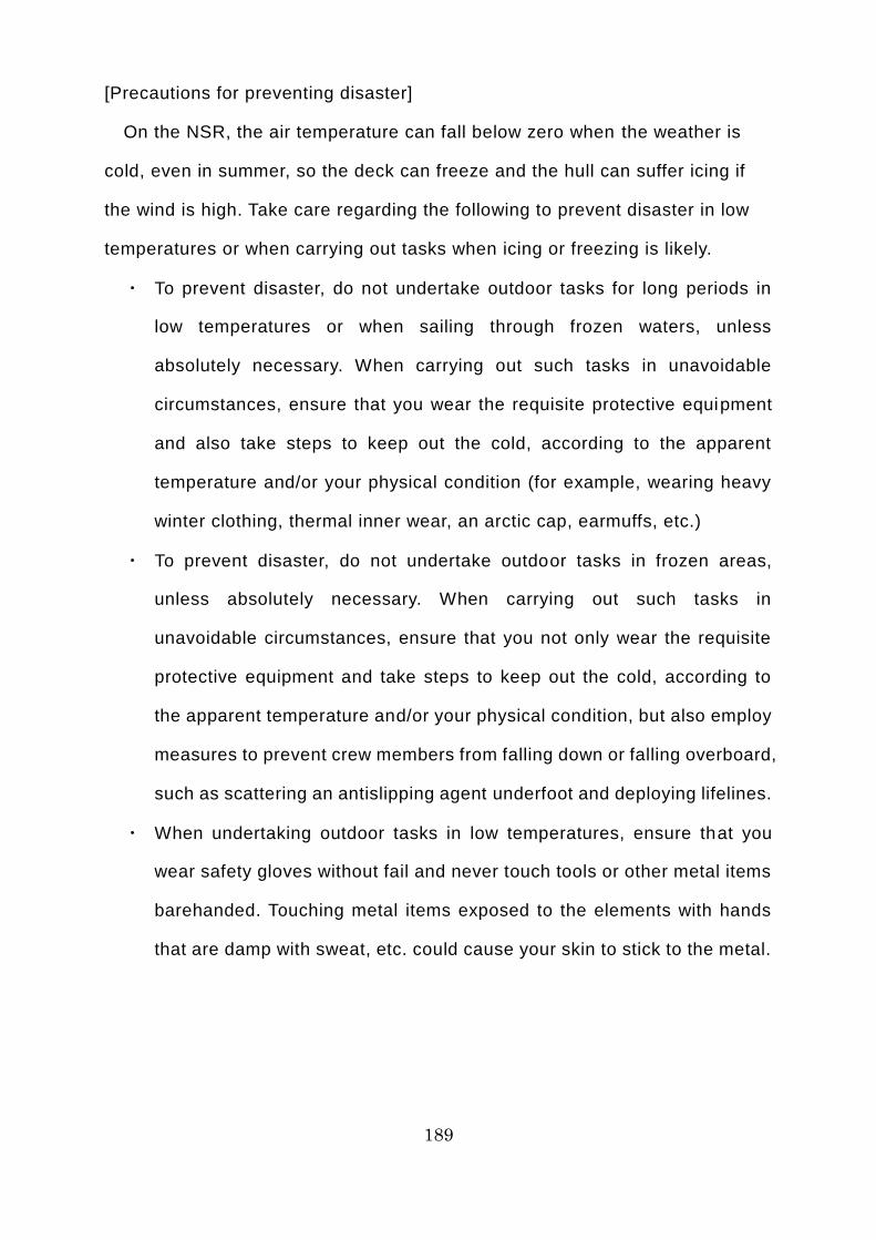
189
[Precautions for preventing disaster]
On the NSR, the air temperature can fall below zero when the weather is
cold, even in summer, so the deck can freeze and the hull can suffer icing if
the wind is high. Take care regarding the following to prevent disaster in low
temperatures or when carrying out tasks when icing or freezing is likely.
・ To prevent disaster, do not undertake outdoor tasks for long periods in
low temperatures or when sailing through frozen waters, unless
absolutely necessary. When carrying out such tasks in unavoidable
circumstances, ensure that you wear the requisite protective equipment
and also take steps to keep out the cold, according to the apparent
temperature and/or your physical condition (for example, wearing heavy
winter clothing, thermal inner wear, an arctic cap, earmuffs, etc.)
・ To prevent disaster, do not undertake outdoor tasks in frozen areas,
unless absolutely necessary. When carrying out such tasks in
unavoidable circumstances, ensure that you not only wear the requisite
protective equipment and take steps to keep out the cold, according to
the apparent temperature and/or your physical condition, but also employ
measures to prevent crew members from falling down or falling overboard,
such as scattering an antislipping agent underfoot and deploying lifelines.
・ When undertaking outdoor tasks in low temperatures, ensure that you
wear safety gloves without fail and never touch tools or other metal items
barehanded. Touching metal items exposed to the elements with hands
that are damp with sweat, etc. could cause your skin to stick to the metal.
190
Icing on a ship sailing
through frozen waters (Image courtesy of Kazutaka Tateyama)
191
Column 21: What is the Secret to Boosting Your Success Rate in
Catching Food to Survive in the Arctic Ocean?
What would you do if, having met with a marine accident and evacuated the
ship on a life raft, the rescue party was delayed and you ran out of food? Life
rafts, etc. are equipped with simple fishing tackle, in case such a situation
should arise. It is not as easy as you might think to fish with a line, hook, sinker,
and trolling sinker with an artificial lure. So here is a suggestion for boosting
your success rate in catching food in the Arctic Ocean.
In winter, the Arctic Ocean is covered in vast sheets of ice and there is little
daylight during the long polar nights, so it is hard for phytoplankton to thrive,
because they cannot photosynthesize properly. However, in early spring, small
algae called ice algae reproduce, clinging to the ice under the ocean surface
and forming a brown layer. This is because ice algae are phytoplankton that
have adapted to frozen waters and thus are able to photosynthesize even in
weak light. Shrimp larvae and other zooplankton gather around ice algae to feed
on it. In addition, small fish gather to feed on the zooplankton, and medium to
large fish gather to feed on the small fish.
Watching out for polar bears, carefully approach ice that has ice algae
attached and use a bucket or ladle to scoop up any small fish there. Once you
have caught some live bait, place it on the fishing hook and use a sinker to
submerge it below the surface; this will substantially increase your odds of
catching medium to large fish. Fish from the sculpin, salmon, cod, and flounder
families live in the Arctic Ocean.

192
You will have a much better chance of catching fish if you can get hold of some live bait near
ice algae!
193
Final Day of the Voyage
In the evening of September 26, 20XX, the Tiger Gate reached the waters off
a certain port in Japan’s Seto Inland Sea. Early the following morning, escorted
by three tugboats, the Tiger Gate looks as though it is gliding slowly over the
ultramarine surface of the sea. The peculiarly loud screeching of seabirds –
probably gulls – resonates around the port in the stillness of dawn.
Stationed at the bow at Suzuki’s direction, John feels the early autumn sea
breeze stir pleasantly against his cheeks. Suddenly, he remembers the wind
that he had experienced on the flying bridge on the NSR. Before long, the Tiger
Gate halted right alongside Hokkai Steel Company’s No. 3 Wharf and the signal
soon came from the bridge to keep it in that position. Then, two boats glide up
to the ship from fore and aft, and the crew members stationed at the bow and
stern set to work to make the huge, 185-meter-long and 30-meter-wide ship fast
using 16 hawsers (mooring ropes).
“Bow made fast, sir!”
“Thank you, Chief Officer. Please come back here. The foreman (the person
from Hokkai Steel Company in charge of cargo handling) is waiting for you in
the tally office. In addition, your successor, young Yamashita, has come on
board.”
“Understood, Captain. I’ll return right away.”
“I’m going back, John. Make sure you firmly secure the brakes on the hawser
winches. Then attach the rat guards to all of the hawsers. It’s one of the port’s
rules.”
“Understood, Chief Officer!”
“Incidentally, John, I’ll have to disembark as soon as I’ve talked to the
foreman about the cargo handling and handed over to Yamashita, because I
194
have to get to our sister ship, the Tiger Hill, which is being made ready at
Kyokkai Shipbuilding Company in Kyushu.
“You’ve been promoted to captain at last. Congratulations!”
“Thanks. I’m told that the Tiger Gate will finish cargo handling late tomorrow
night and then leave port the following morning, heading back to the Port of
Murmansk through the Arctic Ocean via the Bering Strait.”
“So I’ll be able to experience the NSR once more. I’m looking forward to it. I
might even meet Captain Karaev again.”
“Yes, you might. In fact, the Tiger Hill is also due to head for the Port of
Murmansk via the Arctic Ocean after preparations for the voyage have been
completed before the weekend, I hear. I’ve sailed the NSR many times as a
chief officer, but this is the first time that I’ll be sailing it as captain. I’m going to
do my very best, taking it as seriously as I took my first voyage. Just like you
when you came aboard at Murmansk.
When it comes to the NSR, you still have a lot to learn and experience. After
all, even I still learn new things each time I sail the NSR. I didn’t tell you at the
time, but I learned several new things from Captain Karaev on this voyage alone.
There’s so much to learn about navigating the NSR. We both still need to study
hard.”
“Understood, Chief Officer. I’ll study even harder!”
In recent years, the number of foreign merchant ships sailing between Europe
and Asia via the Arctic Ocean has been growing. You too might one day have
the chance to experience the NSR for the first time, like John. If that day should
come, we hope that you will remember this book and flip through its pages again.
You are bound to find something useful in it.

195
You’re bound to find something useful.
See you all again sometime.
196
Commentary 23: NSR-related Rules, etc. [Overview]
As of January 2015, the main rules relating to ships sailing the NSR are as
follows.
[The United Nations Convention on the Law of the Sea]
The United Nations Convention on the Law of the Sea is also called the Law
of the Sea Treaty. The Law of the Sea Treaty is an international convention set
forth by the United Nations (UN) with the aim of forming a set of international
legal principles governing the sea. Also known as the “Constitution of the
Oceans,” it contains a comprehensive set of internat ional rules governing
various maritime issues, including territorial waters, exclusive economic zones,
continental shelves, the high seas, the deep ocean floor, and conservation of
the marine environment.
[The Polar Code]
The Polar Code is a set of international rules formulated by the IMO
(International Maritime Organization) to ensure the safety of vessels sailing in
polar waters (the Arctic Ocean and the Southern Ocean) and protect the
environment in those waters. It sets out technical standards for hull construction
that take into account the hazards peculiar to polar waters, as well as standards
for safe operation, fire prevention and lifesaving equipment, communications,
passage planning, the training and certification of seafarers, and environmental
protection, among other matters.
To make the Polar Code a legally binding framework, its safety standards
have been incorporated into the SOLAS Convention, its environmental
protection standards into the MARPOL Convention, and its standards on the
training and certification of seafarers into the STCW Convention.

197
The conference room at IMO headquarters in London, UK
198
[The SOLAS Convention]
The 1974 International Convention for the Safety of Life at Sea is known as
the SOLAS Convention. The SOLAS Convention is an international convention
prescribed by the IMO (International Maritime Organization), which sets out
international standards for such matters as the hull construction, lifesaving
equipment, radio communications, and nautical instruments required to ensure
the safety of life at sea.
[The MARPOL Convention]
The International Convention for the Prevention of Pollution from Ships, 1973
as modified by the Protocol of 1978 is known as the MARPOL Convention. The
MARPOL Convention is an international convention prescribed by the IMO,
which sets out international standards for equipment to prevent marine or
atmospheric pollution by ships, according to the type of pollutant (oil,
wastewater, waste products, atmospheric pollutants, etc.)
[The STCW Convention]
The 1978 International Convention on Standards of Training, Certification and
Watchkeeping for Seafarers is known as the STCW Convention. The STCW
Convention is an international convention prescribed by the IMO, which sets
out international standards for the training and certification that seafarers need
to meet minimum ability requirements.
[Rules of Navigation in the Northern Sea Route Water Area]
This is a Russian federal law that prescribes a comprehensive set of rules
concerning navigation of the NSR by ships. All vessels using the NSR must
comply with these. They consist of the following rules.
・ <Procedure of the navigation of ships in the water area of the Northern
Sea Route> This section prescribes matters including applications to
199
use the NSR and the screening thereof, as well as radio contact when
entering and leaving the NSR.
・ <Rules of the icebreaker assistance of ships in the water area of the
Northern Sea Route> This section prescribes matters including
icebreaker escort service methods and fees for their services.
・ <Rules of the pilot ice assistance of ships in the water area of the Northern
Sea Route> This section prescribes matters including the duties
performed by ice pilots, the qualifications and abilities required to be an
ice pilot, and fees for their services.
・ <Rules of the assistance of ships on seaways of the water area of the
Northern Sea Route> This section prescribes such matters as the need
for radio contact at noon Moscow time each day when sailing the NSR.
・ <Provision about the navigational-hydrographic and hydrometeorologic
support of the navigation of ships in the water area of the Northern Sea
Route> This section prescribes matters including the specific
administrative services required for navigation safety on the NSR (the
supply of nautical charts and information about waterways, the surveying
of marine areas, the maintenance of navigation aids, etc.) and the
organizations that provide them.
・ <Rules of radio communication during the navigation of ships in the water
area of the Northern Sea Route> This section prescribes matters
including the radio communications equipment required for the NSRA and
icebreakers to communicate with ships sailing the NSR, and the methods
used for such communication.
・ <Requirements for ships pertaining to the safety of navigation and
protection of the marine environment from pollution from ships> This
section prescribes matters including the instruments and equipment that
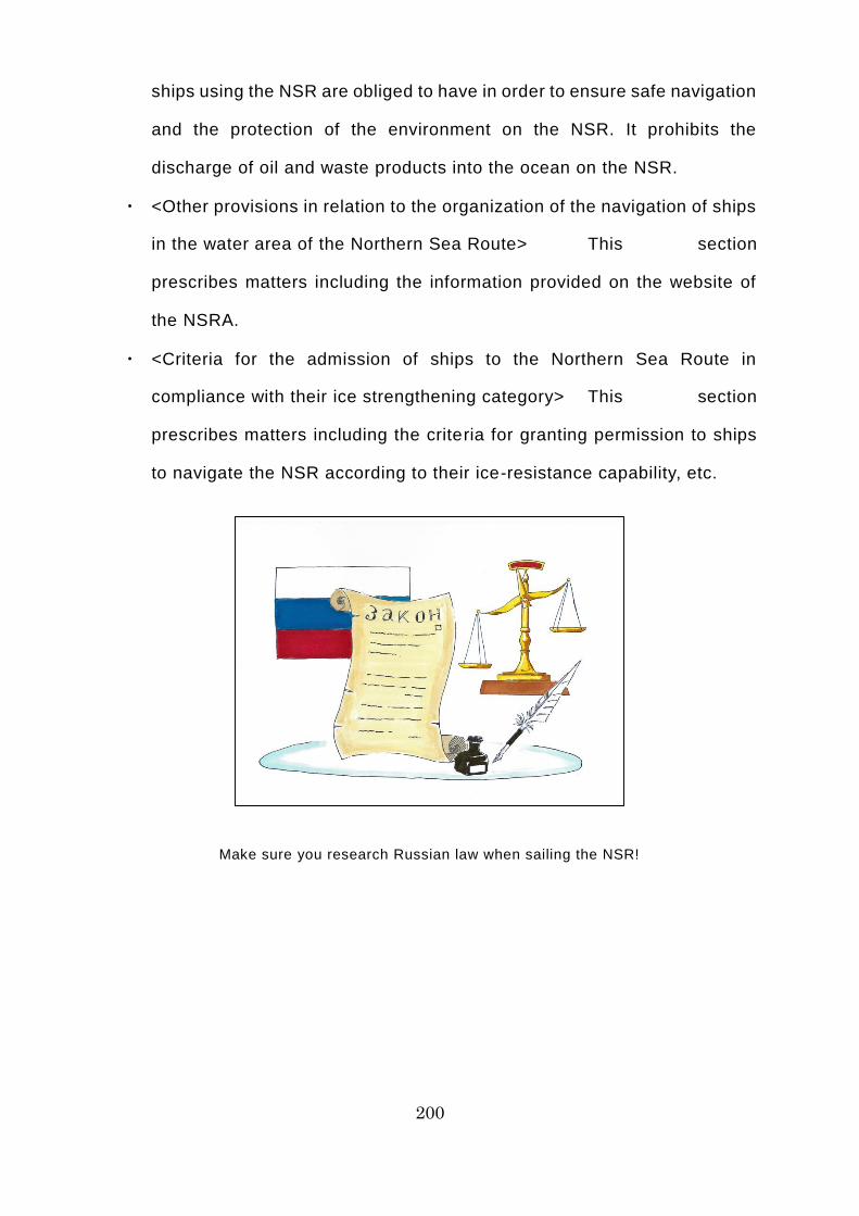
200
ships using the NSR are obliged to have in order to ensure safe navigation
and the protection of the environment on the NSR. It prohibits the
discharge of oil and waste products into the ocean on the NSR.
・ <Other provisions in relation to the organization of the navigation of ships
in the water area of the Northern Sea Route> This section
prescribes matters including the information provided on the website of
the NSRA.
・ <Criteria for the admission of ships to the Northern Sea Route in
compliance with their ice strengthening category> This section
prescribes matters including the criteria for granting permission to ships
to navigate the NSR according to their ice-resistance capability, etc.
Make sure you research Russian law when sailing the NSR!
201
Column 22: Survival in the Arctic Ocean: Can You Really Drown in a
Life Raft?
Some people who evacuate to the sea in a lifeboat or life raft suffer
hypothermia while inside. The human body cannot maintain normal functions
once its core temperature drops below 35°C. Hypothermia begins with severe
trembling and weakness, followed by such symptoms as memory loss, apathy,
and confusion. At 30°C, arrhythmia (irregular pulse) and impaired
consciousness occurs. Symptoms such as muscular rigidity, reduced heart rate,
and hallucinations also occur, eventually leading to complete collapse. At 25°C,
muscles begin to relax and the individual enters a state of apparent death. At
20°C, breathing ceases and death follows shortly thereafter.
It might seem odd, but it is not unusual for people to drown in lifeboats or life
rafts, despite having evacuated to the sea in them. This is because, having
suffered hypothermia in the lifeboat or life raft, they lost consciousness after
collapsing to the floor and, while unconscious, accidentally inhaled seawater
that had collected on the floor.
The death rate among those who have evacuated in a lifeboat or life raft is
said to be at least four times higher in seas where the water temperature is 5°C
or lower than it is in seas where the water temperature is 20-31°C. Your biggest
foe when trying to survive out on the water in the Arctic Ocean is hypothermia.
To prevent hypothermia, it is vital to stay hydrated and maintain your energy
levels, as well as keeping as warm and dry as possible. It is vital to remember
that alcohol disrupts the regulation of body temperature, while nicotine causes
constriction of the blood vessels, so you must refrain from these when your
survival at sea is at stake.

202
To prevent hypothermia, stay hydrated and maintain your energy levels, as well as
keeping warm and dry!
203
Commentary 24: Emergency Response on the NSR [Overview]
There is a risk of hull damage and other accidents due to contact or collisions
with ice in frozen waters. In the event of an emergency on the NSR, take
particular care regarding the following, in addition to the general precautions
required in ordinary waters.
[Rescue by an icebreaker]
In frozen waters, ships often become trapped in the ice, unable to move (a
condition referred to as being “beset”). To avoid becoming beset, it is vital to
ensure that the ship keeps on moving, no matter what. If, despite your best
efforts, the ship becomes beset and is unable to get out from the ice unaided,
you must contact a marine traffic control center or icebreaker and ask to be
rescued. When doing so, take heed of the following.
・ While waiting to be rescued, the crew of the ship to be rescued should, if
possible, fill the ballast tanks with water to give the ship a deeper draft
(to prevent damage resulting from the propeller or rudder coming into
contact with ice while being rescued).
・ If the ship is to be rescued by an icebreaker, the icebreaker will usually
clear the ice around the ship to be rescued to open up a lead and then
escort it back to safe waters. An icebreaker will only tow a ship needing
to be rescued as a last resort.
・ In most cases, the icebreaker will approach the ship to be rescued from
the side and break the ice around the ship, gradually making the pieces
of ice smaller and softer. If the ship to be rescued is a large vessel, the
icebreaker will also open up a path of retreat. You must remember that
rescue work takes time.
・ When an icebreaker escorts a ship needing to be rescued to safe waters,
the distance between them is extremely short. You must do your utmost
204
to prevent a rear-end collision or other accident involving the icebreaker
and the ship to be rescued, by exchanging accurate information and
ensuring clear communication.
[Hull damage and flooding]
If a ship without adequate hull reinforcement becomes beset, the worst -case
scenario is that it could be crushed by the pressure of the surrounding ice,
resulting in its flooding and sinking. If it collides with the ice while sailing at too
high a speed, the hull, propeller, and rudder could sustain serious damage; in
a worst-case scenario, this could cause the ship to sink, due to flooding.
If a collision or other contact with the ice causes hull damage that is likely to
result in flooding, notify the nearest search and rescue body and the water
prevention team immediately, carrying out the requisite tasks bearing the
following in mind.
・ After checking the damage and the areas being flooded, estimate the
volume of flooding per unit time based on the location of the breach (how
many meters below the ocean surface) and its surface area (square
meters). In addition, consider whether or not there is a possibility of
sinking.
・ Remember that once damage occurs, the ice resistance not only of the
damaged area, but also of the surrounding area could be reduced.
・ Stop the influx of water into the hull without delay, if possible, by
transferring or discharging ballast water in the smallest possible area to
adjust the incline and draft of the hull and bring the breach above the
waterline.
・ If it is possible to pump water out of the hull, do so without delay.
・ Close any watertight doors nearest to the site of the flooding, to prevent
the flooding of adjacent sections.
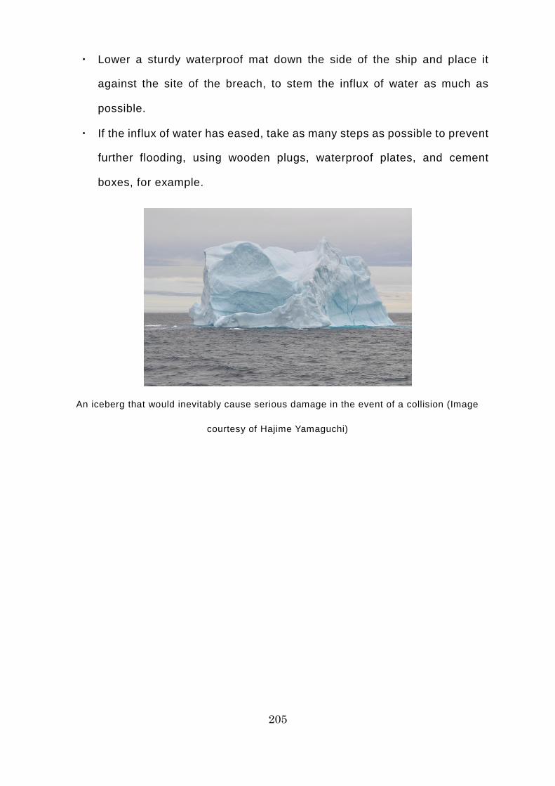
205
・ Lower a sturdy waterproof mat down the side of the ship and place it
against the site of the breach, to stem the influx of water as much as
possible.
・ If the influx of water has eased, take as many steps as possible to prevent
further flooding, using wooden plugs, waterproof plates, and cement
boxes, for example.
An iceberg that would inevitably cause serious damage in the event of a collision (Image
courtesy of Hajime Yamaguchi)
206
[Evacuation]
If a worst-case scenario, such as sinking, is anticipated, you must evacuate
the ship without hesitation. Notify the nearest search and rescue body
immediately and declare evacuation, carrying out the requisite tasks while
bearing the following in mind.
・ To ensure that the oil remains sealed inside the ship and does not leak
out, even if the ship sinks, you must tightly close air vent pipes and the
outlet valves of fuel oil tanks, etc.
・ When evacuating the ship, assess the surrounding ice conditions and use
a lifeboat or life raft if necessary.
・ If, when evacuating using a lifeboat or life raft, the surface directly below
it is an ice floe and not water, only lower the lifeboat or life raft onto it if
you judge that the thickness of the ice floe can fully withstand the weight
of the lifeboat or life raft.
・ Freefall lifeboats are a form of lifeboat fitted to the stern of the ship, which
drops onto the ocean surface when the release device is operated from
inside the lifeboat. A freefall lifeboat will be damaged by the impact if
released onto an ice floe.
・ Even in an emergency, transferring onto the ice without due care is very
dangerous, because of the risk of polar bear attack. You must pay the
utmost care and attention.

207
You must close the valves on all fuel oil tanks before evacuation, without fail!
208
Column 23: Survival in the Arctic Ocean: Is Getting onto the Ice
Really Dangerous?
What would you do if, having met with a marine accident and evacuated the
ship on a life raft, the rescue party was delayed and you ran out of water? While
being tossed about on the waves in the life raft, you spot an ice floe up ahead
that looks as though it could accommodate a large number of people. There are
puddles on the ice floe, so it can probably provide drinking water. In addition, it
looks as though it will afford a better view of the surroundings and areas further
off in the distance than the life raft does. If you dangle a fishing line into the
water from the ice floe, you will undoubtedly be able to catch some fish.
Furthermore, if you stay shut up in the cramped life raft for a long period, there
is a risk of economy class syndrome (a medical condition in which, as a result
of maintaining the same position for a long period, a blood clot forms in one of
the veins of the leg and travels to the pulmonary artery, blocking it and causing
death, in a worst-case scenario). If you land on the ice floe and stretch your
arms and legs, you will be able to prevent this. You might think that there is no
down-side here.
However, you must not land on an ice floe unless you are accompanied by a
bear guard (hunter). This is because of the risk of polar bear at tacks. Polar
bears are the largest carnivores on Earth, growing to a height of 2-3 meters and
weighing between 300 and 800 kilograms. They have an outstanding sense of
smell that enables them to sniff out earless seals beneath the ice. When they
attack an animal, they charge it at a speed of 50 kilometers per hour or more,
felling it with a single blow of their front paws. They can also keep swimming
for hours. The biggest hunters in the Arctic Ocean also attack humans.

209
Polar bear parent and cubs in transit over the ice (Image courtesy of Hiroki Shibata)
210
Column 24: What is the Surprising Reason for Low Mood in the Arctic
Ocean?
Seasonal affective disorder (SAD) is a condition affecting sufferers only at a
certain time of the year, which is characterized by symptoms such as low mood,
apathy, lethargy, and tiring easily. Symptoms are particularly likely to occur in
winter, so it is also called “winter depression.” The cause is still not properly
understood, but it is said to result from reduced neurotransmitter activity in the
brain during winter, when the hours of daylight are shorter, disrupting the
secretion of hormones that regulate the body clock. In other words, the shortage
of daylight means that neurotransmitters in the brain are not activated , so the
body’s “reset switch” is not activated and the body remains in a sleep -like state.
Insufficient daylight is undoubtedly a factor in this condition, because bathing
the body in strong light similar to sunlight is an effective means of treating it. In
high latitudes, such as on the NSR, where the hours of daylight are very short
for long periods in winter and the weather is overcast with little or only weak
sunshine for long periods in summer, there is a risk that SAD could occur in any
season. Particular care is required in the case of Southeast Asian seafarers, as
they are accustomed to warm environments where the sun is very strong.
Sunbathing is the best way of preventing this condition. If the sun comes out
during the voyage, make an effort to get outside and soak up some of the
sunshine. In addition, rather than lying around in bed in the morning, get up
straight away and take a hot shower, which will leave you feeling refreshed.
Also said to be effective are foods rich in B vitamins, including o ily fish such as
sardines, mackerel, and herring, and liver.

211
Take a hot shower to wake up and you will have the energy to work hard all day!
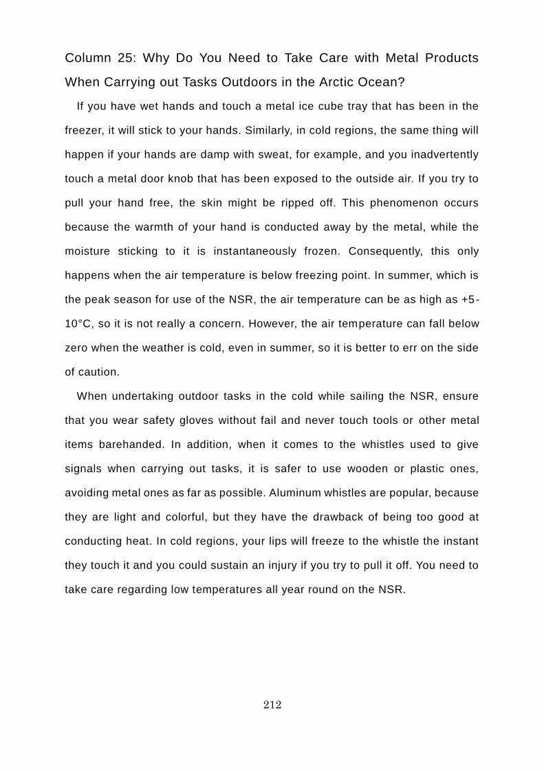
212
Column 25: Why Do You Need to Take Care with Metal Products
When Carrying out Tasks Outdoors in the Arctic Ocean?
If you have wet hands and touch a metal ice cube tray that has been in the
freezer, it will stick to your hands. Similarly, in cold regions, the same thing will
happen if your hands are damp with sweat, for example, and you inadvertently
touch a metal door knob that has been exposed to the outside air. If you try to
pull your hand free, the skin might be ripped off. This phenomenon occurs
because the warmth of your hand is conducted away by the metal, while the
moisture sticking to it is instantaneously frozen. Consequently, this only
happens when the air temperature is below freezing point. In summer, which is
the peak season for use of the NSR, the air temperature can be as high as +5-
10°C, so it is not really a concern. However, the air temperature can fall below
zero when the weather is cold, even in summer, so it is better to err on the side
of caution.
When undertaking outdoor tasks in the cold while sailing the NSR, ensure
that you wear safety gloves without fail and never touch tools or other metal
items barehanded. In addition, when it comes to the whistles used to give
signals when carrying out tasks, it is safer to use wooden or plastic ones,
avoiding metal ones as far as possible. Aluminum whistles are popular, because
they are light and colorful, but they have the drawback of being too good at
conducting heat. In cold regions, your lips will freeze to the whistle the instant
they touch it and you could sustain an injury if you try to pull it off. You need to
take care regarding low temperatures all year round on the NSR.
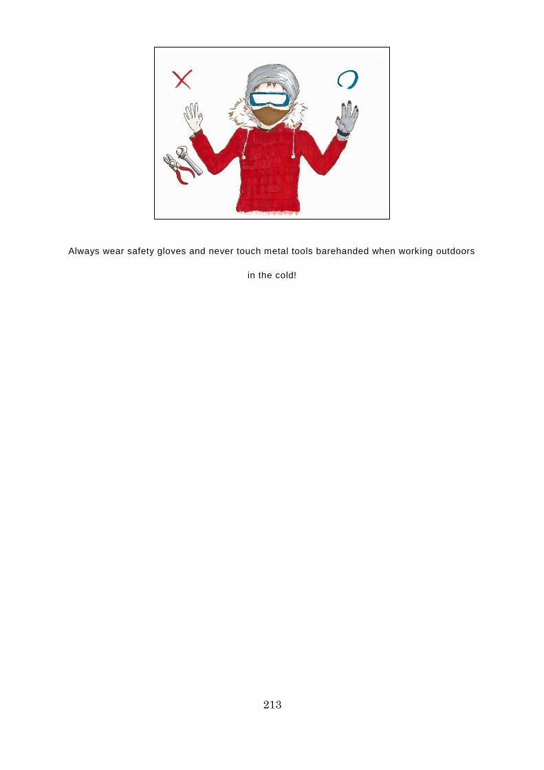
213
Always wear safety gloves and never touch metal tools barehanded when working outdoors
in the cold!
214
Column 26: What is the Secret to Avoiding Becoming a “Sleep
Refugee” in the Arctic Ocean?
Recently, the number of people unhappy with the quality of their sleep has
been on the rise, with complaints including being unable to get off to sleep,
feeling exhausted even after sleeping, and waking up often in the night. Almost
half of these people say that they did not see any improvement at all after taking
steps to improve the quality of their sleep or that they did not take any particular
steps because they did not know what to do. These people are called “sleep
refugees.” Not only the quantity, but also the quality of sleep is important.
Coldness and stress are said to be the two biggest factors that reduce the
quality of sleep. Consequently, to liberate yourself from the status of sleep
refugee, it is vital to take steps to combat coldness and stress that suit your
daily life.
On board ships sailing the NSR, air conditioning equipment keeps the interior
of the ship at a pleasant temperature. However, almost all ships use a central
air conditioning system powered by a large unit. Unlike the individual air
conditioning systems found in hotel rooms, central air conditioning systems
cannot be adjusted separately in single-degree increments in each room.
Consequently, some people may find the temperature inside the ship too cold,
which can lead to stress, which can result in their becoming sleep refugees. In
days gone by, Japanese ships used to have a wonderful way of preventing crew
members from becoming sleep refugees. At a time when freshwater was still a
rare and precious treasure, they would bathe in seawater. Many people became
fans of seawater baths, because they warm the body to its very core, washing
away fatigue and stress, and enabling the bather to get a sound night’s sleep.
However, due to advances in desalination technology, modern ships do not have
seawater baths. This helpful trick has faded into history as just another bit of

215
folklore from the good old days. So you need to think of other methods that will
suit you, such as placing a warm compress under your neck when you go to
bed.
Seawater baths were a handy way to prevent seafarers from becoming sleep refugees in
days gone by!
216
Column 27: What Healthy Foods Can You Eat on the NSR to Keep
Warm?
If you allow yourself to stay cold, your circulation will deteriorate and you will
have difficulty sleeping; this will cause stress to build up, which could leave you
susceptible to various ailments. In the olden days, there was a saying: coldness
is the root of all diseases. There is a tendency to think of susceptibility to the
cold as a symptom unique to women, but the number of men complaining of it
has been growing of late. In environments like the NSR, where even in summer
the temperature can be low, with little or only weak sunlight for days on end,
even people who had not been susceptible to the cold might begin to feel it.
Particular care is required in the case of Southeast Asian seafarers, as they are
accustomed to warm environments where the sun is very strong. Foods that
warm the body are one means of combating the cold. However, obesity is a
growing problem among seafarers across the globe, so lower-calorie meals are
recommended. So what foods are both healthy and convenient, while having
the added advantage of helping to warm the body? Here are a few suggestions.
In the case of cereals and pulses, in general, darker-colored ones are
recommended, including black rice, unpolished rice, black beans, and adzuki
beans. Black bread made with rye or a mixture of grains is also helpful. When
it comes to vegetables, root vegetables such as burdock, lotus root, garlic, and
ginger, and winter vegetables such as leeks, carrots, and garlic chives are
recommended. Looking at fish, shellfish, and meat, goat, chicken, chicken liver,
pork liver, salmon, sardines, bonito, and oysters are recommended. Of course,
you must not eat too much of anything, even if it is low in calories and effective
against the cold. The key thing is to eat in moderation, consuming dishes
containing ingredients with a good nutritional balance.

217
Eat in moderation, consuming dishes containing ingredients with a good nutritional balance

218
Column 28: What Handy Techniques Can You Use on the NSR to
Keep Warm?
This section outlines a number of techniques you can practice in your room
on board ship, to ward off the cold and keep yourself warm and toasty. The first
is Bhastrika breathing. Bhastrika means “bellows,” the human -powered
ventilator used by the blacksmiths of yore to keep the iron red hot while they
worked it. Sit quietly, maintaining a good posture, and breathe deeply through
your nose at intervals of 1-2 seconds, repeating this 20-30 times in succession.
Breathe out through your mouth, using the abdominal muscles as you do so,
making a blowing sound and consciously inflating and deflating your abdomen,
just like a bellows. The key to this is doing it vigorously and rhythmically.
Bhastrika breathing is said to raise the body temperature and stimulate the
internal organs. However, you must not overdo it. People with high blood
pressure need to take particular care. Flapping your hands and feet, and
repeatedly curling and stretching your fingers and toes are also effective: you
can do these exercises while sitting on the edge of a chair or bed, or while
soaking in the bath.
Taking breaks for ginger tea in your room is another simple way to stay warm
and healthy. Ginger has been used in traditional Chinese medicine since ancient
times. Grate a pinch of ginger into piping hot black tea. You can also use brown
sugar or honey instead of white sugar. If you can’t get hold of raw ginger, you
can use the ready-grated ginger that comes in a tube, but dried ginger appears
to be most effective. Ginger tea warms the body to its very core. In particular, if
you drink it when you wake up in the morning, you feel like someone has flipped
a switch that gets your day started properly. Do give it a try.

219
Use breathing techniques and tea breaks to stay warm
220
Column 29: What traditional Asian remedies are used to combat the
cold on the NSR?
The various parts of Japan have their own centuries-old traditional remedies
for keeping the cold at bay. For example, there is something called a “sacral hot
compress.” The sacrum is a large, triangular bone at the base of the spine. This
remedy is simple: it just involves placing a hot compress made from a steamed
towel, etc. on a chair and sitting on it for a while to warm your sacrum. There
are many acupressure points around the sacrum. Warming the area is said to
improve the circulation through the pelvis, warming the whole body and
banishing coldness.
It is not only Japan that has traditional remedies for combating the cold: so
too do various other Asian countries. For example, in South Korea, there is a
traditional remedy based on mugwort and other medicinal herbs, which is said
to have a history dating back hundreds of years. Medicinal herbs such as
mugwort are said to help to banish coldness by boosting circulation. On the
Indonesian island of Bali, they have a traditional remedy called Balinese boreh.
Herbs, ginger, cloves, and cinnamon are mixed together to form poultice that is
applied to the whole body. It improves circulation, so it is effective against joint
pain, as well as helping to keep out the cold. Hilot is an ancient Filipino art of
healing that uses coconut oil and it is said to be effective against the cold. There
are also believed to be meridian points that are effective against the cold when
targeted by Chinese moxibustion, which is said to have a history dating back
3,000 years.
However, apart from the sacral hot compress, all of these remedies require
special techniques or tools, so they would seem to be unsuitable as a means of
combating the cold on the NSR.

221
Each country has its own traditional remedy for keeping out the cold
222
Column 30: Food is the Source of Sailors’ Strength. Which Dishes
are Best on the Northern Sea Route?
When talking about a typical dish for a cold winter’s day, the first thing that
springs to mind for most Japanese people is hot pot. No matter how harsh the
cold or intense the blizzard outside might be, there is no greater pleasure for
Japanese people than to sit around a hot pot with their family. It is also the best
way to ward off the cold. The term “hot pot” encompasses a diverse array of
dishes involving meat, seafood and/or tofu cooked with vegetables in a broth
that may or may not be flavored with miso or soy sauce, depending on the
variety of hot pot. These include yose-nabe, mizutaki, oden, sukiyaki, shabu-
shabu, yudofu, kimchi-nabe, chanko-nabe, motsu-nabe, and kani-nabe. So
what dishes are typically eaten on cold days in other Asian countries?
The Korean dish samgyetang is a soup made from a whole chicken stuffed
with ginseng, jujubes, pine nuts, garlic, and glutinous rice. Originally, it was a
nutritious dish served to ward off the fatigue engendered by the heat of summer.
However, it contains many ingredients that warm the body to its very core, so it
is not unusual to see it on the menu at some restaurants all through the year.
There is also jjigae, a typical Korean hot pot featuring kimchi, meat, fish and
shellfish, vegetables, and tofu simmered in a broth seasoned with gochujang
(spicy Korean miso) and chili peppers. Both of these dishes are ideal for
warding off summer fatigue and winter cold.
Chicken adobo is a Filipino dish typically served at home. It consists of
chicken seasoned with garlic and spices, which is then simmered in vinegar and
coconut milk. Just like nikujaga (stewed meat and potatoes) is among Japanese,
chicken adobo is a familiar, well-loved dish among Filipinos. It contains chicken,
garlic, and many other ingredients that warm the body, so it could well be an
effective ally in keeping out the cold while sailing the NSR.

223
Nothing beats hot pot on a cold winter ’s day!
Northern Sea Route Handbook
First published 2015
―――――――――――――――――――――――
Published by The Japan Association of Marine Safety
1-3, Toranomon 1-chome Minato-ku, Tokyo 105-0001 JAPAN