Embed Size (px)
Citation preview

NPS Intermountain Region Office
Intermountain Region Geographic Resources
Program Update
The Next Step
http://imgis.nps.gov

NPS Intermountain Region Office
Program Focus
Support the parks and programs in the Intermountain Region.
60% focus is Regional 40% Park specific

NPS Intermountain Region Office
Future Plans discussed at this meeting two years ago included:
• Migrate from ArcIMS to ArcServer for public facing mapping application.
• Expand park visits and support as funds allow.
NPS Intermountain Region Office
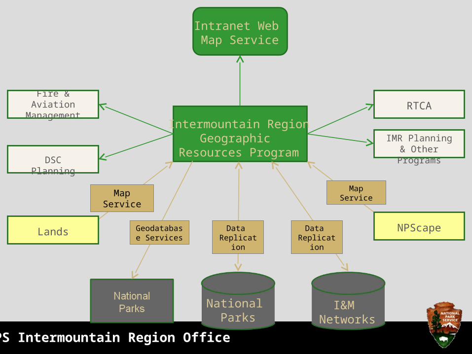
I&M Networks
National Parks
Intermountain RegionGeographic
Resources ProgramDSC Planning
Fire & Aviation Management RTCA
Map Service
Data Replication
Map Service
IMR Planning & Other Programs
NPScapeLands Data Replication
Geodatabase Services
Intranet Web Map Service

NPS Intermountain Region Office
Moving from external to internal mapping service.
This allows us to point to mapping services for the Lands program and NPScape
Start with a variety of Pilot Projects
We’ll keep external services when needed

NPS Intermountain Region Office
I&M Networks
National Parks
Intermountain RegionGeographic
Resources ProgramDSC Planning
Fire & Aviation Management RTCA
Map Service
Data Replication
Map Service
IMR Planning & Other Programs
NPScapeLands Data Replication
Geodatabase Services
Intranet Web Map Service
NPS Intermountain Region Office
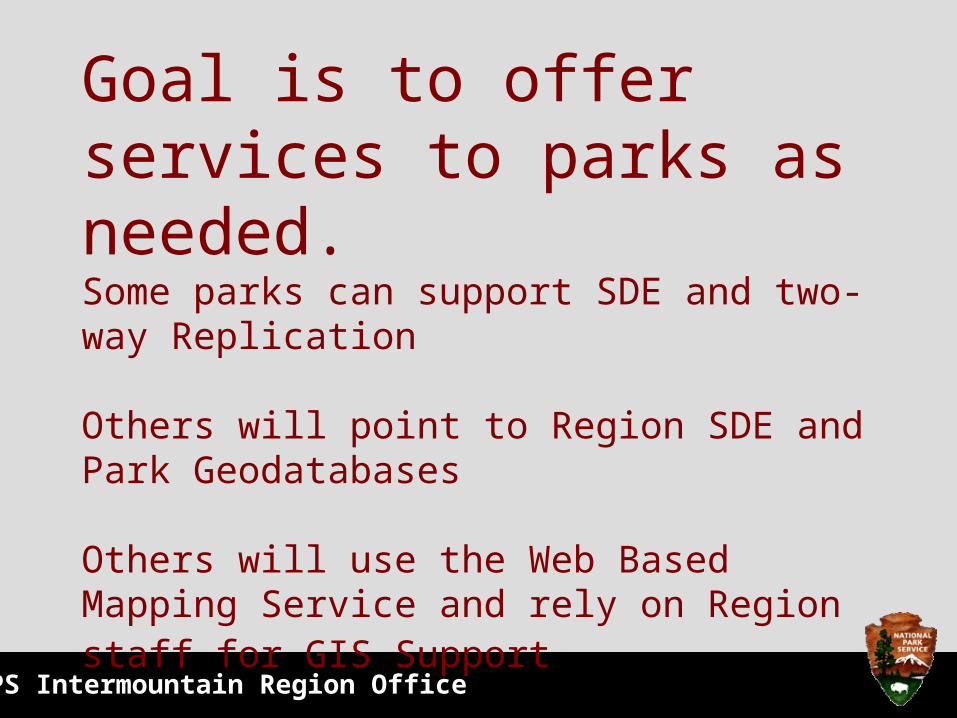
Goal is to offer services to parks as needed.Some parks can support SDE and two- way Replication
Others will point to Region SDE and Park Geodatabases Others will use the Web Based Mapping Service and rely on Region staff for GIS Support

NPS Intermountain Region Office
I&M Networks
National Parks
Intermountain RegionGeographic
Resources ProgramDSC Planning
Fire & Aviation Management RTCA
Map Service
Data Replication
Map Service
IMR Planning & Other Programs
NPScapeLands Data Replication
Geodatabase Services
Intranet Web Map Service

NPS Intermountain Region Office
Geographic Resources Program
IMRO GIS Web Based Mapping Service
that NOW HAS A REALLY COOL NAME
ParkMap

NPS Intermountain Region Office
What is a Web Based Mapping Service?
A Web Based Mapping Service is an interactive web based interface that allows the user to view and use GIS data to create layouts and print maps without specialized GIS software or training.

NPS Intermountain Region Office
Program Objective?• Our Mapping Service’s primary objective is to
take GIS data that has been collected for Parks and make that information available to park staff.
• With staffing changes many times GIS skills are lost to a park but the data should not be.
• Our new mapping service is an internal and external facing site.

NPS Intermountain Region Office
How does it work?
Our Mapping Service takes GIS data stored on the online NPS GIS Data Store, standardizes its appearance and makes it available through an easy to use, easy to access web portal. Additionally it provides a link so users can download GIS data and view detailed descriptions of the data.
NPS Intermountain Region Office
What else does it do?
GeoCortex Essentials provides a whole suite of specialized tools allowing users to measure distances and areas, draw features onto maps, add your own shape files, find locations, save and print specialized layouts and much, much more...

NPS Intermountain Region Office
How to use
the IMSOpen your internet
browser and type in the URL: http://imgis.nps.gov/
To open the web viewer select
Interactive Maps in the left column
For questions concerning the
website application please contact Nancy Shock
(303) 987-6653
NPS Intermountain Region Office
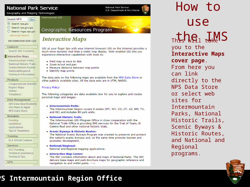
How to use the IMS
This will take you to the Interactive Maps cover page. From here you can link directly to the NPS Data Store or select web sites for Intermountain Parks, National Historic Trails, Scenic Byways & Historic Routes, and National and Regional programs.
NPS Intermountain Region Office
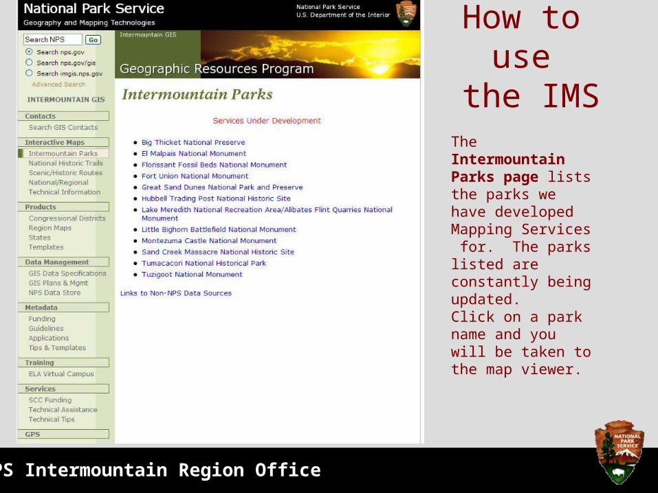
How to use the IMS
The Intermountain Parks page lists the parks we have developed Mapping Services for. The parks listed are constantly being updated. Click on a park name and you will be taken to the map viewer.
NPS Intermountain Region Office
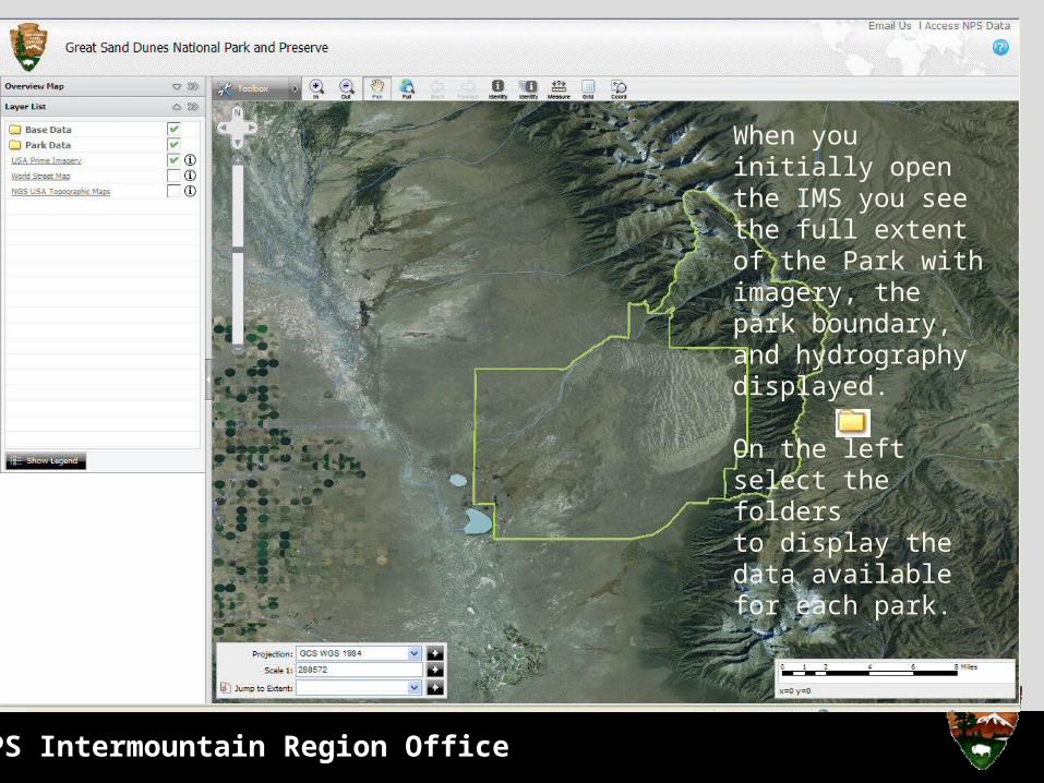
When you initially open the IMS you see the full extent of the Park with imagery, the park boundary, and hydrography displayed.
On the left select the folders to display the data available for each park.

NPS Intermountain Region Office
How to use the Mapping ServiceTo turn on and off Map Layers use the left mouse button and select the yellow folder
Then turn on and off specific layers by using the left mouse button to turn on or off the layer. A
means the layer is on and being drawn and a means the layer is not being drawn.
Left click on thesymbol by a layer and then select a feature onthe map to get a list of the detailed GIS information for that layer.
Left click on the Legend button to Show or Hide the legend information in the Layer List.