Embed Size (px)
DESCRIPTION
San Diego State University. NSF-ATE (#0401990) Scalable Skills GIS Certificate Program (Web-based GIS Education). John Johnson, Project-PI, Mesa College Dr. Ming-Hsiang (Ming) Tsou, Co-PI, Associate Professor, SDSU E-mail: [email protected]. - PowerPoint PPT Presentation
Citation preview
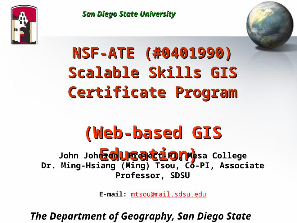
NSF-ATE (#0401990)NSF-ATE (#0401990)Scalable Skills GIS Certificate Scalable Skills GIS Certificate
ProgramProgram
(Web-based GIS Education)(Web-based GIS Education) John Johnson, Project-PI, Mesa College
Dr. Ming-Hsiang (Ming) Tsou, Co-PI, Associate Professor, SDSU
E-mail: [email protected]
The Department of Geography, San Diego State University
San Diego State UniversitySan Diego State University
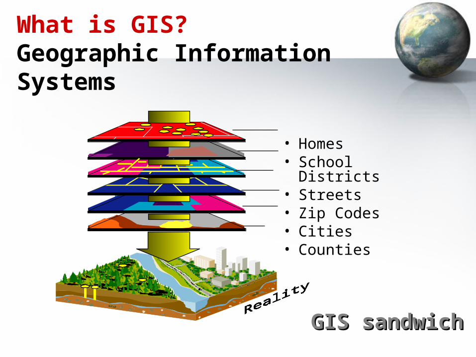
What is GIS?Geographic Information Systems
• Homes• School Districts• Streets• Zip Codes• Cities• Counties
GIS sandwichGIS sandwich
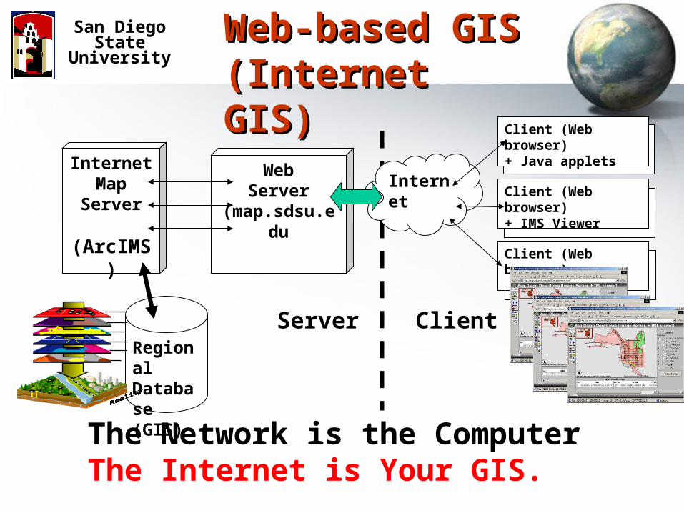
Web-based GIS Web-based GIS (Internet GIS)(Internet GIS)
San Diego State University
InternetMap
Server
(ArcIMS)
WebServer
(map.sdsu.edu
Internet
Client (Web browser)+ Java applets
Client (Web browser)+ IMS Viewer
Client (Web browser)
RegionalDatabase(GIS)
Server Client
The Network is the ComputerThe Internet is Your GIS.
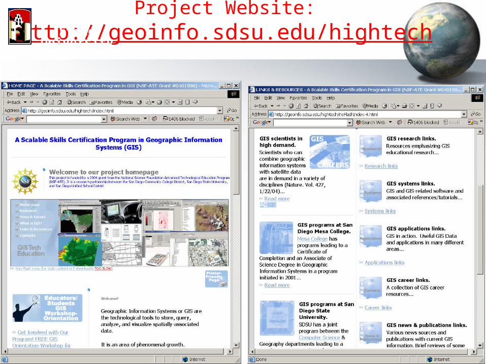
Project Website:Http://geoinfo.sdsu.edu/hightech
San Diego State University
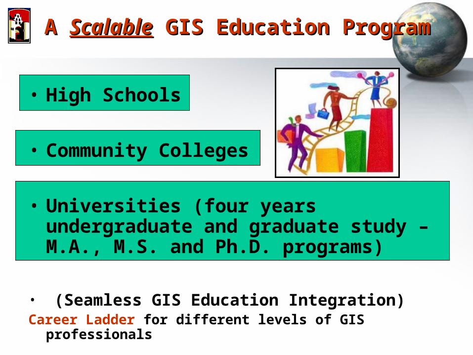
A A ScalableScalable GIS Education Program GIS Education Program
• High Schools
• Community Colleges
• Universities (four years undergraduate and graduate study – M.A., M.S. and Ph.D. programs)
• (Seamless GIS Education Integration)Career Ladder for different levels of GIS professionals
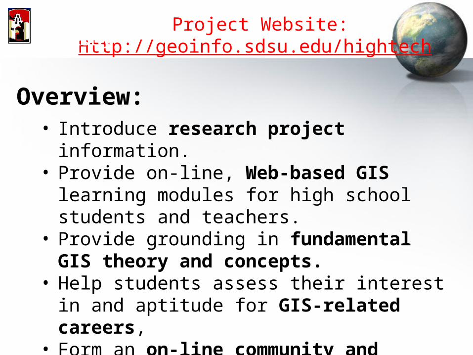
Project Website:Http://geoinfo.sdsu.edu/hightech
San Diego State University
Overview:• Introduce research project information.• Provide on-line, Web-based GIS learning
modules for high school students and teachers.• Provide grounding in fundamental GIS theory
and concepts.• Help students assess their interest in and
aptitude for GIS-related careers, • Form an on-line community and portal for
GIS-education research and related projects.
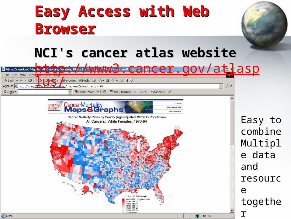
Easy Access with Web BrowserEasy Access with Web Browser
NCI's cancer atlas website NCI's cancer atlas website http://www3.cancer.gov/atlasplus/
Easy to combine Multiple data and resource together
Web-based GIS for high school teachers and students
• Avoid the complicated (and often expensive) software installation in traditional GIS.
• Students can utilize a Web browser to access maps and GIS from anywhere (schools, homes, or libraries).
• Combine with Multimedia (sounds, animation, and 3D) in an integrated Web environment.
Web-based GIS Learning Modules for High Schools
• Provide Web-based GIS exercises for existing High school courses in Geography, Earth Science, Biology, or Mathematics.
• Rather than create a brand-new courses for high school students. (Difficult to implement a new course in current high school schedules)
• Teach ________ with GIS (First Step) • Teach ________ about GIS (in the future)
San Diego State University
Web-based GIS Learning Modules for High Schools
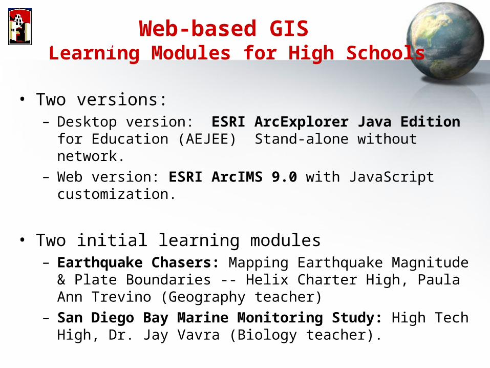
• Two versions:– Desktop version: ESRI ArcExplorer Java Edition for Education
(AEJEE) Stand-alone without network.– Web version: ESRI ArcIMS 9.0 with JavaScript customization.
• Two initial learning modules– Earthquake Chasers: Mapping Earthquake Magnitude & Plate
Boundaries -- Helix Charter High, Paula Ann Trevino (Geography teacher)
– San Diego Bay Marine Monitoring Study: High Tech High, Dr. Jay Vavra (Biology teacher).
San Diego State University
Web-based GIS Learning Modules for High Schools
San Diego State University
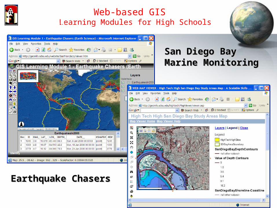
Earthquake ChasersEarthquake Chasers
San Diego Bay San Diego Bay Marine MonitoringMarine Monitoring
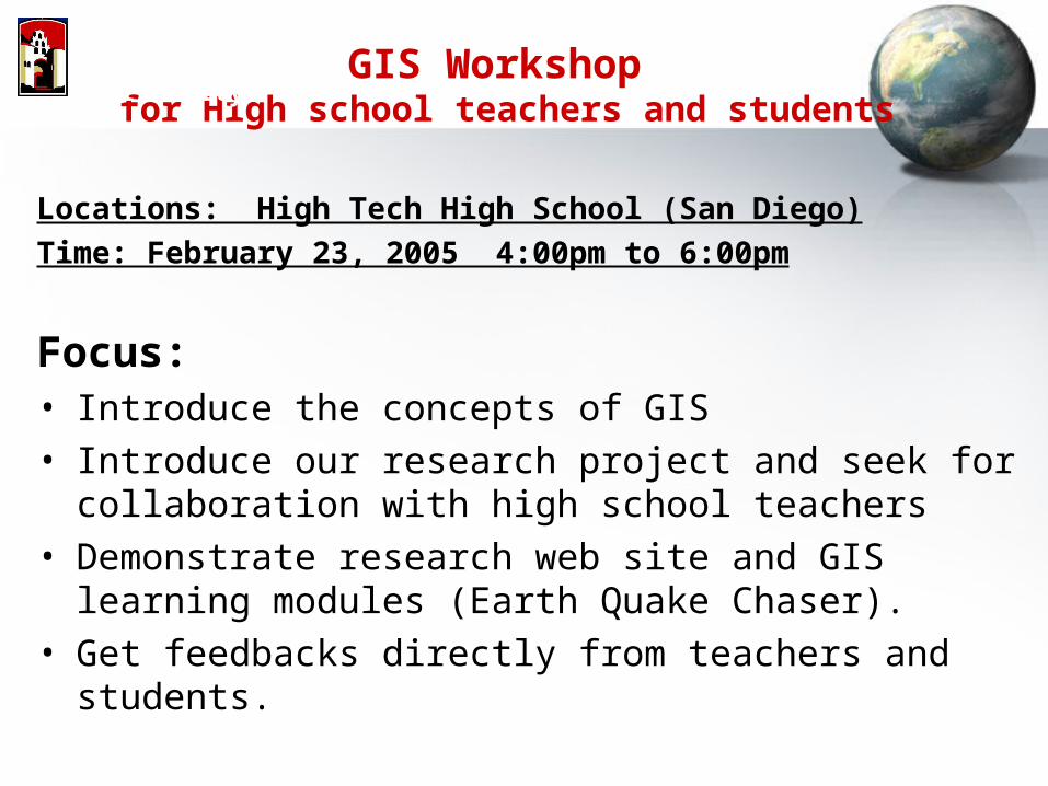
GIS Workshop for High school teachers and students
Locations: High Tech High School (San Diego)
Time: February 23, 2005 4:00pm to 6:00pm
Focus: • Introduce the concepts of GIS• Introduce our research project and seek for collaboration
with high school teachers• Demonstrate research web site and GIS learning modules
(Earth Quake Chaser).• Get feedbacks directly from teachers and students.
San Diego State University
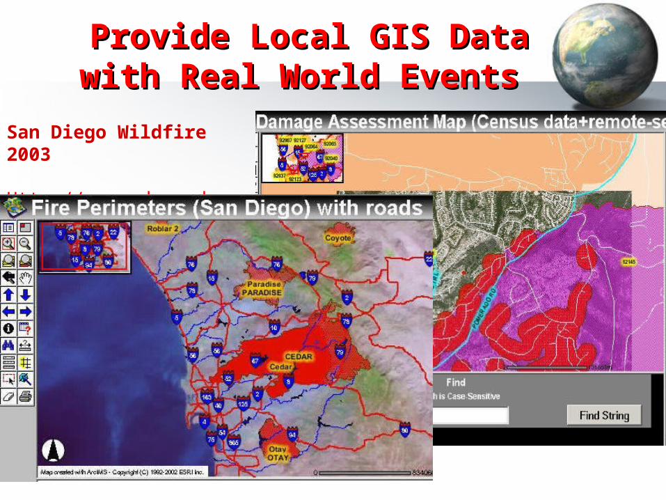
San Diego Wildfire 2003
Http://map.sdsu.edu
Provide Local GIS Data Provide Local GIS Data with Real World Events with Real World Events
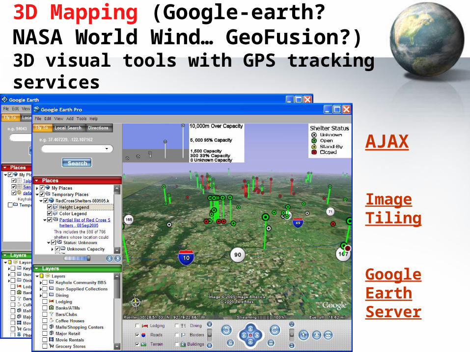
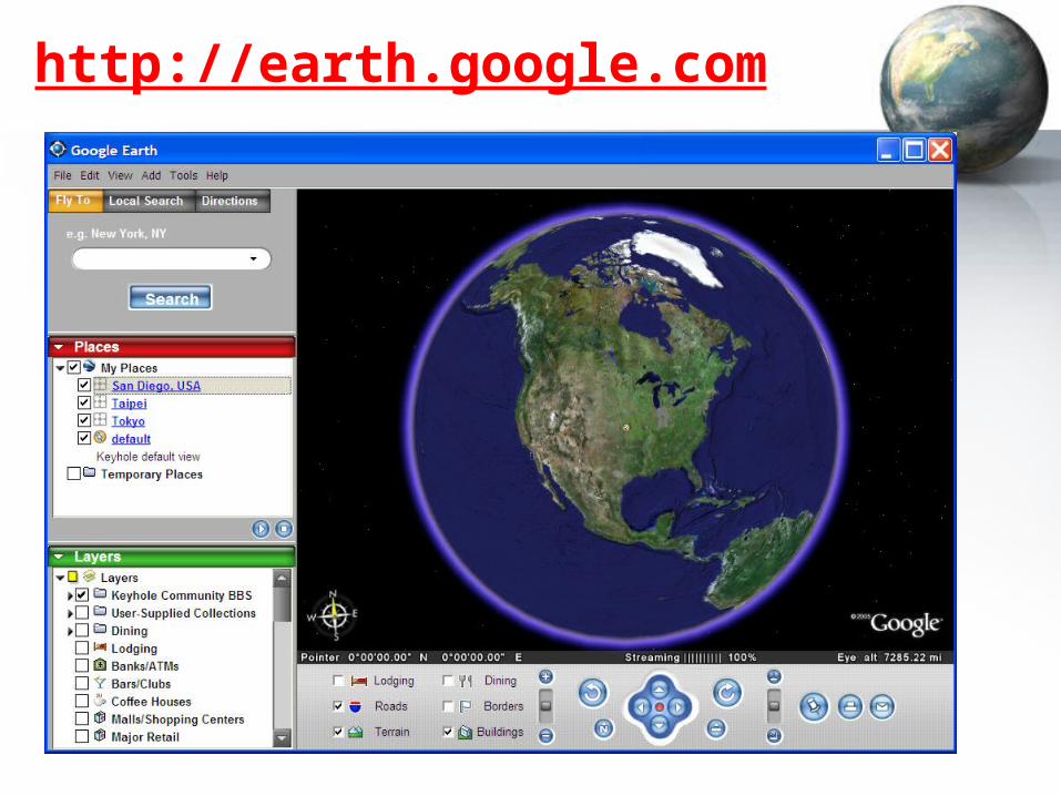
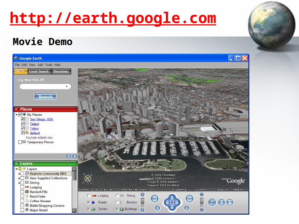
3D Mapping (Google-earth? NASA World Wind… GeoFusion?)3D visual tools with GPS tracking services
AJAX
Image Tiling
Google Earth Server
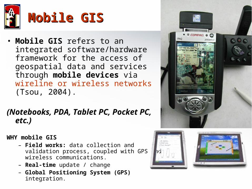
• Mobile GIS refers to an integrated software/hardware framework for the access of geospatial data and services through mobile devices via wireline or wireless networks (Tsou, 2004).
(Notebooks, PDA, Tablet PC, Pocket PC, etc.)
WHY mobile GIS – Field works: data collection and validation
process, coupled with GPS and wireless communications.
– Real-time update / change– Global Positioning System (GPS) integration.
Mobile GISMobile GIS
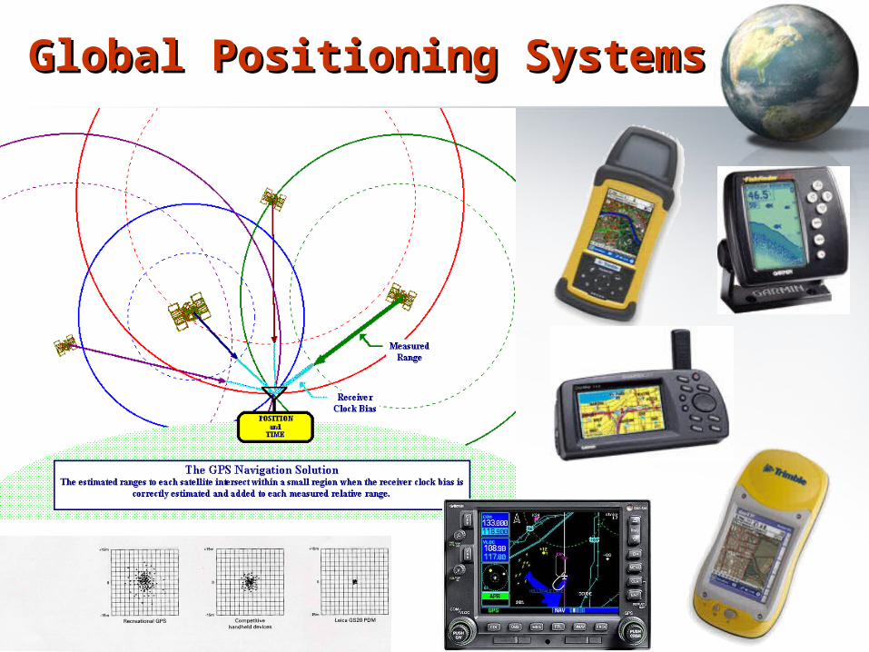
Global Positioning SystemsGlobal Positioning Systems
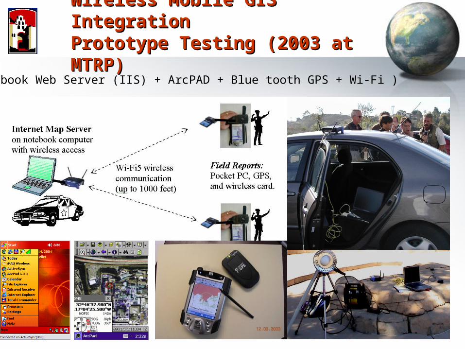
Wireless Mobile GIS IntegrationWireless Mobile GIS IntegrationPrototype Testing (2003 at MTRP)Prototype Testing (2003 at MTRP)
(Notebook Web Server (IIS) + ArcPAD + Blue tooth GPS + Wi-Fi )
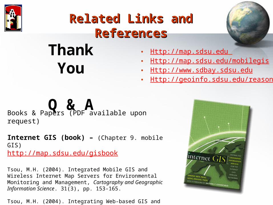
Related Links and Related Links and ReferencesReferences
Thank You
Q & A
• Http://map.sdsu.edu • Http://map.sdsu.edu/mobilegis• Http://www.sdbay.sdsu.edu• Http://geoinfo.sdsu.edu/reason
Books & Papers (PDF available upon request)
Internet GIS (book) – (Chapter 9. mobile GIS)http://map.sdsu.edu/gisbook
Tsou, M.H. (2004). Integrated Mobile GIS and Wireless Internet Map Servers for Environmental Monitoring and Management, Cartography and Geographic Information Science. 31(3), pp. 153-165. Tsou, M.H. (2004). Integrating Web-based GIS and On-line Remote Sensing Facilities for Environmental Monitoring and Management. The Journal of Geographical Systems, No. 6: 1-20.