Embed Size (px)
Citation preview

Pete GienckeGIS Data Engineer, Google
Ocean in Google Earth
NFRA Regional Product Developers Workshop

Overview
Ocean in Google Earth (Ocean) data discovery/visualization
Technical Lessons Learned
Questions?

Ocean in Google Earth
Ocean in Google Earth (Ocean) data discovery/visualization
Technical Lessons Learned
Questions?

Earth 5.0+ (Ocean)
Ocean Layers

Ocean Layers
Cousteau Ocean World

Ocean Layers
Wanna Surf

Ocean Layers
Lake St. Clair C-Man Station

Bathymetry
http://earth.google.com/support/bin/request.py?&contact_type=geocontent_3dwh

Ocean Showcase
A showcase to feature "best of" Ocean content
Includes narrated KML tours from NOAA, MBARI, and others
View in browser using Google Earth plugin
Download tours to view Google Earth
Contribute your Ocean content

Explore the Ocean
http://earth.google.com/ocean/showcase/#explore-oceans

Monterey Bay Aquarium Research Institute
http://earth.google.com/ocean/showcase/#mbari

NOAA Great Lakes Environmental Research Laboratory
http://earth.google.com/ocean/showcase/#great-lakes
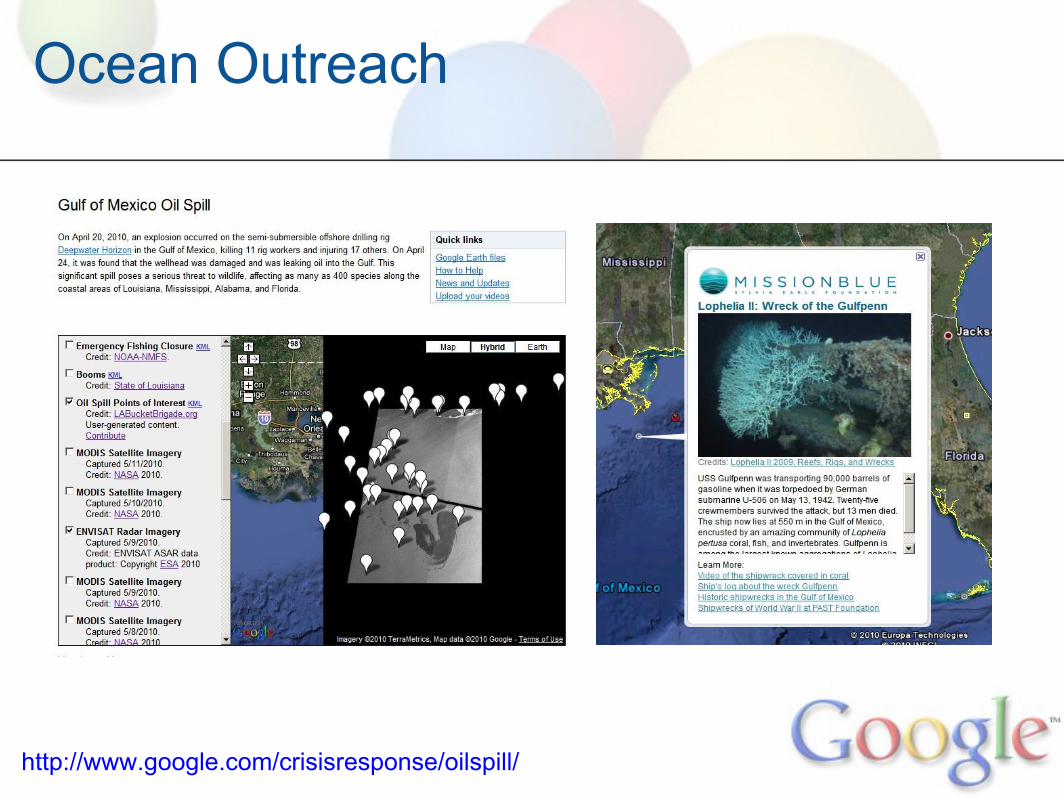
Ocean Outreach
http://www.google.com/crisisresponse/oilspill/

NOAA-Google CRADA
"Through this agreement, Google’s technical expertise will help to improve access to NOAA data in ways that allow the scientific community and the public to better use our information to understand earth science and make informed decisions."
Ocean ObservationsBathymetryClimate DataScience on a SphereMarine Zoning/RegulationScientific Expeditions
http://groups.google.com/group/ioos-kml
http://www.noaanews.noaa.gov/stories2010/20100125_google.html

Ocean in Google Earth
Ocean in Google Earth (Ocean) data discovery/visualization
Technical Lessons Learned
Questions?

Ocean-specific elevation modes
<altitudeMode>relativeToGround<altitudeMode>

Ocean-specific elevation modes
<altitudeMode>clampToGround<altitudeMode>
Image credit: ASA Science

Ocean-specific elevation modes
<altitudeMode>absolute<altitudeMode>
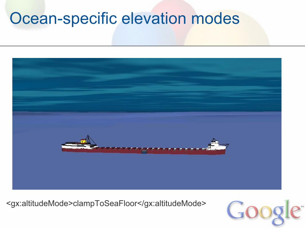
Ocean-specific elevation modes
<gx:altitudeMode>clampToSeaFloor</gx:altitudeMode>

Ocean-specific elevation modes
<gx:altitudeMode>relativeToSeaFloor</gx:altitudeMode>

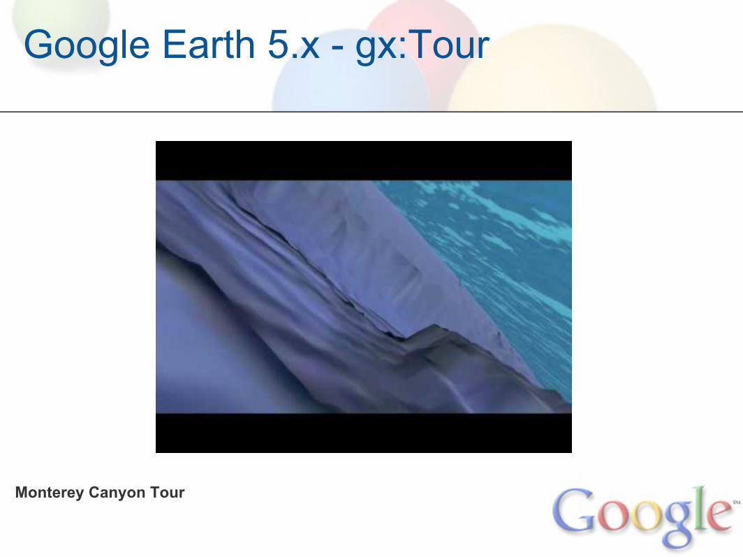
KML Touring with Google Earth
Enables controlled flights through geospatial data
Includes audio narration
Smoothly fly-by your placemarks
Or zoom in, and display a custom overlay or play a video

KML Touring with Google Earth
http://www.glerl.noaa.gov/pr/ourlakes/gl_tour.html

Google Earth Browser Plugin
Embed a fully-featured Google Earth in your website
Control the Plugin with JavaScript, similar to Google Maps
Can include Tours, Models, and all Ocean content

Google Earth Browser Plugin
http://www.gearthblog.com/blog/archives/2010/04/google_earth_plug-in_now_tied_direc.html

Google Earth Browser Plugin
http://ships1.planetinaction.com/
Ocean in Google Earth
Ocean in Google Earth (Ocean) data discovery/visualization
Technical Lessons Learned
Questions?

Access/Discoverability
Demand for geo/GIS increasing
Results from data catalogs mixed:geodata.gov (Geospatial Onestop)data.govgcmd.nasa.gov (Global Master Change Directory)gis.glin.net
Search engine indexing key to lay data discoverabilityOpen, interoperable data key to lay data usability
Access/Discoverability
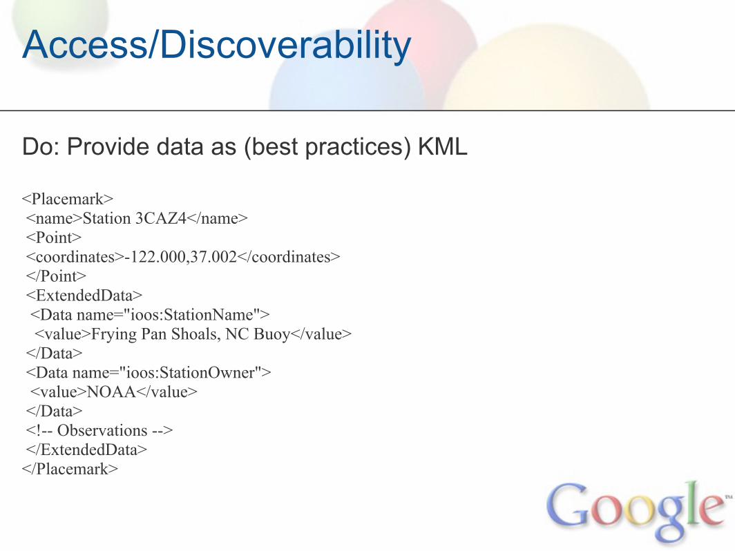
Do: Provide data as (best practices) KML
<Placemark> <name>Station 3CAZ4</name> <Point> <coordinates>-122.000,37.002</coordinates> </Point> <ExtendedData> <Data name="ioos:StationName"> <value>Frying Pan Shoals, NC Buoy</value> </Data> <Data name="ioos:StationOwner"> <value>NOAA</value> </Data> <!-- Observations --> </ExtendedData> </Placemark>

Access:
KML-savant geobrowsershttp://en.wikipedia.org/wiki/Keyhole_Markup_Language
ArcGIS ExplorerBing MapsEarthBrowserEarthSpector GISFeature Manipulation Engine (FME)FlickrGeomediaGoogle Earth, Maps, Mobile, SketchupManifold SystemMap My AncestorsMapufactureMicrosoft Virtual EarthOpenLAPIOpenLayers
OssimplanetQStarz Travel RecorderRouteBuddy for MacSuperMap iServerTatukGIS EditorVisual Nature StudioWikiMapiaWorld WindYahoo Pipes3D Maps EXOthers....

Access/Discoverability
Do: Create a geositemap
<urlset xmlns="http://www.sitemaps.org/schemas/sitemap/0.9" xmlns:geo="http://www.google.com/geo/schemas/sitemap/1.0"> <url> <loc>http://www.example.com/download?format=kml</loc> <geo:geo> <geo:format>kml</geo:format> </geo:geo> </url> </urlset>
http://tinyurl.com/geositemap
Ocean in Google Earth
Ocean in Google Earth (Ocean) data discovery/visualization
Technical Lessons Learned
Questions?

Technical Lessons Learned
Search is King
Think scalability: Parallel Processing & Cloud Computing
Data-driven Decision Making
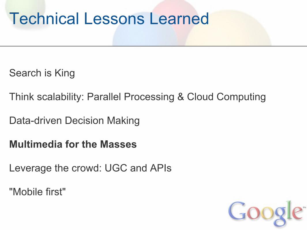
Multimedia for the Masses
Leverage the crowd: UGC and APIs
"Mobile first"

Search
http://www.youtube.com/user/ASAscience

Technical Lessons Learned
Search is King
Think scalability: Parallel Processing & Cloud Computing
Data-driven Decision Making
Multimedia for the Masses
Leverage the crowd: UGC and APIs
"Mobile first"

Map Reduce / Hadoop
Software framework for processing massive datasetsEfficiency through parallel processingMany open source tools, e.g. Hadoop
hadoop.org

Technical Lessons Learned
Search is King
Think scalability: Parallel Processing & Cloud Computing
Data-driven Decision Making
Multimedia for the Masses
Leverage the crowd: UGC and APIs
"Mobile first"
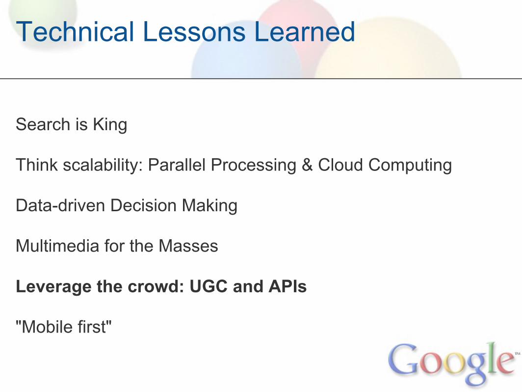
Technical Lessons Learned
Search is King
Think scalability: Parallel Processing & Cloud Computing
Data-driven Decision Making
Multimedia for the Masses
Leverage the crowd: UGC and APIs
"Mobile first"

Visualization: APIs
Google Charts APIhttp://code.google.com/apis/chart/
url-based dynamically charting engineline, bar, pie charts, maps, QR codes, moretotally customizable, e.g.http://chart.apis.google.com/chart?cht=p3&chd=t:60,40&chs=250x100&chl=Hello|World
ThematicMapping APIhttp://thematicmapping.org/api/
javascript-based visualization libararychoropleth, prism, proportional symbol, pie charts supported

Visualization: APIs
http://thematicmapping.org/engine/
Technical Lessons Learned
Search is King
Think scalability: Parallel Processing & Cloud Computing
Data-driven Decision Making
Multimedia for the Masses
Leverage the crowd: UGC and APIs
"Mobile first"

Geo UGC: Map Maker
Lahore, Pakistan

Technical Lessons Learned
Search is King
Think scalability: Parallel Processing & Cloud Computing
Data-driven Decision Making
Multimedia for the Masses
Leverage the crowd: UGC and APIs
"Mobile first"

Mobile First
http://nexus404.com/Blog/wp-content/uploads2/2009/11/iphone-android.jpg

Ocean in Google Earth
Ocean in Google Earth (Ocean) data discovery/visualization
Technical Lessons Learned
Questions?