Embed Size (px)
Citation preview
Follow the conversation: @tooledesignOff-Road Facilities Part 1: Shared-Use Path Design
Off-Road Facilities Part 1: Shared Use Path Design
Presentation by:Eric Mongelli, P.E.Tom HuberOctober 9, 2012

Follow the conversation: @tooledesignOff-Road Facilities Part 1: Shared-Use Path Design
Toole Design Group is live tweeting this webinar@tooledesign
#AASHTO #BikeGuide
FOLLOW THE CONVERSATION ON TWITTER
Follow the conversation: @tooledesignOff-Road Facilities Part 1: Shared-Use Path Design
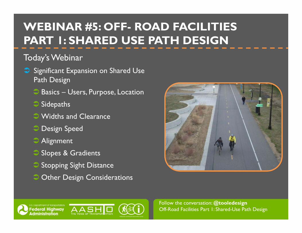
WEBINAR #5: OFF- ROAD FACILITIES PART 1: SHARED USE PATH DESIGNToday’s Webinar
Significant Expansion on Shared Use Path Design
Basics – Users, Purpose, Location
Sidepaths
Widths and Clearance
Design Speed
Alignment
Slopes & Gradients
Stopping Sight Distance
Other Design Considerations
Follow the conversation: @tooledesignOff-Road Facilities Part 1: Shared-Use Path Design
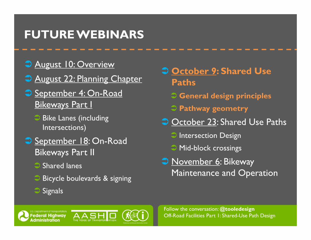
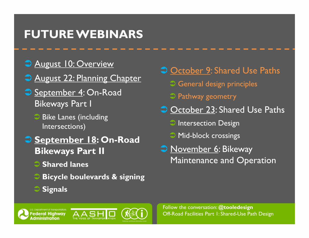
FUTURE WEBINARS
August 10: Overview
August 22: Planning Chapter
September 4: On-Road Bikeways Part I
Bike Lanes (including Intersections)
September 18: On-Road Bikeways Part II
Shared lanes
Bicycle boulevards & signing
Signals
October 9: Shared Use Paths
General design principles
Pathway geometry
October 23: Shared Use PathsIntersection Design
Mid-block crossings
November 6: Bikeway Maintenance and Operation
Follow the conversation: @tooledesignOff-Road Facilities Part 1: Shared-Use Path Design
http://www.walkinginfo.org/training/pbic/AASHTO_Promo_Flyer.pdf
Link will be emailed to webinar attendees
DISCOUNT FOR WEBINAR PARTICIPANTS
Follow the conversation: @tooledesignOff-Road Facilities Part 1: Shared-Use Path Design
What is AASHTO?Mission: “provides technical services to support states in their efforts to efficiently and safely move people and goods”
Some historyLast Guide – 1999, largely written in 96-98
Survey to update Guide - 2004
Standards vs. guidance (Shall vs. should or may)Relationship between AASHTO Guide and the MUTCDInnovation vs. accepted practice
SOME BACKGROUND
Follow the conversation: @tooledesignOff-Road Facilities Part 1: Shared-Use Path Design
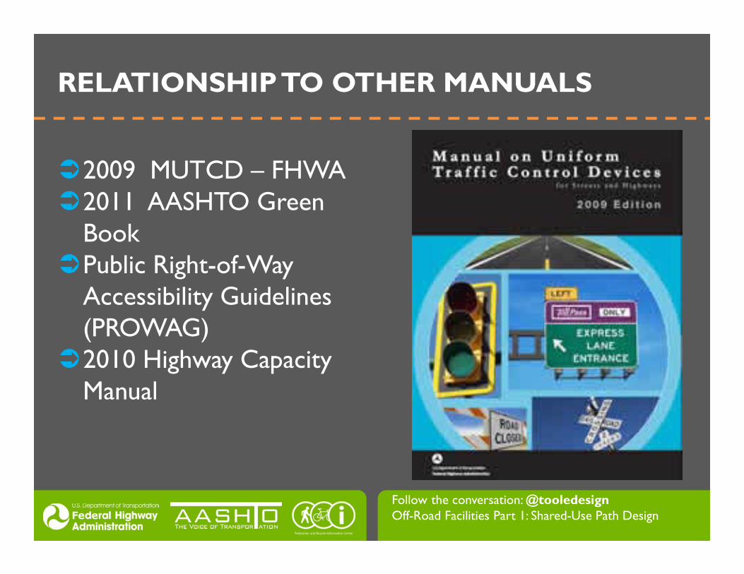
2009 MUTCD – FHWA2011 AASHTO Green BookPublic Right-of-Way Accessibility Guidelines (PROWAG)2010 Highway Capacity Manual
RELATIONSHIP TO OTHER MANUALS
Follow the conversation: @tooledesignOff-Road Facilities Part 1: Shared-Use Path Design
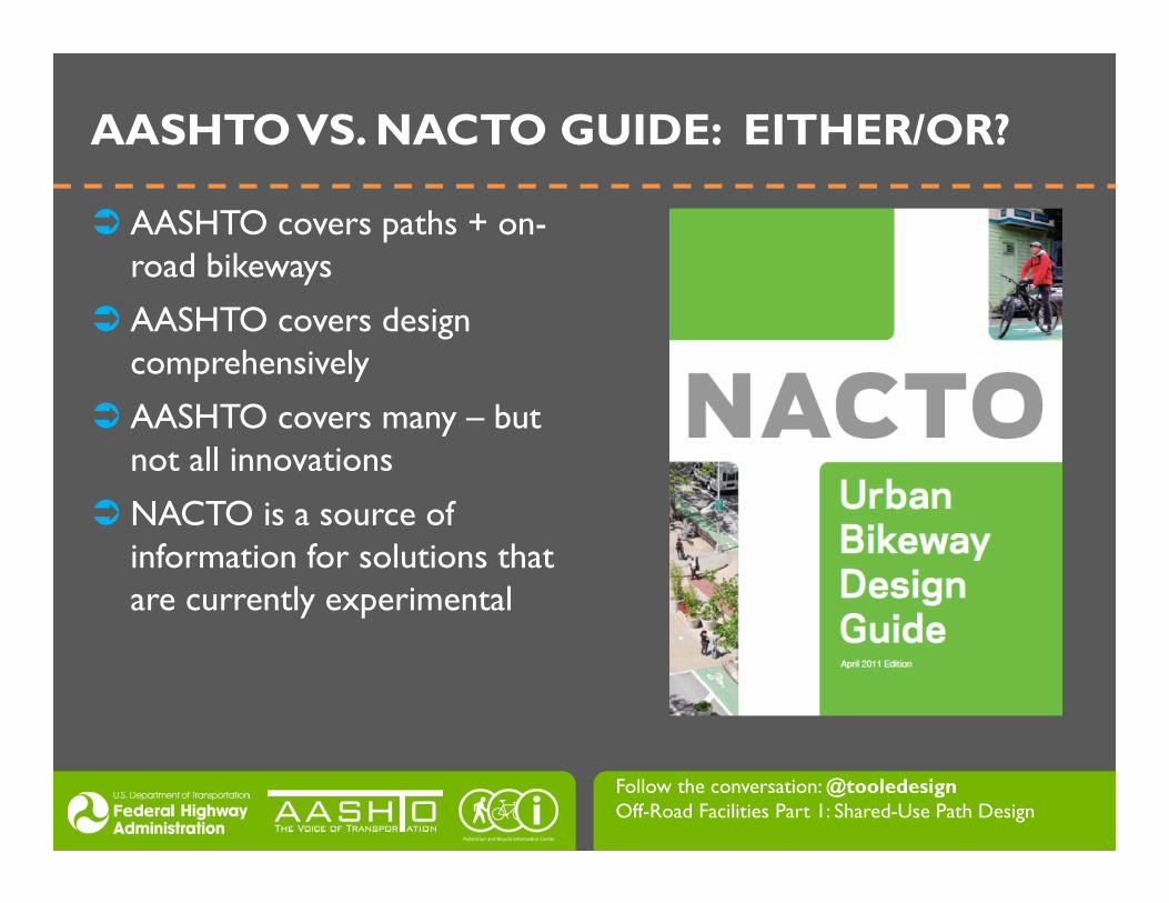
AASHTO covers paths + on-road bikeways
AASHTO covers design comprehensively
AASHTO covers many – but not all innovations
NACTO is a source of information for solutions that are currently experimental
AASHTO VS. NACTO GUIDE: EITHER/OR?

Follow the conversation: @tooledesignOff-Road Facilities Part 1: Shared-Use Path Design
DESIGN GUIDANCE OF GREEN BOOK
Share use path design generally follows principals of the “Green Book”
Design speeds
Horizontal & vertical curves
Cross slopes
Sight distances
Follow the conversation: @tooledesignOff-Road Facilities Part 1: Shared-Use Path Design
“The treatments described reflect typical situations; local conditions may vary and engineering judgment should be applied.”
ENGINEERING JUDGMENT
Follow the conversation: @tooledesignOff-Road Facilities Part 1: Shared-Use Path Design
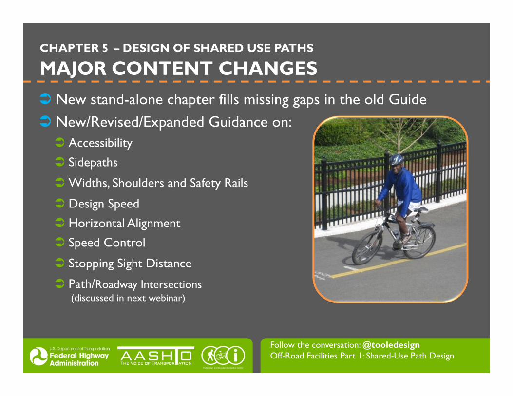
New stand-alone chapter fills missing gaps in the old GuideNew/Revised/Expanded Guidance on:
Accessibility
Sidepaths
Widths, Shoulders and Safety Rails
Design Speed
Horizontal Alignment
Speed Control
Stopping Sight Distance
Path/Roadway Intersections (discussed in next webinar)
CHAPTER 5 – DESIGN OF SHARED USE PATHS
MAJOR CONTENT CHANGES
Follow the conversation: @tooledesignOff-Road Facilities Part 1: Shared-Use Path Design
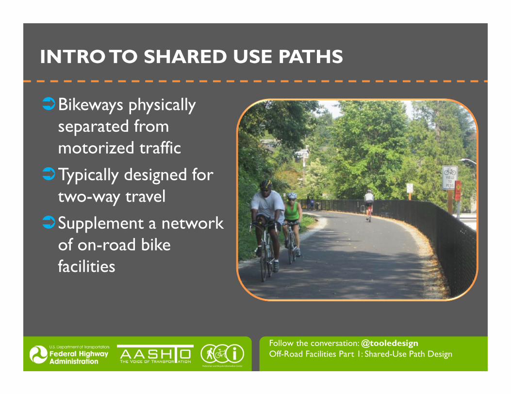
INTRO TO SHARED USE PATHS
Bikeways physically separated from motorized trafficTypically designed for two-way travelSupplement a network of on-road bike facilities
Follow the conversation: @tooledesignOff-Road Facilities Part 1: Shared-Use Path Design
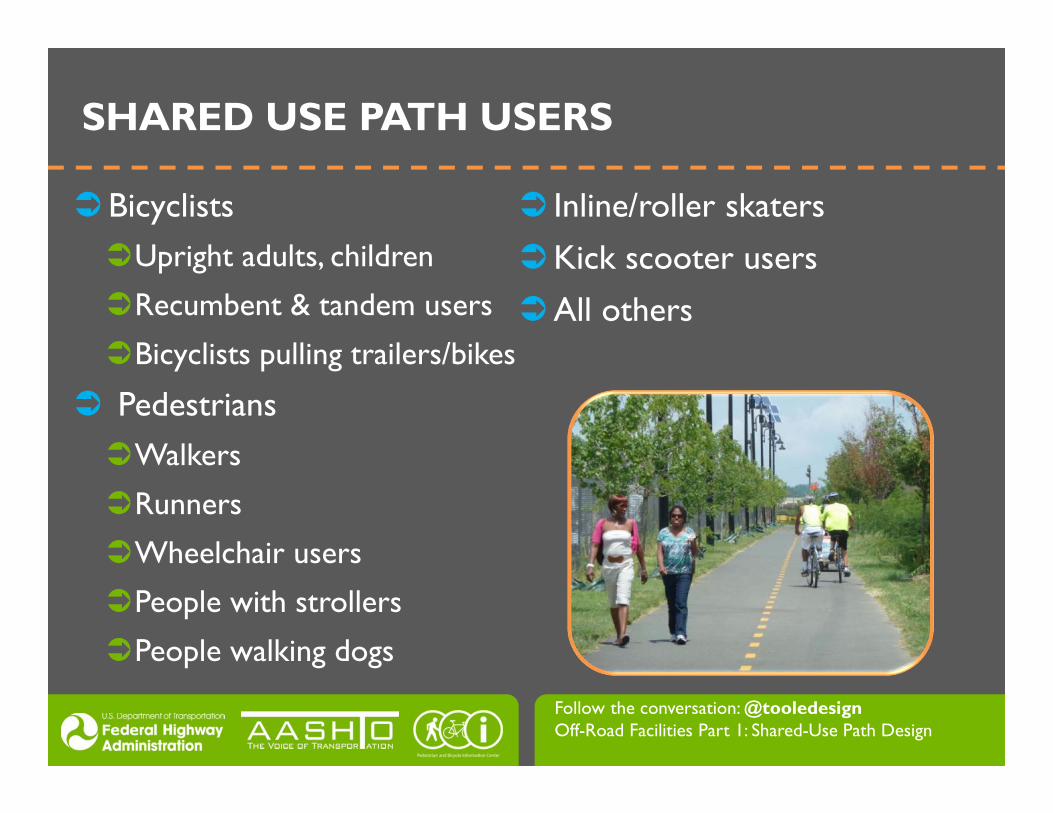
SHARED USE PATH USERS
BicyclistsUpright adults, children
Recumbent & tandem users
Bicyclists pulling trailers/bikes
PedestriansWalkers
Runners
Wheelchair users
People with strollers
People walking dogs
Inline/roller skaters
Kick scooter users
All others
Follow the conversation: @tooledesignOff-Road Facilities Part 1: Shared-Use Path Design
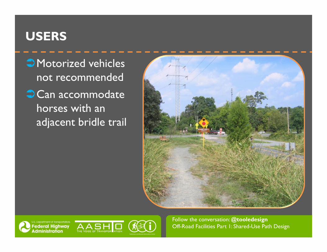
Motorized vehicles not recommendedCan accommodate horses with an adjacent bridle trail
USERS
Follow the conversation: @tooledesignOff-Road Facilities Part 1: Shared-Use Path Design
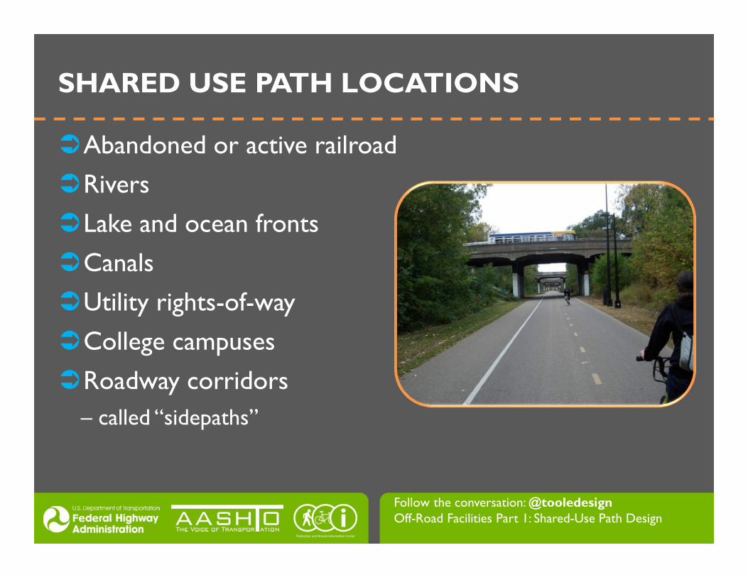
SHARED USE PATH LOCATIONS
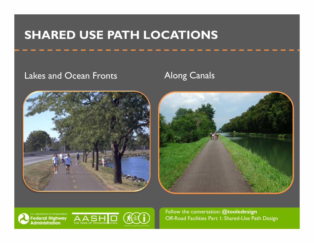
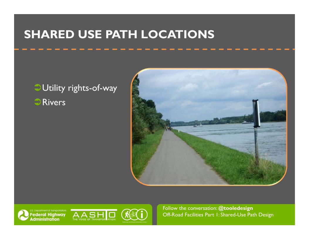
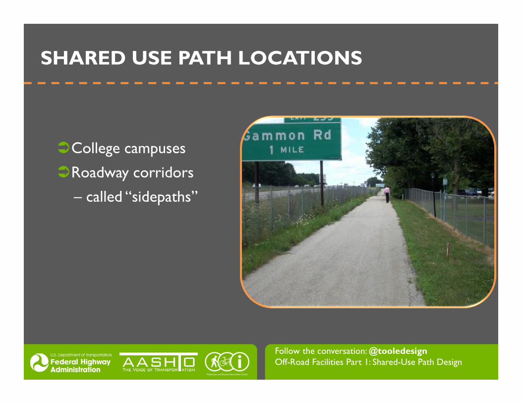
Abandoned or active railroadRiversLake and ocean frontsCanalsUtility rights-of-way College campusesRoadway corridors– called “sidepaths”
Follow the conversation: @tooledesignOff-Road Facilities Part 1: Shared-Use Path Design
SHARED USE PATH LOCATIONS
Lakes and Ocean Fronts Along Canals
Follow the conversation: @tooledesignOff-Road Facilities Part 1: Shared-Use Path Design
SHARED USE PATH LOCATIONS
Utility rights-of-way
Rivers
Follow the conversation: @tooledesignOff-Road Facilities Part 1: Shared-Use Path Design
SHARED USE PATH LOCATIONS
College campuses
Roadway corridors
– called “sidepaths”
Follow the conversation: @tooledesignOff-Road Facilities Part 1: Shared-Use Path Design
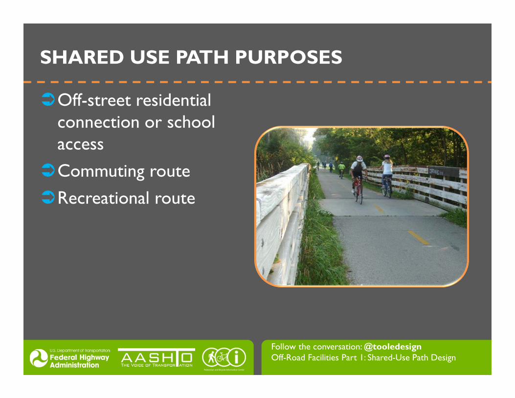
Off-street residential connection or school accessCommuting routeRecreational route
SHARED USE PATH PURPOSES
Follow the conversation: @tooledesignOff-Road Facilities Part 1: Shared-Use Path Design
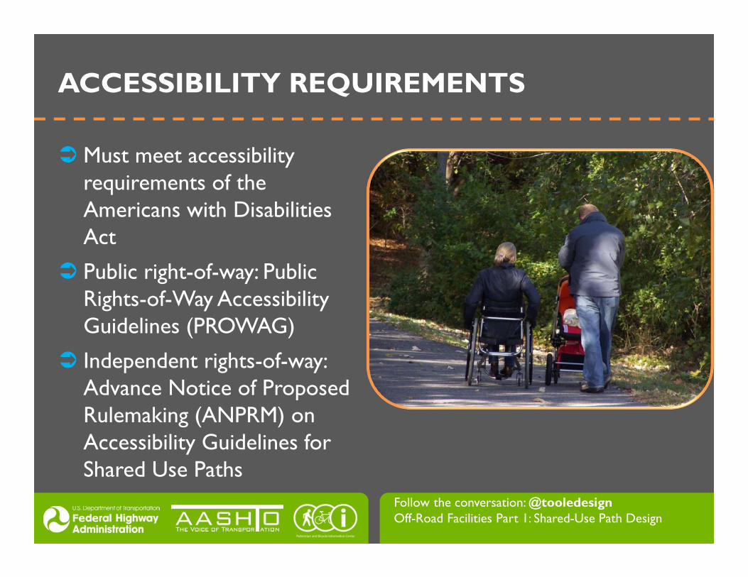
ACCESSIBILITY REQUIREMENTS
Must meet accessibility requirements of the Americans with Disabilities Act
Public right-of-way: Public Rights-of-Way Accessibility Guidelines (PROWAG)
Independent rights-of-way: Advance Notice of Proposed Rulemaking (ANPRM) on Accessibility Guidelines for Shared Use Paths
Follow the conversation: @tooledesignOff-Road Facilities Part 1: Shared-Use Path Design
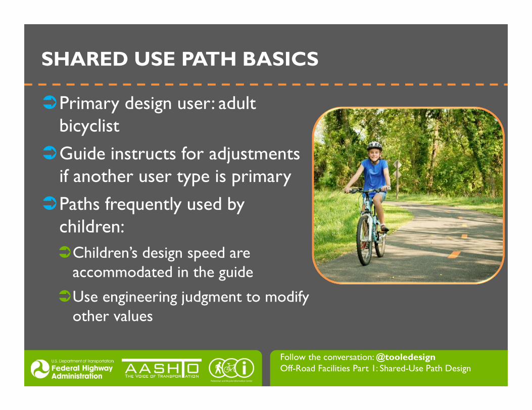
Primary design user: adult bicyclistGuide instructs for adjustments if another user type is primaryPaths frequently used by children:
Children’s design speed are accommodated in the guide
Use engineering judgment to modify other values
SHARED USE PATH BASICS
Follow the conversation: @tooledesignOff-Road Facilities Part 1: Shared-Use Path Design
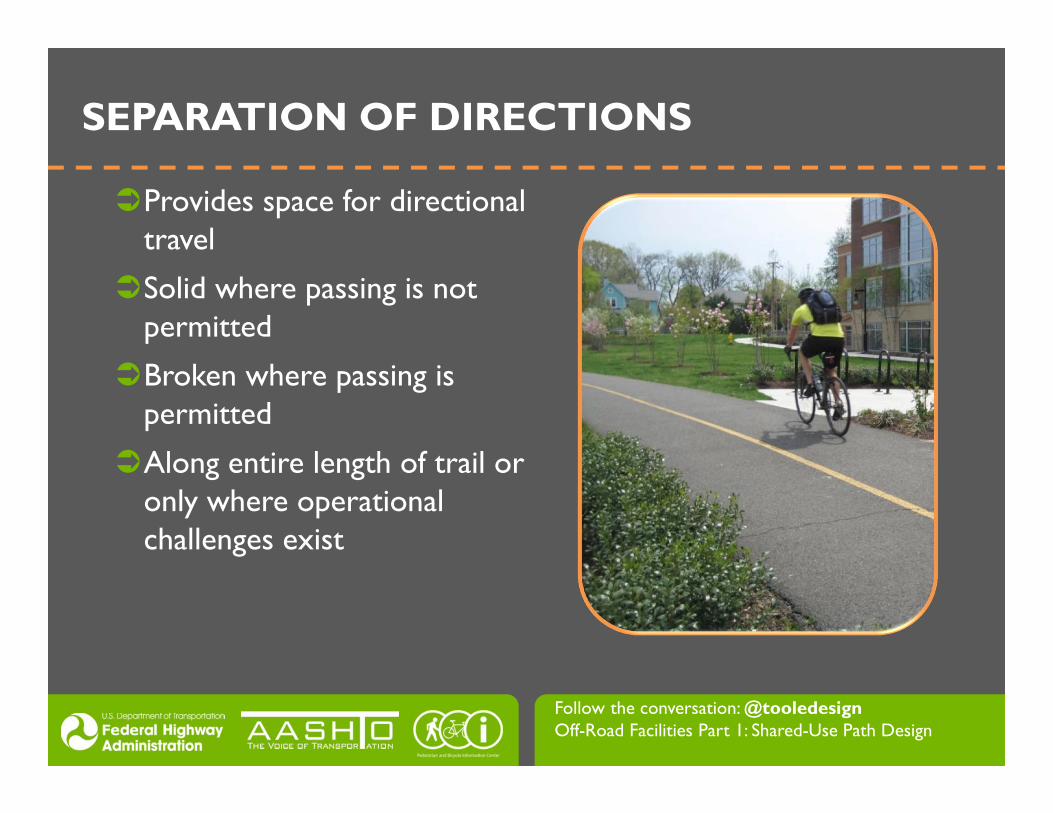
Provides space for directional travel
Solid where passing is not permitted
Broken where passing is permitted
Along entire length of trail or only where operational challenges exist
SEPARATION OF DIRECTIONS
Follow the conversation: @tooledesignOff-Road Facilities Part 1: Shared-Use Path Design
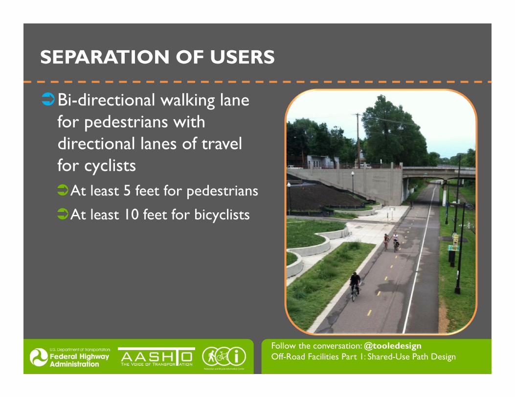
Bi-directional walking lane for pedestrians with directional lanes of travel for cyclists
At least 5 feet for pedestrians
At least 10 feet for bicyclists
SEPARATION OF USERS
Follow the conversation: @tooledesignOff-Road Facilities Part 1: Shared-Use Path Design
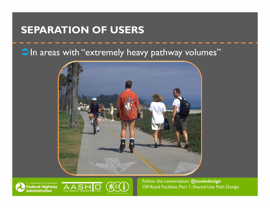
In areas with “extremely heavy pathway volumes”
SEPARATION OF USERS
Follow the conversation: @tooledesignOff-Road Facilities Part 1: Shared-Use Path Design
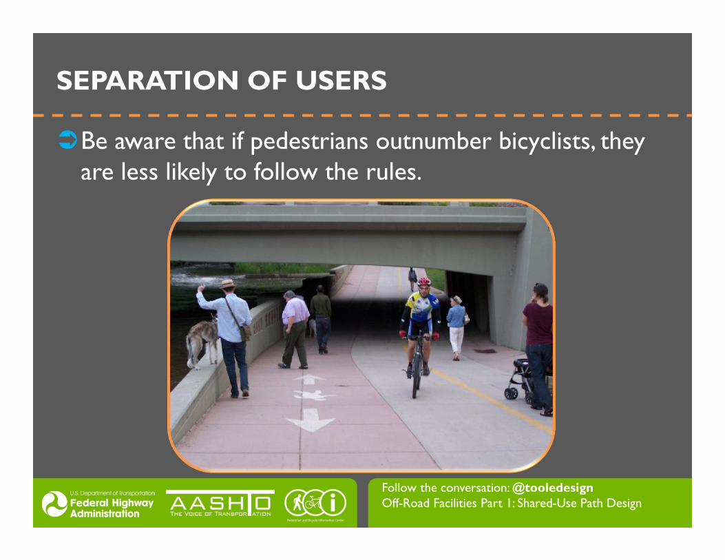
Be aware that if pedestrians outnumber bicyclists, they are less likely to follow the rules.
SEPARATION OF USERS
Follow the conversation: @tooledesignOff-Road Facilities Part 1: Shared-Use Path Design
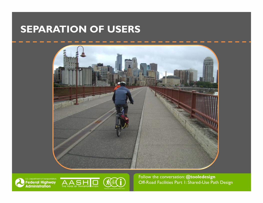
SEPARATION OF USERS
Follow the conversation: @tooledesignOff-Road Facilities Part 1: Shared-Use Path Design
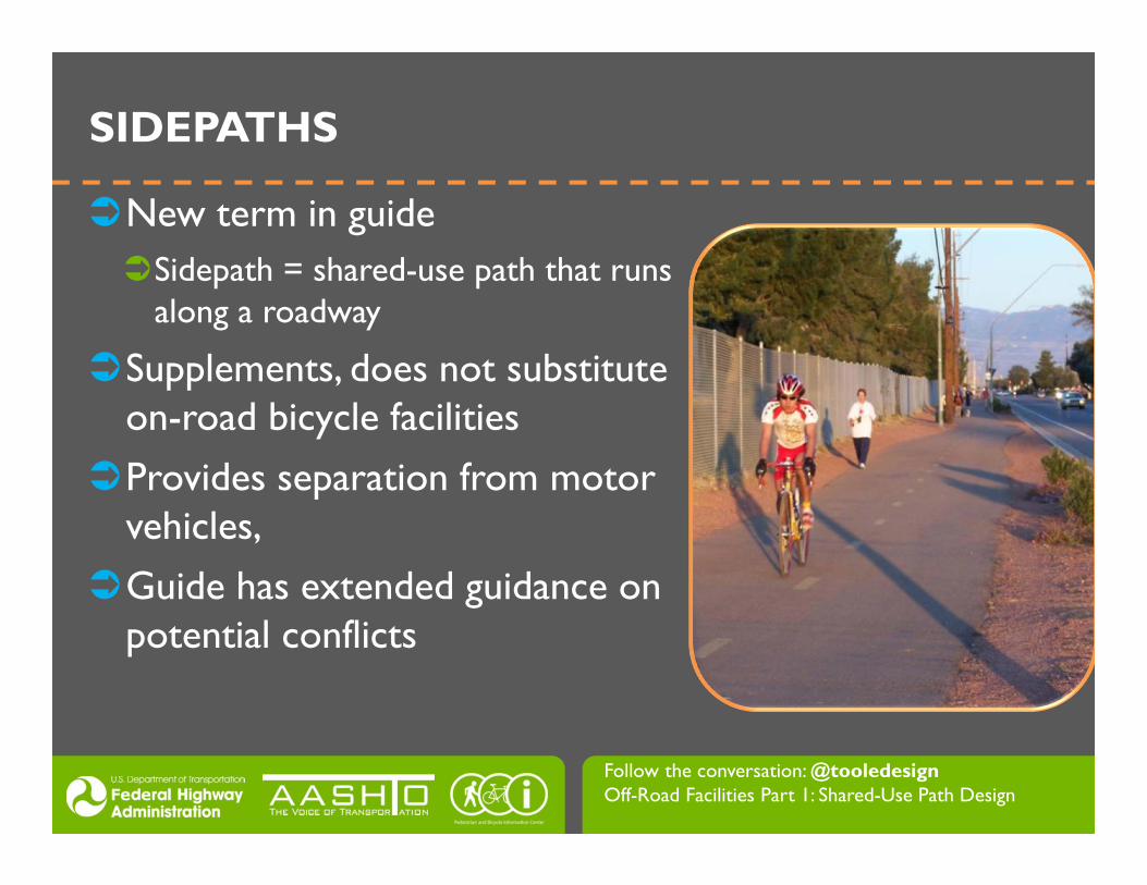
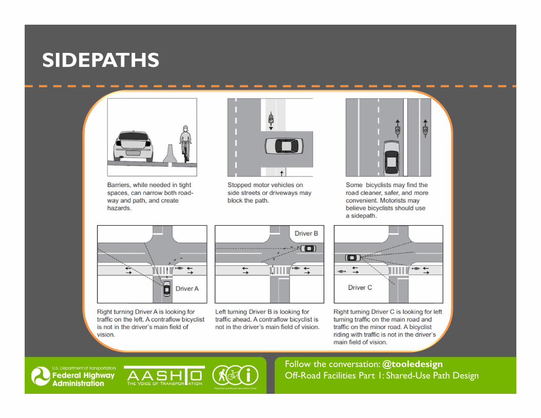
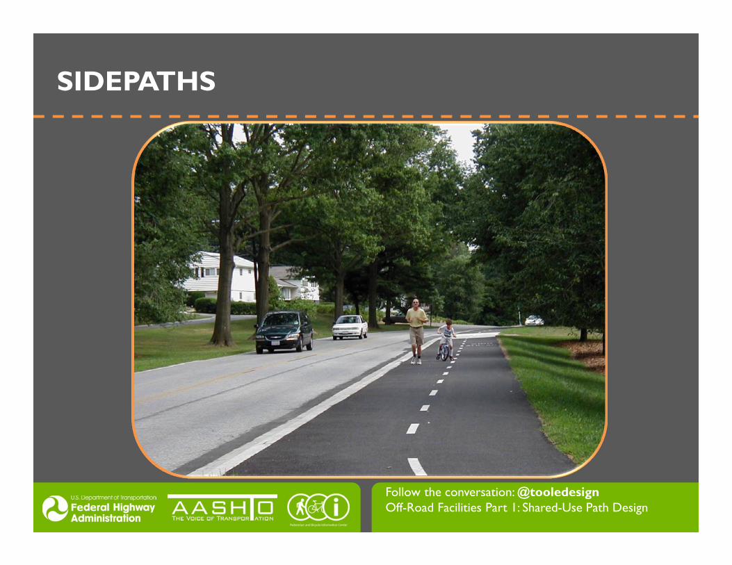
New term in guideSidepath = shared-use path that runs along a roadway
Supplements, does not substitute on-road bicycle facilitiesProvides separation from motor vehicles, Guide has extended guidance on potential conflicts
SIDEPATHS
Follow the conversation: @tooledesignOff-Road Facilities Part 1: Shared-Use Path Design
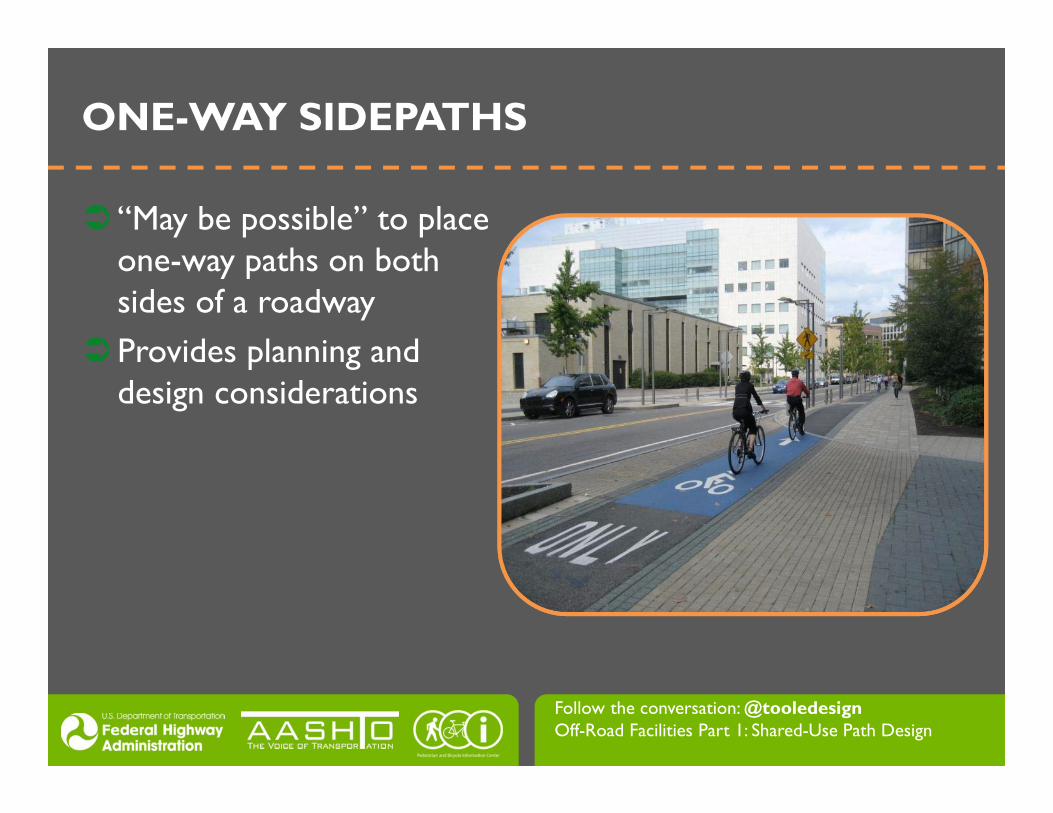
“May be possible” to place one-way paths on both sides of a roadwayProvides planning and design considerations
ONE-WAY SIDEPATHS
GET the best picture of Cambridge’s MIT cycletrack from
Nick
Follow the conversation: @tooledesignOff-Road Facilities Part 1: Shared-Use Path Design
SIDEPATHS
Follow the conversation: @tooledesignOff-Road Facilities Part 1: Shared-Use Path Design
SIDEPATHS
Follow the conversation: @tooledesignOff-Road Facilities Part 1: Shared-Use Path Design
SIDEPATHS
Follow the conversation: @tooledesignOff-Road Facilities Part 1: Shared-Use Path Design
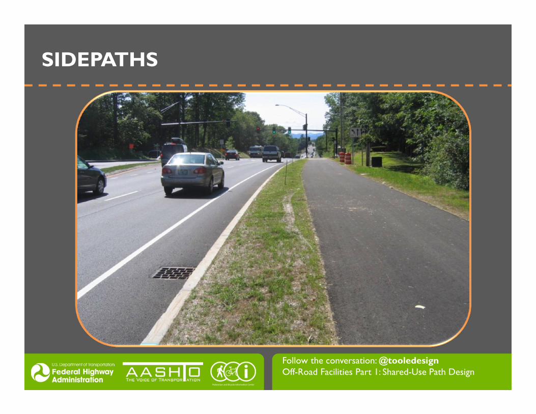
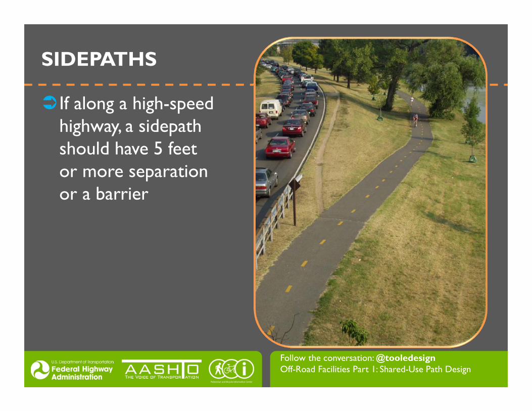
If along a high-speed highway, a sidepathshould have 5 feet or more separation or a barrier
SIDEPATHS
Follow the conversation: @tooledesignOff-Road Facilities Part 1: Shared-Use Path Design
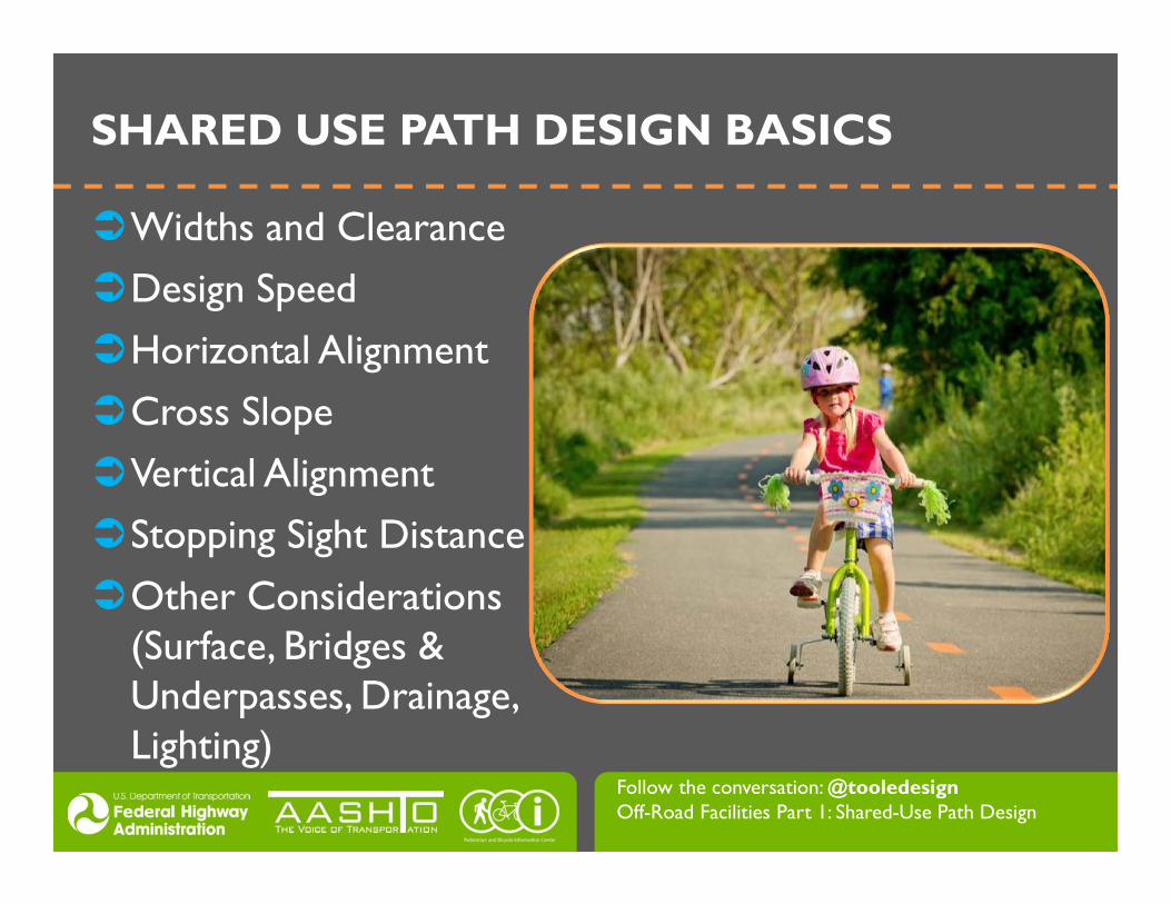
Widths and ClearanceDesign SpeedHorizontal AlignmentCross SlopeVertical AlignmentStopping Sight DistanceOther Considerations (Surface, Bridges & Underpasses, Drainage, Lighting)
SHARED USE PATH DESIGN BASICS
Follow the conversation: @tooledesignOff-Road Facilities Part 1: Shared-Use Path Design
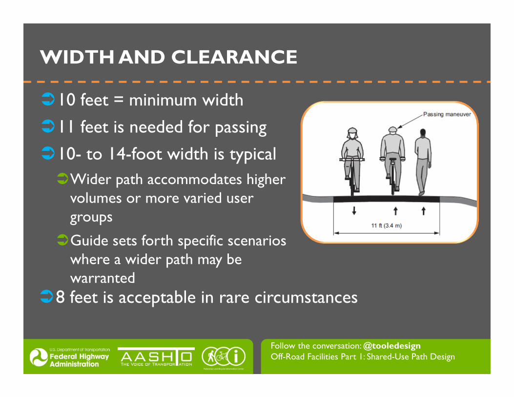
10 feet = minimum width11 feet is needed for passing10- to 14-foot width is typical
Wider path accommodates higher volumes or more varied user groups
Guide sets forth specific scenarios where a wider path may be warranted
WIDTH AND CLEARANCE
8 feet is acceptable in rare circumstances
Follow the conversation: @tooledesignOff-Road Facilities Part 1: Shared-Use Path Design
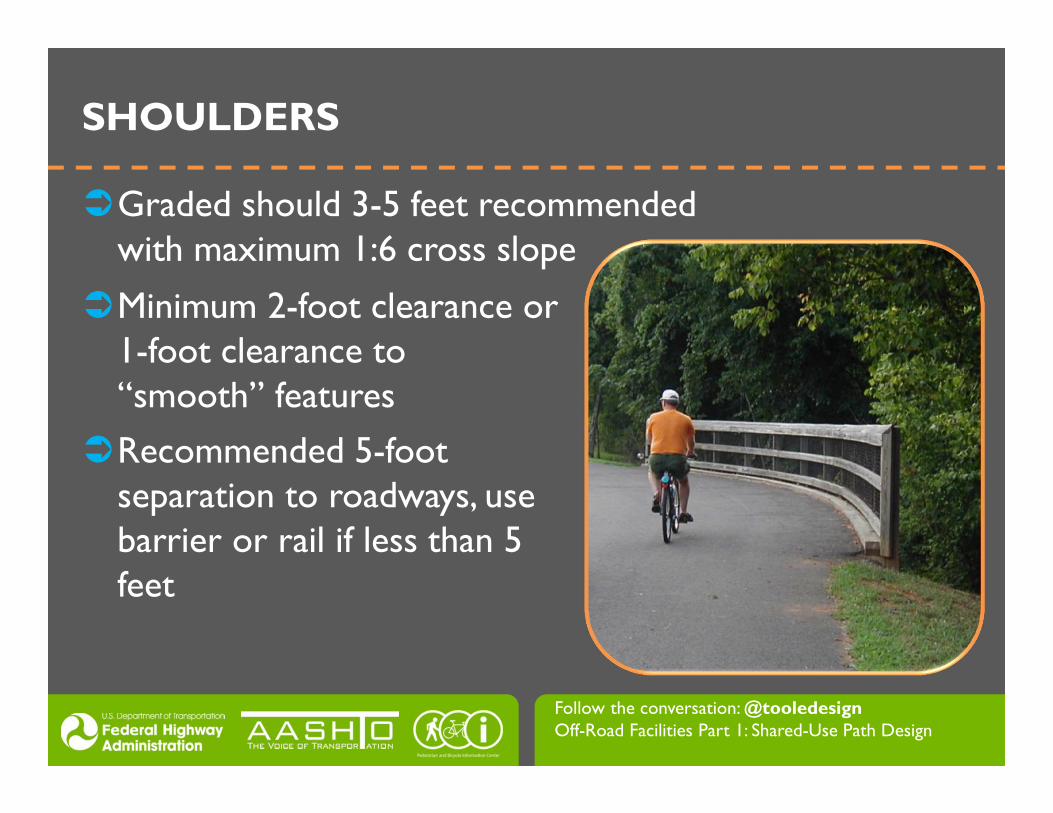
Minimum 2-foot clearance or 1-foot clearance to “smooth” featuresRecommended 5-foot separation to roadways, use barrier or rail if less than 5 feet
SHOULDERS
Graded should 3-5 feet recommended with maximum 1:6 cross slope
Follow the conversation: @tooledesignOff-Road Facilities Part 1: Shared-Use Path Design
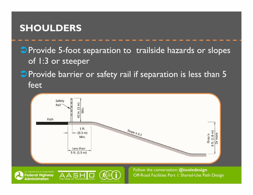
Provide 5-foot separation to trailside hazards or slopes of 1:3 or steeperProvide barrier or safety rail if separation is less than 5 feet
SHOULDERS
Follow the conversation: @tooledesignOff-Road Facilities Part 1: Shared-Use Path Design
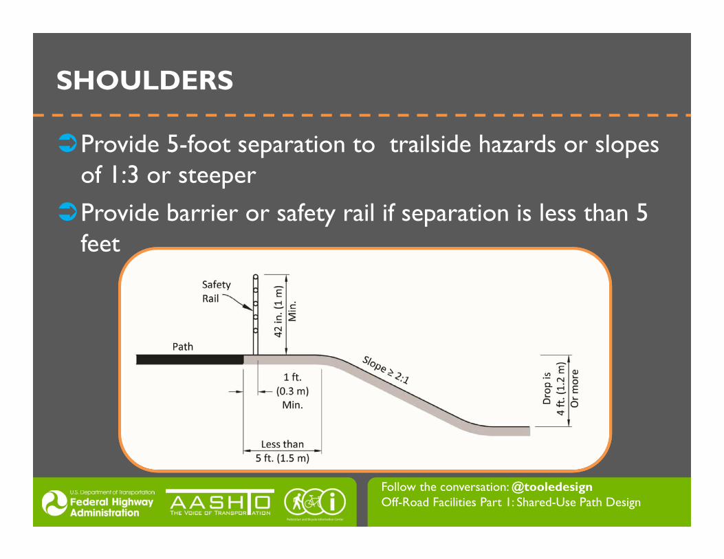
Provide 5-foot separation to trailside hazards or slopes of 1:3 or steeperProvide barrier or safety rail if separation is less than 5 feet
SHOULDERS
Follow the conversation: @tooledesignOff-Road Facilities Part 1: Shared-Use Path Design
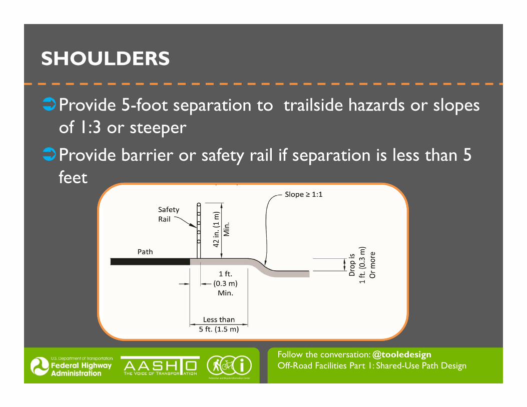
Provide 5-foot separation to trailside hazards or slopes of 1:3 or steeperProvide barrier or safety rail if separation is less than 5 feet
SHOULDERS
Follow the conversation: @tooledesignOff-Road Facilities Part 1: Shared-Use Path Design
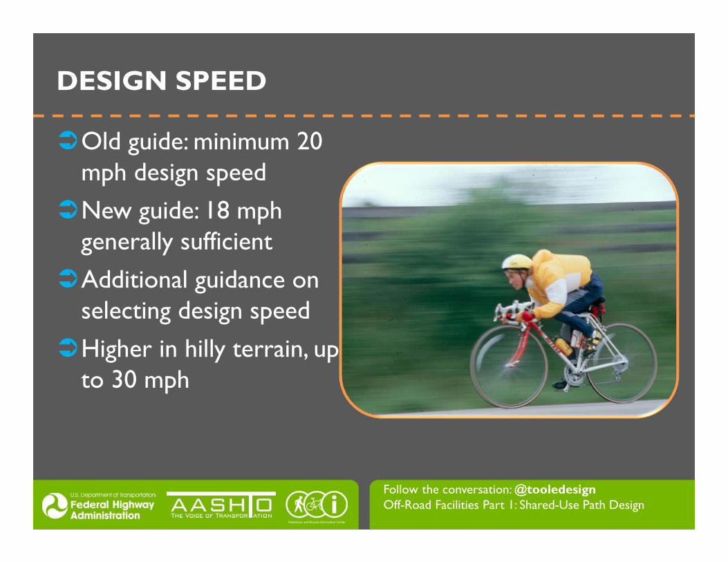
Old guide: minimum 20 mph design speedNew guide: 18 mph generally sufficientAdditional guidance on selecting design speed Higher in hilly terrain, up to 30 mph
DESIGN SPEED
Follow the conversation: @tooledesignOff-Road Facilities Part 1: Shared-Use Path Design
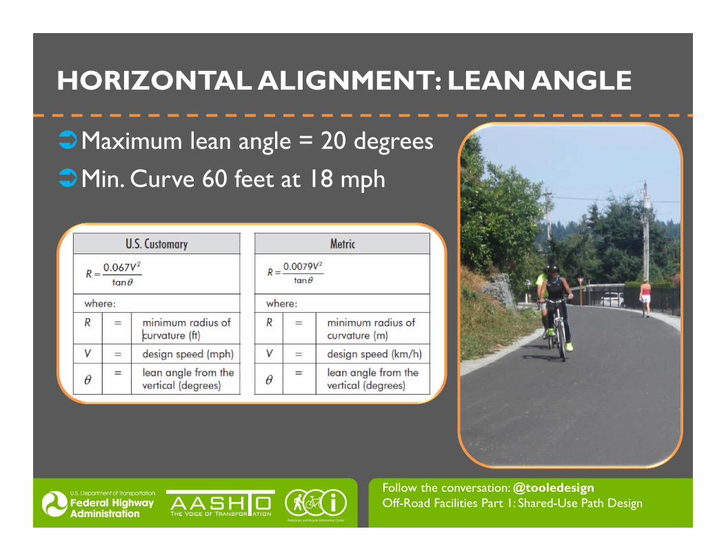
Maximum lean angle = 20 degreesMin. Curve 60 feet at 18 mph
HORIZONTAL ALIGNMENT: LEAN ANGLE
Follow the conversation: @tooledesignOff-Road Facilities Part 1: Shared-Use Path Design
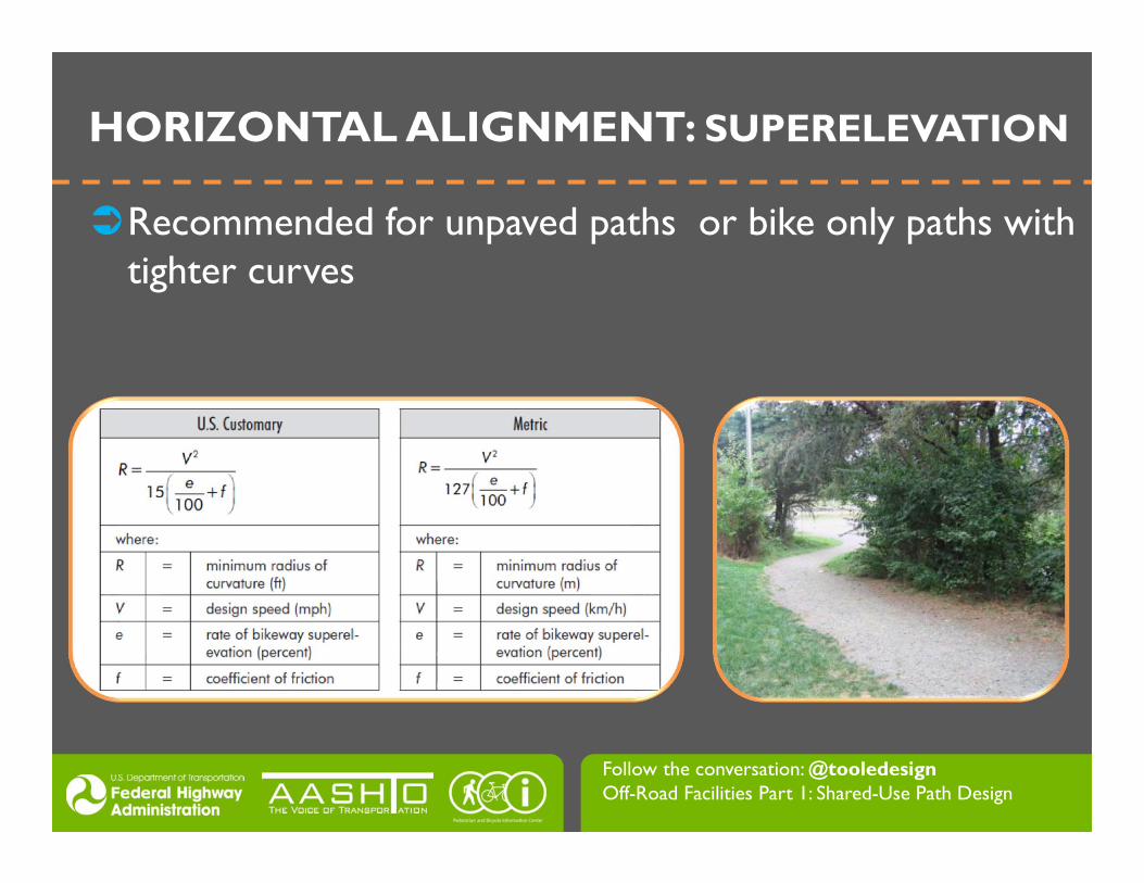
Recommended for unpaved paths or bike only paths with tighter curves
HORIZONTAL ALIGNMENT: SUPERELEVATION
Follow the conversation: @tooledesignOff-Road Facilities Part 1: Shared-Use Path Design
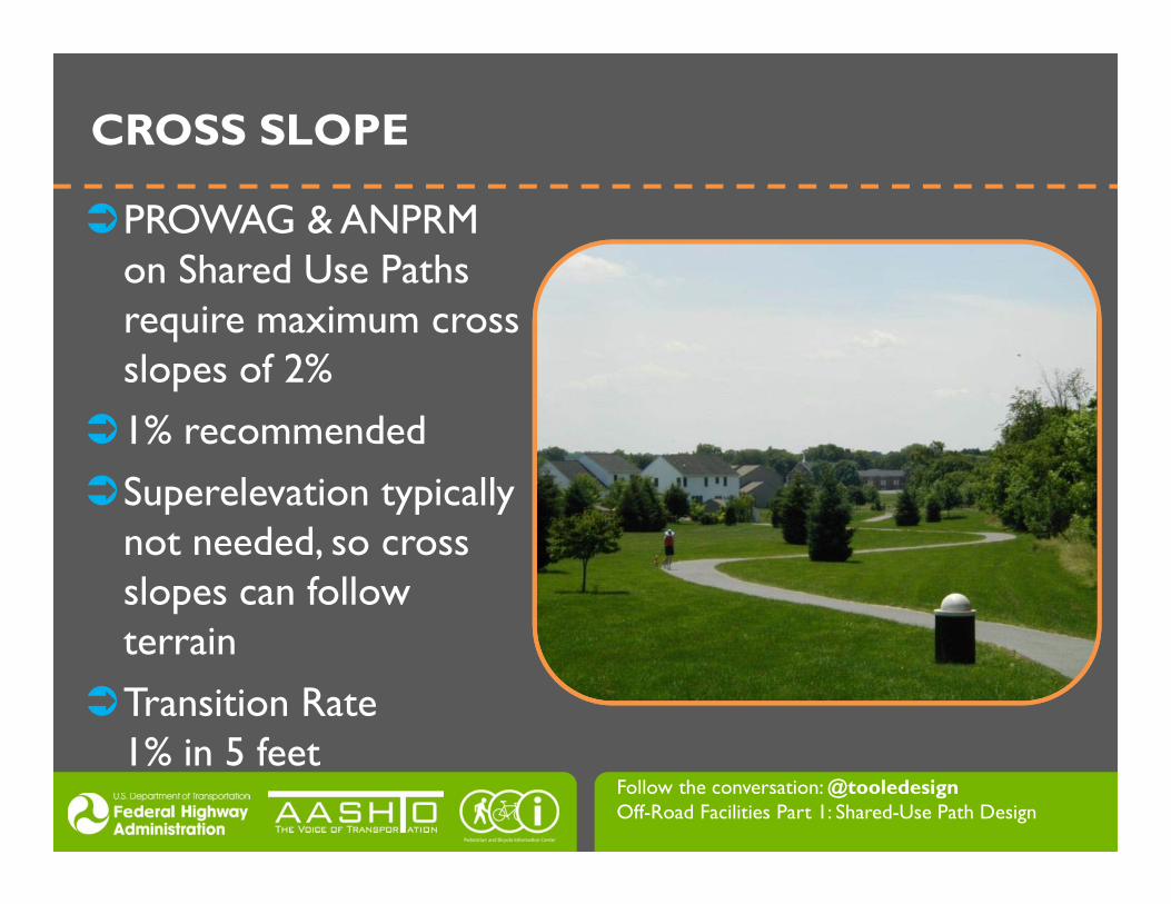
PROWAG & ANPRM on Shared Use Paths require maximum cross slopes of 2%1% recommendedSuperelevation typically not needed, so cross slopes can follow terrainTransition Rate 1% in 5 feet
CROSS SLOPE
Follow the conversation: @tooledesignOff-Road Facilities Part 1: Shared-Use Path Design
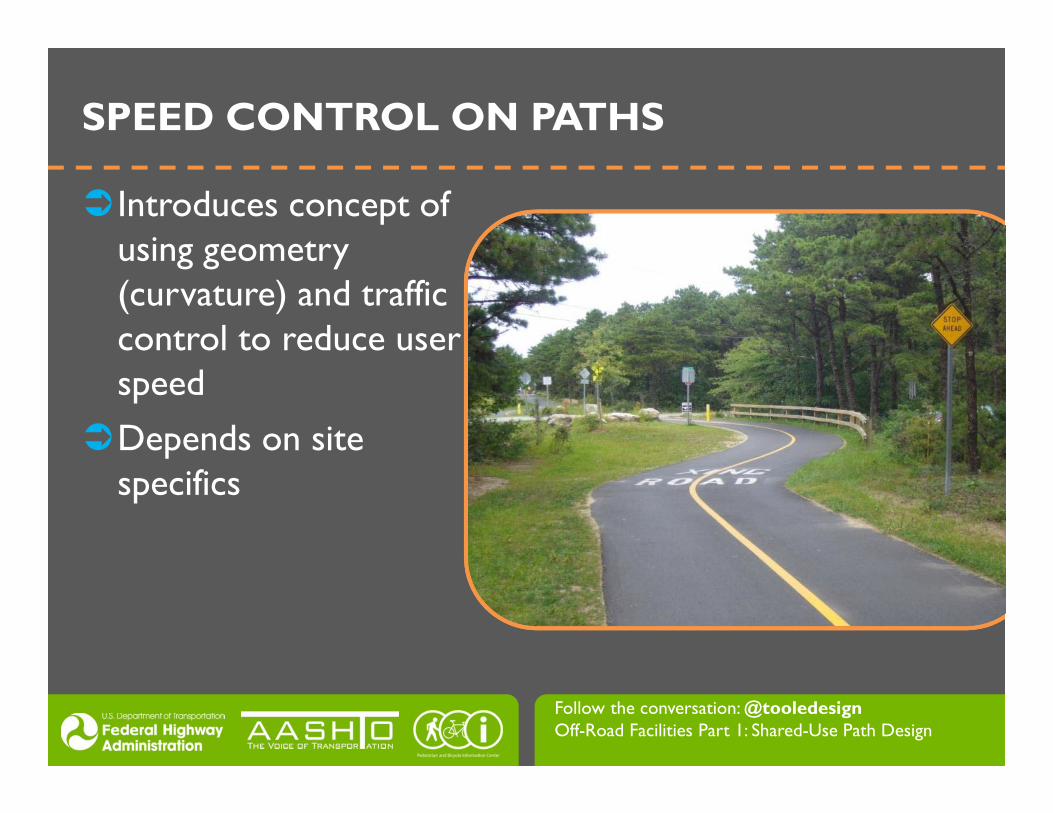
Introduces concept of using geometry (curvature) and traffic control to reduce user speedDepends on site specifics
SPEED CONTROL ON PATHS
Follow the conversation: @tooledesignOff-Road Facilities Part 1: Shared-Use Path Design
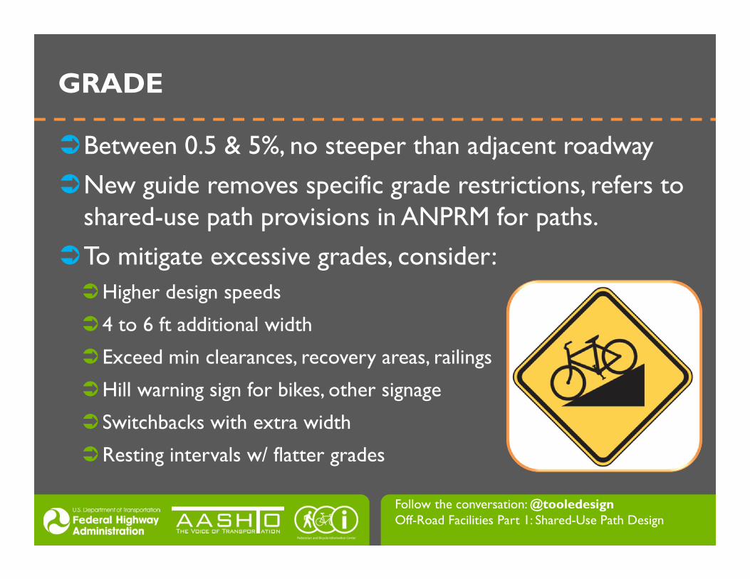
Between 0.5 & 5%, no steeper than adjacent roadwayNew guide removes specific grade restrictions, refers to shared-use path provisions in ANPRM for paths.To mitigate excessive grades, consider:
Higher design speeds
4 to 6 ft additional width
Exceed min clearances, recovery areas, railings
Hill warning sign for bikes, other signage
Switchbacks with extra width
Resting intervals w/ flatter grades
GRADE
Follow the conversation: @tooledesignOff-Road Facilities Part 1: Shared-Use Path Design
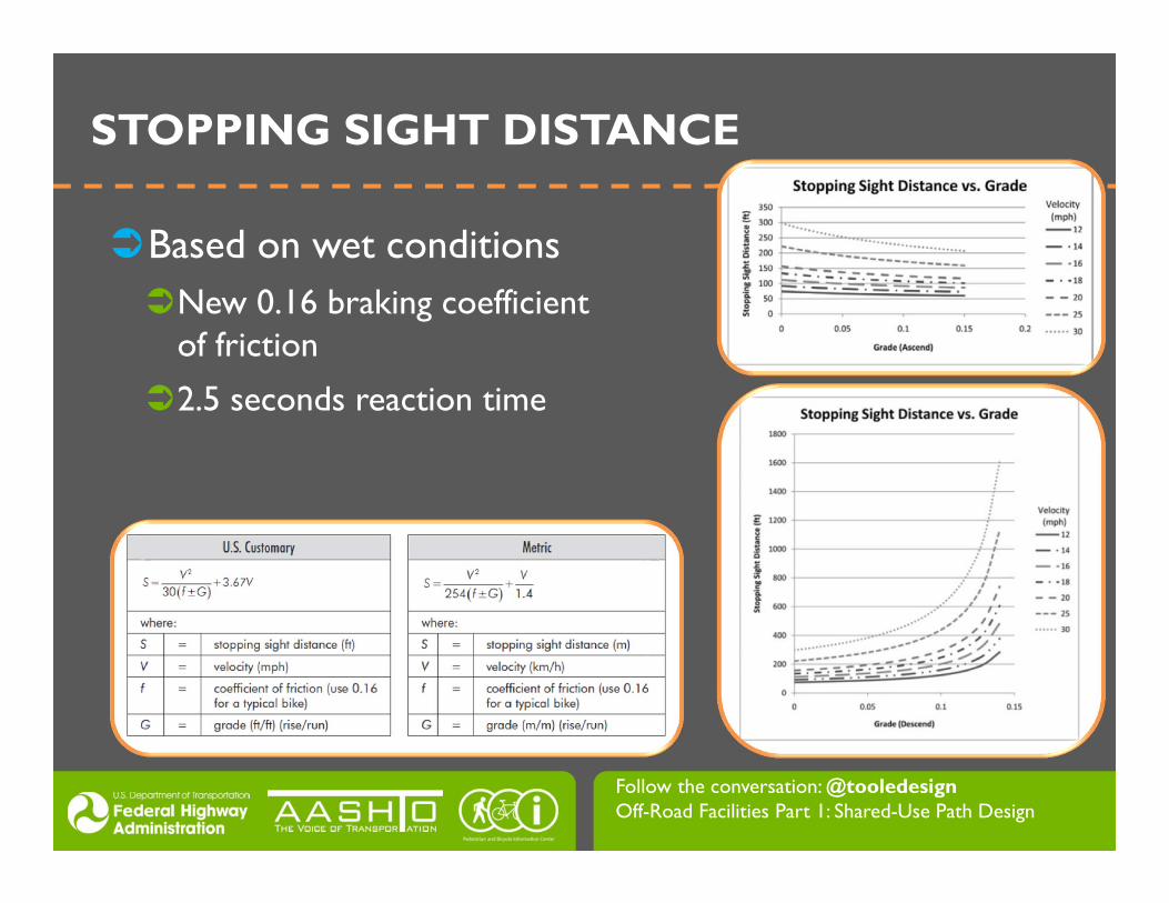
STOPPING SIGHT DISTANCE
Based on wet conditions New 0.16 braking coefficient of friction
2.5 seconds reaction time

Follow the conversation: @tooledesignOff-Road Facilities Part 1: Shared-Use Path Design
VERTICAL CURVE LENGTH
Consider other users
Recumbent cyclists sit lower and travel faster, if many are expected, crests should be longer
Follow the conversation: @tooledesignOff-Road Facilities Part 1: Shared-Use Path Design
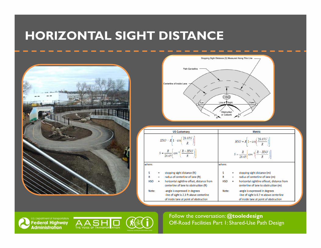
HORIZONTAL SIGHT DISTANCE
Follow the conversation: @tooledesignOff-Road Facilities Part 1: Shared-Use Path Design
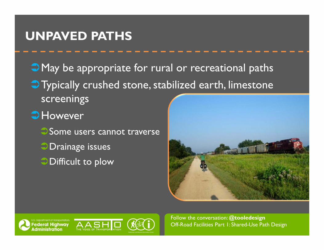
UNPAVED PATHS
May be appropriate for rural or recreational pathsTypically crushed stone, stabilized earth, limestone screeningsHowever
Some users cannot traverse
Drainage issues
Difficult to plow
Follow the conversation: @tooledesignOff-Road Facilities Part 1: Shared-Use Path Design
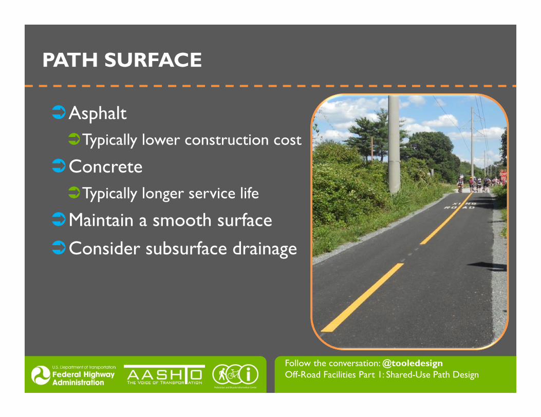
PATH SURFACE
AsphaltTypically lower construction cost
ConcreteTypically longer service life
Maintain a smooth surfaceConsider subsurface drainage
Follow the conversation: @tooledesignOff-Road Facilities Part 1: Shared-Use Path Design
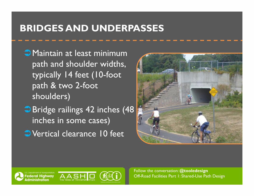
BRIDGES AND UNDERPASSES
Maintain at least minimum path and shoulder widths, typically 14 feet (10-foot path & two 2-foot shoulders)Bridge railings 42 inches (48 inches in some cases)Vertical clearance 10 feet
Follow the conversation: @tooledesignOff-Road Facilities Part 1: Shared-Use Path Design
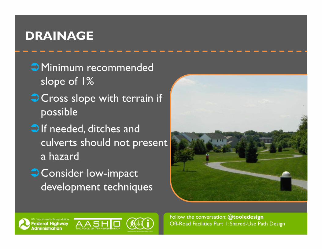
DRAINAGE
Minimum recommended slope of 1%Cross slope with terrain if possibleIf needed, ditches and culverts should not present a hazardConsider low-impact development techniques
Follow the conversation: @tooledesignOff-Road Facilities Part 1: Shared-Use Path Design
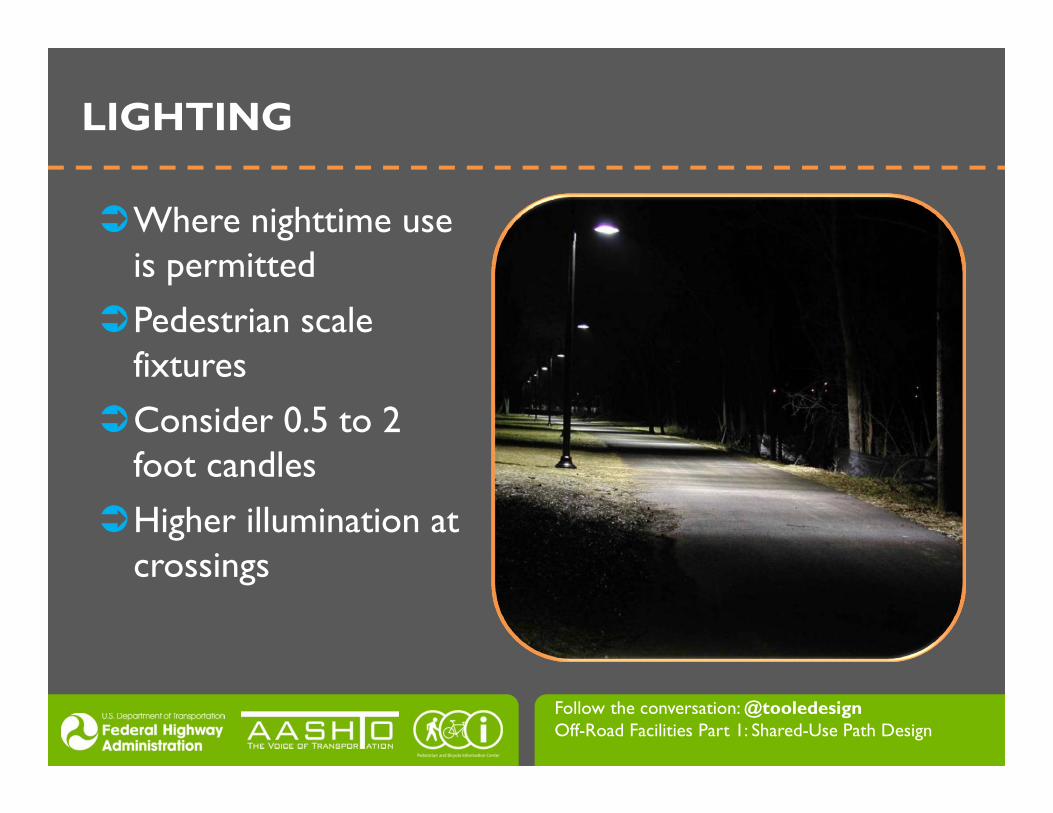
LIGHTING
Where nighttime use is permittedPedestrian scale fixturesConsider 0.5 to 2 foot candlesHigher illumination at crossings

Follow the conversation: @tooledesignOff-Road Facilities Part 1: Shared-Use Path Design
Contact information:
Eric Mongelli, P.E.
Toole Design Group
Tom Huber
Toole Design Group
THANK YOU!
Questions?
Follow the conversation: @tooledesignOff-Road Facilities Part 1: Shared-Use Path Design
FUTURE WEBINARS
August 10: Overview
August 22: Planning Chapter
September 4: On-Road Bikeways Part I
Bike Lanes (including Intersections)
September 18: On-Road Bikeways Part II
Shared lanes
Bicycle boulevards & signing
Signals
October 9: Shared Use PathsGeneral design principles
Pathway geometry
October 23: Shared Use PathsIntersection Design
Mid-block crossings
November 6: Bikeway Maintenance and Operation
Follow the conversation: @tooledesignOff-Road Facilities Part 1: Shared-Use Path Design
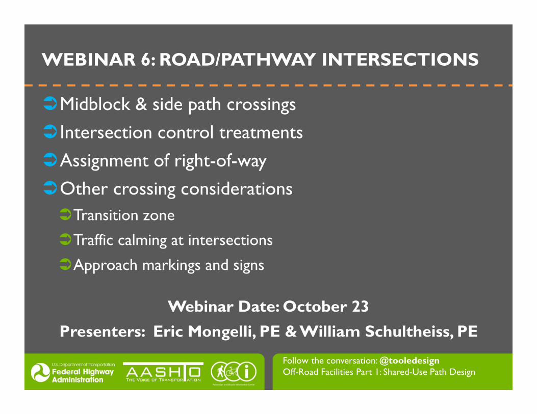
Midblock & side path crossingsIntersection control treatmentsAssignment of right-of-wayOther crossing considerations
Transition zone
Traffic calming at intersections
Approach markings and signs
Webinar Date: October 23Presenters: Eric Mongelli, PE & William Schultheiss, PE
WEBINAR 6: ROAD/PATHWAY INTERSECTIONS