Embed Size (px)
Citation preview

©© 2010, Open Geospatial Consortium2010, Open Geospatial Consortium
Open Geospatial Standards for Preparedness and Open Geospatial Standards for Preparedness and Crisis ManagementCrisis Management
ANSI/HSSP 9th Annual Plenary MeetingPanel 5: Preparedness and Crisis Management Standardization
11 November 2010Mark E. ReichardtPresident & CEO
[email protected]+1 301 840-1361

Making Location Count…© 2010, Open Geospatial Consortium
Location Is KeyLocation Is Key
OGC VisionTo achieve the full societal, economic and scientific
benefits of integrating location resources into commercial and institutional processes worldwide
Landgate, Shared Land Information Platform, Western AustraliaOGC Web Services Standards making data from 20+ agencies available to thousands of users.
Emergency Management – Plume Modeling
Skyview2, EurocontrolOGC Web Services Standards, Aeronautical Information XML based on OGC Geography Markup Language
Aeronautical Information – Flight Safety

Making Location Count…
Heavy Emphasis on Emergency Management, HLS, D&I Heavy Emphasis on Emergency Management, HLS, D&I Requirements in OGC Standards DevelopmentRequirements in OGC Standards Development
(OGC Web Services Phase 4 Testbed - 2006) Dirty bomb scenario in Port of NY/NJ
http://www.opengeospatial.org/pub/www/ows4/index.html
© 2010, Open Geospatial Consortium

Making Location Count…© 2010, Open Geospatial Consortium
OGC OGC -- SummarySummary
OGC Membership Distribution By Region
• Voluntary consensus standards organization founded in 1994
• 404 member organizations and growing
• 30+ implementation standards available free of charge
• Emphasis on rapid prototyping based on user scenarios
• Hundreds of product implementations in the global market
• Broad user community implementation worldwide
• Alliances with many other SDO’s

Making Location Count…© 2010, Open Geospatial Consortium
OGC OGC -- SummarySummary
OGC Membership Distribution By Type
• Voluntary consensus standards organization founded in 1994
• 404 member organizations and growing
• 30+ implementation standards available free of charge
• Emphasis on rapid prototyping based on user scenarios
• Hundreds of product implementations in the global market
• Broad user community implementation worldwide
• Alliances with many other SDO’s

Making Location Count…
Example Member OrganizationsExample Member Organizations
© 2010, Open Geospatial Consortium

Making Location Count…
Example Government Member OrganizationsExample Government Member Organizations
• US DHS• US EPA• US FAA• US NASA• USGS• US NGA• US Census• US NOAA• JPEO• Oakridge National Lab• Natural Resources Canada• North Carolina Dept of Environment
& Natural Resources• Dept. Science & Technology (India)• Korea Land & Housing
• DOD Australia• Geoscience Australia• NSW Dept of Environment and
Climate Change (Australia)• Eurocontrol• European Environment Agency• European Satellite Centre• European Space Agency• EU Joint Research Centre• UK MOD• UK MET Office• METEO France• BRGM (France)• Ordnance Survey (UK)• State Land Agencies (Germany)
© 2010 Open Geospatial Consortium

Making Location Count…
OGC Web Services Standards
Rapid discovery, access, fusion and application of location information for:
•Critical Infrastructure•Emergency Management•Weather Forecasting / Warning•Climate Change•Defense and Intelligence•Local Government Services•Routing / Logistics•And many more applications…
© 2010, Open Geospatial Consortium

Making Location Count…
OGC Web Services Standards
Relevant OGC Web Services Standards:
•Web Map Service (WMS) *•Web Feature Service (WFS)*•Web Coverage Service (WCS)**•Catalogue (CSW)**•Geography Markup Language (GML) *•KML•Others…
Emphasis on Seeking Adoption through ISO / CEN*Adopted as ISO & CEN standards
**Submitted to ISO as New Work Item
© 2010, Open Geospatial Consortium
Making Location Count…© 2010 Open Geospatial Consortium
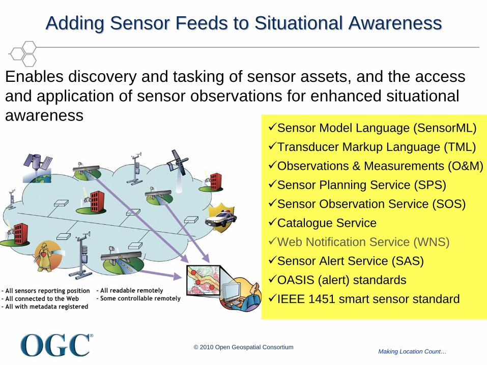
Adding Sensor Feeds to Situational AwarenessAdding Sensor Feeds to Situational Awareness
Sensor Model Language (SensorML)Transducer Markup Language (TML)Observations & Measurements (O&M)Sensor Planning Service (SPS)Sensor Observation Service (SOS)Catalogue Service Web Notification Service (WNS)Sensor Alert Service (SAS)OASIS (alert) standardsIEEE 1451 smart sensor standard
Enables discovery and tasking of sensor assets, and the access and application of sensor observations for enhanced situational awareness

Making Location Count…
MultiMulti--source fusion for Actionable Situational source fusion for Actionable Situational Awareness Via Common Standards Baseline Awareness Via Common Standards Baseline
OGC Web Services Phase 4 Testbed (2006)
Web based integration of geospatial data from
multiple distributed sources
Fusion of Building Information Models and
other engineered information
Standards-based Decision Support Services
available to support Actionable Situational Awareness
Discovery, tasking, access and integration of
real-time sensors and sensor data- fixed and
mobile sensors
© 2010, Open Geospatial Consortium

Making Location Count…
Applications Leveraging OGC and Complimentary Standards for Applications Leveraging OGC and Complimentary Standards for Situational Awareness and Decision SupportSituational Awareness and Decision Support
• Crisis / Disaster Mgt– German Indonesian Tsunami Early Warning
System (GITEWS)– Sahana - Social networking platform for
crises management
© 2010, Open Geospatial Consortium
Source: www.gitews.org
• Public Safety, Defense and Intelligence
• PulseNet, Northrop Grumman• Emergeo FusionPoint
Source: emergeo.comSource: www.sahanafoundation.org

Making Location Count…
Sensor Web Enablement in OGC TestbedsSensor Web Enablement in OGC Testbeds Standardization of Chemical, Biological, Radiological, Nuclear Standardization of Chemical, Biological, Radiological, Nuclear
(CBRN) Sensors(CBRN) Sensors
© 2010 Open Geospatial Consortium15
From OGC Web Services Testbed Phases 6 and 7

Making Location Count…
Support to European ProgramsSupport to European Programs
• GMES -- Global Monitoring for Environmental Security
• INSPIRE -- Infrastructure for Spatial Information in Europe
• GIGAS -- GEOSS, INSPIRE and GMES an Action in Support
© 2010, Open Geospatial Consortium
http://www.sany-ip.eu/
Making Location Count…
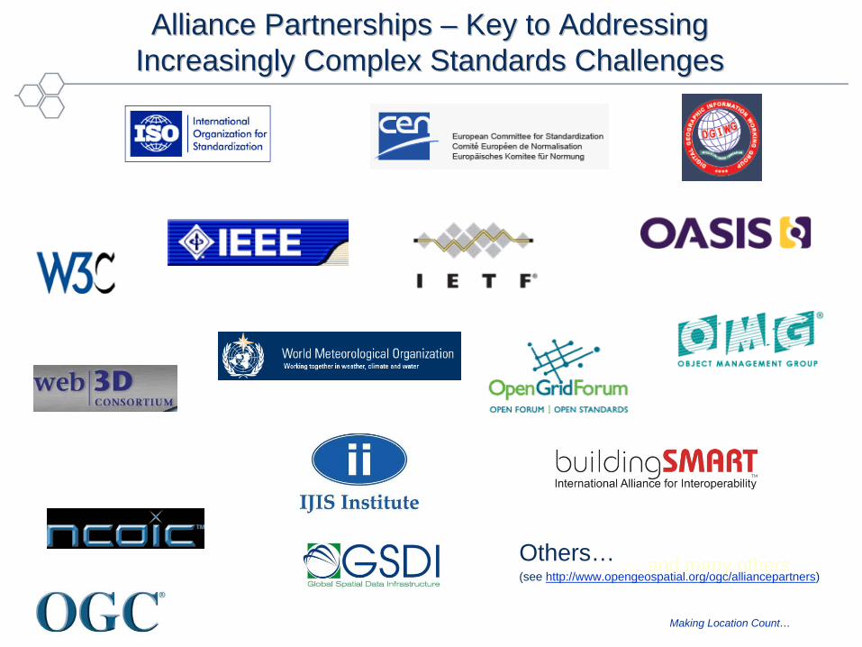
Alliance Partnerships Alliance Partnerships –– Key to Addressing Key to Addressing Increasingly Complex Standards ChallengesIncreasingly Complex Standards Challenges
… and many othersOthers…(see http://www.opengeospatial.org/ogc/alliancepartners)

Making Location Count…
In ClosingIn Closing
• OGC and complimentary ISO and CEN standards provide an interoperable location information underpinning for improved
– Situational awareness
– Decision making
• Requirements driven by user community requirements
• Broad implementation in the global marketplace
• International, multi-sector consensus process
• Collaboration across SDO’s is key to success
© 2010, Open Geospatial Consortium

Making Location Count…© 2010 Open Geospatial Consortium
Thank YouThank You
CityGML – 3D Urban ModelsSource; Thomas Kolbe, Berlin TU
Source: GTA Geoinformatik GmbH, www.gta-geo.de

Making Location Count…
ReferencesReferences
OGC References:
• Approved Standards– www.opengeospatial.org/standards
• Working Groups– www.opengeospatial.org/projects/groups/wg
• Emergency & Disaster Management Working Group
– www.opengeospatial.org/projects/groups/edmdwg
• Reference Model– www.opengeospatial.org/standards/orm
• Membership Listing by Region– www.opengeospatial.org/standards/orm
• Sensor Web Enablement – www.opengeospatial.org/projects/groups/sensorweb
• List of Implementing Products– www.opengeospatial.org/resource/products
Community References:
• Sensors Anywhere (SANY) – European Framework 6 Program, Sensor Services Architecture
– www.sany-ip.eu/publications/3317
• US Federal Geographic Data Committee Endorsement External Standards
– www.fgdc.gov/standards/fgdc-endorsed-external- standards/index_html
• Geospatial Intelligence Standards Working Group Adopted Standards
– www.gwg.nga.mil/
© 2010, Open Geospatial Consortium