Embed Size (px)
Citation preview
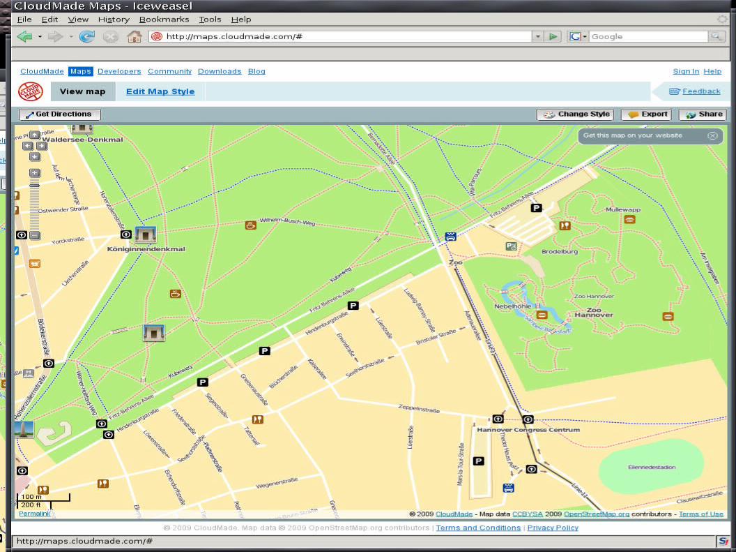
Map of the hour
What is a free map How OpenStreetMap works How to use the data with
PostgreSQL
What is OpenStreetMap
A project to collect & distribute free geographic data
A wiki-editable map of the world
CC-by-SA licensed
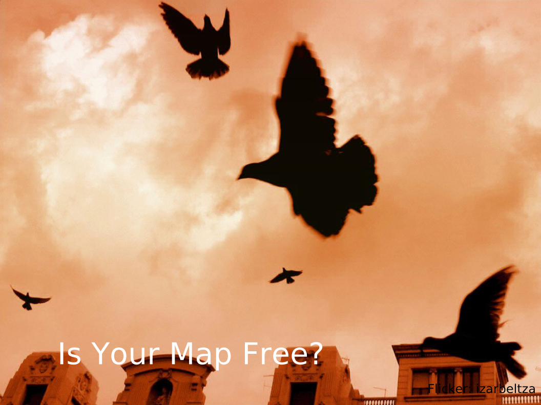
Is Your Map Free?Flicker: izarbeltza
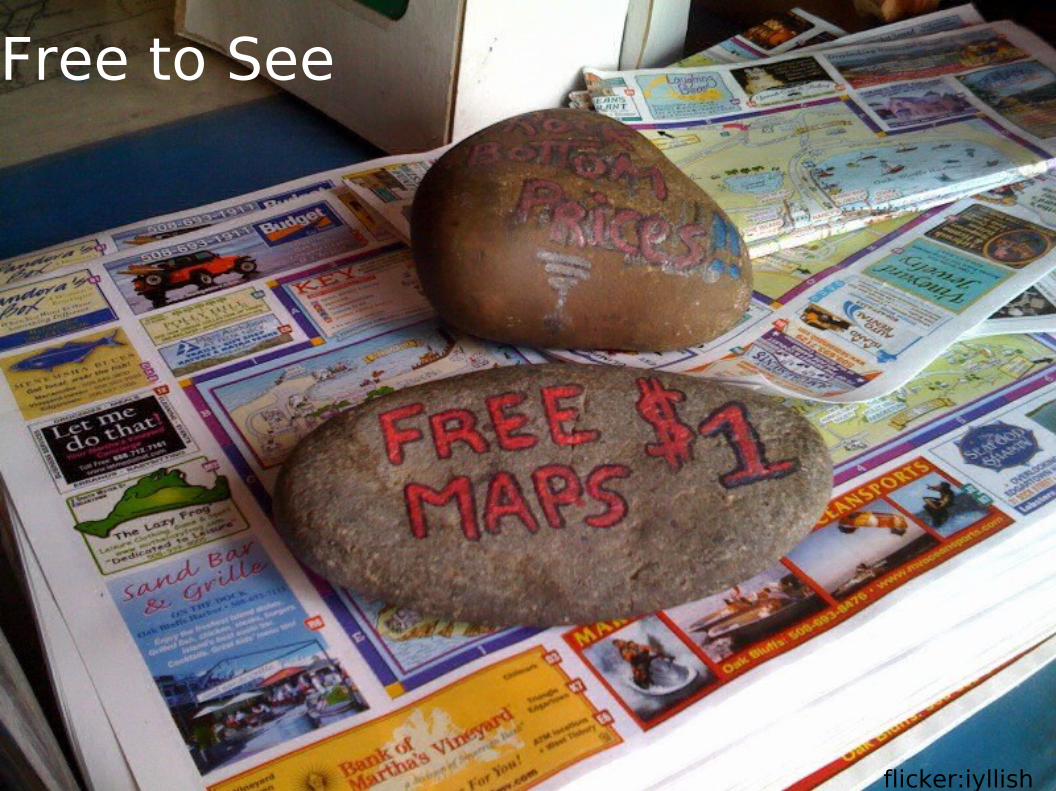
Free to See
flicker:iyllish

Free to give
Publishing Distribution (embedded
devices) Sell
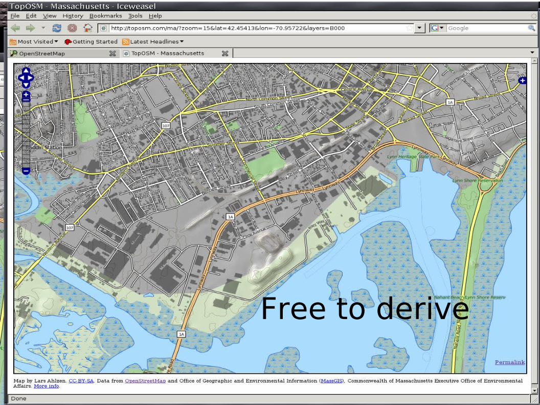
Free to derive
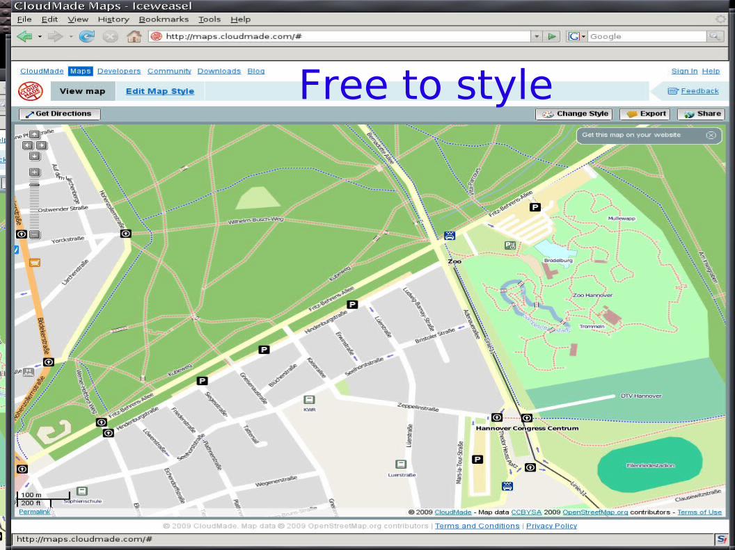
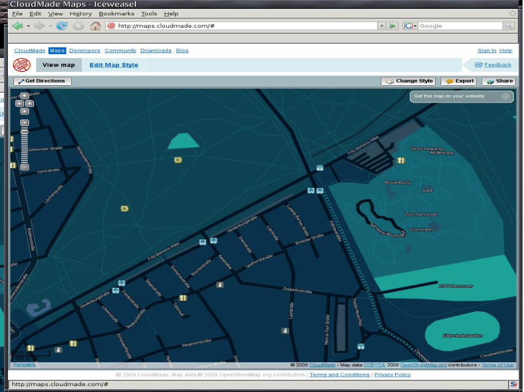
Free to style
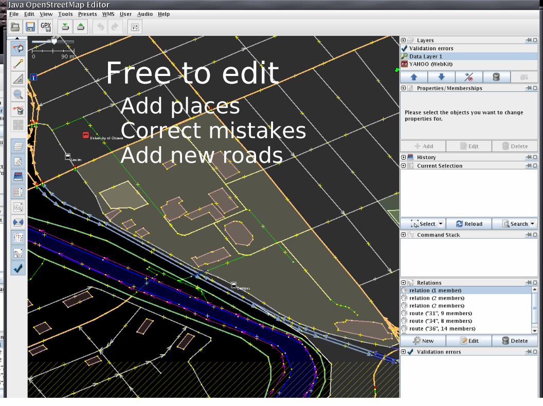
Free to editAdd placesCorrect mistakesAdd new roads
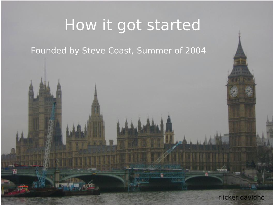
How it got started
Founded by Steve Coast, Summer of 2004
flicker:davidhc
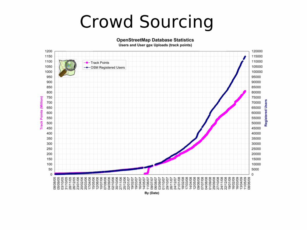
Crowd Sourcing
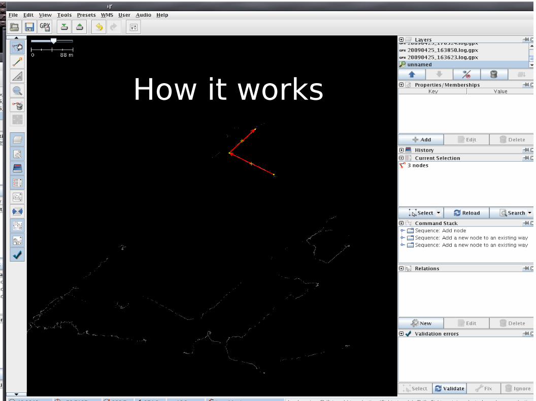
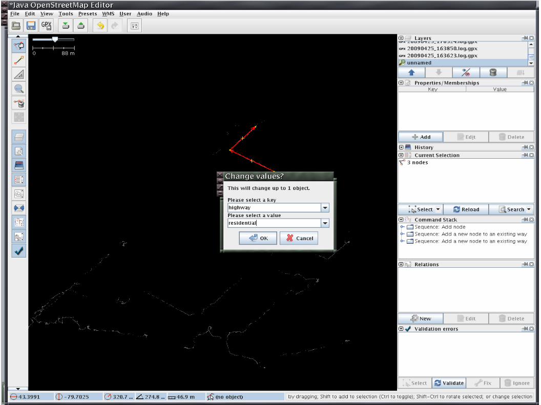
How it works
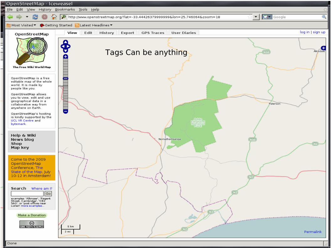
Tags Can be anything
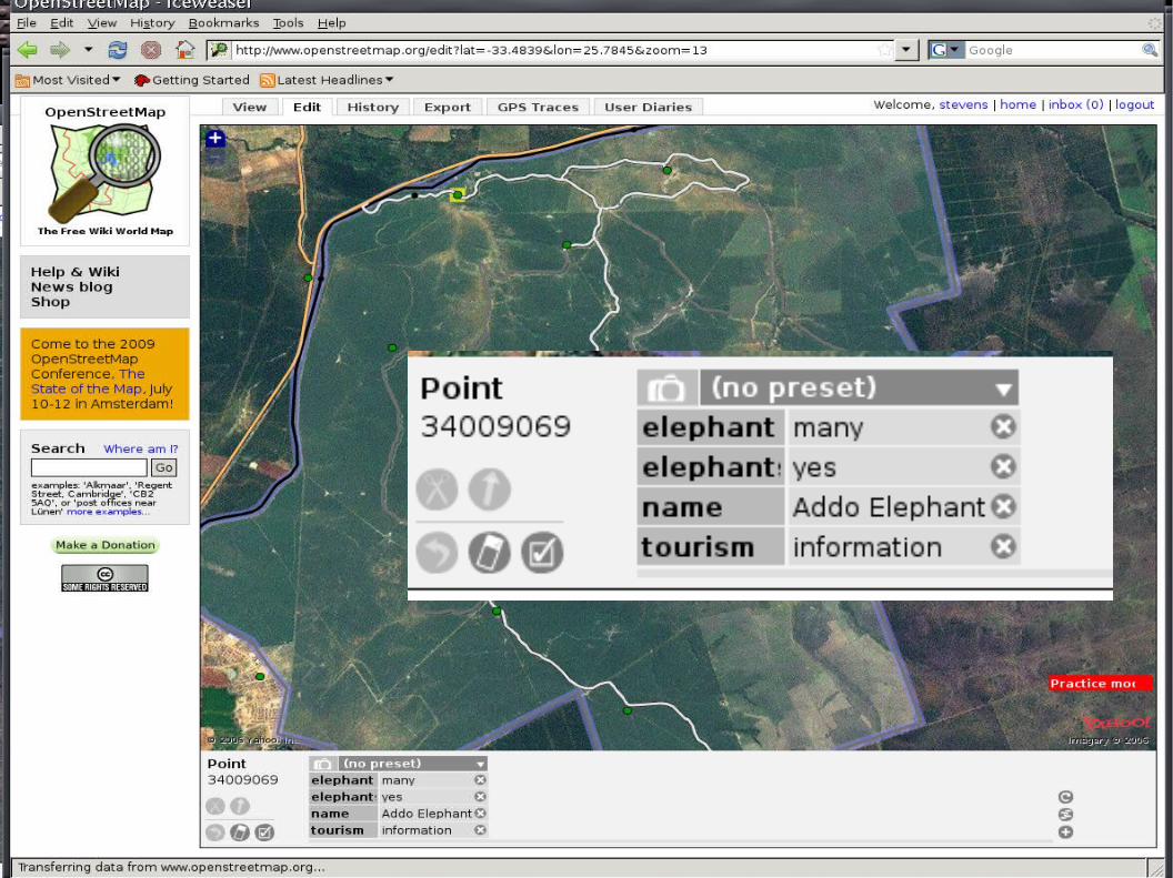
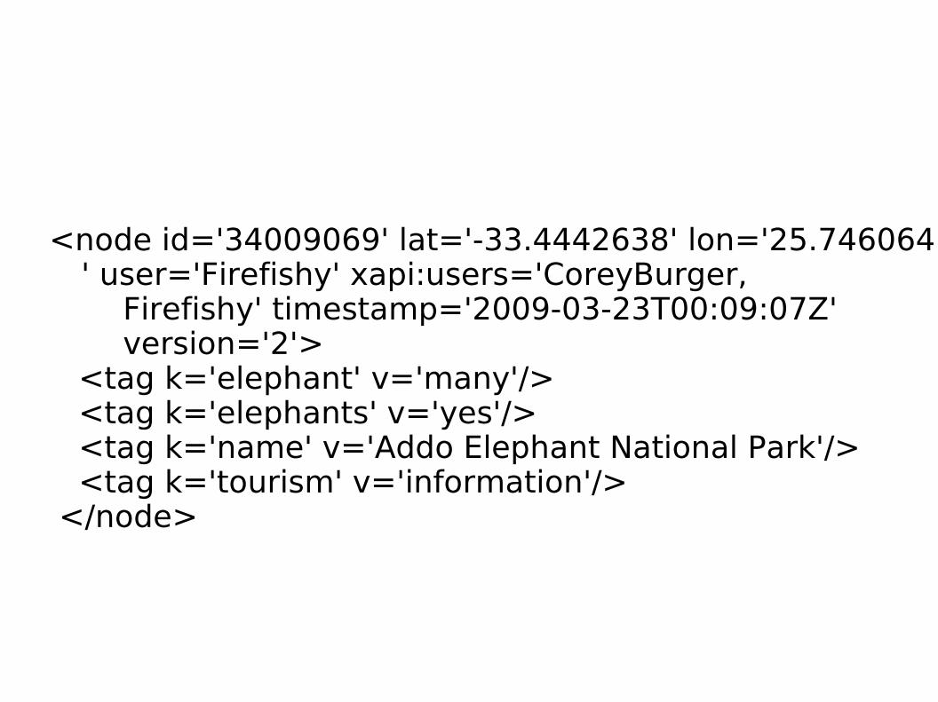
<node id='34009069' lat='-33.4442638' lon='25.746064' user='Firefishy' xapi:users='CoreyBurger,
Firefishy' timestamp='2009-03-23T00:09:07Z' version='2'>
<tag k='elephant' v='many'/> <tag k='elephants' v='yes'/> <tag k='name' v='Addo Elephant National Park'/> <tag k='tourism' v='information'/> </node>
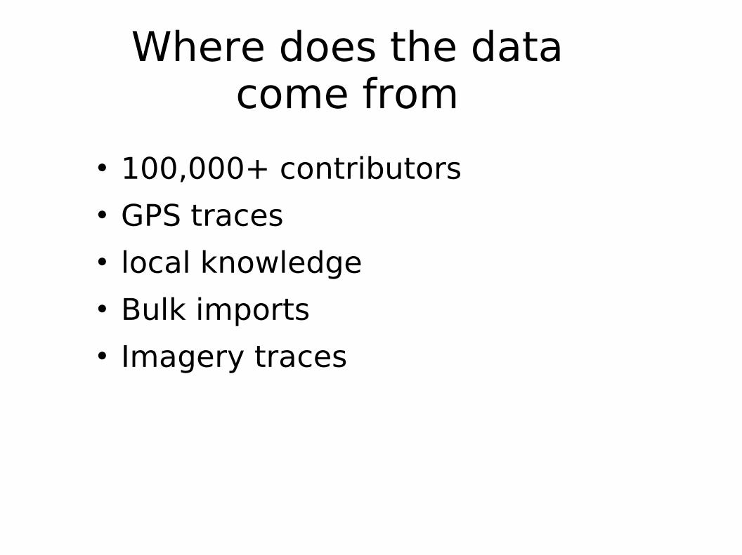
Where does the data come from
100,000+ contributors GPS traces local knowledge Bulk imports Imagery traces
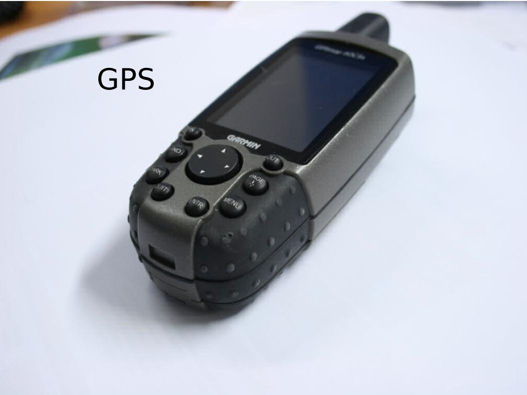
GPS
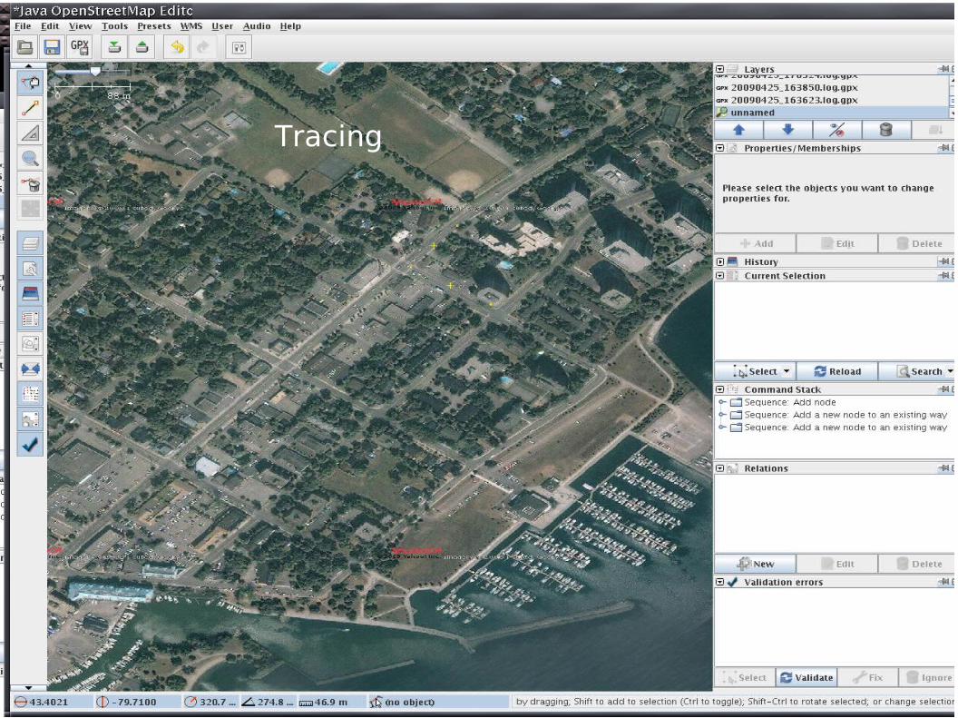
TracingTracing
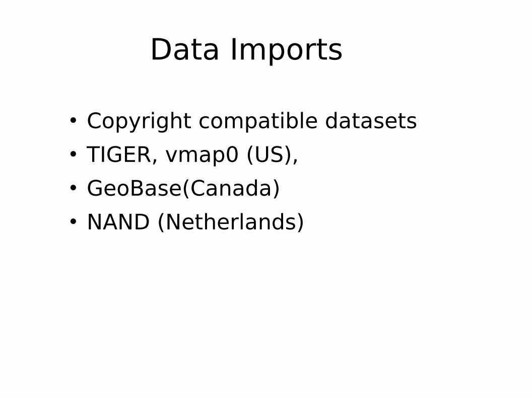
Data Imports
Copyright compatible datasets TIGER, vmap0 (US), GeoBase(Canada) NAND (Netherlands)
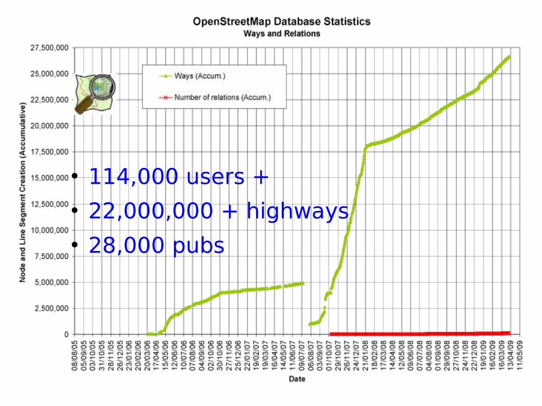
114,000 users + 22,000,000 + highways 28,000 pubs
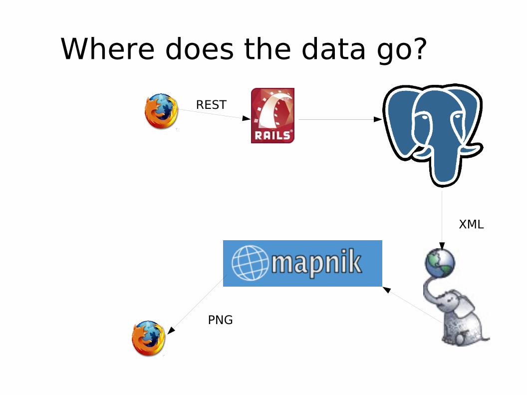
Where does the data go?
XML
REST
PNG
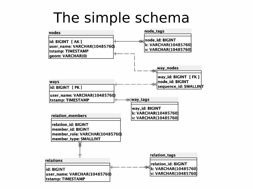
The simple schema
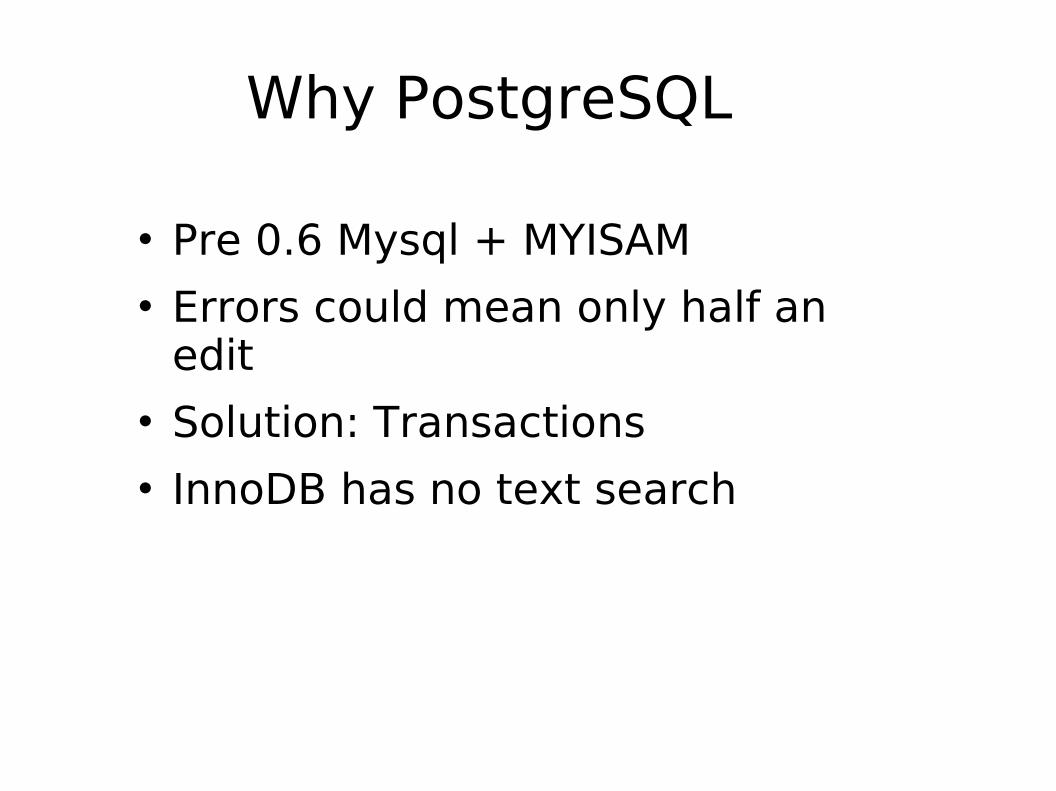
Why PostgreSQL
Pre 0.6 Mysql + MYISAM Errors could mean only half an
edit Solution: Transactions InnoDB has no text search

2x Intel Xeon Processor E5420 Quad Core 2.5Ghz 2x 73GB (3.5) SAS 15K10x 450GB (3.5) SAS 15K
PostgreSQL 8.3
30GB of RAM
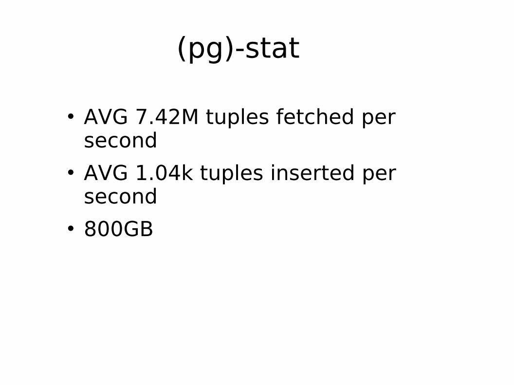
(pg)-stat
AVG 7.42M tuples fetched per second
AVG 1.04k tuples inserted per second
800GB
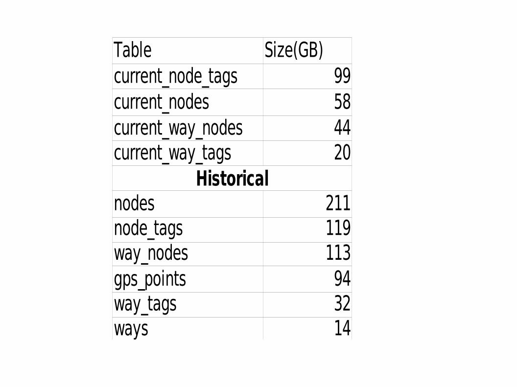
Table Size(GB)current_node_tags 99current_nodes 58current_way_nodes 44current_way_tags 20
Historicalnodes 211node_tags 119way_nodes 113gps_points 94way_tags 32ways 14
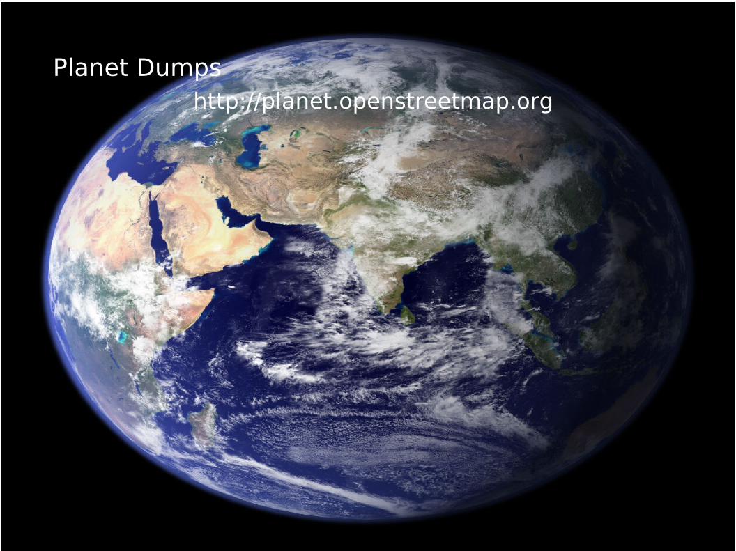
Planet Dumpshttp://planet.openstreetmap.org
Osmosis, your own API
Populates DB from planet dumps
But I really want to use PostGIS
Complex Geometries Spatial queries
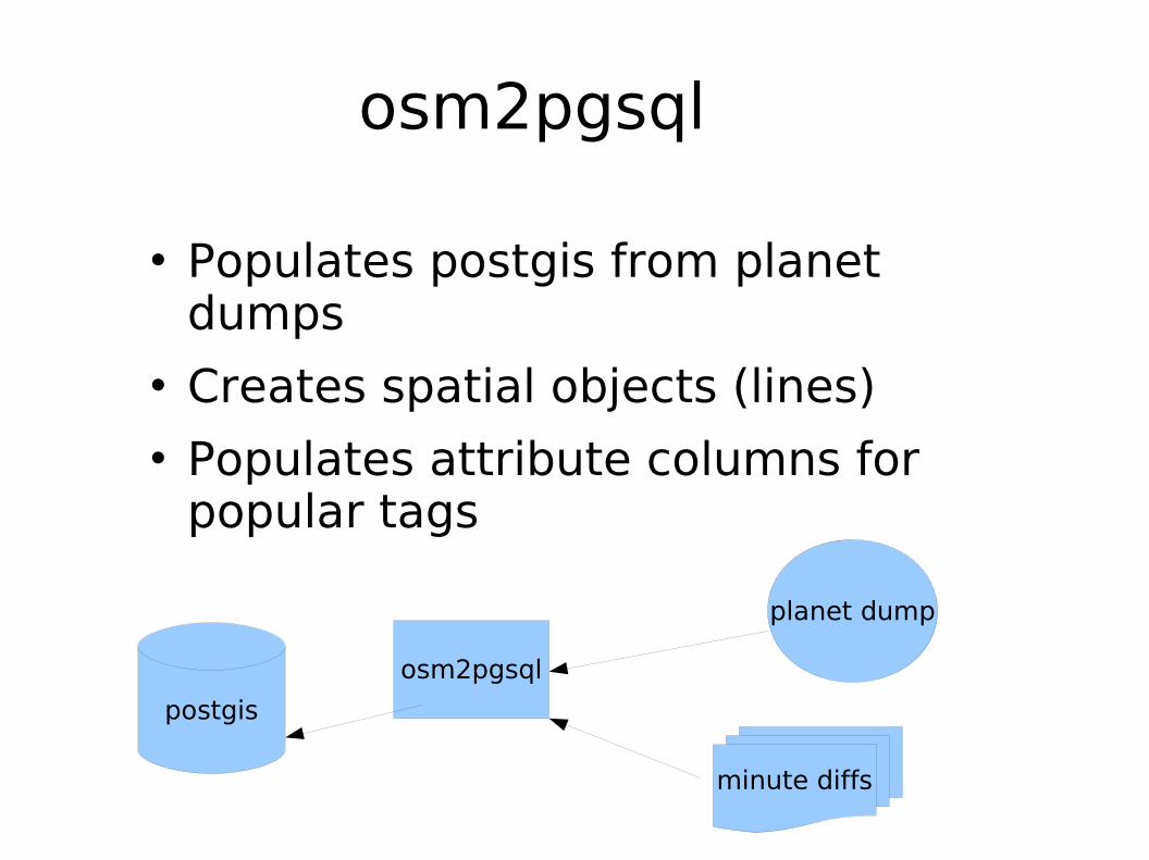
osm2pgsql
Populates postgis from planet dumps
Creates spatial objects (lines) Populates attribute columns for
popular tags
planet dump
postgis
osm2pgsql
minute diffs
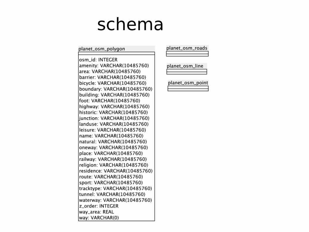
schema
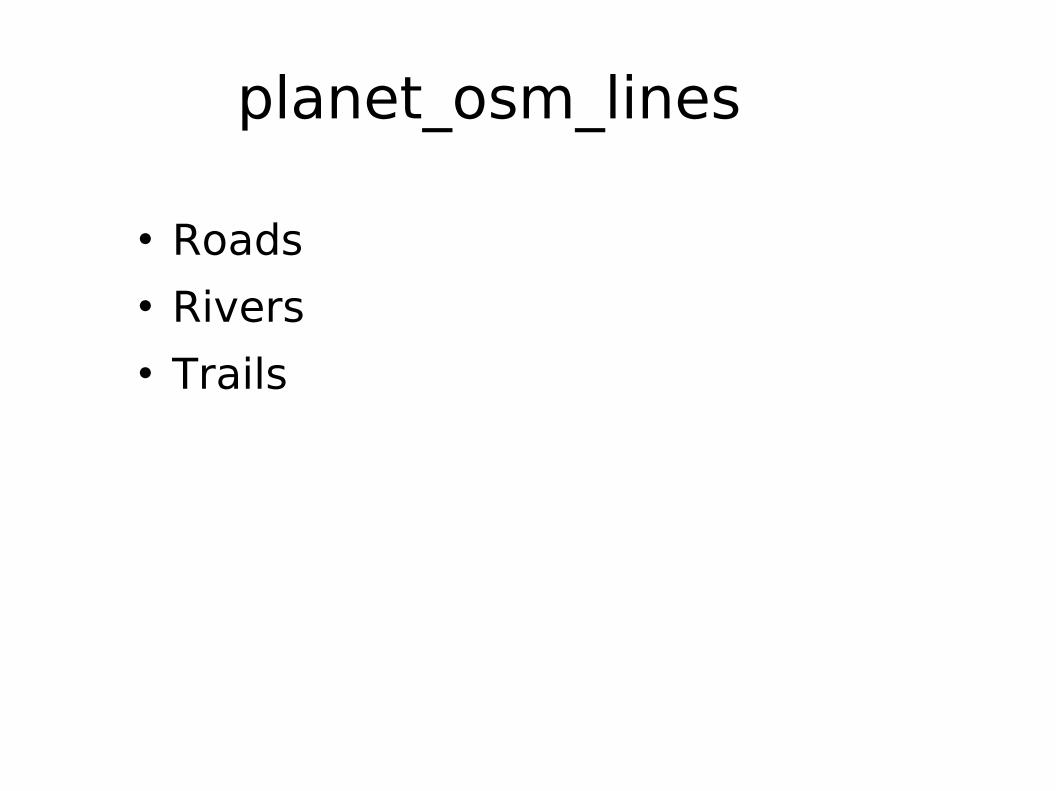
planet_osm_lines
Roads Rivers Trails
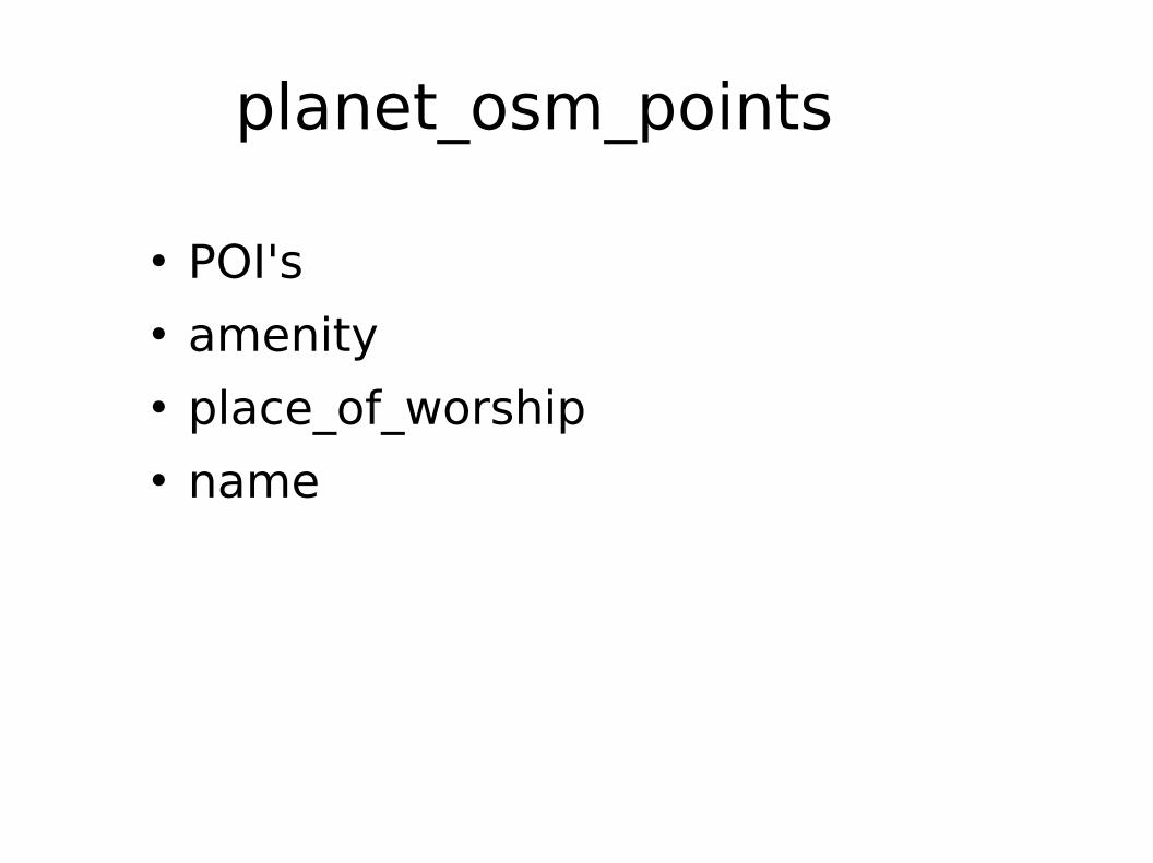
planet_osm_points
POI's amenity place_of_worship name
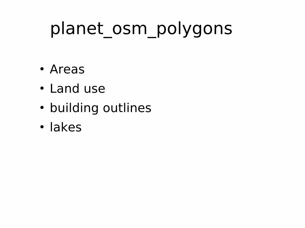
planet_osm_polygons
Areas Land use building outlines lakes
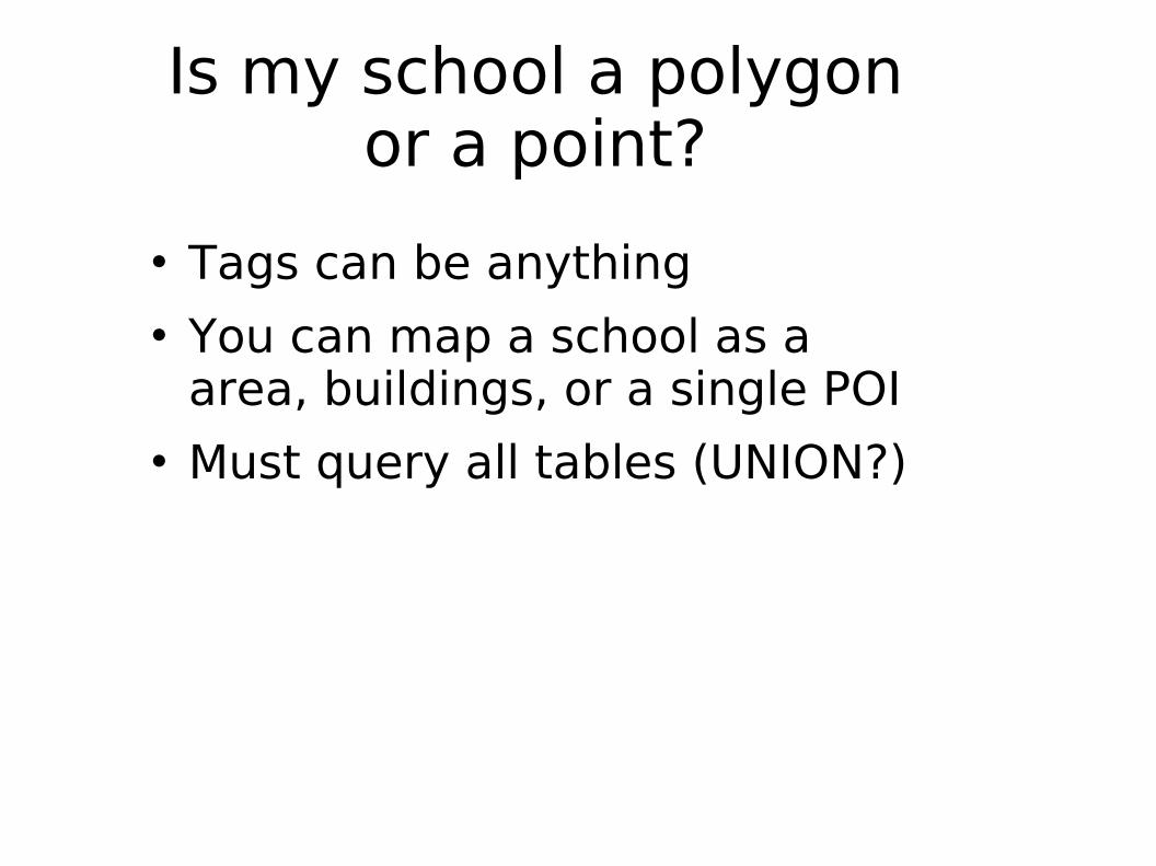
Is my school a polygon or a point?
Tags can be anything You can map a school as a
area, buildings, or a single POI Must query all tables (UNION?)
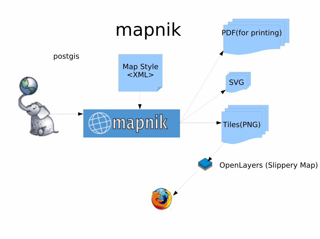
mapnikpostgis
Map Style<XML>
Tiles(PNG)
SVG
PDF(for printing)
OpenLayers (Slippery Map)

I can do *GIS too
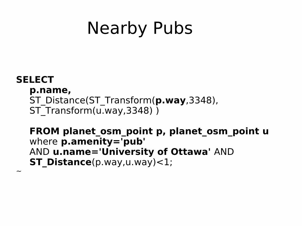
Nearby Pubs
SELECTp.name,ST_Distance(ST_Transform(p.way,3348),ST_Transform(u.way,3348) )
FROM planet_osm_point p, planet_osm_point u where p.amenity='pub' AND u.name='University of Ottawa' AND ST_Distance(p.way,u.way)<1;
~
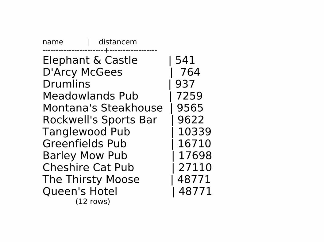
name | distancem-----------------------+------------------
Elephant & Castle | 541D'Arcy McGees | 764Drumlins | 937Meadowlands Pub | 7259Montana's Steakhouse | 9565Rockwell's Sports Bar | 9622Tanglewood Pub | 10339Greenfields Pub | 16710Barley Mow Pub | 17698Cheshire Cat Pub | 27110The Thirsty Moose | 48771Queen's Hotel | 48771 (12 rows)
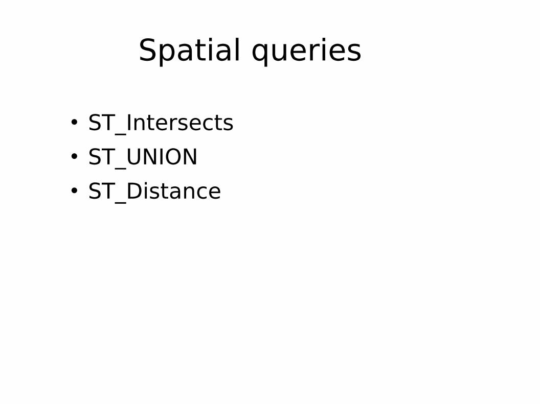
Spatial queries
ST_Intersects ST_UNION ST_Distance

Things we can do
How free is your map? About OpenStreetMap How to use with PostGIS
http://www.openstreetmap.org
http://www.mapnik.org
http://postgis.refractions.net
https://www.openjump.org
http://www.qgis.org
Questions?
Steve [email protected]@radintl.comIRC: StevenSn

Map Copyright OpenStreetMap & contributors
http://www.flickr.com/photos/izarbeltza/68084109/http://www.flickr.com/photos/jyllish/3497579854/
Photo Credits
NASA
http://www.flickr.com/photos/davidhc/382148384/
http://wiki.openstreetmap.org