Embed Size (px)
Citation preview
Oracle Spatial and Graph
2 Copyright © 2013, Oracle and/or its affiliates. All rights reserved.
Agenda
Introducing Oracle Spatial and Graph
Goals for Spatial Features in 12c
New Spatial and NDM Graph Features in 12c
Goals for RDF Graph Features in 12c
New RDF Graph Features in 12c
Unique advantages using Exadata
3 Copyright © 2013, Oracle and/or its affiliates. All rights reserved.
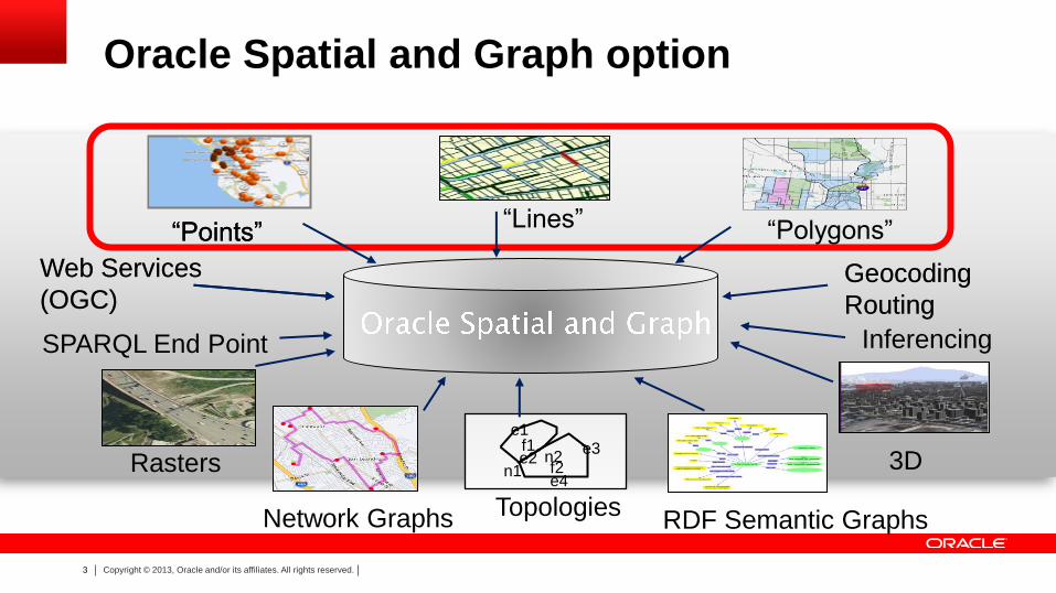
“Points” “Lines” “Polygons”
Rasters
Topologies
3D f1
f2 n1 n2
e1
e2 e3
e4
Network Graphs
Web Services
(OGC) Geocoding
Routing
RDF Semantic Graphs
Oracle Spatial and Graph option
“Points”
Web Services
(OGC)
SPARQL End Point
Geocoding
Routing
Inferencing
4 Copyright © 2013, Oracle and/or its affiliates. All rights reserved.
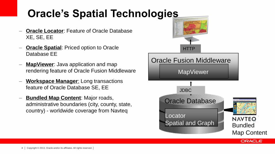
Oracle’s Spatial Technologies
– Oracle Locator: Feature of Oracle Database
XE, SE, EE
– Oracle Spatial: Priced option to Oracle
Database EE
– MapViewer: Java application and map
rendering feature of Oracle Fusion Middleware
– Workspace Manager: Long transactions
feature of Oracle Database SE, EE
– Bundled Map Content: Major roads,
administrative boundaries (city, county, state,
country) - worldwide coverage from Navteq
JDBC
Oracle Fusion Middleware
HTTP
MapViewer
Locator
Spatial and Graph
Oracle Database
Bundled
Map Content
5 Copyright © 2013, Oracle and/or its affiliates. All rights reserved.
INTRODUCING
6 Copyright © 2013, Oracle and/or its affiliates. All rights reserved.
Why rename this Oracle Database option From “Oracle Spatial” to “Oracle Spatial and Graph”
• Highlights existing graph capabilities in Oracle Spatial
– W3C RDF graph since Oracle 10gR2
– Network Data Model graph since Oracle 10gR1
• Addresses increasing market demand for graph database
capabilities
– Social Network Graph database popularity
– Multimodal and integrated transportation, utility and communications
networks
7 Copyright © 2013, Oracle and/or its affiliates. All rights reserved.
Spatial Features
8 Copyright © 2013, Oracle and/or its affiliates. All rights reserved.
Our Spatial Technology Strategy • Location-Enable the Oracle Stack
– Oracle Spatial and Graph, Oracle Database Locator
– Oracle Fusion Middleware MapViewer
• Partnerships With Leading Spatial Vendors
– Software vendors
– Integrators
– Data suppliers
• Commitment To Standards
– Open Geospatial Consortium, SQL, ISO TC-211, TC-204
• Part of Oracle applications, tools, engineered systems
– Exadata, Exalogic, Exalytics
– Oracle Business Intelligence Enterprise Edition, Fusion, e-Business, CRM, Primavera, Utilities, Retail and more
9 Copyright © 2013, Oracle and/or its affiliates. All rights reserved.
Most Widely Deployed Spatial Database
• Utilities – Omaha Public Power, Reliant, Southern, US DoE, Western Power Corp, Severn Trent, Bejing Power,
Georgia Power, Czech Telem, Copenhagen Energy, Electrable, Gaz de France, Hydro-Quebec, Equitable Resources, Nova Naturgas, Sao Paulo Electric, Xcel Energy
• Telco & Wireless LBS – AT&T, Bell South, British Telecom, Cingular, DoCoMo, KDDI, Intrado, JPhone, Nextel, Sprint, T-Mobile,
Telkom, Telenor, Telstra, Telus, Telia, Cellcom, Verizon, VIAG, Vodaphone, Wind
• Transportation Management – German Rail, Austrian Rail, California, Iowa, Florida, Maine, Maryland, Minnesota, New York, Oklahoma,
Pennsylvania, Alabama, Alberta, London Rail, Netherlands Transport, Australia,
• Local Authorities – Berlin, Dutch Police, New York City, Chicago, Los Angeles, San Jose, San Mateo, Washington DC,
Cleveland, Detroit, Phoenix, Winnipeg, Vancouver, Edmonton, Stockholm…
• National Mapping, Cadasters & Hydrographic Agencies – Ordnance Survey (UK, IR, NI), US Census, NIMA, USGS, US Army, Denmark, Sweden, The Netherlands,
Poland, Australia, Singapore Land Authority
10 Copyright © 2013, Oracle and/or its affiliates. All rights reserved.
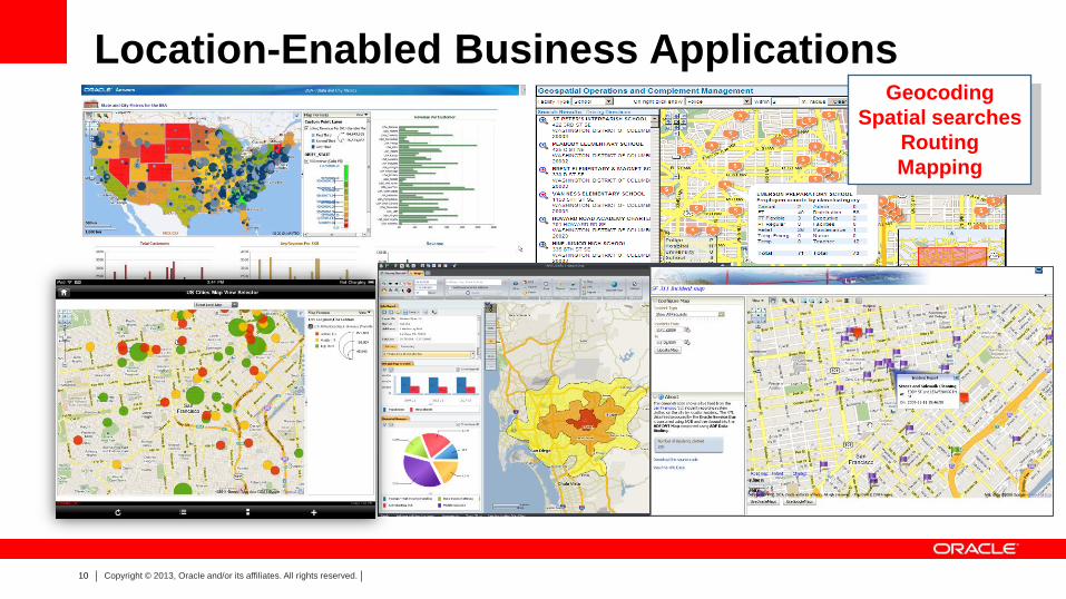
Location-Enabled Business Applications Geocoding
Spatial searches
Routing
Mapping
11 Copyright © 2013, Oracle and/or its affiliates. All rights reserved.
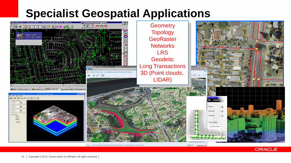
Specialist Geospatial Applications Geometry
Topology
GeoRaster
Networks
LRS
Geodetic
Long Transactions
3D (Point clouds,
LIDAR)
12 Copyright © 2013, Oracle and/or its affiliates. All rights reserved.
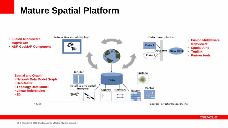
Mature Spatial Platform
• Fusion Middleware
MapViewer
• ADF GeoMAP Component
Spatial and Graph
• Network Data Model Graph
• GeoRaster
• Topology Data Model
• Linear Referencing
• 3D
• Fusion Middleware
MapViewer
• Spatial APIs
• Toplink
• Partner tools
13 Copyright © 2013, Oracle and/or its affiliates. All rights reserved.
Goals for Spatial Features
14 Copyright © 2013, Oracle and/or its affiliates. All rights reserved.
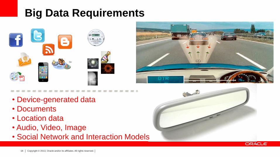
Big Data Requirements
• Device-generated data
• Documents
• Location data
• Audio, Video, Image
• Social Network and Interaction Models
15 Copyright © 2013, Oracle and/or its affiliates. All rights reserved.
Advances with Oracle Database 12c New Spatial Features
Dramatic
Performance
Simplified
Application
Development
16 Copyright © 2013, Oracle and/or its affiliates. All rights reserved.
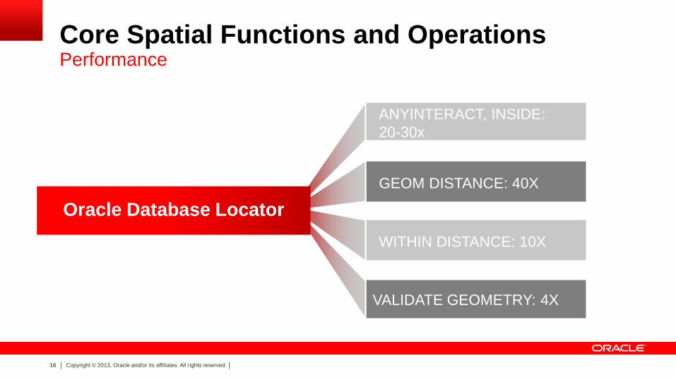
Core Spatial Functions and Operations
Performance
VALIDATE GEOMETRY: 4X
ANYINTERACT, INSIDE:
20-30x
GEOM DISTANCE: 40X
WITHIN DISTANCE: 10X
Oracle Database Locator
17 Copyright © 2013, Oracle and/or its affiliates. All rights reserved.
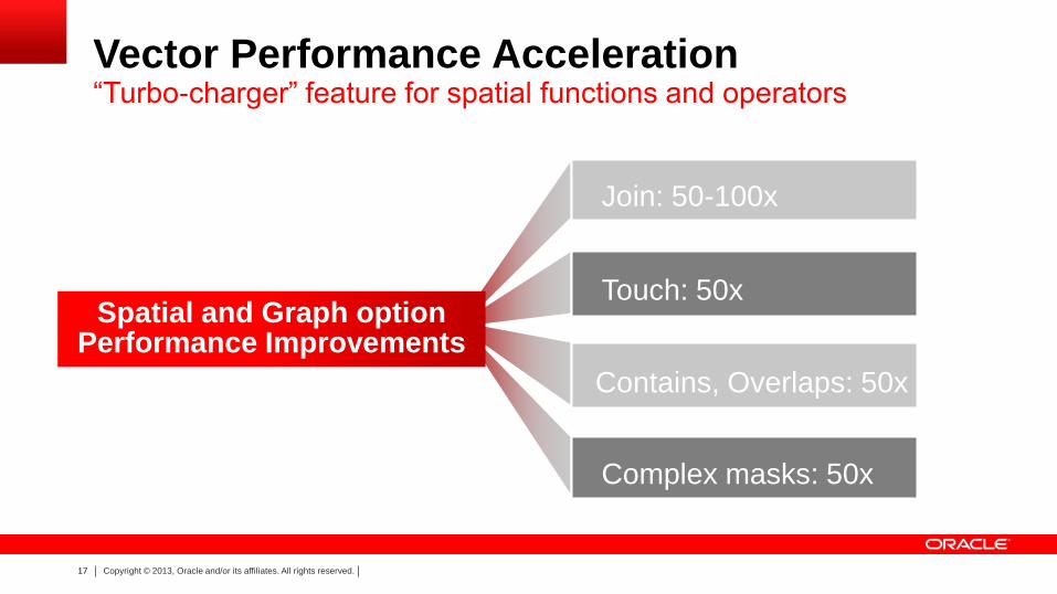
Vector Performance Acceleration “Turbo-charger” feature for spatial functions and operators
Join: 50-100x
Touch: 50x
Complex masks: 50x
Spatial and Graph option Performance Improvements
Contains, Overlaps: 50x
18 Copyright © 2013, Oracle and/or its affiliates. All rights reserved.
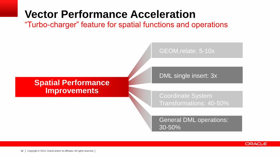
Vector Performance Acceleration “Turbo-charger” feature for spatial functions and operations
GEOM.relate: 5-10x
DML single insert: 3x
Coordinate System
Transformations: 40-50%
General DML operations:
30-50%
Spatial Performance Improvements
19 Copyright © 2013, Oracle and/or its affiliates. All rights reserved.
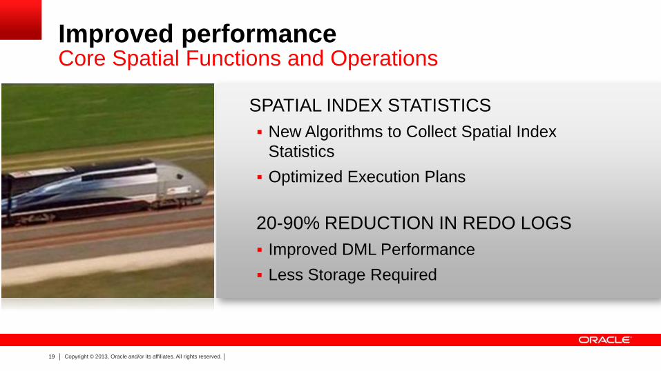
New Algorithms to Collect Spatial Index
Statistics
Optimized Execution Plans
20-90% REDUCTION IN REDO LOGS
Improved DML Performance
Less Storage Required
SPATIAL INDEX STATISTICS
Improved performance Core Spatial Functions and Operations
20 Copyright © 2013, Oracle and/or its affiliates. All rights reserved.
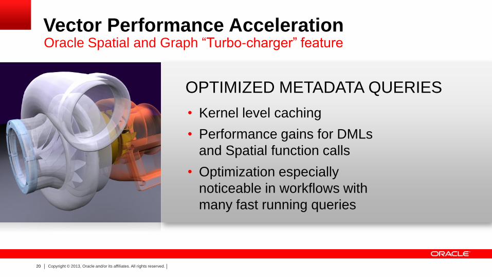
OPTIMIZED METADATA QUERIES
Vector Performance Acceleration
• Kernel level caching
• Performance gains for DMLs
and Spatial function calls
• Optimization especially
noticeable in workflows with
many fast running queries
Oracle Spatial and Graph “Turbo-charger” feature

21 Copyright © 2013, Oracle and/or its affiliates. All rights reserved.
• MANY RASTER FUNCTIONS CAN
PARALLELIZE
• SERIAL OPERATIONS PERFORM
UP TO 3X FASTER
• SCALES TO OVER 100X FASTER
ON HIGHLY PARALLEL SYSTEMS
Parallel Raster Operations
SDO_GEOR_RA.classify
SDO_GEOR_RA.findCells
SDO_GEOR_RA.rasterMathOp
SDO_GEOR_RA.rasterUpdate
SDO_GEOR_AGGR.mosaicSubset
SDO_GEOR.generatePyramid
22 Copyright © 2013, Oracle and/or its affiliates. All rights reserved.
US Army Corps of Engineers is making extensive use of the Point Cloud data type in Oracle Database Spatial and Graph option to store, retrieve, subset and analyze LiDAR data used to model 3D landscapes to support in-theatre, mission-critical DoD operations. … [W]e are storing more than 150Tb of data including 100Tb of point cloud data (with more on the way). A single instance currently stores more than 1 Trillion points,” said Michael Smith, US Army Corp, Remote Sensing Center. The enhancements to Oracle Spatial and Graph in Oracle Database 12c have dramatically increased scalability for multisession point cloud creation and provide a considerable savings of storage space.
Michael Smith US Army Corp, Remote Sensing Center
3D Point Cloud data

23 Copyright © 2013, Oracle and/or its affiliates. All rights reserved.
Advances with Oracle Database 12c Spatial Features
Dramatic
Performance
Simplified
Application
Development
24 Copyright © 2013, Oracle and/or its affiliates. All rights reserved.
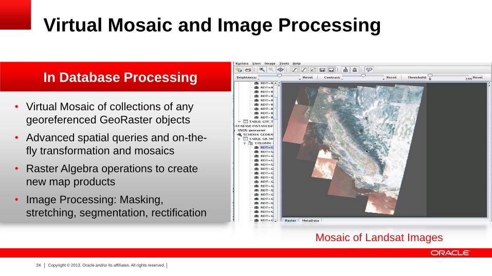
• Virtual Mosaic of collections of any
georeferenced GeoRaster objects
• Advanced spatial queries and on-the-
fly transformation and mosaics
• Raster Algebra operations to create
new map products
• Image Processing: Masking,
stretching, segmentation, rectification
In Database Processing
Virtual Mosaic and Image Processing
Mosaic of Landsat Images
25 Copyright © 2013, Oracle and/or its affiliates. All rights reserved.
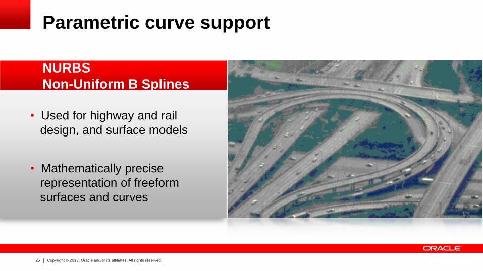
• Used for highway and rail
design, and surface models
• Mathematically precise
representation of freeform
surfaces and curves
Parametric curve support
NURBS
Non-Uniform B Splines
26 Copyright © 2013, Oracle and/or its affiliates. All rights reserved.
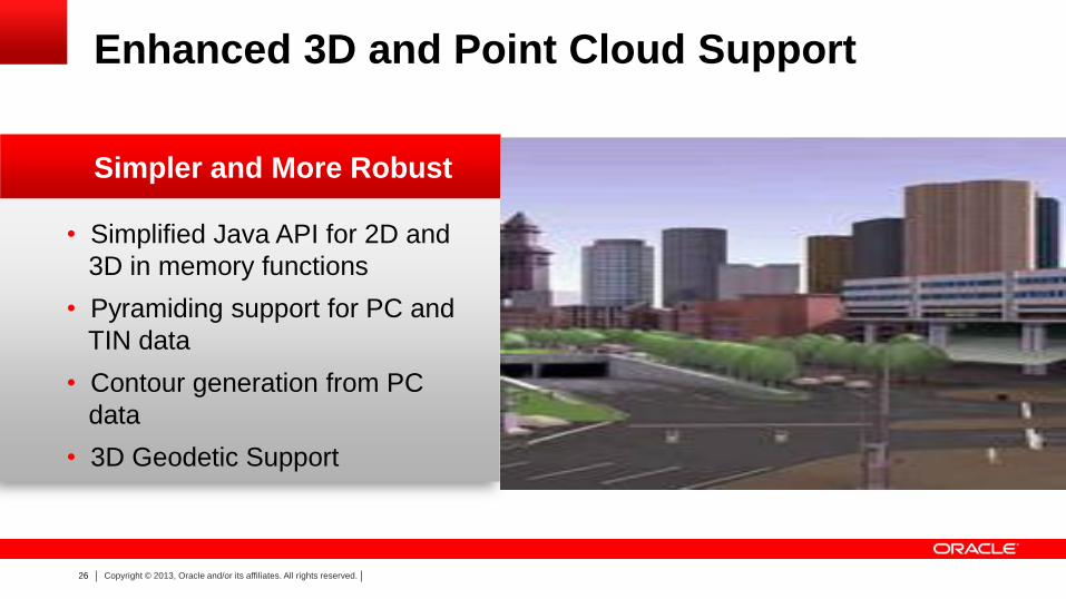
• Simplified Java API for 2D and
3D in memory functions
• Pyramiding support for PC and
TIN data
• Contour generation from PC
data
• 3D Geodetic Support
Enhanced 3D and Point Cloud Support
Simpler and More Robust
27 Copyright © 2013, Oracle and/or its affiliates. All rights reserved.
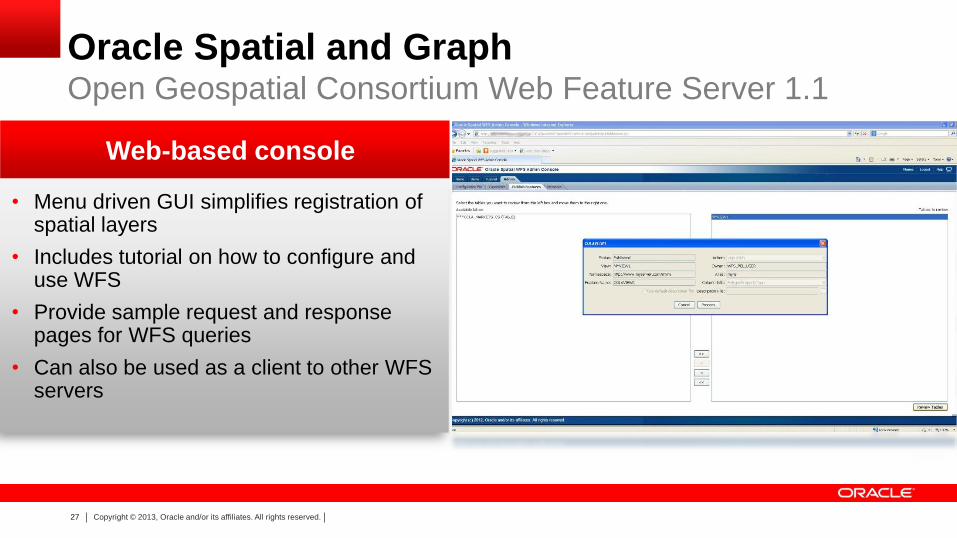
• Menu driven GUI simplifies registration of spatial layers
• Includes tutorial on how to configure and use WFS
• Provide sample request and response pages for WFS queries
• Can also be used as a client to other WFS servers
Web-based console
Oracle Spatial and Graph Open Geospatial Consortium Web Feature Server 1.1
28 Copyright © 2013, Oracle and/or its affiliates. All rights reserved.
Summary of New Spatial Features
Vector Performance Acceleration
Parallel GeoRaster and Enhanced Raster Operations
Parametric Curve Data Type
Extended 3D and Point Cloud data type functionality
Web Feature Server Console
29 Copyright © 2013, Oracle and/or its affiliates. All rights reserved.
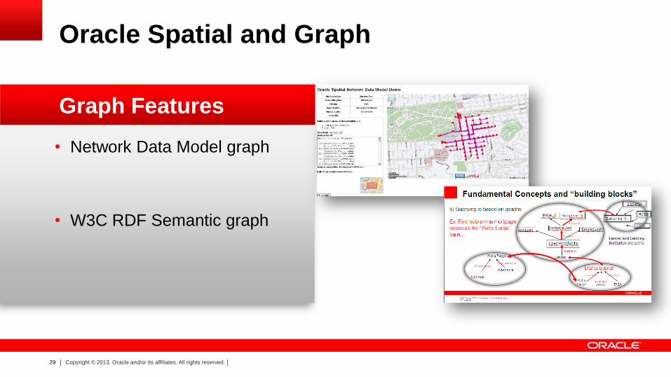
• Network Data Model graph
• W3C RDF Semantic graph
Graph Features
Oracle Spatial and Graph
30 Copyright © 2013, Oracle and/or its affiliates. All rights reserved.
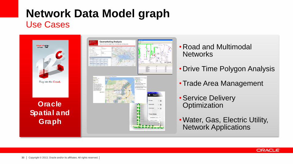
Network Data Model graph
•Road and Multimodal Networks
•Drive Time Polygon Analysis
•Trade Area Management
•Service Delivery Optimization
•Water, Gas, Electric Utility, Network Applications
Use Cases
Oracle
Spatial and
Graph
31 Copyright © 2013, Oracle and/or its affiliates. All rights reserved.
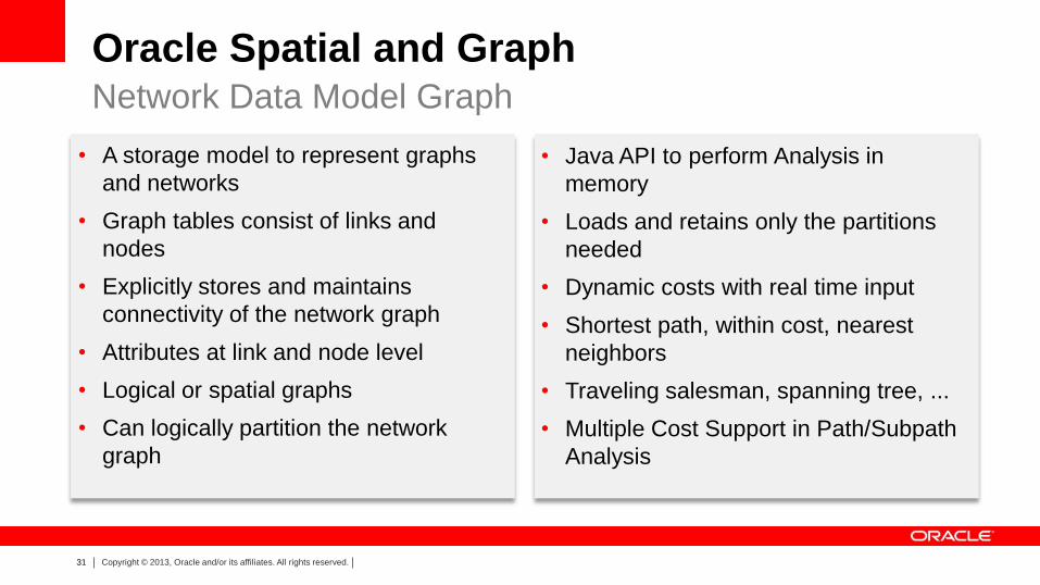
Oracle Spatial and Graph Network Data Model Graph
• A storage model to represent graphs
and networks
• Graph tables consist of links and
nodes
• Explicitly stores and maintains
connectivity of the network graph
• Attributes at link and node level
• Logical or spatial graphs
• Can logically partition the network
graph
• Java API to perform Analysis in
memory
• Loads and retains only the partitions
needed
• Dynamic costs with real time input
• Shortest path, within cost, nearest
neighbors
• Traveling salesman, spanning tree, ...
• Multiple Cost Support in Path/Subpath
Analysis
32 Copyright © 2013, Oracle and/or its affiliates. All rights reserved.
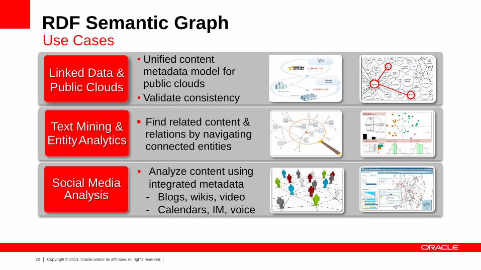
RDF Semantic Graph
• Unified content metadata model for public clouds
• Validate consistency
Social Media Analysis
Analyze content using
integrated metadata
- Blogs, wikis, video
- Calendars, IM, voice
Linked Data &
Public Clouds
Find related content & relations by navigating connected entities
Text Mining & Entity Analytics
Use Cases
33 Copyright © 2013, Oracle and/or its affiliates. All rights reserved.
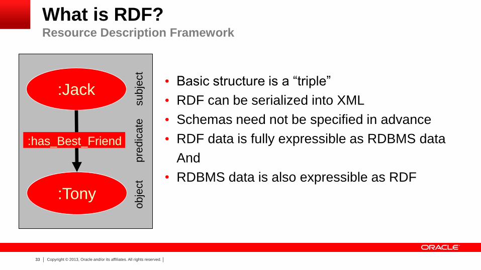
• Basic structure is a “triple”
• RDF can be serialized into XML
• Schemas need not be specified in advance
• RDF data is fully expressible as RDBMS data
And
• RDBMS data is also expressible as RDF
:Tony
:Jack
:has_Best_Friend subje
ct
pre
dic
ate
obje
ct
What is RDF? Resource Description Framework
34 Copyright © 2013, Oracle and/or its affiliates. All rights reserved.
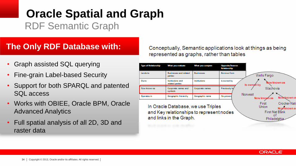
• Graph assisted SQL querying
• Fine-grain Label-based Security
• Support for both SPARQL and patented
SQL access
• Works with OBIEE, Oracle BPM, Oracle
Advanced Analytics
• Full spatial analysis of all 2D, 3D and
raster data
The Only RDF Database with:
Oracle Spatial and Graph RDF Semantic Graph
35 Copyright © 2013, Oracle and/or its affiliates. All rights reserved.
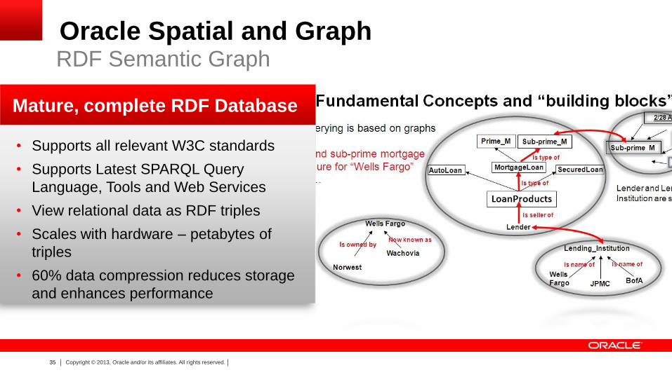
• Supports all relevant W3C standards
• Supports Latest SPARQL Query
Language, Tools and Web Services
• View relational data as RDF triples
• Scales with hardware – petabytes of
triples
• 60% data compression reduces storage
and enhances performance
Mature, complete RDF Database
Oracle Spatial and Graph RDF Semantic Graph
36 Copyright © 2013, Oracle and/or its affiliates. All rights reserved.
Advances with Oracle Database 12c Graph Features
Dramatic
Performance
Simplified
Application
Development
37 Copyright © 2013, Oracle and/or its affiliates. All rights reserved.
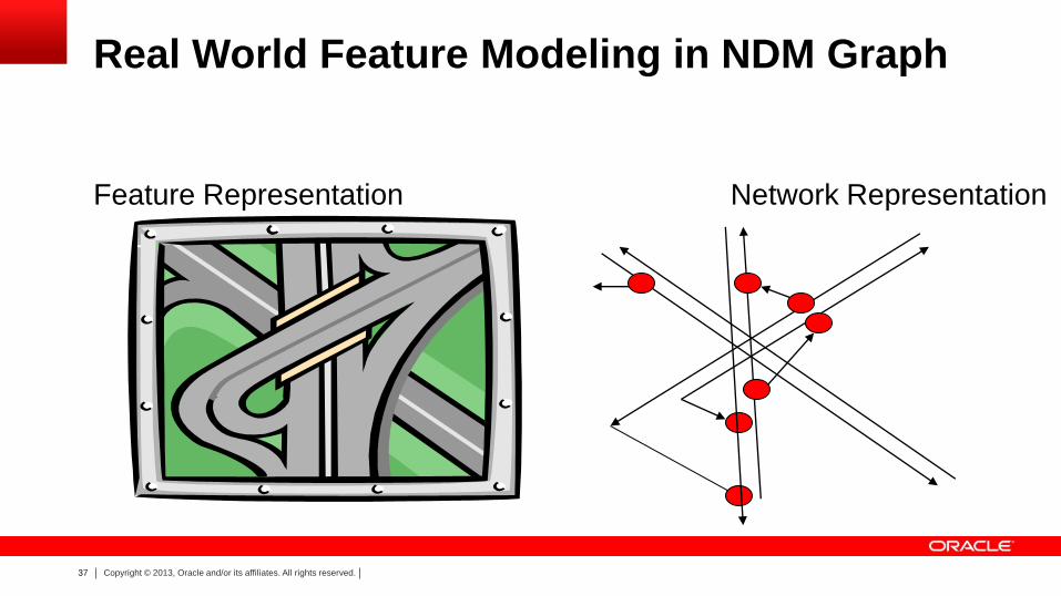
Real World Feature Modeling in NDM Graph
Feature Representation Network Representation
38 Copyright © 2013, Oracle and/or its affiliates. All rights reserved.
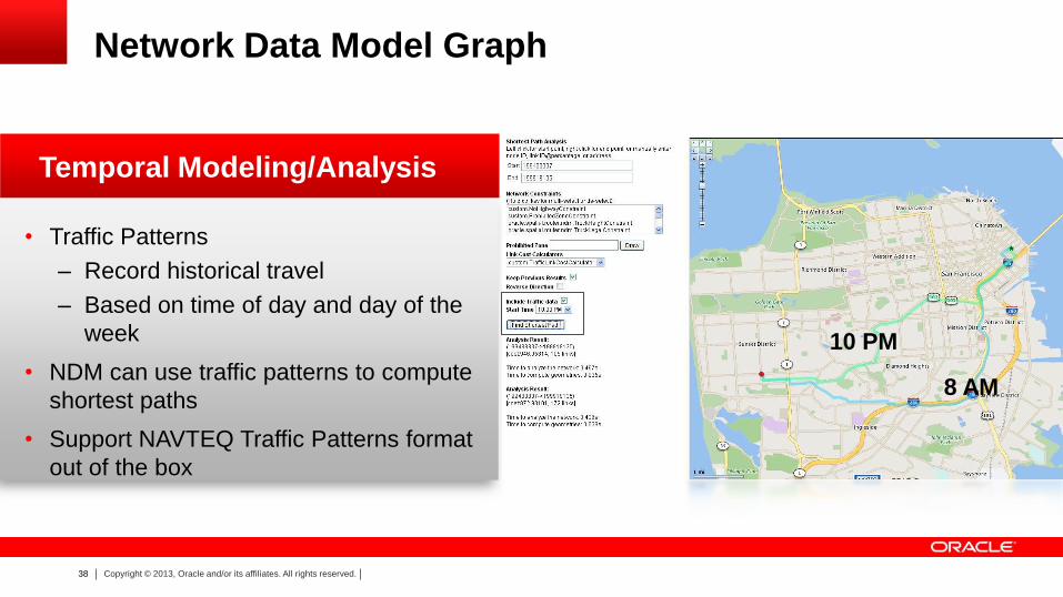
10 PM
8 AM
• Traffic Patterns
– Record historical travel
– Based on time of day and day of the
week
• NDM can use traffic patterns to compute
shortest paths
• Support NAVTEQ Traffic Patterns format
out of the box
Temporal Modeling/Analysis
Network Data Model Graph
39 Copyright © 2013, Oracle and/or its affiliates. All rights reserved.
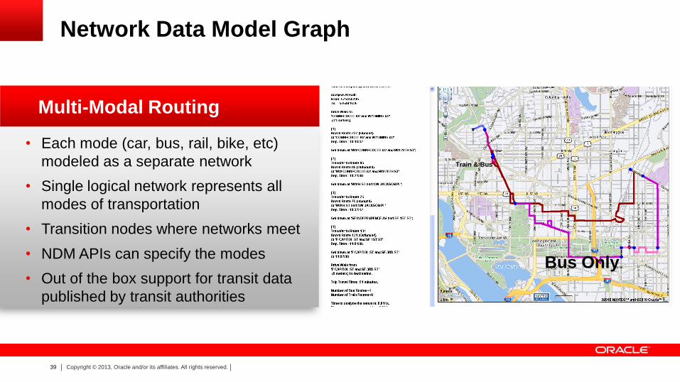
• Each mode (car, bus, rail, bike, etc)
modeled as a separate network
• Single logical network represents all
modes of transportation
• Transition nodes where networks meet
• NDM APIs can specify the modes
• Out of the box support for transit data
published by transit authorities
Multi-Modal Routing
Train & Bus
Bus Only
Network Data Model Graph
40 Copyright © 2013, Oracle and/or its affiliates. All rights reserved.
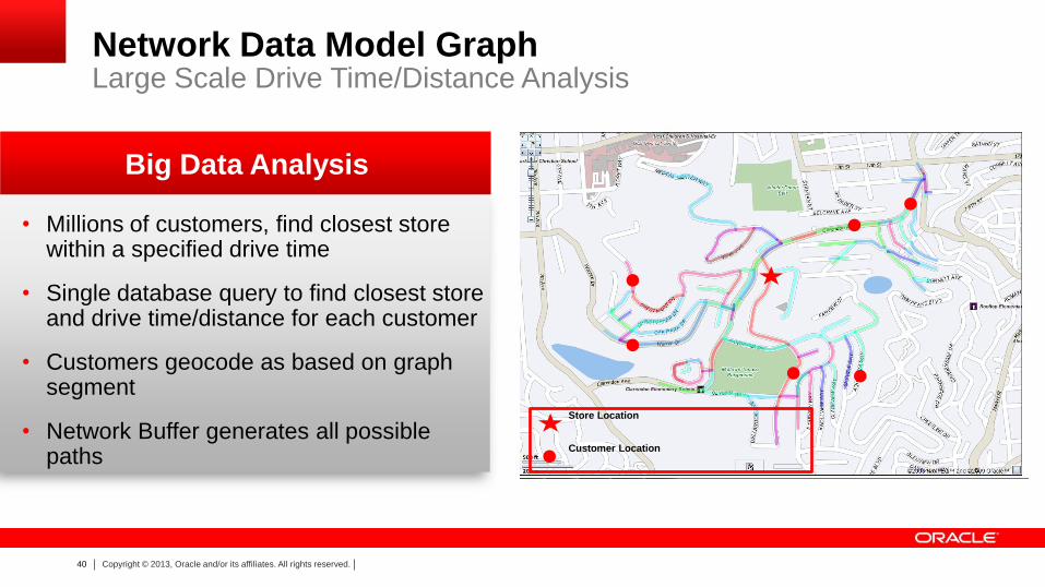
• Millions of customers, find closest store within a specified drive time
• Single database query to find closest store and drive time/distance for each customer
• Customers geocode as based on graph segment
• Network Buffer generates all possible paths
Big Data Analysis
Large Scale Drive Time/Distance Analysis
Store Location
Customer Location
Network Data Model Graph
41 Copyright © 2013, Oracle and/or its affiliates. All rights reserved.
New functions in Oracle Database 12c
• RDF views on relational tables
– RDF views can be created on a set of relational tables and/or views
– SPARQL queries access data from both a relational and RDF store
– Allows filtering of data in a relational store based upon graph analysis
– Support RDF view creation using
• Direct Mapping: simple and straightforward to use
• R2RML Mapping: customizations allowed
RDF Semantic Graph
42 Copyright © 2013, Oracle and/or its affiliates. All rights reserved.
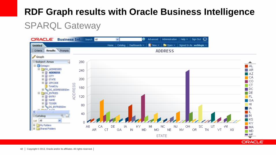
RDF Graph results with Oracle Business Intelligence
SPARQL Gateway
43 Copyright © 2013, Oracle and/or its affiliates. All rights reserved.
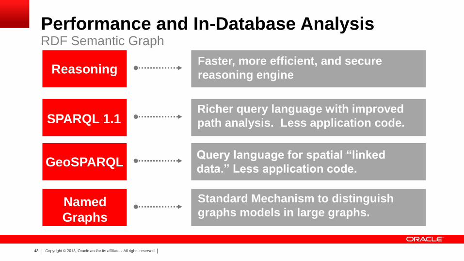
Performance and In-Database Analysis RDF Semantic Graph
SPARQL 1.1
Named
Graphs
Standard Mechanism to distinguish
graphs models in large graphs.
Reasoning Faster, more efficient, and secure
reasoning engine
GeoSPARQL
Richer query language with improved
path analysis. Less application code.
Query language for spatial “linked
data.” Less application code.
44 Copyright © 2013, Oracle and/or its affiliates. All rights reserved.
Summary of New Graph Features
Network Data Model graph
– Real World Feature Modeling
– Multimodal Routing, Temporal Modeling and Analysis
– Large Scale Drive Time/Distance Analysis
RDF Semantic Graph
– RDF views on relational tables
– SPARQL 1.1, GeoSPARQL, SPARQL Gateway
– Enhanced Reasoning and Security
– Named Graphs
45 Copyright © 2013, Oracle and/or its affiliates. All rights reserved.
Oracle Exadata Spatial and Graph Resides in Oracle Database Kernel
• Code resides in Database Address Space
• Spatial Index operations performed in
Database SGA
• Spatial operators are parallel enabled by
default and execute in Database Address
Space for maximum scalability
• Spatial and Graph analysis and data
models seamlessly exploit Database
security, compression, partitioning services
46 Copyright © 2013, Oracle and/or its affiliates. All rights reserved.
Oracle Exadata Faster Index and Query Operations
• Spatial operations are performed in
Database System Global Area
memory
• Spatial data warehouse performance
increases of up to 100x faster
• Spatial Box and Distance queries up
to 25x faster
47 Copyright © 2013, Oracle and/or its affiliates. All rights reserved.
Oracle Exadata Extreme Compression for Point, Line and Polygon Data Sets
• Point, Line and Polygon geometries can all
benefit from EHCC
• Lines and Polygons, they must be stored
inline (less than 4K in size).
• Options include:
– COMPRESS FOR QUERY LOW
– COMPRESS FOR QUERY HIGH
– COMPRESS FOR ARCHIVE LOW
– COMPRESS FOR ARCHIVE HIGH
48 Copyright © 2013, Oracle and/or its affiliates. All rights reserved.
Oracle Exadata Extreme Scalability for Millions of Spatial Objects
• Millions of spatial objects evaluated in
minutes
– Point in polygon analysis
– Polygon to polygon analysis
– Deviation from route
– Distance covered
• Millions of Spatial objects ingested in minutes
– Weather readings
– Traffic readings
– Sensor readings
49 Copyright © 2013, Oracle and/or its affiliates. All rights reserved.
Oracle Exadata High Performance RDF Graph Workloads
• RDF Semantic Graph is designed for
the Exadata architecture
• 3x faster inferencing and querying
• Parallel load, inference and query
• Inferencing accelerated with Hybrid
Columnar Compression
• Queries faster with OLTP index
compression on B-tree indexes
50 Copyright © 2013, Oracle and/or its affiliates. All rights reserved.
Oracle Exadata Summary
• Only Oracle Spatial and Graph is
designed for the Exadata architecture
• Breaks new boundaries for ingesting
spatial data
• Data warehouse spatial query
performance up to 100x faster
• Spatial box and distance queries up
to 25x faster
• Accelerated parallel, compressed
RDF Graph workloads
51 Copyright © 2013, Oracle and/or its affiliates. All rights reserved.
Oracle Spatial and Graph
Proven, industry-leading technology
Dramatically improved performance
Simpler, more scalable applications
Engineered for Exadata