Embed Size (px)
Citation preview
Harpers Ferry Center National Park Service U.S. Department of the Interior
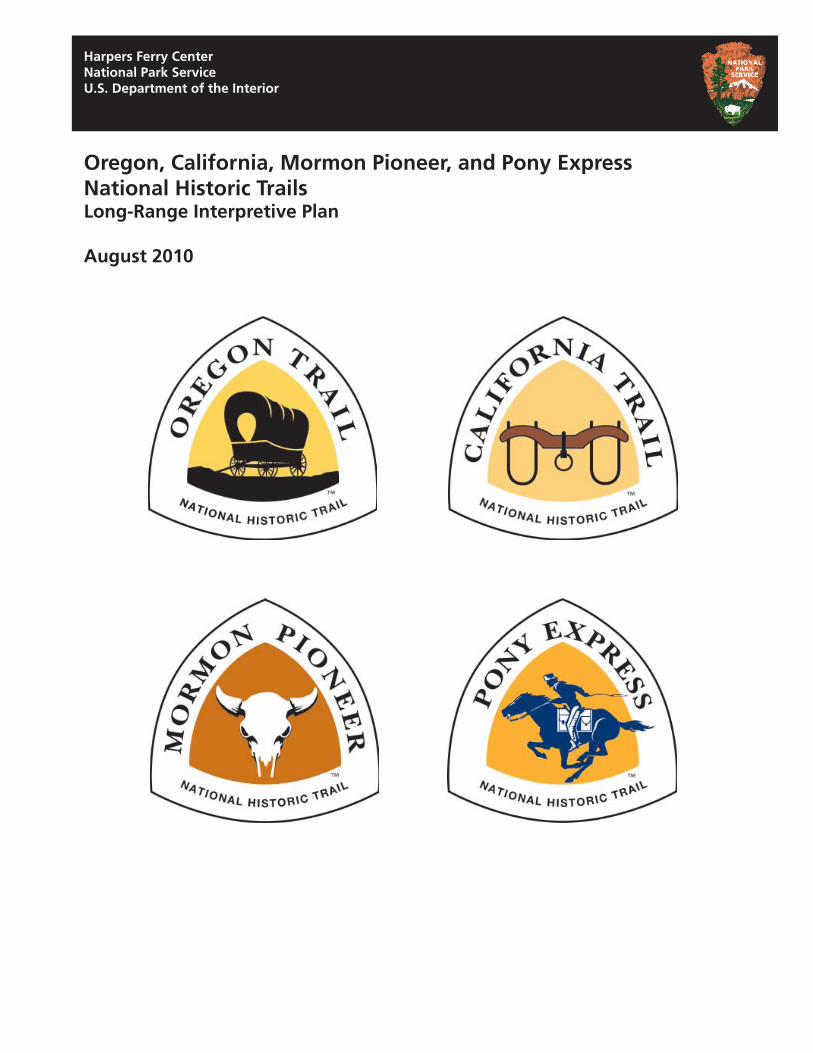
Oregon, California, Mormon Pioneer, and Pony Express National Historic Trails Long-Range Interpretive Plan
August 2010
Oregon, California, Mormon Pioneer, and Pony Express National Historic Trails Long-Range Interpretive Plan
August 2010
Prepared by: National Trails Intermountain Region & Harpers Ferry Center Interpretive Planning
National Park Service U.S. Department of the Interior
Photo Credits: National Park Service unless otherwise noted
Table of Contents
Introduction
Planning Background
Planning Foundation Vision for the Trails 1
Purpose and Significance of the Trails 1
Trails-Wide Interpretive Themes 6
Trail-Specific Sub Themes 8
Interpretive Program Goals 10
Partnership Expectations 11
Recommendations 12 Technical Assistance 13
New Technology 15
Communications and Marketing 15
Topics and Audiences 17
Relationship Building 18
Special Populations 18
Staffing Needs 19
Planning Team 19
Appendices 20 Appendix A: Representative Trail-Related Visitor Centers and Interpretive Sites 21
Appendix B: Decade Goals for the National Trails 24
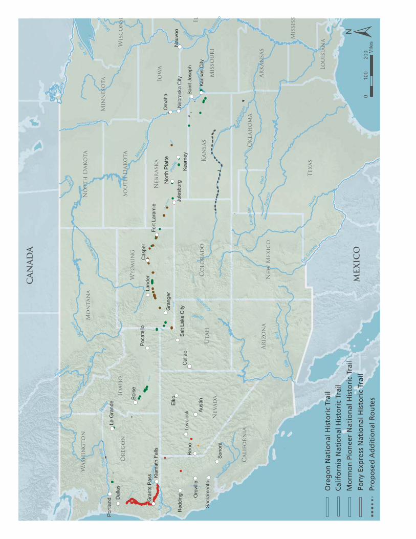
CANADA
Rai
ny
!( !(
!(
!(
!(
!(
!(
!(
!(
!(
!(
!(
!(
!(
!(
!(
!(
!(
!(
!(
!(
!( !(
Bois
e
La G
rand
ePo
rtlan
d
MEXICO
Miss
ouri
!(
!(
!(
!(
!(
Aust
in
Cal
lao
Nor
th P
latte
!(Nau
voo
Miss
issip
piArkansas
Gila
Re d
Br
azos
Snak
e
Mis
sour
i
Rio
Grand
e
Pecos
St. C
lair
Canadia
n
Plat
te
Gr e
e n
Sal t
Nor
thP
latte
Colu
mbi
a
Yello
wst
one
Col
orad
o
Cla
rkFo
rk
Klam
ath
King
s
Wi s
co n s
i n
Bear
Sa cramento
Willa
met
te
Flat
head
SanJoaquin
Souris
Red River of the North
Pend Oreille
Texa
s
Mo
ntan
a
Utah
Nevad
a
Id
ah
o
Califo
rn
ia
Ar
izo
na
Or
eg
on
Io
wa
Kan
sas
Wyo
min
g
Co
lo
rad
o
New
M
exic
o
Min
neso
ta
Nebr
ask
a
Misso
ur
i
Il
Ok
lah
om
a
Wash
in
gto
n
So
uth
D
ak
ota
Wisc
on
si
No
rth
D
ak
ota
Ar
kan
sas
Mississ
Lo
uisian
a
Ren
o
Elko
O
mah
a
Sono
ra
Cas
per
Land
er
Dal
las
Kear
ney
Gra
nger
Red
ding O
rovi
lle
Love
lock
Ju
lesb
urg
Poca
tello
Sacr
amen
to
Kans
as C
ity
Gra
nts
Pas
s
Sain
t Jos
eph
Fort
Lara
mie
Neb
rask
a C
ity
Klam
ath
Falls
Salt
Lake
City
Miss
issipp
Arka
nsas
Gila
Red
Br
azos
Snak
e
Miss
ouri
RioGra
nde
Peco
s
St. C
lair
Can
adia
n
Rai
ny
Plat
te
Green
Salt
Col
umbi
a Ye
llows
tone
Colorad
o
Illinois
Cla
rkFo
rk
Kl a m
a t h
Kings
Wisc
onsi
Flathead
Sour
is
Pro
po
sed
Ad
dit
ion
al R
ou
tes
± 0
100
200 M
iles
Ore
go
n N
atio
nal
His
tori
c Tr
ail
Cal
ifo
rnia
Nat
ion
al H
isto
ric
Trai
l
Mo
rmo
n P
ion
eer
Nat
ion
al H
isto
ric
Trai
l
Pon
y Ex
pre
ss N
atio
nal
His
tori
c Tr
ail
Introduction
The Oregon and Mormon Pioneer Trails were authorized as national historic trails by Congress in 1978 (National Trails System Act, section 5 (a) (3) and (4) respectively). In 1992 Congress established the California and Pony Express National Historic Trails (National Trails System Act, section 5 (a) (18) and (19) respectively). The National Trails System Act also authorizes the secretary of the interior to enter into cooperative agreements with states, local governments, landowners, and private organizations or individuals to help operate, develop, and maintain trail segments outside federal ownership. These cooperative agreements can include provisions for limited financial or technical assistance to encourage participation in trail management activities. Cooperative agreements can also secure volunteer assistance for the protection and management of the trails and their related resources.
The National Trails Intermountain Region (NTIR) administers these four trails, but does not manage trail resources on a day-to-day basis. The responsibility for managing trail resources remains in the hands of current trail managers at the federal, state, local, and private levels. A representative listing of the trail-related visitor centers and interpretive sites on the four trails appears in Appendix A.
The offices of NTIR are located in Santa Fe, New Mexico, and Salt Lake City, Utah. These offices serve as a clearinghouse for comprehensive trail resource data, provide information on different resource management strategies used at sites throughout the corridors, and guide the development of the interpretive program for the trails. In addition, these offices can assist partners in overall coordination efforts, as well as the preparation of memorandums of understanding, cooperative agreements, and site certifi cations.
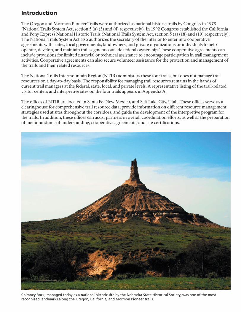
Chimney Rock, managed today as a national historic site by the Nebraska State Historical Society, was one of the most recognized landmarks along the Oregon, California, and Mormon Pioneer trails.
Planning Background
As required by the National Trails System Act, a Comprehensive Management and Use Plan was completed for the four national historic trails in 1999. This plan provides broad-based policies, guidelines, and standards for administering the four trails to ensure the protection of trail resources, their interpretation, and their continued use. Subsequent planning efforts tier off of the Comprehensive Management and Use Plan and provide more detailed recommendations and guidance. Among the many recommendations in the Comprehensive Management and Use Plan is one calling for a trails-wide interpretive plan.
A long-range interpretive plan (LRIP) provides an overall vision and basis for decision-making relating to interpretation and education media. The LRIP is a component of a Comprehensive Interpretive Plan (CIP), which is described in NPS Directors Orders-6. To date, no comprehensive interpretive planning has been conducted for any of the four national historic trails. Interpretive media and program development has generally been the result of individual interest and available funding, without an overall strategy for identifying and meeting specific goals. Comprehensive planning also would ensure that interpretation of any new resources on routes added to the designated trails would complement existing media and programs.
In March of 2009, the Omnibus Public Land Act became Public Law 111-11. This law calls for a number of new suitability and feasibility studies that would make recommendations on proposed additions to the existing trails. These studies are to begin in 2010, and will undoubtedly have a number of implications for this LRIP.
Using the trails-wide and trail-specific purpose and significance statements, along with the primary interpretive themes and visitor experience goals, this LRIP articulates a vision for the interpretive future of the trails, and makes recommendations for ways that NTIR can better serve their many partners and audiences, and be successful in achieving management goals and helping people make meaningful connections with resources and stories.
Work on this document was initiated in July 2007, with a planning workshop held in Salt Lake City. A Project Agreement between the Harpers Ferry Center and NTIR was signed in January 2008. A second workshop, to develop plan recommendations, was held in Salt Lake City in July 2009.
This LRIP is different from those usually developed for individual parks or sites. This is because the NTIR administers the national historic trails, but does not manage any specific trail-related sites. In addition, the huge geographic areas traversed by the trails, along with the large number of trail partners made it impossible (with existing funds) to visit or address each site and to meet with all of the partners.
Despite these issues, however, participation of trail partners was deemed critical in the development of this LRIP. To gain partner participation in the process in the most economical way, the planning team developed two information gathering strategies. First, a list of seven questions was developed and emailed to trail partners and affi liated federally recognized American Indian tribes regarding interpretive and educational topics. Second, members of the planning team conducted a workshop in 2008 at the annual meeting of the Oregon and California Trail Association (OCTA), and elicited comments from members of the National Pony Express Association (NPEA). A representative selection of significantly impacted American Indian tribes that are affiliated with the trails were contacted. The information gathered was then tabulated and used in the development of the recommendations.
The specific questions posed to the trail partners and tribes were:
1) In your opinion, what areas (topics) of trail interpretation need the greatest attention?
2) What ideas do you have to better connect the information and interpretation about the many trail sites?
3) Other than continuing to provide project funding, technical support and guidance, what can the National Park Service trail offices (Santa Fe and Salt Lake City) do to better promote the trail as a whole, or your site(s) in particular?
4) How can we attract and engage broader and more diverse audiences to the trails’ stories?
5) How can interpretation serve to get children interested in trail history – getting kids on the trail and having a memorable experience?
6) What improvements can be made in getting trail information to prospective and virtual visitors?
7) In the next 5-10 years, what would you like to see developed in the areas of new interpretive/educational media or programs for the trails?
This LRIP is not an end in itself, but rather it establishes an overall framework for the planning and design of interpretive and education media and programs for the next five to ten years. It also provides a list of action items for ways NTIR can work to better help the trail partners in the areas of technical assistance, new technologies, communications and marketing, relationship building, and addressing diverse audiences.
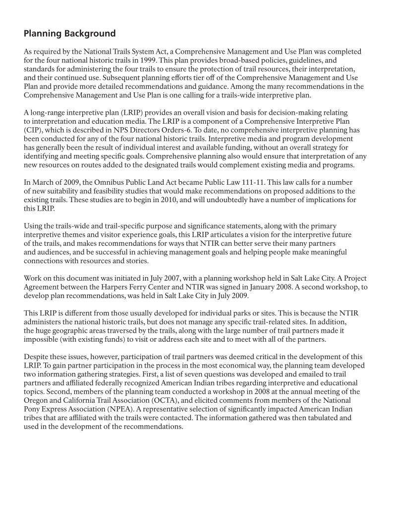
Pilot Peak, located in the Pilot Range along the Utah-Nevada border, served not only as a guiding landmark, but also supplied life-sustaining water for pioneer wagon trains after crossing the Great Salt Lake Desert on the Hastings Cutoff of the California Trail.
Planning Foundation
Planning Foundation
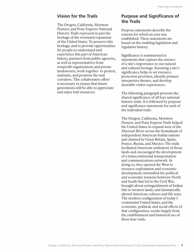
Vision for the Trails
The Oregon, California, Mormon Pioneer, and Pony Express National Historic Trails represent in part the heritage of the westward expansion of the United States. To preserve this heritage, and to provide opportunities for people to understand and experience this part of American history, partners from public agencies, as well as representatives from nonprofit organizations and private landowners, work together to protect, maintain, and promote the trail corridors. This collaborative eff ort is necessary to ensure that future generations will be able to appreciate and enjoy trail resources.
Purpose and Signifi cance of the Trails
Purpose statements describe the reasons for which an area was established. These statements are based on the enabling legislation and legislative history.
Significance is summarized in statements that capture the essence of a site’s importance to our natural and cultural heritage. Knowing a site’s significance helps to set resource protection priorities, identify primary interpretive themes, and develop desirable visitor experiences.
The following paragraph presents the shared significance of all four national historic trails. It is followed by purpose and significance statements for each of the individual trails.
The Oregon, California, Mormon Pioneer, and Pony Express Trails helped the United States to expand west of the Missouri River across the homelands of independent American Indian nations and claimed by Great Britain, Spain, France, Russia, and Mexico. The trails facilitated American settlement of those lands and encouraged the development of a transcontinental transportation and communications network. In doing so, they opened the West to resource exploitation and economic development, intensified the political and economic tensions between North and South that led to the Civil War, brought about extinguishment of Indian title to western lands, and dramatically altered American cultures and life ways. The modern configuration of today’s continental United States, and the economic, political, and social eff ects of that configuration, results largely from the establishment and historical use of these four trails.
Oregon, California, Mormon Pioneer, and Pony Express National Historic Trails Long-Range Interpretive Plan I 1
Planning Foundation
Oregon National Historic Trail
The purposes of the trail are to:
• identify, preserve, and interpret the sites, route, and history of the OregonTrail for all people to experience and understand.
• recognize the westward movement of emigrants to the Oregon country as an important chapter of our national heritage.
The trail is signifi cant because:
• it was the first trail that demonstrates the feasibility of moving families, possessions, and cultures by wheeled vehicles across an area previously perceived as impassable.
• it was the corridor for one of the largest and longest emigration of families in the history of the United States.
• it is a symbol of American westward traditional migration embodied in traditional concepts of pioneer spirit, patriotism, and rugged individualism.
• it strengthened the United States’ claim to the Pacifi c Northwest.
• use of the trail and resulting settlement signifi cantly contributed to changes in peoples, cultures, and landscapes.
• the route, followed earlier by American Indians and western explorers and travelers, provided a foundation for American transportation and communication systems west of the Mississippi River.
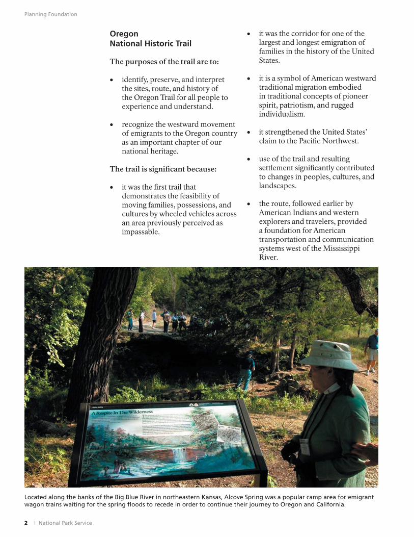
Located along the banks of the Big Blue River in northeastern Kansas, Alcove Spring was a popular camp area for emigrant wagon trains waiting for the spring floods to recede in order to continue their journey to Oregon and California.
2 I National Park Service
Planning Foundation
California National Historic Trail
The purposes of the trail are to:
• enable all people to envision and experience, in a coherent and convenient way, the heritage and impacts of the western overland migration.
• encourage preservation of its history and physical remains.
The trail is signifi cant because:
• it is one of the major highways of the 19th century, which provided a 2,400-mile path for emigrants to the West. The route itself and the resulting settlement signifi cantly contributed to changes in people, cultures, and landscapes.
• one of the largest overland migrations in American westward expansion used the trail as a result of the California gold rush.
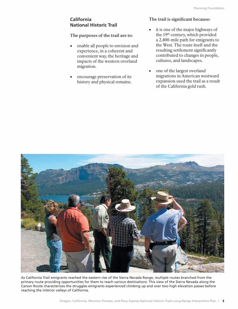
As California Trail emigrants reached the eastern rise of the Sierra Nevada Range, multiple routes branched from the primary route providing opportunities for them to reach various destinations. This view of the Sierra Nevada along the Carson Route characterizes the struggles emigrants experienced climbing up and over two high elevation passes before reaching the interior valleys of California.
Oregon, California, Mormon Pioneer, and Pony Express National Historic Trails Long-Range Interpretive Plan I 3
Planning Foundation
Mormon Pioneer National Historic Trail
The purposes of the trail are to:
• identify, preserve, and explain the sites, route, and history of the Mormon Pioneer Trail for all people to experience and understand.
• recognize the 19th century migration of Mormon emigrants to the Valley of the Great Salt Lake as an important aspect of our national heritage.
The trail is signifi cant because:
• the trail was used by cohesive Mormon companies seeking religious freedom, with the intent of locating their new Zion in the Far West.
• the trail was traveled/developed by communities or companies of people with the intent of bringing church members to settle the Valley of the Great Salt Lake and surrounding regions, and put a theocratic society in control of the Great Basin, and that distinctive society is still infl uential today.
• The Mormons, in using the trail in both directions, improved the route and provided assistance along the way.
• use of the trail and resulting settlement signifi cantly contributed to changes in peoples, cultures, and landscapes.
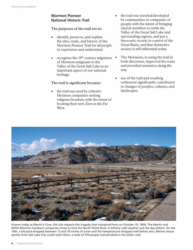
Known today as Martin’s Cove, this site respects the tragedy that transpired here on October 19, 1856. The Martin and Willie Mormon handcart companies chose to ford the North Platte River in bitterly cold weather just the day before. On the 19th, a blizzard dropped between 12 and 18 inches of snow and the temperatures dropped well below zero. Before rescue parties from Salt Lake City could reach them, a total of 576 people had perished in the bitter cold.
4 I National Park Service
Planning Foundation
Pony Express National Historic Trail
The purposes of the trail are to:
• identify, preserve, and explain the sites, route, and history of the Pony Express for all people to experience and understand.
• commemorate the rapid mail delivery that linked eastern and western states.
The trail is signifi cant because:
• the Pony Express reinforced the viability of a central United States overland communication system and was a forerunner of a transcontinental telegraph and railroad.
• the Pony Express required good organizational skills, and the horse-and-rider relay system became the
nation’s most direct and fastest means of east-west communications before completion of the telegraph system.
• the Pony Express played a vital role in aligning California with the Union by providing a link between the eastern states and California just before the Civil War; it allowed westerners to develop and maintain a sense of contact with the East at a critical time in United States history.
• the Pony Express made important contributions to journalism, commerce, and personal domestic and international communication by providing news and original documents in a timely manner.
• the legendary feats, stories, and experiences of the lone riders and station keepers supplied the bases for an enduring image of the American West.
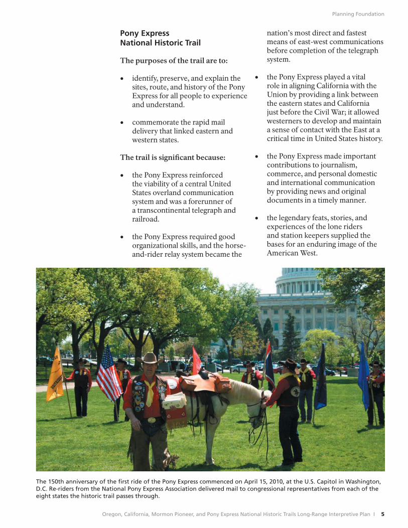
The 150th anniversary of the first ride of the Pony Express commenced on April 15, 2010, at the U.S. Capitol in Washington, D.C. Re-riders from the National Pony Express Association delivered mail to congressional representatives from each of the eight states the historic trail passes through.
Oregon, California, Mormon Pioneer, and Pony Express National Historic Trails Long-Range Interpretive Plan I 5
Planning Foundation
Trails-Wide Interpretive Themes
Primary interpretive themes are those ideas/concepts that are critical for achieving visitor understanding and appreciation of the significance of four trails. Primary themes do not include everything that may be interpreted, but they do provide the foundation from which programs and media are developed. All interpretive eff orts, through both personal and non-personal services, should relate to one or more of the primary themes. Effective interpretation results when visitors are able to connect concepts (intangibles) with resources (tangibles) and derive something meaningful from the experience.
The following interpretive themes apply to all four trails and are critical to visitor understanding and appreciation of their importance. These theme statements are followed by trail-specifi c sub-themes.
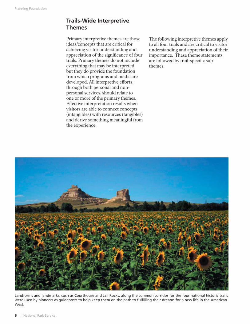
Landforms and landmarks, such as Courthouse and Jail Rocks, along the common corridor for the four national historic trails were used by pioneers as guideposts to help keep them on the path to fulfilling their dreams for a new life in the American West.
6 I National Park Service
Planning Foundation
• These corridors were the • The influx of close to 500,000 “superhighways” of westward emigrants and communications expansion during the mid-19th corridors across and into the century, a period of “manifest traditional homelands of the destiny” when the nation realized its American Indians undermined dream of stretching from ocean to the latter groups’ political and ocean. economic independence in the
• The geographically central corridor trans-Mississippi West, resulting in resource losses, disease, violence,
of these four historic trails (up the increased intertribal confl icts, and Platte, the North Platte, and the loss of lifestyle. Sweetwater Rivers to South Pass) has been called “the best natural • There was a broad range of road in the world.” Segments of intercultural contact ranging from this corridor had been used for mutually beneficial to violent thousands of years by American conflict that led to open warfare. Indians and in the mid-19th century became the transportation route • All 19th century overland travelers for successive waves of European shared similar experiences while trappers, missionaries, soldiers, traveling west: the drudgery of teamsters, stagecoach drivers, walking or riding hundreds of Pony Express riders, and overland miles, suffocating dust, violent emigrants bound for opportunity thunderstorms, mud, temperature in the Oregon territory, the Great extremes, bad weather, poor forage, Basin, and the California goldfi elds. fear of Indians, accidents, sickness,
• Though overland traffi c declined and death. These experiences — frequently recorded in journals,
dramatically after the completion diaries, and letters — became a of the transcontinental railroad part of our national heritage and in 1869, the trail corridors laid inspired a romantic movement the basis for communication and in art, literature, and cinema that transportation systems that are still has had an enormous eff ect on in use today. Railroads, modern American popular culture. highways, pipelines, and powerlines still follow the general routes of the • After surviving the journey, old emigrant trails. and reaching their destinations,
• Landforms, landmarks, forage, emigrants still faced hardship, hard work, and deprivation to realize
wood, and water dictated the paths their dreams. of migration. Numerous factors, such as weather, fl ooding rivers, • The impact to the indigenous tribes adequate pasture for draft animals, was devastating. After suff ering and water for animals and humans through the introduction of alien affected the organization and diseases and loss of homeland, outfitting of wagon trains and the the tribes were placed on Pony Express. reservations. The story of survival
of the American Indian is a story that covers all aspects of human strengths. The dreams of the emigrant may have been attained, but the dreams of American Indians were altered as well.
Oregon, California, Mormon Pioneer, and Pony Express National Historic Trails Long-Range Interpretive Plan I 7
Planning Foundation
Trail-Specific Sub Themes
Oregon California National Historic Trail National Historic Trail
• Between 1841 and 1869, more than • Between 1841 and 1869, more than 250,000 Americans traversed the 200,000 Americans traversed the OregonTrail to escape economic adversity, or to obtain better farmlands.
California Trail to escape economic adversity, obtain better farmlands, or get rich quick in the gold rush.
•
•
The OregonTrail was the harbinger of America’s westward expansion and the core of one of the largest and longest mass migrations in U.S. history.
In 1836 when Presbyterian missionaries Marcus Whitman and
• Although most of the overland emigrants to Oregon and California through 1848 sought to establish farms and permanent homes, a majority of the forty-niners were single young men, hoping to make their fortunes in the goldfi elds of the Sierra Nevada and return home
Henry Spalding took their wives over the OregonTrail to establish Indian missions in the Oregon country; they proved the feasibility of moving families and wheeled vehicles across an area previously perceived as impassable.
•
to the East.
The California Trail emigrants represented various cultures, ethnic groups, religious denominations, educational backgrounds, and economic interests.
•
•
Farming families, with their oxen and wagons, traveled the Oregon Trail to reach the promise of rich, fertile land in the OregonTerritory.
The waves of migration to Oregon strengthened U.S. claims to the Pacific Northwest. By 1846, when the treaty with Great Britain established the northern boundary of the United States at the 49th
• The rapid infl ux of Americans along the California Trail infl uenced national politics, international relations and boundaries, and U.S. policy toward American Indians. Settlement was so rapid that California became a state in 1850 without having been a territory.
parallel, more than 5,000 emigrants had settled in the fertile Willamette Valley.
8 I National Park Service
Planning Foundation
Mormon Pioneer Pony Express National Historic Trail National Historic Trail
• The migrating Mormons were • The Pony Express offered the fastest bound together by a common faith transcontinental mail service of its and a desire for religions freedom. day, providing a vital, all-season This was a movement of an entire communication link between the people, an entire religion, and an east and west during a critical entire culture driven by religious period in American history. fervor and determination.
• Unlike other elements of the • The organization and
implementation of this complex westward expansion, the cohesive system required the contributions of Mormon companies showed clear hundreds of people — among them lines of authority and a sense of district superintendents, clerks, community. station keepers, stock tenders,
and riders — a stark contrast to • The Mormons viewed themselves the popular image of the solitary
as a people apart and self-suffi cient. express rider. Unlike other wagon trains, the Mormons did not hire professional • The route of the Pony Express guides, choosing instead to follow had to reconcile requirements for existing trails, use maps and favorable topography and water accounts of early explorers, and sources with the need to minimize gather information from travelers distance. and frontiersmen they met along the way. • With the completion of the
• Through the construction of transcontinental telegraph, the Pony Express discontinued operations
bridges, ferries, and supply stations, after only 19 months in service. Yet the Mormons improved conditions the trail proved the feasibility of and communications along the trail a central overland transportation for travelers moving both east and route and played a vital role in west, and Salt Lake City became aligning California with the Union a resupply stop on the trail to just before the Civil War. California.
• The Mormon community funded • The Pony Express stations and
riders became targets of Indian continued migration of poor frustrations due to violent contacts church members and converts from on the California Trail. Europe. About half of all Mormon emigrants came directly from • Pony Express riders became foreign countries. celebrities in their own time, due to
their feats of endurance, skill and • The influx of Mormons into bravery, contributing to the popular
the Salt Lake basin and beyond culture and mythology of the has resulted in a politically and American West. socially conservative block in the Intermountain and upper Southwest regions that survives today – tying the present with the past.
Oregon, California, Mormon Pioneer, and Pony Express National Historic Trails Long-Range Interpretive Plan I 9
Planning Foundation
Interpretive Program Goals
In concert with our partners, the staff of NTIR will work to achieve the following goals:
• Provide a variety of interpretive media, experiences, and facilities for people planning to visit or use the trails.
• Ensure that everyone knows what the NTIR does, what types of services are provided, and how to contact the staff .
• Develop interpretive and visitor experience threads that connect trail resources and sites.
• Provide information, interpretation, and education material from a broad perspective of trail experiences and impacts.
• Appeal to broader and more diverse audiences.
• Incorporate modern technology in delivering information, interpretation, and education messages.
• Address the applicable goals of the “Decade for the National Trails” initiative (see Appendix B).
• Improve communication.
• Assist with training and program development.
• Utilize evaluation tools and services for media and programs.
• Promote greater and easier consultation with federal, state, and tribal entities.
• Incorporate multiple perspectives in trail interpretation.
• Promote design continuity, or branding, with our partners for the various on-site interpretive media so that visitors can recognize that all sites from one end of the trail to the other are part of a national historic trail.
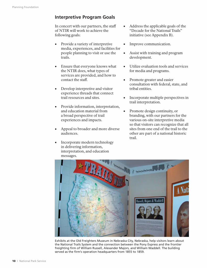
Exhibits at the Old Freighters Museum in Nebraska City, Nebraska, help visitors learn about the National Trails System and the connection between the Pony Express and the frontier freighting firm of William Russell, Alexander Majors, and William Waddell. The building served as the firm’s operation headquarters from 1855 to 1859.
10 I National Park Service
Planning Foundation
Partnership Expectations
The success of the LRIP will depend in large part on the continued and improved relationships with the many trail partners. Partnerships are successful when all parties contribute to and gain from the alliance, when all parties are involved in defi ning goals and responsibilities, and when there is a continuous liaison among all parties.
NTIR asks that partners:
• Notify us when replacements are needed for interpretive media (wayside exhibits, signs, passport stamps, stocks of publications and auto tour route signs).
• Notify us if they become aware of problems with the eff ectiveness of any of our products or programs so that we can correct/improve them.
• Make sure that their interpretive staffs are appropriately trained and know the subject matter they are interpreting.
• As subject matter experts, assist us by providing feedback on interpretive media.
• Provide information that characterizes the types of visitor they come into contact with (visitor profile) at their locales; e.g., when do people visit, numbers, singles or families, where are they from, racial and age information, are they following trail or inadvertently encountering it? Are they using our media? This could entail conducting visitor surveys that identify trail-related visitor information.
• Be inclusive and present multiple perspectives/balanced interpretation on trails events, impacts, stories, themes etc.
• Consider developing site-specifi c trail interpretation within the
context of trails-wide interpretive themes presented in this plan.
• Work with NPS to provide continuity in “branding” design for various on-site interpretive media so that visitors can recognize that sites are part of the National Trails System.
• Be stewards of the resources by keeping sites physically accessible and inviting to visitors; by fi rst protecting the integrity of the historic landscape when considering where on-site interpretive media and other developments might be desirable and appropriate; by placing interpretive wayside exhibits and other modern intrusions so they are not intrusive and do not interfere with photographs of the subject; by working toward achieving the objectives of the National Trails System Act.
• Consider providing reciprocal web links to NPS trail websites. (These are: www.nps.gov/oreg, /cali, /poex, and /mopi)
In order to provide a quality visitor experience, NTIR will:
• Provide trails-wide orientation and wayfinding materials (signs, auto tour route guides, brochures, maps, etc.).
• Provide technical expertise and training for interpretive planning and media development.
• Work with our partner subject matter experts in terms of presenting historically accurate information and stories.
• Keep in contact with site/visitor facility partners in terms of their needs, mutual concerns, and issues.
Oregon, California, Mormon Pioneer, and Pony Express National Historic Trails Long-Range Interpretive Plan I 11
Recommendations
Recommendations
The following is a description of program and media recommendations designed to further defi ne, support, and communicate the trails’ purpose, significance, goals, partnership expectations, and interpretive themes. Implementation of these recommendations will help ensure that visitors are well prepared and informed, and that they will be able to develop meaningful connections with tangible and intangible resources.
Technical Assistance
New Tasks/Projects
Year 1
• Direct the general public and partners to repositories of trail-related historic images for use. Develop a representative inventory to reference various repositories of historic image collections, emphasizing that copyright and reproduction/use fees may apply.
In addition to the inventory, NTIR would continue to assist the public in fi nding/acquiring “special” images.
Years 2-5
• Conduct interpretive planning and interpretive skills workshops. NTIR staff could work with the various regional NPS Interpretive Development Program teams to offer training opportunities whereby participants could become certifi ed interpreters. Training could be conducted at specific sites, at sites within certain geographic areas, and especially to members of various partner organization chapters.
Other training or workshop venues could include the various programs offered through the National Association for Interpretation. Here, participants can take advantage of training programs already in place, or NTIR could offer their own programs at some of the national, regional, or sectional meetings.
• Work with trail partners to provide packaged traveling exhibits for use by trail partners. NTIR would work with interested trail partners to develop trail specific exhibits and collaborate on methods to cover shipping costs. NTIR would collaborate with trail partners to advertise these exhibits. Partners could handle the scheduling, contact information, and distribution of the exhibits.
The traveling exhibits mentioned above would be different from the traveling trunks generally used for school groups. While traveling trunks could certainly be a part of this program, they are more labor intensive to develop and maintain. Besides, a number of trail facilities already have traveling trunk programs, although NTIR might play a more valuable role in providing a list of these types of media on their website.
On-Going Tasks/Projects
• Complete development of guidebook program. Five trail interpretive guides have been completed by NTIR staff , and four remain to complete the series. The completed volumes are also available online as PDF files. Each of these guidebooks will need to be continually updated as new areas are added and as driving routes and other conditions change. Consideration should be given to eventually adding GPS coordinates for listed sites along each trail.
Oregon, California, Mormon Pioneer, and Pony Express National Historic Trails Long-Range Interpretive Plan I 13
Recommendations
14 I National Park Service
• Provide assistance with site development and design. NTIR staff should continue to work with partners to help them
• Respond to requests for technical assistance from outside organizations. This would include continuing to
determine the best procedures to respond to a variety of trail-related use for site development. Plans requests from entities beyond would provide for positive and trail partners. In cases where the meaningful visitor experiences expertise does not lie within the (e.g., where to park, how to NTIR, a list of contacts (including manage visitation use, and how to websites) could be developed and provide outstanding and relevant maintained.
•
information to visitors etc.).
Share historical and interpretive expertise with partners. This would involve helping partners
• Provide guidance for conducting tribal consultation and for seeking assistance and advice on a formal and informal basis.
with the planning, researching, NTIR staff would off er this writing, layout\design, and assistance on request through production of various types of meetings and/or workshops with interpretive media. It would include individual sites or multiple partners. information regarding various types of new technologies and their uses. • Review documents for technical Assistance also could be for fi nding graphic and bibliographic materials.
and historical accuracy. NTIR staff will continue to provide
• Work with partners to develop Challenge Cost Share Program project applications. NTIR will continue to assist
this service upon request. These documents could include various types of research reports, or planning and design documents for interpretive media and programs.
partners through the cost share program with the development of various types of site specifi c interpretive media. Since many
• Assist partners with planning and organization of special events. This can include help with special
of the requests are for wayside publications and media, or referring exhibits, NTIR needs to continue its event sponsors to appropriate efforts to ensure that partners know sources for equipment, supplies, etc. the proper maintenance practices; that many of their wayside exhibit panels can be replaced; and that backup copies may already exist.
In cases where staff expertise is not available, NTIR should refer partners to appropriate contractors or other entities such as Harpers Ferry Center.
Recommendations
New Technology
New Tasks/Projects
Year 1
• Develop interactive site and trails map for public on-line use. This would assist visitors with overall trail and site orientation, education, and trip planning. It would include a searchable database. Links to partner websites would be included.
A more detailed version (accessible through different means) would be maintained and made available for researchers.
• Develop downloadable messages that people can use as they travel. NTIR staff should explore the many options available for providing trail interpretation through electronic means. This would include offering material that travelers could download to their iPods, cell phones, GPS navigational units, or other current and future portable devices. The downloadable messages could include audio and video as well as still image features.
This information would complement other forms of on-site interpretive media, and in some cases it might provide the only means of communicating interpretive messages.
Years 2-5
• Develop virtual trail-related/ museum tours for the websites. These tours, which could include video segments and still images targeted for various age groups (kids/adults). They could include tours of trail segments, museum exhibits, living history programs, or special events. The tours also would be developed for use on the NTIR or various partner websites.
Communications and Marketing
New Tasks/Projects
Year 1
• Put research reports (as appropriate) from NPS-funded projects on the trail websites. Restrictions may apply to some material. For example, some documents such as trail journals may be copyright protected; therefore, these and other documents may be better suited for placement on an internal website for use by researchers.
Years 2-5
• Communicate our portfolio of interpretive products, services, and programs. This would be done to demonstrate the variety of services, products, and interpretive media that NTIR can assist our partners in developing.
On-Going Tasks/Projects
• Update and maintain an internet listing of visitor experience opportunities along the trails. While the listings cannot be fully comprehensive, they should be updated to include new museums, visitor centers, interpretive sites, etc.
• Communicate our identity and mission within the NPS. This would include better communication with NPS trails parks and the NPS in general. It also will involve taking advantage of opportunities to promote awareness of NTIR and the National Trails System within the regional offices and the Washington, D.C. office.
Oregon, California, Mormon Pioneer, and Pony Express National Historic Trails Long-Range Interpretive Plan I 15
Recommendations
16 I National Park Service
•
•
Continue to ask partners to provide information about specifi c events. These can be posted on the trail websites.
Communicate info about the
• Continue supporting and updating the Eastern National passport program for the four trails. In addition, the possibility of developing individual passport books for each trail should be
national historic trails and the National Trails System to broader audiences. This would include the development of media such as rack cards, press releases about special events, general and specifi c postings on websites, information about new products and recent accomplishments. In addition to providing this type of information on the Internet, it would be
•
explored. Individual site stamps (which meet standards to be developed) could be available at key venues. Such a program could increase visitation to trail specific sites; however, it would require additional monitoring and maintenance.
Maintain a list of current recommended readings on the trail websites.
made available for inclusion in This could be in the form of an tribal newspapers and partner newsletters.
annotated bibliography, which could be periodically updated.
•
o Assist with the preparation of the NTIR annual report or newsletter. One of the main objectives would be to inform the public about NTIR interpretive activities and partner accomplishments. The report or newsletter would be posted on trail websites and mailed to affiliated tribes and specifi c partner and non-partner organizations.
Maintain and periodically update a traveling exhibit for use at special events. This could be designed to function as a staffed or unstaff ed exhibit. The purpose would be to provide information about the trails and
•
•
Take advantage of opportunities to promote awareness of NTIR and NPS through organizations such as National Parks and Conservation Association.
Work closely with the various State Departments of Transportation, local highway authorities, and partners to develop and implement highway sign plans using the NTIR standards. This includes assuring sign standards are easily available to partners on the websites and other media, and sign protocols are used consistently along all four trails. Interpretation will work closely with planning and development to assure that there is consistent Auto
the National Trails System. It would be used at a variety of events such as trail conferences, National Association of Interpretation conferences, specifi c site commemorations/celebrations, or at tribal activities and/or events.
Tour Route signing across the trails, and that Local Tour Route and site signing is encouraged to enhance visitor use and experience.
Recommendations
Topics and Audiences
This section includes topics for further study and topics that have been underrepresented in NTIR interpretive efforts, plus ways to attract and engage broader and more diverse audiences and strengthen/broaden our understanding of their historic relationships with trails.
New Tasks/Projects
Year 1
• Strengthen interpretation of emigrant relationships with and impacts on American Indians. Engage federally recognized tribes in developing interpretive media to tell their trail-related histories.
• Develop Junior Ranger programs for children. These programs could be trail specific and available to download from the Internet. These programs might also be linked with the passport program discussed earlier.
Years 2-5
• Strengthen interpretation of experiences of women and children, other ethnic groups, and entrepreneurs on the trails. Research may be required to identify and provide resource materials on the perspectives of these experiences.
• Assist with and promote national historic trail patches with scouting organizations.
• Develop interpretive/resource materials for classroom use. This does not mean developing lesson plans and curricula, as many partner sites do this already. However, educators have expressed a need for trails-wide interpretive resource materials that would supplement and provide context for specifi c site-related activities. Through this effort teachers also could learn how to get copies of audiovisual programs and other materials for use in the classroom.
• Develop strategy to help minority and urban audiences (underserved audiences) engage with trails and develop “connections to place.” The goal would be to develop ways to help urban audiences fi nd relevance in and connections with the emigrant trails experiences. One model could be the Jim Beckwourth Club in Denver. Another possibility might be to explore having school groups or other audiences “adopt” a trail segment near an urban area, or to participate in events such as trail rides, living history programs, etc. Outreach efforts would focus on culturally diverse audiences (Hispanic, Black, Asian, other).
Oregon, California, Mormon Pioneer, and Pony Express National Historic Trails Long-Range Interpretive Plan I 17
Recommendations
Relationship Building Special Populations
On-Going Tasks/Projects Planning and design teams for future
18 I National Park Service
• Build and strengthen relationships with tribes. Continue with more government to government consultation and ongoing listening sessions. The purpose is to broaden interpretation to incorporate American Indian perspectives and their story of survival.
• Continue to nurture relationships with a spectrum of existing partners. Continue attending conferences, etc. Consideration also should be given to gathering interpreters and/or education specialists from various sites along a specifi c trail for meetings/workshops to focus on personal and non-personal interpretive topics. Gatherings such as these also offer opportunities to develop trail-related professional networks among sites and agencies. Consider providing orientation tours of sections of historic trails and sites.
• Develop stronger relationships with state offi ces. This would involve advancing relationships with state historic preservation offi ces, state historical societies, state parks, etc. It could include consultations on major trails interpretive projects and plans, and inviting these people to review draft media, etc.
• Keep up with technological advances in interpretive media and communications. Maintain and establish connections with other interpretive media offices (i.e., Harpers Ferry Center), organizations, and groups that specialize in various forms of information technology. This would involve attending training sessions and passing relevant information on to trail partners.
media projects should refer to the new Harpers Ferry Center Accessibility Guidelines at http://www.nps.gov/hfc/ accessibility/index.htm.
Provisions will be made to accommodate the needs of special populations who visit trail-related sites and facilities. Special populations are identified as those with sight, hearing, learning, and mobility impairments; visitors who do not speak English; and the elderly and young children.
Public Law 90-480, the Architectural Barriers Act, and the Americans with Disabilities Act of 1990 establish standards for physical access. Other regulations, laws, and standards include Sections 504 and 508 of the Rehabilitation Act of 1973, Director’s Orders No. 42, and the Accessibility for Visitors with Disabilities in National Park Service Programs, Facilities, and Services. All newly constructed facilities utilizing federal funds, as a matter of course, will be designed for accessibility for physically disabled visitors and employees.
Every effort will be made to provide full access to interpretive media and programs to ensure that people with physical and mental disabilities, as well as people who do not speak or understand English, have access to the same information necessary for a safe and meaningful visits. All new interpretive media should follow the standards for accessibility as described in the NPS, October 2007 Programmatic Accessibility Guidelines for National Park Service Interpretive Media.
Recommendations
Staffi ng Needs
The following is a fi ve-year staffing plan for NTIR interpretation:
• (1) Chief of Interpretation, GS-12, Santa Fe
• (1) Interpretive Specialist, GS-12, Salt Lake City
• (5) Interpretive Specialists, GS-9/11, combined for Santa Fe and Salt Lake City
These seven positions are identified in the NTIR Organizational Chart (2009-2014), which describes staffing needs required to administer not just the Oregon, California, Mormon Pioneer, and Pony Express national historic trails, but fi ve additional trails also administered by NTIR. The seven positions will overlap in duties to include activities across all nine national historic trails, regardless of being located in Salt Lake City or in Santa Fe. This staffing will be required to implement the recommendations in this LRIP.
Planning Team
In addition to the members of the core planning group listed below, a special thank you is extended to the many trail partners who responded to the questionnaire, and to those who attended the planning workshop held at the 2008 OCTA convention.
Aaron Mahr, Superintendent NTIR Sharon A. Brown, Chief of Trail Operations, NTIR Santa Fe Chuck Milliken, Lead Interpretive Specialist, NTIR Salt Lake City Lee Kreutzer, Cultural Resource Specialist, NTIR Salt Lake City Kay Threlkeld, GIS Dabase manager, NTIR Salt Lake City, Retired Otis Halfmoon, Tribal Liaison, NTIR Santa Fe Jere Krakow, former Superintendent NTIR, Retired Paul Lee, Interpretive Planner, Harpers Ferry Center, Retired
Oregon, California, Mormon Pioneer, and Pony Express National Historic Trails Long-Range Interpretive Plan I 19
Appendices
Appendices
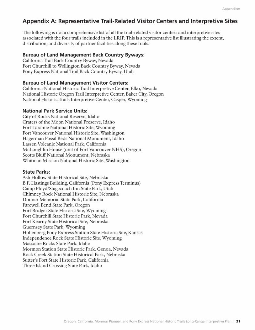
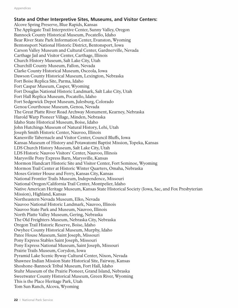
Appendix A: Representative Trail-Related Visitor Centers and Interpretive Sites
The following is not a comprehensive list of all the trail-related visitor centers and interpretive sites associated with the four trails included in the LRIP. This is a representative list illustrating the extent, distribution, and diversity of partner facilities along these trails.
Bureau of Land Management Back Country Byways: California Trail Back Country Byway, Nevada Fort Churchill to Wellington Back Country Byway, Nevada Pony Express National Trail Back Country Byway, Utah
Bureau of Land Management Visitor Centers: California National Historic Trail Interpretive Center, Elko, Nevada National Historic OregonTrail Interpretive Center, Baker City, Oregon National Historic Trails Interpretive Center, Casper, Wyoming
National Park Service Units: City of Rocks National Reserve, Idaho Craters of the Moon National Preserve, Idaho Fort Laramie National Historic Site, Wyoming Fort Vancouver National Historic Site, Washington Hagerman Fossil Beds National Monument, Idaho Lassen Volcanic National Park, California McLoughlin House (unit of Fort Vancouver NHS), Oregon Scotts Bluff National Monument, Nebraska Whitman Mission National Historic Site, Washington
State Parks: Ash Hollow State Historical Site, Nebraska B.F. Hastings Building, California (Pony Express Terminus) Camp Floyd/Stagecoach Inn State Park, Utah Chimney Rock National Historic Site, Nebraska Donner Memorial State Park, California Farewell Bend State Park, Oregon Fort Bridger State Historic Site, Wyoming Fort Churchill State Historic Park, Nevada Fort Kearny State Historical Site, Nebraska Guernsey State Park, Wyoming Hollenberg Pony Express Station State Historic Site, Kansas Independence Rock State Historic Site, Wyoming Massacre Rocks State Park, Idaho Mormon Station State Historic Park, Genoa, Nevada Rock Creek Station State Historical Park, Nebraska Sutter’s Fort State Historic Park, California Three Island Crossing State Park, Idaho
Oregon, California, Mormon Pioneer, and Pony Express National Historic Trails Long-Range Interpretive Plan I 21
Appendices
State and Other Interpretive Sites, Museums, and Visitor Centers: Alcove Spring Preserve, Blue Rapids, Kansas The Applegate Trail Interpretive Center, Sunny Valley, Oregon Bannock County Historical Museum, Pocatello, Idaho Bear River State Park Information Center, Evanston, Wyoming Bentonsport National Historic District, Bentonsport, Iowa Carson Valley Museum and Cultural Center, Gardnerville, Nevada Carthage Jail and Visitor Center, Carthage, Illinois Church History Museum, Salt Lake City, Utah Churchill County Museum, Fallon, Nevada Clarke County Historical Museum, Osceola, Iowa Dawson County Historical Museum, Lexington, Nebraska Fort Boise Replica Site, Parma, Idaho Fort Caspar Museum, Casper, Wyoming Fort Douglas National Historic Landmark, Salt Lake City, Utah Fort Hall Replica Museum, Pocatello, Idaho Fort Sedgewick Depot Museum, Julesburg, Colorado Genoa Courthouse Museum, Genoa, Nevada The Great Platte River Road Archway Monument, Kearney, Nebraska Harold Warp Pioneer Village, Minden, Nebraska Idaho State Historical Museum, Boise, Idaho John Hutchings Museum of Natural History, Lehi, Utah Joseph Smith Historic Center, Nauvoo, Illinois Kanesville Tabernacle and Visitor Center, Council Bluff s, Iowa Kansas Museum of History and Potawatomi Baptist Mission, Topeka, Kansas LDS Church History Museum, Salt Lake City, Utah LDS Historic Nauvoo Visitors’ Center, Nauvoo, Illinois Marysville Pony Express Barn, Marysville, Kansas Mormon Handcart Historic Site and Visitor Center, Fort Seminoe, Wyoming Mormon Trail Center at Historic Winter Quarters, Omaha, Nebraska Moses Grinter House and Ferry, Kansas City, Kansas National Frontier Trails Museum, Independence, Missouri National Oregon/California Trail Center, Montpelier, Idaho Native American Heritage Museum, Kansas State Historical Society (Iowa, Sac, and Fox Presbyterian Mission), Highland, Kansas Northeastern Nevada Museum, Elko, Nevada Nauvoo National Historic Landmark, Nauvoo, Illinois Nauvoo State Park and Museum, Nauvoo, Illinois North Platte Valley Museum, Gering, Nebraska The Old Freighters Museum, Nebraska City, Nebraska OregonTrail Historic Reserve, Boise, Idaho Owyhee County Historical Museum, Murphy, Idaho Patee House Museum, Saint Joseph, Missouri Pony Express Stables Saint Joseph, Missouri Pony Express National Museum, Saint Joseph, Missouri Prairie Trails Museum, Corydon, Iowa Pyramid Lake Scenic Byway Cultural Center, Nixon, Nevada Shawnee Indian Mission State Historical Site, Fairway, Kansas Shoshone-Bannock Tribal Museum, Fort Hall, Idaho Stuhr Museum of the Prairie Pioneer, Grand Island, Nebraska Sweetwater County Historical Museum, Green River, Wyoming This is the Place Heritage Park, Utah Tom Sun Ranch, Alcova, Wyoming
22 I National Park Service
Appendices
Western Historic Trails Center, Council Bluff s, Iowa Willie Handcart Historic Site, Sweetwater Station Junction, Wyoming Wyoming Pioneer Memorial Museum, Douglas, Wyoming
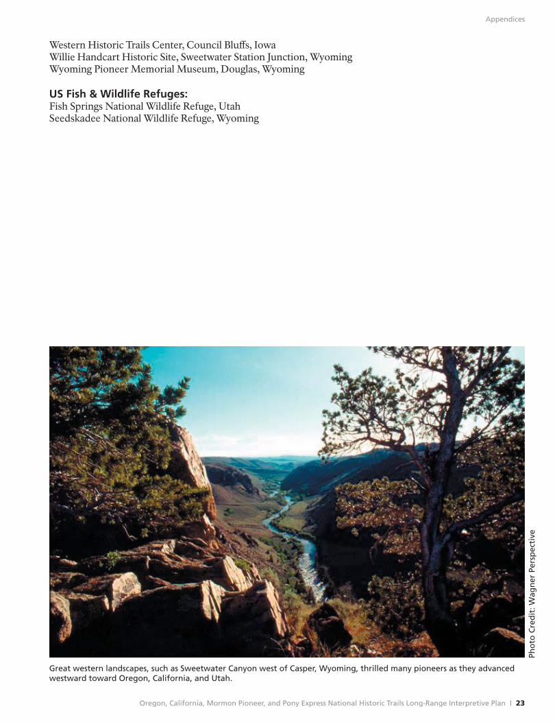
US Fish & Wildlife Refuges: Fish Springs National Wildlife Refuge, Utah Seedskadee National Wildlife Refuge, Wyoming
Pho
to C
red
it: W
agn
er P
ersp
ecti
ve
Great western landscapes, such as Sweetwater Canyon west of Casper, Wyoming, thrilled many pioneers as they advanced westward toward Oregon, California, and Utah.
Oregon, California, Mormon Pioneer, and Pony Express National Historic Trails Long-Range Interpretive Plan I 23
Appendices
Appendix B: Decade Goals for the National Trails
The Partnership for the National Trails System has developed a number of initiatives to commemorate “A Decade for the National Trails” which spans the System’s 40th anniversary in 2008 and its 50th anniversary in 2018. Specific goals and objectives have been identified to quicken the pace of developing the National Trails System, both its individual components and the System as a whole. There is a need for more resources, more funding, more volunteers, and more trained staff for non-profits and government agencies. There is also a need for much greater awareness by the public.
Three goals and associated objectives have been articulated. Goals 1 and 2 have direct implications for interpretation and education, and are summarized below.
• Goal 1: Increase public awareness of the National Trails System and its component trails so that it becomes well known to every citizen and community in the United States.
o Objective A: Develop and implement educational and interpretive media to increase public appreciation, use, and enjoyment of the National Trails.
o Objective B: Engage all Americans, especially youth, “Baby Boom” retirees, and people from our Nation’s diverse cultures to become stewards of the National Scenic, Historic, and Recreational Trails.
o Objective C: Provide an opportunity for every American and U.S. visitors to explore and enjoy a National Scenic, Historic, Recreation or “rail banked” trail.
• Goal 2: Complete and enhance the designated National Trails for public appreciation and enjoyment.
o Objective A: Complete inventories of the natural and cultural resources, route mapping, identification, and signage appropriate for the National Scenic, Historic and Recreational Trails.
o Objective B: Delineate, acquire, and protect gaps in rights-of-way and resource preservation corridors of the National Scenic Trails and preserve unprotected and threatened significant sites and segments along the National Historic Trails.
o Objective C: Delineate preservation corridors to permanently protect the resources and quality of visitor experiences along National Scenic and Historic Trails on public lands and waters.
o Objective D: Complete construction of National Scenic Trails and on-site interpretation along these and National Historic Trails, and where appropriate, restore the setting of significant sites and segments of National Historic Trails to their historic period.
24 I National Park Service

Harpers Ferry Center National Park Service U.S. Department of the Interior
Oregon, California, Mormon Pioneer, and Pony Express National Historic Trails
National Trails Intermountain Region National Park Service PO Box 728 Santa Fe, NM 87504 505-988-6098
324 S. State Street Suite 200 Salt Lake City, UT 84111 801-741-1012
Oregon NHT www.nps.gov/oreg
California NHT www.nps.gov/cali
Mormon Pioneer NHT www.nps.gov/mopi
Pony Express NHT www.nps.gov/poex
Harpers Ferry Center HFC Interpretive Planning PO Box 50 Harpers Ferry, WV 25425
EXPERIENCE YOUR AMERICA™

![Tschanz Rare Books · 1957 Pioneer Days Rodeo Poster 1- [Utah] [Mormon Pioneers]. Days of '47 World Championship ... This is the rarer companion piece to John Hafen’s Pioneer Camp](https://img.pdfslide.net/doc/110x75/5fab5bf6bbc46078f6289836/tschanz-rare-books-1957-pioneer-days-rodeo-poster-1-utah-mormon-pioneers-days.jpg)