Embed Size (px)
Citation preview


Organize Traffic Safety
Committee
Study School Route Roadway
Crossings
Develop School Route Plan
Select Mitigation Measures
Plan Implementation
Maintain School Route Plan
School Zone Program
1. Create school route plan
2. Maintain school route plan
3. Review citizen input
1. Locate areas of concern
2. Apply a uniform procedure of study
3. Apply a uniform procedure of analysis
1. Post the plan for viewing purposes
2. Send a copy home with each student
1. Perform regular field checks
2. Complete an annual review of the plan
1. Review MUTCD standards
2. Selected appropriate measures
based on MUTCD and Iowa Traffic
Control Devices and Pavement
Markings Manual
1. Develop a school route map
2. Review with traffic safety committee,
parent/teacher associations, and
neighborhood organizations
3. Make adjustments as needed
3. Review with traffic safety committee,
parent/teacher associations, and
neighborhood organizations
3. Conduct regular meetings with traffic
safety committee

School Zone Program 6.1
INTRODUCTIONINTRODUCTION
School zone safety is one of the most pressing, controversial, and emotional concerns that elected officials,
traffic engineers, city staff, school officials, and enforcement agencies are faced with. Pedestrian and
bicycle safety depends upon public understanding of accepted methods for traffic control. This
understanding becomes extremely important in a school zone. School children and motorists cannot be
expected to navigate safely in school zones unless they understand the need for traffic control devices and
how these controls function for their mutual benefit.
The following facts may be considered in the developmental stages of a school zone program (MUTCD
2001):
• Analysis shows that at many locations school crossing controls requested by parents, teachers,
and other citizens are unnecessary and costly and tend to lessen the respect for controls that
are warranted.
• Pedestrian safety depends in large measure upon public understanding of accepted methods
for efficient traffic control.
• Non-uniform procedures and devices cause confusion among pedestrians and vehicle
operators, prompt wrong decisions, and can contribute to accidents.
• The type of school area traffic control used, either warning or regulatory, must be related to
the volume and speed of traffic, roadway width, and the number of children crossing.
Note that the school zone program described here does not serve to select the device or solution for a
particular situation. Instead, a procedure is outlined for logical selection of locations where school zone
safety concerns exist. Engineering judgment is applied to the process of selecting a uniform approach.

6.2 School Zone Programs
RESPONSIBILITY FOR TRESPONSIBILITY FOR THE SAFETY OF SCHOOL HE SAFETY OF SCHOOL PEDESTRIANSPEDESTRIANS
The responsibility to provide safe walking and biking conditions and to develop self-reliance and safe habits
among children is shared by parents, school authorities, government agencies, and the children themselves.
Parents hold the basic responsibility of their children walking and biking to and from school. School and
traffic officia ls work to provide the appropriate traffic control devices. Without the full cooperation of the
parents, the program may not be successful. Parents are obligated to understand traffic regulations and
control measures and to make sure their children also understand them (Des Moines Safety Council 1997).
By their example, parents are the greatest influence in their child’s development of safe and self-reliant
actions.
KEY STEPS TO A SCHOOKEY STEPS TO A SCHOOL ZONE PROGRAML ZONE PROGRAM
Development of a school zone program includes six key steps (ITE 1988):
1. Organize a traffic safety committee. 2. Develop a school route plan. 3. Configure the school site. 4. Consider other relevant elements. 5. Select mitigation measures (not within the scope of the handbook). 6. Distribute and maintain school route plan.
Organize a Traf f ic Safety CommitteeOrganize a Traf f ic Safety Committee
The traffic safety committee is a key tool to aid in the development and maintenance of a school zone
safety program. The traffic safety committee should be composed of government and school board
officials who have the authority, interest, and ability to get things accomplished. A jurisdiction’s traffic
engineer, the chief of police, and school representatives should be official members. The manager of the
local safety council, the presidents of parent-teacher associations (PTAs), and representatives of other
interested organizations can also serve on the committee.
The duties of the committee are to guide and coordinate all activities connected with the school zone
safety program. These activities may include the following (ITE 1988):

School Zone Program 6.3
• Establish policies and procedures within the program. • Develop a school route map. • Review and approve the various phases of the school traffic safety program. • Review and handle complaints and requests from citizens. • Establish priorities on projects to administer. • Promote good public relations. • Take immediate action to correct emergency school traffic safety concerns.
Develop a School Route PlanDevelop a School Route Plan
The school traffic safety committee should take the lead to develop a suggested school route plan for
schools serving elementary and kindergarten students. Many kinds of existing information may be
necessary to develop the plan. The school principal, the PTA, or any organized citizen group involved in
public safety may provide information pertaining to the following items:
• student walking areas • safety patrol and/or crossing guard locations • locations of concern • school hours
The school route plan should include a map that shows the following (see Figure 6.1; ITE 1988):
• the school • nearby roadways • existing traffic control devices • the suggested school route for children to follow
The following criteria may be considered when developing a school route plan (ITE 1988):
• The school route plan should be designed to provide maximum protection to the children at a
minimum cost to the taxpayer.
• School route plans should be designed to take advantage of existing of traffic control devices.

6.4 School Zone Programs
• School children should be thoroughly instructed by the schools and parents on the purpose and
proper use of the school rout plan. Each child should be provided with a copy of the map
showing the school route plan.
• Special precautions should be taken in those areas where unusual conditions exist that create
problems for school children.
The following factors may be considered when determining the feasibility of requiring children to walk a
longer distance to a location with existing traffic control: the availability of adequate, safe sidewalks or off
roadway sidewalk areas to and from the location with existing control; the number of children using the
crossing; the age levels of the children using the crossing; and the total extra walking distance (MUTCD
2001).
Figure 6.1. Example School Route Plan

School Zone Program 6.5
The ideal uses and functions of the school route plan map are as follows (Bismark 1986):
• to guide children and avoid roadside and intersection hazards • to provide for the most effective use of protective measures such as traffic control signals,
stop signs, pavement markings, and sidewalks • to minimize the number of crossings on major traffic roadways • to maximize the use of existing sidewalks and roadways that have wide smooth shoulders • to choose roadway crossings with adequate sight distance • to provide a basis for engineering studies of school related traffic control devices • to indicate priorities for sidewalk construction
Conf igure the School S i teConf igure the School S i te
Figure 6.2 is an example school site configuration. This site was reconstructed some years after the initial
construction was completed. The purpose of the reconstruction was to provide a higher level of safety.
The school site was designed to separate staff and visitor parking (bottom left) from the student drop off
and pickup area (top left). As shown, the arterial roadway (off the school site) in front of the school is
designed for student drop off and pickup. The only parking that is allowed in the access driveway on the
school site is for school buses (bottom right) and handicapped individuals (top right). There is a wide
sidewalk between the school building and the access driveway to allow students to move freely.

6.6 School Zone Programs
Figure 6.2. Example School Site Configuration

School Zone Program 6.7
Consider Other Relevant E lementsConsider Other Relevant E lements
A school zone safety program may also consider the following relevant elements:
• school bus operations • school crossings where concerns have been expressed • appropriate traffic control devices or assistance measures
School Bus Operations
The safe and efficient management of bus transportation of students is a critical element of a school zone
safety program. Although school buses are not involved in a large number of traffic crashes, they are
important because of their size, limited maneuvering characteristics, and the site restriction they create.
It is important to establish school bus routes that provides safe, efficient, and economical transportation of
students. Bus stops should be designed to provide the safest location for stopping the bus and loading or
unloading students. This includes the bus stop(s) located at/on a school site. A safe sight distance of
approaching vehicles is one of the critical elements of providing a safe bus stop. Children need this critical
sight distance for crossing the street safely.
The following information may be helpful in establishing school bus routing (Missouri Safety Center 1996):
• the location of students’ residences • the grade and age of students to be transported • the type and condition of roads • the standard of service required • the funds available for transportation service • the general safety of all routes in relation to hazards such as hills, intersections, railroad
crossings, bridges, sharp curves, and obstructions to sight distance • the safety of loading/unloading stops in relation to visibility of approaching vehicles • the walking distance to the bus stop in relation to the age of the student
School Crossings Where Concerns Have Been Expressed
During the development of the school route plan, a school route may cross a major roadway. By applying
a uniform procedure of study and analysis to each crossing, it is possible to make recommendations and
assign priorities for the application of traffic control devices or other measures.

6.8 School Zone Programs
For information regarding the procedure for making field studies for an analysis at a location where
concerns have been expressed, refer to A Program for School Crossing Protection (ITE 1988). The
recommended procedure for study is based on the following assumptions:
• Alternating gaps and blockades are formed in the vehicular traffic stream in a pattern related
to each location. This requires an analysis of the concerns at each location.
• Pedestrians will wait a reasonable time for an adequate gap in traffic before crossing a
roadway.
Appropriate Traffic Control or Assistance Measures
There are several specific standard guidelines and warrants for the application of signs, markings, and
signals that would ordinarily be installed on roadways near school sites. To obtain these detailed guidelines,
refer to Part 7 (Traffic Controls for School Areas) of the Manual for Uniform Traffic Control Devices
(MUTCD 2001). Some example traffic control devices and assistance measures are given here. Note: the
decision to use a particular device at a particular location should be made on the basis of an engineering
study.
Signs. Uniformity of the physical characteristics of signs is critical in school areas. Consequently, the
removal of any nonstandard signs should carry a high priority. Signs that are associated with school areas
include “School Crossing,” “School Bus Stop Ahead,” “School Speed Limits,” “End of School Zone,” and
“Flashing Yellow Breakers” signs. See Figure 6.3.

School Zone Program 6.9
Figure 6.3. School Site Signs
Markings. Markings have definite and important functions in a proper school area traffic control plan.
Markings may be used to supplement the regulations and warnings provided by other devices such as
traffic signs or signals. Markings can also be used on their own to produce results that cannot be obtained
from any other device. See Figure 6.4.
Figure 6.4. School Site Markings
6.10 School Zone Programs
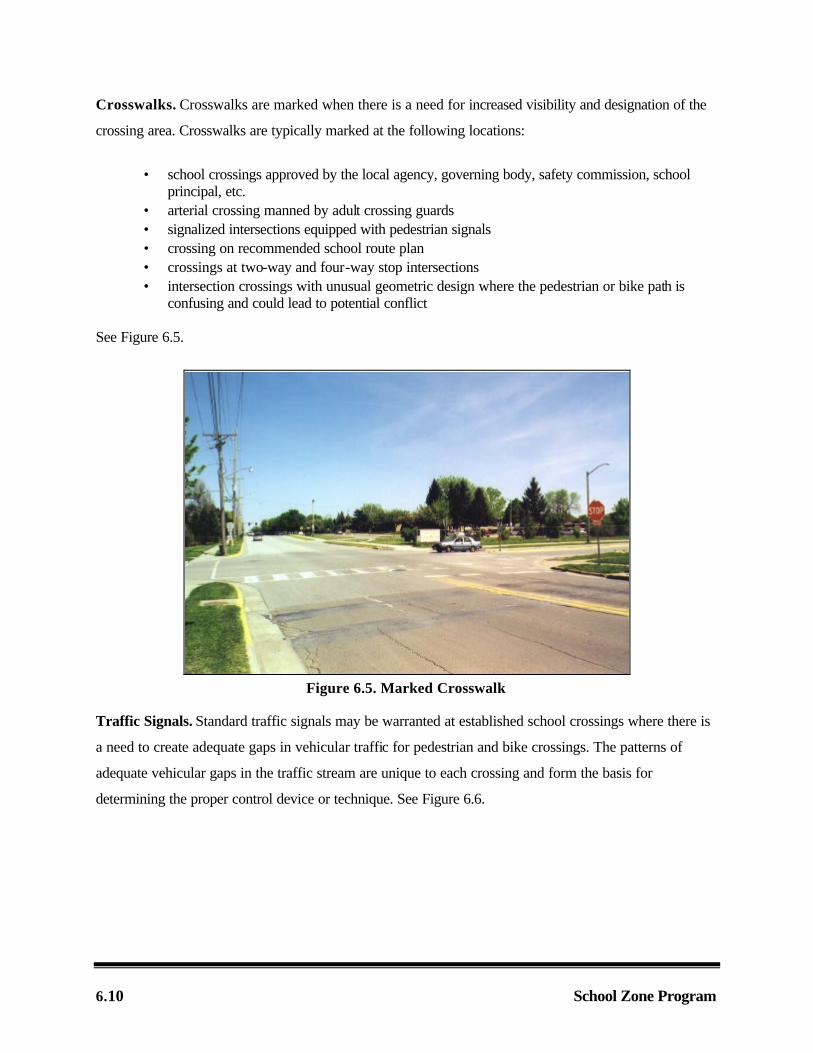
Crosswalks. Crosswalks are marked when there is a need for increased visibility and designation of the
crossing area. Crosswalks are typically marked at the following locations:
• school crossings approved by the local agency, governing body, safety commission, school principal, etc.
• arterial crossing manned by adult crossing guards • signalized intersections equipped with pedestrian signals • crossing on recommended school route plan • crossings at two-way and four-way stop intersections • intersection crossings with unusual geometric design where the pedestrian or bike path is
confusing and could lead to potential conflict See Figure 6.5.
Figure 6.5. Marked Crosswalk
Traffic Signals. Standard traffic signals may be warranted at established school crossings where there is
a need to create adequate gaps in vehicular traffic for pedestrian and bike crossings. The patterns of
adequate vehicular gaps in the traffic stream are unique to each crossing and form the basis for
determining the proper control device or technique. See Figure 6.6.

School Zone Program 6.11
Figure 6.6. Signalized Crosswalk
Crossing Supervision. Many school crossings involve traffic situations problematic to young pedestrians
despite the proper application of traditional traffic control devices. In these cases, adult crossing guards,
police officers, or student patrol may supervise school crossings. See Figures 6.7 and 6.8.
Figure 6.7. Student Patrol

6.12 School Zone Programs
Figure 6.8. Adult Crossing Guard
Distr ibute and Maintain School Route PlanDistr ibute and Maintain School Route Plan
Once the school route plan has been developed, it is distributed to users and maintained by school
authorities.
School Route Plan Distribution
The school route plan should be transmitted to the agency responsible for traffic control in a given
jurisdiction for final approval. Upon approval, the school should post a copy where everybody can view it.
Instructions should be given on general pedestrian safety rules, and on of the use the plan. A copy of the
plan should be sent home with each student so that parents can assist in identifying and explaining the
correct route to school for their children.
School Route Plan Maintenance
Regular field checks by school authorities should be undertaken to make sure that students are following
recommended routes to school. Lack of compliance with the plan should be investigated to determine if
corrective measures or a plan revision is required.

School Zone Program 6.13
The school route plan is reviewed annually to determine whether revisions are necessary due to changes
in school district boundaries, new sidewalk construction, installation of new traffic control devices, or other
factors that affect pedestrian and bike safety. Along with changes, necessary revisions should also be
made on the map that displays sidewalk location, intersection traffic controls, and school-related traffic
controls.
EXAMPLE SCHOOL ZONE EXAMPLE SCHOOL ZONE PROGRAM STUDYPROGRAM STUDY
The city of Scottsville’s elementary school is considering developing a school zone safety program.
Concern has been expressed at PTA meetings about the overall safety of children walking or biking to and
from school. Currently there is not a school route plan in place. Consequently, Scottsville Elementary
School has decided to implement a school zone safety program.
Scottsville Elementary School organized the Scottsdale Elementary School Traffic Safety Committee. The
goal of the committee was to develop a school route plan. Along with the development of this plan, the
committee desires to handle public input positively and to promote good public relations.
The committee developed a school route map depicting the school, roadways, existing traffic control
devices, and a suggested route for children to follow walking or biking to and from school. During the
process of developing the school route map, the committee identified two intersections of concern, as
illustrated in Figure 6.9. These were also the areas that the PTA had expressed concerned with. The
committee desires to evaluate the traffic conditions at these locations.

6.14 School Zone Programs
Figure 6.9. Example School Zone Map
The committee met with the local law enforcement and city traffic engineering officials to present the
school route map. The main concern of the committee was the crash history and speeding in this area.
The local law enforcement officials replied that the only concern they had was at the intersection of Main
Street and 8th Street. There had been complaints from citizens about speeding and there was an existing
crash history at that intersection.
The committee presented the school route map to the city administrator for Scottsville and requested
assistance in conducting initial traffic studies.
The city conducted preliminary spot speed studies (as explained in Chapter 2 of this handbook) at both of
the intersections. The city calculated the 85th percentile of speed for both intersections. The city found

School Zone Program 6.15
that at the intersection of I Avenue and 8th Street the 85th percentile of speed was 1 mph below the
posted speed limit. At the intersection of Main Street and 8th Street the 85th percentile of speed was 7
mph over the posted speed limit. A 5-mph rule of thumb is sometimes used to determine whether the 85th
percentile of speed is high compared to the posted speed limit. If the 85th percentile of speed is 5 mph or
more above the posted speed limit, the situation should be evaluated. In this case, the 85th percentile of
speed was 7 mph above the posted speed limit, so speeding may be an issue. This intersection should be
considered for further speeding evaluation. Several actions may be considered as described in Chapter 2
of this handbook.
The city also conducted preliminary 15-minute traffic volume counts at both intersections (as described in
Chapter 3 of this handbook). The city conducted the volume counts and compared the results with historic
traffic volume counts. The 15-minute counts were consistent with the historic traffic counts.
The city staff used a measuring wheel, a target rod, and sighting rod (as shown in Chapter 4 of this
handbook) to conduct an intersection sight distance study at both intersections. The results of the study
showed the sight distance at both intersections was adequate.
At this point, the city decided the school route plan could not continue without further assistance because
of possible safety issues within the school route area. The city wishes to have a consulting engineering
firm analyze the traffic conditions within the area included within the school route map. Information on
contracting for a school zone safety program study, including a project work order using the Scottsville
example, follows.

6.16 School Zone Programs
CONTRACTING FOR A SCCONTRACTING FOR A SCHOOL ZONE PROGRAM STHOOL ZONE PROGRAM STUDYUDY
In format ion Gather ingInformat ion Gather ing
Before a jurisdiction contacts an engineering consulting firm to perform a school zone study, a variety of
information may need to be collected. Any information provided may aid the consulting firm in adequately
completing their analysis. The following is a list of possible information that an engineering consulting firm
may use:
• issue at hand • crash history • preliminary speed studies • traffic volumes • sight distances • documentation from PTAs • traffic control devices • roadway classifications • posted speed limits in and around study area • school hours • list of regularly scheduled events • student demographics • school site map • school bus operations/schedules • pedestrian access ways • citizen input • location map • appropriate contact persons • any other relevant information
The following project work order may assist local governments in contracting to an engineering firm. The
example project work order contains information comes from the school zone example (a blank form is
presented in Appendix E).
School Zone Program 6.17
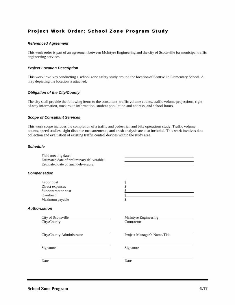
Project Work Order : School Zone Program StudyProject Work Order : School Zone Program Study
Referenced Agreement
This work order is part of an agreement between McIntyre Engineering and the city of Scottsville for municipal traffic engineering services.
Project Location Description
This work involves conducting a school zone safety study around the location of Scottsville Elementary School. A map depicting the location is attached.
Obligation of the City/County
The city shall provide the following items to the consultant: traffic volume counts, traffic volume projections, right-of-way information, truck route information, student population and address, and school hours.
Scope of Consultant Services
This work scope includes the completion of a traffic and pedestrian and bike operations study. Traffic volume counts, speed studies, sight distance measurements, and crash analysis are also included. This work involves data collection and evaluation of existing traffic control devices within the study area.
Schedule
Field meeting date: Estimated date of preliminary deliverable: Estimated date of final deliverable: Compensation
Labor cost $ Direct expenses $ Subcontractor cost $ Overhead $ Maximum payable $ Authorization
City of Scottsville McIntyre Engineering City/County Contractor City/County Administrator Project Manager’s Name/Title Signature Signature Date Date

6.18 School Zone Programs

School Zone Program 6.19
REFERENCESREFERENCES
Benjamin Design Collaborative. 2000. School Site Configuration. Ames, Iowa: Benjamin Design Collaborative.
Bismark. 1986. School Crossing Studies. Bismark, N.D.: Bismark.
Des Moines Safety Council. 1997. Manual for School Crossing Control. Des Moines, Iowa.
FHWA. 2001. Part 7: Traffic Controls for School Areas. In Manual on Uniform Traffic Control Devices: Millennium Edition. Washington, D.C.: Federal Highway Administration, U.S. Department of Transportation.
ITE. 1988. A Program for School Crossing Protection. Washington D.C.: Institute of Transportation Engineers.
Missouri Safety Center. 1996. School Transportation and Traffic Safety. Jefferson City, Mo.: Missouri Department of Transportation, pp. 53–61.