Embed Size (px)
Citation preview
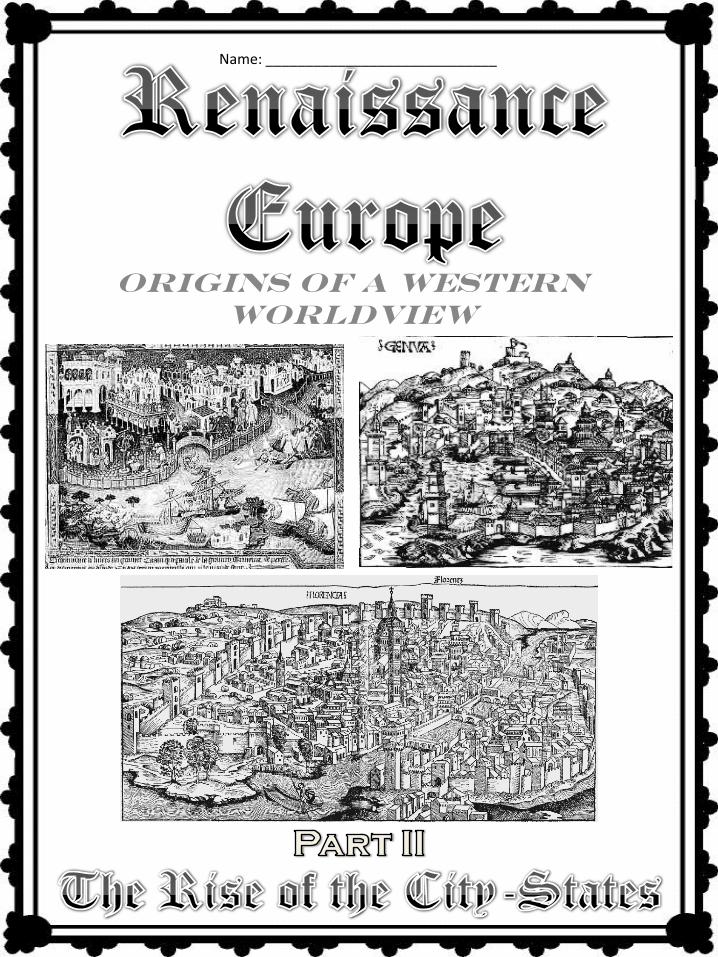
Origins of a Western
Worldview
Name: _____________________________
KNOWLEDGE and UNDERSTANDING
• I describe how exploration and intercultural contact affected citizenship and identity.
SKILLS and PROCESSES
• I construct and interpret maps and geographic tools to help interpret information and
understand economic and political issues.
1. How did the physical geography of Renaissance Europe
affect trade and competition among European countries?
2. How did increased trade lead to the emergence of powerful city-states (i.e. Florence, Venice, Genoa)?
• I apply and participate in the research process using a variety of processing tools and
technology as a means of reflecting on various perspectives and opinions.
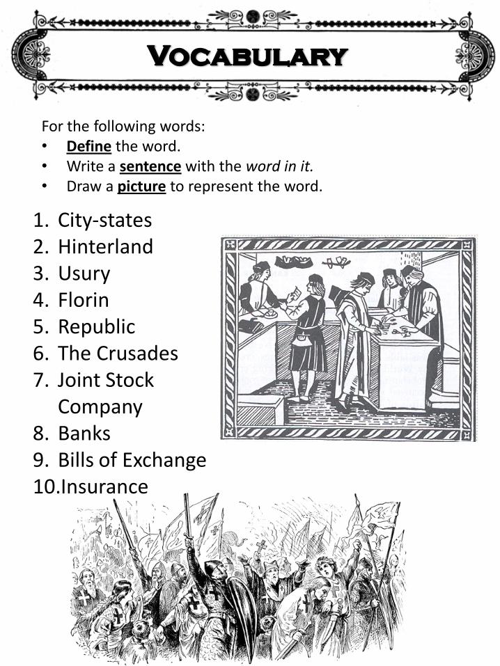
For the following words: • Define the word. • Write a sentence with the word in it. • Draw a picture to represent the word.
1. City-states 2. Hinterland 3. Usury 4. Florin 5. Republic 6. The Crusades 7. Joint Stock
Company 8. Banks 9. Bills of Exchange 10.Insurance
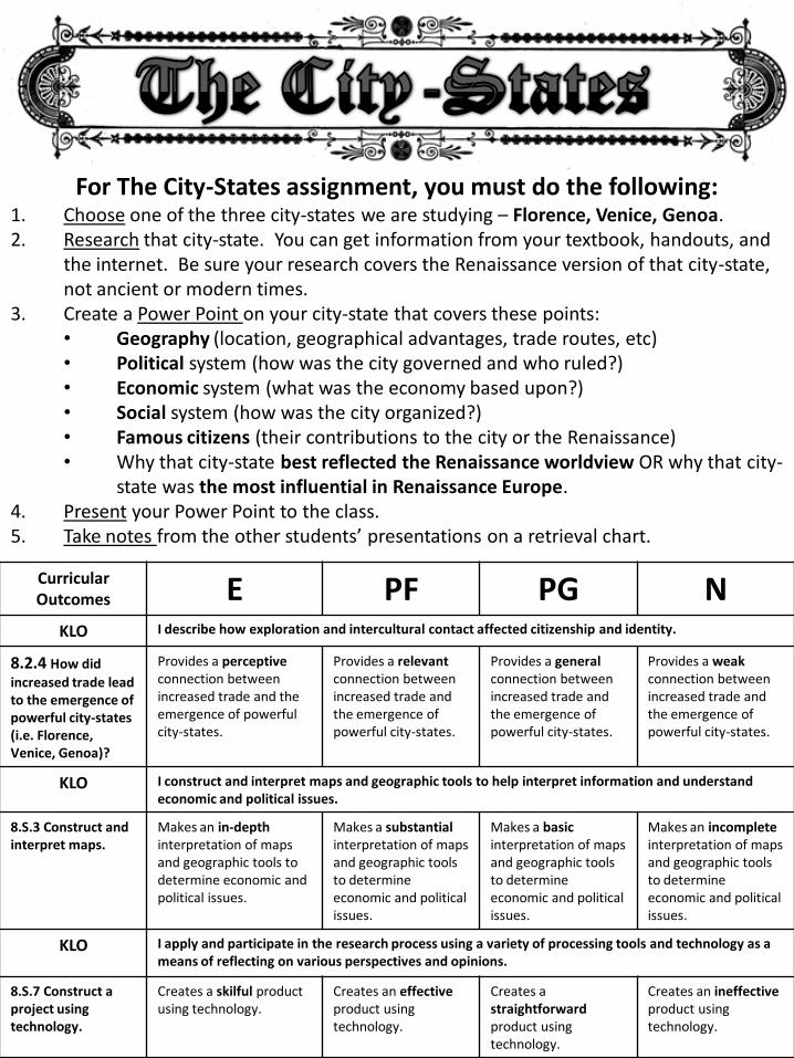
For The City-States assignment, you must do the following: 1. Choose one of the three city-states we are studying – Florence, Venice, Genoa. 2. Research that city-state. You can get information from your textbook, handouts, and
the internet. Be sure your research covers the Renaissance version of that city-state, not ancient or modern times.
3. Create a Power Point on your city-state that covers these points: • Geography (location, geographical advantages, trade routes, etc) • Political system (how was the city governed and who ruled?) • Economic system (what was the economy based upon?) • Social system (how was the city organized?) • Famous citizens (their contributions to the city or the Renaissance) • Why that city-state best reflected the Renaissance worldview OR why that city-
state was the most influential in Renaissance Europe. 4. Present your Power Point to the class. 5. Take notes from the other students’ presentations on a retrieval chart.
Curricular Outcomes E PF PG N
KLO I describe how exploration and intercultural contact affected citizenship and identity.
8.2.4 How did
increased trade lead to the emergence of powerful city-states (i.e. Florence, Venice, Genoa)?
Provides a perceptive connection between increased trade and the emergence of powerful city-states.
Provides a relevant connection between increased trade and the emergence of powerful city-states.
Provides a general connection between increased trade and the emergence of powerful city-states.
Provides a weak connection between increased trade and the emergence of powerful city-states.
KLO I construct and interpret maps and geographic tools to help interpret information and understand economic and political issues.
8.S.3 Construct and interpret maps.
Makes an in-depth interpretation of maps and geographic tools to determine economic and political issues.
Makes a substantial interpretation of maps and geographic tools to determine economic and political issues.
Makes a basic interpretation of maps and geographic tools to determine economic and political issues.
Makes an incomplete interpretation of maps and geographic tools to determine economic and political issues.
KLO I apply and participate in the research process using a variety of processing tools and technology as a means of reflecting on various perspectives and opinions.
8.S.7 Construct a project using technology.
Creates a skilful product using technology.
Creates an effective product using technology.
Creates a straightforward product using technology.
Creates an ineffective product using technology.
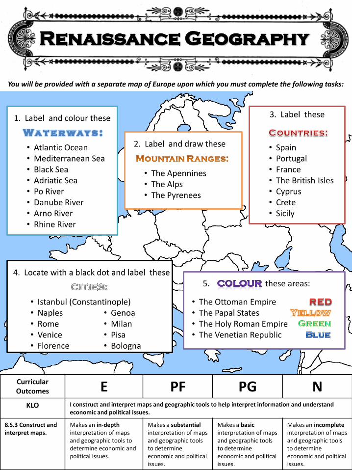
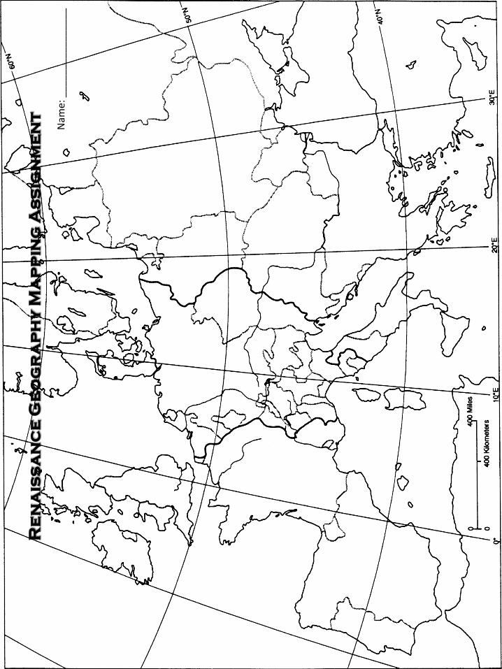
You will be provided with a separate map of Europe upon which you must complete the following tasks:
1. Label and colour these
• Atlantic Ocean • Mediterranean Sea • Black Sea • Adriatic Sea • Po River • Danube River • Arno River • Rhine River
2. Label and draw these
• The Apennines • The Alps • The Pyrenees
3. Label these
• Spain • Portugal • France • The British Isles • Cyprus • Crete • Sicily
5.
• The Ottoman Empire • The Papal States • The Holy Roman Empire • The Venetian Republic
these areas:
Curricular Outcomes E PF PG N
KLO I construct and interpret maps and geographic tools to help interpret information and understand economic and political issues.
8.S.3 Construct and interpret maps.
Makes an in-depth interpretation of maps and geographic tools to determine economic and political issues.
Makes a substantial interpretation of maps and geographic tools to determine economic and political issues.
Makes a basic interpretation of maps and geographic tools to determine economic and political issues.
Makes an incomplete interpretation of maps and geographic tools to determine economic and political issues.
4. Locate with a black dot and label these
• Istanbul (Constantinople) • Naples • Rome • Venice • Florence
• Genoa • Milan • Pisa • Bologna
Nam
e: _
___
____
____
____
![The Revolutions of 1848-49 Sicily and Naples [January] Tuscany [February] Piedmont [March] Papal States [March] Lombardy & Venetia [March] Political](https://img.pdfslide.net/doc/110x75/56649ce45503460f949b07fe/the-revolutions-of-1848-49-sicily-and-naples-january-tuscany-february-piedmont.jpg)