Embed Size (px)
Citation preview

our vision: a wind lidar on every commercial wind project
and integrated into every large wind turbine
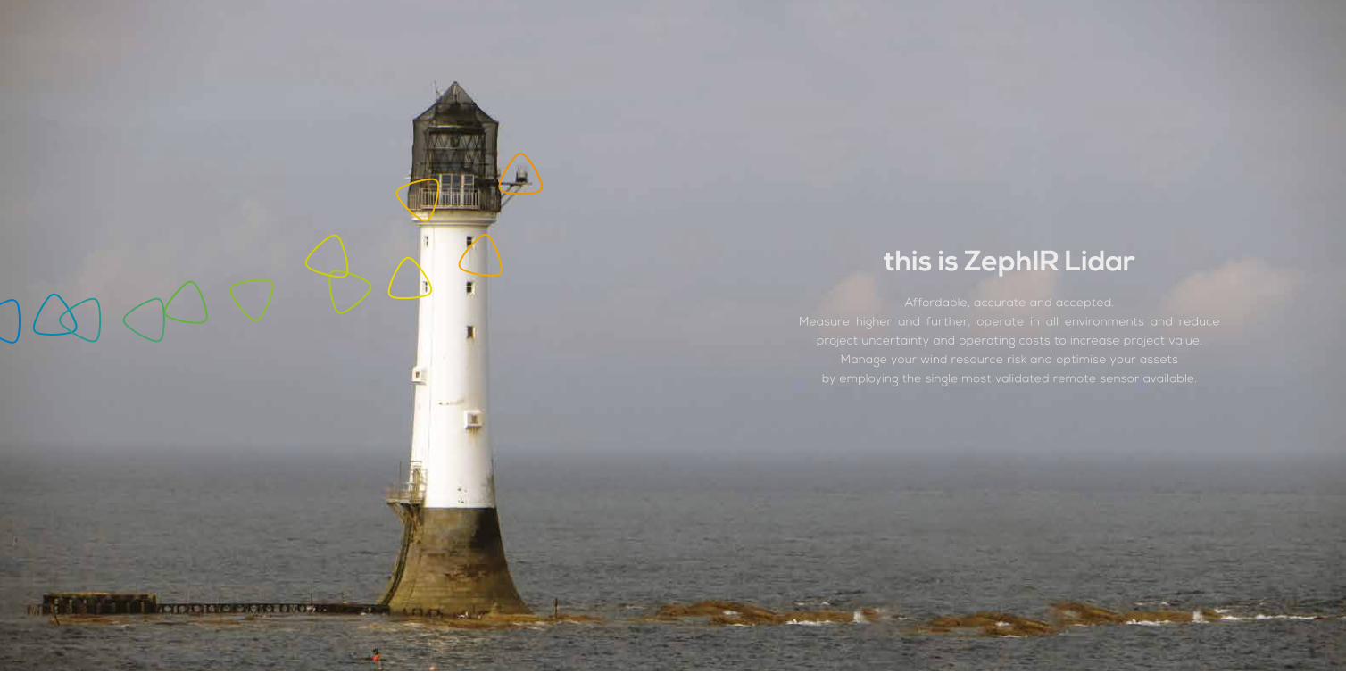
this is ZephIR LidarAffordable, accurate and accepted.
Measure higher and further, operate in all environments and reduce
project uncertainty and operating costs to increase project value.
Manage your wind resource risk and optimise your assets
by employing the single most validated remote sensor available.
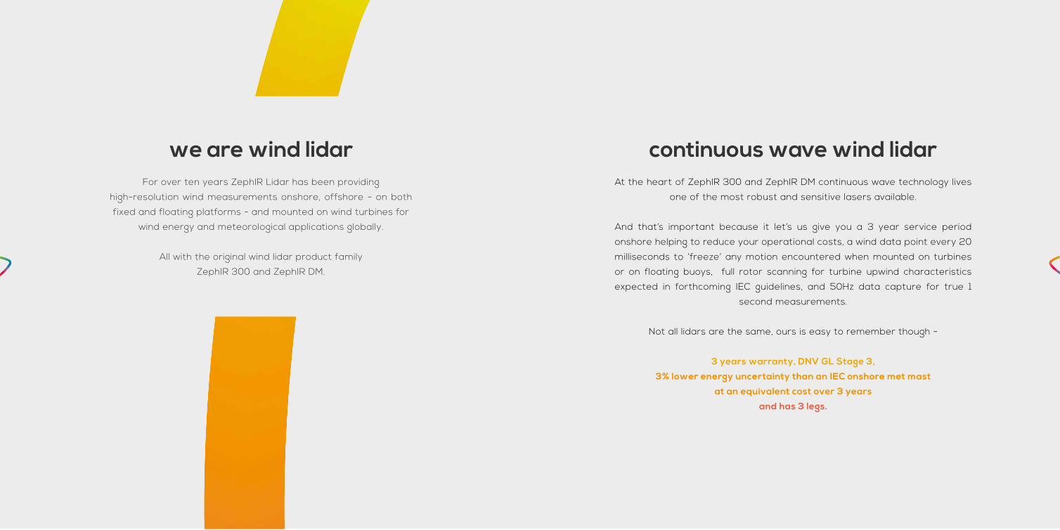
continuous wave wind lidarAt the heart of ZephIR 300 and ZephIR DM continuous wave technology lives
one of the most robust and sensitive lasers available.
And that’s important because it let’s us give you a 3 year service period
onshore helping to reduce your operational costs, a wind data point every 20
milliseconds to ‘freeze’ any motion encountered when mounted on turbines
or on floating buoys, full rotor scanning for turbine upwind characteristics
expected in forthcoming IEC guidelines, and 50Hz data capture for true 1
second measurements.
Not all lidars are the same, ours is easy to remember though -
3 years warranty, DNV GL Stage 3,
3% lower energy uncertainty than an IEC onshore met mast
at an equivalent cost over 3 years
and has 3 legs.
we are wind lidarFor over ten years ZephIR Lidar has been providing
high-resolution wind measurements onshore, offshore - on both
fixed and floating platforms - and mounted on wind turbines for
wind energy and meteorological applications globally.
All with the original wind lidar product family
ZephIR 300 and ZephIR DM.

The industry’s most validated wind lidar1 for ground-based, 10 metre to
200+ metre wind measurements ideal for site resource assessment,
power curve measurements and bankable Annual Energy Prediction
(AEP) campaigns at the lowest cost of lidar ownership available
and a 3 year ZephIR Care warranty as standard onshore with no
requirement for annual servicing or calibration.
The unique Dual-Mode wind lidar for turbine-mounted, high resolution,
full rotor wind measurements upwind of a wind turbine from 10
metres to 300+ metres to benchmark turbine performance, identify
opportunities for increased production and inform O&M strategies.
All with the added functionality of ground-based deployments from
the same core product.
1 Over 200 performance validations against a consistent, IEC compliant met mast site
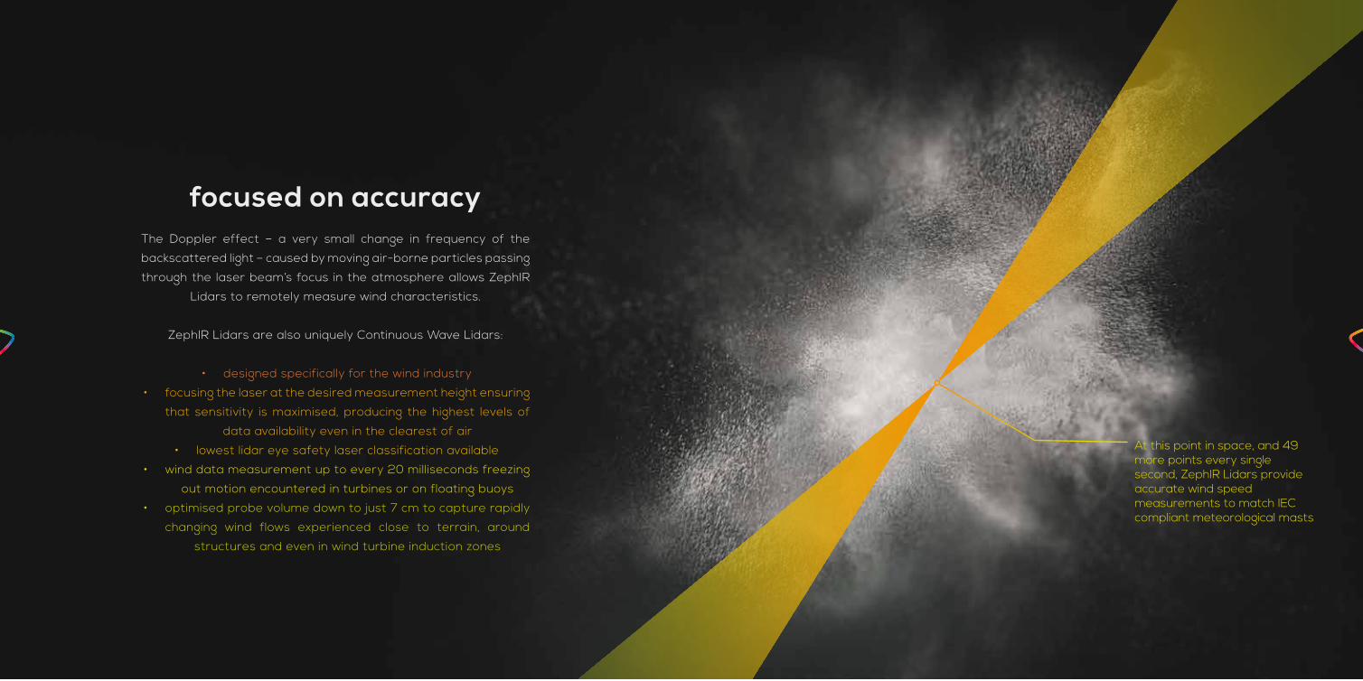
focused on accuracyThe Doppler effect – a very small change in frequency of the
backscattered light – caused by moving air-borne particles passing
through the laser beam’s focus in the atmosphere allows ZephIR
Lidars to remotely measure wind characteristics.
ZephIR Lidars are also uniquely Continuous Wave Lidars:
• designed specifically for the wind industry
• focusing the laser at the desired measurement height ensuring
that sensitivity is maximised, producing the highest levels of
data availability even in the clearest of air
• lowest lidar eye safety laser classification available
• wind data measurement up to every 20 milliseconds freezing
out motion encountered in turbines or on floating buoys
• optimised probe volume down to just 7 cm to capture rapidly
changing wind flows experienced close to terrain, around
structures and even in wind turbine induction zones
At this point in space, and 49 more points every singlesecond, ZephIR Lidars provide accurate wind speed measurements to match IEC compliant meteorological masts
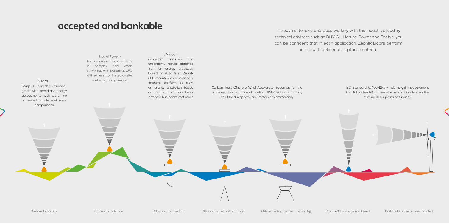
accepted and bankable
DNV GL - Stage 3 - bankable / finance-grade wind speed and energy assessments with either no or limited on-site met mast
comparisons
Natural Power - finance-grade measurements in complex flow when converted with Dynamics CFD with either no or limited on site
met mast comparisons
DNV GL - equivalent accuracy and uncertainty results obtained from an energy prediction based on data from ZephIR 300 mounted on a stationary offshore platform as from an energy prediction based on data from a conventional offshore hub height met mast
Carbon Trust Offshore Wind Accelerator roadmap for the commercial acceptance of floating LIDAR technology - may
be utilised in specific circumstances commercially
IEC Standard 61400-12-1 - hub height measurement (+/-1% hub height) of free stream wind incident on the
turbine (>2D upwind of turbine)
Through extensive and close working with the industry’s leading
technical advisors such as DNV GL, Natural Power and Ecofys, you
can be confident that in each application, ZephIR Lidars perform
in line with defined acceptance criteria.
Onshore: benign site Onshore: complex site Offshore: fixed platform Offshore: floating platform - buoy Offshore: floating platform - tension leg Onshore/Offshore: ground-based Onshore/Offshore: turbine-mounted
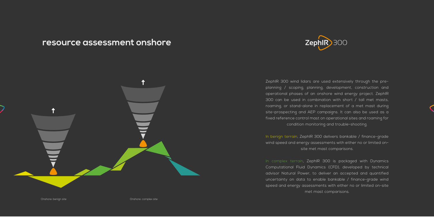
ZephIR 300 wind lidars are used extensively through the pre-
planning / scoping, planning, development, construction and
operational phases of an onshore wind energy project. ZephIR
300 can be used in combination with short / tall met masts,
roaming, or stand-alone in replacement of a met mast during
site-prospecting and AEP campaigns. It can also be used as a
fixed reference control mast on operational sites and roaming for
condition monitoring and trouble-shooting.
In benign terrain, ZephIR 300 delivers bankable / finance-grade
wind speed and energy assessments with either no or limited on-
site met mast comparisons.
In complex terrain, ZephIR 300 is packaged with Dynamics
Computational Fluid Dynamics (CFD), developed by technical
advisor Natural Power, to deliver an accepted and quantified
uncertainty on data to enable bankable / finance-grade wind
speed and energy assessments with either no or limited on-site
met mast comparisons.
resource assessment onshore
Onshore: benign site Onshore: complex site

absolute accuracyZephIR 300 has been deployed in a world first 'absolute accuracy' test
in LM Windpower’s wind tunnel, Denmark.
ZephIR 300 successfully measured wind speeds
with an averaged difference of just 0.4%
for a sustained period of time and across all measured speeds.
from the most* validated remote sensor
ZephIR 300 has been successfully validated in more than 200
Performance Verifications *at a consistent IEC 61400-12-1 Compliant
Site, approved for use by technical and engineering services providers
DNV GL, and Natural Power.
Data availability is, on average, 97% through all heights measured
and up to 200 metres from ground level.

key features & benefitsDNV GL Stage 3 approved finance-grade data in benign terrain
Natural Power approved finance-grade data in complex terrain
200+ single type batch verification at IEC compliant site
Absolute accuracy demonstrated through wind tunnel testing
• Hub height wind direction, horizontal and vertical wind speeds
• True 1 second, or averaged 10 minute wind data
• Vertical wind shear
• Wind veer (variation of wind direction with height)
• Turbulence Intensity (TI) and other turbulence measures
• 36 months warranty
• No annual servicing or annual calibration
the economic benefitsWind resource assessment determines the long-term wind
resource and flow characteristics across the project site so that
wind turbine siting, specification and suitability studies can be
performed, and to determine the long-term wind resource so
that accurate annual and life-time energy yield predictions can
be made, including an assessment of the uncertainty in such
calculations.
ZephIR 300 delivers measurements at heights across the entire
rotor-swept area, confirming hub-height resource as well as wind
shear, veer and turbulence across the rotor. Shear extrapolation
bias and uncertainty are therefore greatly reduced.
ZephIR 300 improves flow model accuracy through multiple
spatially separated measurement points on the site for model
verification and tuning. Advanced flow models provide significantly
improved horizontal and vertical extrapolation of measured wind
resource, especially in complex and forested terrain.
ZephIR 300 is re-deployable, portable and does not require lengthy
planning applications before installation. Data can be collected
easily at multiple points on a site to provide representative
measured data for all turbine locations and tuning / verification
points for flow models further reducing uncertainty.
These reductions in uncertainty and bias improve the potential
profitability of a wind farm through more accurate wind resource
assessment. Further, understanding of wind flow for wind turbine
performance through power curve measurements across the
entire rotor diameter to IEC 61400-12-1 is achieved.
Reduction in uncertainty by measurement method,
demonstrated by technical advisor Ecofys,
full paper available by request.
Lidar
moved around site
Lidar
next to mast
Lidar
stand-alone
Met mast only
Climate-based
0% 5% 10% 15%
Wind statistics
Vertical exploration
Horizontal exploration
Long term representation

commercial experience
Extreme snow conditions
Operational site measurements
Packaged power and ZephIR
ZephIR + Short-mast project financing
Satellite communications pack Complex terrain finance-grade measurements
Wind farm trouble-shooting
Autonomous operation
0 5 10 15 20
20
15
10
5
0
Mast wind speed (m/s)
Zep
hIR
30
0 w
ind
sp
eed
(m/s
)
Proven accuracy onshore
Desert conditions and extreme high temperatures

specification
PERFORMANCE ZephIR 300
Range (min.)Range (max.)
10 metres200 metres
Probe length @ 10 mProbe length @ 100 m
± 0.07 metres± 7.70 metres
Heights measured 10 (user-configurable)
Sampling rate 50Hz
Averaging period user configurable (1 second as standard)
Scanning cone angle 30° (other angles available)
Speed accuracy variation* < 0.1 m/s
Speed range < 1 m/s to 70 m/s
Direction accuracy variation* < 0.5°
OPERATIONS ZephIR 300
Temp range (min.)Temp range (max.)
-40°C+50°C
Power consumption 69 Watts**
Power input 12 V
Weight (excluding flight casing) 55 kg
Service interval 36 months
DATA ZephIR 300
10 minute averaging 90Kb / day
1 second data 3MB / day
On board storage 36 months
Data transfer LAN; MODBUS; WiFi; Global SIM; Sat Comms
Timestamp / Location GPS
SAFETY ZephIR 300
Laser classification Class 1
Eye safety standard IEC 60825-1
IP Rating IP67
Compliance Full CE accreditation
* As measured against a calibrated moving target. ** In off-grid, DC power situations, excluding any convertor losses and in standard climates. Always refer to manufacturers guidelines on power before specifying 3rd party power solutions. Alternatively use the ZephIR Power support package.
DATA HEADING UNIT EXPLANATION
Reference - Numerical reference of each record
Time and date - In text format, to the nearest second
Timestamp Seconds Time and date of the reading as numerical value in seconds
Info. flags - Operational mode information
Status flags - Internal ZephIR status
Battery Volts Internal battery voltage
Generator Volts External supply voltage, if present
Upper temp / lower temp
Degrees Celsius
Pod temperature
Pod humidity Percent Internal ZephIR humidity
GPS DecimalDegrees
GPS location (lat and long)
ZephIR bearing Degrees Direction of the ZephIR wrt True North
Tilt Degrees Pitch and roll away from vertical
Air Temp. Degrees Celsius
Ambient temperature
Pressure Millibar / Hectopas-cals
Ambient pressure
Humidity Percent Ambient humidity
Met station wind speed
Metres per second
Horizontal wind speed measured by the Met station
Met station direction
Degrees Wind direction measurement by the Met station
Raining - Rain sensor detects rain
Horizontal wind speed
Metres per second
Horizontal wind speed measured by ZephIR
Vertical wind speed
Metres per second
Vertical wind speed measured by ZephIR
Horizontal min / max
Metres per second
Minimum / maximum horizontal wind speeds measured by ZephIR
TI - Turbulence Intensity
1
2
3
4
55
6
7
8
7
8
1. MARINE METEOROLOGICAL STATION providing temperature, pressure and humidity measurements, designed to operate in harsh marine environments and includes a GPS device for data timestamp & location facilitating synchronisation with other devices
2. AUTOMOTIVE MOISTURE SENSOR for activating wiper arm, flagging periods of precipitation and designed to operate in exhaustive automotive applications
3. MARINE WIPER SYSTEM with silicone wiper blade for extended operation, keeping window surface clear of moisture and debris, designed to operate in the harshest of environments fed by industrial specification screen wash capable of operation in sub-zero temperatures
4. INSULATED ENCLOSURE manufactured in twin-skin Polyethylene, operating across all temperature ranges (-40°C to +50°C) and with IP seals across all surfaces and connector panels
5. 3 X CARBON FIBRE LEGS resistant to horizontal wind loading while keeping overall weight minimised, and providing a proven tripod levelling system
6. MARINE GRADE ROPE at three locations around waist of product for ease of lifting across uneven terrain
7. QUICK RELEASE HANDLES for simple levelling adjustments and designed for gloved operation
8. WIDE SPREAD FEET for stable footing in all terrains and all ground surfaces with security bolt through apertures

3 years warranty and support, 3 year service interval
and 3 years courtesy lidar cover.
ZephIR Care answers the need for truly autonomous provision of wind
data onshore and provides you with the ability to operate ZephIR
300 in the field for unbroken measurement campaigns of 3 years
particularly suitable in applications where the sensor must remain in
place long-term such as during an Annual Energy Prediction. In these
campaigns the economic viability of recovering a sensor demands the
highest levels of reliability and support, now delivered by ZephIR Lidar.
3 years warranty
3 years dedicated technical support engineer
via telephone and to perform remote diagnostics
An IEC compliant met mast validation
Optional daily monitoring
Choice of data delivery (email, FTP, web interface, real-time)
A ‘courtesy’ ZephIR 300 in any event where an infield issue cannot be
quickly resolved remotely
How? This support offering is as unique as the continuous wave laser
technology inside ZephIR, and continuous wave = continuous operation.
We provide a low-cost, stand-alone power system designed specifically
for the wind industry’s continuing adoption of remote sensing.
ZephIR Power is a fully modular off-grid power supply which can be
set up for the most arduous of deployments and uses a combination
of a methanol fuel cell with 220Ah batteries. The modular concept
allows you to a add a wind turbine of up to 450W and solar PV micro
panels together with an optional battery extension pack to maximise
the renewable inputs. With extended complete autonomy of up to 12
months and a specified operating temperature range of -40°C to +50°C,
ZephIR Power is of optimal design for the remote conditions often
encountered by remote sensors such as the ZephIR 300 wind lidar.
With just a small number of visits to site required annually and the
lowest capital investment we are confident that ZephIR Power answers
many of your needs alongside our bankable wind lidar.
ZephIR Power ensures the highest possible system availability for
your ZephIR solution in off-grid locations where the power supply is a
fundamental requirement of secure autonomous operation.

ZephIR Direct* delivers a 24 months fixed rental period of
ZephIR 300 wind lidar provision with the industry leading
ZephIR Care warranty and support package
for the duration of the contract:
No annual servicing or calibration
Courtesy lidar coverage
DNV GL Stage 3 / Natural Power finance-grade wind data**
IEC compliant met mast validation
Dedicated technical support engineer
Choice of data delivery
ZephIR Direct represents the lowest annual cost of "hub-height
and above" finance-grade wind data from the most validated
wind lidar available.
*subject to limited availability, terms & conditions**onshore (benign and complex) and offshore (fixed platforms)
resource assessment offshore
85% of floating wind lidar platform manufacturers choose ZephIR
for resource assessment offshore.
On fixed platforms, technical advisors DNV GL and Natural Power
place equivalent accuracy and uncertainty results from an
energy prediction based on data from ZephIR 300 mounted on a
stationary offshore platform as from an energy prediction based
on data from a conventional offshore hub height met mast.
Economic savings can also be realised in the area of offshore
wind resource assessment in addition to overcoming practical
challenges where met masts are not a viable option. And, with
ever larger turbines offshore the need to understand the full
swept area wind characteristics / resource becomes increasingly
important.
Offshore: fixed platform Offshore: floating platform - buoy Offshore: floating platform - tension leg
“ZephIR Lidar is the industry’s leading wind lidar due to its proven
accuracy and reliability.
Hosting it on a stable platform, combined with ZephIR Lidars’ unique
Continuous Wave laser technology which delivers unparalleled 50Hz
wind data, completely removes the need for mechanical motion
compensation or post processing algorithms for data correction. This
provides exceptionally high data availability without compromising on
accuracy and eliminates potential sources of error and uncertainty.“
trusted to deliver TM
the practical benefitsWind resource assessment offshore can be conducted with tall
met mast structures however there are a number of practical
and economic limitations.
ZephIR 300 ensures no flow distortion on measured data
as there is no requirement for tall structures at or near the
measurement height.
ZephIR 300 enables accurate measurement of resource and
shear profiles across ranges between 10m and 200m above
platform height
Proven accuracy and confidence of ZephIR onshore measured
wind resource is maintained offshore due to the uniform wind
flow conditions.
Reduced logistical costs, time-scales and risk with no
requirements for working at height.
Operational costs are greatly reduced with no requirement
for routine maintenance or sensor recalibration during the
warranted period.
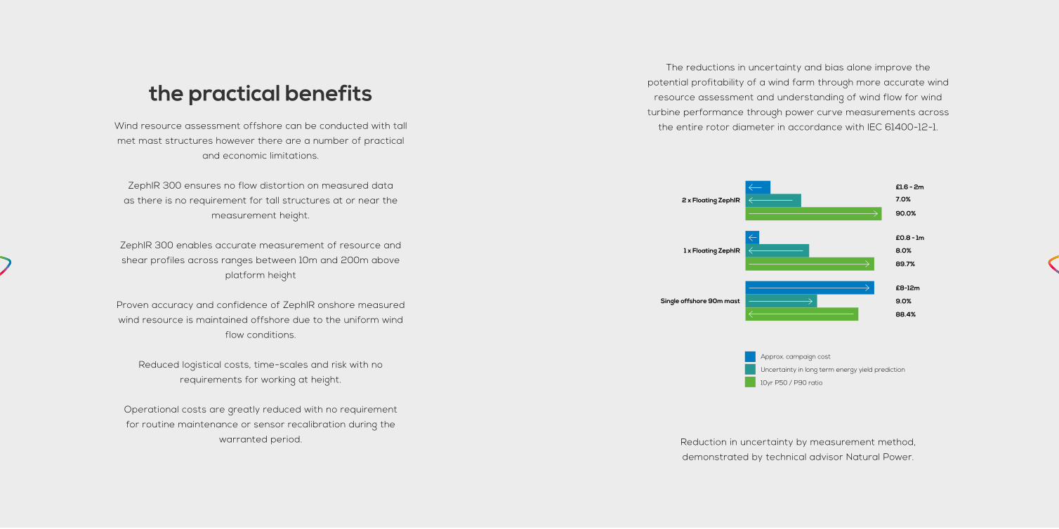
The reductions in uncertainty and bias alone improve the
potential profitability of a wind farm through more accurate wind
resource assessment and understanding of wind flow for wind
turbine performance through power curve measurements across
the entire rotor diameter in accordance with IEC 61400-12-1.
Reduction in uncertainty by measurement method,
demonstrated by technical advisor Natural Power.
2 x Floating ZephIR
1 x Floating ZephIR
Single offshore 90m mast
8.0%
89.7%
7.0%
90.0%
9.0%
88.4%
£8-12m
£0.8 - 1m
£1.6 - 2m
Approx. campaign cost
Uncertainty in long term energy yield prediction
10yr P50 / P90 ratio
offshore floating lidarFloating lidar provides significant opportunities for up-front cost
savings in any offshore anemometry campaign. However, devices
are subjected to motion which could, if not understood, increase
the uncertainty connected to the measurement. Increased
measurement uncertainties may make the solution unviable and
negatively offset any potential CAPEX savings, impacting across
the lifetime of the wind farm.
Buoys typically exhibit translational (surge, sway and heave) and
rotational motions (pitch, roll and yaw). Continuous Wave lidar,
at the heart of ZephIR 300, offers unique properties to manage
these motions.
All of the available laser energy is focussed at the user defined
measurement height leading to a consistently high carrier-to-
noise-ratio (CNR) and consequently very high line-of-sight velocity
data rates of 50 Hz. This leads to 50 line-of-sight wind data points
being acquired during a 1 second scan at each height. The nature
of buoy motion is such that very little movement occurs over the
20 ms required for each line-of-sight measurement, and even
over the 1 second required to measure at each height, the motion
is limited resulting in a negligible measured and simulated bias in
wind speeds, all without the need for a mechanical gimbal.
Both simulations and offshore trials demonstrate that the
10-minute averaged wind speed recorded by ZephIR 300 is very
resilient to the presence of the type of motion experienced by a
range of buoy designs, even when no mechanical stabilisation or
software compensation is applied. Yaw is easily compensated for
by using a compass to determine the actual bearing at the time
of the measurement, translation motions tend to average to zero
over 10-minutes and do not degrade the results.
85% of floating wind lidar platform manufacturers agree, and
choose ZephIR 300 for resource assessment offshore.
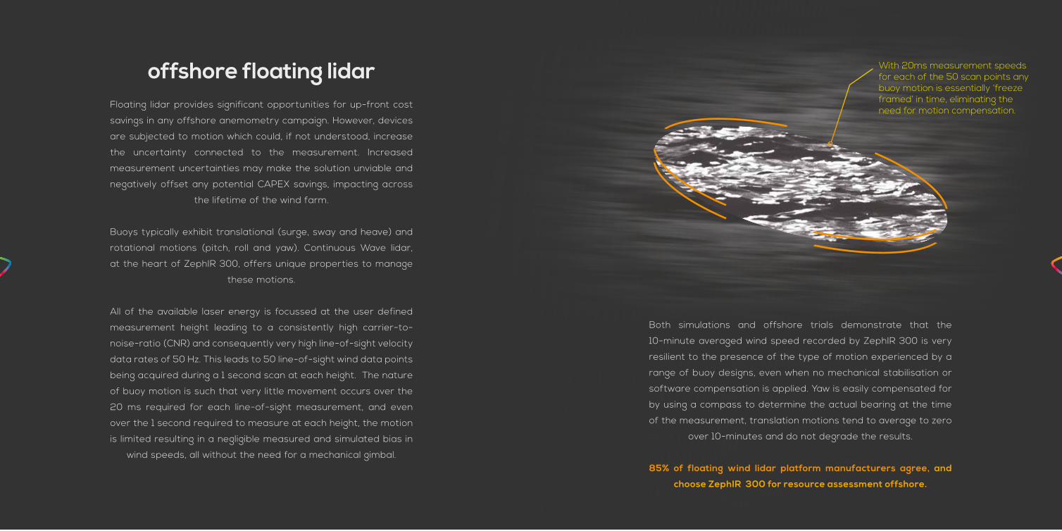
With 20ms measurement speeds for each of the 50 scan points any buoy motion is essentially ‘freeze framed’ in time, eliminating the need for motion compensation.
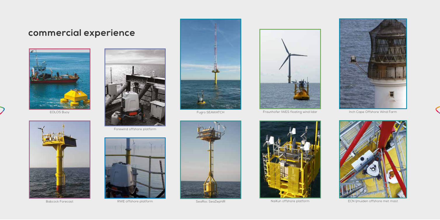
commercial experience
Forewind offshore platform
EOLOS Buoy
Babcock Forecast
Fugro SEAWATCH
SeaRoc SeaZephIR NaiKun offshore platform
Fraunhofer IWES floating wind lidar
RWE offshore platform
Inch Cape Offshore Wind Farm
ECN Ijmuiden offshore met mast
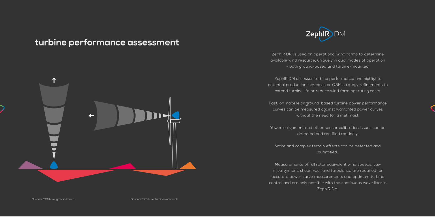
turbine performance assessmentZephIR DM is used on operational wind farms to determine
available wind resource, uniquely in dual modes of operation
- both ground-based and turbine-mounted.
ZephIR DM assesses turbine performance and highlights
potential production increases or O&M strategy refinements to
extend turbine life or reduce wind farm operating costs.
Fast, on-nacelle or ground-based turbine power performance
curves can be measured against warranted power curves
without the need for a met mast.
Yaw misalignment and other sensor calibration issues can be
detected and rectified routinely.
Wake and complex terrain effects can be detected and
quantified.
Measurements of full rotor equivalent wind speeds, yaw
misalignment, shear, veer and turbulence are required for
accurate power curve measurements and optimum turbine
control and are only possible with the continuous wave lidar in
ZephIR DM.
Onshore/Offshore: ground-based Onshore/Offshore: turbine-mounted

N
S
EW
versatility and transparency From a single product, ground-based and nacelle-mounted
measurements allow for complete asset performance transparency
previously not possible with site and SCADA data alone.

key benefitsMeasure power curves to compare against warranted power curves
without the need for a met mast, allowing you to fully understand the
performance of your operating asset.
Benchmark performance with our standardised reports to classify
and prioritise each turbine in your portfolio to action tailored O&M
strategies down to turbine level.
Detect yaw misalignment and other sensor calibration issues which
when rectified routinely delivers 1-5% AEP increase.
Reduce the load experienced by a WTG through the measurement of
extreme wind events and enable wake detection / sector management
to extend turbine life or reduce wind farm operating costs.
key features• Hub height and rotor equivalent horizontal wind speeds
• Wind yaw alignment relative to turbine
• Power law and non-power law vertical wind shear quantification,
including low level jets
• Wind veer (variation of wind direction with height)
• TI and other turbulence measurements
• Wind field complexity
• Turbine wakes and effects of complex terrain for sector
management
• 24 months warranty
• No annual servicing or annual calibration within warranty period
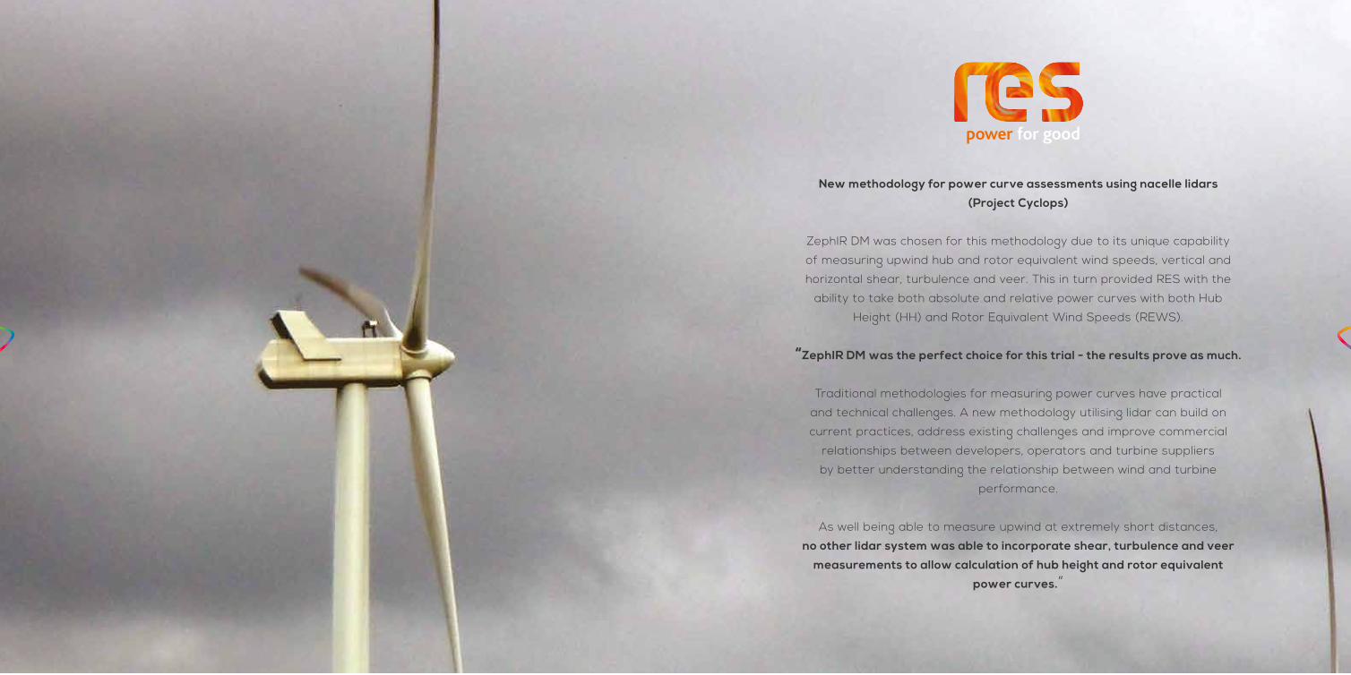
New methodology for power curve assessments using nacelle lidars
(Project Cyclops)
ZephIR DM was chosen for this methodology due to its unique capability
of measuring upwind hub and rotor equivalent wind speeds, vertical and
horizontal shear, turbulence and veer. This in turn provided RES with the
ability to take both absolute and relative power curves with both Hub
Height (HH) and Rotor Equivalent Wind Speeds (REWS).
“ZephIR DM was the perfect choice for this trial - the results prove as much.
Traditional methodologies for measuring power curves have practical
and technical challenges. A new methodology utilising lidar can build on
current practices, address existing challenges and improve commercial
relationships between developers, operators and turbine suppliers
by better understanding the relationship between wind and turbine
performance.
As well being able to measure upwind at extremely short distances,
no other lidar system was able to incorporate shear, turbulence and veer
measurements to allow calculation of hub height and rotor equivalent
power curves.”

specification1
2
3
4
5
5
6
7
8
7
8
5
1. MARINE METEOROLOGICAL STATION providing temperature, pressure and humidity measurements, designed to operate in harsh marine environments and includes a GPS device for data time-stamp & location facilitating synchronisation with other devices
2. AUTOMOTIVE MOISTURE SENSOR for activating wiper arm, designed to operate in exhaustive automotive applications
3. MARINE WIPER SYSTEM with silicone wiper blade for extended operation, keeping window surface clear of moisture and debris, designed to operate in the harshest of environments fed by industrial specification screen wash capable of operation in sub-zero temperatures
4. INSULATED ENCLOSURE manufactured in twin-skin Polyethylene, with IP seals across all surfaces and connector panels
5. CARBON FIBRE LEGS resistant to horizontal wind loading while keeping overall weight minimised
6. DUAL-MODE FRAME to allow both ground-based and turbine-mounted installation from the same platform
7. QUICK RELEASE HANDLES for simple levelling adjustments and designed for gloved operation
8. WIDE SPREAD FEET for stable footing on nacelle roof, and bolt through apertures for quick fixing to all surface materials
PERFORMANCE ZephIR DM
Range (min.)Range (max.)
10 metres300+ metres
Probe length @ 10 mProbe length @ 100 m
± 0.07 metres± 7.70 metres
Ranges measured 10 (user-configurable)
Sampling rate 50Hz
Averaging period 1 second as standard (user-configurable)
Readout rate 100ms (user-configurable)
Scanning cone angle 30° or 15°(other angles available)
Speed accuracy 0.1 m/s
Speed range < 1 m/s to 70 m/s
Direction accuracy < 0.5°
Visible laser alignment accuracy
1°
Measurement accuracy compensation
0.1 m/s
Inclination and roll measurement compensation accuracy
0.1°
Temp range (min.)Temp range (max.)
-25°C+50°C
Power consumption 85 Watts
Power input 250 -90 V AC 50-60Hz or 12V DC
Weight (excluding flight casing)
41kg
10 minute averaging 1 second data On board storage
90Kb / day3Mb / day36 months
Service interval 24 months
Data transfer LAN, MODBUS, WiFi, Global SIM, Sat Comms
Timestamp / Location GPS
Laser classification Class 1
Eye safety standard IEC 60825-1
Enclosure IP Rating IP69
Compliance Full CE accreditation
ZephIR DM OUTPUT
UNIT EXPLANATION
Reference - Numerical reference of each record
Time and date - In text format, to the nearest second
Timestamp Seconds Time and date of the reading as numerical value in seconds
Hub height horizontal wind speed
Metres per second
Horizontal wind speed measured by the ZephIR DM at hub height, with real-time inclination correction
Rotor-equivalent horizontal wind speed
- Rotor equivalent horizontal wind speed, as described in IEC 61400-12-1 CD, additionally incorporating real-time inclination correction and wind veer across the turbine
Vertical Wind Shear Exponent
- Power law wind shear exponent as measured by the ZephIR DM around the centre of the scan. Positive values indicate that the wind speed is higher above the optical axis than below.
Wind Yaw Misalignment
Degrees Angle of the horizontal wind direction vector to the ZephIR DM optical axis (i.e. yaw) as measured by the ZephIR DM. Positive values indicate that the wind direction is crossing from right to left (when looking from behind the ZephIR DM into the wind.
Horizontal Std.Dev.
Metres per second
Standard deviation of un-averaged horizontal wind speeds included in 10-min average.
Wind Yaw Misalignment Std.Dev.
Degrees Standard deviation of the un-averaged wind yaw angles included in the 10-min average.
Vertical veer Degrees per metre
Variation of wind direction with height
Range Metres Range at which the various wind quantities are determined
Flow complexity - A quantified measure of the wind flow complexity measured around the ZephIR DM scan. Useful for identifying wakes and complex wind flow conditions
Inclination Angle Min
Degrees Minimum inclination angle detected by the motion sensors. Positive inclination angles indicate that the ZephIR DM optical axis in the direction of laser emission is tilted above the horizontal axis.
ZephIR DM OUTPUT
UNIT EXPLANATION
Inclination Angle Max
Degrees Maximum inclination angle detected by the motion sensors.
Inclination Angle Mean (deg)
Degrees Mean inclination angle detected by the motion sensors.
Inclination Angle Std. Dev
Degrees Standard deviation of inclination angle detected by the motion sensors.
Fore-Aft Velocity Max
Metres per second
Maximum fore-aft velocity detected by the motion sensors.
Fore-Aft Velocity Mean
Metres per second
Mean fore-aft velocity detected by the motion sensors.
Fore-Aft Velocity Std. Dev
Fit Flags - A bit field representing the result of fitting process. Flag values.
Mean Fit Residual
Metres per second
The average fit residual of all the measurement points included in the fitting of the wind model.
TI - Turbulence Intensity
Upper temp / lower temp
Degrees Celsius
Pod temperature
Enclosure humidity
Percent Internal humidity
GPS Decimal Degrees
GPS location (lat and long)
ZephIR bearing Degrees Direction of the ZephIR with respect to True North
Tilt Degrees Pitch and roll away from vertical
Air Temp. Degrees Celsius
Ambient temperature
Pressure Millibar Ambient pressure
Humidity Percent Ambient humidity
MET wind speed Metres per second
Horizontal wind speed measured by the MET station
MET direction Degrees Wind direction measurement by the MET station
Raining - Rain sensor detects rain
Status Flags Colour coded
Continuous operational status
1
2
3
4
5
6
7
8
7
8
5

commercial experience
Redefining IEC standards
Power curve measurements
Operational trouble-shooting
Power curve measurements and optimisation
Wind turbine control
Dual Mode capability
Proven accuracy
0 5 10 15 20
20
15
10
5
0
Mast hub height wind speed (m/s)
Zep
hIR
DM
hub
hei
ght w
ind
sp
eed
(m/s
)
Performance optimisation and reporting
Yaw misalignment detection

We are the home of wind lidar for the wind industry.
We were the original,
we continue to be the ‘first’ in every application
and we strive always to be the best.
We are wind lidar.

the original wind lidarIn 2003 we released the first commercial wind lidar, ZephIR,
exploiting decades of research at UK government Research &
Development establishment QinetiQ. Designed specifically for the
wind industry ZephIR has paved the way for many of the remote
sensing devices seen in the market today.
Our original lidar technology continues to innovate with world
firsts such as taking measurements from a wind turbine spinner
and being the first to deploy an offshore wind lidar, both fixed
and floating. ZephIR has also now amassed more than 10 million
hours of operation across 1000+ deployments globally spanning
a decade of commercial experience.
The launch of ZephIR Care and ZephIR Direct build on technology
innovation to deliver truly innovative commercial solutions for
wind lidar ownership at the lowest cost available to you.
2003The first wind lidar to make upwind measurements
from a turbine nacelle.
2004The first and original commercially available
lidar for the wind industry. The first wind lidar to investigate the behaviour of turbine wakes.
2005The first wind lidar to be deployed offshore on
a fixed platform.
2007The first wind lidar to take measurements from
a turbine spinner.
2009The first wind lidar to be deployed offshore on a
floating platform.
2008The first wind lidar to be signed off against an
industry-accepted validation process.
2011New ZephIR 300 launched with optimised original, proven core technology at the heart, and the first
wind lidar to be proven in a wind tunnel.
2010The first wind lidar to re-finance and re-power a
wind farm.
2012The first wind lidar to be used with very short
masts and secure project financing.
2013The first wind lidar to provide true dual mode
functionality in one platform (ZephIR DM).
2014Largest batch of single-type lidar verifications
against an IEC-compliant met mast.
2015ZephIR Care and ZephIR Direct deliver the lowest
cost of lidar ownership available

zephirlidar.com
© 2015 Zephir Ltd. All rights reserved. ZephIR, Zephir, ZephIR 300, ZephIR DM,
ZephIR Care, ZephIR Direct, ZephIR Power and Waltz are trademarks of ZephIR
Lidar. Other company and product names may be trademarks of their respective
owners. All facts and figures correct at time of print. This document is not
contractual and all information may change without notice.