Embed Size (px)
Citation preview

NunavutMining, Mineral Exploration and Geoscience
Overview 2020

About Nunavut: Mining, Mineral Exploration and Geoscience Overview 2020
This publication is a combined effort of four partners: Crown‑Indigenous Relations and Northern Affairs Canada (CIRNAC), Government of Nunavut (GN), Nunavut Tunngavik Incorporated (NTI), and Canada‑Nunavut Geoscience Office (CNGO). The intent is to capture information on exploration and mining activities in 2020 and to make this information available to the public and industry stakeholders.
We thank the many contributors who submitted data and photos for this edition. Prospectors and mining companies are welcome to submit information on their programs and photos for inclusion in next year’s publication. Feedback and comments are always appreciated.
Note to Readers
This document has been prepared based on information available at the time of writing. All resource and reserve figures quoted in this publication are derived from company news releases, websites, and technical reports filed with SEDAR (www.sedar.com). Readers are directed to individual company websites for details on the reporting standards used. The authors make no guarantee of any kind with respect to the content and accept no liability, either incidental, consequential, financial or otherwise, arising from the use of this document.
All exploration information was gathered prior to December 2020. Exploration work was completed and reported during 2019 or 2020 for all projects with active status in this publication. Projects with inactive status had exploration work last completed on them in 2017 or 2018, have active mineral tenure, and may have valid land use permits and/or water licences as issued by CIRNAC and the Nunavut Water Board.
The term National Instrument 43‑101 (NI 43‑101) refers to a standard for the disclosure of scientific and technical information about mineral projects. This standard is supervised
by the Canadian Securities Administrators (CSA), the regulatory body which oversees stock market and investment practices, and is intended to ensure that misleading, erroneous, or fraudulent information relating to mineral properties is not published and promoted to investors on the stock exchanges overseen by the CSA. Resource estimates reported by mineral exploration companies that are listed on Canadian stock exchanges must be NI 43‑101 compliant.
Acknowledgements
This publication was written by the Mineral Resources Division at CIRNAC’s Nunavut Regional Office (Matthew Senkow, Alia Bigio, Samuel de Beer, Yann Bureau, Cedric Mayer, and Steve Sharpe, who provided cartography). Contributions were received from Linda Ham and colleagues at the CNGO, Peter Ohokanoak and Laura Thompson at NTI, and Paul Budkewitsch at the GN.
Cover photo: Helicopter carrying airborne electromagnetic survey equipment at Sabina’s Back River project. Courtesy of Sabina Gold & Silver Corp.
For information regarding reproduction rights, please contact Crown‑Indigenous Relations and Northern Affairs Canada at: [email protected]
www.canada.ca/crown‑indigenous‑relations‑northern‑affairs1‑800‑567‑9604 TTY only 1‑866‑553‑0554
Catalogue: R71‑39EISSN: 2292‑7751
© Her Majesty the Queen in Right of Canada, 2020.
This publication is also available in French under the title: Activités d’exploration minérale, d’exploitation minière et de géoscience aperçu 2020
Contents
3 Land Tenure in Nunavut
6 Government of Canada
10 Government of Nunavut
16 Nunavut Tunngavik Incorporated
20 Canada-Nunavut Geoscience Office
24 Kitikmeot Region
26 Kivalliq Region
28 Qikiqtani Region
30 Base Metals
31 Diamonds
32 Gold
44 Iron
46 Inactive projects
49 Glossary
50 Guide to Abbreviations
51 Index

Spanning two million square kilometres (km2), the territory has 25 communities and an estimated population of 39,353. Inuit represent 84 per cent of the residents, creating the foundation of the territory’s culture and values. With the exception of Baker Lake, communities are located on coasts, where hunting and fishing traditionally sustained Inuit. There is no road access to Nunavut, nor are there roads connecting communities within the territory. Access is mainly by air with ships delivering supplies during the open water season.
Land Tenure in Nunavut
Aurora borealis over a drill rig on Sabina’s Back River project. Courtesy of Sabina Gold & Silver Corp.
3Nunavut Mining, Mineral Exploration and Geoscience Overview 2020

As a modern day treaty, the Nunavut Agreement provides certainty and clarity of rights to ownership and use of lands and resources within Nunavut. Under the Agreement, Inuit have fee simple title to 356,000 km2 of land, making it the largest Indigenous land settlement in Canadian history. There are 944 parcels of Inuit Owned Land (IOL) where Inuit hold surface title only. The Crown retains the mineral rights to these lands. Inuit also hold fee simple title including mineral rights to 150 parcels of IOL, which totals 38,000 km2 and represent approximately two per cent of the territory. Surface title to all IOL is held in each of the three regions (Kitikmeot, Kivalliq, and Qikiqtani) by the respective Regional Inuit Association (RIA), while title to subsurface IOL is held and administered by Nunavut Tunngavik Incorporated (NTI). Exploration agreements and mineral production leases are negotiated by NTI on land where it owns the subsurface rights, while access permission and land use licences are granted by RIAs on all IOL.
The Government of Canada administers sub‑surface rights for the remaining 98 per cent of Nunavut. Mineral claims, and mineral leases are issued pursuant to the Nunavut Mining Regulations by Crown‑Indigenous Relations and Northern Affairs Canada’s (CIRNAC) Nunavut Regional Office.
Surface rights for Crown land are administered according to the Territorial Lands Act and its regulations.
For more information on the location of IOL and Crown land in the territory, refer to the Nunavut Mineral Exploration, Mining and Geoscience Projects 2020 Map. For details on mineral tenure, visit the Nunavut Map Viewer at https://services.aadnc‑aandc.gc.ca/nms‑scn/gv/index.html. The table on page five displays the number of prospecting permits, mineral claims and mineral leases held in good standing as of November 2020 and the accompanying figure illustrates the location and extent of this mineral tenure.
The Nunavut Planning Commission (NPC) is responsible for land use planning in Nunavut and is the entry point to the regulatory system. There are two approved land use plans covering portions of Nunavut, the Keewatin Regional Land Use Plan and the North Baffin Region Land Use Plan. NPC is developing a territory‑wide plan to guide and direct resource use and development in Nunavut; the most recent draft of the plan was released in 2016. A new draft is being developed based on input received from participants. Once the Nunavut Land Use Plan is approved, it will replace both existing regional plans.
‘Runway’ on a gravel river beach at a field camp near St Joseph Plateau, northern Baffin Island. Courtesy of CIRNAC.
4 Nunavut Mining, Mineral Exploration and Geoscience Overview 2020
Land Tenure in Nunavut

!
!
!
!
!
!
!
!
!
!
!
!
!
!
!
!
!
!
!
!
!
!
!!
!
!
!
!
!
!
Qikiqtarjuaq
Kimmirut
IQALUIT
Pangnirtung
Arviat
Chesterfield Inlet
Kingnait
Whale Cove
Rankin Inlet
Coral Harbour
Naujaat
Kugluktuk
Baker Lake
Cambridge Bay
Pond Inlet
Sanirajak
Igloolik
Arctic Bay
Grise Fiord
KugaarukGjoa Haven
Taloyoak
Clyde River
Resolute
YELLOWKNIFE
40°W60°W
80°W
80°W
100°W
100°W120°W140°W
70°N
70°N
60°N
60°N
!Sanikiluaq
80°W
80°W
Projection: Canada Lambert Conformal Conic, NAD 83
! Community
Crown Mineral TenureActive Mineral Leases (519)
Active Mineral Claims (2454)
Active Prospecting Permts(129)
NTI AgreementsExploration Agreement (37)
Mineral Production Lease (3)
Mineral Tenurein
Nunavut
Data as of Nov. 18, 2020
0 125 250 375 50062.5
Kilometers
Mineral Tenure in Good Standing in Nunavut
2011 2012 2013 2014 2015 2016 2017 2018 2019 2020
Prospecting Permits 314 259 196 110 132 124 78 147 137 129
Claims 6,777 6,066 5,562 4,278 4,279 3,335 3,699 2,855 2,588 2,454
Leases 567 627 701 492 461 477 487 470 519 519
Source: CIRNAC
Exploration and Deposit Appraisal Expenditures in Nunavut
2011 2012 2013 2014 2015 2016 2017 2018 2019 2020*
Juniors (Millions $) 163.0 129.0 111.0 73.6 42.5 35.6 61.0 60.1 20.0 22.0
Seniors (Millions $) 372.6 293.5 146.6 84.4 172.5 168.9 116.0 95.5 96.4 46.0
Total 535.6 422.5 257.6 158.0 215.0 204.5 177.0 155.6 116.4 68.0
Source: Natural Resources Canada
*Revised spending intentions current to September 2020
5Nunavut Mining, Mineral Exploration and Geoscience Overview 2020
Land Tenure in Nunavut

Crown-Indigenous Relations and Northern Affairs Canada
Representing one‑fifth of Canada‘s land mass, Nunavut has tremendous resource potential and is a place of significant opportunity for Inuit, Northerners, and all Canadians. However, the COVID‑19 pandemic and the restrictions put in place by the Government of Nunavut to prevent its spread in Nunavut led many mineral exploration proponents to cancel or delay planned exploration programs in the territory. Statistics released by Natural Resources Canada indicate that only $68 million, the lowest amount since 2001, was spent on mineral exploration and deposit appraisal in the territory in 2020, down from the original forecast of $115 million in February. Recognizing that many mineral industry proponents were unable to proceed with work on their mineral tenure in 2020, CIRNAC offered relief of reporting requirements to prospecting permit and mineral claim holders under Sections 16 and 51 of the Nunavut Mining Regulations, respectively. Since the regulations did not allow any relief measures for mineral lease
holders, Daniel Vandal, Minister of Northern Affairs, made an Order extending the time limits to pay rent for mineral leases. The Nunavut Mining Regulations were also amended to waive the payment of annual rent due on mineral leases for the one‑year period from March 13, 2020 to March 12, 2021.
Crown‑Indigenous Relations and Northern Affairs Canada (CIRNAC)’s mandate related to mineral resource development in Nunavut includes the implementation of the Nunavut Agreement, the administration of surface and subsurface rights on Crown land, and the stewardship of land and water resources.
CanadaGovernment of
6 Nunavut Mining, Mineral Exploration and Geoscience Overview 2020

Implementation of the Nunavut AgreementSigned in 1993, the Nunavut Agreement guarantees the right of Inuit to participate in decision‑making concerning the use, management, and conservation of land, water, and resources. To support this, the Nunavut Agreement created five institutions of public government:
• Nunavut Planning Commission (NPC) prepares and assesses compliance with land use plans;
• Nunavut Impact Review Board (NIRB) conducts environmental impact assessments;
• Nunavut Water Board (NWB) manages fresh water resources;
• Nunavut Surface Rights Tribunal manages disputes related to surface rights; and
• Nunavut Wildlife Management Board manages wildlife.
Administration of Surface and Subsurface RightsNunavut is the last jurisdiction in Canada where the Government of Canada, rather than the province or territory, administers Crown land. On August 15, 2019, the Minister of Crown‑Indigenous Relations and Northern Affairs Canada, the Premier of Nunavut, and the President of Nunavut Tunngavik Incorporated signed an Agreement‑in‑Principle for the devolution of land, rights in respect of waters, and natural resource management in Nunavut. Devolution in Nunavut is an essential step in the political and economic development of the territory. The signing of the Agreement‑in‑Principle is a significant milestone towards placing decision‑making power over lands and resources into the hands of Nunavut residents, while ensuring that economic and other benefits of resource development in the region are shared with the people of Nunavut. The next step is the negotiation of a Final Devolution Agreement, which is expected within five years.
CanadaGovernment of
Photo: Lake panorama, Committee Bay camp. Courtesy of CIRNAC.
7Nunavut Mining, Mineral Exploration and Geoscience Overview 2020
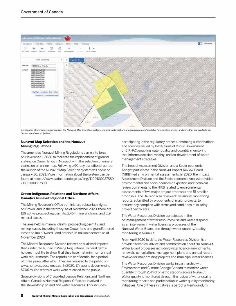
Nunavut Map Selection and the Nunavut Mining Regulations
The amended Nunavut Mining Regulations came into force on November 1, 2020 to facilitate the replacement of ground staking on Crown lands in Nunavut with the selection of mineral claims on an online map. Following a 90‑day transitional period, the launch of the Nunavut Map Selection system will occur on January 30, 2021. More information about the system can be found at https://www.aadnc‑aandc.gc.ca/eng/1100100027889/1100100027890.
Crown-Indigenous Relations and Northern Affairs Canada’s Nunavut Regional Office
The Mining Recorder’s Office administers subsurface rights on Crown land in the territory. As of November 2020, there are 129 active prospecting permits, 2,454 mineral claims, and 519 mineral leases.
The area held as mineral claims, prospecting permits, and mining leases, including those on Crown land and grandfathered leases on Inuit Owned Land, totals 5.16 million hectares as of November 2020.
The Mineral Resources Division reviews annual work reports that, under the Nunavut Mining Regulations, mineral rights‑holders must file to show that they have met minimum annual work requirements. The reports are confidential for a period of three years, after which they are released to the public on www.nunavutgeoscience.ca. In 2020, 17 reports documenting $7.06 million worth of work were released to the public.
Several divisions of Crown‑Indigenous Relations and Northern Affairs Canada’s Nunavut Regional Office are involved in the stewardship of land and water resources. This includes
participating in the regulatory process, enforcing authorizations and licences issued by Institutions of Public Government or CIRNAC, enabling water quality and quantity monitoring that informs decision‑making, and co‑development of water management strategies.
The Impact Assessment Division and a Socio‑economic Analyst participate in the Nunavut Impact Review Board (NIRB)‑led environmental assessments. In 2020, the Impact Assessment Division and the Socio‑economic Analyst provided environmental and socio‑economic expertise and technical review comments to the NIRB related to environmental assessments of two major project proposals and 51 smaller proposals. The Division also reviewed five annual monitoring reports, submitted by proponents of major projects, to ensure they complied with terms and conditions of existing project certificates.
The Water Resources Division participates in the co‑management of water resources use and waste disposal as an intervenor in water licensing processes of the Nunavut Water Board, and through water quantity/quality monitoring in Nunavut.
From April 2020 to date, the Water Resources Division has provided technical advice and comments on about 90 Nunavut Water Board processes including water licence amendments, renewals, cancellations, management plans and annual report reviews for major mining projects and municipal water licences.
The Water Resources Division works in partnership with Environment and Climate Change Canada to monitor water quantity through 25 hydrometric stations across Nunavut. Water quality is monitored through the review of water quality monitoring reports and participation in water quality monitoring initiatives. One of these initiatives is part of a Memorandum
8 Nunavut Mining, Mineral Exploration and Geoscience Overview 2020
Government of Canada
Screenshot of unit selection process in the Nunavut Map Selection system, showing units that are unencumbered and available for selection (green) and units that are available but have encumbrances (yellow).

CONTACTS
Nunavut Regional OfficePO Box 2200, Iqaluit, NU X0A 0H0t: 867 975 4500f: 867 975 4276
Lands DirectorateErik Allain, Directort: 867 975 4295e: [email protected]
Land Administratione: [email protected]
Tracey McCaie, Managert: 867 975 4280 e: [email protected]
Karen Dunphy, Senior Mining Recordert: 867 975 4281 f: 867 975 4286e: [email protected]
Mineral Resourcese: [email protected]
Matthew Senkow, Managert: 867 975 4290e: [email protected]
Alia Bigio, District Geologistt : 867 975 4292e: [email protected]
Archives Information t: 867 975 4279f: 867 975 4286e: [email protected]
Field Operations (Inspections, Compliance and Enforcement)Justin Hack, Manager t: 867 975 4553e: [email protected]
Resource Management DirectorateSpencer Dewar, Director t: 867 975 4546e: [email protected]
Water Resources Godwin Okonkwo, Managert: 867 975 4550e: [email protected]
Impact AssessmentFelexce Ngwa, Managert: 867 975 4657e: [email protected]
Nunavut General Monitoring PlanMarcus Bermann, Managert: 867 975 4531e: [email protected] www.ngmp.ca
Website www.aandc-aadnc.gc.ca/nu
of Agreement with the Kivalliq Inuit Association that involves the monitoring of water quality around mining and exploration activities in the Kivalliq Region. Another water quality monitoring initiative involves water sampling and analysis in and around the City of Iqaluit, and is conducted solely by the Water Resources Division. The Water Resources Division is also working towards the implementation of a collaborative initiative for a cumulative effects water monitoring program termed Inuu‘tuti. The Inuu‘tuti is a watershed‑based monitoring program for the Baker Lake Basin through collaboration between CIRNAC’s Water Resources Division, NGMP, the Kivalliq Inuit Association, and the Nunavut Water Board.
The Water Resources Division is also supporting the co‑development of a Nunavut Water Management Strategy through collaboration with the Nunavut Water Board, Nunavut Tunngavik Incorporated, Government of Nunavut, Nunavut Planning Commission and Nunavummiut.
The Field Operations Division ensures compliance with the Nunavut Waters and Nunavut Surface Rights Tribunal Act, the Territorial Lands Act, the Nunavut Planning and Project Assessment Act, the Arctic Waters Pollution Prevention Act and related regulations. They also conduct inspections of sites that hold land‑use permits, leases, and water licences to ensure compliance with the terms and conditions contained in these authorizations.
The Land Administration division, in addition to the responsibilities explained above, supports the licensing and environmental assessment processes by incorporating terms and conditions of project certificates into the authorizations they issue.
In addition to the monitoring noted above, CIRNAC hosts the Nunavut General Monitoring Plan (NGMP) Secretariat. NGMP is mandated under Article 12.7.6 of the Nunavut Agreement and the Nunavut Project Planning Assessment Act to monitor socio‑economic and ecosystemic conditions within the Nunavut Settlement Area and to periodically report on findings. NGMP, through targeted investments, funds research initiatives that complement or build on existing knowledge and priorities. The purpose of this monitoring is to increase public access to important ecosystemic and socio‑economic information and to inform decision‑making. The NGMP is a partnership overseen by a steering committee comprised of CIRNAC, on behalf of the Government of Canada, the Nunavut Planning Commission, the Government of Nunavut, and Nunavut Tunngavik Incorporated.
NGMP is also responsible for coordinating the Socio‑economic review of all major project submissions, screening requests, and annual report reviews submitted by the Nunavut Impact Review Board. NGMP works in close partnership with the Impact Assessment division in the completion of this work.
9Nunavut Mining, Mineral Exploration and Geoscience Overview 2020
Government of Canada

NunavutGovernment of
10 Nunavut Mining, Mineral Exploration and Geoscience Overview 2020

NunavutGovernment of
The Government of Nunavut (GN) is committed to supporting a strong and diversified minerals industry based on best practices of sustainable development and partnerships between Nunavummiut and industry. Responsible development of our abundant natural resources contributes significantly to the economic foundation of Nunavut and is important for ensuring long-term prosperity.From west to east, four mines have been established over the past decade: the Hope Bay gold mine, the Meliadine and Meadowbank gold mine complexes, and the Mary River iron mine. Mineral production in each region is enabling Nunavummiut from across the territory to participate in employment and career opportunities. The GN is committed to support further participation of Nunavummiut as new projects emerge, such as the Sabina Gold & Silver Back River gold project.
The worldwide COVID-19 pandemic has impacted numerous enterprises in Nunavut and the exploration sector and mining companies were not spared significant disruption. Nonetheless, all mines continued to function albeit with a reduced number of employees and without the local workforce. Voluntarily modified workforce measures were implemented to isolate mine sites from communities and at the time of writing, there have been no community cases of COVID-19. In the latter part of 2020, mineral production improved compared to the second quarter when activities were reduced, and some facilities were put on care and maintenance.
The GN Department of Economic Development and Transportation (EDT) provides guidance and economic support to prospectors, exploration, and the mining sector. Programs through the Minerals and Petroleum Resources Division prioritizes geoscience information, resource management, prospector skills development, carving stone
supplies, building community education and awareness, as well as investor confidence, and socio-economic monitoring. The Division has its headquarters in Iqaluit, with resident geologists and community mining awareness staff based in Arviat and Cambridge Bay. EDT also has regional offices in Kugluktuk, Rankin Inlet, Pond Inlet, and Pangnirtung.
Department StrategiesParnautit: A foundation for the future (2007) and Ingirrasiliqta: Let’s Get Moving (2009), are two key strategies outlining the priorities for the GN in support of natural resource development (www.gov.nu.ca/edt/information/strategies). Parnautit, Nunavut’s mineral exploration and mining strategy, describes the vision for mineral exploration and mining in the territory and aims to create an attractive environment for the minerals industry sector that ultimately contributes to an improved quality of life for Nunavummiut. Many of the priorities for resource development in Nunavut have been achieved and others remain ongoing objectives to ensure that through devolution and beyond, the next decades will be prosperous for Nunavummiut.
Ingirrasiliqta, Nunavut’s Transportation Strategy, guides projects that focus on developing new infrastructure across the north. EDT is advancing several important projects covering air, land and marine transportation modes. The Iqaluit deep
Rain on the horizon, Fury Gold's Committee Bay project. Courtesy of CIRNAC.
11Nunavut Mining, Mineral Exploration and Geoscience Overview 2020

water port project is entering its final year of construction, with operations to begin in 2022. The department has secured funding under the federal Oceans Protection Plan for improvements to sealift barge ramps and laydown areas in various other communities, including Rankin Inlet, Arviat, Chesterfield Inlet, Baker Lake, Kugaaruk and Cambridge Bay.
Funding has been secured and design is underway for air terminal building replacements in Kugluktuk, Naujaat, Chesterfield Inlet, Whale Cove and Kimmirut, as well as a major expansion of the Rankin Inlet air terminal building.
The department is also initiating a major study of an intercommunity road network in the Kivalliq region, connecting Arviat, Whale Cove, Rankin Inlet, Chesterfield Inlet and Baker Lake. This study, which is anticipated to begin in 2021, consists of route selection, engineering and environmental assessment.
These strategic visions are shared between several partners, including various Canadian industry associations, Nunavut Tunngavik Incorporated and the Government of Canada (GoC).
Uranium Policy StatementIn 2012, the GN released a uranium policy statement (www.uranium.gov.nu.ca) to highlight the importance of safe and responsible development of uranium mineral resources. Uranium mined in Nunavut shall be used only for peaceful and environmentally responsible purposes and be subject to international agreements and national law; however, any proposed mine must also have the support of Nunavummiut, especially in communities close to development projects. The GN supports the mandate and responsibilities of the Canadian Nuclear Safety Commission and recognizes the jurisdiction and important roles of the Nunavut Impact Review Board and the Nunavut Water Board as established by the Nunavut Agreement in the regulation of uranium exploration and mining.
Petroleum ResourcesPetroleum exploration in Nunavut began in 1962 and occurred throughout the territory until 1986. Nunavut is estimated to hold 25 to 30 per cent of Canada’s petroleum resource endowment. Estimates of undiscovered and discovered conventional resources range from 18 to 267 billion barrels of oil and 180 to 1228 trillion cubic feet of gas. For 11 years (1985‑1996), oil production occurred in Nunavut at the Bent Horn field on Cameron Island. In total, approximately three million barrels were produced, and it is estimated that another three million barrels remain.
On December 20, 2016, the GoC announced a moratorium on oil and gas activity in Canadian Arctic waters. This decision will be revisited through a science‑based review in December 2021. In February 2017, the Minister of Indigenous and Northern Affairs Canada (INAC) appointed the Nunavut Impact and Review Board (NIRB) to conduct a Strategic Environmental Assessment (SEA) for Baffin Bay and Davis Strait (nirb.ca/project/125087). The NIRB submitted their final report in July 2019. In the report, NIRB
outlines 79 recommendations and concludes by recommending the GoC to extend the moratorium in the region for another 10 years. The GN will continue to actively participate in the SEA process concerning the moratorium decision which is anticipated from the CIRNAC Minister in 2021.
Following the SEA and community engagement sessions, the GN drafted a set of priorities and a policy statement with regards to oil and gas. The statement outlines guiding principles and conditions for future oil and gas development:
1. The GN supports oil and gas development that provides for economic development and sound investment opportunities in the best interests for Nunavummiut. Before the GN supports a project, proponents must demonstrate proven benefits for Nunavummiut, such as employment and training opportunity for Inuit, as well as financial benefits such as taxes and royalties for the territory.
2. The GN supports responsible and sustainable development to ensure wildlife and environmental protection. The GN will only support the development of oil and gas projects showing that environmental impacts can be managed or mitigated. Any drilling operations in Arctic waters must focus heavily on spill prevention and have in place robust and redundant safety mechanisms and procedures to prevent catastrophic events. For any drilling operations in waters near Nunavut, the proponents must be in position to respond to a spill and able to minimize adverse impacts to the environment and wildlife effectively and quickly.
3. The GN supports building the best knowledge base with regards to oil and gas development for Nunavummiut that employs both Inuit Qaujimajatuqangit and science. The GN will continue to support research and the gathering of knowledge with regards to oil and gas to ensure informed decision‑making.
4. The GN supports maximizing public awareness and engagement with regards to oil and gas development. Before a project can be authorized in Nunavut, communities must be meaningfully engaged and informed about benefits and impacts specific exploration or development projects may entail. Communities must be able to access information in Inuktitut and participate in the permitting process.
Impact Assessment and MonitoringEDT is the lead department for the GN on the assessment and management of socio‑economic impacts and benefits associated with mineral development. EDT participates in environmental assessment processes for the GN through the Environmental Assessment Review Team (EART).
Focused on both environmental and socio‑economic impacts and comprising two committees and a lead coordinator, the EART ensures resource development projects are carried out responsibly. Together with the Environmental and Human Health Assessment Committee, led by the Department of Environment,
12 Nunavut Mining, Mineral Exploration and Geoscience Overview 2020
Government of Nunavut

EART reviews environmental impact statements submitted to the NIRB and actively participates in technical meetings, hearings, and regulatory workshops. Since the inception of the EART in 2012, the GN has participated in all NIRB processes for the review of major mining projects. In 2020, the GN participated in the ongoing NIRB review of Baffinland’s Mary River Phase 2 Expansion Project. Due to the COVID‑19 pandemic, the assessment process was put on hold for parts of 2020; however technical meetings, a community roundtable, and pre‑hearing conference resumed in Pond Inlet in October 2020, with video and teleconferencing options available to accommodate stakeholders from outside of the territory.
In addition to responsibilities for impact assessment, EDT assumes a leading role in ongoing socio‑economic monitoring of approved projects. The department leads three regional socio‑economic monitoring committees in Nunavut (nunavutsemc.com).
Each regional committee monitors the socio‑economic impacts and benefits associated with major resource development projects and determine if they are performing according to forecasts in the environmental impact statement for the project. The reviews provide a venue for a variety of stakeholders to take part in meaningful discussions surrounding resource development.
In 2018 the department took the first step towards a comprehensive territory‑wide mineral monitoring framework and published the first Nunavut Socio‑Economic Monitoring Report – “Tunngavia: Foundations for Development”. The report tracks several valuable socio‑economic components and associated
indicator data to provide a fulsome overview of the impacts of mining and mineral development on Nunavummiut. Subsequent reports will be produced annually using data from projects’ socio‑economic monitoring programs, the Nunavut Bureau of Statistics, and Statistics Canada to be the definitive guide to the relationship between Nunavut and the mining industry.
Nunavut GeoscienceThe GN remains strongly committed to improving public geoscience as a means of encouraging new exploration investment. EDT provides core funding and additional program support for territorial mapping and geological research to the Canada‑Nunavut Geoscience Office (CNGO).
Prospector DevelopmentSince 1999, EDT geologists have offered a one‑week Introduction to Prospecting Course (IPC) to interested residents each year. Over the past 21 years, more than 1,200 participants have completed the course. The IPC has been delivered 122 times in total, reaching every community throughout the territory. This year the IPC was suspended due to COVID‑19, however plans are to resume the program when possible. Course participation averages about 60 people each year and interest remains strong. The department is exploring ideas for novel course delivery and is updating the course content. IPC outlines basic principles of geology and practical field skills to encourage an interest in prospecting and to apply Inuit Qaujimajatuqangit of the land to mineral exploration.
Brecciated greenstone boulder on the shore of Hudson Bay. Courtesy of M. Beauregard.
13Nunavut Mining, Mineral Exploration and Geoscience Overview 2020
Government of Nunavut

Nunavut Prospectors ProgramThe Nunavut Prospectors Program (NPP) provides support to individuals to encourage exploration and prospecting for minerals in Nunavut. Many participants who have successfully completed IPC have subsequently applied to the NPP to start their own projects. Successful applicants qualify for a financial contribution of up to $8,000 (per recipient, per year) towards expenses to carry out their own work. Applicants must be a resident of Nunavut, hold a valid Prospector’s License, and have demonstrated prospecting experience or completion of the IPC. Contributions are awarded based on the project proposal and past performance of the applicant in the program. In 2020, four projects were awarded funding through the NPP.
Community Engagement Support ProgramIn 2019, EDT initiated the Community Engagement Support Program (CESP) which replaced the Fuel Tax Rebate and Development Partnership Agreement Policy. The CESP is designed to support exploration and junior mining companies complete community engagement and consultation work in the early phases of project development when community support and buy‑in are critical. Effective stakeholder engagement can lead to increased valuations for junior mining and exploration companies, making the territory a more economically viable and attractive jurisdiction in which to operate.
Under the program, companies are eligible to apply for up to $100,000 in funding annually to support engagement work in Nunavut communities near their project sites. Eligible expenses under the program include costs associated with direct engagement activities, including travel, document preparation, translation services, and facility rentals, as well as salaries to hire a project liaison employee or employees from within the potentially impacted community. To qualify for funding, the applicant must provide a draft Community Engagement Plan that considers the communities closest to the project location, identifies potential concerns and benefits, and endeavours to meaningfully engage communities in project planning, monitoring, and reporting. Additionally, the applicant must have a signed authorization from a community organization in a potentially impacted community indicating that the organization has reviewed and approved of the plan.
Due to the COVID‑19 pandemic, EDT recognizes that face to face meetings may not be possible in the 2020 or 2021 application years. Potential applicants are encouraged to contact program staff to discuss options for alternative engagement initiatives that are of mutual benefit to Nunavummiut, communities, and project proponents.
For application materials and further information, please visit the program website: gov.nu.ca/economic‑development‑and‑transportation/programs‑services/community‑engagement‑support‑program.
A student in the Nunavut Prospectors Program in Cape Dorset examines loose rock on a scree slope. Courtesy of Government of Nunavut.
14 Nunavut Mining, Mineral Exploration and Geoscience Overview 2020
Government of Nunavut

For more information, please contact the Minerals and Petroleum Resources Division of EDT
Headquarters (Iqaluit)Paul Budkewitsch, acting Directort: 867 975 7809e: [email protected]
Erika Zell, Manager, Environmental Assessment and Regulationt: 867 975 7806e: [email protected]
Annie Cyr-Parent, Sr. Advisor, Petroleumt: 867 975 7827e: [email protected]
Arviat Officee: [email protected]
Ronnie Suluk, Manager, Community Mining Engagementt: 867 857 3166e: [email protected]
Jolene Manik, Project Manager, Industry Agreementst: 867 857 3167e: [email protected]
Mike Beauregard, Resident Geologistt: 867 857 3165e: [email protected]
Anne Renee Angalik, Mining Awareness Coordinatort: 867 857 3164e: [email protected]
Cambridge Bay Officee: [email protected]
Hugh MacIsaac, Resident Geologistt: 867 983 4224e: [email protected]
Website www.gov.nu.ca/edt
Community Education and TrainingEDT works with various stakeholders, such as the Department of Education, Nunavut Arctic College, the GoC, regional Inuit associations and industry partners to coordinate mining‑related education and training programs and provides support to partners in community engagement activities. The Nunavut Mine Training Fund provides our training partners with leverage funding to develop, coordinate and execute mining training programs for Nunavummiut that will give them specific skills needed by mining companies and leading to employment opportunities. EDT contributes up to $200,000 per year and an external panel, the Nunavut Mine Training Roundtable, review applications and recommends project funding. For 2020‑2021, projects included:
• Mining North Works! (NWT/NU Chamber of Mines), www.miningnorthworks.com
• Heavy Equipment Operator Training (Hamlet of Arviat), and www.arviat.ca/hamlet‑office/departments/economic‑development
• Kitikmeot Inuit Employment Strategy (Kitikmeot Corporation). www.kitikmeotcorp.ca
Completed in 2019/20:
• Mining North Works! Nunavut Minerals Industry Career Catalogue (NWT & Nunavut Chamber of Mines), www.miningnorthworks.com
• Class 3Q Airbrakes Driver Training (Hamlet of Arviat), www.arviat.ca/hamlet‑office/departments/economic‑development
• Mining Matters Summer Camp (Agnico Eagle Mines Ltd.), and
• Hospitality Orientation (Kitikmeot Corporation). www.kitikmeotcorp.ca
The Science Education Enabling Program (SEEP) provides grants and awards to Nunavut students interested in science, technology, engineering, and mathematics. The two components of SEEP are the Math and Science Awards Fund and the Independent Science Programs for Youth. EDT recognizes that a solid foundation in math and science helps Nunavummiut to pursue further education in science and technology related fields. Other grants in 2020‑2021 included:
• Nunavut High School Math and Science Awards Program, and
• Unique Mining & STEM activity remote programming (ACTUA & NWT & Nunavut Chamber of Mines).
2019/20 Independent Science Programs for Youth:
• STEM & Robotics (Ataguttaaluk Elementary School),
• Kivalliq Science Cultural Camp (Kivalliq Science Educators’ Community), and
• STEM Outreach Programming (ACTUA)
These projects are intended to recognize and support students enrolled in math and science courses, and to encourage continued interest in these important fields.
15Nunavut Mining, Mineral Exploration and Geoscience Overview 2020
Government of Nunavut

16 Nunavut Mining, Mineral Exploration and Geoscience Overview 2020

Nunavut Tunngavik IncorporatedNunavut Tunngavik Incorporated (NTI) is the Inuit Corporation responsible for overseeing the Nunavut Agreement‘s implementation. NTI’s mandate includes safeguarding, administering and advancing the rights and benefits of the Inuit of Nunavut to promote their economic, social, and cultural well-being through succeeding generations.
Photo: Prospecting on the GoT claims on Agnico Eagle’s Amaruq property. Courtesy of Agnico Eagle Mines Ltd.
17Nunavut Mining, Mineral Exploration and Geoscience Overview 2020

As a modern‑day treaty, the Nunavut Agreement provides clarity of rights to ownership and use of lands and resources within Nunavut. It gave Inuit fee simple title to 356,528 km2 of land, making the Nunavut Agreement the largest Indigenous land settlement in Canadian history. There are 950 parcels of Inuit Owned Land (IOL) where Inuit hold surface title only and 152 parcels where Inuit own sub‑surface rights.
The NTI Department of Lands and Resources, in cooperation with the three Regional Inuit Associations (RIA) — the Kitikmeot, Kivalliq, and Qikiqtani, who are the surface owners of the IOL parcels — is responsible for the implementation of Inuit responsibilities related to the management of IOL
NTI holds the title to the Minerals in, on or under IOL. The Land Title (surface) and Mineral Title (sub‑surface) are severed and co‑managed between NTI and the three Regional Inuit Associations in Nunavut. Each RIA holds the land title to all IOL in their respective region.
For these minerals, NTI issues mineral rights through a negotiated Mineral Exploration Agreement (MEA) that provides a holder with the right, if it meets the terms of the MEA, to receive a mineral production lease that allows for mining a discovered resource.
The RIA is the holder of the IOL parcels. This includes all specified substances, and excludes the mines and minerals that may be found to exist within, upon or under such lands. RIAs issue land use permits, licenses, rights of way and leases (including quarry permits and concessions). They collect the appropriate application fees and set or negotiate land rental and Quarry royalty.
NTI only enters into MEAs with companies where the IOLs have been opened to exploration and mining by the appropriate RIA after consultation with their Community Lands and Resources Committee (CLARC) or Community Beneficiary Committee (CBC). NTI obtains RIA approval before entering into an MEA with a company.
NTI cannot enter a Land Access Agreement that grants surface (land use) access. For land use access to IOL, a land‑use right must be obtained from the appropriate RIA.
NTI uses a map staking process for the acquisition of mineral rights. Interested parties submit to NTI an expression of interest, including a map of the proposed exploration area. Expressions of Interest and subsequent correspondence and negotiation are kept confidential by NTI and the applicable RIA until required to be made public, typically upon signing a Mineral Exploration Agreement between NTI and the applicant.
Under the standard terms, successful applicants, upon executing the MEA and submitting the first year‘s annual fees, will be granted the exclusive right to explore for minerals throughout the exploration area. However, to gain access to the land, the applicant must first obtain a surface right, such as an RIA land‑use license.
Holders of MEAs are required to submit annual exploration work reports to NTI that remain confidential for a period of up to three years.
Although the process described above normally applies, NTI has complete discretion as to whether it will issue an MEA (or other agreement), what the process will be to obtain an agreement, as well as the terms of the agreement. The terms may include, for example, NTI holding a direct interest option in a project or additional benefits such as shares or milestone payments.
The Department of Lands and Resources staff in Cambridge Bay promotes Inuit Owned Land by attending annual events in Yellowknife (Geoscience Forum), Vancouver (Annual Mineral Exploration Roundup), Toronto (Prospectors and Developers Association of Canada ‑ PDAC), and Iqaluit (Nunavut Mining Symposium). NTI invites members from each RIA to PDAC to promote themselves in the NTI booth space at one of the largest and longest‑running mining conferences in the world. This co‑management system is on display to all conference delegates, illustrating NTI Lands and Resources and RIA representatives’ availability and interest to interact with attendees, be it industry representatives, politicians, educators, students, potential investors, and to anyone with an interest in Nunavut.
In 2020, Agnico‑Eagle presented at the luncheon held by NTI in Toronto (PDAC) to update their projects on IOL and elsewhere worldwide. At PDAC 2020, Agnico‑Eagle won the "Sustainability Award for outstanding leadership in environmental protection and/or good community relations.” Agnico‑Eagle Mines Limited‘s Nunavut Community Relations, Education & People Development Team, was recognized for developing a strong Inuit workforce and supporting the Kivalliq region of Nunavut with training, education and community‑led projects that benefit everyone.
We believe that we garner the most interest in Inuit Owned Land when everyone involved works together to find common ground. Together, we can forge a prosperous future.
Uranium, Mining and Reclamation PoliciesNTI has developed a series of policies applicable to exploration and mining, specifically a general Mining Policy, a Uranium Policy, and a Reclamation Policy. The policies specify that NTI will support exploration and mining provided that:
• there are minimal negative environmental and socio‑economic impacts;
• Inuit cultural and social needs are respected;
• investment in Nunavut is encouraged;
• land‑use conflicts are resolved equitably; and
• Inuit economic opportunities are maximized.
The texts of all the policies are available from NTI.
18 Nunavut Mining, Mineral Exploration and Geoscience Overview 2020
Nunavut Tunngavik Incorporated

Projects on Inuit Owned Lands (IOL)
Many of the advanced exploration projects in Nunavut fall on IOL parcels for which NTI is the mineral title owner. The table summarizes the current active MEAs and their locations.
Grandfathered Leases are Mineral Leases established on Crown land that became IOL after the Nunavut Agreement was signed. The leases continue to be managed by the Crown, although the leases‘ rental fees and royalty are transferred to NTI.
Projects on Subsurface Inuit Owned Land
Kitikmeot Region
High Lake1 MMG Canada Ltd.
Hope Bay2 TMAC Resources Inc.
Hood River Inukshuk Exploration Incorporated
WestKit‑0001 West Kitikmeot Gold Corp.
Willy ‑ Bandit Victoria Copper Inc.
Kivalliq Region
Angilak/Lac Cinquante ValOre Metals Corp.
Amaruk Agnico‑Eagle Mines Limited
Meadowbank3 Agnico‑Eagle Mines Limited
Meliadine4 Agnico‑Eagle Mines Limited
Huckleberry‑0001 Agnico‑Eagle Mines Limited
Peter Lake NxGold Ltd.
Huckleberry‑0002 John Tugak
Heninga Lake John Tugak
Spy Lake Corrine Tugak
Qikiqtani Region
Foxe ValOre Metals Corp.
Baffin Gold Commander Resources Ltd.
Haig Inlet Iron Hemlo Explorers Inc.
Mary River5 Baffinland Iron Mines Corporation
1. The project involves Crown land and land held under NTI MEAs and grandfathered leases.
2. The Boston deposit is located on surface IOL, while the Doris, Madrid, South Patch, Naartok, and Suluk deposits are on subsurface IOL, distributed among grandfathered leases and NTI MEAs. A potential extension of the Boston deposit down‑dip or along strike to the north will also be on subsurface IOL.
3. The project involves land held under NTI MEAs, grandfathered leases, and the Vault Mineral Production Lease issued by NTI.
4. The project involves land held under NTI MEAs as well as grandfathered claims and leases.
5. The Mary River mine is located on a grandfathered lease. Additional showings and deposits in the area are located on a mixture of subsurface IOL and Crown land.
CONTACTS
NTI Department of Lands and ResourcesPO Box 1269Cambridge Bay, NU X0B 0C0Telephone: 867 983 5600Fax: 867 983 5624
Carson Gillis, DirectorEmail: [email protected]
Jorgan Aitaok, Senior Advisor, Minerals, Oil and Gas ManagementEmail: [email protected]
Chris Kalluk, Manager, Geographic Information Systems & Internet TechnologiesEmail: [email protected]
Peter Ohokanoak, Manager, Mineral Agreements & PromotionsEmail: [email protected]
Websiteshttps://ntilands.tunngavik.com/Department of Lands and Resources
www.tunngavik.comNunavut Tunngavik Incorporated
A driller orients a core sample from the Ulu gold project. Courtesy of Blue Star Gold Corp.
19Nunavut Mining, Mineral Exploration and Geoscience Overview 2020
Nunavut Tunngavik Incorporated
Canada-Nunavut Geoscience Office
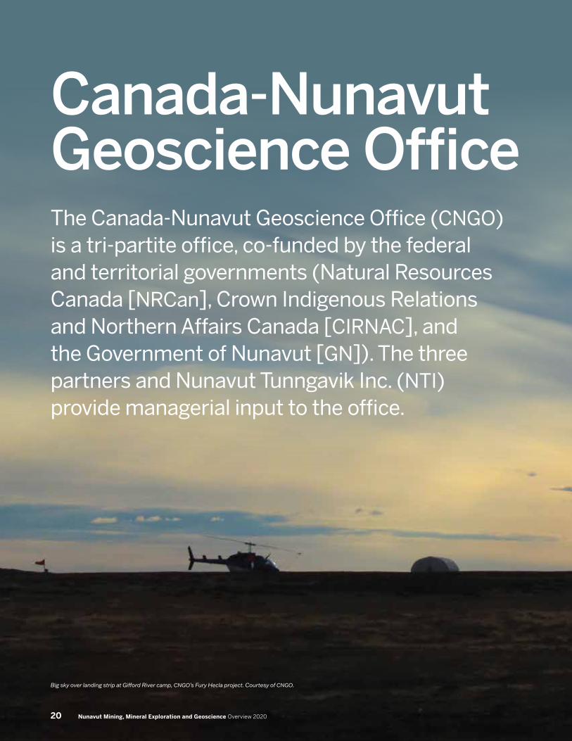
Big sky over landing strip at Gifford River camp, CNGO’s Fury Hecla project. Courtesy of CNGO.
The Canada-Nunavut Geoscience Office (CNGO) is a tri-partite office, co-funded by the federal and territorial governments (Natural Resources Canada [NRCan], Crown Indigenous Relations and Northern Affairs Canada [CIRNAC], and the Government of Nunavut [GN]). The three partners and Nunavut Tunngavik Inc. (NTI) provide managerial input to the office.
20 Nunavut Mining, Mineral Exploration and Geoscience Overview 2020
The CNGO, located in Iqaluit, is Nunavut’s de‑facto geological survey and supplies geoscience information and expertise in Nunavut in support of responsible exploration and development of mineral and energy resources. This information may be used by all stakeholders (i.e., governments, NGO’s, communities etc.) to make decisions about activities that could affect Nunavut’s land, natural resource development and extraction, and the environment.
The CNGO has six professionals with varied expertise; the office has extensive capabilities to deliver on bedrock and surficial mapping with a bedrock mapper, Paleozoic stratigrapher, and surficial geoscientist. Two professionals, a GIS Specialist and Geotechnology Analyst, deliver on IT, map‑making and data dissemination.
The Agreement‑in‑Principle (AIP) between the governments of Canada and Nunavut – including both the Government of Nunavut and NTI – for Nunavut assuming control over its Crown lands and natural resources was signed in August 2019. This agreement is a significant step toward improving governance in Nunavut. The AIP directly affects the federal government (i.e., CIRNAC‑Nunavut Regional Office) and the CNGO, in that both organizations and their staff will be devolved to the GN. For CNGO, its staff will likely amalgamate with some GN and CIRNAC staff (i.e., the geologists and other professionals directly related to land and resource management) and the collective group will form the Nunavut Geological Survey under the GN. The governments are aiming to have devolution in place by 2024‑2025.
The world depends on natural resources and their development, with mineral and energy resources being essential components of advanced societies and economies. Governmental geological surveys ensure that geoscience information is available when required. Moreover, with appropriate oversight and handling, such information (e.g., digital and paper products, sample materials) will be useful for many years. The preservation and dissemination of this information is a core function of virtually every geological survey organization.
Early in 2020, Canada and the United States finalized the Canada–U.S. Joint Action Plan on Critical Minerals Collaboration. The listing of the critical element commodities, called ‘critical minerals’ – as determined by governments – include: aluminum, antimony, arsenic, barite, beryllium, bismuth, cesium, chromium, cobalt, fluorspar, gallium, germanium, graphite, hafnium, helium, indium, lithium, magnesium, manganese, niobium, PGEs, potash, REEs, rhenium, rubidium, scandium, strontium, tantalum, tellurium, tin, titanium, tungsten, uranium, vanadium, and zirconium. The world needs these critical minerals for important manufacturing sectors, including communication technology, aerospace and defence, and clean technology. The Action Plan will promote joint initiatives, including research and development cooperation, supply chain modelling and increased support for industry.
Of the 35 critical minerals outlined in the Action Plan, Nunavut has known occurrences of many: antimony, arsenic, barium/barium minerals, bismuth, chromium, cobalt, fluorite/fluorine minerals, graphite, lithium, manganese, niobium, PGE, REEs, tantalum, tellurium, titanium, tungsten, uranium and vanadium. Collecting and understanding fundamental geoscience (i.e., mapping and compilation) in Nunavut will allow the territory to play its part in further efforts to outline more of these critical minerals.
It is now estimated that every dollar ($1) invested in geoscience generates a minimum of $7 in exploration investment. The exploration investment that leads to the discovery of new mineral resources is worth many times ($125) the original investment.
In 2020, the world ground to a halt mid‑March 2020 with the appearance of the Coronavirus disease (COVID‑19), an infectious disease caused by a newly discovered coronavirus. On March 15, offices and schools across Canada shut down to prevent the spread of this sometimes‑fatal disease. For CNGO, the office shut down, all employees continue to work remotely and travel (i.e., to the field) was non‑existent in the summer of 2020.
21Nunavut Mining, Mineral Exploration and Geoscience Overview 2020

There were several projects planned for the summer of 2020 that involved field work; these projects have been postponed and hopefully can be resumed in the future (summer 2021?). Without this field work, the CNGO focussed on planning for the future and taking this time to write up past research.
With devolution on the horizon, priorities for the CNGO and for Nunavut include: a greater emphasis on public geoscience that highlights the economic potential of Nunavut and supports mineral resource development; a greater focus on improving access to Nunavut’s public geoscience information; a focus for geological mapping for smaller, more targeted activities, particularly in areas with high mineral potential; and how to adapt to a changing climate and permafrost degradation in Nunavut.
Mapping to highlight economic potential: CNGO’s main mapping project for the past few years was the Fury and Hecla Geoscience Project (2017‑2020) that mapped the ground between Igloolik and Arctic Bay. This multi‑faceted project started in 2017 with a geophysical survey and continued in 2018 and 2019 with field programs. The rocks mapped include the Fury and Hecla sedimentary basin in the southern portion of the study area and the Archean basement rocks of the area north. Bedrock and surficial maps are being completed.
A collaboration was being developed between the CNGO, NRCan‑GSC and the mineral industry (TMAC Resources) to have government geologists assist TMAC by mapping on some of the company’s ground where geological information is little known or understood. This proposed program would have involved four‑five weeks of mapping while staying at the Hope Bay mine and having daily commutes to the field areas. However, with the pandemic and a proposed takeover of TMAC, these plans for the 2020 summer were postponed.
Road access through the Slave Geological Province from NWT (Yellowknife) to Nunavut would help realize the full potential of this resource‑rich region of both NWT and Nunavut. The CNGO recently partnered with the Northwest Territories Geological Survey (NTGS) to update the Slave Province Compilation Map; this map was released in 2019 and incorporated geological information and knowledge into the earlier 2005 compilation map.
Surficial work continues on developing the regional surficial geology knowledge on northeastern and central Baffin Island. This work is collaborative with MEOPAR (Marine Environmental Observation, Prediction and Response Network; a federal Centre of Excellence) and Dalhousie University, and developed knowledge relative to earthquakes and tsunamis for work with the ULLINIQ project (Underwater Listening Network for Novel Investigations of Quakes).
Stratigraphic work and determination of petroleum potential: Work continues on the determination of the stratigraphy of the Ordovician rocks of northern Baffin Island and their
corresponding petroleum potential. This project was a sub‑activity of the Fury and Hecla geoscience project and evaluated the Ordovician stratigraphy in the NTS map areas 37F and 37C. This work will provide essential data for more detailed stratigraphic division, evaluating the ages of different stratigraphic units, assessing the petroleum potential in the studied area, and making stratigraphic correlations with other areas in Foxe Basin.
Similarly, Paleozoic stratigraphic work continues on a sub‑project with the recent NRCan’s Geo‑Mapping for Minerals and Energy (GEM‑2) Boothia‑Somerset Project on Boothia Peninsula to study two formations to determine their ages. This study aims to establish micro‑fossil (conodont) biozonation within the two formations, determine their stratigraphic positions in the regional stratigraphic formations on Boothia Peninsula, and determine, using the conodonts, the regional thermal maturation of these rocks.
NunavutGeoscience.ca and other databases: NunavutGeoscience.ca is a project of CNGO, CIRNAC and the GN aimed at disseminating geoscience information about Nunavut. Contributions to the project have come from NRCan and NTI. This website disseminates geoscience data about Nunavut; this data includes a database of mineral showings and references, and a repository containing assessment reports, open file reports and other publications. NunavutGeoscience.ca is continually evolving. This year, the partners are re‑vamping the website to ensure there will be an improved user interface with a single new application using modern technologies to provide visitors an easier, better and more engaging experience.
Adapting to climate change and permafrost degradation: CNGO and CIRNAC have a current collaboration, using the strengths of a CIRNAC professional with expertise in permafrost. For this work in 2020, CNGO and NRCan‑GSC compiled permafrost and surficial information in the western Kitikmeot, over the area where a road (the Grays Bay Road) is proposed by private industry and an Inuit organization to link mineral resources in both Nunavut and NWT to water for transportation.
A new collaboration between GN‑EDT (Transportation), CIRNAC and the CNGO involves the GN‑EDT receiving funding from Transport Canada (TC) under their NTAI (Northern Transportation Adaptation Initiative) program. This funding arrangement is for GN‑EDT (Transportation) and DoE (Climate Change Secretariat) to pursue obtaining permafrost information for infrastructure projects (i.e., airport upgrading, community infrastructure) in Nunavut. This project is using the permafrost expertise of the CIRNAC professional, as above, until (at least) March 31, 2021 on a collaborative or seconded arrangement between CIRNAC and GN‑EDT (Transportation).
22 Nunavut Mining, Mineral Exploration and Geoscience Overview 2020
Canada-Nunavut Geoscience Office
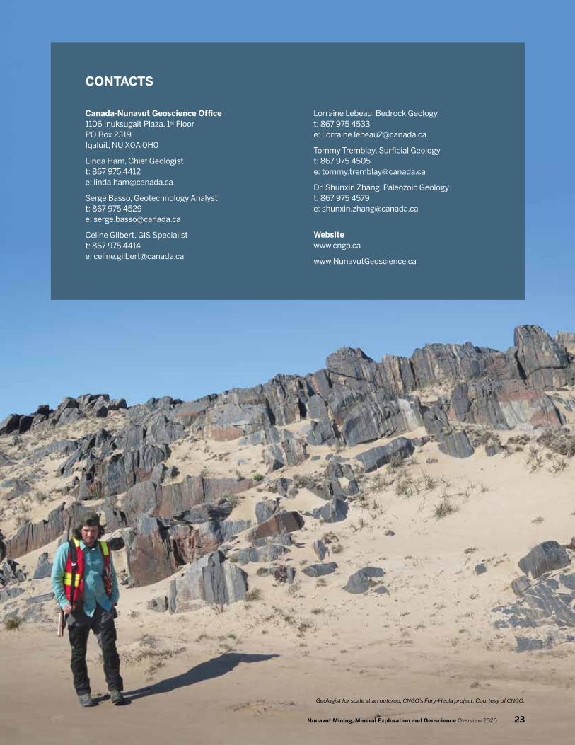
CONTACTS
Canada-Nunavut Geoscience Office 1106 Inuksugait Plaza, 1st Floor PO Box 2319 Iqaluit, NU X0A 0H0
Linda Ham, Chief Geologistt: 867 975 4412 e: [email protected]
Serge Basso, Geotechnology Analyst t: 867 975 4529 e: [email protected]
Celine Gilbert, GIS Specialist t: 867 975 4414 e: [email protected]
Lorraine Lebeau, Bedrock Geology t: 867 975 4533 e: [email protected]
Tommy Tremblay, Surficial Geology t: 867 975 4505 e: [email protected]
Dr. Shunxin Zhang, Paleozoic Geology t: 867 975 4579 e: [email protected]
Website www.cngo.ca
www.NunavutGeoscience.ca
Geologist for scale at an outcrop, CNGO’s Fury-Hecla project. Courtesy of CNGO.
23Nunavut Mining, Mineral Exploration and Geoscience Overview 2020

Covering over 440,000 square kilometres (km2), the Kitikmeot is the smallest of the three Nunavut regions. This region encompasses most of the Canadian western Arctic, including the western and northern portions of the Nunavut mainland, the King William and Stefansson islands, the Boothia Peninsula, and portions of Victoria, Prince of Wales, and Somerset islands. The region is one of the least densely populated in the world with density of less than 0.02 people/km2 and an estimated total population of 6,872 people living in five permanent communities. Cambridge Bay (Ikaluktuuttiaq), located on the southern shore of Victoria Island, is the largest community in the Kitikmeot, with a population of 1,864 people. Another community, Gjoa Haven, is located on King William Island. The other three communities are located on mainland Nunavut, with Kugaaruk on Simpson Peninsula on Pelley Bay, Kugluktuk located on Coronation Gulf and Taloyoak on the Boothia Peninsula. With no current road connections between the Kitikmeot communities, Yellowknife, the capital of the Northwest Territories, is the main logistical and supply centre for the region. The Grays Bay Road and Port Project is an intended infrastructure and transportation system that would connect the Slave Province (located in Nunavut and the Northwest Territories) to Arctic shipping routes. This would not only promote regional economic development but would also create the transportation backbone needed to improve the quality of life of communities in this region. The proposed port at Grays Bay would be Canada’s first and only deep‑sea water port in the Western Arctic. This route would also connect Nunavut to the national highway and rail systems in the Northwest Territories.
The geology of the Kitikmeot region is dominated by Archean and Proterozoic aged rocks of the Bear, Slave, and Churchill provinces, and by the Paleozoic Arctic Platform in the north. This region has been explored historically for gold, base metals, uranium, platinum group elements, and diamonds. As of November 2020, the Kitikmeot region has a total of 780 mineral claims, 48 prospecting permits, and 290 mineral leases. Of these land holdings, prospecting permits totalled about 1.01 million hectares (ha) and mineral claims totalled over 845,000 ha. Four past‑producing mines are located in the Kitikmeot region: the Roberts Bay and Ida Bay silver mines are located in the Hope Bay area, south of the Coronation Gulf and Victoria Island, and the Lupin gold mine and Jericho diamond mine are located near the border with the Northwest Territories. The Kitikmeot’s currently operating mine, Doris North gold mine, is located at the northern end of the Hope Bay greenstone belt, approximately 125 km southwest of Cambridge Bay.
In 2020, TMAC Resources Inc., owner of the Doris mine, completed 3,270 metres of underground drilling at Doris and
260 metres of drilling at Madrid. The total proven and probable mineral resources of the deposits have been updated to 16,881,000 tonnes at 6.5 grams per tonne (g/t) gold (Au) for a total of 3,545,000 ounces of gold. A preliminary feasibility study was completed that projects a mine‑life of 15 years at 6.5 g/t Au and an estimated 3.5 million ounces of gold. A new processing plant is planned to be built at Madrid to be operational by 2024.
Following the declaration of a global pandemic in mid‑March 2020, TMAC sent its Nunavut‑based workers home with pay, began operating at reduced levels, and largely suspended exploration. The mine suffered an outbreak of COVID‑19 in September and October 2020, with fourteen confirmed cases and two presumptive cases identified. Production up to the end of September totalled 79,680 ounces of gold. TMAC signed a sales agreement with Shandong Gold Mining Co., Ltd. in 2020. The transaction was reviewed by the federal government under the Infrastructure Canada Act, and in December the government indicated that the review was complete and the sale would not be permitted to proceed.
Sabina Gold & Silver Corp. raised $55 million in financing for its Back River Project in 2020. A planned spring drilling program at the Goose Lake property was postponed due to COVID‑19 but was restarted in early July with a 13,500 m drill program focused on the Umwelt and Llama deposits. Sabina received approval for the placement of its tailings pond, and announced that the company will be developing an underground exploration ramp to facilitate further drilling.
Blue Star Gold Corp. operated a drill program with two rigs on its Hood River and Ulu gold properties. The drill program started in mid‑July and a total of 7,624 m was drilled in over 38 holes. Fourteen of these holes were drilled on the North Fold Nose at Hood River. Further program results are expected by the end of 2020.
Silver Range Resources Ltd. completed metallic screen assays on panel samples collected from the Main and West zones of the Tree River Project. Samples returned 36.3 g/t Au for the Main Zone and 0.29 g/t Au for the West Zone. Through the MERC (Mineral Exploration Research Centre at Laurentian University) programming, the University of Alberta sampled two 10 kg samples of the Tree River Conglomerate in 2018 and recovered three diamonds, confirming the presence of alluvial diamonds in these rocks. Results of this research were released in 2020. Isotope age dating has indicated that the Tree River Conglomerate’s maximum deposition age is similar to that of the gold‑rich conglomerates of the Witwatersrand basin in South Africa and Pilbara region of western Australia.
Kitikmeot Region
24 Nunavut Mining, Mineral Exploration and Geoscience Overview 2020

!
!
!
!
!
!
!
!
! !
!
!
!
!!
!
!
1
Ekati Mine
Lupin Mine
Diavik Mine
Jericho Mine
Snap Lake Mine
Nanisivik Mine
Ulu
Uist
Inuk
Seal
Bling
Stein
Storm
Muskox
Block B
Block A
Boston
Naujaat
Qannituq
Goldbugs
Elu Belt
Atlantis
Wolverine
Contwoyto
Greyhound
Contwoyto
Esker Lake
Tree River
Doris Mine
Hood River
Goose Lake
Anuri-RavenWest Plains
George Lake
Amaruq Mine
Three Bluffs
Meadow River
Mountain Lake
Block C
Madrid
White Hills
Four Hills-Cop
Meadowbank Mine
102
202
322324
301
302
303
308
306
307
304305332
333
309310
312
315
316314
323319
320321
327
203206
336338
339
340
501
337
313
101
103
0 100 200 300 40050
Kilometres
Transportation Routes
Proposed Bathurst Inlet Port and RoadProposed Grays Bay Road
Yellowknife-Contwoyto Winter Road
LEGEND(Number of Properties)Commodity
Areas with Surface and/or Subsurface Restrictions
BoundariesNLCA Nunavut Settlement AreaNunavut RegionsProvincial / Territorial
Inuit Owned Lands (Fee simple title)Surface OnlySurface and Subsurface
CPMAMBSNPNWATPWPWS
Caribou Protection Measures ApplyMigratory Bird SanctuaryNational ParkNational Wildlife AreaTerritorial ParkWildlife PreserveWildlife Sanctuary
1
NLCA The Nunavut Land Claims Agreement1
Base Metals, Active (1)
Diamonds, Active (1)
Diamonds, Inactive (2)
Gold, Active (13)
Gold, Inactive (7)
Mine, Active (1)
Uranium, Inactive (1)
Mine, Inactive (2)
Geological Mapping ProgramsCanada-Nunavut Geoscience Office

The Kivalliq region covers 445,109 km2 and occupies the central portion of Nunavut. Starting at the west coast of Hudson Bay, the region is bounded to the south by Manitoba and to the west by the Northwest Territories. Rankin Inlet (Kangiqliniq) is the regional hub; it and Baker Lake (Qamani’tuuq), the territory’s only inland community, are key gateways for exploration and mining in this region. The Kivalliq region also includes the communities of Arviat, Whale Cove (Tikirarjuaq), Chesterfield Inlet (Igluligaarjuk), Coral Harbour (Salliq), and Naujaat. Two of Canada’s earliest mines located north of 60° were located in the Kivalliq: the North Rankin nickel mine that operated from 1957‑1962, and the Cullaton‑Shear Lake gold mine west of Arviat that operated in the early 1980s. The population of the Kivalliq region is estimated at 11,673 in 2020, with more than half of those inhabitants in Rankin Inlet and Arviat.
As of November 2020, mineral tenure in the region showed moderate changes in each type of tenure over the previous year. Mineral claims decreased slightly to 1,092 claims covering 984,155 ha, while the number of prospecting permits nearly doubled to 53 permits covering 717,741 ha. Although the total number of mineral leases dropped marginally, the total area covered by leases increased to 150,778 ha.
The bedrock geology of the Kivalliq region is characterized by Archean and Proterozoic plutonic rocks, extensive Paleoproterozoic sedimentary basins, and the numerous metasedimentary and greenstone belts of the Rae and Hearne domains of the Western Churchill Province. Paleozoic‑age strata of the Hudson Bay Lowlands are found in the east on Southampton and Coats islands. The region’s economic geology is diverse and consists of a number of significant mineral occurrences and deposits, including historical and current resources in gold, uranium, diamonds, nickel, and platinum‑group and rare earth elements. Gold continues to be the main exploration target in the region. Like the rest of the territory, exploration and mining activity in the Kivalliq was affected significantly by the ongoing COVID‑19 pandemic. Additionally, uncertain commodity markets and territorial public health restrictions on travel resulted in many companies scaling back or postponing any work planned for the 2020 field seasons in Nunavut.
Agnico Eagle Mines Limited’s Amaruq (part of the Meadowbank Complex) and Meliadine gold mines, located 85 km north of Baker Lake and 20 km north of Rankin Inlet, respectively, entered commercial production in 2019. The Meadowbank mine owned by Agnico Eagle ceased production late that same year. The company increased its capital expenditures at Amaruq and Meliadine in 2020 to move forward on restarting underground
operations at Amaruq, and to prepare for installation of a water line at Meliadine, pending permitting. By the end of September 2020, year‑to‑date gold production at Amaruq totalled 140,679 ounces of gold.
At Meliadine, Agnico Eagle was able to continue with its 2020 plans for an 11,500‑metre drill program on the Discovery deposit, southeast of the main Tiriganiaq deposit. The Discovery deposit has the potential to operate as a satellite deposit for the mine; a technical study of this deposit is expected in early 2021. Drilling also occurred at the Wesmeg and Tiriganiaq deposits. In addition, the company was able to complete repairs and upgrades to the Meliadine processing plant’s crusher apron, which failed in January 2020, and to the filter press and feeder. Year‑to‑date gold production at Meliadine at the end of September 2020 totalled 224,125 ounces of gold.
Solstice Gold Ltd. was able to complete a summer exploration program on its Kahuna Gold Project (now referred to as KGP) near Rankin Inlet. The program included regional surface mapping and grab sampling over an area of 40 km2 covering the Qaiqtuq, Enterprise, Arrow, and South targets. The company has identified three highly prospective areas in which gold‑bearing boulders are interpreted to indicate a local bedrock source. Including two electromagnetic geophysical anomalies identified in 2019, Solstice now has five drill‑ready targets on the property.
Western Atlas Resources Inc.’s Meadowbank gold exploration project saw its first drill program in July and August 2020. The 3,500‑metre, 13‑hole program focused mainly on banded iron formation‑hosted targets identified in previous field seasons. Analyses from drill core samples returned anomalous gold, silver, nickel, chromium, and zinc values.
In May 2020, Gold79 Mines Ltd. (formerly Aura Resources Inc.) announced results from 2019 fieldwork with its joint venture partner Agnico Eagle at the Greyhound property. Gold79 has interpreted structures identified in drill core as part of the hanging wall of a volcanogenic massive sulphide system. In addition, a comprehensive review of property‑wide geochemical samples has identified three priority targets for a future drill program; this is currently under consideration. Results from Agnico Eagle’s 2020 till sampling program on the property are pending.
Canarc Resource Corp. completed a 7‑hole reverse circulation drill program at its optioned Hard Cash project west of Arviat. The drilling intersected gold mineralization, but narrow intervals and relatively low grade resulted in Canarc terminating its option agreement with Silver Range Resources Ltd. in November 2020.
Kivalliq Region
26 Nunavut Mining, Mineral Exploration and Geoscience Overview 2020

!
!
!
!
!
!
!
!
!
! !
!
!!
!
!
4
KPG
Mel
Inuk
Kiyuk
Block B
Block A
Boston
Kahuna
Naujaat
Fox Lake
Atlantis
Hard Cash
Greyhound
Cone Hill
Pistol Bay
Doris Mine
Goose Lake
Parker Lake
Anuri-RavenWest Plains
George Lake
Amaruq Mine
Three Bluffs
Meadow River
Gibson MacQuoid
Kuulu
Yandle
Block C
Madrid
White Hills
Meliadine Mine
Four Hills-Cop
Meadowbank Mine
204
205
322324
301
308
306
307
304305
329
330
334
309310
311
317
318
323319
320321
325
326
207
335
331
341
0 100 200 300 40050
Kilometres
HUDSON BAY
BAIE D' HUDSON
Transportation RoutesMeadowbank / Amaruq RoadMeliadine Road
NLCA The Nunavut Land Claims AgreementNILCA The Nunavik Inuit Land Claims Agreement
1
2
LEGEND(Number of Properties)Commodity
Proposed Nunavut to Manitoba Road
Diamonds, Inactive (2)
Gold, Active (10)
Gold, Inactive (6)
Mine, Active (2)
Areas with Surface and/or Subsurface Restrictions
BoundariesNLCA Nunavut Settlement AreaNunavut RegionsNILCA Nunavik Settlement AreaProvincial / Territorial
Inuit Owned Lands (Fee simple title)Surface OnlySurface and Subsurface
CPMAMBSNPNWATPWPWS
Caribou Protection Measures ApplyMigratory Bird SanctuaryNational ParkNational Wildlife AreaTerritorial ParkWildlife PreserveWildlife Sanctuary
2
1
Geological Mapping ProgramsCanada-Nunavut Geoscience Office
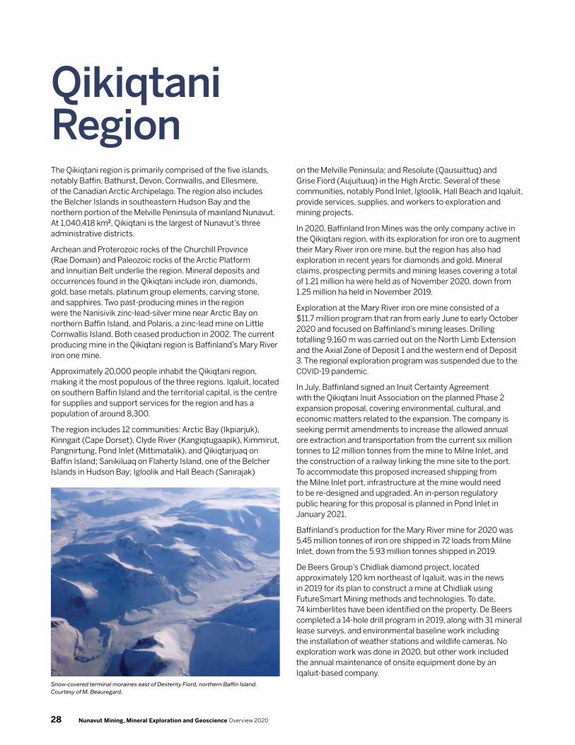
The Qikiqtani region is primarily comprised of the five islands, notably Baffin, Bathurst, Devon, Cornwallis, and Ellesmere, of the Canadian Arctic Archipelago. The region also includes the Belcher Islands in southeastern Hudson Bay and the northern portion of the Melville Peninsula of mainland Nunavut. At 1,040,418 km2, Qikiqtani is the largest of Nunavut’s three administrative districts.
Archean and Proterozoic rocks of the Churchill Province (Rae Domain) and Paleozoic rocks of the Arctic Platform and Innuitian Belt underlie the region. Mineral deposits and occurrences found in the Qikiqtani include iron, diamonds, gold, base metals, platinum group elements, carving stone, and sapphires. Two past‑producing mines in the region were the Nanisivik zinc‑lead‑silver mine near Arctic Bay on northern Baffin Island, and Polaris, a zinc‑lead mine on Little Cornwallis Island. Both ceased production in 2002. The current producing mine in the Qikiqtani region is Baffinland’s Mary River iron one mine.
Approximately 20,000 people inhabit the Qikiqtani region, making it the most populous of the three regions. Iqaluit, located on southern Baffin Island and the territorial capital, is the centre for supplies and support services for the region and has a population of around 8,300.
The region includes 12 communities: Arctic Bay (Ikpiarjuk), Kinngait (Cape Dorset), Clyde River (Kangiqtugaapik), Kimmirut, Pangnirtung, Pond Inlet (Mittimatalik), and Qikiqtarjuaq on Baffin Island; Sanikiluaq on Flaherty Island, one of the Belcher Islands in Hudson Bay; Igloolik and Hall Beach (Sanirajak)
on the Melville Peninsula; and Resolute (Qausuittuq) and Grise Fiord (Aujuituuq) in the High Arctic. Several of these communities, notably Pond Inlet, Igloolik, Hall Beach and Iqaluit, provide services, supplies, and workers to exploration and mining projects.
In 2020, Baffinland Iron Mines was the only company active in the Qikiqtani region, with its exploration for iron ore to augment their Mary River iron ore mine, but the region has also had exploration in recent years for diamonds and gold. Mineral claims, prospecting permits and mining leases covering a total of 1.21 million ha were held as of November 2020, down from 1.25 million ha held in November 2019.
Exploration at the Mary River iron ore mine consisted of a $11.7 million program that ran from early June to early October 2020 and focused on Baffinland’s mining leases. Drilling totalling 9,160 m was carried out on the North Limb Extension and the Axial Zone of Deposit 1 and the western end of Deposit 3. The regional exploration program was suspended due to the COVID‑19 pandemic.
In July, Baffinland signed an Inuit Certainty Agreement with the Qikiqtani Inuit Association on the planned Phase 2 expansion proposal, covering environmental, cultural, and economic matters related to the expansion. The company is seeking permit amendments to increase the allowed annual ore extraction and transportation from the current six million tonnes to 12 million tonnes from the mine to Milne Inlet, and the construction of a railway linking the mine site to the port. To accommodate this proposed increased shipping from the Milne Inlet port, infrastructure at the mine would need to be re‑designed and upgraded. An in‑person regulatory public hearing for this proposal is planned in Pond Inlet in January 2021.
Baffinland’s production for the Mary River mine for 2020 was 5.45 million tonnes of iron ore shipped in 72 loads from Milne Inlet, down from the 5.93 million tonnes shipped in 2019.
De Beers Group’s Chidliak diamond project, located approximately 120 km northeast of Iqaluit, was in the news in 2019 for its plan to construct a mine at Chidliak using FutureSmart Mining methods and technologies. To date, 74 kimberlites have been identified on the property. De Beers completed a 14‑hole drill program in 2019, along with 31 mineral lease surveys, and environmental baseline work including the installation of weather stations and wildlife cameras. No exploration work was done in 2020, but other work included the annual maintenance of onsite equipment done by an Iqaluit‑based company.
Qikiqtani Region
Snow-covered terminal moraines east of Dexterity Fiord, northern Baffin Island. Courtesy of M. Beauregard.
28 Nunavut Mining, Mineral Exploration and Geoscience Overview 2020

!
AberdeenLake
Amadjuak
Lake
River
Baker Lake
DubawntLake
Kazan
Nettilling
Lake
South HenikLake
Thlewiaza River
Yathkyed Lake
Riv
er
River
Back
Thel
on
River
Dub
awnt
North HenikLake
OCÉAN ARCTIQUE
BAIE DE BAFFIN
Détroit de Davis
Détroit d' Hudson
Baie d'Ungava
BAFFIN BAY
HUDSON BAY
ARCTIC OCEAN
Davis Strait
FOXE
BASIN
Hudson Strait
C H A N N E L
Prince Gustaf AdolfSea
Foxe Channel
M'Clintock
Nar
es S
trai
t
Gulf of Boothia
Prin
ce R
egen
t Inl
et
Viscount
Ungava Bay
Victor
ia Stra
it
Wager Bay
Wellington C
hannel
Adm
iralty Inlet
Barrow Strait
Belcher
Bowman Bay
Byam M
artin ChannelCommittee
Bay
Cumberland Sound
Dease Strait
Eur
eka
Soun
d
Fran
klin
Str
ait
Frobisher Bay
Fury and Hecla Strait
Hassel Sound
Hazen Strait
Jones Sound
Kane
Basin
Lady Ann Strait
Lancaster Sound
Larsen Sound
Markham Bay
Massey Sound
Sound
Norwegian Bay
Peary Channel
Peel Sound
Penny Strait
Queen Maud Gulf
Rasmussen
Basin
Roe
s W
elco
me
Soun
d
Storis PassageChannel
Melville Sound P A R R Y
Channel
Nansen
Steensby Inlet
Miln
e In
let
Tasiujaq
Hadley B
ay
Kiluhiqtuq
CollinsonPeninsula
Boothia
Peninsula
Brodeur
Peninsula
Borden
Peninsula
METAINCOGNITAPENINSULA
MELVILLE
PENINSULA
CUMBERLANDPENINSULA
HALL PENINSULA
Storkerson
Peninsula
ÎLE
D'ELLESMERE
ÎLE
BAFFIN
DE
ÎLES DE
REINE - ÉLIS
ABETH
LAELLESMERE
ISLAND
BAFFINVICTORIA ISLAND
AXELHEIBERGISLAND
DEVON ISLAND
MELVILLE ISLAND
BATHURST
ISLAND
SOMERSETISLAND
PRINCE OF WALESISLAND
SOUTHAMPTON
ISLAND
Ellef RingnesIsland Amund
Ringnes Island
CornwallisIsland
StefanssonIsland
Bylot Island
KingWilliamIsland Prince
Charles
Island
CoatsIsland Mansel
Island
Wales I.
Big
Island
ISLAND
Resolution
Island
Charles
Island
QUEENELIZ
ABETHISL
ANDS
PARRYISLANDS
Kivalliq
Kitikmeot
Qikiqtani
Agassiz
Ice Cap
MüllerIce Cap
Prince of Wales
Icefield
DevonIce Cap
Barnes
Ice Cap
Penny
Ice Cap
GREENLAND/GROENLAND
Kalaallit N
unaat
(DENMARK/D
ANEMARK)
Auyuittuq NP
Beverly CPMA
Bowman
Bay WS
Bylot Island
MBS
Nirjutiqavvik
NWA
Dewey Soper
MBS
East Bay MBS
HarryGibbons
MBS
Niginganiq NWA
McConnell River MBS
QausuittuqNP
Polar Bear PassNWA
Prince Leopold
Island MBS
QamanirjuaqCPMA
Queen Maud GulfMBS
Quttinirpaaq NP
Sirmilik NP
Thelon WS
Ukkusiksalik NP
Katannilik TP
Qaqulluit NWA
Akpait NWA
SirmilikNP
Qikiqtarjuaq
Kimmirut
IQALUIT
Pangnirtung
Arviat
Chesterfield Inlet
Kinngait
Whale Cove
Rankin Inlet
Coral Harbour
Naujaat
Baker Lake
Cambridge Bay
Pond Inlet
Sanirajak
Igloolik
Arctic Bay
Grise Fiord
KugaarukGjoa Haven
Taloyoak
Clyde River
Resolute
ARCTIC CIRCLE
CERCLE ARCTIQUE
!
!
!
!
!
!
!
!
!
!
!
!
!
!
!
!
!
!
!
!
!
!
!!
!
!
!
!
!
1
3
2
4
Raglan Mine
Polaris Mine
Nanisivik Mine
Nunavik Nickel Mine
KPG
Mel
Inuk
Seal
Kiyuk
Stein
Storm
Block B
Block A
Boston
Kahuna
Naujaat
Qannituq
Elu Belt
Fox Lake
Atlantis
Chidliak
Hard Cash
Greyhound
Cone Hill
Pistol Bay
Doris Mine
Goose Lake
Parker Lake
Anuri-RavenWest Plains
Baffin Gold
George Lake
Amaruq Mine
Three Bluffs
Meadow River
Mary River Mine
Gibson MacQuoid
Kuulu
Yandle
Block C
Madrid
White Hills
Meliadine Mine
Four Hills-Cop
Meadowbank Mine
102
201
204
205
202
322324
301
328
308
306
307
304305
329
330
333
334
309310
311
315
316314
317
318
323319
320321
325
326
207
335
331
103
401
341
!
Baie James
James Bay
Belcher
Islands
Akimiski
Island Akimiski I.
MBS
Boatswain Bay MBS
Hannah Bay MBS
James Bay WP
Twin Islands WS
Sanikiluaq
0 50 100 15025
Kilometres
70°N
0 125 250 375 50062.5
Kilometres
Transportation Routes
Milne Inlet Tote Road / Proposed Rail LineProposed Steensby Inlet Rail Line
NLCA The Nunavut Land Claims AgreementNILCA The Nunavik Inuit Land Claims Agreement
1
2
LEGEND(Number of Properties)Commodity
Areas with Surface and/or Subsurface Restrictions
BoundariesNLCA Nunavut Settlement AreaNunavut RegionsNILCA Nunavik Settlement AreaProvincial / Territorial
Inuit Owned Lands (Fee simple title)Surface OnlySurface and Subsurface
CPMAMBSNPNWATPWPWS
Caribou Protection Measures ApplyMigratory Bird SanctuaryNational ParkNational Wildlife AreaTerritorial ParkWildlife PreserveWildlife Sanctuary
2
1
Geological Mapping ProgramsCanada-Nunavut Geoscience Office
Base Metals, Inactive (2)
Diamonds, Active (1)
Diamonds, Inactive (1)
Gold, Inactive (1)
Mine, Active (1)
Mine, Inactive (2)

Base Metals
101 Wolverine
Operator/Owner Rio Algom Exploration Inc.
Commodity Copper
NTS 077B06, 077B09, 077B10, 077B11, 077B14 – 077B16, 077C01 – 077C03, 077C06 – 077C08
Land Tenure Crown, Surface IOL
Location 184 km west of Cambridge Bay
Rio Algom Exploration Inc., a subsidiary of BHP Billiton, is exploring for sedimentary copper deposits at its Wolverine Project on Victoria Island. The island is underlain by Cambrian‑Silurian carbonate and siliciclastic rocks from the Paleozoic Era, dated at having formed between 490 to 435 million years ago. A stable platform developed from the Cambrian through the Silurian and thick carbonates with high oil and gas potential
were deposited in this area. The Caledonian orogeny brought uplift and erosion from the Silurian through the early Devonian, generating potential red bed‑related copper deposits in a thick clastic wedge.
In 2018, Rio Algom was issued two blocks of prospecting permits, with two to three dozen permits in each block. The South Block, on southern Victoria Island, is close to the Coronation Gulf where carbonate and siliciclastic formations from the late Cambrian and early Silurian are found. This block comprises 33 prospecting permits with an area of 782,340 hectares. The North Block, on the northern part of the island between the Northwest Territories border and Hadley Bay, was relinquished following the 2019 program.
Work during the 2019 field season was supported by a field camp located within the South Block, and limited to two days of mapping, prospecting, and collecting samples for analysis, and a 2,100 line‑km airborne electromagnetic survey.
There was no work on the property in 2020.
294 carats of diamonds larger than 2.3 mm from the 2017 bulk sample at Chidliak. Courtesy of Peregrine Diamonds (now De Beers Group).
30 Nunavut Mining, Mineral Exploration and Geoscience Overview 2020

Diamonds
201 Chidliak
Operator/Owner De Beers Group
Commodity Diamonds
NTS 026B01, 026B02, 026B07, 026B08, 026B10
Land Tenure Crown
Location 117 km northeast of Iqaluit
De Beers Group’s Chidliak Project is located on the Hall Peninsula of Baffin Island northeast of Iqaluit. To date 74 kimberlites have been identified on the property. De Beers purchased the project’s previous operator, Peregrine Diamonds, in 2018. De Beers decreased its mineral tenure holdings on the property in 2019, retaining only about 33,000 hectares (ha) of claims and leases from the more than 315,000 ha held in 2018.
The kimberlites at Chidliak are hosted in Archean orthogneiss and Archean to Paleoproterozoic supracrustal rocks of the Hall Peninsula block. Glacial till cover is found throughout the project area, typically up to 3 metres (m) thick, and up to 15 m in some places. The kimberlites occur as sheet‑like dykes and pipe‑like bodies, injected between 157 and 139 million years ago. The kimberlite pipes are divided into 1) those infilled with volcaniclastic material only, and these rocks tend to be larger in size, and 2) those infilled by a combination of volcaniclastic‑pyroclastic, coherent kimberlite and apparent coherent kimberlite. This second group of kimberlites are most likely to have economic potential. Out of the 51 kimberlites tested, 41 have potential for diamonds.
Peregrine Diamond’s 2018 Preliminary Economic Assessment report suggested open pit mining of the CH‑6 and CH‑7 kimberlites to extract 16.7 million carats of diamonds over a 13‑year mine life, and construction of an all‑weather road to Iqaluit to allow the transportation of supplies to site. However, in 2019, De Beers announced alternative plans to construct a mine at Chidliak using FutureSmart Mining methods and technologies. The company completed a 14‑hole exploration program that year, along with 31 mineral lease surveys, and environmental baseline work including the installation of weather stations and wildlife cameras.
No exploration work was done in 2020, but the onsite equipment required annual maintenance that was done by an Iqaluit‑based company. This team was able to locate and inspect the weather stations and all but three of the installed cameras.
In 2020, a team of researchers at the University of British Columbia analyzed kimberlite rock samples recovered from Chidliak, and the analyses allowed them to reconstruct the shapes of ancient continents based on deeper mantle rocks. This research unveiled the composition of the North Atlantic craton as an ancient part of the Earth’s continental crust that stretches from Scotland to Labrador. The research will provide De Beers with information about the deep diamondiferous mantle.
202 Stein
Operator/Owner GGL Resources Corp., Arctic Star Exploration Corp.
Commodity Diamonds
NTS 057C13, 057C14, 057F03 – 057F06
Land Tenure Crown, Surface IOL
Location 85 km northwest of Taloyoak
GGL Resources Corp. optioned the Stein project from Arctic Star Exploration Corp. in 2018, and can earn a 60 per cent interest in Stein by discovering in‑situ kimberlites. The property is 45 kilometres from the coast of southern Boothia Peninsula and consists of 19 mineral claims covering an area of 23,750 ha. In 2019, the company staked these claims within and just outside the area of four contiguous prospecting permits covering an area of 106,500 ha, which originally made up the property and will expire in January 2021.
The bedrock on the Boothia Peninsula ranges in age from Archean to Tertiary. The Boothia Plateau is underlain by complexly folded and faulted Archean gneissic and granitic terrains termed the Boothia Horst event. The overall structure of the Boothia Peninsula is dominated by the Boothia Uplift event, a basement‑controlled region of uplift active from the Archean to the Devonian periods. The Stein property is underlain by rocks of the Boothia Horst that is assigned to the lowest structural‑level event of the Boothia Uplift event. The Boothia Horst is believed to be the northern extension of the Churchill Province; age determinations from 1.63 to 1.67 billion years ago (Ga) suggest that the gneiss domains formed during the Hudsonian Orogeny. The horst has an overall north‑trending structure and the main fold has a northerly strike parallel to that of the Boothia Uplift. Surface sediments were deposited during the late Wisconsin glaciation. Deglaciation began more than 9,250 years ago; the Boothia Peninsula was largely ice‑free by 8,800 years before present.
Many previous exploration programs with more than $1.5 million in expenditures have been carried out over the project area. Historical heavy mineral sampling traced kimberlite indicator minerals up‑ice to a potential source area. Detailed airborne magnetic surveys flown over this source area identified numerous high‑priority targets with signatures similar to kimberlites found elsewhere in Canada’s North. In 2019, GGL conducted ground‑based magnetic surveys over high‑priority airborne targets in preparation for future drill testing. A range of kimberlite‑like signatures was defined during the surveys; this bolsters the possibility of a new kimberlite field being discovered at Stein.
No work was completed in 2020, but the planned next steps are target evaluation with drilling.
31Nunavut Mining, Mineral Exploration and Geoscience Overview 2020

Gold
301 Atlantis
Operator/Owner Silver Range Resources Ltd.
Commodity Gold
NTS 066H10, 066H11, 066H14, 066H15
Land Tenure Crown
Location 176 km north of Baker Lake
Two prospecting permits covering 31,778 hectares (ha) were issued to Silver Range in February 2019 over a 21 km2 prospective gold target that is underlain by similar rock types as those found at Agnico Eagle’s Amaruq gold mine, 55 km south‑southeast of the Atlantis project. This prospective formation of Archean mafic volcanic rocks was first identified on maps published in 2002 by the Geological Survey of Canada. Although the area was previously included in prospecting permits granted to Uranium North Resources, no exploration is known to have been conducted in the immediate project area. No work was completed in 2020 and no results have been released from the intended 2019 summer exploration program.
302 303 Back River (George Lake1, Goose Lake2)
Operator/Owner Sabina Gold & Silver Corp.
Commodity Gold
NTS 076G092, 076G102, 076G131, 076G141, 076J031, 076J041
Land Tenure Crown1, 2, Surface IOL1, 2
Location 362 km southwest of Cambridge Bay1, 391 km south of Cambridge Bay2
In June 2020, Sabina Gold & Silver Corp. announced that it had raised $55 million in financing for its Back River project. After Sabina’s winter and spring drilling programs at Goose Lake were postponed due to the COVID‑19 pandemic, the Back River site was reopened in early July, and the company began a 13,500 m drill program focused on the Umwelt and Llama deposits. Exploration work planned for 2020 included continued exploration modelling of the Nuvuyak discovery, the Llama Extension zone and extensive project‑wide targets.
The Back River property is located in the central part of the Slave Structural Province and is underlain by sedimentary rocks of the Beechey Lake Group consisting of oxide and silicate banded iron formation rocks hosted in turbidites with lesser greywacke and mudstone. The sequence is cut by gabbroic and felsic dykes, with the latter ranging in thicknesses from 0.5 to 5 metres. The bulk of gold mineralization present at the Goose Lake property is structurally controlled, and associated with quartz and quartz‑carbonate veining associated with
shearing and accompanied by silicification within banded iron formation rocks and the interbedded sedimentary rocks. Gold is usually associated with pyrite, arsenopyrite and pyrrhotite with free gold present in quartz and quartz‑carbonate veining. Gold mineralization is also found in porphyritic quartz‑ and quartz‑feldspar dykes but not found in the younger gabbro dykes that post‑date mineralization.
The Goose Lake Project is now fully permitted for construction and operations. In June of this year, Sabina received the final operational approval for the placement of the tailings into the project’s proposed tailings storage facility. A Framework Agreement with the Kitikmeot Inuit Association, including a 20‑year renewable mining lease agreement, was completed in 2018.
Several infrastructure upgrades were completed, including blasting and quarrying for on‑site road network construction, preparations for construction of the Goose Lake ramp portal, and extension of the existing airstrip at Goose Lake to accommodate heavy lift aircraft.
To further explore the high‑grade corridor at Umwelt, Sabina is moving forward with an underground exploration ramp that can facilitate further exploration drilling as well as providing for bulk sampling. The exploration ramp, with approximately 1,500 m of ramp development, could provide early access to continue exploring the V2 Zone deposit. The portal box cut, initiated in 2020, is expected to be completed before the winter break demobilization in December.
Internal studies conducted earlier in 2020 suggest that mining the higher‑grade underground material at the beginning of the mine life could have a significant positive impact on the project economics by increasing gold production in the early years. Drilling was designed to delineate and detail the nature of the high‑grade structure at Umwelt – a deposit that has never been discretely targeted.
Helicopter orientation for staff at the Back River project’s Goose camp. Courtesy of Sabina Gold & Silver Corp.
32 Nunavut Mining, Mineral Exploration and Geoscience Overview 2020

A long section of the Umwelt deposit planned 3K FS Open Pit and Underground looking southwest. The sequence of seven drill holes focused on the V2 Zone in the upper portion of the Umwelt Underground all returned significant intercepts above 100 g*m products. The inset shows the Umwelt antiform and the high-grade corridor that extends from the open pit down towards the Vault Zone. Courtesy of Sabina Gold & Silver Corp.
Drilling in 2020 focused on a zone directly under the proposed Umwelt open pit (V2 Zone) deposit at a depth that ranges from 135 m to 285 m below surface, over a plunge extent of approximately 300 m. All seven drill holes targeting this zone returned exceptional widths of gold mineralization, with up to two to three times the average grade of the Umwelt underground reserve. These figures included grades of between 5.88 g/t Au over 20.10 m and a high of 51.50 g/t Au over 8.20 m, with an outstanding grade of 19.89 g/t Au over 32.2 metres.
The V2 Zone mineralization is similar to the Vault Zone, further supporting the concept of additional high‑grade underground corridors within the Umwelt deposit. These results will be incorporated into an updated Feasibility Study expected to be released in the first quarter of 2021.
The company’s 6,400 metre, nine‑hole spring drill program focused on the Llama Extension zone, Umwelt deposit and the Nuvuyak target, all located approximately 700 m down plunge to the west of the main Goose Lake deposit. In order to upgrade the resources at Llama and Nuvuyak from the Inferred to Indicated categories, an estimated 63,000 m of drilling would additionally be required. The Umwelt deposit needs an additional 6,500 m of drilling to further evaluate the potential for higher‑grade intersections in the existing corridor.
Once a production decision is made and due to the seasonality of logistics, the project will take approximately 36 months from the start of construction to the first gold pour.
Visible gold in core from the Back River project. Courtesy of Sabina Gold & Silver Corp.
33Nunavut Mining, Mineral Exploration and Geoscience Overview 2020
Gold

304 305
306 307
308
Committee Bay (Anuri‑Raven1, Four Hills‑Cop2, Inuk3, Three Bluffs4, West Plains5)
Operator/Owner Fury Gold Mines Limited
Commodity Gold
NTS 046M123, 056F135, 056J10 – 056J144, 046J153,4, 056J163,4, 056K02 – 056K045, 056K062,5, 056K071,2,5, 056K081, 056K091,4, 056K101,2, 056K112, 056K164, 056O013,4, 056P03 – 056P103
Land Tenure Crown1-5, Surface IOL1,3,4, Subsurface IOL3
Location 242 km southwest of Kugaaruk1, 259 km southwest of Kugaaruk2, 130 km south of Kugaaruk3, 198 km south of Kugaaruk4, 296 km southwest of Kugaaruk5
The Committee Bay project covers over 300,000 ha of the Committee Bay greenstone belt and is located approximately 180 km northeast of Agnico Eagle’s Meadowbank Complex, and extends a further 300 km to tidewater. The project is wholly owned by Fury Gold Mines Ltd., formerly Auryn Resources Inc. In July 2020, Auryn announced it would acquire Eastmain Resources Inc. and form a new company Fury Gold to operate the two entities’ Canadian projects. The international projects of the former companies have been spun out.
The Committee Bay greenstone belt can be traced along the entire property and varies in width from 5 km and 30 km. Rocks of the belt are poorly exposed due to an extensive sequence of thick till cover. Basalts, intermediate to felsic tuffs, komatiites, coarse‑grained metasedimentary rocks, and banded iron formations dominate the stratigraphy. Gold mineralization in the Committee Bay belt is commonly associated with quartz veining, silicification, and sulphidization within silicate, oxide,
and/or sulphide facies banded iron formation rocks of the volcano‑sedimentary Archean Prince Albert Group. Gold mineralization is also found in quartz veins associated with shear zones in gabbroic, volcanic, and sedimentary rocks and is generally accompanied by arsenopyrite, pyrite, and pyrrhotite mineralization.
The Geological Survey of Canada first mapped the rocks of the Committee Bay area in the 1960s. The area was subsequently the focus of base metal, uranium, and gold exploration that led to the discovery of the Three Bluffs deposit in 2003. This deposit, located in the central part of the property, contains a NI 43‑101 compliant indicated mineral resource of 524,000 ounces of gold at 7.85 g/t Au and an inferred resource of 720,000 ounces of gold grading at 7.64 g/t Au. More than 40 other gold prospects are identified in the greenstone belt; recent targets for exploration include the Kaluliq‑Aiviq corridor, and the Anuri and Shamrock targets, as well as the Three Bluffs deposit itself.
In its 2019 exploration program, Auryn drilled seven holes totalling 2,700 metres on traditional and “machine learning”‑generated targets. The machine learning target generation was considered to have positive results; further refining of the system is planned. Drilling at Shamrock and Aiviq prospects intersected gold mineralization, with the highlight at Shamrock being a 30‑metre interval grading 0.67 g/t Au hosted in quartz veins within gabbroic rocks. At Aiviq, the best result was 10.5 metres grading 1.22 g/t Au.
In early 2020, the company undertook an extensive review of drill results based on geophysical survey data, and in May announced that the work had led to better understanding of the influence of shallow‑plunge fold hinge zones and strongly conductive rock types on high‑grade mineralization. As a result, Fury Gold has identified two significant fold hinge‑based targets, one at Anuri and one at Amautik; neither of these have been previously drilled. The targets will be drill‑ready after an induced polarization geophysical survey on the two locations is complete. The company continued the review work through the summer and in September announced that 12 drill targets are defined on the Kaluliq‑Aiviq corridor, Anuri target, and at Three Bluffs. A drill program is planned for the 2021 field season that will target the extension of the Three Bluffs deposit as well as several greenfields prospects.
Geologists approach the discovery outcrop at Three Bluffs, Committee Bay project. Courtesy of CIRNAC.
34 Nunavut Mining, Mineral Exploration and Geoscience Overview 2020
Gold

309 310 Greyhound1, White Hills2
Operator/Owner Agnico Eagle Mines Limited1,2, Gold79 Mines Ltd.1
Commodity Gold1,2, Copper1, Lead1, Silver1, Zinc1
NTS 056D121, 056D131, 066A091,2, 066A102
Land Tenure Crown1, 2, Surface IOL 2
Location 40 km north of Baker Lake1, 37 km northwest of Baker Lake2
The Greyhound metals project consists of 22 claims in two separate parcels, covering 21,749 ha of Crown land. The smaller parcel covers 6,072 ha in seven claims and is 100 per cent owned by Gold79 Mines, a name change from Aura Silver effective August 2020. The larger parcel, located to the southwest, comprises 15 claims totalling 15,676 ha and is subject to an option agreement signed in 2014 between Aura Silver and Agnico Eagle Mines Limited. Agnico Eagle completed the first phase of the agreement in 2017 and earned a 51 per cent interest in that ground. The company can increase its ownership in Greyhound to 70 per cent with further spending.
The White Hills property is a 17,211 ha parcel adjacent to the Greyhound claims and is 100 per cent owned by Agnico Eagle. Both properties are located along the all‑season road connecting the community of Baker Lake to the Meadowbank Complex 35 km to the north.
Gold exploration at Greyhound is focused on the boundary between a felsic sub‑volcanic intrusion and the mafic meta‑volcanic rocks of a greenstone belt, both part of the Woodburn Lake Group. Exploration has focused on two principal gold targets: a strongly silicified zone that extends approximately 9 km along the western margin of the greenstone belt, and a banded iron formation southwest of Aura Lake, which caps the greenstone belt and has a known strike length of about 10 km.
The 2017 program at Greyhound consisted of 10 diamond drill holes and returned best results of 3.3 g/t Au over 3.0 m. A prospecting survey over the Dingo Zone returned results up to 126.0 g/t Au and 356 g/t Ag from a quartz vein exposed over approximately 1 kilometre.
Agnico Eagle conducted surface mapping, geophysical surveys, geochemical sampling, and drilling on the NW Fold and South Aura Lake target areas in 2018. A new target with characteristics of volcanogenic massive sulphide (VMS) mineralization was identified from this program. This target may be the source of the VMS‑style mineralized boulders that occur about 1 km to the west and which have returned assays up to 9.2% Cu and 18.4% Zn.
Three holes drilled in 2019 intersected graphitic mudstone and intermediate volcanoclastic strata, strengthening the VMS
interpretation of Greyhound, with a best assay result of 1.09 g/t Au over 0.9 metres.
In May 2020, Gold79 announced that re‑examination of geophysical and soil geochemical data, along with a review of surface sample results for the entire project area, resulted in the definition of seven new gold target areas for the next exploratory drilling program at Greyhound. However, the timing of future drilling remains subject to decisions of the Agnico Eagle management and local community approvals, and to modifications of any COVID‑19 restrictions allowing the safe resumption of exploration. If conditions permit, the proposed program could take place in 2021.
311 Hard Cash
Operator/Owner Silver Range Resources Ltd.
Commodity Gold
NTS 065C13, 065C14
Land Tenure Crown
Location 392 km west of Arviat
In 2019, Canarc Resource Corporation ran an exploration program on its Hard Cash project, optioned from Silver Range Resources in 2018. The Hard Cash Property is located in the Ennadai Greenstone Belt in southwest Nunavut on the shores of Ennadai Lake. Since the initial discovery of gold on the property in 1946, additional showings have been discovered during exploration conducted by four different exploration companies. This showing is a typical Archean lode type of gold occurrence, with gold mineralization occurring in late, laminated quartz veins and associated with pyrite, galena, chalcopyrite, and tellurides mineralization.
Exploration work in 2019 included geological mapping, soil sampling, and rock‑chip sampling program that resulted in the discovery of a new high‑grade vein trend, the 400‑m long Dryland zone, along a conspicuous linear magnetic break. Chip sample analyses from the zone returned grades up to 18.7 g/t Au. Dryland is parallel to the 1.5‑km long high‑grade Swamp vein trend located 1 km to the north.
In August 2020, Canarc carried out a seven hole, 1,019 m reverse circulation drilling program at Hard Cash to test the Swamp and Dryland showings; the program was originally proposed to include up to 1,500 metres. The drill results confirmed gold mineralization over a 1.5 km strike‑length, but mineralization seems to consist of remobilized gold in veins from widespread shearing and alteration instead of being a shear‑zone hosted, orogenic gold occurrence. The most significant interval intersected contained 3.12 g/t Au and 7.00 g/t Ag over 3.0 m.
Based on these results, the company terminated its option agreement with Silver Range for both the Hard Cash and the nearby Nigel properties.
35Nunavut Mining, Mineral Exploration and Geoscience Overview 2020
Gold
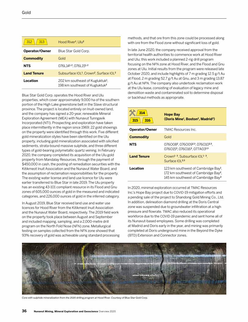
312 313 Hood River1, Ulu2
Operator/Owner Blue Star Gold Corp.
Commodity Gold
NTS 076L141, 2, 076L151, 2
Land Tenure Subsurface IOL1, Crown2, Surface IOL2
Location 202 km southeast of Kugluktuk1, 198 km southeast of Kugluktuk2
Blue Star Gold Corp. operates the Hood River and Ulu properties, which cover approximately 9,000 ha of the southern portion of the High Lake greenstone belt in the Slave structural province. The project is located entirely on Inuit‑owned land, and the company has signed a 20‑year, renewable Mineral Exploration Agreement (MEA) with Nunavut Tunngavik Incorporated (NTI). Prospecting and exploration have taken place intermittently in the region since 1969; 22 gold showings on the property were identified through this work. Five different gold mineralization styles have been identified on the Ulu property, including gold mineralization associated with silicified sediments, strata‑bound massive sulphide, and three different types of gold‑bearing polymetallic quartz veining. In February 2020, the company completed its acquisition of the Ulu gold property from Mandalay Resources, through the payment of $450,000 in cash, the posting of remediation securities with the Kitikmeot Inuit Association and the Nunavut Water Board, and the assumption of reclamation responsibilities for the property. The existing water license and land use licence for Ulu were earlier transferred to Blue Star in late 2019. The Ulu property has an existing 43‑101 compliant resource in its Flood and Gnu zones of 605,000 ounces of gold in the measured and indicated categories, and 226,000 ounces of gold in the inferred category.
In August 2019, Blue Star received land use and water use licences for Hood River from the Kitikmeot Inuit Association and the Nunavut Water Board, respectively. The 2019 field work on the property took place between August and September and included mapping, sampling, and a 2,000‑metre drill program on the North Fold Nose (NFN) zone. Metallurgical testing on samples collected from the NFN zone showed that 93% recovery of gold was achievable using standard processing
methods, and that ore from this zone could be processed along with ore from the Flood zone without significant loss of gold.
In late June 2020, the company received approval from the territorial health authorities to commence work at Hood River and Ulu; this work included a planned 2‑rig drill program focusing on the NFN zone at Hood River, and the Flood and Gnu zones at Ulu. Initial results from the program were released late October 2020, and include highlights of 7 m grading 12.5 g/t Au at Flood, 2 m grading 52.7 g/t Au at Gnu, and 3 m grading 13.87 g/t Au at NFN. The company also undertook reclamation work at the Ulu lease, consisting of evaluation of legacy mine and demolition waste and contaminated soil to determine disposal or backhaul methods as appropriate.
314
315 316
Hope Bay (Doris Mine1, Boston2, Madrid3)
Operator/Owner TMAC Resources Inc.
Commodity Gold
NTS 076O082, 076O092,3, 076O102,3, 076O153, 076O163, 077A031,3
Land Tenure Crown1 - 3, Subsurface IOL1 - 3, Surface IOL2,3
Location 123 km southwest of Cambridge Bay1, 172 km southwest of Cambridge Bay2, 145 km southwest of Cambridge Bay3
In 2020, minimal exploration occurred at TMAC Resources Inc.’s Hope Bay project due to COVID‑19 mitigation efforts and a pending sale of the project to Shandong Gold Mining Co., Ltd. In addition, delineation diamond drilling at the Doris Central zone was suspended due to groundwater infiltration at a high pressure and flowrate. TMAC also reduced its operational workforce due to the COVID‑19 pandemic and sent home all of its Nunavut‑based employees. Some drilling was completed at Madrid and Doris early in the year, and mining was primarily completed at Doris underground mine in the Beyond the Dyke (BTD) Extension and Connector zones.
Core with sulphide mineralization from the 2020 drilling program at Hood River. Courtesy of Blue Star Gold Corp.
36 Nunavut Mining, Mineral Exploration and Geoscience Overview 2020
Gold

The north‑south trending Hope Bay belt is located in the Bathurst Block in the northeastern portion of the Slave Structural Province and covers an area roughly 80 km long and up to 20 km wide. Archean mafic metavolcanic rocks and intermediate to felsic metavolcanic rocks with interbedded metasedimentary units dominate the belt, with lesser amounts of ultramafic rocks. Felsic intrusions along the eastern flank of the Hope Bay belt separate it from the Elu greenstone belt. Gold mineralization is found along the entire length of the Hope Bay greenstone belt and is classified as Archean lode‑gold type. At the Doris mine, located near the northern end of the belt, mineralization is hosted in a steeply dipping quartz vein system within a sequence of folded and metamorphosed pillow basalts, at the contact between iron‑titanium tholeiite and magnesium tholeiite. Gold mineralization at the Madrid Trend, located mid‑way in the belt, is generally associated with structural breaks and breccia zones, while mineralization at the Boston deposit, located in the southern end of the belt, is found within deformed quartz‑carbonate veins hosted in a complex series of altered sedimentary‑volcanic sequences.
Current mineral resources contained within Doris, Madrid and Boston deposits at Hope Bay include 1,570,000 t of measured mineral resources grading 9.5 g/t Au, containing a total of 481,000 ounces of gold. Indicated mineral resources at Hope Bay are estimated at 20,246,000 tonnes grading 7.2 g/t Au for a total of 4,691,000 ounces of gold. Inferred mineral resources are estimated at 10,917,000 t, grading 6.1 g/t Au, containing 2,127,00 ounces of gold. Measured and indicated resources have increased by 21 per cent for tonnage, 11 per cent decrease in gold grade and an 8 per cent increase in gold ounces compared to 2019’s estimates mainly due to a decrease in cut‑off grade,
higher gold prices and a higher recovery. There is great potential to add to the mineral resources at Doris in the BTD Extension, Connector and Central zones. In addition, the Suluk zone at Madrid, exploratory drilling at Boston and historical drilling at the 1000 m level at Boston have all potential to increase the mineral resources of the Hope Bay Project. Total Proven and probable mineral reserves in at the Hope Bay Project consists of 16.88 million tonnes grading at 6.5 g/t Au, containing a total of 3.54 million ounces of gold.
The preliminary feasibility study outlined in March 2020 indicated the pre‑tax net present value discounted at 5 per cent of Hope Bay is $549 million and the after tax net present value is $486 million, based on proven and probable mineral reserves. TMAC Resources Inc. anticipates the life of the mine to be 15 years with an estimated 3.5 million ounces of gold at an average of 6.5 g/t that will be processed over the life of the mine. The Doris processing plant will continue to be in operation from 2020 to 2023 processing 2,000 tonnes per day. A new processing plant is planned to be built at Madrid North by 2024, and is expected to process 4,000 tonnes per day with an overall recovery of 88 per cent over its operating period.
In early 2020, TMAC Resources Inc. announced the reduction of its operations in response to COVID‑19. During operations in 2020, total gold produced by the end of the third quarter was 79,680 ounces of gold with an average feed grade of 10.1 g/t and a total recovery of 85 per cent.
TMAC had initially planned a 10,000‑metre regional exploration drill program and 12,000 metres of definition drilling on the Madrid North‑Naartok West zone, and 50,000 m of underground drilling at Doris. Regional exploration focused on the Doris Valley area was planned to follow up on significant results of up to 8.9 g/t Au over 8.5 metres and 97.6 g/t Au over 0.3 metres from the 2019 drill program north of the Doris deposit.
Decreased operating capacity due to the pandemic meant that the various drill programs were reduced or suspended. Continuation of the 2019 surface drilling program into 2020 at Boston was paused to focus on Doris and Naartok West, while underground drilling was concentrated on Madrid and Doris underground.
A total of 3,530 m was drilled with 260 metres of ramp development at Madrid and 3,270 metres of underground drilling at Doris. Development at Madrid is set to continue in 2021, with preparations now underway.
Due to COVID‑19, TMAC sent home its Nunavut‑based workforce in March with pay to avoid the possibility of virus transmitting to the local communities. In accordance with labour laws, their employment was terminated six months later in late September. TMAC also announced in August that it would reduce its workforce to align with the reduced operations. A total of 14 employees at TMAC tested positive for COVID‑19, in addition to two presumptive cases, all related to two positive cases first identified on September 21, 2020. A rapid response team was deployed by the Government of Nunavut to help with
Geologists examining historical core at TMAC’s Hope Bay mine. Courtesy of CIRNAC.
37Nunavut Mining, Mineral Exploration and Geoscience Overview 2020
Gold

contact tracing. The mine camp was isolated with only essential travel and cargo allowed to come in and out of the site. Flights for the workforce at TMAC were delayed by 13 days to ensure that all COVID‑19 cases were identified. TMAC is looking into implementing technology‑based contact tracing to accelerate the process for any future cases at the mine.
TMAC reached an agreement in 2020 under which Shandong Gold Mining Co., Ltd. would purchase all outstanding shares of TMAC. More than 97 per cent of TMAC shareholders supported the transaction. A national security review of the transaction was ordered by the federal government under the Investment Canada Act. In December, the government indicated the review was complete and the sale would not be allowed to proceed.
317 KGP
Operator/Owner Solstice Gold Corp.
Commodity Gold
NTS 055J13, 055J14, 055N01, 055N08, 055O02 – 055O07
Land Tenure Crown, Surface IOL
Location 45 km northeast of Rankin Inlet
Solstice Gold Corporation’s wholly owned Kahuna Gold Project (KGP), near Rankin Inlet and 15 km from Agnico‑Eagle’s Meliadine gold mine, covers approximately 886 km2. The company was spun out of Dunnedin Ventures, since renamed Kodiak Copper, late in 2017 to explore the gold potential of the project. Solstice has primary mineral title to 66 claims within the Kahuna project area, a 50 per cent interest in another 12 claims, and secondary rights to 67 claims held by Kodiak Copper.
Gold was discovered in 1972 in the region on what is now the Meliadine property. Additional prospecting for gold took place in claims adjacent to Kahuna between 1990 and 2006.
The property is located in the Archean Rankin Inlet Greenstone Belt within the Hearne Domain in the Churchill Structural Province of the northern Canadian Shield, and is underlain by metasedimentary and granitic rocks of the Ennadai‑Rankin granite‑greenstone belt. The deposits occur either in arsenopyrite‑rich rocks, associated with sulpidized iron formations, or hosted in metasedimentary rocks, and are associated with splays and folds, and complex structural history, close to the local Pyke Fault. The deposit types respond to magnetic and electromagnetic geophysical surveys, the latter being important in determining the potential for sulphide mineralization.
Six drill holes were completed during the 2019 program on the Megafold, Grizzly, Westshore Enterprise Lake, and South Enterprise targets. Results released indicated that three of the six holes have anomalous gold results, including 5.6 m at 0.25 g/t Au and 1.14 g/t Au over 0.94 m at South Enterprise. Multiple occurrences of sulphidized iron formation were found in five out of six holes.
The 2020 summer exploration program at Kahuna consisted of regional surface mapping and boulder sampling focused on an area 40 km2 that include the Qaiqtuq, Enterprise, Arrow, and South targets. In October, Solstice announced it had identified three well‑constrained drill target areas through surface grab sampling, with highlights of the sampling including 6.33 g/t Au and 6.99 g/t Au from the Enterprise West zone. Two further targets have electromagnetic geophysical anomalies.
318 Kiyuk
Operator/Owner Cache Exploration Inc.
Commodity Gold
NTS 065C07 – 065C10
Land Tenure Crown
Location 345 km west of Arviat
The Kiyuk Lake project is located in the southwestern corner of the Kivalliq region near the Nunavut‑Manitoba border, and comprises 51 mineral claims and 3 mining leases with a total area of 46,345 ha.
Gold mineralization on the property is hosted within Paleoproterozoic clastic metasedimentary rocks of the Kiyuk and Hurwitz groups. Sodic and calcic alteration is found within the host rocks, and gold mineralization is associated with pyrrhotite, pyrite, arsenopyrite, and magnetite.
Gold mineralization in the Kiyuk Lake area was discovered by prospectors in 1991 and has been sporadically explored since then. In 2017, Cache carried out an exploration program consisting of till sampling, prospecting, and a five‑hole diamond drill program which resulted in better definition of the
Sulphides in quartz vein grab sample from Solstice Gold’s KGP property. Courtesy of CIRNAC.
38 Nunavut Mining, Mineral Exploration and Geoscience Overview 2020
Gold
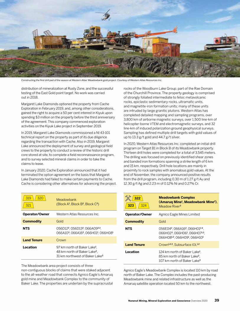
distribution of mineralization at Rusty Zone, and the successful testing of the East Gold point target. No work was carried out in 2018.
Margaret Lake Diamonds optioned the property from Cache Exploration in February 2019, and, among other considerations, gained the right to acquire a 50 per cent interest in Kiyuk upon spending $3 million on the property before the third anniversary of the agreement. This company commenced exploration activities on the Kiyuk Lake project in September 2019.
In 2019, Margaret Lake Diamonds commissioned a NI 43‑101 technical report on the property as part of its due diligence regarding the transaction with Cache. Also in 2019, Margaret Lake announced the deployment of survey and geological field crews to the property to conduct a review of the historic drill core stored at site, to complete a field reconnaissance program, and to survey selected mineral claims in order to take the claims to lease.
In January 2020, Cache Exploration announced that it had terminated the option agreement on the basis that Margaret Lake Diamonds had failed to make certain payments to Cache. Cache is considering other alternatives for advancing the project.
319 320
321
Meadowbank (Block A1, Block B2, Block C3)
Operator/Owner Western Atlas Resources Inc.
Commodity Gold
NTS 056D122, 056D132, 066A092,3, 066A103, 066A162, 066H011, 066H081
Land Tenure Crown
Location 97 km north of Baker Lake1, 48 km north of Baker Lake2, 31 km northwest of Baker Lake3
The Meadowbank area project consists of three non‑contiguous blocks of claims that were staked adjacent to the all‑weather road that connects Agnico Eagle’s Amaruq gold mine and Meadowbank Complex to the community of Baker Lake. The properties are underlain by the supracrustal
rocks of the Woodburn Lake Group, part of the Rae Domain of the Churchill Province. The property geology is comprised of strongly foliated intermediate to felsic metavolcanic rocks, epiclastic sedimentary rocks, ultramafic units, and magnetite‑iron formation units; many of these units are intruded by large granitic plutons. Western Atlas has completed detailed mapping and sampling programs, over 3,800 km of airborne magnetic surveys, over 1,500 line‑km of helicopter‑borne VTEM and electromagnetic surveys, and 32 line‑km of induced polarization ground geophysical surveys. Sampling has defined multiple drill targets with gold values of up to 13.3 g/t gold and 44.7 g/t silver.
In 2020, Western Atlas Resources Inc. completed an initial drill program on Target B1 in Block B of its Meadowbank property. Thirteen drill holes were completed for a total of 3,545 meters. The drilling was focused on previously identified shear zones and banded iron formations spanning a strike length of 6 km and 15 km, respectively. Drill hole locations are mainly in proximity to rock samples with anomalous gold values. At the end of November, the company announced positive results from the drill program, including 0.30 m of 1.27 g/t Au and 12.30 g/t Ag and 2.23 m of 0.12% Ni and 0.27% Cr.
322
323 324
Meadowbank Complex (Amaruq Mine1, Meadowbank Mine2), Meadow River3
Operator/Owner Agnico Eagle Mines Limited
Commodity Gold
NTS 056E042, 066A162, 066H012,3, 066H023, 066H061, 066H071,3, 066H081,3, 066H091, 066H101
Land Tenure Crown1,2,3, Subsurface IOL1,2
Location 124 km north of Baker Lake1, 85 km north of Baker Lake2, 107 km north of Baker Lake3
Agnico Eagle’s Meadowbank Complex is located 110 km by road north of Baker Lake. The Complex includes the past‑producing Meadowbank mine and related infrastructure as well as the Amaruq satellite operation located 50 km to the northwest.
Constructing the first drill pad of the season at Western Atlas’ Meadowbank gold project. Courtesy of Western Atlas Resources Inc.
39Nunavut Mining, Mineral Exploration and Geoscience Overview 2020
The Meadowbank mine was in production from March 2010 through the end of 2019, and produced approximately 3.2 million ounces of gold over that time. The Amaruq mine reached commercial production in September 2019, and is estimated to have a 6 year mine life based on current reserves, with the possibility for this to be extended depending on both surface and underground exploration results. The mine infrastructure and deposits are all located on IOL with grandfathered Crown mining leases, for a total of 68,735 ha of tenure.
The Amaruq property is underlain by Archean volcanic and sedimentary rocks of the Woodburn Lake Group consisting of mafic to ultramafic volcanic rocks interlayered with carbon‑rich sedimentary rocks, which can be intruded by granitoids and lamprophyres. All of these formations have been affected by various deformation phases and are generally metamorphosed to greenschist facies.
There are nine mineralized zones identified to date at Amaruq – Whale Tail, Whale Tail North, I, V, R, Mammoth 1 and 2, Buffalo, and Tugak. Gold mineralization is found in quartz pyrite‑arsenopyrite veins in volcano‑sedimentary rocks, similar to that found at the Goose and Portage deposits at the past‑producing Meadowbank mine. Whale Tail, the largest deposit, has a strike length of 2.3 km, a known depth of 915 m, and remains open at depth and along strike.
Mining operations related to the Amaruq project use the existing infrastructure at the Meadowbank mine site, including mining equipment, concentrator, tailings, camp and airstrip. Additional infrastructure has also been built at the Amaruq project site, consisting of a truck maintenance shop and warehouse, fuel storage and an additional camp facility. Ore mined at Amaruq is transported by long haul off‑road type trucks along a 64 km long all‑season road to Meadowbank concentrator site for processing. In 2020, Agnico Eagle produced 74,921 ounces of gold in the first three‑quarters of the year, employing 896 people.
In March 2020, due to travel restrictions and other measures related to the COVID‑19 pandemic, Agnico Eagle reduced its operation at the Meadowbank Complex to approximately 50 per cent capacity, and also reduced its workforce. Employees from Nunavut were sent home with pay to prevent transmission of the virus from the mine site to the communities. Production was reduced to approximately 50,000 tonnes per day to build up stockpiles, and crushing activities were suspended. The company took advantage of this period of reduced operation to carry out maintenance work on equipment and further develop the eastern part of the Whale Tail pit. Operations began a gradual ramp‑up in May, and full production levels were restored in June. In collaboration with Nunavut authorities, Agnico Eagle is evaluating ways to reintegrate its Nunavut employees into mining operations as soon as conditions allow.
Agnico Eagle budgeted a total of $6.3 million for exploration programs of its Nunavut properties in 2020. Exploration work at the Meadowbank Complex took place on the mineral claims surrounding the Amaruq and Meadowbank sites. On the
Meadowbank land holdings, 256 till samples and 1,277 grab samples were collected over the different mineralized zones, 13 diamond drill holes were completed totalling 1,791 m, and 20 line‑km of induced polarization ground geophysical surveys were carried out. At Amaruq, 181 grab samples were collected and 13 diamond drill holes totalling 3,237 m were completed, along with 14.4 line‑km of ground induced polarization geophysical surveying. A conversion drilling program was carried out over a 330 m portion of the IVR West area to potentially add these zones to the mine’s mineral resources. Although the Amaruq underground project was postponed earlier in the year, ramp development re‑started in the third quarter and is expected to reach the ore zone by the end of 2020.
The 59,042‑ha Meadow River claim block adjacent to Amaruq also had exploration completed in the 2020 season. A total of 13 till samples and 1,358 rock samples were collected and a 15. line‑km induced polarity ground geophysical survey was conducted. Diamond drilling also took place, with a total of 4,435 m drilled across 34 holes.
In June 2020, Agnico Eagle received approvals from the federal departments of Environment and Climate Change Canada and Fisheries and Oceans for various activities related to mining at the IVR open pit and Amaruq underground deposits. As a result, the company has begun dewatering and fish transfer activities from lakes in the planned IVR waste rock storage facility, and for ore extraction from the IVR and Whale Tail underground deposits at Amaruq.
325 Meliadine Mine
Operator/Owner Agnico Eagle Mines Limited
Commodity Gold
NTS 055J13, 055J14, 055K15, 055K16, 055N01, 055N02, 055O0
Land Tenure Crown, Subsurface IOL
Location 19 km north of Rankin Inlet
Agnico Eagle Mines Limited acquired the Meliadine project from Comaplex Minerals Corp. in 2010. The site is connected to the hamlet of Rankin Inlet by an all‑weather road and is located 290 km southeast of the past‑producing Meadowbank mine. Commercial production at the Meliadine mine began in May 2019, and is Agnico Eagle’s second mine in Nunavut. It is the company’s largest gold deposit in terms of mineral resources. The property consists of 111,358 ha of Crown mineral claims and grandfathered Crown mineral leases on IOL, and an additional 4,827 ha under a Mineral Exploration Agreement (MEA) with NTI. Surface rights for the grandfathered lease and MEA are administered by the Kivalliq Inuit Association. The mine’s workforce in 2020 totalled 526 people. An Inuit Impact
40 Nunavut Mining, Mineral Exploration and Geoscience Overview 2020
Gold

Benefit Agreement for the project was established with the Kivalliq Inuit Association in 2015.
The Meliadine mine is expected to remain in operation for 12 years; at an average grade of 6.10 grams per tonne, reserves are currently estimated at 4.1 million ounces of gold. Its lifetime could be extended, however, as many of the seven known deposits on the property remain open at depth, and the company believes that the local greenstone belt has potential for further gold discoveries.
Meliadine is located in the northern portion of the Archean‑aged Rankin Inlet greenstone belt that includes deformed mafic volcanic rocks, felsic pyroclastic rocks, sedimentary rocks, and gabbro sills, and is locally metamorphosed from lower to middle greenschist grade. Known deposits and highly prospective areas within the Meliadine trend are mainly located along the Pyke Fault, a high‑strain shear zone several kilometres wide and over 80 km in length. Locally, gold mineralization occurs in association with quartz‑carbonate shear zones and/or laminated quartz vein systems. The highest‑grade ore is hosted in structurally controlled, multi‑deformed and sulphidized iron formation units of the Tiriganiaq and Upper Oxide formations. Most of the major deposits at Meliadine – Normeg, Wesmeg, Wolf, Pump, and F Zone – occur within a five‑kilometre radius of the main Tiriganiaq deposit, with the Discovery deposit located 17 km to the southeast.
Two phases of operation are planned for the Meliadine mine. Mill throughput during Phase 1 has been greater than the expected initial capacity of 3,750 tonnes per day, sourced solely from underground workings via two access ramps. As a result, the planned increase to Phase 2 of production has been advanced by two years and is now expected to take place in 2021. This second phase will consist of an increase to approximately 6,000 tonnes of ore processed per day. The Tiriganiaq deposit is the main source of ore, and has a reserve of 3.8 million tons grading 4.89 g/t Au, corresponding to approximately 590,400 ounces gold. Additional ore will be sourced from an open pit. Production from Meliadine in the first 9 months of 2020 totalled 224,125 ounces of gold, including a quarterly record of 94,775 ounces achieved in the third quarter.
As at the Meadowbank Complex, Agnico Eagle sent its Nunavut‑based workforce home in response to the COVID‑19 pandemic and operated at reduced levels from mid‑March through early June. Exploration was also suspended until May.
The company forecasted its 2020 expenditures at $2.2 million for exploration drilling activities at Meliadine, including 4,900 m of drilling focused on extending the central and western Tiriganiaq zones to follow up on favourable results from previous drilling campaigns. An additional 20,000 m of underground drilling was planned to follow up on positive results from an ore lens identified at 1,370 m depth, and to test newly identified mineralized zones below the existing mineral reserves and known mineral resources.
The Discovery deposit, located 17 km east‑southeast of Tiriganiaq, was previously drilled in 2014 and is considered by the company to have potential as a satellite deposit to the Meliadine mine. The 2020 field season had a total of 11,150 metres of diamond drilling for conversion, exploration, and geotechnical evaluation related to potential underground development. A preliminary technical study on the Discovery deposit is expected in early 2021.
Agnico Eagle has applied for amendments to its water license that will allow construction of a permanent, seasonally operated water line from the Meliadine site to discharge saline effluent at tidewater, and an increase of the discharge limit to 1,600 cubic metres per day. The current water management plan includes segregation of underground dewatering and surface runoff waters in specific ponds, then treatment and seasonal discharge to Meliadine Lake or to the sea. The goal of the permanent line is to reduce costs and the environmental impact of trucking effluent for discharge. The increase in the amount of saline discharge was approved in June 2020, and consultations on the water line amendments are underway with regulatory agencies. The Nunavut Impact Review Board technical hearings, in‑person community round table, and pre‑hearing conference originally scheduled for late November 2020 have been postponed due to pandemic‑related travel restrictions. This postponement may affect the final hearing on the amendment originally scheduled for February 2021.
Sulphide mineralization in a rock face on the 200 level underground at Agnico Eagle’s Meliadine mine. Courtesy of CIRNAC.
41Nunavut Mining, Mineral Exploration and Geoscience Overview 2020
Gold

326 Pistol Bay
Operator/Owner Northquest Ltd.
Commodity Gold
NTS 055K05 – 055K07, 055K12, 055L08, 055L09
Land Tenure Crown, Surface IOL
Location 51 km northwest of Whale Cove
Northquest Ltd., a subsidiary of NordGold SE since 2016, is the operator of the Pistol Bay project that covers over 78,000 ha near Whale Cove.
The project area is underlain by the Kaminak Group, part of the Rankin‑Ennadai greenstone belt, in the Hearne Domain of the Churchill Province. The Kaminak Group consists primarily of
volcanic and volcaniclastic rocks, iron formations, mudstones, and siltstones. Numerous syn‑volcanic to late tectonic igneous intrusions are found on the property and are dated at roughly 2.7 billion years old. Tectonically, the group is interpreted as a series of back‑arc islands that were accreted to the Rae Craton. Minor Paleoproterozoic rocks of the Hurwitz Group also underlie the property.
Numerous gold occurrences have been identified at Pistol Bay, but the majority of the work has focused on the Vickers gold deposit. In February 2020, Nordgold released a revised NI 43‑101 inferred resource for the deposit of 1.58 million ounces of gold at an average grade of 2.2 g/t Au, doubling the 2016 estimate of 739,000 ounces. Mineralization at Vickers is located predominantly along the southeast‑plunging northeast contact between the Kaminak Group and a gabbroic/quartz‑dioritic intrusion known as the Gereghty Plug, hosted within sub‑vertical felsic and intermediate metavolcanic and metavolcaniclastic strata. Gold mineralization is present within and adjacent to the intrusion, to at least 300 m below surface, and the Vickers deposit remains open at depth.
A helicopter at the end of the rainbow, Pistol Bay camp. Courtesy of Northquest Ltd.
42 Nunavut Mining, Mineral Exploration and Geoscience Overview 2020
Gold

The 2018 program included geological mapping, rock chip sampling, and till sampling, mainly in the eastern half of the property. Historic drill core re‑logging was also carried out to assist with a planned update of the Vickers deposit model. The 2019 program followed up on that work with 10 diamond drill holes focused on expanding the Vickers resource. This work targeted the southern and western continuations of high‑grade mineralization and demonstrated that the gold mineralization at Vickers extended beyond the previously modelled limits.
A $3.9 million exploration program was planned for the 2020 field season, but did not take place due to COVID‑19 restrictions.
327 Tree River
Operator/Owner Silver Range Resources Ltd.
Commodity Gold
NTS 086P01
Land Tenure Crown, Surface IOL
Location 145 km southeast of Kugluktuk
The 39,250 ha property comprises three prospecting permits issued to the company in February 2018 and covers an area with known gold mineralization hosted in a monomictic, clast‑supported quartz pebble conglomerate, similar to that found at Witwatersrand in South Africa and Pilbara in Australia. The conglomerate found at Tree River is also of similar age (about 2.9 Ga) to the two above‑mentioned gold mineralization settings.
The Tree River property is located in the northern portion of the Anialik greenstone belt. The quartz pebble conglomerate straddles the mafic volcanic‑sedimentary contact and is located within 80 metres up‑section from the contact. Two mineralized units occur in proximity to this contact. The Main Zone, previously identified by BHP Billiton and Strongbow Exploration, has had samples return values up to 142 g/t Au. In addition, a chip sample collected by Silver Range returned 0.20 m at 540 g/t Au. The Main Zone is exposed sporadically at surface over a strike length of 650 m. The West Zone, discovered by Silver Range, has a strike length of 300 m but remains open. Grab samples from the West Zone returned values up to 14.05 g/t Au. The unit, traceable over a 4.8 km strike length, ranges between 15 and 20 metres in thickness with the gold‑bearing horizon between 4 and 8 metres. Gold is associated with pyrite and to a lesser degree with arsenopyrite, chalcopyrite, stibnite, and sphalerite. The area was explored by BHP and Strongbow in the 1990s and early 2000s with prospecting, channel sampling, airborne magnetic surveys, geological mapping, and petrographical studies conducted. BHP concentrated its exploration efforts on structurally controlled veins, but the Strongbow geologists recognized the Witwatersrand‑style mineralization.
In 1997, two diamonds were recovered while processing samples from the Tree River Conglomerate (TRC) to recover zircons for dating. A University of Alberta research team followed up this discovery in 2018 and recently identified three alluvial, kimberlitic diamonds from two 10 kg samples of the TRC. The samples were collected on the IOL parcel CO‑69 from the basal unit of the TRC that also contains anomalous gold.
In 2020, Silver Range collected two panel samples of the TRC from the Main Zone (49.5 kg) and West Zone (55.5 kg). The samples were crushed and analyzed by both fire assay and metallic screen fire assay, although some of the sample was sent for heavy mineral separation but no diamonds were recovered. The metallic screen assay returned 36.3 g/t Au (Main Zone) and 0.29 g/t Au (West Zone).
Gold mineralization in the TRC has been interpreted to be associated with the first organic production of oxygen and consequent fixing of soluble gold, similarly to gold deposits of the Witwatersrand. Based on U‑Pb and Hf isotope dating of zircon within a sample taken from the lower sections of the TRC, the maximum deposition age of the TRC is 2964 +/‑ 9 Ma.
Sulphide minerals in a hand sample from the Pistol porphyry, Nordgold’s Pistol Bay project. Courtesy of CIRNAC.
43Nunavut Mining, Mineral Exploration and Geoscience Overview 2020
Gold

Iron
401
Mary River Mine
Operator/Owner Baffinland Iron Mines Corporation
Commodity Iron
NTS 037C09, 037C10, 37C16, 037D13, 037E04 – 037E06, 037E11, 037E12, 037E14, 037E15, 037F01, 037F10, 037F12 – 037F16, 037G01 – 037G07, 037G11, 047H08
Land Tenure Crown, Subsurface IOL, Surface IOL
Location 155 km south of Pond Inlet
Baffinland Iron Mines Corporation’s (BIMC) Mary River iron mine,
on northern Baffin Island, has been in production since late
2014. The property consists of 411,949 hectares (ha) of tenure,
including 363,323 ha of Crown mineral claims and three NTI
Mineral Exploration Agreements covering 48,626 ha. The Mary
River iron ore discovery occurred in 1962, and initial exploration
took place until 1965. No further exploration was done in the area
until BIMC acquired the property in 2004.
Nine deposits and several additional prospects are hosted in the metasedimentary and metavolcanic rocks of the late Archean 2.76‑2.71 billion‑year‑old (Ga) Mary River Group. The area was impacted by three major tectonic events, the most significant being the Trans‑Hudson Orogeny at 1.8 Ga. The lithological units of interest are a stratigraphically lower sequence of metavolcanic rocks and an upper sequence of metasedimentary rocks, with an iron formation unit forming a prominent marker. In the Mary River area, all known high‑grade iron mineralization is associated with large‑scale fold structures along structural boundaries. Mineralization at Deposit No. 1, the deposit currently mined, averages 64% iron, with few deleterious elements.The high‑grade iron ore is associated with footwall chlorite schist, and occurs as hematite, magnetite, or specularite in banded iron formation.
Baffinland’s 2019 exploration program was based out of the Mary River mine site and focused on claims in the central portion of the land holdings. Exploration and infill drilling activities had the objective of increasing the resource at Deposit 1, the main deposit, and Deposit 3. Regional exploration activities included mapping, sampling, geophysics, a backpack drill program, and a hyperspectral survey. Legal surveys were completed for 10 claims covering a highly prospective fold structure, and 49 claims were staked to cover the Magnetite Hill fold belt.
Exploration drilling on the North Limb zone of Deposit No. 1 at the Mary River mine, northern Baffin Island. Courtesy of Baffinland Iron Mines Corp.
44 Nunavut Mining, Mineral Exploration and Geoscience Overview 2020

The $11 million exploration program on the Mary River property in 2020 included further infill and exploration drilling on Deposits 1 and 3. The North Limb Extension of Deposit 1 had a total of 5,838 m drilled over 21 holes, and at the Axial Zone occurrence, 1,267 m were drilled in nine holes. At Deposit 3, 2,055 m were drilled in eight holes at the western end of the deposit. Regional exploration activities across the property did not take place in 2020 due to COVID‑19 restrictions. A total of 5.46 million tonnes (Mt) of iron ore, in 72 ship loads averaging just under 76,000 tonnes per ship, was transported from Milne Inlet in 2020, a decrease of roughly half a million tonnes compared to 2019.
BIMC is in the process of amending its Phase 2 proposal with the Nunavut Impact Review Board (NIRB). The amendments include an increase to the allowed annual quantity of ore shipped through the Milne Inlet Port to 12 Mt and construction of a railway (termed the North Railway) parallel to the existing tote road to transport the ore. Public hearings on the amendments began in November 2019, but after community members in the affected communities expressed significant concerns about this proposal, the NIRB filed a motion to adjourn the
Iqaluit hearings and postpone the public hearings in Pond Inlet. Additionally, the technical meetings concerning the Phase 2 amendments were initially planned for Iqaluit in March 2020, but were postponed due to the risks posed by the COVID‑19 pandemic for people to travel and have large gatherings. The meetings took place in September through a combination of in‑person attendance in Pond Inlet and teleconferencing for those outside the community, and included a pre‑hearing conference and a separate community roundtable along with the technical sessions. In October 2020, the NIRB released its pre‑hearing decision report, and indicated that public hearings to discuss the Phase 2 amendments are to reconvene in Pond Inlet in January 2021.
In June 2020, Baffinland signed an Inuit Certainty Agreement with the Qikiqtani Inuit Association. This agreement is contingent on the regulatory approval of Phase 2 proposal for the mine, and sets out the terms for additional commitments from the company and the financial benefits to Inuit in the communities that will be affected by these Phase 2 plans. . The terms will be added to the existing Inuit Impact Benefit Agreement and commercial lease for the project.
Haul trucks moving ore at Deposit 1, Mary River Mine. Courtesy of CIRNAC.
45Nunavut Mining, Mineral Exploration and Geoscience Overview 2020
Iron

Inactive projects
Number Project Owner
Base Metals
102, 103 Nunavut Property (Seal‑102, Storm‑103)
Aston Bay Holdings Ltd.
Diamonds
203 Contwoyto Benchmark Metals Inc.
204 Kahuna Kodiak Copper Corp.
205 Mel North Arrow Minerals Inc.
206 Muskox Benchmark Metals Inc.
207 Naujaat North Arrow Minerals Inc.
Gold
328 Baffin Gold ValOre Metals Corp.
329 ‑ 331 Cone Hill‑329, Fox Lake‑330, Parker Lake‑331
Agnico Eagle Mines Limited
332 Contwoyto Benchmark Metals Inc.
333 Elu Belt TMAC Resources Inc.
334 Gibson MacQuoid Fury Gold Mines Limited
335 Kuulu International Consolidated Uranium Inc.
336 ‑ 340 South Kitikmeot Gold (Bling‑336, Esker Lake‑337, Goldbugs‑338, Qannituq‑339, Uist‑340)
Silver Range Resources Ltd.
341 Yandle Silver Range Resources Ltd.
Uranium
501 Mountain Lake International Consolidated Uranium Inc., IsoEnergy Ltd.
Aston Bay Holdings Ltd.’s Nunavut Property is located on Somerset Island in Nunavut’s High Arctic, and comprises the Seal Zinc deposit and Storm Copper prospect. The company optioned the project in 2011 from Commander Resources, and consolidated ownership in 2015. In 2017, a NI 43‑101 inferred resource was released for Seal, estimating it contains 1.01 million tonnes of ore averaging 10.24% Zn and 46.5 grams per tonne silver, at a cutoff of 4.0% Zn. The last reported work on the property was a drill program in 2018, and included sealifting supplies to support a proposed 2019 program. However, the
company has since focused its efforts outside of Nunavut.
Benchmark Metals Inc. owns the Muskox diamond project in the Kitikmeot region of Nunavut, as well as the Contwoyto diamond and gold projects. The properties include diamondiferous kimberlites discovered in the 1990s and early 2000s, most notably the Muskox kimberlite, which graded up to 0.53 carats per tonne from a mini‑bulk sample collected in 2006. Benchmark purchased the Contwoyto gold project from North Arrow Minerals in 2017, and carried out a short drill program that year testing gold‑mineralized iron formation. Two
claims were added to the project in 2018, but no further work has been conducted.
The Kahuna diamond project is owned by Kodiak Copper Corp., a name change from Dunnedin Ventures Inc., and is located between Chesterfield Inlet and Rankin Inlet. Historical work on the property has identified at least 88 kimberlites. The 2018 program focused on testing a newly discovered cluster of possibly diamondiferous kimberlites, resulting in a new kimberlite discovery. Till sampling also identified a discrete target area for potential diamond sources at the head of a trend of diamond indicator minerals for which no source is yet known. No further work has been reported, and the company has changed its focus to other commodities outside Nunavut.
North Arrow Minerals owns the Mel diamond project on the Melville Peninsula and the Naujaat diamond project near the hamlet of the same name. Since starting work on Mel in 2013, North Arrow has identified three kimberlites on the property, ML‑8 (Upper), ML‑8 (Lower), and ML‑345. The property also has multiple kimberlite indicator mineral trains with unresolved sources. The last work on the property included drilling and till sampling in 2018. Since acquiring the Naujaat project from Stornoway Diamond Corporation in 2013, North Arrow collected two mini‑bulk samples in 2014 and 2017. The goal was to improve understanding of the quantity and grade of the Q1‑4 kimberlite complex’s two populations of diamonds, one of which has fancy yellow colouration. In 2019, North Arrow worked with the hamlet of Naujaat to plan and permit a community access trail that would pass within 1.5 km of the project. The company also initiated an engineering study of a small‑scale mobile diamond recovery plant to be used as part of a bulk sampling program. In 2020, North Arrow signed an option agreement with EHR Resources, under which EHR may earn a 40 per cent interest in the project by funding the collection of a $5.6 million, 1,500 to 2,000 tonne preliminary bulk sample in 2021.
The Baffin Gold project covers 160 km of the Foxe Fold Belt on central Baffin Island, and has been explored by
46 Nunavut Mining, Mineral Exploration and Geoscience Overview 2020

multiple operators since gold was discovered there in 2001. ValOre Metals Corp. optioned the property in 2017, and consolidated ownership in 2018. The company carried out exploration at Baffin Gold in 2017 and 2018 that extended the geophysical survey coverage of the property and identified three areas with anomalous gold‑in‑till values.
Agnico Eagle has several regional exploration properties located along the western extension of the Pyke Fault, the main structural control for the Meliadine gold mine, in the Rankin greenstone belt and the Gibson Macquoid greenstone belt. All these properties are located between the Meliadine mine and the hamlet of Baker Lake. Cone Hill is the most northerly, Parker Lake is about 80 km to the south, and Fox Lake is southeast of Parker. The last reported work for each was in 2017.
Northeast of its Hope Bay Project and the Doris Mine, TMAC Resources also owns the Elu Belt gold project that covers the 10 km by 80 km Elu greenstone belt. TMAC has conducted several geophysical surveys over the property, the most recent in 2018 over the Elu Link area, interpreted to be a stratigraphic link between the Hope Bay and Elu belts. No further work has been reported.
Fury Gold Mines Limited, formerly Auryn Resources Inc., owns the Gibson Macquoid gold project between the Meliadine and Meadowbank mines. The project covers about 52 km strike‑length of the Gibson Macquoid greenstone belt. The company carried out sampling programs in 2017 and 2018. This work identified eight gold‑in‑till anomalies, but no further results from these programs have been released.
In 2020, NxGold Ltd. changed its name to International Consolidated Uranium Inc. The company has optioned two projects in Nunavut: the Kuulu gold project in the central Kivalliq, adjacent to Agnico Eagle’s Meliadine gold mine, and the Mountain Lake uranium project in the Hornby Bay basin, southwest of Kugluktuk. Kuulu has been under option
from Meliadine Gold Ltd. since 2016, but the company has faced persistent challenges in obtaining surface access authorizations for exploration. NxGold delivered notice of force majeure to Meliadine Gold in 2017 and Nunavut Tunngavik Inc. in 2018, suspending its obligations under both the option agreement and Mineral Exploration Agreement, respectively. The company also entered an option agreement with IsoEnergy Ltd. in July 2020 for the Mountain Lake project, which has a historical inferred resource estimate of 8.2 million pounds of U3O8 at an average grade of 0.23%. No work has been reported since IsoEnergy staked the project in 2016. The property is within an area with proposed prohibitions on mineral exploration included in the 2016 draft Nunavut Land Use Plan, and due to the uncertainty this situation creates, the company was granted a suspension of work requirements under Section 51 of the Nunavut Mining Regulations.
Silver Range Resources Ltd. has a portfolio of gold projects in the Kitikmeot and Kivalliq regions of Nunavut. The South Kitikmeot Gold project comprises five properties within the Back River‑Contwoyto greenstone belt. Bling, Esker Lake, Goldbugs, and Uist are southwest of Sabina Gold & Silver’s George Lake and Goose Lake properties, and the fifth, Qannituq, is between them. Amaroq Gold Corp. optioned the project in 2018, but Silver Range terminated the agreement in January 2020, due to Amaroq’s failure to satisfy certain agreement terms. The most recent work reported on any of these properties was done by Silver Range in 2017 at Bling, Uist, and Qannituq. Silver Range also owns the Yandle project, located west of Arviat in the Kivalliq region, which includes two showings documented in the NUMIN database. Mapping, prospecting, and ground geophysical surveys were carried out on the property by Silver Range in 2017.
Malachite and azurite mineralization at Aston Bay’s Storm prospect’s 2700 zone. Courtesy of CIRNAC.
47Nunavut Mining, Mineral Exploration and Geoscience Overview 2020
Inactive projects

Geese flying south for the winter over Whale Cove. Courtesy of CIRNAC.

base metal a metal that corrodes or oxidizes easily, such as iron, lead, copper, or zinc.
breccia a type of rock made up of angular rock or mineral fragments that have been fractured by forces within the Earth and then cemented together. Breccias can be good hosts for mineral deposits because the fractures in the rock provide spaces for mineralization to occur.
bulk sample the collection of a large amount of mineralized material from a deposit to determine its average metal or mineral content. Bulk samples are usually several hundred kilograms to several tonnes in size.
carat a unit of weight used for diamonds and other gemstones. One carat is equivalent to 0.2 grams.
deposit a natural concentration of a metal, gemstone or other mineral substance, which may be economically extracted but which needs more detailed study to be classified as a resource. Also known as a mineral deposit.
drilling the extraction of a sample of bedrock or other surface material such as glacial till or clay, in order to examine the occurrence of rock types, understand an area’s geological structure, or verify the presence or absence of ore minerals.
element a pure substance that contains only one type of atom. Gold, copper, iron, and other metals are elements.
feasibility study a final report prepared to evaluate the most suitable plan for a proposed mine, based on options presented in the pre‑feasibility study. It includes specifics related to project budget, design, and construction, and demonstrates that the project can be accomplished in an environmentally and technically sound way.
fee simple a type of private land ownership in which the owner has the right to use, control access to, and transfer the land. Inuit hold fee simple title to Inuit Owned Land.
geochemical survey the collection of rock, soil, or water samples from a defined area and their subsequent chemical analysis in a laboratory, to identify abnormal concentrations of chemical elements that indicate the presence of metals or gemstones. Also referred to as geochemical exploration.
geophysical survey the collection of information associated with bedrock using sensing instruments. These surveys can be conducted from the air or the ground to detect physical properties of rocks such as magnetism, gravity or conductivity.
grab sample a rock sample, collected by hand, that is examined for its physical characteristics and chemically analyzed to determine whether valuable minerals or metals are present.
grade a measurement of the quantity of metal or other commodity in ore, expressed as grams or carats per tonne for precious metals or gemstones, or as a weight per cent for base metals and iron.
greenstone belt a linear zone or “belt” of metamorphosed volcanic rocks that often host deposits of gold and other valuable metals. Their characteristic colour comes from several different green minerals that make up the volcanic rocks. These belts can be tens to hundreds of kilometres in length and are found in several places across Nunavut.
kimberlite a type of igneous rock that sometimes contains diamonds. Kimberlites can be composed of intrusive and/or extrusive rock. Kimberlite indicator minerals (KIMs) are minerals found in glacial or other sediments that suggest the nearby presence of a kimberlite.
mafic rock any igneous rock composed primarily of dark‑coloured minerals, usually with a high iron and magnesium content. Ultramafic rocks are rocks made up of greater than 90 per cent mafic minerals, and some can be used as carving stone.
Mineral Exploration Agreement an agreement signed between Nunavut Tunngavik Inc. and exploration companies, which allows exploration on Inuit Owned Lands.
National Instrument 43-101 a set of rules and guidelines for reporting information related to mineral exploration projects that are listed on Canadian stock exchanges.
ore a rock or mineral that contains an economically important metal, that can be mined and processed to produce that metal.
precious metal a metal such as gold or silver, which has high economic value and does not corrode.
preliminary economic assessment an initial economic study done on a mineral deposit to determine whether or not the project can be profitable under current market conditions.
pre-feasibility study the evaluation of an exploration project’s potential to become a mine, prior to proceeding with infrastructure development, underground expansion, or other large‑scale activities. It includes various mine design options, preliminary geotechnical and/or metallurgical studies, ore processing tests, and cost estimates for construction, as well as provide justification for increasing spending on a project.
Glossary
Geese flying south for the winter over Whale Cove. Courtesy of CIRNAC.
49Nunavut Mining, Mineral Exploration and Geoscience Overview 2020

GUIDE TO ABBREVIATIONS
CIRNAC Crown-Indigenous Relations and Northern Affairs Canada
CNGO Canada-Nunavut Geoscience Office
EDT Department of Economic Development and Transportation, Government of Nunavut
GN Government of Nunavut
g/t grams per tonne
IOL Inuit Owned Land
KIM kimberlite indicator mineral
MEA Mineral Exploration Agreement
MPR Minerals and Petroleum Resources Division, Department of Economic Development and Transportation, Government of Nunavut
NI 43-101 National Instrument 43-101
NIRB Nunavut Impact Review Board
NTI Nunavut Tunngavik Incorporated
SEDAR System for Electronic Document Analysis and Retrieval
reserve a published estimate of the amount of naturally occurring metal, gemstone, or other mineral substance in a deposit that can be economically extracted at the time of publication of the estimate. Classifying a deposit as a reserve indicates that a company has strong confidence in the quantity and quality of ore in that deposit. Mineral deposits must meet specific legal criteria to be classified as reserves.
resource a published estimate of the amount of naturally occurring metal, gemstone, or other mineral substance in a deposit, which is present in an amount that could allow for economic extraction of the material in the future. Classifying a deposit as a resource indicates that a company has moderate confidence in the quantity and quality of ore in that deposit, but that more exploration is needed to consider it a reserve. Mineral deposits must meet specific legal criteria to be classified as resources.
shear a type of deformation resulting from forces within the earth that cause parts of a rock mass to stretch, compress, or fracture. This deformation can form shear zones, bodies of rock with many parallel fractures that can be good hosts for hydrothermal mineral deposits.
sulphide a group of minerals that contain the element sulphur, including a large number of metal‑bearing minerals that are sources for metals such as gold, zinc, and copper. They are commonly referred to as economic minerals. Sulphide deposits can be massive (minerals are concentrated over small areas) or disseminated (minerals are distributed over large areas).
50 Nunavut Mining, Mineral Exploration and Geoscience Overview 2020
Glossary

Map Number Project Name Page
Agnico Eagle Mines Limited
329 Cone Hill 47
330 Fox Lake 47
309 Greyhound 35
322–323 Meadowbank Complex (Amaruq Mine-322, Meadowbank Mine-323)
39
324 Meadow River 39
325 Meliadine Mine 40
331 Parker Lake 47
310 White Hills 35
Arctic Star Exploration Corp.
202 Stein 31
Aston Bay Holdings Ltd.
102, 103 Nunavut Property (Seal‑102, Storm‑103) 46
Baffinland Iron Mines Corporation
401 Mary River Mine 44
Benchmark Metals Inc.
203 Contwoyto (Diamond) 46
332 Contwoyto (Gold) 46
206 Muskox 46
Blue Star Gold Corp.
312 Hood River 36
313 Ulu 36
Cache Exploration Inc.
318 Kiyuk 38
De Beers Group
201 Chidliak 31
Fury Gold Mines Limited
304–308 Committee Bay Gold (Anuri‑Raven‑304, Four Hills‑Cop‑305, Inuk‑306, Three Bluffs‑307, West Plains‑308)
34
334 Gibson MacQuoid 47
GGL Resources Corp.
202 Stein 31
Gold79 Mines Ltd.
309 Greyhound 35
Map Number Project Name Page
International Consolidated Uranium Inc.
335 Kuulu 47
501 Mountain Lake 47
IsoEnergy Limited
501 Mountain Lake 47
Kodiak Copper Corp.
204 Kahuna 46
North Arrow Minerals Inc.
205 Mel 46
207 Naujaat 46
Northquest Ltd.
326 Pistol Bay 42
Rio Algom Exploration Inc.
101 Wolverine 30
Sabina Gold & Silver Corp.
302, 303 Back River (George Lake-302, Goose Lake-303)
32
Silver Range Resources Ltd.
301 Atlantis 32
311 Hard Cash 35
327 Tree River 43
336–340 South Kitikmeot Gold (Bling‑336, Esker Lake‑337, Goldbugs‑338, Qannituq‑339, Uist‑340)
47
341 Yandle 47
Solstice Gold Corp.
317 KGP 38
TMAC Resources Inc.
333 Elu Belt 47
314–316 Hope Bay (Doris Mine-314, Boston-315, Madrid-316)
36
ValOre Metals Corp.
328 Baffin Gold 46
Western Atlas Resources Inc.
319–321 Meadowbank (Area A‑319, Area B‑320, Area C‑321)
39
Bold project number and name signifies an advanced or major project.
Index
51Nunavut Mining, Mineral Exploration and Geoscience Overview 2020

Discover the geoscience of Nunavut through these interactive tools
Exploration OverviewThe online version of this annual publication of exploration activities throughout Nunavut
NUMIN ReferencesA downloadable library of scientific publications, maps and data
NUMIN ShowingsFor browsing the mineral occurrences database with links to supporting references
Nunavut Mineral Project InventoryAn inventory of previously explored mineral projects categorized by commodity, mineral potential and tenure availability
www.NunavutGeoscience.caThe most authoritative stop for Nunavut geoscience information