Embed Size (px)
Citation preview

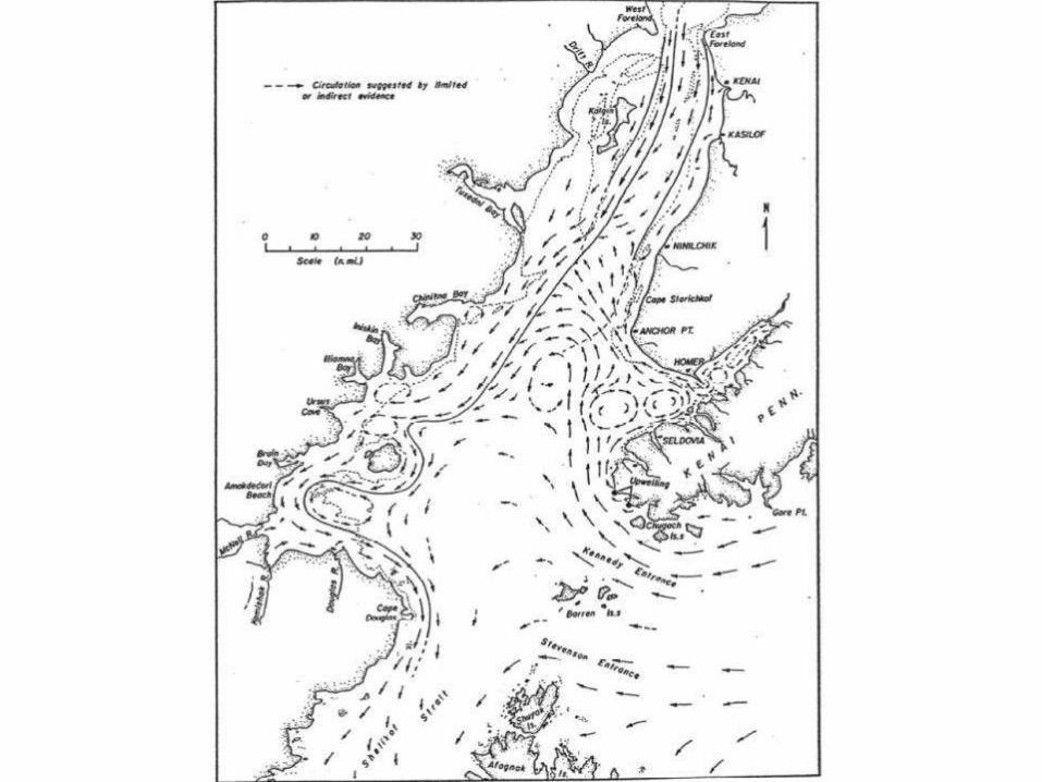
Overview: Cook Inlet Oceanography
Susan Saupe “Not a Physical Oceanographer”
Cook Inlet RCAC


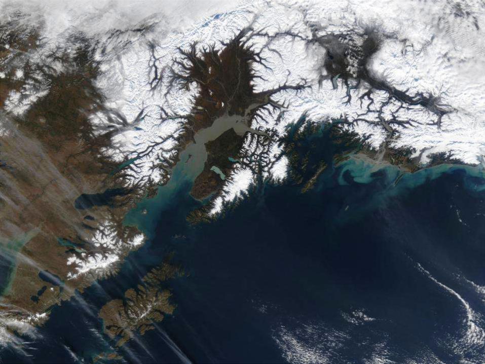
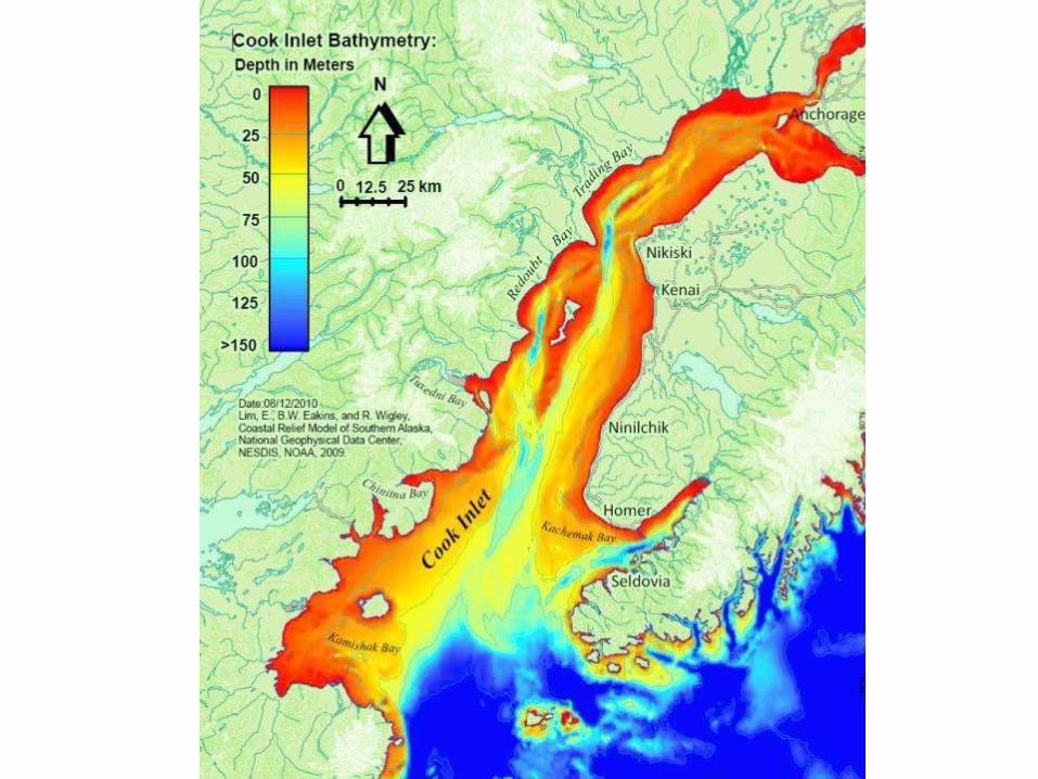
Freshwater Influences in Cook Inlet


If it weren’t for the
currents, Cook Inlet
would become a
gigantic mud flat.
If it weren’t for the mud,
Cook Inlet would
become current-swept
sand and gravel
beaches.
Instead, it’s both….

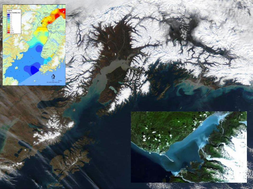
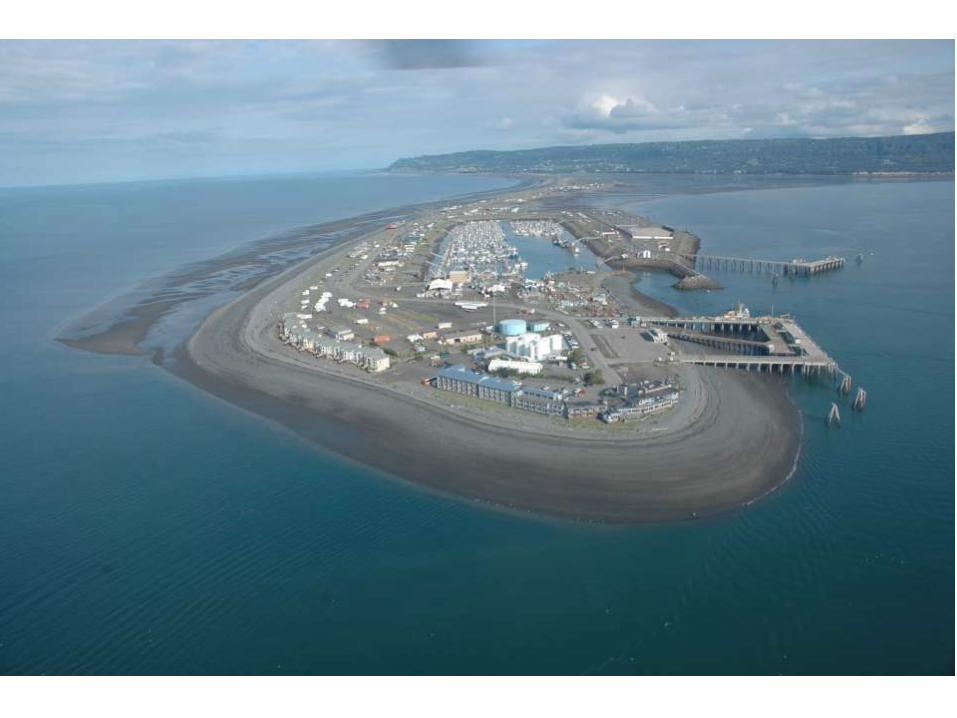
Depositional, Erosional, and Non-mobile Shorelines


South Shoal

CIRCAC photo
CIRCAC photo
CIRCAC photo

MHHW
Zero
Katchemak BayKamishak Bay
1 mile
Rock ramp
Rock wall
26 ft
Slide by Mandy Lindeberg (NMFS)

Highest Observed
Mean Higher High Water
Mean High Water
Mean Tide Level
Mean Low Water
Mean Lower Low Water
Lowest Observed
Tidal Datums
MHHW
MHW
MTL
MLW
MLLW “0”


Armap.org


From Oey et. al. 2007
Tal Ezer

AlaskaGeography.com
Note Scale Difference


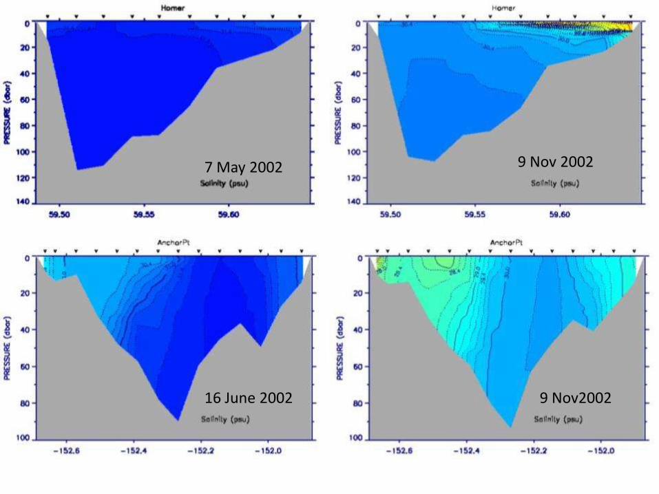
7 May 2002 9 Nov 2002
16 June 2002 9 Nov2002

3 June 2002 2-3 October 2002
20 June 2002 2 October 2002
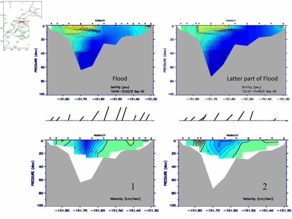
Flood Latter part of Flood

Transition to ebb


We need models