Embed Size (px)
Citation preview

Overview of Climate Services in Indonesia
Ardhasena Sopaheluwakan
Presented at the 2011 WMO RA-V Regional Seminar. Honiara, Solomon Islands, 2 November 2011BMKG
Outline• Climatological settings
• Current capacities for climate
services
• Current status of climate services
Badan Meteorologi Klimatologi dan Geofisika
Climatological settings
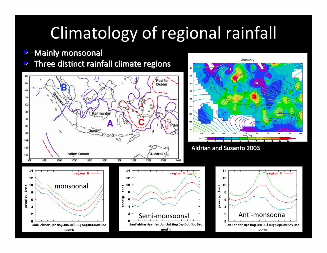
Climatology of regional rainfall•• Mainly monsoonalMainly monsoonal
•• Three distinct rainfall climate regionsThree distinct rainfall climate regions
Aldrian and Susanto 2003Aldrian and Susanto 2003
monsoonalmonsoonal
SemiSemi--monsoonalmonsoonal AntiAnti--monsoonalmonsoonal
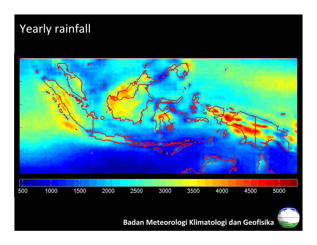
Yearly rainfall
Badan Meteorologi Klimatologi dan Geofisika
1979 1990 2000 2010
Temperature [d
egree C
elcius]
23
24
25
26
27
28
29
30
31
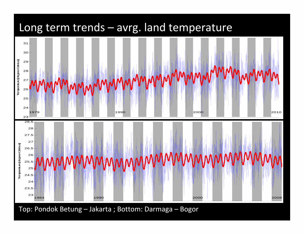
Long term trends – avrg. land temperature
Top: Pondok Betung – Jakarta ; Bottom: Darmaga – Bogor
1984 1990 2000 2008
Tempe
rature [d
egree
Celcius]
23
23.5
24
24.5
25
25.5
26
26.5
27
27.5
28
28.5
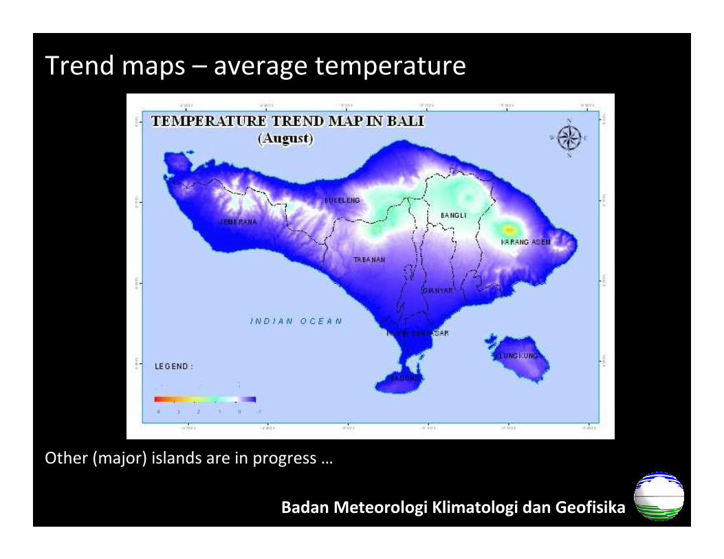
Trend maps – average temperature
Other (major) islands are in progress …
Badan Meteorologi Klimatologi dan Geofisika
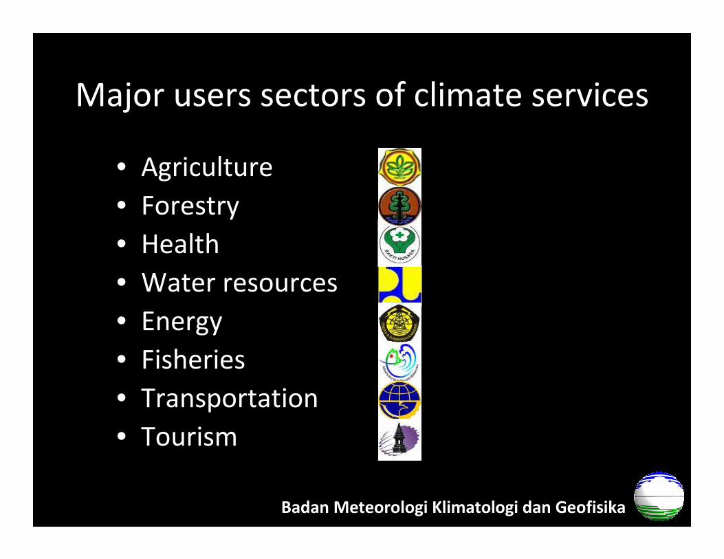
Major users sectors of climate services
• Agriculture
• Forestry
• Health
• Water resources
• Energy
• Fisheries
• Transportation
• Tourism
Badan Meteorologi Klimatologi dan Geofisika
Current capacities for climate services
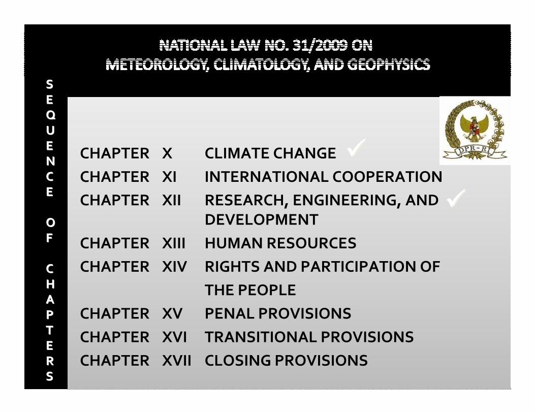
CHAPTER X CLIMATE CHANGE
CHAPTER XI INTERNATIONAL COOPERATION
CHAPTER XII RESEARCH, ENGINEERING, AND
DEVELOPMENT
CHAPTER XIII HUMAN RESOURCES
CHAPTER XIV RIGHTS AND PARTICIPATION OF
THE PEOPLE
CHAPTER XV PENAL PROVISIONS
CHAPTER XVI TRANSITIONAL PROVISIONS
CHAPTER XVII CLOSING PROVISIONS
SS
EE
UU
EE
NN
CC
EE
OO
FF
CC
HH
AA
PP
TT
EE
RR
SS
��������
��������
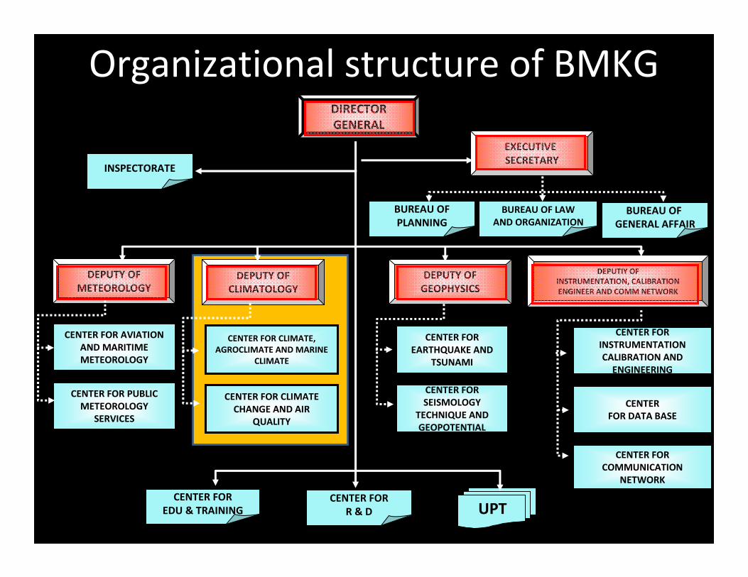
CENTER FOR PUBLIC
METEOROLOGY
SERVICES
CENTER FOR AVIATION
AND MARITIME
METEOROLOGY
CENTER FOR CLIMATE,
AGROCLIMATE AND MARINE
CLIMATE
CENTER FOR
EARTHQUAKE AND
TSUNAMI
CENTER FOR
SEISMOLOGY
TECHNIQUE AND
GEOPOTENTIAL
CENTER FOR
INSTRUMENTATION
CALIBRATION AND
ENGINEERING
CENTER FOR
COMMUNICATION
NETWORK
CENTER
FOR DATA BASE
DEPUTY OF
METEOROLOGY
DEPUTY OF
CLIMATOLOGY
DEPUTY OF
GEOPHYSICS
DEPUTIY OF
INSTRUMENTATION, CALIBRATION
ENGINEER AND COMM NETWORK
UPTCENTER FOR
R & D
CENTER FOR
EDU & TRAINING
EXECUTIVE
SECRETARY
DIRECTOR
GENERAL
BUREAU OF
PLANNING
BUREAU OF LAW
AND ORGANIZATIONBUREAU OF
GENERAL AFFAIR
INSPECTORATE
CENTER FOR CLIMATE
CHANGE AND AIR
QUALITY
Organizational structure of BMKG
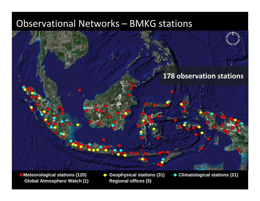
Observational Networks – BMKG stations
Meteorological stations (120) Geophysical stations (31) Climatological stations (21)Global Atmosphere Watch (1) Regional offices (5)
178 observation stations
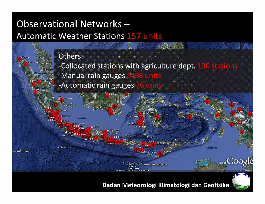
Observational Networks –Automatic Weather Stations 157 units
Badan Meteorologi Klimatologi dan Geofisika
Others:
-Collocated stations with agriculture dept. 130 stations
-Manual rain gauges 5498 units
-Automatic rain gauges 76 units
Current status of climate services
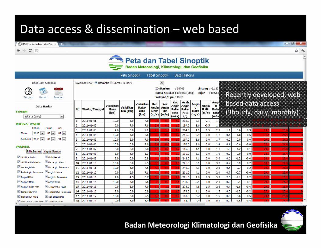
Data access & dissemination – web based
Badan Meteorologi Klimatologi dan Geofisika
Recently developed, web
based data access
(3hourly, daily, monthly)
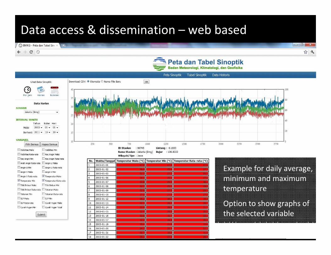
Data access & dissemination – web based
Example for daily average,
minimum and maximum
temperature
Option to show graphs of
the selected variable
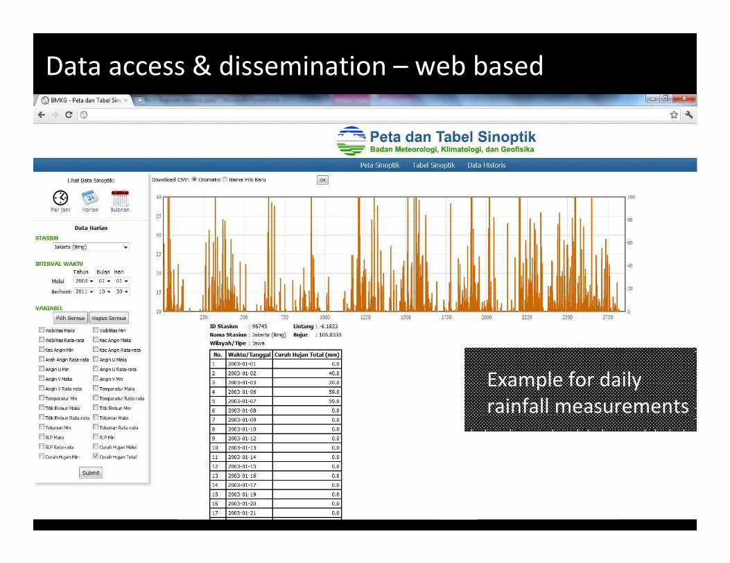
Data access & dissemination – web based
Example for daily
rainfall measurements
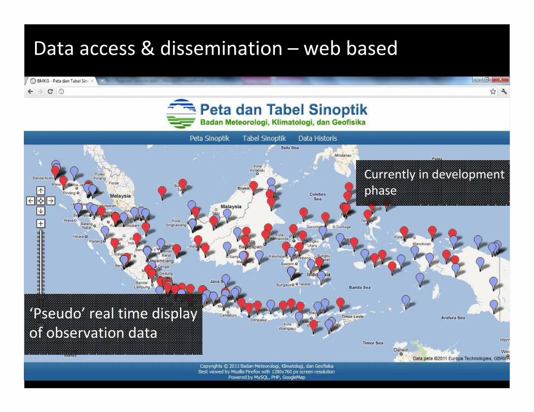
Data access & dissemination – web based
‘Pseudo’ real time display
of observation data
Currently in development
phase
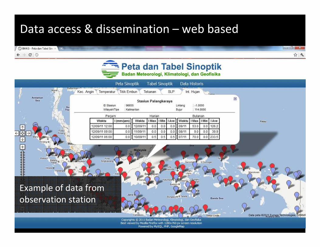
Data access & dissemination – web based
Example of data from
observation station
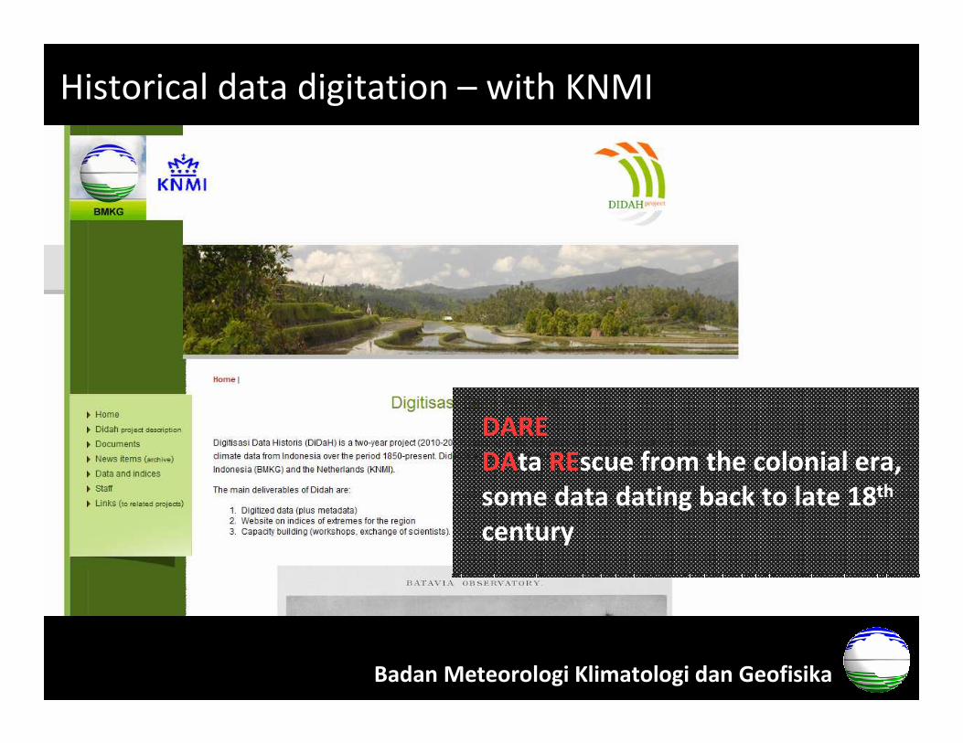
Historical data digitation – with KNMI
Badan Meteorologi Klimatologi dan Geofisika
DARE
DAta REscue from the colonial era,
some data dating back to late 18th
century
Routine products (1)
• Forecast of rainy and dry season onset
• Forecast of monthly rainfall (up to 3 month
lead time)
• Soil moisture information
• Agroclimate suitability map
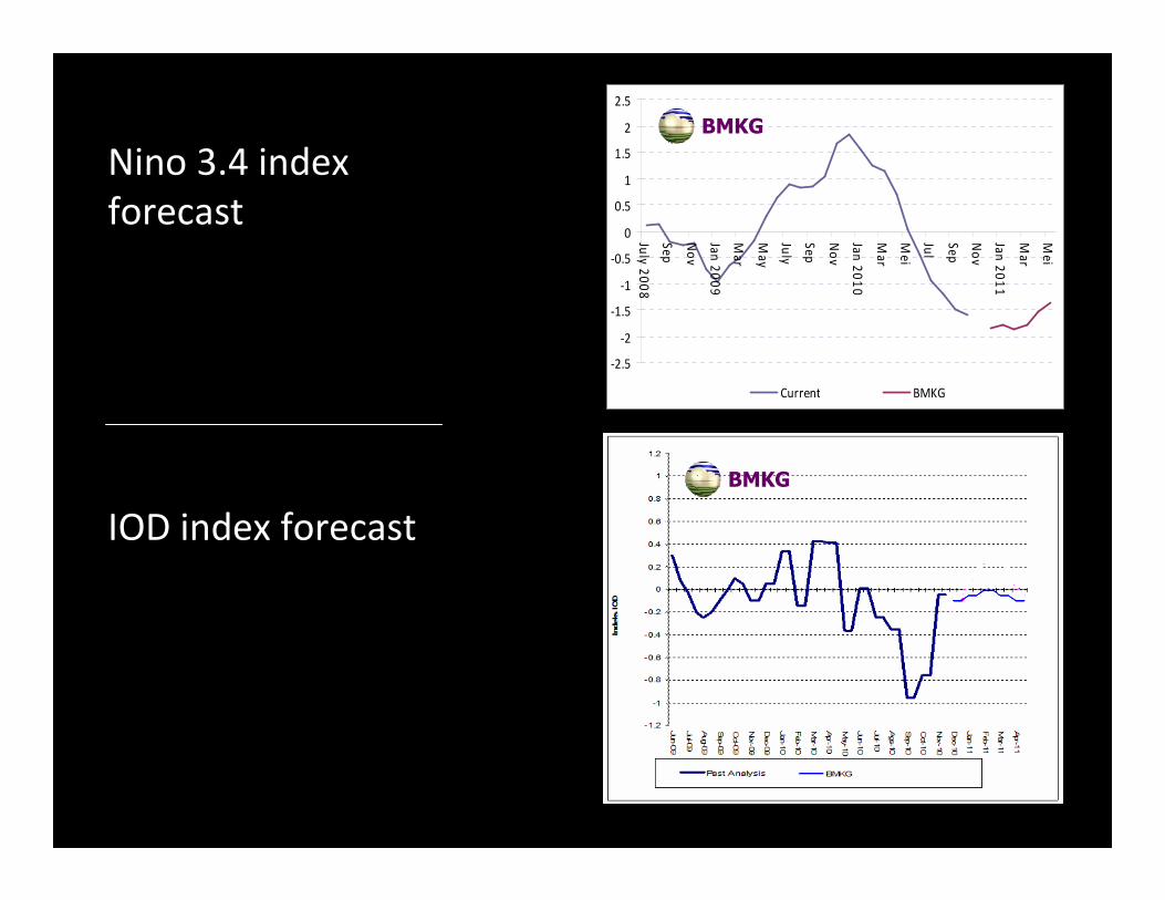
• ENSO & IOD indices forecast
• Short range Sea Surface Temperature forecast
Badan Meteorologi Klimatologi dan Geofisika
Routine products (2)
• Return period map of maximum rainfall
• Climatology of rainfall, temperature, wind
• Climatology of rainy and dry season onset
• Maps of shifts of rainy and dry season onset
• Vulnerability map to drought for rice producing
provinces
• Climate Field School for farmers in crop producing
provinces
• …
Badan Meteorologi Klimatologi dan Geofisika

Forecast of rainy
season onset
Released yearly on
September
Example: onset of rainy
season 2011
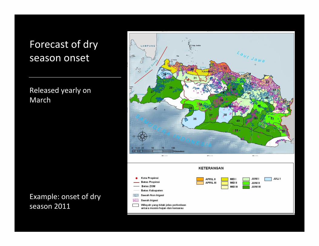
Forecast of dry
season onset
Released yearly on
March
Example: onset of dry
season 2011
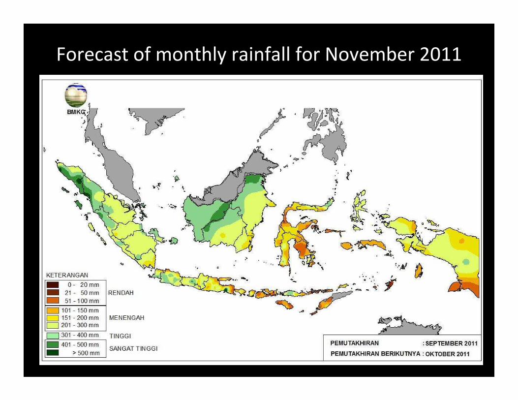
Forecast of monthly rainfall for November 2011
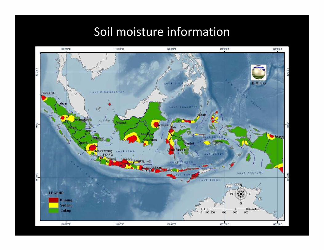
Soil moisture information
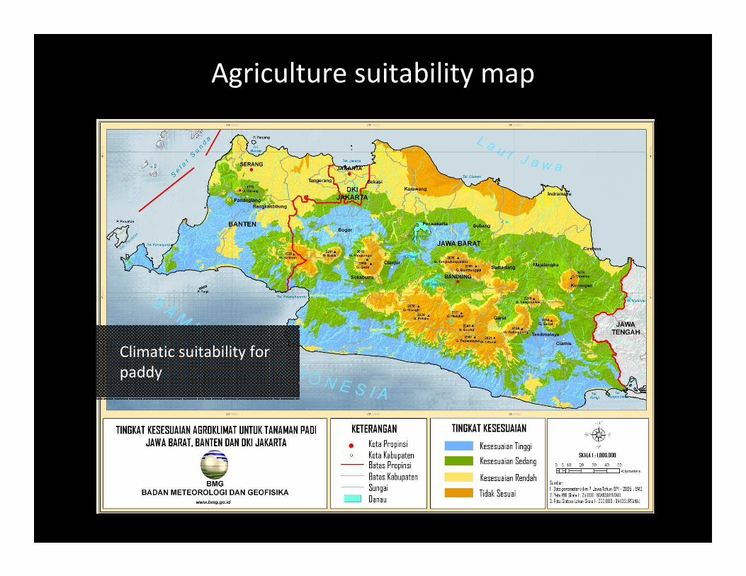
Agriculture suitability map
Climatic suitability for
paddy
-2.5
-2
-1.5
-1
-0.5
0
0.5
1
1.5
2
2.5
July
20
08
Se
p
No
v
Jan
20
09
Ma
r
Ma
y
July
Se
p
No
v
Jan
20
10
Ma
r
Me
i
Jul
Se
p
No
v
Jan
20
11
Ma
r
Me
i
Current BMKG
BMKG
Nino 3.4 index
forecast
BMKG
IOD index forecast
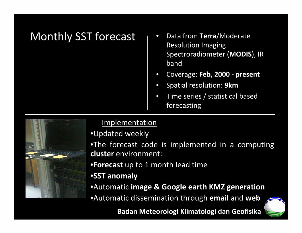
• Data from Terra/Moderate
Resolution Imaging
Spectroradiometer (MODIS), IR
band
• Coverage: Feb, 2000 - present
• Spatial resolution: 9km
• Time series / statistical based
forecasting
Implementation
•Updated weekly
•The forecast code is implemented in a computingcluster environment:
•Forecast up to 1 month lead time
•SST anomaly
•Automatic image & Google earth KMZ generation
•Automatic dissemination through email and web
Badan Meteorologi Klimatologi dan Geofisika
Monthly SST forecast
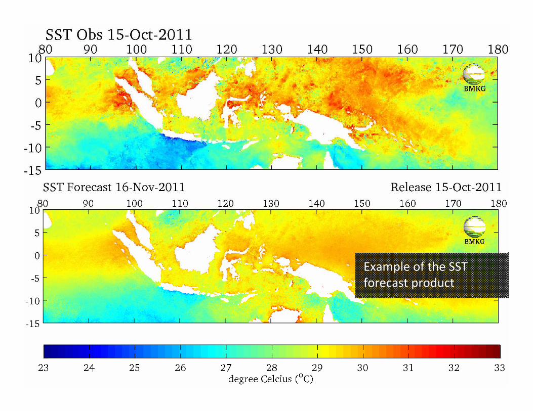
Example of the SST
forecast product
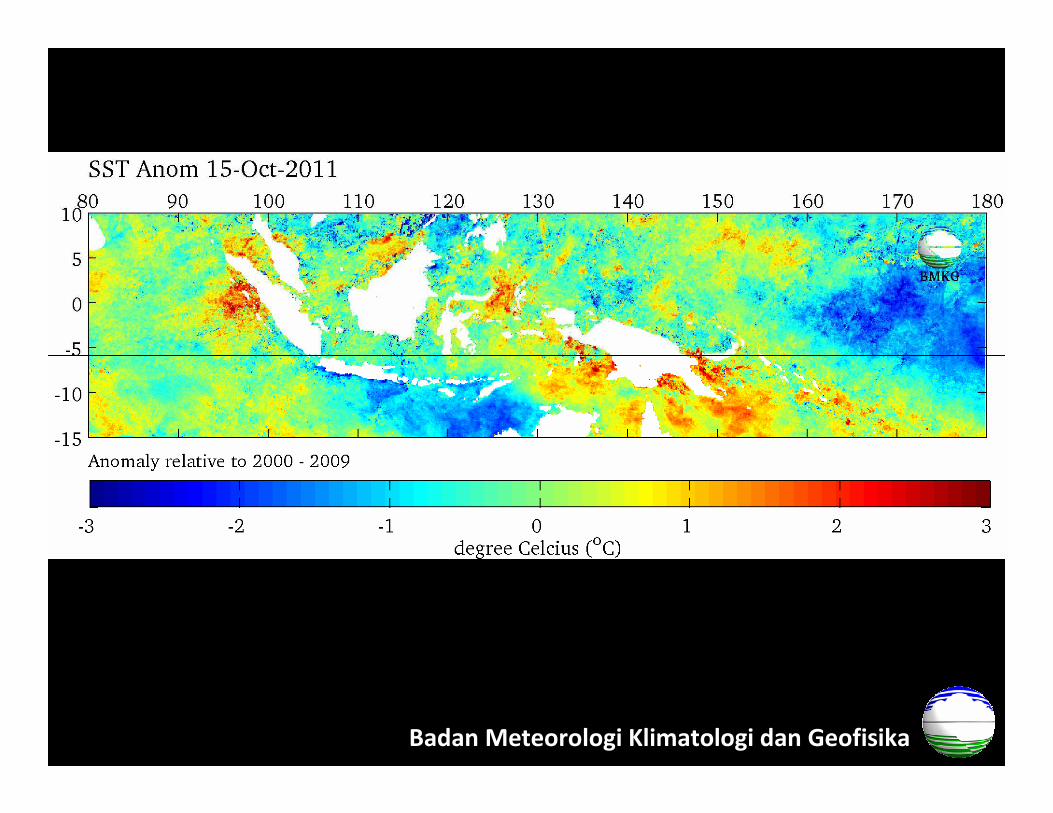
Badan Meteorologi Klimatologi dan Geofisika
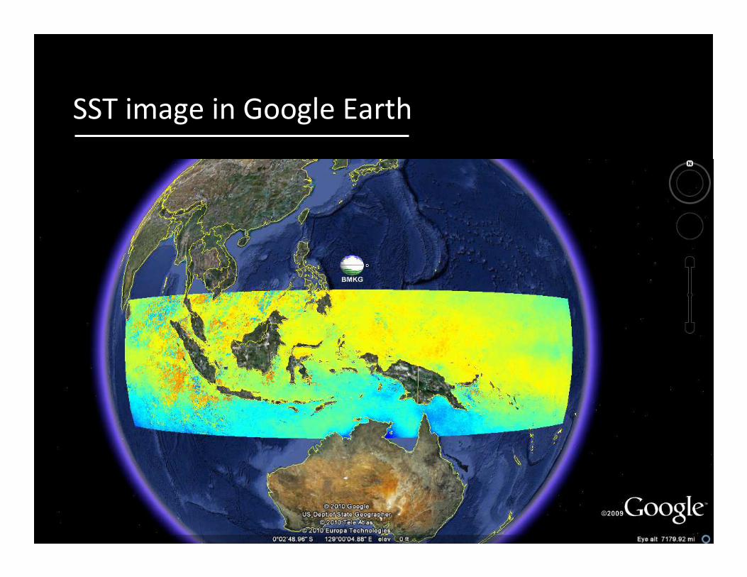
SST image in Google Earth

HISTORICAL
IN-SITU DATA
HISTORICAL
IN-SITU DATA
REAL-TIME
SATELLITE DATA
(Validated)
REAL-TIME
SATELLITE DATA
(Validated)
HISTORICAL
SATELLITE DATA
HISTORICAL
SATELLITE DATA
DROUGHT
FORECAST
DROUGHT
FORECAST
VALIDATIONVALIDATION
WEATHER
FORECAST
WEATHER
FORECAST
DROUGHT
EARLY
WARNING
SYSTEM
DROUGHT
EARLY
WARNING
SYSTEM
FLOOD EARLY
WARNING
SYSTEM
FLOOD EARLY
WARNING
SYSTEM
MINISTRY OF
PUBLIC WORKS
MIN OF PUBLIC WORKS
&
MIN OF AGRICULTURE
BMK
G
1b
1a
2a
2b
3b
4b
4a
BMKG
BMKG
2009 - 2011 2012 - 2013
BMKG
3a

Needs
• Ocean observations
• Operational coupled ocean & regional
atmosphere model (weather and climate)
• Capacity building for downscaling techniques
• Capacity building for tailoring climate
information to users
• …
Badan Meteorologi Klimatologi dan Geofisika

Badan Meteorologi Klimatologi dan Geofisika
Thank you for your attention
…
Dr. Ardhasena Sopaheluwakan
Center for Climate Change and Air Quality
Agency for Meteorology Climatology and Geophysics

Error analysis
• Normalized (non-dimensional)
absolute error (norm. L1 error).
Badan Meteorologi Klimatologi dan Geofisika
5 10 15 20 25 30 35
0.016
0.017
0.018
0.019
0.02
0.021
0.022
0.023
0.024
0.025
0.026
Aug Sept Oct Nov Dec Jan Feb Mar Apr May Jun
E2
2010 2011
Average normalized error between 1.5% - 2.5%

2010 …
• High rainfall rate over Indonesia
throughout the year
• Floods even in the normal dry
period
• High SST anomaly > 1oC
• WMO: Record high average
land and sea surface
temperature

Data access & dissemination – web based
Badan Meteorologi Klimatologi dan Geofisika

Observational Networks –Automatic Weather Stations 159 units
Badan Meteorologi Klimatologi dan Geofisika
Others:
-Co–hosted stations with agriculture dept. 130 stations
-Manual rain gauges 5498 units
-Automatic rain gauges