Embed Size (px)
Citation preview

Partial Relinquishment Report – EL26899 July 2015 Consolidated Global Investments Limited
1
Partial Relinquishment Report EL26899- Flora -Daly Basin
For the period 5th May 2009 to 4th May 2015
Partial Relinquishment Report – EL26899 July 2015 Consolidated Global Investments Limited
2
PROJECT DETAILS
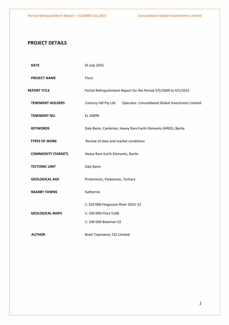
DATE 16 July 2015
PROJECT NAME Flora
REPORT TITLE Partial Relinquishment Report for the Period 5/5/2009 to 4/5/2015
TENEMENT HOLDERS Century Hill Pty Ltd Operator: Consolidated Global Investment Limited
TENEMENT NO. EL 26899
KEYWORDS Daly Basin, Cambrian, Heavy Rare Earth Elements (HREE), Barite
TYPES OF WORK Review of data and market conditions
COMMODITY (TARGET) Heavy Rare Earth Elements, Barite
TECTONIC UNIT Daly Basin
GEOLOGICAL AGE Proterozoic, Palaeozoic, Tertiary
NEARBY TOWNS Katherine
1: 250 000-Fergusson River SD52-12
GEOLOGICAL MAPS 1: 100 000-Flora 5168
1: 100 000-Bowman 52
AUTHOR Brett Townsend, CGI Limited
Partial Relinquishment Report – EL26899 July 2015 Consolidated Global Investments Limited
3
ABSTRACT
A review of data and market conditions was conducted during 2014 and the exploration potential EL26899 was
re-evaluated by the Company. It was concluded that the barite deposits on the south western side of the
tenement remained highly prospective and further exploration would focus on the barite potential of that
area.
The Company has retained an area of 29 blocks to the northwest and southern area adjacent to the Dorisvale
fault and an area of 30 blocks was surrendered.
This report pertains to work done on the 30 block area of EL26899 which was surrendered. The period covered
spans 5 May 2009 to 4 May 2015. The retained and surrendered blocks are shown on Appendix 1.
Work conducted during the period included:
Open file research and preparation of base maps
Review of existing radiometric, magnetic, landsat and mineral data
Geological review of proximal HREE discoveries
HREE market review
Design of airborne radiometric survey
Completion of Flora River NT Airborne Geophysical Survey
Area included in helicopter reconnaissance (International Geoscience)
Area included in 9 day field reconnaissance and sampling
Review of mineral potential in light of market conditions
Partial Relinquishment Report – EL26899 July 2015 Consolidated Global Investments Limited
4
CONTENTS
1.0 INTRODUCTION page 6
2.0 REGIONAL GEOLOGY page 8
3.0 PROJECT GEOLOGY page 9
4.0 MINERAL PROSPECTIVITY page 10
5.0 REFERENCES page 15
Partial Relinquishment Report – EL26899 July 2015 Consolidated Global Investments Limited
5
LIST OF FIGURES
Table 1 Tenement Schedule
Figure 1 Tenure location
Figure 2 Simplified Geology of the Georgina, Wiso and Daly basins
Figure 3 Regional Geology
Figure 4 Project and District Geology
Figure 5 U²/Th Anomalies Regionally
Figure 7 2012 Field Reconnaissance Sample Locations
Figure 8 2013 Field Reconnaissance Sample Locations
Appendix EL 26899 – Area to be Retained
Figure 6 Survey Plan
Partial Relinquishment Report – EL26899 July 2015 Consolidated Global Investments Limited
6
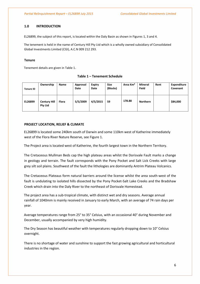
1.0 INTRODUCTION
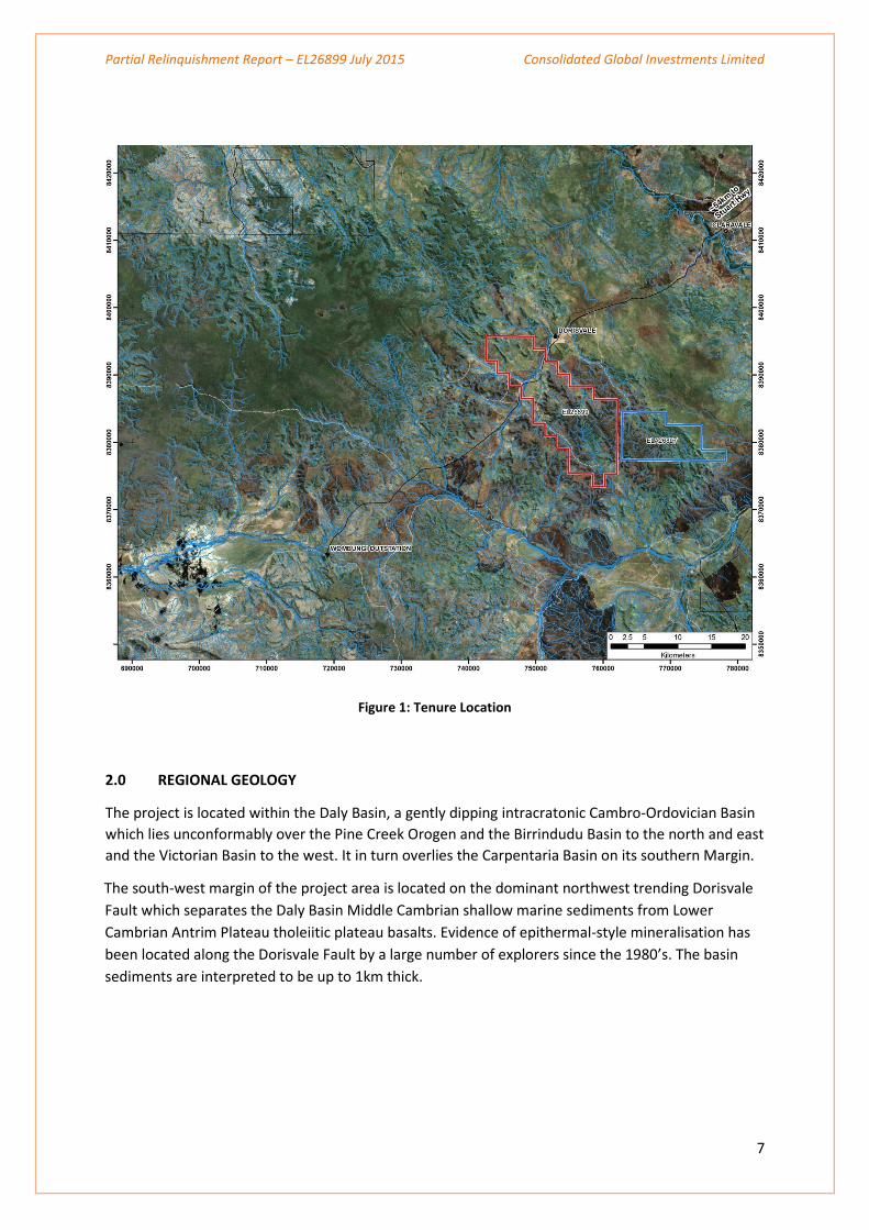
EL26899, the subject of this report, is located within the Daly Basin as shown in Figures 1, 3 and 4.
The tenement is held in the name of Century Hill Pty Ltd which is a wholly owned subsidiary of Consolidated
Global Investments Limited (CGI), A.C.N 009 212 293.
Tenure
Tenement details are given in Table 1.
Table 1 – Tenement Schedule
Tenure ID
Ownership Name Approval Date
Expiry Date
Size (Blocks)
Area Km² Mineral Field
Rent Expenditure Covenant
EL26899
Century Hill Pty Ltd
Flora
5/5/2009
4/5/2015
59
178.88
Northern
$84,000
PROJECT LOCATION, RELIEF & CLIMATE
EL26899 is located some 240km south of Darwin and some 110km west of Katherine immediately
west of the Flora River Nature Reserve, see Figure 1.
The Project area is located west of Katherine, the fourth largest town in the Northern Territory.
The Cretaceous Mullman Beds cap the high plateau areas whilst the Dorisvale Fault marks a change
in geology and terrain. The fault corresponds with the Pony Pocket and Salt Lick Creeks with large
grey silt soil plains. Southwest of the fault the lithologies are dominantly Antrim Plateau Volcanics.
The Cretaceous Plateaus form natural barriers around the license whilst the area south-west of the
fault is undulating to isolated hills dissected by the Pony Pocket-Salt Lake Creeks and the Bradshaw
Creek which drain into the Daly River to the northeast of Dorisvale Homestead.
The project area has a sub-tropical climate, with distinct wet and dry seasons. Average annual
rainfall of 1040mm is mainly received in January to early March, with an average of 74 rain days per
year.
Average temperatures range from 25° to 35° Celsius, with an occasional 40° during November and
December, usually accompanied by very high humidity.
The Dry Season has beautiful weather with temperatures regularly dropping down to 10° Celsius
overnight.
There is no shortage of water and sunshine to support the fast growing agricultural and horticultural
industries in the region.
Partial Relinquishment Report – EL26899 July 2015 Consolidated Global Investments Limited
7
Figure 1: Tenure Location
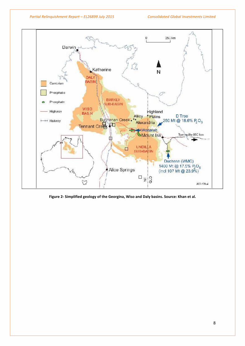
2.0 REGIONAL GEOLOGY
The project is located within the Daly Basin, a gently dipping intracratonic Cambro-Ordovician Basin
which lies unconformably over the Pine Creek Orogen and the Birrindudu Basin to the north and east
and the Victorian Basin to the west. It in turn overlies the Carpentaria Basin on its southern Margin.
The south-west margin of the project area is located on the dominant northwest trending Dorisvale
Fault which separates the Daly Basin Middle Cambrian shallow marine sediments from Lower
Cambrian Antrim Plateau tholeiitic plateau basalts. Evidence of epithermal-style mineralisation has
been located along the Dorisvale Fault by a large number of explorers since the 1980’s. The basin
sediments are interpreted to be up to 1km thick.
Partial Relinquishment Report – EL26899 July 2015 Consolidated Global Investments Limited
8
Figure 2- Simplified geology of the Georgina, Wiso and Daly basins. Source: Khan et al.
Partial Relinquishment Report – EL26899 July 2015 Consolidated Global Investments Limited
9
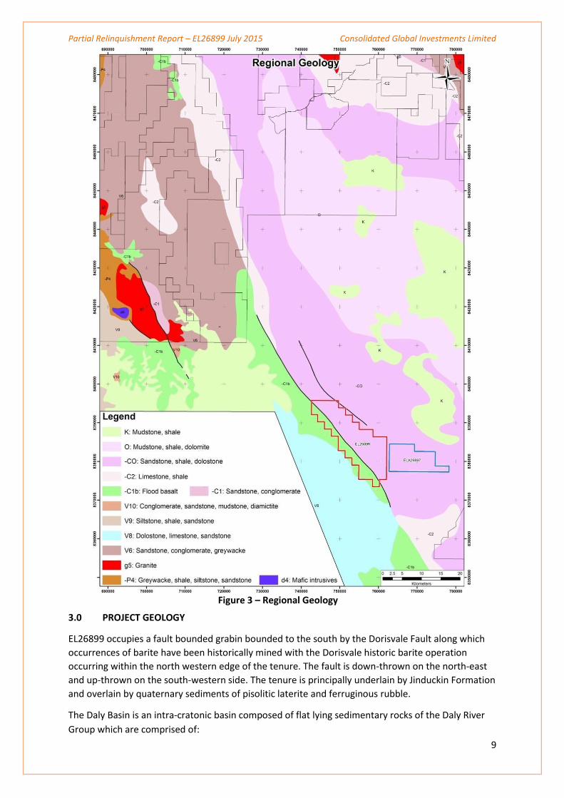
Figure 3 – Regional Geology
3.0 PROJECT GEOLOGY
EL26899 occupies a fault bounded grabin bounded to the south by the Dorisvale Fault along which
occurrences of barite have been historically mined with the Dorisvale historic barite operation
occurring within the north western edge of the tenure. The fault is down-thrown on the north-east
and up-thrown on the south-western side. The tenure is principally underlain by Jinduckin Formation
and overlain by quaternary sediments of pisolitic laterite and ferruginous rubble.
The Daly Basin is an intra-cratonic basin composed of flat lying sedimentary rocks of the Daly River
Group which are comprised of:
Partial Relinquishment Report – EL26899 July 2015 Consolidated Global Investments Limited
10
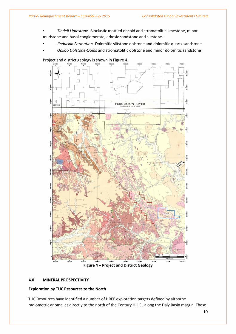
• Tindell Limestone- Bioclastic mottled oncoid and stromatolitic limestone, minor
mudstone and basal conglomerate, arkosic sandstone and siltstone.
• Jinduckin Formation- Dolomitic siltstone dolstone and dolomitic quartz sandstone.
• Oolloo Dolstone-Ooids and stromatolitic dolstone and minor dolomitic sandstone
Project and district geology is shown in Figure 4.
Figure 4 – Project and District Geology
4.0 MINERAL PROSPECTIVITY
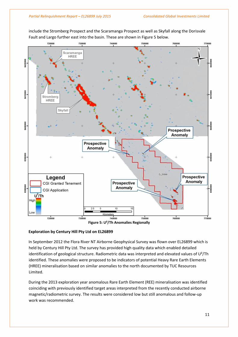
Exploration by TUC Resources to the North
TUC Resources have identified a number of HREE exploration targets defined by airborne
radiometric anomalies directly to the north of the Century Hill EL along the Daly Basin margin. These
Partial Relinquishment Report – EL26899 July 2015 Consolidated Global Investments Limited
11
include the Stromberg Prospect and the Scaramanga Prospect as well as Skyfall along the Dorisvale
Fault and Largo further east into the basin. These are shown in Figure 5 below.
Figure 5: U²/Th Anomalies Regionally
Exploration by Century Hill Pty Ltd on EL26899
In September 2012 the Flora River NT Airborne Geophysical Survey was flown over EL26899 which is
held by Century Hill Pty Ltd. The survey has provided high quality data which enabled detailed
identification of geological structure. Radiometric data was interpreted and elevated values of U²/Th
identified. These anomalies were proposed to be indicators of potential Heavy Rare Earth Elements
(HREE) mineralisation based on similar anomalies to the north documented by TUC Resources
Limited.
During the 2013 exploration year anomalous Rare Earth Element (REE) mineralisation was identified
coinciding with previously identified target areas interpreted from the recently conducted airborne
magnetic/radiometric survey. The results were considered low but still anomalous and follow-up
work was recommended.
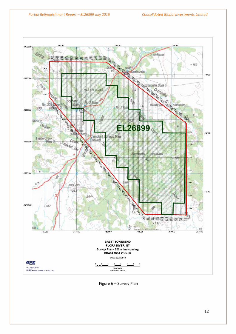
Figure 6 – Survey Plan
12
Partial Relinquishment Report – EL26899 July 2015 Consolidated Global Investments Limited
Partial Relinquishment Report – EL26899 July 2015 Consolidated Global Investments Limited
13
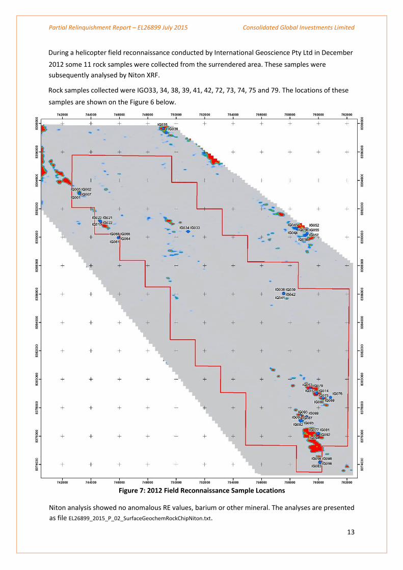
During a helicopter field reconnaissance conducted by International Geoscience Pty Ltd in December
2012 some 11 rock samples were collected from the surrendered area. These samples were
subsequently analysed by Niton XRF.
Rock samples collected were IGO33, 34, 38, 39, 41, 42, 72, 73, 74, 75 and 79. The locations of these
samples are shown on the Figure 6 below.
Figure 7: 2012 Field Reconnaissance Sample Locations
Niton analysis showed no anomalous RE values, barium or other mineral. The analyses are presented
as file EL26899_2015_P_02_SurfaceGeochemRockChipNiton.txt.
Partial Relinquishment Report – EL26899 July 2015 Consolidated Global Investments Limited
14
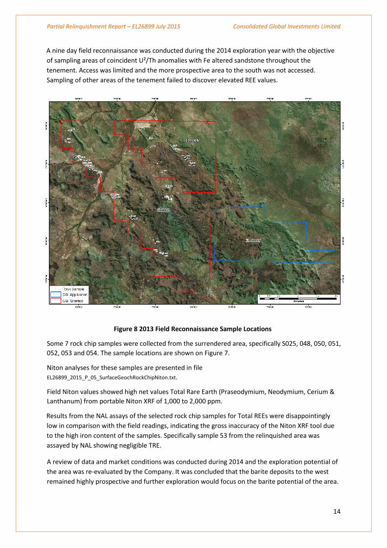
A nine day field reconnaissance was conducted during the 2014 exploration year with the objective
of sampling areas of coincident U²/Th anomalies with Fe altered sandstone throughout the
tenement. Access was limited and the more prospective area to the south was not accessed.
Sampling of other areas of the tenement failed to discover elevated REE values.
Figure 8 2013 Field Reconnaissance Sample Locations
Some 7 rock chip samples were collected from the surrendered area, specifically S025, 048, 050, 051,
052, 053 and 054. The sample locations are shown on Figure 7.
Niton analyses for these samples are presented in file
EL26899_2015_P_05_SurfaceGeochRockChipNiton.txt.
Field Niton values showed high net values Total Rare Earth (Praseodymium, Neodymium, Cerium &
Lanthanum) from portable Niton XRF of 1,000 to 2,000 ppm.
Results from the NAL assays of the selected rock chip samples for Total REEs were disappointingly
low in comparison with the field readings, indicating the gross inaccuracy of the Niton XRF tool due
to the high iron content of the samples. Specifically sample 53 from the relinquished area was
assayed by NAL showing negligible TRE.
A review of data and market conditions was conducted during 2014 and the exploration potential of
the area was re-evaluated by the Company. It was concluded that the barite deposits to the west
remained highly prospective and further exploration would focus on the barite potential of the area.
Partial Relinquishment Report – EL26899 July 2015 Consolidated Global Investments Limited
15
The Company has retained an area of 29 blocks to the northwest and southern area adjacent to the
Dorisvale fault. An area of 30 blocks was surrendered.
5.0 REFERENCES
Open File Company Records-NT Geological Survey – CR19690058, CR19690059, CR19800012, CR19810067
TUC Resources website
Geophysics and Drilling Collaborations Final Report, Airborne Geophysical Survey Flora River, Northern
Territory, Consolidated Global Investment Ltd, October 2012
Field Investigation of Flora Tenement, International Geoscience Pty Ltd, December 2012
Copyright Statement
The owned information acquired by Consolidated Global Investments Limited and
Century Hill Pty Ltd includes all information under the previous work by Brett
Townsend and work during reporting year sections. The rest of the information has
been sourced from open reports and data through the Department of Resources -
Minerals and Energy. The Minister has authority to publish the copyrighted
information accordingly