Embed Size (px)
Citation preview

PROCEEDING
The 9th International Conference of Rural Research and Planning Group
194
Universitas Mahasaraswati Denpasar, July 6-8, 2018, Bali-Indonesia
Participatory Mapping Solution for Village Potential and Boundary
Irland Fardani
Universitas Islam Bandung, Taman Sari Street No. 1, Bandung 40166, Indonesia
Abstract
A common problem in every village in Indonesia is that identification of borders between
villages cannot be spatially depicted, one of the methods used to accelerate village boundary
settlement is to use participatory mapping methods. Participatory mapping is a map-making
process that attempts to make visible the association between land and local communities by
using the commonly understood and recognized language of cartography. Participatory
mapping is the bottom-up approach that’s allows the all the villagers can draw the maps of
their village In this study, application of Remote Sensing and Geographic Information System
(GIS) allow to identify the boundaries of Campakamulya village, a comprehensive mapping of
329 Ha of village was conducted. In this case, community local knowledge of the village
boundaries is very less, only a few elders of the villagers knew the boundaries of the village.
With the maps of village boundaries that gather by participatory mapping method, knowledge
of the boundaries of these village can be well documented. Participatory mapping method in
determining the boundary of this village can correct the existing village boundary data in the
Participatory and Partnership in Rural Development (7)
PROCEEDING
The 9th International Conference of Rural Research and Planning Group
195
Universitas Mahasaraswati Denpasar, July 6-8, 2018, Bali-Indonesia
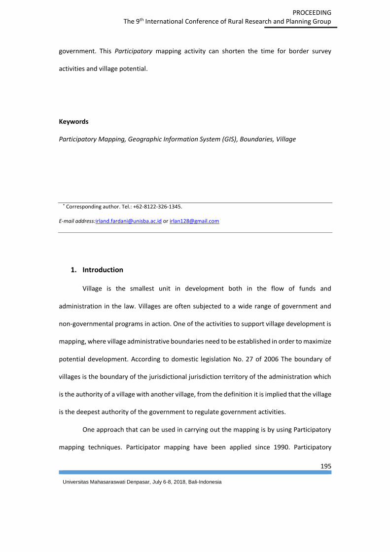
government. This Participatory mapping activity can shorten the time for border survey
activities and village potential.
Keywords
Participatory Mapping, Geographic Information System (GIS), Boundaries, Village
* Corresponding author. Tel.: +62-8122-326-1345.
E-mail address:[email protected] or [email protected]
1. Introduction
Village is the smallest unit in development both in the flow of funds and
administration in the law. Villages are often subjected to a wide range of government and
non-governmental programs in action. One of the activities to support village development is
mapping, where village administrative boundaries need to be established in order to maximize
potential development. According to domestic legislation No. 27 of 2006 The boundary of
villages is the boundary of the jurisdictional jurisdiction territory of the administration which
is the authority of a village with another village, from the definition it is implied that the village
is the deepest authority of the government to regulate government activities.
One approach that can be used in carrying out the mapping is by using Participatory
mapping techniques. Participator mapping have been applied since 1990. Participatory

PROCEEDING
The 9th International Conference of Rural Research and Planning Group
196
Universitas Mahasaraswati Denpasar, July 6-8, 2018, Bali-Indonesia
mapping is a map-making process that attempts to make visible the association between land
and local communities by using the commonly understood and recognized language of
cartography (IFAD,2009).
In Indonesia, participatory mapping had been done many times, by the government
or by the Non- Government Organization (NGO), about 1.5 million hectare is have been
mapped by the local communities in the past 10 years. Many local communities have been
professionally trained by The Indonesian Community Mapping Network (Jaringan Kerja
Pemetaan partispatif or JKPP), Open Street Maps, Green Maps etc.
The paradigm that has been running on the completion of the administrative boundary
area is with the top-down hierarchy system. The use of a top-down hierarchy system often
encounters many problems, one of which is the many conflicting interests in each province
government. For that we need to try to solve this administrative boundary problem with
bottom-up method, namely to solve the administrative boundary problem of the smallest unit
that is border of village or village boundary. Participatory mapping can produce an
administrative boundary map agreed upon by the masses as high as will not create conflicts
and can be done faster mapping process (Arini, 2016). With this participatory mapping a
general picture of the region can be updated, and describes all potential and strategic issues
as well as tools for sustainable villages (Tallo, 2016).
2. Material and Methods
In this research, qualitative descriptive method is used by finding information from the
community about the limits in Campakamuly village. Sources of the data is comes from
primary and secondary data, primary data is direct field observation about village boundaries
obtained from community leaders and head of the existing hamlet, while secondary data

PROCEEDING
The 9th International Conference of Rural Research and Planning Group
197
Universitas Mahasaraswati Denpasar, July 6-8, 2018, Bali-Indonesia
obtained from village boundary data obtained from the Central Bureau of Statistics (BPS) or
Geospatial Information Agency (BIG).
The purpose of this activity is map making in sub district of Cempaka Mulya, District of
Bandung with participative mapping approach which later can be used for the needs of local
community, while the benefit of this activity is simplify the process of using map for planning
of rural development in the future.
2.1 Research Location
Campakamulya village includes district cimaung bandung regency with an area of 329.99 Ha.
Have an altitude of 900 meters above sea level. The administrative area of Campakamulya
village is limited by:
North : Desa Pasirhuni
East : Desa Pasirmulya
South : Perum Perhutani
West : Desa Cimaung dan Desa Mekarsari
Campakamulya village based on information in 2015 is divided into 4 Dusun, 48 RT
and 12 RW with a population of 8,324 inhabitants. In general, the land in Campakamulya
village is used productively and only a few are not used. This shows that the area of
Campakamulya Village has adequate natural resources and is ready to be processed. As the
PROCEEDING
The 9th International Conference of Rural Research and Planning Group
198
Universitas Mahasaraswati Denpasar, July 6-8, 2018, Bali-Indonesia
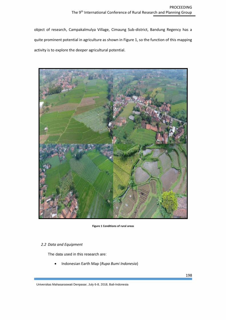
object of research, Campakalmulya Village, Cimaung Sub-district, Bandung Regency has a
quite prominent potential in agriculture as shown in Figure 1, so the function of this mapping
activity is to explore the deeper agricultural potential.
Figure 1 Conditions of rural areas
2.2 Data and Equipment
The data used in this research are:
Indonesian Earth Map (Rupa Bumi Indonesia)
PROCEEDING
The 9th International Conference of Rural Research and Planning Group
199
Universitas Mahasaraswati Denpasar, July 6-8, 2018, Bali-Indonesia
Indonesia Earth map that used is in 1:25.000 scale, its come from Geospatial
Information Agency, used to be one of the existing road and river
identification guidelines.
Google Earth Image Map
Map google earth imagery used to be the first reference in the depiction of
the condition of land cover in the village Campakamulya.
Image photo from drone processing
Image photo form drone are used to detail the land cover and physical
boundaries used as administrative boundaries.
Equipment that is used :
GPS Handheld
Drone DJI Phantom 4
Camera

PROCEEDING
The 9th International Conference of Rural Research and Planning Group
200
Universitas Mahasaraswati Denpasar, July 6-8, 2018, Bali-Indonesia
Figure 2 Equipment used in the survey
2.3 Methodology
The administrative boundary mapping process in Desacempaka mulya uses
participatory mapping method, ie mapping that essentially invites the community to be
actively involved in making administrative boundary map or regional potency. The
community or elder chairman plays a very important role by showing the physical nature
marks that mark the administrative boundary. Flow chart of the administrative boundary
mapping can be shown in figure 4.

PROCEEDING
The 9th International Conference of Rural Research and Planning Group
201
Universitas Mahasaraswati Denpasar, July 6-8, 2018, Bali-Indonesia
Figure 4 Flowchart Participatory Mapping Boundary Administration
Within the boundary of the village, a preliminary survey is carried out first, the core
of the preliminary survey activity is data collecting existing data and conducting village
research. The next step is to roll out the first Group Discussion Forum (FGD), the activities
provided by the satellite image of the village of Campaka Mulya and then the village heads
and community leaders train to know the borders of the hamlet or the potentials of each of
their hamlets. In the delineation of administrative boundaries, it turns out that not all
Preliminary Survey
Forum Group Discussion
(FGD) I
Boundary Validation with
Tracking
Draft Map Making
Forum Group Discussion
(FGD) II
Administrative Boundary
Agreement
PROCEEDING
The 9th International Conference of Rural Research and Planning Group
202
Universitas Mahasaraswati Denpasar, July 6-8, 2018, Bali-Indonesia
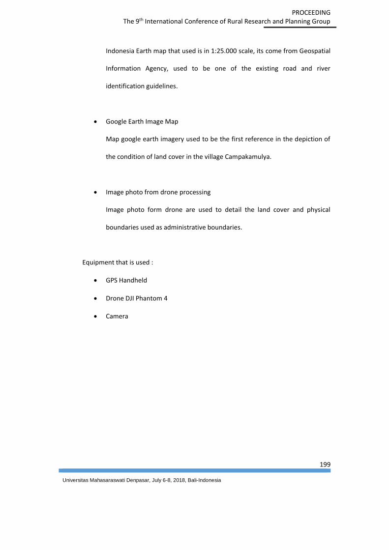
residents present know the administrative boundaries, only each customary chairman or head
of the hamlet knows the administrative boundaries exactly as shown in Figure 5.
Gambar 5 Village Boundaries and Potential Displays by the community.
To get a better picture of the condition of the village, mapping also utilized the drone
to get a cempaka mulya village aerial photograph as shown in Figure 6. In this series of
activities, tracking and plotting the village boundaries and potential use of GPS as can be seen
in figure 7.

PROCEEDING
The 9th International Conference of Rural Research and Planning Group
203
Universitas Mahasaraswati Denpasar, July 6-8, 2018, Bali-Indonesia
Figure 6 Mapping Using Drone
Figure 7 Activity ploting Administrative boundaries and potential villages

PROCEEDING
The 9th International Conference of Rural Research and Planning Group
204
Universitas Mahasaraswati Denpasar, July 6-8, 2018, Bali-Indonesia
From FGD data and Mapping using drone, next is data processing from administrative
boundary is overlay with map of aerial photograph from drone which resulted draft map
boundary administration. The draft result of this administrative boundary map and potential
is discussed again in FGD II which aims to verify in order to reduce errors on the displayed map
content, from this activity obtained some correction to improve the content of the map
already created. The final process is a process of agreement on the administrative boundaries
and potential of the village.
Results
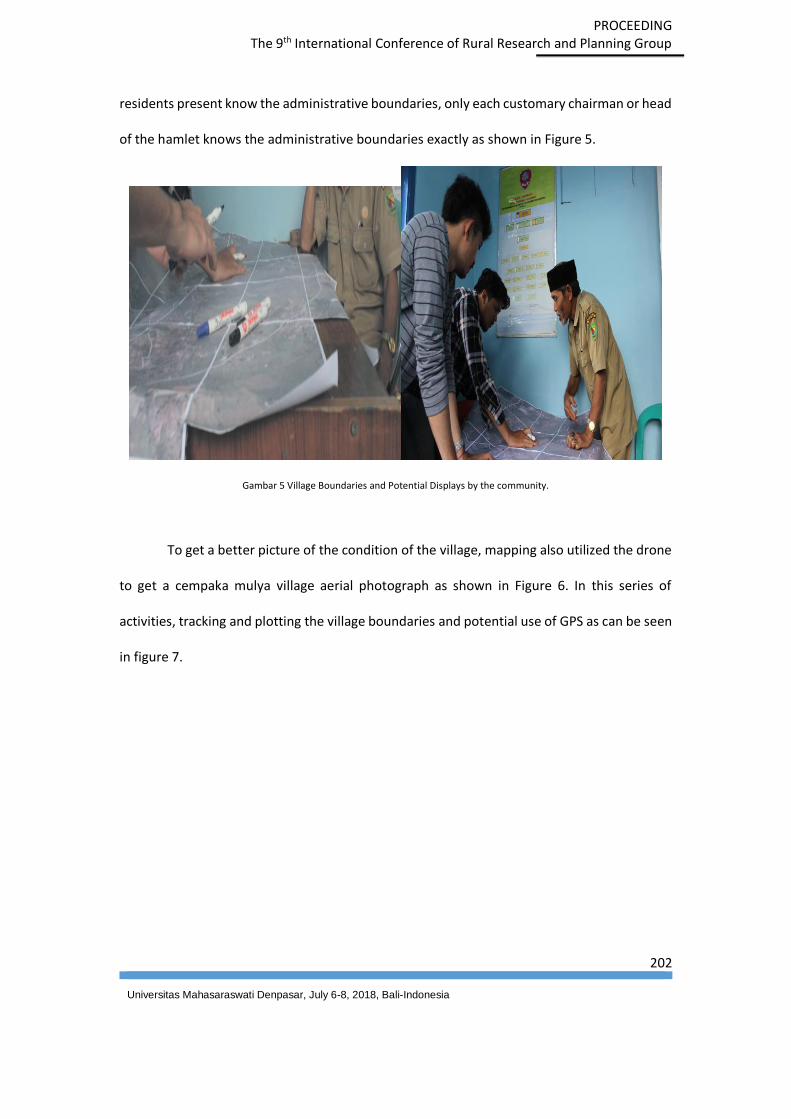
The result of this research is an administrative boundary map and potency of
Campakamulya village, Campakamulya village consists of 4 Dusun and 12 RW as shown in
Figure 8. In administrative boundary division in Cempaka mulya village, entirely using physical
limit such as; roads, rivers, drainage and irrigation networks.
PROCEEDING
The 9th International Conference of Rural Research and Planning Group
205
Universitas Mahasaraswati Denpasar, July 6-8, 2018, Bali-Indonesia
Figure 8 Map Campaka Mulya Administration.
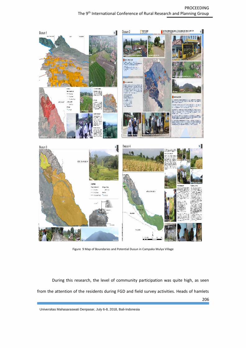
The potential of agriculture and plantations in the village is quite large by covering
food crops, vegetables, fruits of land use in the mountains in the form of protected forest
areas, production forests and tourism forests. Currently there is favorite commodities coffee,
which is being intensively - incessantly socialized to be more developed. For the hamlet
potential map can be seen in Figure 9.
PROCEEDING
The 9th International Conference of Rural Research and Planning Group
206
Universitas Mahasaraswati Denpasar, July 6-8, 2018, Bali-Indonesia
Figure 9 Map of Boundaries and Potential Dusun in Campaka Mulya Village
During this research, the level of community participation was quite high, as seen
from the attention of the residents during FGD and field survey activities. Heads of hamlets

PROCEEDING
The 9th International Conference of Rural Research and Planning Group
207
Universitas Mahasaraswati Denpasar, July 6-8, 2018, Bali-Indonesia
and villagers were enthusiastic to participate in field survey activities by tracking each hamlet
boundary. The result of this administrative boundary mapping is made in 2 forms, namely the
A0 boundary of the booklet which is directly submitted to the village head as shown in Figure
10.
Figure 10 Product Result Book Mapping of Administration and Product Delivery Limit to village head
Discussion
The participatory mapping process can be a methodology with a bottom up hierarchy
used to solve administrative boundary problems. Community livelihood is very important in
this methodology, because without the active participation of existing information society can
not be well explored. Approach to the community informing the importance of this village
map will lead to good participation.

PROCEEDING
The 9th International Conference of Rural Research and Planning Group
208
Universitas Mahasaraswati Denpasar, July 6-8, 2018, Bali-Indonesia
References
Dwi, Arini., Et all. (2016). Pemetaan Partisipatif Nagari Pamatang Panjang Kecamatan
Sijunjung Kabupaten Sijunjung Sumatera Barat Guna Mendukung Percepatan
Pembuatan Peta Desa. Seminar Nasional 3rd CGISE dan FIT ISI 2016. Yogyakarta,
Indonesia.
IFAD. (2009). Good practice in Participatory Mapping. International Fund for Agricultural
Development
Jong Tallo, Amandus (2016). Participatoru mapping Solution Village Development Karengas in
a Suistainable Way. Seminar Nasional Peran Geospasial dalam Membingkai NKRI.
Cibinong, Indonesia.