Embed Size (px)
Citation preview

1
Pays Dogon Visitor Center and Signage Siting Mission Report August 11, 2011
Rick Harlan Schneider, IStudio
[email protected] 202.758.2037
Brad Cownover, USDA FS
[email protected] 503.808.2439

2
Acknowledgements
The International Programs office of USDA Forest Service (USFS) would like to express its gratitude to its partners in Mali for hosting the Forest Service Design Team during our field work. The team deeply appreciates the hospitality and coordination of the US Agency for International Development (USAID) in Mali, the Bandiagara Mayor‘s office, the Mission Culturelle de Bandiagara, and OMATHO. These colleagues were instrumental in the success of the trip. The enthusiasm and commitment of all partners helped to provide a positive professional experience for the USFS Design Team. The Team was extremely impressed with the dedication and commitment of the represented organizations and is eager to continue cooperation and implementation of the project. In addition, the USFS would like to recognize the Cristina Nardone Foundation, the GSTA/PD (Global Sustainable Tourism Alliance / Pays Dogon) project, OMATHO (Office malien du tourisme et de l‘hotellerie),and the Mayor of Bandiagara and his delegates. Summary
In late June of 2011, the USFS sent a team to Pays Dogon in Mali to conduct site reconnaissance and stakeholder interviews necessary in developing a conceptual design and interpretive program for a Visitor Center (VC) for Pays Dogon in Bandiagara. The Design Team – made up of technical experts in landscape architecture, green architecture and interpretation, along with an International Program Specialist – worked closely with Solimar International and project leaders from USAID‘s Global Sustainable Tourism Alliance (GSTA) to meet with stakeholders to understand their priorities for a welcoming interpretive facility in Bandiagara. The team surveyed various potential VC sites and toured the region to gain insight into the visitor experience. Meetings with village leaders were scheduled in order to gain additional information regarding interpretative programming for the Visitor Center. Building on information gathered by the GSTA/USFS ―Pays Dogon – Interpretive Signs and Journal‖ project, the team documented important cultural, historical, and technical references intended to help inform the design of an environmentally responsive visitor center that fits within its context. While in the field, the Team also identified ways to improve on the work done for the previous signage project and make it more cohesive with the proposed VC project.

3
Background
The goal of USAID‘s Global Sustainable Tourism Alliance/ Pays Dogon (GSTA/PD) is—through sustainable tourism—to provide income-earning opportunities to local communities while simultaneously protecting the natural resources of Pays Dogon. As has been cited in the previous Pays Dogon missions, tourism development has been identified as a top priority of the Malian government in order to help diversify their economy and raise the standards of living for citizens. With three UNESCO World Heritage Sites (one of which is the Pays Dogon area - the area of focus for this mission), increasing visitation while preserving the historic, cultural and environmental resources is an overriding concern for the Malian government, USAID, and all members of the GSTA/PD. The US Forest Service has provided previous support to the Pays Dogon GSTA activity, most recently in the form of interpretive and graphic design technical assistance to develop interpretive signage and an interpretive journal highlighting sixteen featured villages within Pays Dogon; these interpretive resources are intended to improve the visitor experience and provide additional tourist income to the villages. The signage, made of durable fused poly-resin material on an aluminum post, will be installed in the villages on appropriate sites that were initially selected with input from the village leaders. The interpretive journal provides two to three pages of information about each site, space for visitor notations, and a spot for an emblematic stamp from each village visited. Income from the purchase of the interpretive journal and stamps will be used on projects that will benefit the villages directly. By documenting completed and on-going project work in the community, each village may be able to receive an additional donation from travelers as well. In October 2010, the USFS/GSTA team generated a report for the interpretive signage/journal which highlighted the need for a visitor center in Bandiagara worthy of its World Heritage Site status and intended to serve the entire region. The report outlined the need for a single source of visitor information and recommended Bandiagara as the gateway to Pays Dogon. The idea had been promoted by Cristina Nardone, the former GSTA/PD project director and a former Peace Corps volunteer in Bandiagara whose inspirational life and tragic death two years earlier helped to galvanize support. A foundation was set up in her memory with the mission of ―facilitating projects that meet the needs of local communities and promote the values that guided Cristina: sustainable development, community empowerment, local ownership and a deep appreciation for the local culture.‖ The foundation requested technical assistance from USFS in order to help make the visitor center a reality. In May 2011 the Christina Nardone Foundation outlined their vision for a visitor center in Bandiagara with the USFS/ISTUDIO Design Team. Board members Jackie Nardone, Ariel Wagner, and Brenda Adelson expressed the Foundation‘s intention to honor Cristina‘s legacy and continue the work she had begun to serve the people of Mali and Pays Dogon. The purpose of the visitor center would be to encourage ecotourism and help educate visitors in order to better appreciate the local culture. The center would fill a need as a central location for information about the people and the places of Pays Dogon. Locating it in Bandiagara would make good sense since most people visiting the region begin there and often use the city as a base of operations. The board members described the Foundation‘s desire for the center to be designed as environmentally sustainable as possible. For inspiration, there is a rich heritage of climatically-responsive architecture of the Dogon – a heritage well-documented and supported locally by the Mission Culturelle de Bandiagara (MCB) among others. The project should be locally-driven where possible, and serve as an investment in the people of the area. In this way the Foundation would also be continuing Cristina‘s work in sustainable tourism and community development. Board members remarked on Cristina‘s charisma and ability to gather people around a development project, and highlighted their interest in harnessing this same energy in realizing the visitor center.

4
The USFS Team identified shared values in sustainable design and community development and discussed ways to help the Foundation realize its mission. Three phases in the design and construction process were outlined: Programming (the phase being undertaken now), Design, and Construction. In the first phase, the team would apply their expertise to help develop a vision for the visitor center facility which could be used by the Foundation for planning, budgeting, and fundraising. They provided a realistic overview of the cost and timeline of a world class visitor center project and remarked on the potential for fund-raising with the name recognition of USAID, USFS, and UNESCO. It was agreed that a trip to Pays Dogon would be necessary both for the purpose of research and for design inspiration.

5
Mission Objectives
The initial objectives for the mission focused on gaining background and building consensus in order to adequately provide a realistic vision for developing a world class visitor center (VC) in the region. Specific components of the original scope of work included the following:
Obtain information about the selected VC site in order to properly analyze it for the intended use
Identify the requirements for the VC facility and draft a program for use in the conceptual design process
Identify preliminary interpretive requirements
Identify the processes and capacity needed for the approval and construction of the VC
Research the culture and the landscape in Bandiagara and the surrounding area
The initial deliverables that were to be developed after returning from the mission included the following:
Mission Report outlining the objectives and recommendations from the mission
Site Analysis showing existing challenges and opportunities
Master Plan for the VC site, including building location(s) and site layout
Renderings of the proposed VC
Design Narrative for the development of the VC
Recommendations for Interpretive Programming, Themes, and possible Exhibits
Rough estimate of the cost for the project based on the design team‘s experience with similar projects
As will be elaborated later in this document, our team responded to the need on the ground by expanding our scope of deliverables to also include the following:
Design guidelines for use with the signage installation for the 16 interpretive signs previously developed by USFS Design documents intended for the installation of the signage and minor site improvements in the villages; the design is to be simple, economical, and sustainable while the documents will be able to be used by a technical expert overseeing local labor using local materials (except for concrete and the sign),

6
Methods
MEETINGS + INTERVIEWS The Team met with town leaders and stakeholders over a period of two weeks in late June and early July 2011 to work through the process of selecting a suitable site for a visitor center. We began by meeting with the mayor‘s office of Bandiagara on two different occasions – first to discuss the Cristina Nardone Foundation‘s intentions and the steps involved in developing a visitor center; then to visit potential VC sites in Bandiagara. The Team reiterated our commitment to preserving the culture and landscape, promoting ecotourism, and providing a resource for the community. We discussed three possible sites: the gare (transportation depot) and two sites at the northwest entrance to town. The mayor‘s office recommended another site outside the city next to the new museum of Bandiagara which we toured with the mayor‘s deputy. We went over some criteria for site selection that included proximity to the city center, size, and availability. The mayor‘s office recommended talking with the city planner in more detail. We also met with the Mission Culturelle de Bandiagara (MCB) on two occasions – first to provide the same background we provided to the mayor‘s office and to view examples of Dogon construction; then to tour the new Musee Regional De Bandiagara. We were given a detailed overview of the MCB complex by the assistant director who described the sustainably-oriented modern facility and some of the more traditional buildings. We discussed the museum facility program, budget, and construction timeline to better understand how projects are developed in the area. We reviewed and obtained copies of two reports documenting valuable research done on Dogon construction techniques and building typology – ―Recommendations pour la construction d‘ecoles en Pays Dogon‖ and ―Inventaire de cultures‖. Members of GIZ (German Society for International Cooperation) also described their mission of preserving the local culture and how the museum project has progressed with European Union (EU) backing. In conversations in Bandiagara, Djenne, and Bamako, we learned about design and building techniques from a master mason and a local architect. Bouboukar Kouroumanse, a master mason and a resource for traditional building, gave us descriptions of banco construction and the history of the mosque in Djenne. Issa Sangho, an architect who designs buildings in Bandiagara, gave us valuable background information on the building approvals process and recommendations on engineers, builders, and materials. Ouman Berte, the city planner for Bandiagara, talked with us about the approval process that includes his review and provided a site plan for the gare site, confirming future plans for that function to move to another site. Our meetings with OMATHO and tour operators helped to fill out background information on visitors and provide us with insight into how they tour the area. They re-affirmed their commitment to sustainable tourism and gave us figures on visitor arrivals. New friends and tour operators Salah, Sylla, Jara and Mabo told us about obtaining a local guide, popular tourist routes, and good places for seeing masked dances among other things critical for a good tour. Our de-brief with USAID at the US Embassy was a good opportunity to summarize the Team‘s progress in the field and look for synchronicity with other current projects. Halima Ouattara-Ayanou (USAID‘s Markets and Trade Program Manager) and other USAID colleagues mentioned Feed the Future projects in the region that might be able to make use of the team‘s expertise to achieve their goals. As the nature of our primary scope of work shifted from designing a visitor center in Bandiagara to both creating a public space / orientation center in Bandiagara and site installations for village interpretive signs, the purpose and outcomes for our meetings with each village adjusted accordingly. Most critical to the Village Signage portion of the project was the information gathered from our meetings with leaders in the villages and the related review of proposed sites selected for sign installation. The Team met with Village Chiefs(dugu tigis), Tourism Committee members, the Stamp Official (tampon tigi), and others to review the Journal/Stamp process, give updates on the signage, and discuss potential sites and surroundings for the interpretive signage. This process served the dual purpose of providing input for the Village Signage work while also giving the stakeholders a chance to test out the Journal/Stamp work and work out the kinks. Each meeting typically culminated in touring the village and walking the signage sites in order to make a selection.

7
The following is a list of the villages in the GSTA/USFS Interpretive Signage and Journal project, showing which ones were visited by the Design Team on this mission and which events took place:
Journal/Stamp Meeting
Signage Site Visit
Selection w/ Leaders of Sign Location
1. Bandiagara
2. Toupere
3. Dogani Bere
4. Borko
5. Sangha
6. Ireli
7. Amani
8. Tereli
9. Nombori
10. Ende
11. Teli
12. Kani Kombole
13. Douentza
14. Koro
15. Bankass
16. Djiguibombo
VILLAGE + SITE TOURS The Team visited a total of 12 of the 16 villages in the Interpretive Signage and Journal project, including time in Bandiagara as a base of operations. We visited the various cultural sites in each one as part of the analysis of the larger context for the signage installation site, making note of natural and man-made features as well as the cultural references such as:
Natural: significant rock formations, trees, waterways
Man-made: village structures, materials, construction techniques, building forms, orientation, placement
Cultural: events, crafts (i.e. carvings), textiles, metalwork
Each village was a different experience, providing a full range of life in Pays Dogon. Village tours of note included a hike down the escarparment to Ireli, a visit to the night market at Kani Komo, and the market in Ende. Photographic documentation, as well as direct observations from each of these villages, will be used to inform site planning and design solutions for the mission objectives. SITE ANALYSIS As part of each site visit of the respective villages, coarse scale site analysis of the proposed sign site locations was conducted, analyzing the data gathered about a site such as: Location, Context, Site Boundaries, Natural Features (including geography, ecology, topography, soils), Man-made Features (including history), Circulation (including paths, edges, districts, nodes, landmarks), Utilities, Sensory, Human/Cultural (including social), and Climate (sun, rain, wind). As part of the on-site discussions with village leaders, we also tried to identify the challenges and opportunities for functionality and sustainability on the site. These findings will be summarized in graphic and narrative form as site analysis diagram(s) and notes for presentation.
SIGNIFICANT SITES In addition to site visits to most of the villages and proposed visitor center site(s) within Bandiagara, we also had the pleasure of visiting several key buildings and points of interest in Bandiagara, Bamako, Mopti, Djenne, and Komo Kani. These offered opportunities to document examples of traditional and
8
contemporary expressions of architecture and building construction. We were able to photographically document these examples and make observations regarding potential precedent design relationships between setting, materials, and function that could be applied as part of design solutions in our project. Some of the significant sites we visited included:
The Bamako Musee + Parc
Niger River communities in Mopti
Dogon Exhibition, Musee Quai Branly, Paris
Contemporary buildings: Institute of Traditional Medicine, Bandiagara; Cheval Blanc in Bandiagara; Centre de L‘Architecture En Terre, Mopti
Mission Culturelle center, Bandiagara
Djenne Mosque and Moroccan (architecture) buildings
Markets in Komo Kani, Bandiagara, Bamako
Findings and Observations
The original objective of this mission was targeted towards developing a conceptual design and interpretative program for a Pays Dogon Visitor Center to be located in Bandiagara, Mali. During the process of local meetings and discussions with team members, a discovery emerged regarding our initial objectives. Stakeholder meetings with the Mayor‘s Office of Bandiagara, the MCB and others helped in identifying key issues that led us to add scope to the project to include improving the sites of the Village Signage. These issues were: VISITOR CENTER LOCATION The location of the proposed visitor center site was still mostly undetermined. There was initially some discussion that the proposed site was to be located along the entry road near the proposed area for the new Syndicat (Bandiagara tourism bureau) building. However, the current gare in the center of town was expected to move near the Syndicat, so another consideration was that the visitor center might be located in the area vacated by the gare. This was later corrected to reflect that the proposed location was to be in an area outside of town in a ‗hotel‘ zone that coincided with the location of the recently completed museum building, a vacant new hotel, and the current high school. Upon visiting the proposed site with the Mayor‘s primary agent, it was determined that while they preferred it be located somewhere in this zone, they had not yet selected an exact site, nor had any of the legal work necessary to acquire land within the zone been investigated. In addition, there was very little, if any, base information available for this area to help us with any site-specific analysis or siting recommendations for a world-class visitor center.
VILLAGE SIGNAGE INSTALLATION One of the primary philosophies our team brought with us into this mission was to ensure our work built upon the sustainable tourism project work already in place and being developed in the area. This primarily included the Pays Dogon Interpretive Signs and Journal project which involves the design, fabrication, and installation of interpretative panels in 16 villages. After detailed discussions regarding the nature of the interpretive panels, it was concluded that more guidance on the site planning and design (placement, location, materials, interpretation through form, visitor experience, etc.) was needed in order for these signs to be successful both individually, as well as collectively.
CHRISTINA NARDONE MEMORIAL One of the initial catalysts for the concept of developing a Pays Dogon Visitor Center in Bandiagara came from members of the Cristina Nardone Foundation as a means to honor her memory and provide a legacy to her work in the area. During our visits with the Mayor‘s office and local team members, we were informed of another, seemingly parallel effort to provide a memorial to her memory through a proposed tree planting/ street-naming of an existing road within Bandiagara. We discussed, in general, the possible location of the streets under consideration. An opportunity to leverage this project in conjunction with our mission seemed realistic.

9
THE GARE SITE During our discussions with team members and local stakeholders, it was confirmed that the current location of the Gare of Bandiagara was to be relocated to an area near the primary entry road into town near the new location of the Syndicat. During site visits to the gare, the area to be vacated seemed to be an ideal location for restoration into a public space. It was in a wedge-shaped space off the central roundabout to the city, where a prominent hotel and primary restaurants were located. In addition, a monument to Bandiagara is being built in the center of this circle, suggesting that both local residents and visiting tourists would gravitate to the location. Discussions regarding the potential for locating a visitor center (as originally proposed) in this area led us to conclude that the site offered numerous opportunities for creating a positive public, community, and visitor space in a location that was at the ‗heart‘ of the city. MUSEE REGIONAL DE BANDIAGARA A critical discovery during the mission included information obtained during a visit to the recently constructed museum in the hotel zone, near the edge of town. In discussions with the Mission Culturelle de Bandiagara on-site, it was revealed that many of the fundamental program components associated with the proposed Visitor Center were in fact, aspects they are planning to incorporate into the services and experience at the new museum. These include: visitor orientation, gift shop, café, cultural heritage interpretation, maps and photography, brochures, guide services, indoor and outdoor demonstration and exhibit spaces, classroom and research wing, etc. As such, they plan to develop and market the facility more as a ‗multi-cultural center‘, not just a museum and are hoping that visitors to the Dogon villages visit the facility before embarking on their journey. Hence, it was apparent that the potential for duplication of basic visitor services was a reality and the pursuance of a separate visitor facility adjacent to this facility may create challenges in either, or both, being successful.
Recommendations
Based upon these primary issues, along with complementary discussion regarding the nature of large project development in Mali, we discussed during the mission the possibility of adding to our mission deliverables components that met the immediate needs for sustainable tourism outcomes (in the context of the inherent capacity issues of the area, political, financial, resource, workforce, as well as the longevity of external oversight in the form of the GSTA project). The Team agreed that both the Village Signage siting improvements and the idea of a Visitor Center + Greenspace in Bandiagara in honor of Cristina Nardone were worthwhile projects and both should be developed. VILLAGE SIGNAGE As we obtained more background on the Interpretive Signs and Journal project, it became clearer that it was linked with the VC project by more than just proximity and purpose; thus an opportunity was identified: The signage - although intended to be built at the village sites before the VC project had begun - could be designed as satellite installations of the VC itself, helping to orient visitors on their journey through the region as part of the overall interpretive plan, while also satisfying basic visitor needs, such as shade, seating, and establishing a sense of place. Each one should be thought of as more than simply the physical sign itself, such that the site location and possible related site development could provide interpretive opportunities in and of itself. In this context, while each of the site plans for the signs would be designed to be harmonious with the respective village, collectively, these signs represent a family of installations that help provide image and identity to the UNESCO World Heritage site of Pays Dogon. The village signage installations would be built with the same design principals in mind such as good site

10
orientation, durable local materials, and construction techniques that draw from the culture. The timing is right since the signs will be delivered in the summer of 2011 but have yet to be installed. The team quickly developed a set of objectives for the Site Signage Installation as we began visiting many of the 16 village sites included in the Journal:
Consider the proposed sign installation sites and make a suitable recommendation with buy-in from local authorities
Obtain information about the selected sign installation sites in order to properly analyze them for the intended use
Identify preliminary interpretive requirements
Research the culture and the landscape of the various villages
The Deliverable for the Village Signage (in addition to the scope of this work for the Mission Report) is a package of design documents intended for the installation of the signage and minor site improvements in the villages. These drawings would also be paired with a set of Design Guidelines and Site Installation Recommendations that would apply to all villages. The drawings would include:
Site Analysis showing existing challenges and opportunities
Plans and elevations (in sketch form) as necessary for each of the signage installation sites, including the location of any built forms
Photo/renderings of the proposed sites The design goal for each sign installation is that it be simple, economical, and sustainable while the documents will be drafted in a manner such that they can be used by a technical expert (i.e. Boubakar Kouroumanse, a master mason, or Issa Sangho, an architect) overseeing local labor using local materials (except for concrete and the sign). Projects may be undertaken in groups of 3-5 at a time, with a duration of approximately one week. If grouped by village proximity, this would allow for oversight by the technical expert who can travel between nearby villages to first layout and then approve the direction of the installation. VISITOR CENTER + GREENSPACE This vision is that the gare space will serve as more than simply the location for the Bandiagara interpretive sign, but that it also is developed to include a small visitor orientation center and welcoming outdoor space. It should be designed and programmed not just to cater to visitors, but also to be a welcoming public space for locals that could be utilized for outdoor events. Plans for the site may demonstrate opportunities for spatially connecting the proposed street tree planting project through urban planning and design improvements. The following are some preliminary expectations for the programming of this public space:
Provide a much-needed attractive, sustainable, outdoor public space near the center of town
Help interpret and memorialize the work of Cristina Nardone, as well as the Pays Dogon region, through the design of the space itself, and any buildings and plantings within it
Incorporate the Bandiagara interpretive sign installation in a manner appropriate with its context
A modest Visitor Center facility should provide an introduction to Pays Dogon and inform visitors of related points of interest within Bandiagara, such as the Museum, the MCB, the Palais Aguibou Tall, the Syndicat, and the market. The facility should provide these needed functions while leaving the exhibition of cultural artifacts and interpretation to the Musee Regional de Bandiagara. Anticipated architectural programming includes:
Reception area for 6-8 people comfortably
Reception desk for 1 staff w/ cubby storage and cashbox
Room for brochure/journal display
Fridge for sale of drinks
Space for small amount of souvenirs
Maintenance closet/shed

11
No telephone, cash register, or toilets
Some space for small amount of exhibit, preferably wall-hung
Map
Small outdoor covered area w/ table
Some accommodation outside for events
Site limitations as stated by the City Planner, with a site plan from his office TIMELINE The timeline for delivering the primary components of the project have been divided into two separate milestones. The first deliverable, the Pays Dogon Village Sign installation concept designs and related design guidelines is scheduled for completion by September 15, 2011. This will allow some time for installation prior to the onset of the tourist season. The second component will focus on the development of the village sign installation for Bandiagara in the context of a more comprehensive outdoor public greenspace and visitor welcome center. This tentative timeline for delivering this component is no later than October 27, 2011. PROJECT PLANNING From a design and construction standpoint, a project like the Pays Dogon Visitor Center should likely be organized into three phases:
1. Programming Work during this phase includes the Design Team‘s trip to Pays Dogon documented in this report. The purpose was to meet with stakeholders, understand their priorities for the Visitor Center (VC), survey and analyze the site, and get to know the surrounding people and places for inspiration. The Team will then develop a vision for the VC facility which can be used for planning, budgeting, and fundraising. The timeline for this work is 2-3 months and began in late June 2011.
2. Design
This phase will involve an Architect/Engineer (A/E) team developing the design for the VC and making sure the project is properly coordinated. The A/E team will work with the owner of the facility to make sure the project follows the vision laid out in the programming phase, while being in line with a budget and timeline. The A/E team will produce drawings and other documents needed for bidding, approvals, and construction. This work is often begun once pre-development funds are identified and a site is secured, and may happen concurrently with fundraising for construction. The design could be a 6 month process for a modest facility, but approvals that are dependent on municipalities can draw out this timeline.
3. Construction
During this phase, the A/E team will likely work with the owner and a construction manager to oversee construction and approve payments to the builder. Depending on the complexity of the project, this timeline may be 6-12 months and can begin once Design is complete and the builders are selected.
12
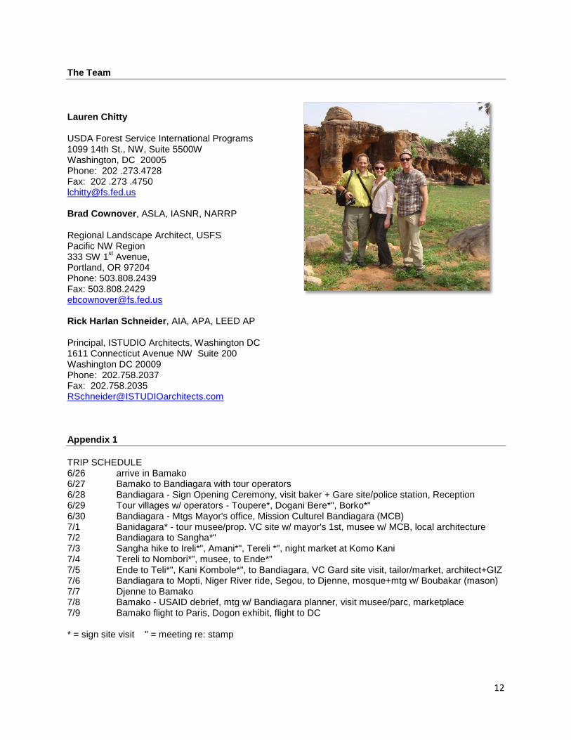
The Team
Lauren Chitty USDA Forest Service International Programs 1099 14th St., NW, Suite 5500W Washington, DC 20005 Phone: 202 .273.4728 Fax: 202 .273 .4750 [email protected] Brad Cownover, ASLA, IASNR, NARRP Regional Landscape Architect, USFS Pacific NW Region 333 SW 1
st Avenue,
Portland, OR 97204 Phone: 503.808.2439 Fax: 503.808.2429 [email protected] Rick Harlan Schneider, AIA, APA, LEED AP Principal, ISTUDIO Architects, Washington DC 1611 Connecticut Avenue NW Suite 200 Washington DC 20009 Phone: 202.758.2037 Fax: 202.758.2035
[email protected] Appendix 1
TRIP SCHEDULE 6/26 arrive in Bamako 6/27 Bamako to Bandiagara with tour operators 6/28 Bandiagara - Sign Opening Ceremony, visit baker + Gare site/police station, Reception 6/29 Tour villages w/ operators - Toupere*, Dogani Bere*", Borko*" 6/30 Bandiagara - Mtgs Mayor's office, Mission Culturel Bandiagara (MCB) 7/1 Banidagara* - tour musee/prop. VC site w/ mayor's 1st, musee w/ MCB, local architecture 7/2 Bandiagara to Sangha*" 7/3 Sangha hike to Ireli*", Amani*", Tereli *", night market at Komo Kani 7/4 Tereli to Nombori*", musee, to Ende*" 7/5 Ende to Teli*", Kani Kombole*", to Bandiagara, VC Gard site visit, tailor/market, architect+GIZ 7/6 Bandiagara to Mopti, Niger River ride, Segou, to Djenne, mosque+mtg w/ Boubakar (mason) 7/7 Djenne to Bamako 7/8 Bamako - USAID debrief, mtg w/ Bandiagara planner, visit musee/parc, marketplace 7/9 Bamako flight to Paris, Dogon exhibit, flight to DC * = sign site visit " = meeting re: stamp

13
ISTUDIO architecture | design | planning
Appendix 2 mtg date: 26.July.11 mtg location: Istudio project: Mali project no: 11025 name: Strahan date: 11-Aug-11 attending: Brad Cownover (USFS), Rick Schneider (i), Portia Strahan (i) Cc:
No Notes Action
Of Note for GSTA follow up.
1. Nombori: To the Mission Culturelle: The signage site location we proposed is directly adjacent to and owned/managed by Mission Culturelle of Bandiagara. Is the proposed sign site in Nombori acceptable?
GSTA
2. Teli: To the Teli Tourism Committee / Village Leadership: Are we able to incorporate the area of the former pit latrine into our site design for the village sign?
GSTA
3. Bandiagara: (Map of Bandiagara Gare Site Follows) Need to have some email correspondence with the urban planner in Bandiagara to get some site specific understanding of what our limitations are in the space near the police station, as well as some details on existing use, namely: 1. What is the current use of the two largest building north of the police station and are they currently fully occupied and in use 2. The eastern of these two buildings appears to have a new extra foundation in place... does this mean the existing building is proposed for expansion? Or is this a new proposed building? 3. The drawing provided by the urban planner shows what appears to be a street or right of way? Immediately north of the two buildings(labeled 10 on the map). This line shows as being exactly on the boundary of the wall of these buildings. We need to know: a) if that boundary is a proposed street or just a right of way access and how it implicates our ability to design anything in or immediately adjacent to that corridor and b) if that line is literally the same as the building facade wall or is that approximate? If it's not the same... then we need to know what flexibility there is in that line location. 4. Similarly, there is a street or right of way corridor displayed immediately north of the police station, (labeled 10 on the map). We need to know the same details as described above, for this space.
GSTA
ISTUDIO | 1611 Connecticut Av Suite 200 Washington DC 20009 | T:202.445.8325 F:202.449.8512 ISTUDIOarchitects.com

14


![Julio Arrieta [=] Dogon, un misterio inexistente](https://img.pdfslide.net/doc/110x75/577c7bc81a28abe0549850f5/julio-arrieta-dogon-un-misterio-inexistente.jpg)
