Embed Size (px)
Citation preview
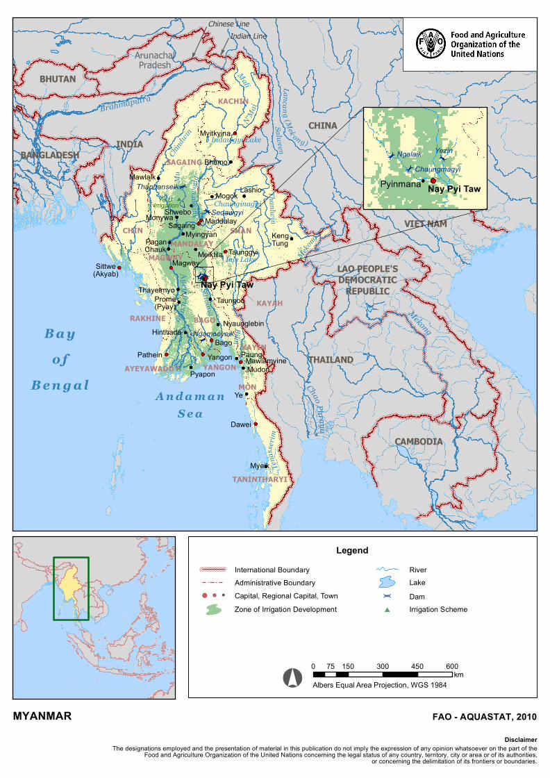
KACHIN
SAGAING
SHANMANDALAY
MAGWAY
CHIN
RAKHINE BAGO
KAYIN
KAYAH
YANGONAYEYAWADDY
TANINTHARYI
MON
THAILAND
LAO PEOPLE'SDEMOCRATIC
REPUBLIC
CHINAINDIA
BANGLADESH Chindw
inAy
eyar
wady
Lancang (Mek on g)
Thanlwin
Sittuang
Myitkyina
Sittwe(Akyab)
Pathein
Myeik
Dawei
Mudon
Ye
Mawlamyine
Hinthada
Prome(Pyay)
Thayetmyo Nay Pyi Taw
MagwayChauk
Nyaunglebin
Taungoo
MonywaMyingyan
Meiktila
MawlaikLashioMogok
Shwebo
TaunggyiKengTung
Bhamo
Pyapon
MandalaySagaing
B a yo f
B e n g a l
Bilin
Inle Lake
Indawgyi Lake
Sedawgyi
Yangon
Ngamoeyeik
Thaphanseik Mu
Paung
Chaunginagyi
Mali
N'Mai
Pagan
Ye-U Irrigation
A n d a m a nS e a
Bago
VIET NAM
CAMBODIA
BHUTAN
Indian LineChinese Line
ArunachalPradesh
Tena
sserim
Mekong
Mekong
Salween
Brahmaputra
Ayeyarwady
Chao Phraya
MYANMAR
Albers Equal Area Projection, WGS 1984
Legend
LakeDam
River
Capital, Regional Capital, TownZone of Irrigation Development
International BoundaryAdministrative Boundary
The designations employed and the presentation of material in this publication do not imply the expression of any opinion whatsoever on the part of theFood and Agriculture Organization of the United Nations concerning the legal status of any country, territory, city or area or of its authorities,
or concerning the delimitation of its frontiers or boundaries.
Disclaimer
FAO - AQUASTAT, 2010
NgalaikChaungmagyi
Yezin
Nay Pyi TawPyinmana
Irrigation Scheme
0 150 300 450 60075km