Embed Size (px)
Citation preview
Cities, Vol. 24, No. 5, p. 379–390, 2007
� 2007 Elsevier Ltd. All rights reserved.
*Corresponding author. Tel.: +91-80-2293-
3099/2506x213; fax: +91-80-2360-1428/0683;e-mail: [email protected], [email protected], [email protected].
0264-2751/$ - see front matter
www.elsevier.com/locate/cities
doi:10.1016/j.cities.2007.04.003
City profile
BangaloreH.S. SudhiraCentre for Sustainable Technologies, Indian Institute of Science,Bangalore 560 012, India
Department of Management Studies, Indian Institute of Science,Bangalore 560 012, India
T.V. Ramachandra *
Centre for Sustainable Technologies, Indian Institute of Science,
Bangalore 560 012, IndiaCentre for Ecological Sciences, Indian Institute of Science, Bangalore560 012, India
M.H. Bala SubrahmanyaDepartment of Management Studies, Indian Institute of Science,Bangalore 560 012, India
Received 4 December 2006; received in revised form 3 April 2007;
1 The namfor renamgovernmeMumbai,to Kolkotthrough.
5 April 2007
acceptedAvailable online 4 September 2007Bangalore is one of the fastest growing cities in India and is branded as ‘Silicon Valley of India’ for her-alding and spearheading the growth of Information Technology (IT) based industries in the country.With the advent and growth of IT industry, as well as numerous industries in other sectors and the onsetof economic liberalisation since the early 1990s, Bangalore has taken lead in service-based industriesfuelling substantial growth of the city both economically and spatially. Bangalore has become a cosmo-politan city attracting people and business alike, within and across nations. This profile notes the urbansetting and provides an overview of the urban fabric, while discussing various prospects related to infra-structure and governance. This paper also outlines the challenges in planning to ensure better delivery ofbasic services across the city.� 2007 Elsevier Ltd. All rights reserved.
Keywords: Bangalore, Silicon Valley, Garden City
2
Bangalore
Bangalore1 is the principal administra-tive, cultural, commercial, industrial,and knowledge capital of the state of
e, Bangalore has been proposeding to ‘Bengalooru’ by the Statent following suit of Bombay toMadras to Chennai and Calcuttaa. However, we use Bangalore all
379
Karnataka. Greater Bangalore,2 anarea of 741 km2 agglomerating the
The Urban Development Department,Government of Karnataka has issuedgazette notification vide No. UDD/92/MNY/2006, dated 2.11.2006 for constitut-ing the Bruhat Bangalore MahanagaraPalike (Greater Bangalore City Corpora-tion) merging the existing area of BangaloreCity Corporation, 8 Urban Local Bodies(ULBs) and 111 Villages of BangaloreUrban District.
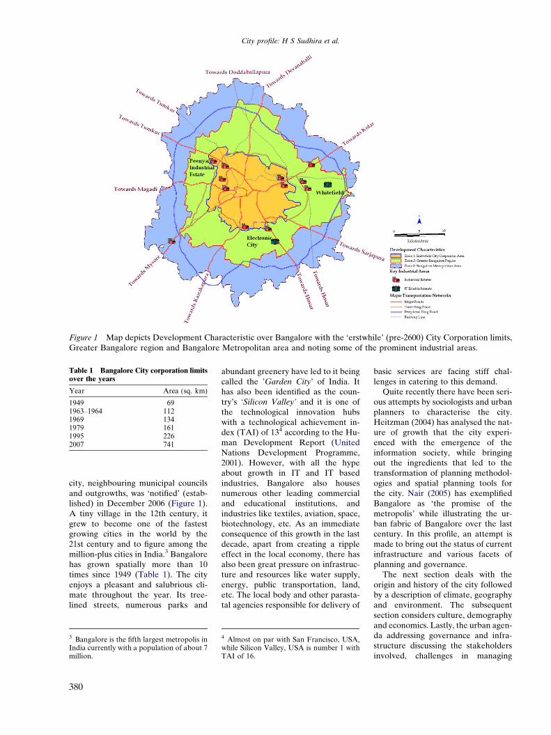
Figure 1 Map depicts Development Characteristic over Bangalore with the ‘erstwhile’ (pre-2600) City Corporation limits,Greater Bangalore region and Bangalore Metropolitan area and noting some of the prominent industrial areas.
Table 1 Bangalore City corporation limitsover the years
Year Area (sq. km)
1949 691963–1964 1121969 1341979 1611995 2262007 741
City profile: H S Sudhira et al.
city, neighbouring municipal councilsand outgrowths, was ‘notified’ (estab-lished) in December 2006 (Figure 1).A tiny village in the 12th century, itgrew to become one of the fastestgrowing cities in the world by the21st century and to figure among themillion-plus cities in India.3 Bangalorehas grown spatially more than 10times since 1949 (Table 1). The cityenjoys a pleasant and salubrious cli-mate throughout the year. Its tree-lined streets, numerous parks and
3 Bangalore is the fifth largest metropolis inIndia currently with a population of about 7million.
380
abundant greenery have led to it beingcalled the ’Garden City’ of India. Ithas also been identified as the coun-try’s ‘Silicon Valley’ and it is one ofthe technological innovation hubswith a technological achievement in-dex (TAI) of 134 according to the Hu-man Development Report (UnitedNations Development Programme,2001). However, with all the hypeabout growth in IT and IT basedindustries, Bangalore also housesnumerous other leading commercialand educational institutions, andindustries like textiles, aviation, space,biotechnology, etc. As an immediateconsequence of this growth in the lastdecade, apart from creating a rippleeffect in the local economy, there hasalso been great pressure on infrastruc-ture and resources like water supply,energy, public transportation, land,etc. The local body and other parasta-tal agencies responsible for delivery of
4 Almost on par with San Francisco, USA,while Silicon Valley, USA is number 1 withTAI of 16.
basic services are facing stiff chal-lenges in catering to this demand.
Quite recently there have been seri-ous attempts by sociologists and urbanplanners to characterise the city.Heitzman (2004) has analysed the nat-ure of growth that the city experi-enced with the emergence of theinformation society, while bringingout the ingredients that led to thetransformation of planning methodol-ogies and spatial planning tools forthe city. Nair (2005) has exemplifiedBangalore as ‘the promise of themetropolis’ while illustrating the ur-ban fabric of Bangalore over the lastcentury. In this profile, an attempt ismade to bring out the status of currentinfrastructure and various facets ofplanning and governance.
The next section deals with theorigin and history of the city followedby a description of climate, geographyand environment. The subsequentsection considers culture, demographyand economics. Lastly, the urban agen-da addressing governance and infra-structure discussing the stakeholdersinvolved, challenges in managing
City profile: H S Sudhira et al.
urban infrastructure and issues in plan-ning and development are elaborated.
History and culture
The earliest reference to the name,in the form ‘Bengalooru’, is seen ina ninth century Ganga inscription(hero-stone) from Begur, referringto a battle that was fought in thatplace. The present name of the city,Bangalore is an anglicised form ofBengalooru which according to thepopular belief is derived from Benga-alu – synonymous of Benda kaalu orboiled beans and ooru meaning atown. Tradition associates HoysalaKing Vira Ballala (12th century) withthe origin of this name. Vira Ballala,during one of his hunting expeditionsin this region, lost his way and afterhours of wandering reached the hutof an old woman. This woman is be-lieved to have offered cooked beans
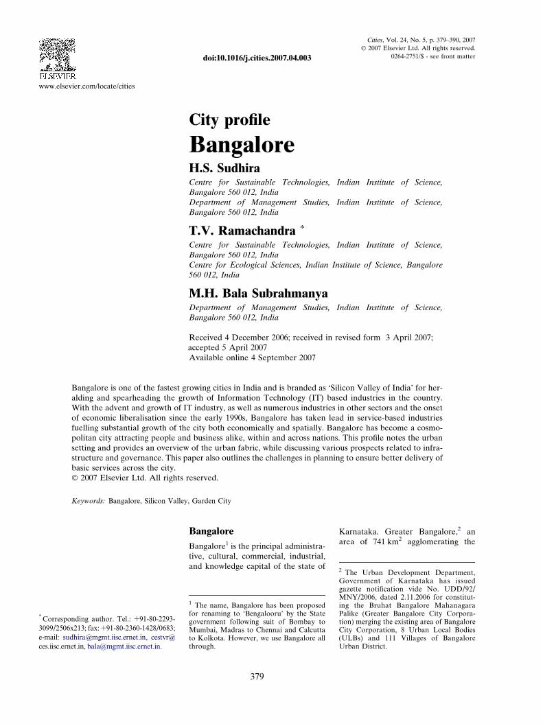
Figure 2 The Kempe Gowda Tower at LGowda built to demarcate the extent ofH.S. Sudhira].
to the king. Pleased with her hospi-tality, the king named the place as‘benda kaala ooru’ (town of boiledbeans). But it is interesting to notethat there was already evidence forname of the place much beforeHoysalas. Kamath (1990) notes thatBangalore is said to have got itsname from benga, the local Kannadalanguage term for Pterocarpus mar-
supium, a species of dry and moistdeciduous tree, and ooru, meaningtown. However, the founding ofmodern Bangalore is attributed toKempe Gowda, a scion of the Yelah-anka line of chiefs, in 1537 (Kamath,1990). Kempe Gowda is also creditedwith construction of four towersalong four directions from Petta, thecentral part of the city, to demarcatethe extent of city growth (Figure 2).By the 1960s the city had sprawledbeyond these boundaries (AsianDevelopment Bank, 2001).
albagh – one of the four towers Kempecity growth in four directions [Photo:
Later on, the city was administeredby the Wodeyars, rulers of Mysore, un-til it was given as Jagir (with rights forgeneral administration and collectionof taxes) to Hyder Ali during late18th century. Hyder Ali and later, hisson, Tippu Sultan, were responsiblefor growth and development of Banga-lore in a significant way with the con-struction of summer palace andLalbagh. Indeed, Bangalore was al-ready the commercial capital duringTippu’s time and the second importantcity after Srirangapatna, Tippu’s capi-tal. During the early 19th century, thecity was known to have almost all coinsin circulation from different places andkingdoms, thus evidencing a flourish-ing trade and commerce (Buchanan,1870). The fall of Bangalore in the Sec-ond Mysore War of 1792, may alsohave led to the fall of Tippu Sultan inThird Mysore War of 1799, after whichBangalore became a base for the Brit-ish troops and saw the establishmentof the Cantonment in 1802. Britishcontrol over Bangalore was initiallyestablished indirectly through theMaharaja of Mysore. By 1831, theadministration of the city was takenover by the British, and in 1862 twoindependent municipal boards wereestablished: Bangalore City Municipal-ity (in the older areas), and BangaloreCivil and Military Station Municipal-ity. At Independence, Bangalore wasnotified as the capital of Mysore (nowKarnataka) State. In 1949, the twomunicipalities were merged and theBangalore City Corporation wasformed. Subsequently, to keep up withthe pace of growth and development,there have been reorganizations withrespect to the zones and wards withinthe corporation, rising from 50 divi-sions in 1949 to 95 wards in 1980s, 100wards in 1995 and now about 150wards. With the 2006 notification, theBangalore City Corporation is nowreorganized as Greater Bangalore CityCorporation (Footnote 2).
Bangalore, in spite of the buzzaround IT-based and related commer-cial activities, has retained much of itsunique cultural ties keeping its datewith its history, culture and tradition.The city is known for historical tem-ples such as the Someshwara templein Halasuru (neighbourhood of Ban-galore) built during 12–13th century
381
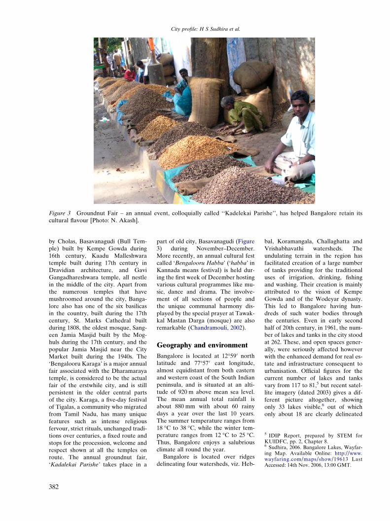
Figure 3 Groundnut Fair – an annual event, colloquially called ‘‘Kadelekai Parishe’’, has helped Bangalore retain itscultural flavour [Photo: N. Akash].
5 IDIP Report, prepared by STEM forKUIDFC, pp. 2, Chapter 8.6 Sudhira, 2006. Bangalore Lakes, Wayfar-ing Map. Available Online: http://www.wayfaring.com/maps/show/19613 LastAccessed: 14th Nov. 2006, 13:00 GMT.
City profile: H S Sudhira et al.
by Cholas, Basavanagudi (Bull Tem-ple) built by Kempe Gowda during16th century, Kaadu Malleshwaratemple built during 17th century inDravidian architecture, and GaviGangadhareshwara temple, all nestlein the middle of the city. Apart fromthe numerous temples that havemushroomed around the city, Banga-lore also has one of the six basilicasin the country, built during the 17thcentury, St. Marks Cathedral builtduring 1808, the oldest mosque, Sang-een Jamia Masjid built by the Mog-huls during the 17th century, and thepopular Jamia Masjid near the CityMarket built during the 1940s. The‘Bengalooru Karaga’ is a major annualfair associated with the Dharamarayatemple, is considered to be the actualfair of the erstwhile city, and is stillpersistent in the older central partsof the city. Karaga, a five-day festivalof Tigalas, a community who migratedfrom Tamil Nadu, has many uniquefeatures such as intense religiousfervour, strict rituals, unchanged tradi-tions over centuries, a fixed route andstops for the procession, welcome andrespect shown at all the temples onroute. The annual groundnut fair,‘Kadalekai Parishe’ takes place in a
382
part of old city, Basavanagudi (Figure3) during November–December.More recently, an annual cultural festcalled ‘Bengalooru Habba’ (‘habba’ inKannada means festival) is held dur-ing the first week of December hostingvarious cultural programmes like mu-sic, dance and drama. The involve-ment of all sections of people andthe unique communal harmony dis-played by the special prayer at Tawak-kal Mastan Darga (mosque) are alsoremarkable (Chandramouli, 2002).
Geography and environment
Bangalore is located at 12�59 0 northlatitude and 77�57 0 east longitude,almost equidistant from both easternand western coast of the South Indianpeninsula, and is situated at an alti-tude of 920 m above mean sea level.The mean annual total rainfall isabout 880 mm with about 60 rainydays a year over the last 10 years.The summer temperature ranges from18 �C to 38 �C, while the winter tem-perature ranges from 12 �C to 25 �C.Thus, Bangalore enjoys a salubriousclimate all round the year.
Bangalore is located over ridgesdelineating four watersheds, viz. Heb-
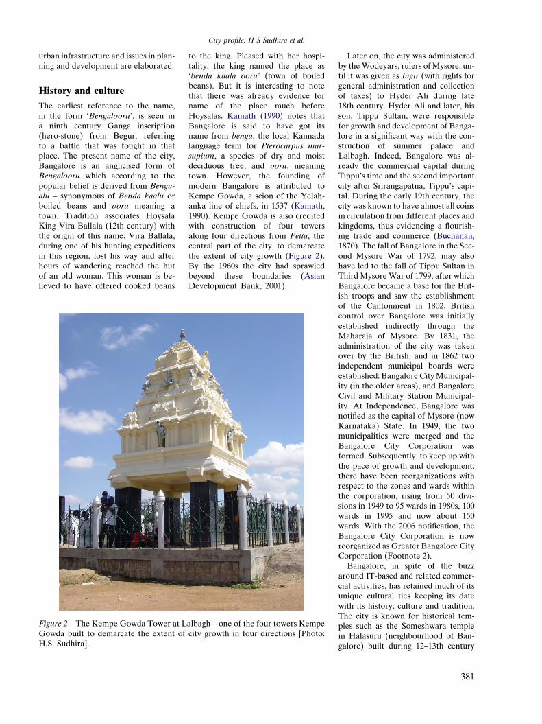
bal, Koramangala, Challaghatta andVrishabhavathi watersheds. Theundulating terrain in the region hasfacilitated creation of a large numberof tanks providing for the traditionaluses of irrigation, drinking, fishingand washing. Their creation is mainlyattributed to the vision of KempeGowda and of the Wodeyar dynasty.This led to Bangalore having hun-dreds of such water bodies throughthe centuries. Even in early secondhalf of 20th century, in 1961, the num-ber of lakes and tanks in the city stoodat 262. These, and open spaces gener-ally, were seriously affected howeverwith the enhanced demand for real es-tate and infrastructure consequent tourbanisation. Official figures for thecurrent number of lakes and tanksvary from 117 to 81,5 but recent satel-lite imagery (dated 2003) gives a dif-ferent picture altogether, showingonly 33 lakes visible,6 out of whichonly about 18 are clearly delineated
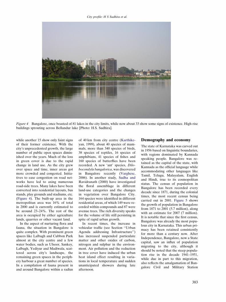
Figure 4 Bangalore, once boasted of 81 lakes in the city limits, while now about 33 show some signs of existence. High-risebuildings sprouting across Bellandur lake [Photo: H.S. Sudhira].
City profile: H S Sudhira et al.
while another 15 show only faint signsof their former existence. With thecity’s unprecedented growth, the largenumber of public open spaces dimin-ished over the years. Much of the lossin green cover is due to the rapidchange in land use. As the city grewover space and time, inner areas gotmore crowded and congested. Initia-tives to ease congestion on road net-works have led to axing numerousroad-side trees. Many lakes have beenconverted into residential layouts, busstands, play grounds and stadiums, etc.(Figure 4). The built-up area in themetropolitan area was 16% of totalin 2000 and is currently estimated tobe around 23–24%. The rest of thearea is occupied by either agriculturelands, quarries or other vacant land.
In the aspect of nurturing flora andfauna, the situation in Bangalore isquite complex. With prominent greenspaces like Lalbagh and Cubbon Parkalmost at the city centre and a fewwater bodies, such as Ulsoor, Sankey,Lalbagh, Yediyur and Madiwala, scat-tered across city’s landscape, theremaining green spaces in the periph-ery harbour a great number of species.In a compilation of fauna present inand around Bangalore within a radius
of 40 km from city centre (Karthike-yan, 1999), about 40 species of mam-mals, more than 340 species of birds,38 species of reptiles, 16 species ofamphibians, 41 species of fishes and160 species of butterflies have beenrecorded. A new ‘ant’ species, Dilo-
bocondyla bangalorica, was discoveredin Bangalore recently (Varghese,2006). In another study, Sudha andRavidranath (2000) have investigatedthe floral assemblage in differentland-use categories and the changesin vegetation over Bangalore City.164 species were identified in differentresidential areas, of which 149 were re-corded within compounds and 87 wereavenue trees. The rich diversity speaksfor the volume of life still persisting inspite of rapid urban growth.
In recent times, the increase invehicular traffic (see Section ‘‘UrbanAgenda addressing Infrastructure’’)has increased suspended particulatematter and other oxides of carbon,nitrogen and sulphur in the environ-ment. Air pollution and the reductionin tree cover have induced the urbanheat island effect resulting in varia-tions in local temperature and suddenunanticipated showers during lateafternoon.
Demography and economy
The state of Karnataka was carved outin 1956 based on linguistic boundaries,with regions dominated by Kannadaspeaking people. Bangalore was re-tained as the capital of the state, withKannada as the official language whileaccommodating other languages likeTamil, Telugu, Malayalam, Englishand Hindi, true to its cosmopolitanstatus. The census of population inBangalore has been recorded everydecade since 1871, during the colonialtimes, the most recent census beingcarried out in 2001. Figure 5 showsthe growth of population in Bangalorefrom 1871 to 2001 (5.7 million), alongwith an estimate for 2007 (7 million).It is notable that since the first census,Bangalore was already the most popu-lous city in Karnataka. This urban pri-macy has been retained consistentlyfor more than a century now. AfterIndependence, Bangalore, now a Statecapital, saw an influx of populationmigrating to the city, although itshould be noted that the steep popula-tion rise in the decade 1941–1951,while due in part to this migration,also reflects the amalgamation of Ban-galore Civil and Military Station
383
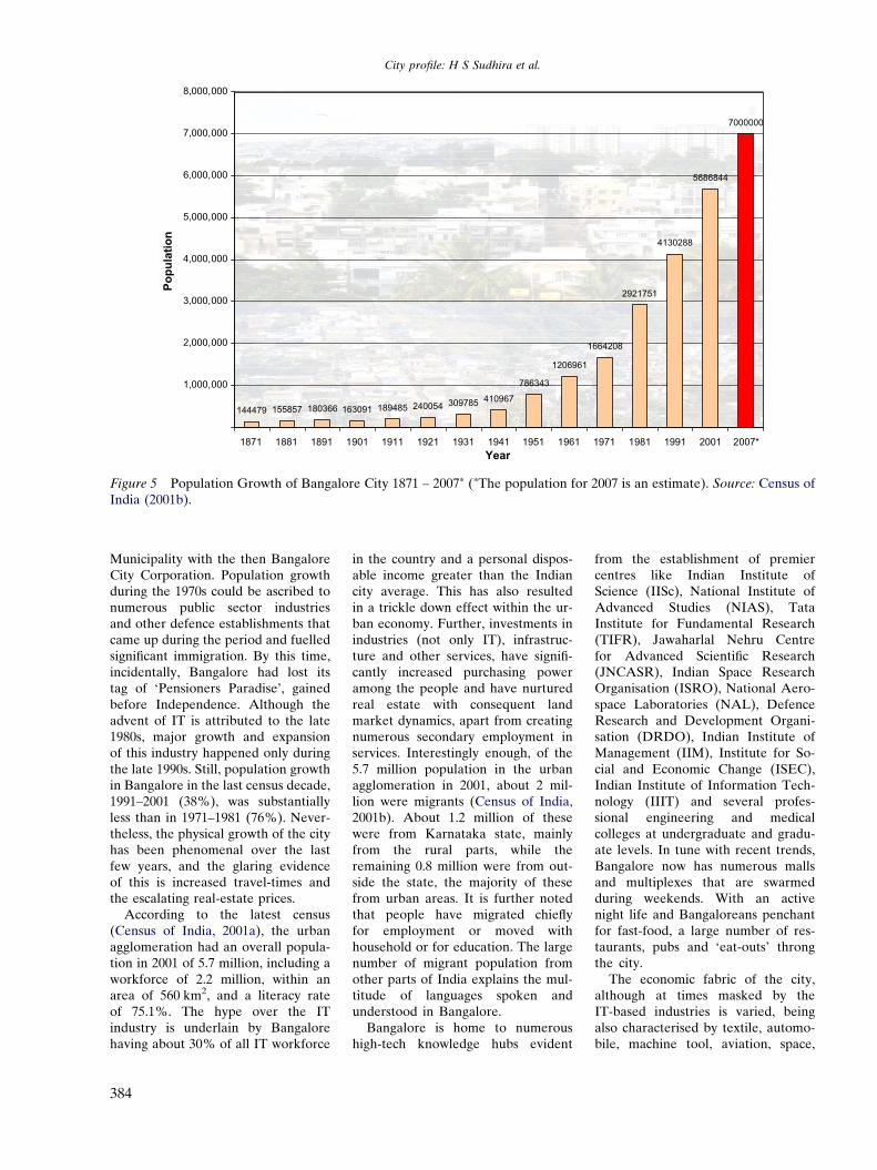
144479 155857 180366 163091 189485 240054 309785 410967
786343
1206961
1664208
2921751
4130288
5686844
7000000
1,000,000
2,000,000
3,000,000
4,000,000
5,000,000
6,000,000
7,000,000
8,000,000
1871 1881 1891 1901 1911 1921 1931 1941 1951 1961 1971 1981 1991 2001 2007*Year
Popu
latio
n
Figure 5 Population Growth of Bangalore City 1871 – 2007* (*The population for 2007 is an estimate). Source: Census ofIndia (2001b).
City profile: H S Sudhira et al.
Municipality with the then BangaloreCity Corporation. Population growthduring the 1970s could be ascribed tonumerous public sector industriesand other defence establishments thatcame up during the period and fuelledsignificant immigration. By this time,incidentally, Bangalore had lost itstag of ‘Pensioners Paradise’, gainedbefore Independence. Although theadvent of IT is attributed to the late1980s, major growth and expansionof this industry happened only duringthe late 1990s. Still, population growthin Bangalore in the last census decade,1991–2001 (38%), was substantiallyless than in 1971–1981 (76%). Never-theless, the physical growth of the cityhas been phenomenal over the lastfew years, and the glaring evidenceof this is increased travel-times andthe escalating real-estate prices.
According to the latest census(Census of India, 2001a), the urbanagglomeration had an overall popula-tion in 2001 of 5.7 million, including aworkforce of 2.2 million, within anarea of 560 km2, and a literacy rateof 75.1%. The hype over the ITindustry is underlain by Bangalorehaving about 30% of all IT workforce
384
in the country and a personal dispos-able income greater than the Indiancity average. This has also resultedin a trickle down effect within the ur-ban economy. Further, investments inindustries (not only IT), infrastruc-ture and other services, have signifi-cantly increased purchasing poweramong the people and have nurturedreal estate with consequent landmarket dynamics, apart from creatingnumerous secondary employment inservices. Interestingly enough, of the5.7 million population in the urbanagglomeration in 2001, about 2 mil-lion were migrants (Census of India,2001b). About 1.2 million of thesewere from Karnataka state, mainlyfrom the rural parts, while theremaining 0.8 million were from out-side the state, the majority of thesefrom urban areas. It is further notedthat people have migrated chieflyfor employment or moved withhousehold or for education. The largenumber of migrant population fromother parts of India explains the mul-titude of languages spoken andunderstood in Bangalore.
Bangalore is home to numeroushigh-tech knowledge hubs evident
from the establishment of premiercentres like Indian Institute ofScience (IISc), National Institute ofAdvanced Studies (NIAS), TataInstitute for Fundamental Research(TIFR), Jawaharlal Nehru Centrefor Advanced Scientific Research(JNCASR), Indian Space ResearchOrganisation (ISRO), National Aero-space Laboratories (NAL), DefenceResearch and Development Organi-sation (DRDO), Indian Institute ofManagement (IIM), Institute for So-cial and Economic Change (ISEC),Indian Institute of Information Tech-nology (IIIT) and several profes-sional engineering and medicalcolleges at undergraduate and gradu-ate levels. In tune with recent trends,Bangalore now has numerous mallsand multiplexes that are swarmedduring weekends. With an activenight life and Bangaloreans penchantfor fast-food, a large number of res-taurants, pubs and ‘eat-outs’ throngthe city.
The economic fabric of the city,although at times masked by theIT-based industries is varied, beingalso characterised by textile, automo-bile, machine tool, aviation, space,
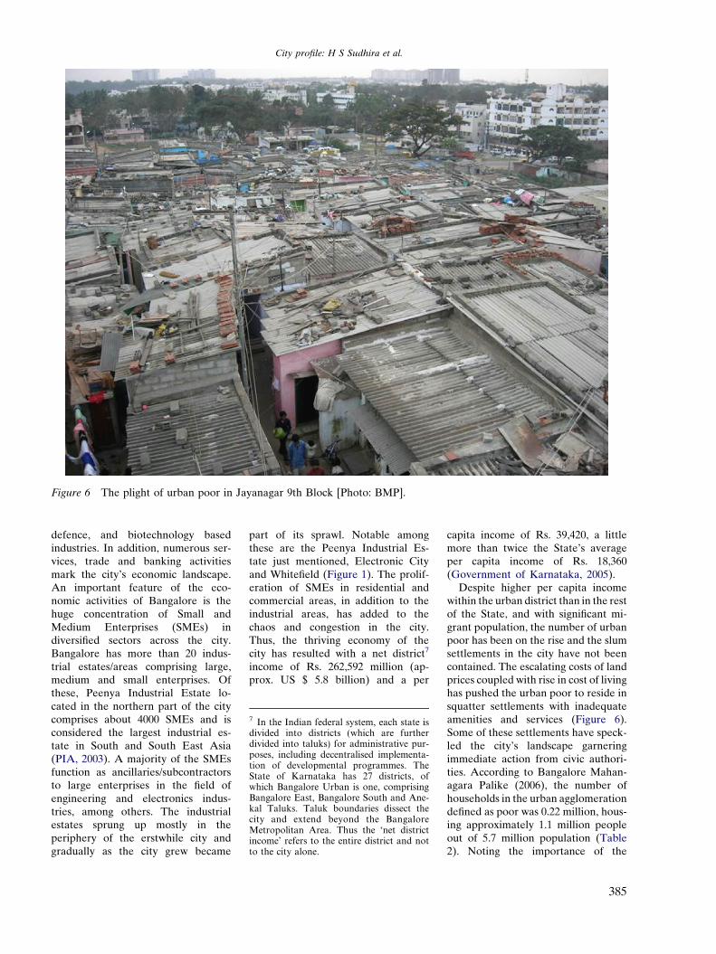
Figure 6 The plight of urban poor in Jayanagar 9th Block [Photo: BMP].
7 In the Indian federal system, each state isdivided into districts (which are furtherdivided into taluks) for administrative pur-poses, including decentralised implementa-tion of developmental programmes. TheState of Karnataka has 27 districts, ofwhich Bangalore Urban is one, comprisingBangalore East, Bangalore South and Ane-kal Taluks. Taluk boundaries dissect thecity and extend beyond the BangaloreMetropolitan Area. Thus the ‘net districtincome’ refers to the entire district and notto the city alone.
City profile: H S Sudhira et al.
defence, and biotechnology basedindustries. In addition, numerous ser-vices, trade and banking activitiesmark the city’s economic landscape.An important feature of the eco-nomic activities of Bangalore is thehuge concentration of Small andMedium Enterprises (SMEs) indiversified sectors across the city.Bangalore has more than 20 indus-trial estates/areas comprising large,medium and small enterprises. Ofthese, Peenya Industrial Estate lo-cated in the northern part of the citycomprises about 4000 SMEs and isconsidered the largest industrial es-tate in South and South East Asia(PIA, 2003). A majority of the SMEsfunction as ancillaries/subcontractorsto large enterprises in the field ofengineering and electronics indus-tries, among others. The industrialestates sprung up mostly in theperiphery of the erstwhile city andgradually as the city grew became
part of its sprawl. Notable amongthese are the Peenya Industrial Es-tate just mentioned, Electronic Cityand Whitefield (Figure 1). The prolif-eration of SMEs in residential andcommercial areas, in addition to theindustrial areas, has added to thechaos and congestion in the city.Thus, the thriving economy of thecity has resulted with a net district7
income of Rs. 262,592 million (ap-prox. US $ 5.8 billion) and a per
capita income of Rs. 39,420, a littlemore than twice the State’s averageper capita income of Rs. 18,360(Government of Karnataka, 2005).
Despite higher per capita incomewithin the urban district than in the restof the State, and with significant mi-grant population, the number of urbanpoor has been on the rise and the slumsettlements in the city have not beencontained. The escalating costs of landprices coupled with rise in cost of livinghas pushed the urban poor to reside insquatter settlements with inadequateamenities and services (Figure 6).Some of these settlements have speck-led the city’s landscape garneringimmediate action from civic authori-ties. According to Bangalore Mahan-agara Palike (2006), the number ofhouseholds in the urban agglomerationdefined as poor was 0.22 million, hous-ing approximately 1.1 million peopleout of 5.7 million population (Table2). Noting the importance of the
385
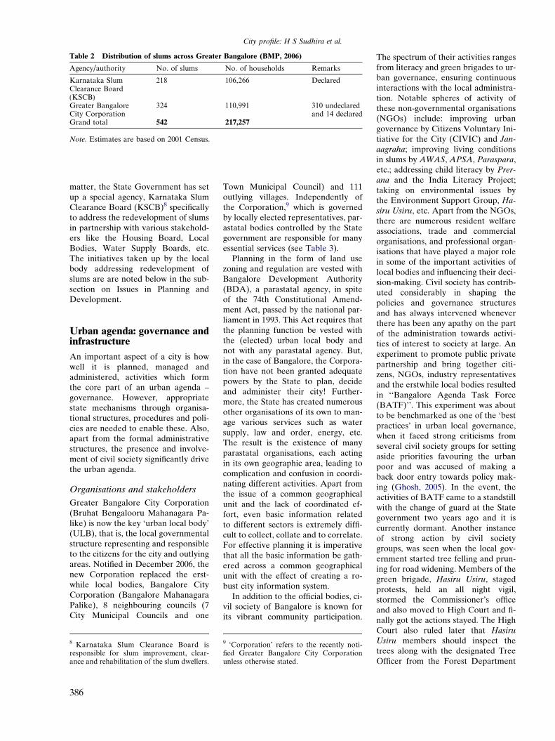
Table 2 Distribution of slums across Greater Bangalore (BMP, 2006)
Agency/authority No. of slums No. of households Remarks
Karnataka SlumClearance Board(KSCB)
218 106,266 Declared
Greater BangaloreCity Corporation
324 110,991 310 undeclaredand 14 declared
Grand total 542 217,257
Note. Estimates are based on 2001 Census.
City profile: H S Sudhira et al.
matter, the State Government has setup a special agency, Karnataka SlumClearance Board (KSCB)8 specificallyto address the redevelopment of slumsin partnership with various stakehold-ers like the Housing Board, LocalBodies, Water Supply Boards, etc.The initiatives taken up by the localbody addressing redevelopment ofslums are are noted below in the sub-section on Issues in Planning andDevelopment.
Urban agenda: governance andinfrastructure
An important aspect of a city is howwell it is planned, managed andadministered, activities which formthe core part of an urban agenda –governance. However, appropriatestate mechanisms through organisa-tional structures, procedures and poli-cies are needed to enable these. Also,apart from the formal administrativestructures, the presence and involve-ment of civil society significantly drivethe urban agenda.
Organisations and stakeholders
Greater Bangalore City Corporation(Bruhat Bengalooru Mahanagara Pa-like) is now the key ‘urban local body’(ULB), that is, the local governmentalstructure representing and responsibleto the citizens for the city and outlyingareas. Notified in December 2006, thenew Corporation replaced the erst-while local bodies, Bangalore CityCorporation (Bangalore MahanagaraPalike), 8 neighbouring councils (7City Municipal Councils and one
8 Karnataka Slum Clearance Board isresponsible for slum improvement, clear-ance and rehabilitation of the slum dwellers.
386
Town Municipal Council) and 111outlying villages. Independently ofthe Corporation,9 which is governedby locally elected representatives, par-astatal bodies controlled by the Stategovernment are responsible for manyessential services (see Table 3).
Planning in the form of land usezoning and regulation are vested withBangalore Development Authority(BDA), a parastatal agency, in spiteof the 74th Constitutional Amend-ment Act, passed by the national par-liament in 1993. This Act requires thatthe planning function be vested withthe (elected) urban local body andnot with any parastatal agency. But,in the case of Bangalore, the Corpora-tion have not been granted adequatepowers by the State to plan, decideand administer their city! Further-more, the State has created numerousother organisations of its own to man-age various services such as watersupply, law and order, energy, etc.The result is the existence of manyparastatal organisations, each actingin its own geographic area, leading tocomplication and confusion in coordi-nating different activities. Apart fromthe issue of a common geographicalunit and the lack of coordinated ef-fort, even basic information relatedto different sectors is extremely diffi-cult to collect, collate and to correlate.For effective planning it is imperativethat all the basic information be gath-ered across a common geographicalunit with the effect of creating a ro-bust city information system.
In addition to the official bodies, ci-vil society of Bangalore is known forits vibrant community participation.
9 ‘Corporation’ refers to the recently noti-fied Greater Bangalore City Corporationunless otherwise stated.
The spectrum of their activities rangesfrom literacy and green brigades to ur-ban governance, ensuring continuousinteractions with the local administra-tion. Notable spheres of activity ofthese non-governmental organisations(NGOs) include: improving urbangovernance by Citizens Voluntary Ini-tiative for the City (CIVIC) and Jan-aagraha; improving living conditionsin slums by AWAS, APSA, Paraspara,etc.; addressing child literacy by Prer-ana and the India Literacy Project;taking on environmental issues bythe Environment Support Group, Ha-siru Usiru, etc. Apart from the NGOs,there are numerous resident welfareassociations, trade and commercialorganisations, and professional organ-isations that have played a major rolein some of the important activities oflocal bodies and influencing their deci-sion-making. Civil society has contrib-uted considerably in shaping thepolicies and governance structuresand has always intervened wheneverthere has been any apathy on the partof the administration towards activi-ties of interest to society at large. Anexperiment to promote public privatepartnership and bring together citi-zens, NGOs, industry representativesand the erstwhile local bodies resultedin ‘‘Bangalore Agenda Task Force(BATF)’’. This experiment was aboutto be benchmarked as one of the ‘bestpractices’ in urban local governance,when it faced strong criticisms fromseveral civil society groups for settingaside priorities favouring the urbanpoor and was accused of making aback door entry towards policy mak-ing (Ghosh, 2005). In the event, theactivities of BATF came to a standstillwith the change of guard at the Stategovernment two years ago and it iscurrently dormant. Another instanceof strong action by civil societygroups, was seen when the local gov-ernment started tree felling and prun-ing for road widening. Members of thegreen brigade, Hasiru Usiru, stagedprotests, held an all night vigil,stormed the Commissioner’s officeand also moved to High Court and fi-nally got the actions stayed. The HighCourt also ruled later that HasiruUsiru members should inspect thetrees along with the designated TreeOfficer from the Forest Department
Table 3 Organisations concerned with Bangalore
Organisations Functional areas (scope of work)
Greater Bangalore City Corporation [Bruhat BangaloreMahanagara Palike (BBMP)]
Urban local body responsible for overall delivery of services –roads and road maintenance including asphalting, pavements andstreet lighting; solid waste management, education and health in allwards, storm water drains, construction of few Ring roads, flyoversand grade separators
Bangalore Development Authority (BDA) Land use zoning, planning and regulation within BangaloreMetropolitan Area; Construction of few Ring roads, flyovers andgrade separators
Bangalore Metropolitan Region DevelopmentAuthority (BMRDA)
Planning, co-ordinating and supervising the proper and orderlydevelopment of the areas within the Bangalore MetropolitanRegion, which comprises Bangalore urban district and parts ofBangalore rural district. BDA’s boundary is a subset of BMRDA’sboundary
Bangalore Water Supply and Sewerage Board (BWSSB) Drinking water – pumping and distribution, sewerage collection,water and waste water treatment and disposal
Bangalore City Police Enforcement of overall law and order; Traffic Police: Manning oftraffic islands; Enforcement of traffic laws; Regulation on Right ofWays (One-ways)
Bangalore Metropolitan Transport Corporation (BMTC) Public transport system – bus-basedBangalore Metro Rail Corporation Ltd. (BMRC) Public transport system – rail-based (Proposed)Regional Transport Office (RTO) Motor vehicle tax; Issue of licenses to vehiclesBangalore Electricity Supply Company (BESCOM) Responsible for power distributionLake Development Authority (LDA) Regeneration and conservation of lakes in Bangalore urban district
City profile: H S Sudhira et al.
before any tree felling and pruning ofbranches was begun.
Challenges in managing urbaninfrastructure
Urban activities require the support ofinfrastructure. Broadly, urban infra-structure can be divided into socialand economic infrastructure. Socialinfrastructure encompasses facilitieslike health care, education, housing,commercial (shops, markets and ho-tels), sports, recreation and entertain-ment. With mixed land use beingpracticed in most parts of Bangalore,shops and markets are the most com-monly found amenities (approxi-mately 1 shop per 100 persons) inthe urban agglomeration10 (KarnatakaUrban Infrastructure Developmentand Finance Corporation, 2006). Theprovision and maintenance of primaryhealth care, elementary education,sports, recreation, and entertainmentare administered mostly by the Corpo-ration, while BDA also facilitatessome of the social infrastructure likeshopping complexes, with provisions
10 The urban agglomeration refers to thearea formally administered by BangaloreCity Corporation and the 8 councils.
for private participation. Economicinfrastructure encompasses water sup-ply, wastewater treatment, stormwater drainage system, solid wastemanagement, telecommunication net-work, and transportation network.
Bangalore Water Supply and Sew-erage Board (BWSSB) is the parasta-tal agency responsible for drinkingwater supply, and wastewater collec-tion and treatment in the city. Banga-lore is on a ridge and does not have itsown year-round sources of water.Drinking water is pumped from theriver Cauvery, a distance of about100 km over an elevation of 500 mwith an energy expenditure of75 MW for approximately 900 millionlitres per day (MLD). Apart fromthe river Cauvery supply, groundwater and water from the riverArkavathy are also tapped. However,while water supply distribution is100% in the former Bangalore CityCorporation limits, only about 20%of the Municipal Council householdsare serviced. In view of the rapidgrowth of the city, and recent notifica-tion of Greater Bangalore, it remainsa challenge to service the remainingareas.
Regarding collection and treatmentof wastewater, the sewerage system is
based on the city’s four natural rivervalleys already noted and BWSSB isthe nodal agency. There are three ma-jor treatment plants with a total capac-ity of about 450 MLD (the outlets ofKoramangala and Challaghatta val-leys are combined to form the K&CValley Treatment Plant at Bellandur).Wastewater stress on natural waterbodies is evident from the fact thatthe present wastewater treatmentcapacity in the city is around 450MLD as against an estimated genera-tion of domestic wastewater of 700MLD. Although more secondarywastewater treatment plants are inprogress, they are yet to be completed.Another problem is the frequent clog-ging of storm water drains, resulting inpollution of natural water bodies.Hence it is now proposed to rehabili-tate and remodel all the major trunksewers to prevent any discharge intothe storm water drains.
Addressing mobility in Bangalorecity, an overview of transportationand traffic reveals the following facts.Bangalore city is estimated to havevehicle population of about 2.6 millionwhile the current city population isabout 7 million. The vehicle to personratio is far higher than any other cityin India. This has led to increased con-
387
City profile: H S Sudhira et al.
gestion in road networks across thecity and frequent traffic jams. Man-ning signalling at traffic islands havealso become unmanageable with theamount of traffic plying across junc-tions. Again, in this sector differentcomponents related to mobility arevested with different parastatalbodies.
Public transportation forms one ofthe key functionalities for mobility inany urban area. In Bangalore wherethe working population is around 2million, the Bangalore MetropolitanTransport Corporation (BMTC) oper-ates on any given day with 4144 sched-ules, 4262 buses, 60,475 trips, andcarries 3.5 million passengers. It earnsRs. 20.5 million per day and pay Rs.0.955 million to the government astaxes (Bangalore Metropolitan Trans-port Corporation, 2006). Further,according to recent estimates, thereare about 1.6 million two-wheelers,0.32 million motor-cars, 80,000 auto-rickshaws, and 0.17 million other vehi-cles totalling to around 2.2 millionvehicles on road (Regional TransportOffice, 2006).
The onus of maintaining andimproving road networks lies withthe Corporation. Although a studyfor the City by consultants iDeCKand Rites (2005) identified 52 high
Table 4 Development characteristics across B
Characteristics Developm
Zone 1
Authority Greater BCorporatBangalorCorporat
Urban status Core city
Infrastructure services Present, bchoked, naugmentiinfrastruc
Impact of growth No scopebut callsrenewal tcongestio
Planning, Developmentand Regulation Controls
CorporatbuildingPlanningBDA.
388
and medium traffic intensity corridorsrequiring various interventions by dif-ferent organisations, the former CityCorporation proposed only to widensome of these roads. A key aspect ig-nored while addressing mobility isthe role of land use in generating traf-fic demand. Failure by the city toacknowledge this, and in particularthe implications of changes in landuse from residential to commercial orindustrial, has led to stereotypical ap-proaches in addressing mobility suchas road widening, creation of new fly-overs and underpasses, or conversioninto ‘one-ways’. In general Bangalorehas over a period promoted mixedland use which at some level has ledto inefficient usage of land. With theCity’s compartmentalised approachesto widening of roads or constructionof flyovers and grade separators, theproblem of mobility is far from beingsolved.
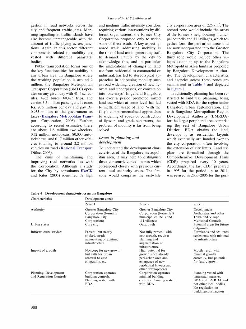
Issues in planning anddevelopment
To understand the development char-acteristics of the Bangalore metropol-itan area, it may help to distinguishthree concentric zones – zones whichcorrespond closely with previous cur-rent local authority areas. The firstzone would comprise the erstwhile
angalore
ent zones
Zone 2
angalore Cityion (formerlye Cityion)
Greater BangaloreCorporation (formmunicipal councils111 villages)Outgrowth
ut nearlyeeds
ng of existingture
Not fully present,new growth, requirplanning andaugmentation ofinfrastructure
for new growthfor urbano easen, etc
High potential forgrowth since alreadperi-urban area anemergence of newresidential layoutsother development
ion operatescontrols.vested with
Corporation operaminimal buildingcontrols. Planningwith BDA.
city corporation area of 226 km2. Thesecond zone would include the areasof the former 8 neighbouring munici-pal councils and 111 villages, which to-gether form the peri-urban areas andare now incorporated into the GreaterBangalore City Corporation. Thethird zone would include other vil-lages extending up to the BangaloreMetropolitan Area limits as proposedby Bangalore Development Author-ity. The development characteristicsand agencies across these zones aresummarised in Table 4 and depictedin Figure 1.
Traditionally, planning has been re-stricted to land use planning, beingvested with BDA for the region underBangalore urban agglomeration, andwith Bangalore Metropolitan RegionDevelopment Authority (BMRDA)for the larger peripheral area compris-ing the rest of Bangalore UrbanDistrict7. BDA obtains the land,develops it as residential layoutswhich eventually are handed over tothe city corporation, often involvingthe extension of city limits. Land useplans are formalised through theComprehensive Development Plans(CDP) prepared every 10 years.Accordingly, the last CDP, preparedin 1995 for the period up to 2011,was revised in 2005–2006 for the peri-
Zone 3
Cityerly 8and
DevelopmentAuthorities and otherTown and VillageMunicipal CouncilsPotential areas for futureoutgrowth
withes
Farmlands and scatteredsettlements with minimalno infrastructure
yd
ands
Mostly rural, withminimal growthcurrently, but potentialfor future growth
tes
vested
Planning vested withparastatal agencies:BDA and BMRDA andnot other local bodies.No regulation onbuilding/construction
City profile: H S Sudhira et al.
od up to 2015 and is currently awaitingapproval. A key aspect of these CDPsare that they indicate the amount andlocation of land use allocated for var-ious uses (like residential, commercial,industrial, etc.) as well as restrictingdevelopment in specific areas demar-cated as Green Belt and Valley Zones.However, another organisation similarto BDA, the Karnataka IndustrialArea Development Board (KIADB),is responsible for development ofindustrial areas. These industrial es-tates are situated for the most part inthe outskirts of the city and KIADBhas powers under the law to take overagricultural lands for the purpose.
Generally, however, the regulationand enforcement of land use zoningregulations are dismal, leading to alarge number of illegal developmentsand encroachments on public land –problems which have led KarnatakaState to constitute a legislative com-mittee to look into irregularities inand around the city. In the particularcase of growth occurring around outerindustrial areas, the urban local bodiesare generally unable to provide basicinfrastructure and services, thus fur-ther aggravating inefficient utilisationof land and other natural resources.With such instances prevailing espe-cially in the areas of the former Muni-cipal Councils, the new Corporationfaces a great challenge to deliver basicinfrastructure and services.
On 3rd December 2005, the Ministryof Urban Development, Governmentof India, launched the Jawaharlal Neh-ru National Urban Renewal Mission(JNNURM). This countrywide pro-gramme addresses renewal of urbanareas for 63 cities encompassing nearly70% of total urban population, its pri-mary aim being to link the revitalisa-tion of urban infrastructure with aspecific agenda of institutional re-forms. Bangalore is one of the benefi-ciaries under this programme with anestimated outlay of US $ 1.7 billionover the next six years. The key mis-sion of this programme is to support re-forms-driven, fast track, planneddevelopment with focus on improvingefficiency in urban infrastructure andservice delivery mechanisms, throughcommunity participation and ensuringaccountability of urban local bodiesand parastatals towards citizens.
JNNURM is made operational withtwo sub-missions:
� Urban Infrastructure and Gover-nance (UIG).� Basic Services to Urban Poor
(BSUP).
The sub-mission on UIG focuses onmajor infrastructure projects for watersupply, sanitation, sewerage, solidwaste management, road network, ur-ban transport and redevelopment ofinner (old) city areas with a view toupgrading infrastructure therein, shift-ing industrial and commercial estab-lishments to conforming areas, etc.The sub-mission on BSUP focuses onintegrated redevelopment of slumscombining housing, water supply,drainage, storm water drains, solidwaste management, street lighting,and community halls.
In accordance with the JNNURMguidelines, the erstwhile BangaloreCity Corporation prepared the CityDevelopment Strategy Plan (CDSP)for both UIG and BSUP (BangaloreMahanagara Palike, 2006). TheCDSP outlines only an investmentplan and financial strategy for takingup various initiatives envisaged in themission. Under BSUP, 218 declaredslums in the former City Corporationlimits would be taken up by KSCBfor redevelopment. Further, thereare 169 slums under the erstwhileCity Corporation jurisdiction that re-main undeclared, which would beredeveloped by the new Corporation.There are, in addition, 155 slums inthe neighbouring former municipalcouncil areas that would be redevel-oped by the new Corporation andKSCB. However a draft communityparticipation law has not been en-acted and in Karnataka State mostof the infrastructure projects andredevelopment plans have beenadministered by ULBs and parastatalagencies and not through communityparticipation as envisioned by themission. The result is a continuationof top-down rather than bottom-upmodes of planning and deliveringinfrastructure and services. This callsfor introspection on the implementa-tion and achievement of the missionobjectives. However, with various ini-tiatives under JNNURM underway,it does offer hope, and perhaps
promise, and in improving the essen-tial urban infrastructure and servicesin city.
Conclusion
Bangalore, with all due respect to itsstatus as ‘Silicon Valley’ and ‘GardenCity’, faces real challenges in termsof addressing and delivery of basicinfrastructure and services to all itsstakeholders. In spite of numerous ini-tiatives and activities envisaged by theurban local bodies, past and present,and by parastatal bodies, the rational-isation of geographical units for theseactivities could mark the beginningof a coordinated effort in addressingthe needs of the city. In the wake ofrecent notification of Greater Banga-lore City Corporation and initiativesunder JNNURM, Bangalore is cur-rently experiencing a strange transfor-mation. Bangalore also stands out as abeacon of globalising world and tosustain this, it needs to systematicallyaddress the key challenges facing thecity in terms of governance andinfrastructure.
Acknowledgements
We thank the Indian Institute ofScience for financial and infra-structure support. We are gratefulto the editor for useful sugges-tions, which have enhanced bothpresentation and quality of thecontent.
References
Asian Development Bank (2001) CitiesData Book: Urban Indicators for Man-aging Cities, in: Westfall, MS and deVilla, VA (Eds.), Asian DevelopmentBank, Manila, Philippines.
Bangalore Mahanagara Palike-BMP (2006)City Development Strategy Plan,Report submitted to Ministry of UrbanDevelopment, Government of India,New Delhi.
Bangalore Metropolitan Transport Corpo-ration (2006) At present, Statisticsavailable online: http://www.bmtcinfo.com/english/atpresent.htm (accessed20.11.2006).
Buchanan, F (1870) A journey from Madrasthrough the countries of Mysore, Canaraand Malabar, Second ed., vols. 1–3.Higginbotham and Co., Madras.
389
City profile: H S Sudhira et al.
Census of India (2001a) Primary CensusAbstract – Andhra Pradesh, Karnatakaand Lakshwadweep, Directorate ofCensus Operations, Government ofIndia, New Delhi.
Census of India (2001b) Migration Datafor Urban Agglomerations in Karna-taka – D-series, Directorate of CensusOperations, Government of India, NewDelhi.
Chandramouli, K (2002) A grand dream,The Hindu, 18 July, 2002, The HinduGroup. http://www.hinduonnet.com/mp/2002/07/18/stories/2002071800480200.htm(accessed 20.11.2006).
Ghosh, A (2005) Public–Private or privatepublic?: Promised Partnership of theBangalore Agenda Task Force. Eco-nomic and Political Weekly SpecialArticles, 19 November 2005. http://www.epw.org.in/showArticles.php?root=2005&leaf=11&filename=9367&filetype=html (accessed 29.03.2007).
Government of Karnataka (2005) Karna-taka at a glance – 2004–05. Directorate
390
of Economics and Statistics, Govern-ment of Karnataka.
Heitzman, J (2004) Planning for an Infor-mation Society: Bangalore City. Oxford.
iDeCK and Rites (2005) Rapid TrafficStudy: Identification of traffic corridorsin Bangalore, Infrastructure Develop-ment Corporation (Karnataka) Limitedand Rites, Bangalore.
Kamath, S (1990) Places of Interest, Kar-nataka State Gazetteer: Bangalore Dis-trict. Government of Karnataka,Bangalore (Chapter 19).
Karnataka Urban Infrastructure Develop-ment and Finance Corporation (2006)Infrastructure Development and Invest-ment Plan for Bangalore: 2006–30,Final Report, Karnataka Urban Infra-structure Development and FinanceCorporation, Bangalore.
Karthikeyan, S (1999) The Fauna of Ban-galore – the Vertebrates and Butterfliesof Bangalore: A checklist, World WideFund for Nature – India. KarnatakaState Office, Bangalore.
Nair, J (2005) Bangalore: The Promise of aMetropolis. Oxford.
PIA (2003) PIA Technical Directory. Pee-nya Industries Association, Bangalore.
Regional Transport Office (2006) Vehiclestrength and growth in Bangalore.Regional Transport Office, TransportDepartment, Government of Karna-taka. http://rto.kar.nic.in/bng-veh-stat.htm (accessed 19.03.2007).
Sudha, P and Ravidranath, N H (2000) Astudy of Bangalore urban forest.Landscape and Urban Planning 47,47–63.
United Nations Development Programme(2001) Human Development Report –2001, Making New Technologies Workfor Human Development, UNDP. NewYork and Oxford University Press, NewYork.
Varghese, T (2006) A new species of theant genus Dilobocondyla (Hymenop-tera: Formicidae) from India, withnotes on nesting behaviour. OrientalInsects 40, 23–32.