PETROPHYSICAL ANALYSIS OF PICEANCE BASIN TIGHT GAS SANDSTONES, NW
17
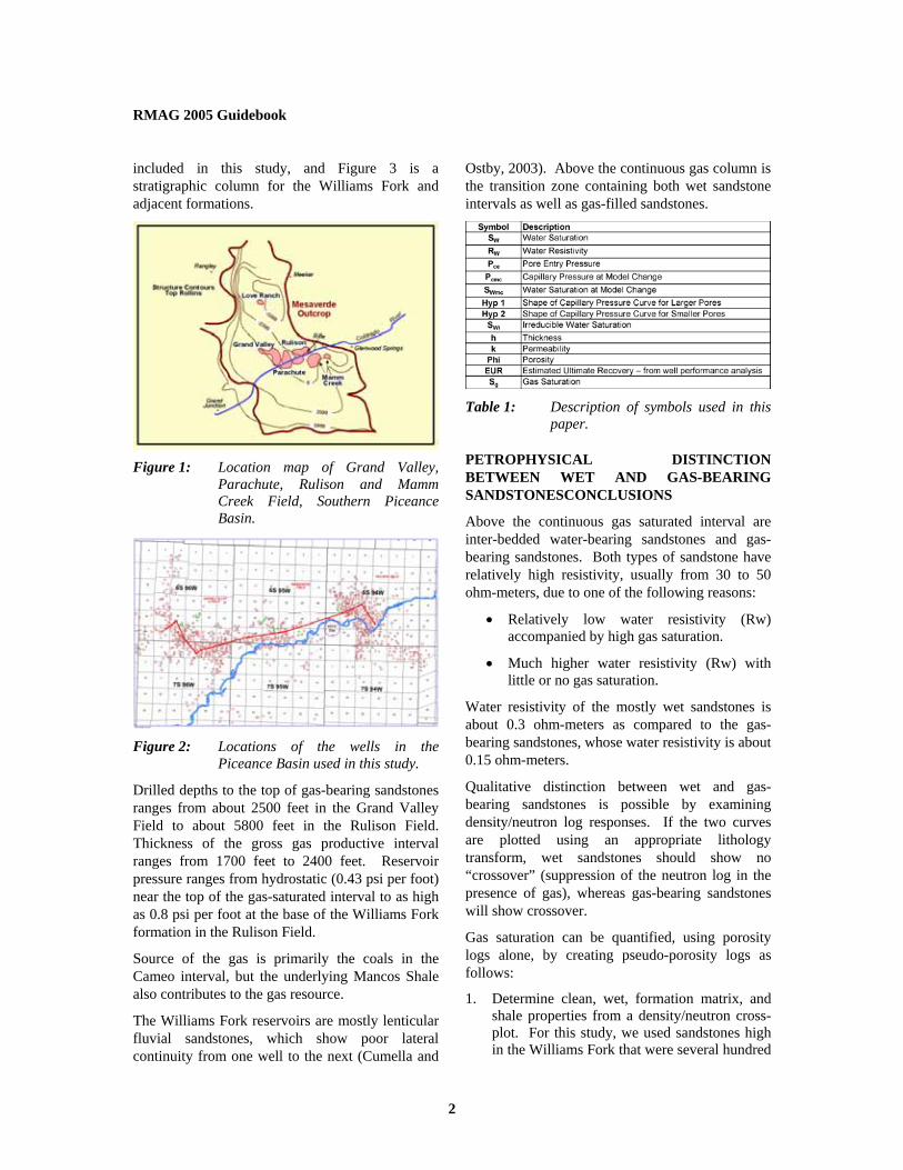
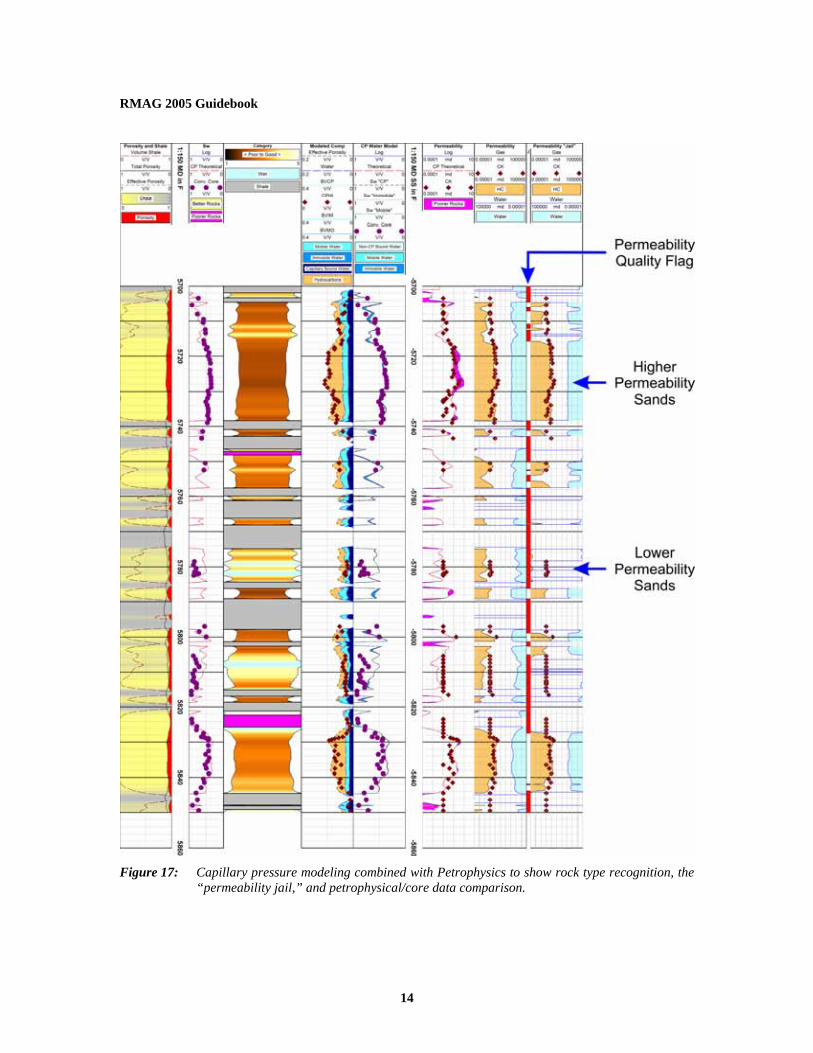
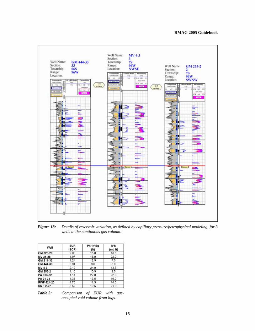
RMAG 2005 Guidebook 1 PETROPHYSICAL ANALYSIS OF PICEANCE BASIN TIGHT GAS SANDSTONES, NW COLORADO, TO DISTINGUISH WET SANDS FROM GAS-BEARING SANDS, AND TO CATEGORIZE ROCK QUALITY VARIATION BY INCORPORATING CAPILLARY PRESSURE INTERPRETATIONS Michael Holmes, Antony M. Holmes, and Dominic I. Holmes, Digital Formation, Inc. Copyright 2005, held by the submitting authors. ABSTRACT In the southern part of the Piceance Basin, NW Colorado, gas-bearing non-marine sandstones of the Williams Fork formation of the Mesa Verde Group occupy a gross interval ranging from 1700 feet to 2400 feet thick. Above this continuous gas column is a transition zone, about 1000 feet thick, where some of the sandstones are wet and contain relatively fresh water, and some are gas-bearing. When completing wells, it is critical to reliably distinguish between wet and gas-bearing sandstones, both of which can have high resistivity response. Within the continuous gas column, porosities range from 5% to 15%, and average about 10%. Matrix permeability is mostly less than 0.1 md. Some of the sandstones, have permeability to gas that is so low that commercial production from these levels is unlikely. This paper is a study of sandstone properties of the Williams Fork formation to address the two issues outlined above. • Distinction between fresh water-wet sandstones and gas-bearing sandstones of the upper transition zone. • Petrophysical analysis of sandstones in the continuous gas column, to differentiate intervals with higher matrix permeability from intervals with lower matrix permeability. To examine the first problem, a technique is described by which density and neutron log responses can be used to quantify gas saturation that does not require knowledge of water resistivity. This approach is used to distinguish between gas-bearing and wet sandstones within the transition zone of the upper part of the Williams Fork formation. To examine the second problem, a different approach combines core-measured capillary pressure measurements, core-measured permeability and porosity, with petrophysical definition of saturation vs. height profiles for the continuous gas column. One of the products of the analysis is a continuous profile of the changing matrix permeability in the sandstones, as a consequence of rock property variation. Once the model is verified by comparison with core data, it can be applied to wells where no core data exists. This allows for a reservoir-wide distinction between sandstones with higher permeability (potentially commercial) from those with lower permeability (probably non-commercial). Results from the analysis of thirteen wells are presented. Three of the wells (MWX-1, MWX-2, MWX-3 – all close to the town of Rulison) are from the extensive Gas Research Institute study which has a core database of capillary pressures together with extensive porosity, permeability, and water saturation measurements for most of the sandstones in the Williams Fork formation. Results of modeling these 3 wells have been applied to 10 wells from the Grand Valley, Parachute and Rulison Fields. INTRODUCTION - GEOLOGIC BACKGROUND Gas production in the southern part of the Piceance Basin is primarily from non-marine sandstones of the Upper Cretaceous Williams Fork formation. Figure 1 shows an area map and Figure 2 a location map, including well locations of the 13 wells
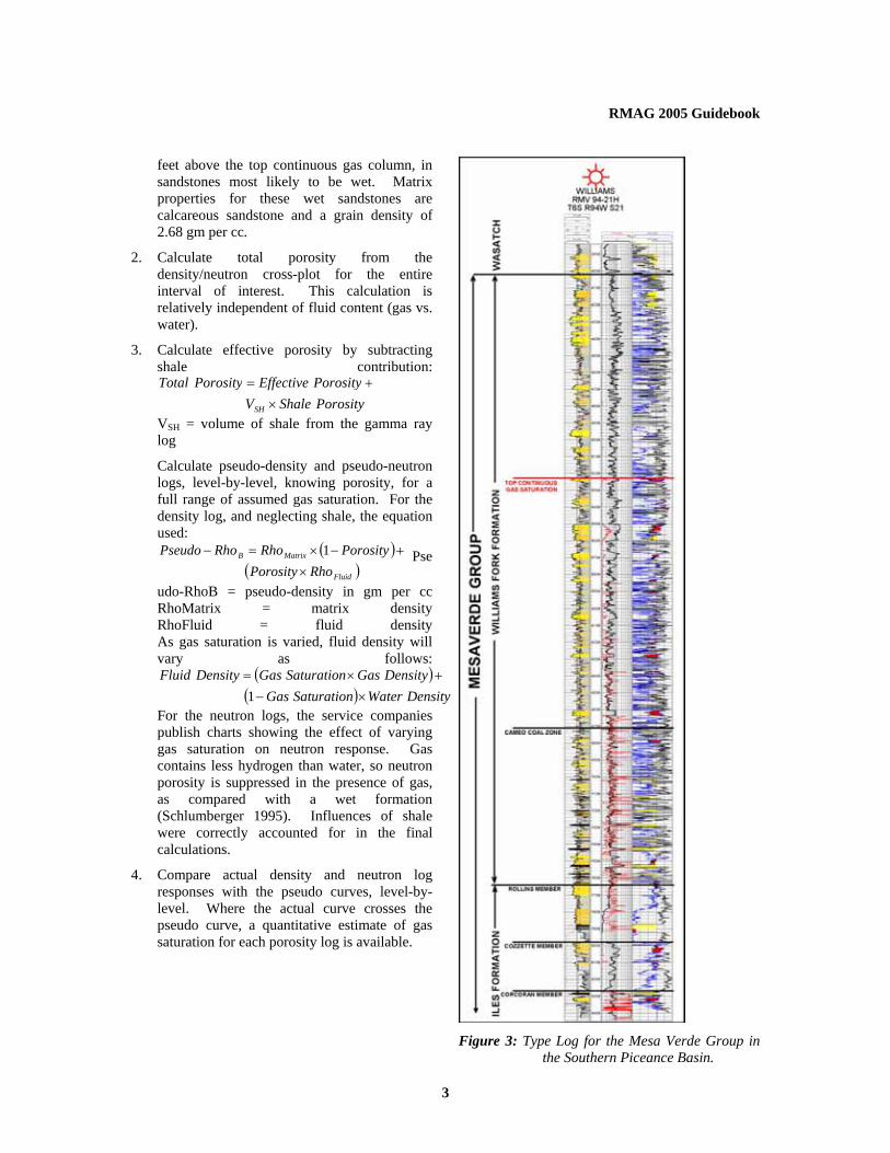
PETROPHYSICAL ANALYSIS OF PICEANCE BASIN TIGHT GAS SANDSTONES, NW