Embed Size (px)
Citation preview
PhotogrammetryDigital Elevation Models
Orthophotographs
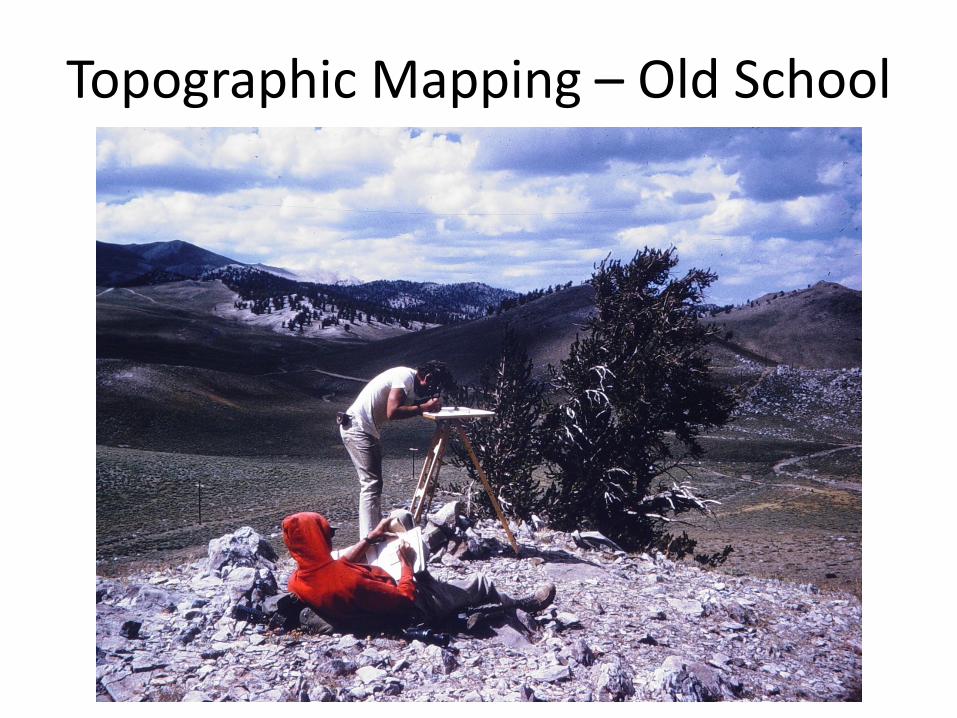
Topographic Mapping – Old School
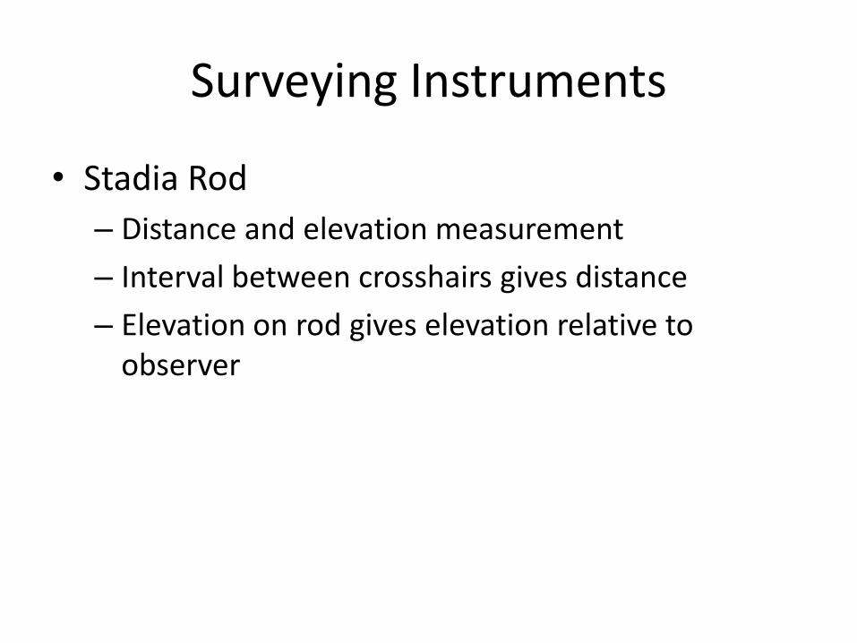
Surveying Instruments
• Stadia Rod
– Distance and elevation measurement
– Interval between crosshairs gives distance
– Elevation on rod gives elevation relative to observer
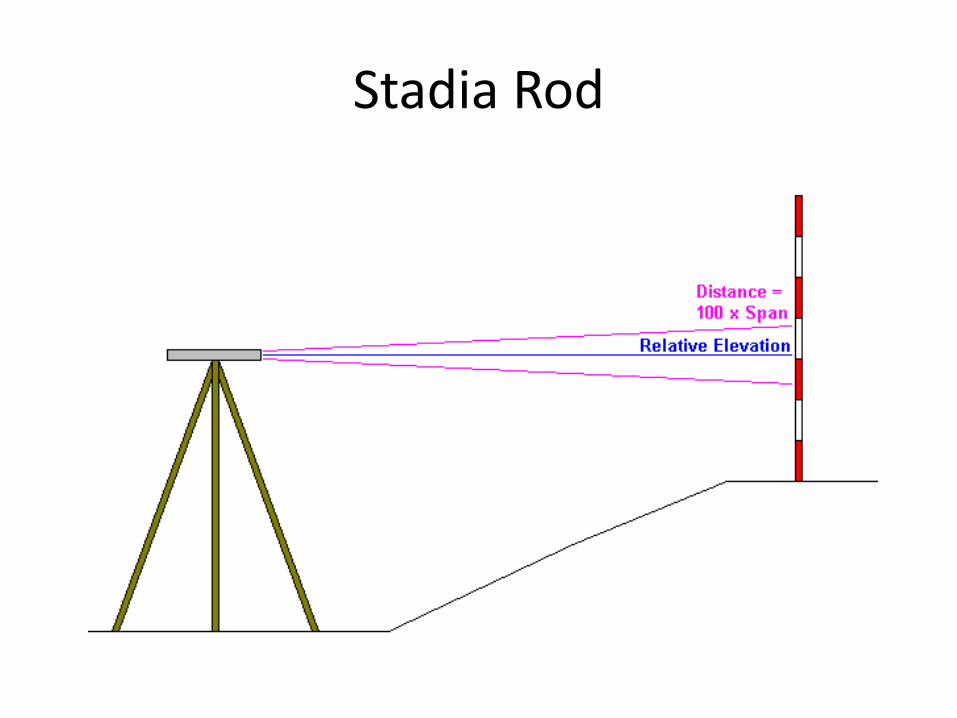
Stadia Rod
Surveying Instruments
• Transit
– Record data in field for later analysis
• Alidade
– Used for direct plotting in field
• Plane Table
– Used in conjunction with Alidade
– Plot distance and elevation directly on rough map
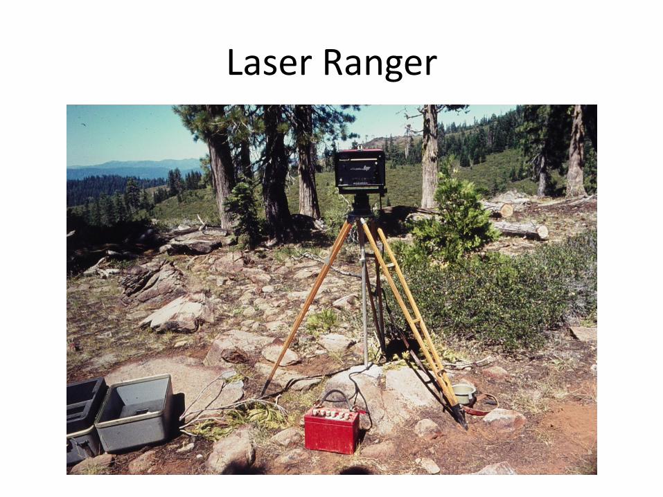
Laser Ranger
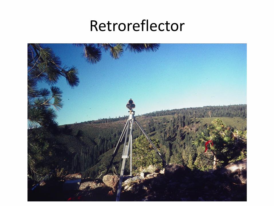
Retroreflector
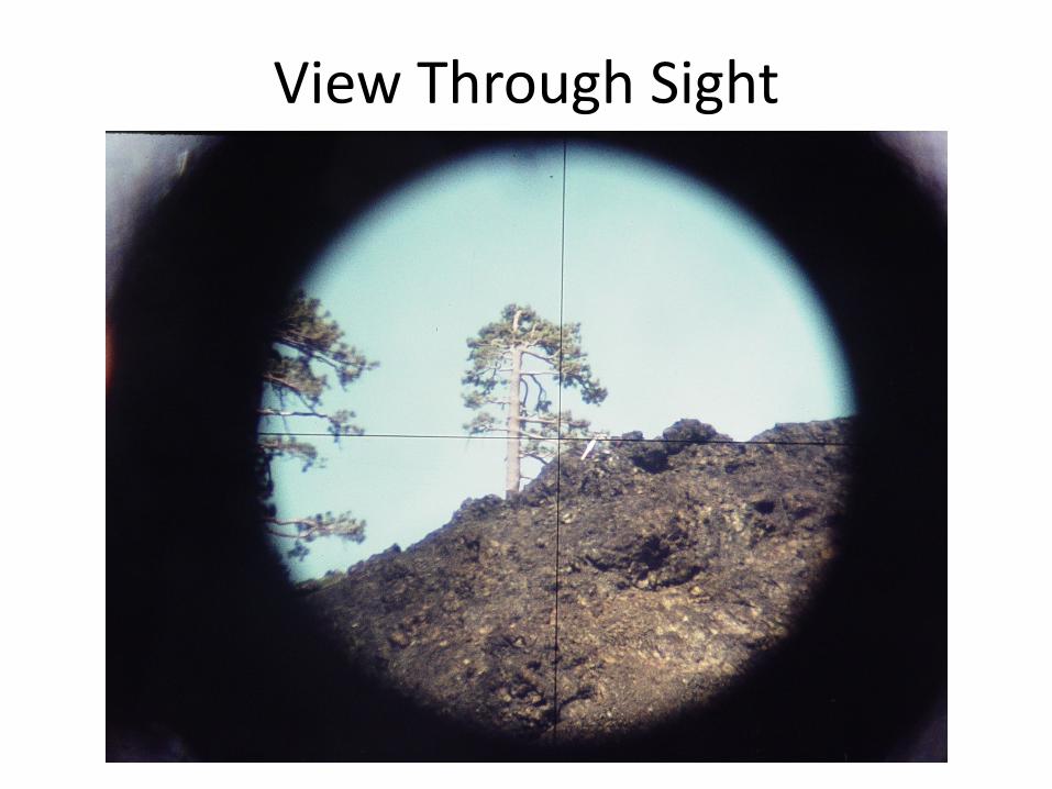
View Through Sight
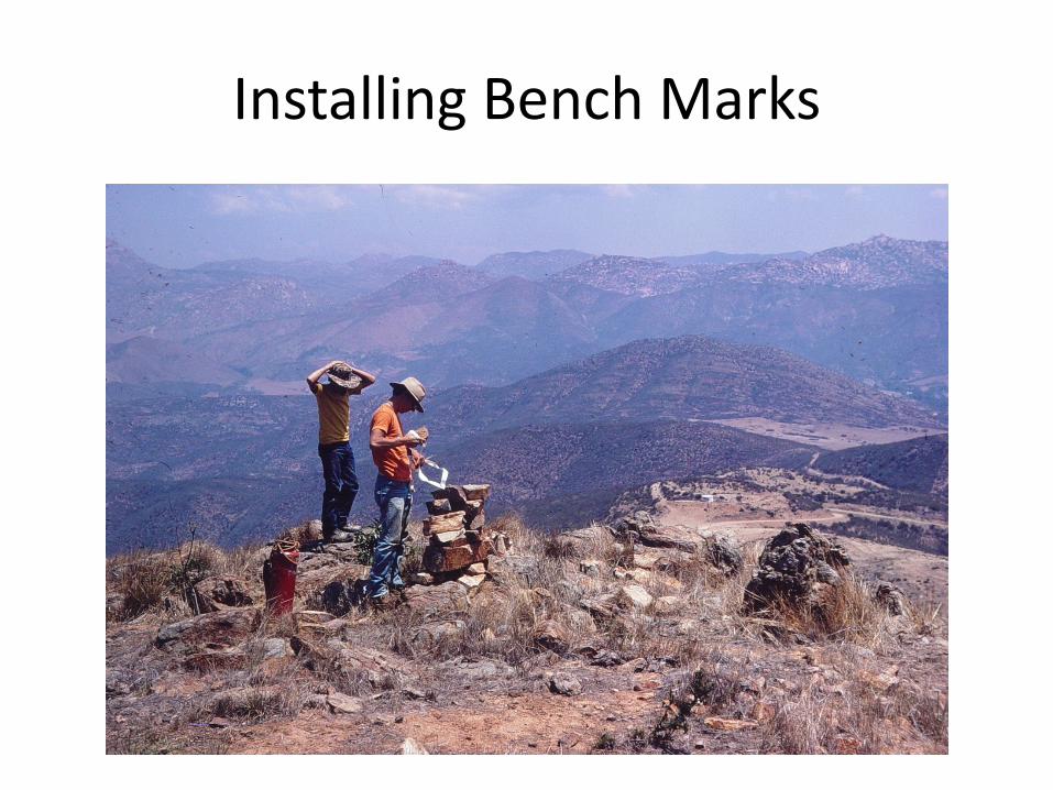
Installing Bench Marks
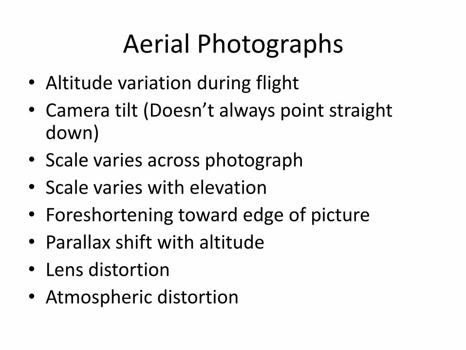
Aerial Photographs
• Altitude variation during flight
• Camera tilt (Doesn’t always point straight down)
• Scale varies across photograph
• Scale varies with elevation
• Foreshortening toward edge of picture
• Parallax shift with altitude
• Lens distortion
• Atmospheric distortion
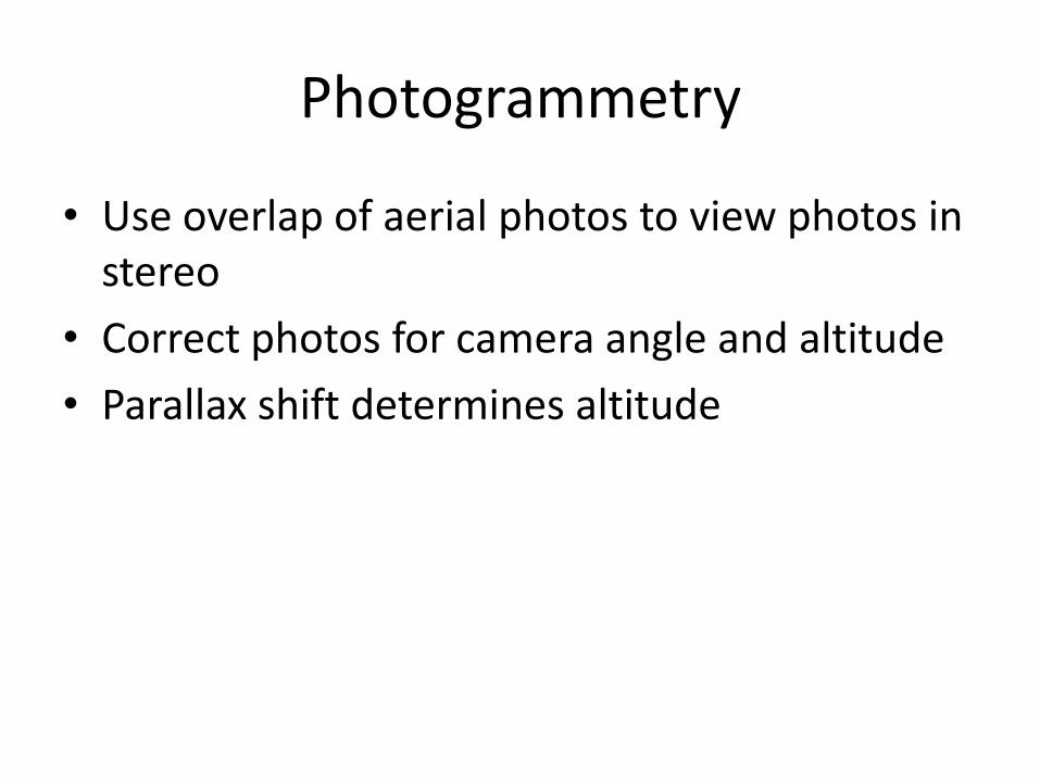
Photogrammetry
• Use overlap of aerial photos to view photos in stereo
• Correct photos for camera angle and altitude
• Parallax shift determines altitude
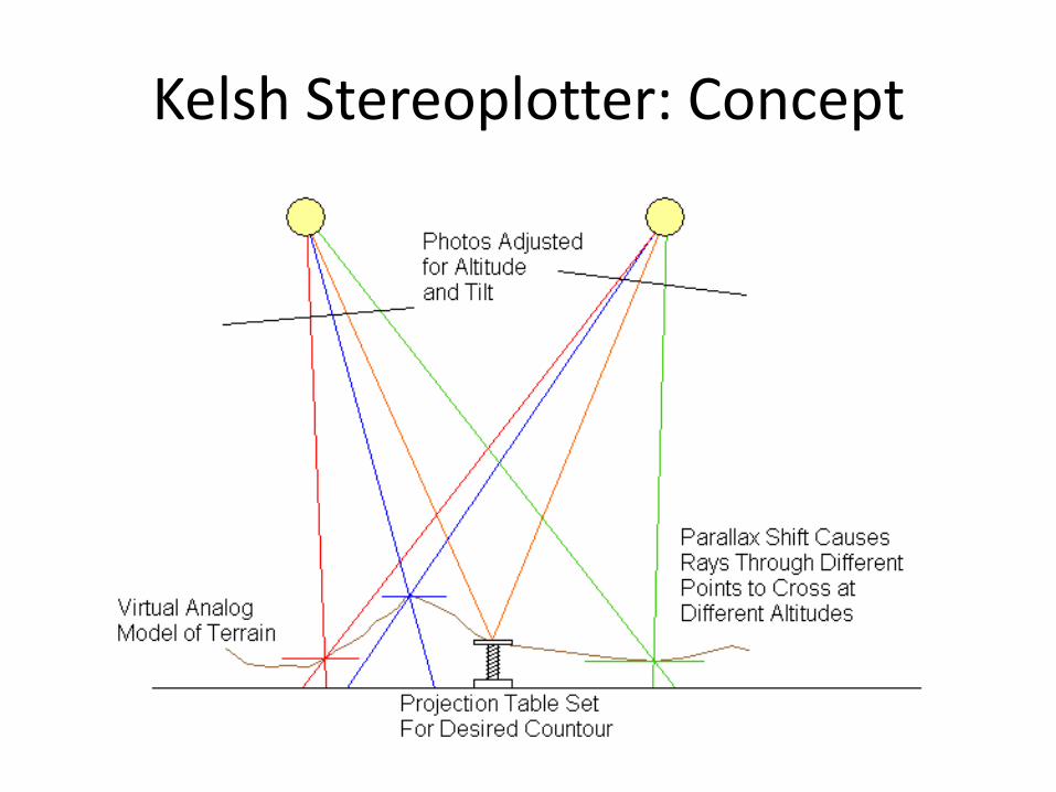
Kelsh Stereoplotter: Concept
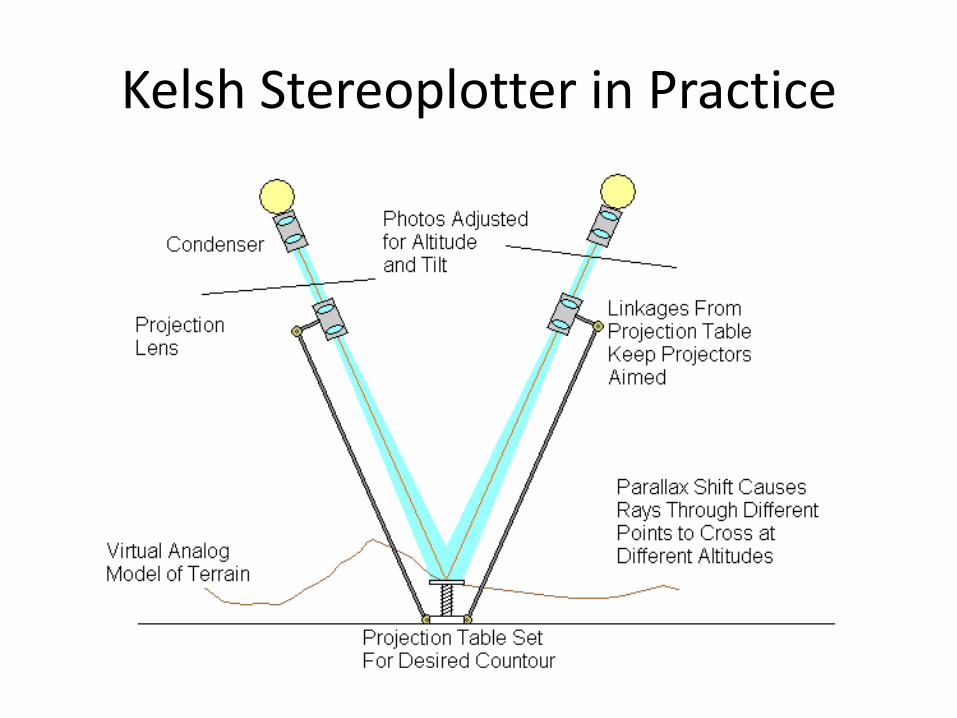
Kelsh Stereoplotter in Practice
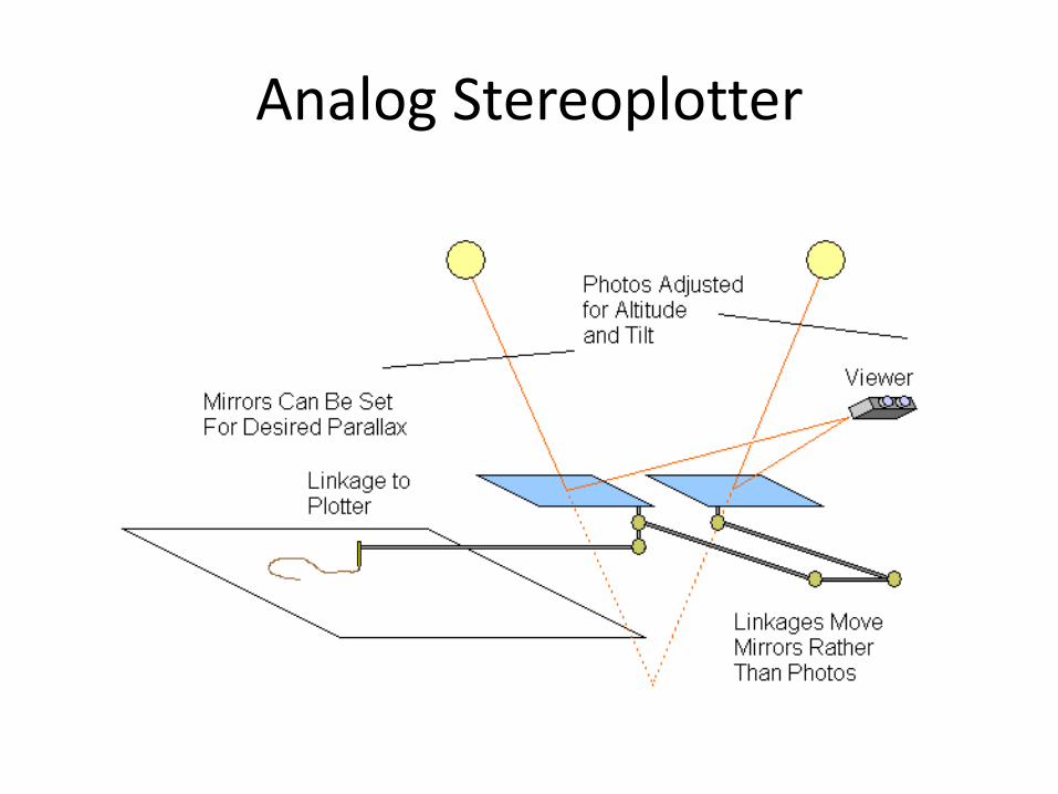
Analog Stereoplotter
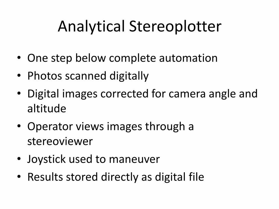
Analytical Stereoplotter
• One step below complete automation
• Photos scanned digitally
• Digital images corrected for camera angle and altitude
• Operator views images through a stereoviewer
• Joystick used to maneuver
• Results stored directly as digital file
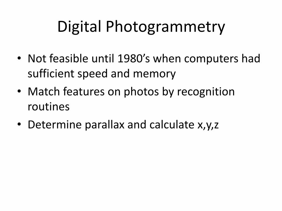
Digital Photogrammetry
• Not feasible until 1980’s when computers had sufficient speed and memory
• Match features on photos by recognition routines
• Determine parallax and calculate x,y,z
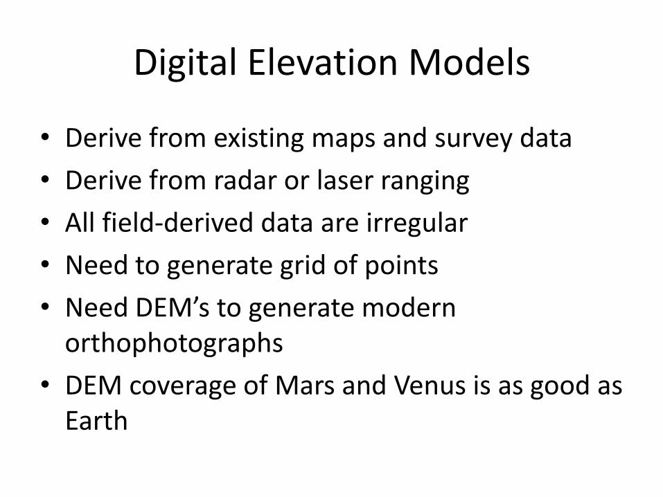
Digital Elevation Models
• Derive from existing maps and survey data
• Derive from radar or laser ranging
• All field-derived data are irregular
• Need to generate grid of points
• Need DEM’s to generate modern orthophotographs
• DEM coverage of Mars and Venus is as good as Earth
Orthophotographs
• Aerial photographs with parallax and scale distortions removed
• Analog methods are modified from photogrammetry– Instead of scribing a contour line, expose a patch
of the images on film
– First invented by Germans and French in 1930’s
– Russell Bean of USGS invented a method in 1955
– Systematic production began at USGS in 1965
– Analog methods used until early 1980’s
Digital Orthophotographs
• Begun in 1980’s when computers finally had enough memory and speed to handle the load
• USDA wanted base maps for soil mapping; contributed funding for development and production
• Full scale production began in 1991, peaked in 1999
• Now nearly complete
• DOQ = Digital Orthophoto Quadrangle
How Orthophotos are Made
• Computer recognizes locations on photograph
• Control points on ground for location accuracy
• Elevation provided by DEM
• Not entirely like digital photogrammetry
• Image generally overlaps latitude-longitude bounds by 50-300 meters
• All use NAD 83 and Universal Transverse Mercator projection