Embed Size (px)
Citation preview


pag. 10
Planetek Italia has always tried to define its strate-gies with the aim of meeting the new needs of
users.
Back in the early 2000s, we tried to formalize our approach to innovation in cooperation with our users. You may remember our slogan: “We don't look at reality through the distorting lenses of technology, but we interpret the real needs and pursue sustainable developments”. In 2007, we started our first projects with the application of the Strategic Design, which aims to identify the dynamic intersection between the Users' Needs,
Technological Skills, and Economic Sustainability.
In those years, we were already aware of the need to face a world that had been changed deeply – by technology, but also by new social behaviours – while experiencing a very serious economic/financial crisis that we immediately saw as a struc-
tural one.
These processes leads us to consider the need to start a radical change that allows us to get Planetek Italia in line with a new world. However, such a project cannot be imple-mented without taking into consideration the global megatrends: surely, the new knowledge distri-bution processes have interconnected the various subjects much more than in the past, and also during the change it is necessary to have a compass to ensure the compatibility of our choices with those of
our stakeholders.
For a Europe-inspired company like Planetek Italia, the decision of making our change consistent with the European innovation programmes is therefore a forced choice, as well as a great idea. The Euro-pean programme Horizon 2020 provides us with a reference framework and a benchmark for the assessment of our change and innovation strate-gies. The strengths of the EU 2020 strategy are the
following:
• Strengthening the European scientific basis by improving the results of basic research, promoting the development of new technologies, encouraging international exchanges and the development of
human capital;
• Boosting the competitiveness and leadership of European industries by promoting the use of new technologies, improving the access to risk capital,
supporting the innovation of SMEs;
• Increasing the contribution of research and inno-vation to the solution of impending social challen-
ges;
• Providing a final users' needs-based support to the scientific and technological research policies of
the Union;
• Improving the integration of the knowledge trian-gle between: research, researchers' training
(University) and innovation.
In this framework, Planetek 2020 starts an path of modernization and change, in line with the choices of the past – e.g. Planetek Estesa – the investments in research and development and internationaliza-tion, the efforts made to establish strong connec-tions with the Universities and Research Centres through the spin-offs GEO-K and GAP, which will gain a new value and a better focusing of their
goals.
Once the strategic framework of the initiative is defined, it is important to explain the "how", i.e. what should be actually changed about Planetek Italia to make it more effective in (re)interpreting this scenario, and the "what", i.e. what we expect
Planetek Italia to be at the end of this process.
Why should a company make changes? Because creating a new reality means creating a boat that uses tradition and exploits innovation. Thus, exploi-ting everything that works, we sail to look for new scenarios, new markets and new products that allow the company to grow – rather than just stay
afloat – thanks to a renewed thrust and to steer towards the uncertainty of the futu-
re.
Although 8 years look like a short lapse of time, they actually are a very long period in the field of techno-logies. Therefore, our 2020
strategy includes 3 phases.
The first phase, Planetek 2020.1, aims to align our organizational model to the implementation of a Users-oriented Planetek Italia. Hence the decision of getting
over the organization based on production-related vertical technologies and the separation between production and sales, with the definition of the SBUs, Strategic Business Units, responding to the
market's needs.
This may meet our need to improve our relationship with the Markets where we operate, or where we aim to operate; however, it does not meet our need to look for new markets and new products
that are suitable for emerging markets.
Thus, the new organization of Planetek Italia inclu-des a dedicated place, the “Design Lab”. It will be in charge of exploring new territories where Plane-tek Italia will expand its business in the future, turning the visions deriving from the above mentio-
ned innovation context into market opportunities.
What will Planetek Italia be at the end of this pro-
cess?
In our intentions, a subject with a codified ability to adapt and a consolidated management of change; In actual facts, it will be an industrial species much more likely to evolve and therefore survive the social, economic and technological changes that we
will face over the years.
Quoting Luis Sullivan, "form ever follows function",
and Planetek Italia complies with this law.
In this issue
Planetek 2020
Giovanni Sylos Labini
C.E.O
Planetek Italia s.r.l.
pag. 4
pag. 8
Planetek Italia s.r.l.
Via Massaua, 12 - I-70132 Bari BA
pkm002-587-9.0 - October 2012 - Free copy
This document is under Creative Commons
licence, available on
http://creativecommons.org/licenses/by-nd/2.5/it
You are free to share, copy, distribute and transmit the
work. You must attribute the work to the author not
altering, transforming, or building upon this work .
Planetek Italia - www.planetek.it 3
Page 6 and cover image: "Earth from above" collection —
Credits www.yannarthusbertrand.org
“It is the pervading law
of all things organic and inorganic,
Of all things physical and metaphysical,
Of all things human
and all things super-human,
Of all true manifestations of the head,
Of the heart, of the soul,
That the life is recognizable
in its expression,
That form ever follows function.
This is the law”
(Luis Sullivan, Architetto, 1986)
ORGANIZATION An evolving organization
EARTH OBSERVATION Sealed areas according to GMES
Urban Heat Islands and urban
thermography
Protecting marine & coastal
environment
Towards landslides forecasting
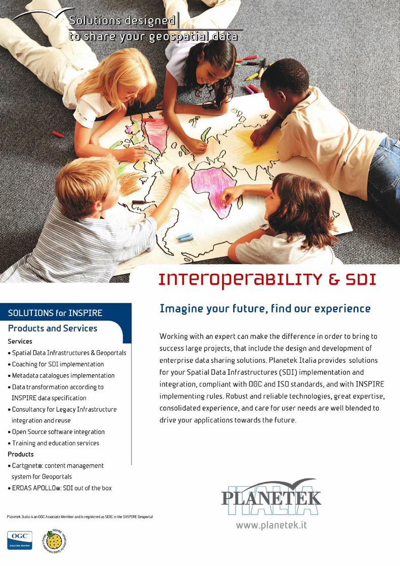
INTEROPERABILITY & SDI The European INSPIRE Geoportal
Design Thinking in Morocco
Towards geographic Linked
Open Data
PRODUCTS AND SOLUTIONS Geospatial products
The power of the Wind
SPACE SYSTEMS On Board Payload Data Processing
Satellite Ground Segment
Easy management and access to
Planetary Data
SHIRA The first Italian user
oriented satellite
pag. 12
pag. 20
pag. 16
pag. 18
pag. 22
pag. 14
pag. 24
pag. 26
pag. 28
pag. 30
pag. 32

der to perform its tasks, the Design Lab also makes use of the
two university spin-offs we have helped found: Geo-k and
GAP.
The market changes and so do our clients, also because of
our growth. In order to better face these changes, we have
decided to adopt a new organizational model that gets over
the organization based on technologies and the separation
between commercial and production functions, through the
creation of our SBUs, Strategic Business Units.
Thus, we have now four Strategic Business Units in Planetek
Italia: SBU Space Systems, which develops and integrates
hardware and software infrastructures for the acquisition,
treatment and distribution of remote-collected data on the
market of international Space Agencies and the main opera-
tors of the aerospace market; SBU European Institutions,
which offers geospace solutions to the European Institutions
and Agencies in the framework, for example, of the GMES
programme and INSPIRE initiatives; SBU Business 2 Business,
which offers the competence of Planetek Italia in the field of
energy and transports to the commercial companies and pri-
vate market; SBU Government & Security, dedicated to Ita-
lian and international Public Administration in charge of the
Defence market.
Our SBUs have all the skills they need to operate fully autono-
mously, from the design and commercial skills to the
production skills. This way our clients know that when they
turn to us, they will always have only one contact person that
is fully in control and responsible for the project and the tar-
gets to achieve, through every phase.
These Units are called Business Units as they are segmented
according to market. This feature allows to better understand
the needs of our clients and ensure continuity over time.
They are called Strategic as each Unit is able to autonomously
define their technical and commercial development plans in
The world is changing, as well as technologies, markets, com-
petitors, and social, ethic and environmental conditions. Cri-
ses follow one another and raise the competitiveness level.
Globalization leads us to internationalization and to operate
in markets where competition is very selective and only the
companies that are able to create value can survive.
“It is not the strongest of the species that survives, nor the
most intelligent, but the one most responsive to change”.
(Charles Darwin).
Thus, in order to be competitive, it is necessary to be able to
change and quickly adapt to this continuous dynamism. In
order to address this dynamism, we have adopted Strategic
Design (Design Thinking) as our operating model for several
years, aiming to identify the best combination, over time, of
the following elements: user, technological feasibility and
economic, social, and environmental sustainability.
This model includes the continuous development of proto-
types and the gradual revision of the requirements that allows
us to develop our solution on the basis of the actual needs of
our clients. Needs that continuously evolve during the design
phases, also thanks to our continuous interaction.
Technologies change, but we believe they are a means and
not an aim. Therefore, we only adopt those technologies that
allow us to achieve the targets we have agreed with our
clients in the best possible way, assuming that technology
should create value and make the users’ life easier.
However, technology is an integral part of ourselves, thus we
invest significant amounts in research and innovation to anti-
cipate its changes. Therefore, we have decided to start our
Design Lab, a place for identifying new solutions derived from
the optimal mixture of technologies and processes. Our De-
sign Lab defines the specifications of innovative products and
services, up to the implementation of prototypes and pilot
projects aimed at both consolidated and new markets. In or-
An evolving organization The market and technologies are changing. In order to be closer to our clients, we have created four Strategic
Business Units in Planetek Italia
4 GeoXperience ENGLISH ISSUE 2012
ORGANIZATION

Massimo Zotti
Head of Gov&Security SBU
Cristoforo Abbattista
Head of Space Systems SBU
Planetek Italia - www.planetek.it 5
order to operate in the assigned business areas in the best
possible way.
Our whole organizational model was therefore adapted in
order to better comply with the ongoing changes. Four Cor-
porate functions operating as support to the whole company
have been defined to help the CEO - Chief Executive Officer:
CMO - Chief Marketing Officer; CTO – Chief Technology Offi-
cer; CQO - Chief Quality Officer; CFO – Chief Financial Offi-
cer.
Thus, over these years, we have implemented a continuous
evolutionary process that led us to revise our organization as
a whole, making the change not only as a necessity to conti-
nue operating but also as a tool for continuous improve-
ment.
THE STRATEGIC BUSINESS UNITS
Each SBU (Strategic Business Unit) is a company structure o-
riented to a specific market segment.
European Institutions
The European Institutions SBU designs and provides geospatial
solutions for European institutions and agencies such as the
European Environment Agency, the European Union Satellite
Centre, European Defence Agency, the European Union (EC,
REA , JRC), European Space Agency (services for Earth Obser-
vation, geospatial data infrastructures, user segment, embed-
ded applications) and the Italian Space Agency (Earth Observa-
tion). The European Institutions SBU mainly operates in the
development and integration of Earth Observation data
processing chains designed for the supply and distribution of
user solutions derived from optical and radar data, as well as
for the integration of these data in a fully operating SDI. It
also has expertise in developing large-scale SDI for managing
multi-source data and user segment elements.
Business 2 Business
The B2B SBU provides geospatial solutions for private commer-
cial and engineering companies operating in national and In-
ternational markets of energy, transport (railways, roads),
construction and agriculture. The B2B SBU solutions portfolio
ranges from business geo-intelligence systems to geo-
information value-added products derived from Earth Observa-
tion data.
Government & Security
The Government & Security SBU provides a wide range of ap-
plication solutions and services mainly for the markets of na-
tional and international Public Administration, Italian defence
agencies, Italian educational and scientific research organiza-
tions. The offered solutions are the result of a mix of techno-
logies in the fields of Earth Observation, Spatial Data Infra-
structure and territorial and environmental applications desi-
gned and customized for urban planning, civil protection and
emergency response, tourism, coastal monitoring and protec-
tion of water resources, agriculture and forestry. The techno-
logies range from Earth Observation data (satellite, airborne
or uav-based) to Free Open Source or proprietary software
platforms, or to leading commercial products (e.g. Intergraph
| ERDAS), and Planetek’s proprietary product lines Preciso®
and Cart@net®.
Space Systems
The Space Systems SBU market includes the Italian and Euro-
pean Space Agency, the European Commission and the major
National and International players in the aerospace sector.
The Space Systems SBU develops and integrates hardware and
software infrastructure for the acquisition, processing and
distribution of satellite data, along the entire chain of
production: from Deep Space to Earth Observation, from the
Space Segment, to the Ground Segment and the User Segment.
The Space SBU main competences are the Systems and Softwa-
re Engineering and the user oriented Space Mission Analysis
and Design (SMAD).
ASK THEM Need more information? Feel free to contact the persons in charge of the
Strategic Business Units in Planetek Italia.
Paolo Manunta
Head of EU Institutions SBU
Sergio Samarelli
Head of B2B SBU
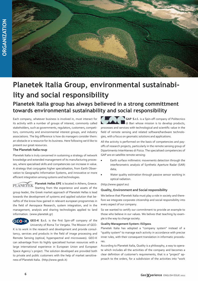
GAP S.r.l. is a Spin-off company of Politecnico
di Bari whose mission is to develop products,
processes and services with technological and scientific value in the
field of remote sensing and related software/hardware technolo-
gies, with a focus on geomatic solutions and applications.
All the activity is performed on the basis of competencies and pay-
offs of research projects, particularly in the remote sensing group of
Dipartimento InterAteneo di Fisica. The specialised competencies of
GAP are on satellite remote sensing:
• Earth surface millimetric movements detection through the
interferometric analysis of Synthetic Aperture Radar (SAR)
data;
• Water quality estimation through passive sensor working in
optical radiation.
(http://www.gapsrl.eu)
Quality, Environment and Social responsibility
We believe that Planetek Italia must play a role in society and there-
fore we integrate corporate citizenship and social responsibility into
every aspect of our company.
So we wanted to certify our commitment to provide an example to
those who believe in our values. We belives that teaching by exam-
ple is the way to change society.
Quality Management System: ISO9001
Planetek Italia has adopted a "company system" instead of a
"quality system" to manage each activity in accordance with precise
inner rules, with their consequent translation in informatic procedu-
res.
According to Planetek Italia, Quality is a philosophy, a way to opera-
te which includes all the activities of the company and becomes a
clear definition of customer's requirements, that is a "project" ap-
proach to the orders, for a subdivision of the activities into "work
Each company, whatever business is involved in, must interact for
its activity with a number of groups of interest, commonly called
stakeholders, such as governments, regulators, customers, competi-
tors, community and environmental interest groups, and industry
associations. The big difference is how do managers consider them:
an obstacle or a resource for its business. Here following we’d like to
present our great resources.
The Planetek Italia roup
Planetek Italia is truly concerned in sustaining a strategy of network
knowledge and extended management of its manufacturing proces-
ses, where specialised skills and competencies can increase in value.
A strategy that conjugates higher specialisation, from Earth Obser-
vation to Geographic Information Systems, and innovative or more
efficient integration among systems and technologies.
Planetek Hellas EPE is located in Athens, Greece.
Starting from the experience and assets of the
group leader, the Greek market approach of Planetek Hellas is lead
towards the development of systems and applied solution that be-
nefits of the know-how gained in relevant european programmes in
the field of Aerospace Research, system integration, and in the
management, analysis and sharing technologies applied to land
information. (www.planetek.gr)
GEO-K S.r.l. is the first Spin-off company of the
University of Roma Tor Vergata. The Mission of GEO-
K is to work in the research and development and provide consul-
tancy, services and products in the field of image processing and
Remote Sensing (optical, hyperspectral and microvawes). GEO-K
can advantage from its highly specialised human resources with a
large international experience in European Union and European
Space Agency`s project. The solution developed are provided both
to private and public customers with the help of market sensitive-
ness of Planetek Italia. (http://www.geok.it)
Planetek Italia Group, environmental sustainabi-
lity and social responsibility Planetek Italia group has always believed in a strong committment
towards environmental sustainability and social responsibility
6 GeoXperience ENGLISH ISSUE 2012
ORGANIZATION

Vincenzo Pompilio
Chief Quality Officer
Planetek Italia - www.planetek.it 7
packages" defining responsible, output, input, work times and
verifications. Such a methodological way of work allows the
planning of the activities, the respect of the times and specific of
the systems realized.
The organization of the company system in conformance with the
ISO normative, has led Planetek Italia to pass the check on January
14th 2000, and to receive the certification. Planetek Italia is certi-
fied in compliance with ISO 9001 standards (n. IT09/0272) with the
scope: "Design, realization and servicing of geographical information
system (G.I.S.), cartographical and Earth Observation data
processing (E.O.). Design and delivery of training services regarding
geographical information system and Earth Observation.".
Environment Management System: ISO14001 & EMAS III
Planetek Italia is truly concerned in considering environment as a
part of its production and business and operates in respect of Ita-
lian and European environment laws and directives. Planetek Italia
is certified in compliance with ISO 14001 standards (n. IT07/1605)
and Reg. CE 1221/2009 (EMAS III)(n.IT-001246).
www.planetek.it/environmental_policy_ENG
Social Responsibility System: SA8000
Planetek Italia has always naturally considered human rights fun-
damental. The road to SA8000 certification is just a written com-
mittment, stating what the company has always believed.
In this path we have stated our Social Responsibility Politicy that
we are pleased to share with our clients, partners, suppliers and
stakeholders in general. Planetek Italia is certified in compliance
with SA8000 standards (n. IT09/0213).
www.planetek.it/corporate_social_responsibility_ENG
Industrial relationships and involvement
Planetek Italia permanently maintains relationships with its industrial
stakeholders, promoting a stable collaboration, participating in initia-
tives and sharing its knowledge and expertise, to foster an overall
progress of the industrial system. Here following the groups and orga-
nizations wich Planetek Italia is involved in.
ASK THEM Feel free to contact the persons in charge of the company organization,
marketing and environmental & quality assurance.
Vincenzo Barbieri
Chief Marketing Officer
Open Geospatial Consortium (OGC)
OGC Associate Member
www.opengeospatial.org/ogc/members
European INSPIRE Directive
INSPIRE SDIC (Spatial Data Interest Communities).
http://inspire.jrc.ec.europa.eu/index.cfm/pageid/181
Founder of the Italian INSPIRE FORUM.
http://inspire-forum.jrc.ec.europa.eu
EARSC
Member of the European Association of Remote Sensing
Companies.
www.earsc.org
AIPAS
Founder member of the Italian Space SMEs Association.
www.aipas.it
AIT
Member of the Italian Remote Sensing Association.
www.aitonline.org
AMFM-GIS
Member of the Automated Mapping, Facilities
Management, Geographic Information Systems (GITA
association).
www.amfm.it
CONFINDUSTRIA BARI-BAT
Member of Confindustria, the main organisation repre-
senting Italian manufacturing and services companies.
www.confindustria.babt.it
Apulian Aerospace District
Member of the Apulian Aerospace large, medium & small
enterprises.
www.apulianaerospace.eu
Distretto Produttivo dell’Informatica
Member of the Apulian Information Technology District.
www.distrettoinformatica.it
Costellazione Apulia
Member of the Apulian consortium Costellazione Apulia.
www.costellazioneapulia.net

vices at European level, based on high-resolution multi-
temporal and orthorectified satellite data. This information
on land cover, will respond to a wide request for environmen-
tal information in different areas at the European level and, if
possible, even at national and regional level.
The 5 high-resolution layers will be extracted both from IR-
SP6/Resourcesat and RapidEye multispectral satellite data,
resampled to 20 meter resolution, and from medium-
resolution AWiFS satellite data, resampled to 60 meters, using
semi-automatic classification techniques.
The production of the 5 high resolution layers is organized in
two steps. The first step is performed by six international
teams which will produce the products and, subsequently, in
the second step, EEA member countries that have expressed
their interest in participating in some phases of the
production process will be involved. The member countries
will participate in the validation process and thematic detail
increasing of the products. The EEA will then make a statisti-
cal analysis to determine the accuracy of the results by using
an independent measure, which will use as a reference of
truth high-resolution data (eg. Aerial, LUCAS data, other sa-
tellite data, thematic maps, etc.).
One of the 5 layers is the Sealed Area map. The sealed areas
derive from the replacement of the original and natural soil
cover with an artificial covering, which generally determines
a high degree of irreversible sealing.
The first version of this level of information was produced in
2006 as part of the GMES Fast Track Service on Land Monito-
ring, then it was updated in 2009 with the Geoland-2 project
and is currently being updated as part of the GMES Land Moni-
toring Service, which entered in its Initial Operations (GIO).
The production of an updated high resolution Sealed Area
Map, also includes the updating of the soil sealing degree - on
Since 2006, in the framework of the programme GMES Fast
Track Service on Land Monitoring, the European Environment
Agency (EEA) has commissioned an international consortium
of companies the study and the production of Sealed Area
Map of the 32 EEA member countries, plus 6 Western Balkan
countries (Albania, Bosnia-Herzegovina, Croatia, Macedonia,
Montenegro and Serbia). The map was updated in 2009 and
now the GMES Land Monitoring Service has entered its Initial
Operations (GIO) in which it is planned to update the Sealed
Area Map to year 2012 (with the addition of Kosovo according
to the United Nations Security Council Resolution 1244/99) for
a total amount of about 6 million square kilometers of covera-
ge.
Strategic discussions between the Member States, the Europe-
an Parliament and the main EU institutions responsible for
environmental policies, reporting and evaluation (DG ENV,
EEA, ESTAT, JRC) have emphasized that the growing need for
a real and quantitative information about the state of the
environment, which is obtained through timely and quality
guaranteed data provision, in particular as regards the cove-
rage and the land use.
As established in the Regulation (EU) No. 911/2010 of the
European Parliament, from the Council of 22 September 2010
on GMES, the European Earth monitoring program - and its
Initial Operations (2011-2013) -, and from the Agreement si-
gned between the European Commission (EC) and the Europe-
an Environmental Agency (EEA), the technical coordination of
the implementation of a pan-European land monitoring servi-
ces of GMES Initial Operations is delegated to EEA.
For the implementation of these pan-European land monito-
ring services, has been planned the the CLC (Corine Land
Cover) update and the production of five high resolution in-
formation layers (HRLs, High Resolution Layers) for the refe-
rence year 2012 , in order to provide a series of low-cost ser-
8
SMART GOV LAND
Sealed areas according to GMES Urbanization is the main cause of soil sealing and land
consumption processes. Earth observation can help
monitoring these processes.
© R
eg
ion
e A
bru
zzo
GeoXperience ENGLISH ISSUE 2012
Anna Maria Deflorio
Senior Technical Specialist
a scale that goes 0 to 100% - and the estimation of the chan-
ge in this level - always on a scale from 0 to 100% -, through
an automatic processing based on the NDVI vegetation in-
dex.
The production began in 2006 and has been carried out on
the entire territory of the 32 member countries of the EEA
plus 6 Western Balkan countries (Albania, Bosnia-
Herzegovina, Croatia, Macedonia, Montenegro and Serbia).
With the upgrade to 2012 the territory of Kosovo (behind the
Resolution of the Security Council The United Nations 1244-
/99) has been added to the map, for a total of about 6 mil-
lion square kilometers of coverage. The entire upgrade pro-
cess is based on the experience gained in the production
carried out in 2006 and 2009 with a final target of at least
85% accuracy.
Planetek Italia has contributed to the creation of impervious
land cover in both 2006 and in 2009 and currently is involved
in the 2012 update.
The implementation of these activities has allowed us to
develop a depth of experience in the methods of mapping
the impervious areas that have been used to develop the
methods of processing of high-resolution satellite data also
at local scale. This information level is the base of the Index
of Soil Loss that is a hallmark of our geo-informative pro-
duct Preciso® Land (see description at page 22-23).
ASK THEM Need more information? Feel free to contact our GMES experts of the
European Institutions SBU.
Planetek Italia - www.planetek.it
9 9
Urban Atlas
® Regione
del Veneto
Daniela Iasillo
Senior Technical Manager
For each of the five main areas of application defined in the GMES
project was launched the Core projects. Planetek Italia and its group
companies, which have a long experience in projects of the GMES
program, are also involved with a leadership role in some Core
projects and in the implementation of some Donwstream services,
that aim to provide application solutions to local authorities .
Within the Core Services projects, Planetek Italia group is active in:
• Geoland 2: The project goal is to develop and demonstrate a
range of European reliable and cheap geo-information service
line, to support to the implementation of European Directives and
National policies. Planetek Italia team participates in the Urban
Atlas production through the development of a protocol for
updating the maps and testing activities of some European cities.
It is also involved in the research and testing of the artificial
areas layer and agricultural areas (grassland) layer, within the
working group dedicated to five high resolution layers.
• SAFER (Services and Applications for Emergency Response): This
project provides a service to respond to emergencies through
thematic products, specifically developed for civil protection and
the humanitarian community. Planetek Hellas is responsible for
the management of GeoRSS and visualization of special maps of
its external feeds.
• GMosaic (GMES services for Management of Operations, Situation
Awareness and Intelligence for regional Crises): The project
provides intelligence services to the EU and its Member States
before, during and after crisis situations. Planetek Italia worked
to maps for classification and change detection for the service of
"Planning for crises", as well as to the design and development of
an infrastructure component for managing the information of the
operators and secure access to geographic data.
• Marine: MARCOAST project (see page 12-13)
• Atmosphere: OZONE 3D project — Thematic maps of the Ozone
distribution. SSE Ozone 3D is a service designed to provide
thematic maps of the Ozone distribution at the different layers of
the atmosphere, through an inversion scheme based on neural
networks and available in the European Space Agency's (ESA)
Service Support Environment webportal.
http://www.planetek.it/eng/projects
PLANETEK ITALIA IN THE GMES

10
SMART GOV SAFETY
Urban Heat Islands and urban thermography
The thermal remote sensing technologies, integrated with
models of urban micro-metereology, allow to identify Urban
Heat Islands
© R
eg
ion
e A
bru
zzo
GeoXperience ENGLISH ISSUE 2012
funded by the European Space Agency (ESA) in the frame-
work of the DUE program, is enlightening.
For each of those 10 urban areas have been realised geoin-
formation products and services with the aim of:
monitoring the Urban Heat sland phenomenon at differend
scales and periodicity, using data from various satellites
starting from low resolution (few kilometers) up to airborne
sensors at very high resolution (from 30 up to 5 meters);
determining the risk of occurrence of Urban Heat Islands
during the spring/summer period;
near-real-time risk evaluation and forecasting of the occur-
rence of heat waves or Urban Heat Islands, together with
the impact of metereologic weather on the citizens health,
by means of specific indicators;
supporting the studies on the energetic balance and the
laws and policies concerning energy efficiency, by means of
thermographic maps.
In particuar in the UHI project have been implemented pro-
ducts and services which, made available during the sum-
mer period, can powerfully support the prevention of risks
for the population and the urban territory.
Starting from the air temperature products delivered in
near real time and as three-days forecasting over urban and
suburban araes – at 1km spatial resolution – other informa-
tion derive, with the same resolution and frequency: ther-
mal stress indexes, to determine the impact of the weather
conditions on the human health; Urban Heat Island maps,
for the identification of areas with a low or high heat emis-
sion within the urban zone; hazard and risk maps of heat
waves occurrence, for the definition of the urban araes at
high-medium-low risk, integrating also local socio-economic
information.
Increasing of sealed areas which greatly exceed the green
ones, exhausts from car’s engines, indutrial plants, air condi-
tioning systems: all those elements, interacting among them,
contribute to a larger heat storage into the urban areas.
The most disastrous consequences of such effect are the heat
waves that periodically strike our cities during summer, incre-
asing the risk level for the health and safety of citizens.
Earth Observation data together with climatological models
can give an important contribute for the study of the thermal
properties of the cities.
The integration of the thermal remote sensing observations
and ground-based measurement from meteo stations with
urban atmosphere models is indeed useful for supporting the
prevention and mitigation of the consequences of heat waves
and for studying the Urban Heat Island (UHI) phenomenon,
for which the temperature of the central urban locations are
several degrees higher than those of nearby rural or suburb
areas of similar elevation, particularly at night.
In general, the Urban Heat Island effect is due to the increa-
sing urbanization of the territory, resulting in the progressive
replacement of natural surfaces by builtsurfaces into and a-
round the city areas. In the cities the global warming of the
planet is more visible than in other areas due to the almost
complete lacking of green areas. A phenomenon that could
lead to health emergency and deep social degradation of cer-
tain urban areas.
However the Urban Heat Islands can be prevented, by means
of operative and informative,activities, involving and stimula-
ting users and decision makers. What have been realised in 10
European cities (Athens, Bari, Brussels, Budapest, Lisbon,
London, Madrid, Paris, Seville and Thessaloniki) within the
UHI - Urban Heat Island and Urban Thermography project

Giulio Ceriola
Senior Technical Specialist
ASK THEM Need more information? Feel free to contact our GMES experts of the
European Institutions SBU.
Planetek Italia - www.planetek.it
11
11
Land Surface Temperature — Athens
Example of daily land surface temperature, at 1km resolution, produced over
the Greater Athens area. This kind of maps allow to identify “hot spots” in
respect to surrounding araes, linked to their soil and urbanisation
characteristics (fig.1).
Very high Resolution Urban Thermography — Brussels
A thermographic map at very high resolution allows to measure the heat
emission from the roof of a building. The map into the example has been
realised during a winter night and allowed to highlight “hot” buildings, that is
which greater dissipate the heat from the inner warming systems through the
roof (fig.4).
Air Temperature — Paris
In the air temperature (at 2m height) map, the Urban Heat Island effect is
well visible: the temperature in the central areas of the city is 2-3°C higher
than the suburbs (fig.3).
Buildings Energy Efficience — Madrid
Another application (fig.2) for the termographic maps at very high resolution
of building is, during the summer, the measurement of its efficiency in
dissipating the heat accumulated during the day: in theory a building much
more warm at day than at night, means a lower efficiency in dissipating the
heat and so higher costs for the daily air conditioning of its internal spaces.
UHI project: examples of products. The city of Bari in the UHI project
Within the UHI project, the city of Bari – in particular the
local section of the Civil Protection within the Bari Municipa-
lity – is one of the users for which some products have been
realised (in particular maps of Land Surface Temperature,
Air Temperature, Urban Heat Island risk from hitorical data,
in near real time and as forecasting). The Municipality of
Bari actively contributed to the collection of the products
requirements and the possibility to integrate them into the
existing monitoring system.
The current heat wave risk management of the Italian Civil
Protection is based on some statistical studies relating the
recorded deaths or illnesses, linked to summer heat, to the
registered air temperatures at reference locations. For the
city of Bari such location is currently the meteo station of
the Italian Air Force placed to the nearby Bari Palese Air-
port, to which six meteo stations distributed among the city
territory are added. The output is a daily bullettin which
forecasts for the current and the enxt two days the poten-
tial occurrence and effects of heat waves.
The advantage of using the products from the UHI project,
stays into the capability of monitoring the air temperature
and the UHI effect continuously over all the city, with diffe-
rent frequency and resolution, so allowing to work on single
areas (e.g. disctricts or quarters). This contributes to the
forecasting of risks, but also to the mitigation of their ef-
fects, thanks to dedicated information campaigns for making
population more sensitive to the problem. Moreover those
resources are very useful for measuring the energetic effi-
ciency of the various city areas and for creating maps useful
for the urban planning and the energetic policy at municipal
level.
The complete description of the project is available at:
www.planetek.it/UHI_eng
Air Temperature Forecast of Bari.
Paolo Manunta
Head of EU Institutions SBU
Fig. 1 Land Surface Temperature of Greater Athens Area
Fig.3 Left image: Paris. 2-m air temperature h
22:00 UT in May-September 2003.
Fig. 2 Madrid. Day-night temperature difference index transformed in a building
energy efficiency classification.
Fig. 4 Right image: Brussels. Very
high Resolution Urban Thermogra-
phic map (only roofs/buildings).
Officially started on January 2010, MarCoast2 would like to
demonstrate that also the services of sea water quality rea-
ched the maturity and can be adopted at an operational le-
vel. The project is funded by the European Space Agency in
the framework of the GMES Marine and Coastal Information
Downstream Services (www.marcoast.eu).
Marcoast2 has the objective of reaching a more operative
involvement of national and regional environmental agencies
(in Italy ISPRA and ARPA of Emilia Romagna, Campania and
Puglia) to stimulate the adoption, also in this applicative
field, of operational services derived from satellite monito-
ring.
A consortium of european partners, belonging to the industy
and research worlds, make available to the institutions re-
sponsible for the environmental policies their experience into
the satellite data processing for the measurement of water
quality parameters, particularly for the coastal areas. Plane-
tek Italia is coordinator at European level of the Water Qua-
lity service and also provides maps of some indicators related
to waetr quality like the sea surface temperatura, th e tran-
sparency and the chlorophyll concentration on all the Italian
seas.
The oil leackage disaster offshore the Louisiana coast in 2010
recalls the attention on the policies of management and pro-
tection of the sea and the coasts. Unfortunately it seems ne-
cessary the occurrence of such events to awake the attention
over environmental protection topics.
The monitoring of sea is a topic naturally relevant for coun-
tries, like Italy, which have thousands of kilometers of coasts
that represent a resource to exploit, protect and preserve for
the future generations.
The sea and coasts monitoring is also a prioritary topic for the
European Community and a lot of research or pilot projects
are currently ongoing for testing new monitoring techniques
also based on satellite data.
The Marcoast (www.marcoast.eu) is among them. In the
three-year period 2006-2008 the project funded by the Euro-
pean Space Agency in the GMES framework, delivered a servi-
ce of Oil Spill and of Water Quality daily monitoring, providing
maps of e.g. sea surface temperature and chlorophyll over
the EU coastal waters.
The move from a sperimental phase to an operational one is
the critical point which determines the success, or in alterna-
tive, the failure of solutions based on innovative methodolo-
gies like Marcoast. Those service need to demonstrate on the
field to be reliable, applicable over large areas, economical
sustainable and can be efficiently integrated into the decisio-
nal processes of the Users. That is they have to really matter
into the operative decisions that the users need to take du-
ring their institutional duties.
The succes of the Marcoast project has been significative,
since the monitoring activities of Oil Spill from satellite have
been considered of interest from EMSA (European Maritime
Security Agency), which adopted those methodologies for
their duties, starting a daily monitoring service using satellite
data, now completely integrated into their operative wor-
kflow.
12
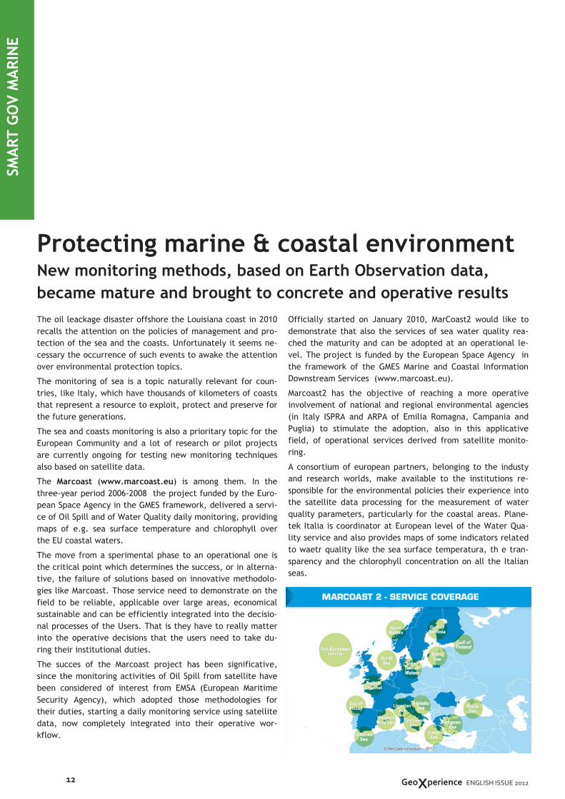
SMART GOV MARINE
Protecting marine & coastal environment New monitoring methods, based on Earth Observation data,
became mature and brought to concrete and operative results
© R
eg
ion
e A
bru
zzo
GeoXperience ENGLISH ISSUE 2012

Giulio Ceriola
Senior Technical Specialist
The project has a duration of 3 years and another objective is
to reach the continuity and improvement of the operative ser-
vices with the aim of making them nearer to the user needs.
All this for making further grow the awareness within the Envi-
ronmental Agencies that this new way of monitoring is no more
sperimental, but is able to give concrete and operative results
that could be immediately used.
The results of Marcoast project 2006/2008
During the three years of the Marcoast project, Planetek Italia
delivered to the instiutional user ISPRA and, for 2008, to ARPA
Emilia Romagna and ARPA Campania, various monitoring servi-
ces with daily provision of chlorophyll and sea surface tempe-
rature maps for the Adriatic, Tyrrhenian and Ligurian seas.
The services’ products have been valiadted by means of a com-
parative analysis over the Adriatic sea using in situ data from
SiDiMar and from ARPA E.R. campaigns. The comparison resul-
ted in a good correlation between the satellite derived measu-
rements and the ones done at sea with traditional sampling
techniques.
Further validation analysis have been done, confirming that
the chlorophyll concentration measured using satellite data
follows the seasonal trends. In particular, the classification of
water done using the Percentile 90 was in good agreement
with the studies conducted by ARPA E.R. at the Cesenatico and
Cattolica sites (ARPA E.R., 2007).
The results of Marcoast2 project 2010/2012
In Marcoast2 the Planetek services extended to all Italian seas
and to two moer users ARPA Puglia and Italian Coast Guard.
The products have been improved to obtain improved product
near the coast. Promising results have been obtained in some
test areas in Campania and Emilia Romagna using in situ mea-
surements from ARPA. Moreover calibration procedures to im-
prove the produtcs over specific areas have been realised, in
collaboration with the research project AquaMar (the test area
was the Puglia coast).
Another aimed goal of the project is to define a roadmap to
reach the economical and technological sustainability of the
services, creating an european network for the water quality
monitoring under the MarCoast flag, with the aim to support
the National Authorities to abide the european and national
directives over the water quality, integrating the traditional
measurements at sea with the satellite products.
To know more: www.planetek.it/eng/projects/marcoast
ASK THEM
Daniela Iasillo
Senior Technical Manager
Need more information? Feel free to contact our GMES experts of the
European Institutions SBU.
Planetek Italia - www.planetek.it
13
13
MarCoast2
MarCoast2 (Marine & Coastal Environmental Information Services) is
a three-years project (2010 – 2012) funded by the European Space
Agency (ESA) under the GMES Service Element framework. MarCoast
delivers, regularyl,a large portfolio of products for supporting the
monitoring of the European seas in terms of water quality and algae
bloom, for institutional users directly involved into the project. The
waetr quality monitoring services in MarCoast are currently
delivered by 14 service providers to 45 users from 16 different
European countries. The services cover all the major European sea
areas and provide a near real time surveillance for the water
quality. Moreover all the products follow a rigorous protocol to
verify and validate their quality, including the comparison with
measurement at sea.
AquaMar
The AquaMar (Marine Water Quality Information Services) project
is research and developing downstream services turning Marine Core
Service products into advanced Water Quality services, demanded by
end user. One of the main objectives of the project is to improve
existing products and develop new products for supporting user
duties of control and reporting at European level.
AquaMar proposes service for obtaining:
• Indicators for the reporting requirement of the Water
Framework Directive and the European Marine Strategy
• Detection of harmful algal blooms
• Support to large scale marine infrastructures
• Services supporting the Bathing Water directive monitoring
• Aquaculture precision farming
MarCoast & AquaMar official website is www.marcoast.eu
SIMS - Posidonia Maps
The SIMS project (2009-2011), funded by ESA, had the objective of
defining and implementing methodologies for the mapping and
monitoring of phanerogam marine plants and in particular Posidonia
Oceanica (P.O.), in coastal areas using Earth Observation data.
The implemented products aim in supporting operatively both the
public institutions and the private firms in their institutional duties
of managing and monitoring the vegetal marine ecosystems, in
particular those with P.O. which, both at the national at the whole
Mediterranean basin level, is amongst the most important species.
The demonstration maps realised on two study areas (S. Marinella in
the Tyrrhenian sea and Monterosso in the Ligurian Sea) varies from
the posidonia distribution, to various indexes (LAI, density, Giraud),
up to the phaenological characterisation of the plants with the
integration of in situ measurements.
MARCOAST, Aquamar & Posidonia Maps
P.O. distribution over Monterosso a Mare, Italy, obtai-
ned from the processing of an IKONOS satellite image

of the territory, aimed at the characterization of risks: hydro-
geological, seismic, volcano, or forest fires.
The combination of the activities of civil protection and land
monitoring, however, it is often complex and ineffective, as
the first work on tight deadlines and need to find information
quickly and reliably, the latter are often based on networks of
instruments characterized by complex data streams collec-
tions, inadequate to the "real time". For example the risk
with instability of the slopes. The traditional methods for
monitoring landslides consist to the extent of property or
morphological, lithological, pedological, hydrological, topo-
graphical surface and subsoil, and for the monitoring of defor-
mations due to instabilities are used clinometers, or more
recently, GPS devices, which generally provide navigation
data in telemetry, devices using GSM or radio.
The major limitations of these technologies based on ground-
based instruments are related to the spatial distribution of
these - and therefore to their measure collections - generally
limited, as well as a lack of precision of the measurements of
the vertical movement, of great importance for the monito-
ring of landslide kinematics slow. Another big problem is then
just the criteria of placement of the devices, usually of
known instability, which leads to the exclusion from monito-
ring other potentially dangerous areas. Earth Observation (EO)
technologies can support more effectively and quickly to the
emergencies and risk monitoring needs.
Are undoubted therefore the enormous potential that charac-
terize an analysis of the area based on satellite remote sen-
sing: speed of data retrieval, width of the zone explored, high
geometric accuracy, fast data processing. In this context a
promising technology with potential applications for EO moni-
toring of landslides is the differential interferometry
(DInSAR), applied to SAR images taken from satellite or terre-
strial platforms. The main advantage of the technology DIn-
In Italy, civil protection activities are based on a complex
organization that involves many actors, from public (state,
regions, provinces and municipalities) that have the task of
coordinating the emergency relief phase, technical structures
and national research (ISPRA, INGV, CNR, ENEA) law enforce-
ment (Police, Police, Army), the Fire brigade, to the great
world of volunteering, working at various levels and with dif-
ferent skills dirtying his hands directly, unfortunately, in mud
and rubble.
In short, our little country, as geologically young and active,
it is often plagued by natural disasters that put a strain on
people, often marking them so painfully. The L'Aquila ear-
thquake, landslides in Giampilieri and the latest tragedy of
Ischia are just the most recent.
And when there are victims and damage are incalculable, the
people inevitably look for a guilty party, for late rescue, for
houses built in a black spot or without a suitable design crite-
ria. As always, the responsibilities are not all on one side, on
the contrary, citizens themselves are part of the system of
civil protection, that they would charge as much as possible
and aware of the risks they face.
And it is the awareness of reality, the real weak point of a
system of civil protection. How well do you know the area?
Which method do we use to quantify the risks? To answer the-
se questions means to go beyond the logic of emergency, that
is to act always and only to the disaster, when you are in the
water and mud to your neck, with the debris that falls on the
head.
All this is possible only by setting up effective and efficient
monitoring systems of the territory, the very heart of decision
support systems (DSS). In Italy the National System of Civil
Protection looks at Functional Centres – both National depar-
tment and decentralized regional departments - the structu-
res in charge of the technical-scientific study and monitoring
14
SMART GOV SAFETY
Towards landslides forecasting The traditional monitoring methodologies based on ground-
based instruments can’t be the right support for Civil
Protection emergency response: Radar data is the answer
© R
eg
ion
e A
bru
zzo
GeoXperience ENGLISH ISSUE 2012

SAR - not yet fully explored - consists of a geographic display
(spatially distributed) of the deformations, at the expense
of a considerably reduced temporal resolution (on the order
of a few or several months). In this sense, the technology
DInSAR is complementary to GPS technology.
MORFEO
In this context, the three-
year pilot project MORFEO,
commissioned by the Italian
Space Agency (ASI), creates
a system to support deci-
sions on civil protection
landslide risk. The objecti-
ve of the project is to provide the user tools for the identifi-
cation and mapping of landslides, landslide monitoring, eva-
luation of susceptibility, hazard and landslide risk, foreca-
sting, and the foreshadowing of landslides and assessment of
damage from landslides.
Planetek Italia is a partner with the Polytechnic of Bari sub-
system EO SAR of the project, which uses jointly technolo-
gies GPS, remote sensing optical images and SAR (Synthetic
Aperture Radar), through interferometric techniques. The
prediction of landslide is carried out using series of acquisi-
tions, necessary for the processing interferometry, using
data acquired from space missions ERS 2 and ENVISAT C-
band sensor, and is scheduled for the later stages of the
project the use of data from missions COSMO-SkyMed (X-
band), SAOCOM (L-band) and PALSAR (L-band).
The maps of deformation of the soil are composed of a set
of points on the ground defined Persistent Scatterers (PS).
The analysis of the movements of PS, detectable with milli-
meter precision, can successfully prevent the occurrence of
landslides or mudslides.
For further information visit http://www.morfeoproject.it
ASK THEM Need more information? Feel free to contact our experts of the European
Institutions SBU.
Planetek Italia - www.planetek.it
15
15
MORFEO (Landslide Monitoring and Risk with Earth Observation
data) is a pilot project funded by the Italian Space Agency (ASI) with
the aim of “developing a product application supporting the Italian
Civil Protection in decisions about the landslide risk, integrating the
traditional methods with Earth Observation technologies and data.
The institutional reference of the project is the network of centers
and functional competence of the Italian Department of Civil
Protection.
The main objectives of MORFEO are:
• Develop a prototype system to support decisions of Civil
Protection against landslides
• Integrate information, Earth observation data and
technologies with traditional ones collected on the ground,
to improve the current capabilities in mapping, monitoring
and predicting landslides.
• Exploring the use of innovative Earth observation data, such
as those provided by the COSMO-SkyMed constellation.
As a follow up to what is fixed in the cooperation agreements
between ASI and the Department, MORFEO provides the National
Civil Protection with a system able to provide products and services
to support the forecasting and monitoring for the management of an
emergency.
SLAM — Service for Landslides Monitoring
The SLAM project was funded by the European Space Agency (ESA)
w i t h i n t h e f r amewo rk o f t h e DUP p r o g r am
(Data User Programme). The goal was to generate three products
oriented to landslide monitoring and mapping: Landslide Motion
Survey, Landslide Displacement monitoring, Landslide Suceptibility
mapping. The products has been designed for the hydrogeological
risk management.
The SLAM products has been derived from integration of data
acquired by traditional methodologies and by Earth Observation into
a GIS environment.
The realization of SLAM project has been carried out by an
international Consortium led by Planetek Italia and by other five
partners: Tele-Rilevamento Europa, Gamma Remote Sensing,
Spacebel, Geotest and the University of Florence.
MASSIVE - Mapping Seismic Vulnerability and Risk of Cities
The main focus of the European Project MASSIVE is to provide Civil
Protection with assessments of seismic hazard, seismic vulnerability
and risk for buildings at local scale, as well as to estimate the traffic
load due to uncontrolled city evacuation. The project, started in
January 2010, allows running site specific earthquake scenarios and
helps the local authorities, as well as organisations involved in Civil
Protection and Emergency Response, to assess the likelihood for
potential damage occurrence in the affected areas.
Two European pilot sites, heavily struck by earthquakes in the past,
namely the North-Western part of Attica (Greece, earthquake of
September 1999), and L’Aquila (Italy, earthquake of April 2009) have
been selected for this purpose. The Project is financed by ECHO, the
European Commission Humanitarian Aid and Civil Protection
Directorate-General.
The project is coordinated by NOA/ISARS and involves as a partner
Planetek Italia, Institute of Geodynamics/NOA, National Technical
University of Athens, GEOAPIKONISIS S.A. and Institute of
Engineering Seismology and Earthquake Engineering.
PROJECTS: MORFEO, SLAM & MASSIVE
Paolo Manunta
Head of EU Institutions SBU
Anna Maria Deflorio
Senior Technical Specialist

flow and User Interface design.
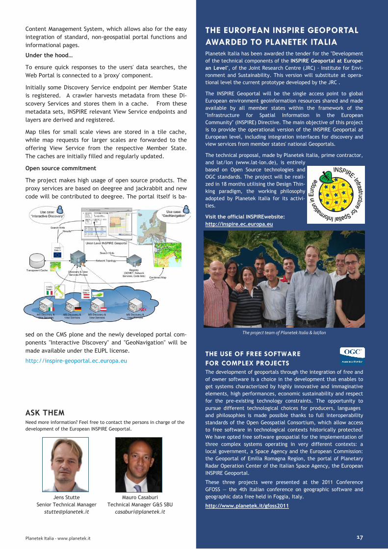
From a survey of existing geoportals and other search websi-
tes emerged a high need for integration of all search functio-
nalities in one single web-page, in order to avoid frustrating
forth and back. This integration allows for a high interaction
between page elements such as search parameters, result list
and result preview in a geoviewer, leading to an "Interactive
Discovery" client.
Another key aspect of this Interactive Discovery is also to
provide the user during his search with the right suggestions
extracted from the thesaurus, other key code lists and the
metadata itself, offering hints to the user, how much results
he can expect from a given search parameter value. This im-
poses also high requirements on the responsiveness of the
underlying Discovery Services, the metadata of which for this
reason are locally cached by the system.
The user can then select spatial datasets directly from the
result list into his working session context, in order to further
explore them within the "GeoNavigation" viewer. This viewer
allows the user to combine and over-lay different layers with
transparency and define their order, providing all basic fun-
ctionality to arrange differ-ent layers to a customized map.
These maps can be shared with other users within the portal
or extracted into standard Web Map Context files with poin-
ters to the original Member State's services.
The Geoportal's architecture is modular and ready to be e-
xtended by additional functionality, like download services
and other INSPIRE network services access. It is based on a
The INSPIRE Directive of 2007 aims at establishing an
“Infrastructure for Spatial Information in the European
Community”. It builds upon existing infrastructures in the
European Member States in order to provide ac-cess to elec-
tronically available spatial data sets held by or on behalf of
Public Authorities to assist policy-making in relation to poli-
cies and activities that may have a direct or indirect impact
on the environment. In order to make these spatial data sets
discoverable and accessible, the Directive requires the Mem-
ber States to set up INSPIRE discovery, view, download, tran-
sformation and invoke network services.
As a central European point of access to these INSPIRE
network services, the European Commission will set up an
INSPIRE geoportal. This geoportal will allow cross-border,
multi-lingual and harmonized access to the Member States’
INSPIRE network services. The technical specifications for this
INSPIRE geoportal are based on past research and prototyping
experience gained by the Spatial Data Infrastructure unit of
the Eu-ropean Commission’s Joint Research Centre. They
form the basis for the current development, carried out by a
consortium consisting of Planetek Italia and lat/lon.
Developments started in March 2011 and are expected to take
eighteen months after which the INSPIRE geoportal will be
installed in the hosting environment of DIGIT (EC’s Directora-
te General for Information Technology) and operated by DG-
ESTAT (Directorate General Eurostat).
The Geoportal “Interactive Discovery”
The usability of the Geoportal is one main focus of the deve-
lopment, in particular for the “Interactive Discov-ery”, which
will allow the user to search through all INSPIRE spatial data-
sets in an easy yet powerful way. The detailed requirements
set by the tender are mostly functional; the challenge is to
put together the single functions into an intuitive information
The European INSPIRE Geoportal The European Union Geoportal will allow cross-border,
multi-lingual and harmonized access to the Member States’
territorial data
16 GeoXperience - novembre 2011
INTEROPERABILITY & SDI
Mauro Casaburi
Technical Manager G&S SBU
Planetek Italia - www.planetek.it 17
Content Management System, which allows also for the easy
integration of standard, non-geospatial portal functions and
informational pages.
Under the hood…
To ensure quick responses to the users' data searches, the
Web Portal is connected to a 'proxy' component.
Initially some Discovery Service endpoint per Member State
is registered. A crawler harvests metadata from these Di-
scovery Services and stores them in a cache. From these
metadata sets, INSPIRE relevant View Service endpoints and
layers are derived and registered.
Map tiles for small scale views are stored in a tile cache,
while map requests for larger scales are forwarded to the
offering View Service from the respective Member State.
The caches are initially filled and regularly updated.
Open source commitment
The project makes high usage of open source products. The
proxy services are based on deegree and jackrabbit and new
code will be contributed to deegree. The portal itself is ba-
sed on the CMS plone and the newly developed portal com-
ponents "Interactive Discovery" and "GeoNavigation" will be
made available under the EUPL license.
http://inspire-geoportal.ec.europa.eu
THE EUROPEAN INSPIRE GEOPORTAL
AWARDED TO PLANETEK ITALIA Planetek Italia has been awarded the tender for the "Development
of the technical components of the INSPIRE Geoportal at Europe-
an Level", of the Joint Research Centre (JRC) - Institute for Envi-
ronment and Sustainability. This version will substitute at opera-
tional level the current prototype developed by the JRC .
The INSPIRE Geoportal will be the single access point to global
European environment geoinformation resources shared and made
available by all member states within the framework of the
"Infrastructure for Spatial Information in the European
Community" (INSPIRE) Directive. The main objective of this project
is to provide the operational version of the INSPIRE Geoportal at
European level, including integration interfaces for discovery and
view services from member states' national Geoportals.
The technical proposal, made by Planetek Italia, prime contractor,
and lat/lon (www.lat-lon.de), is entirely
based on Open Source technologies and
OGC standards. The project will be reali-
zed in 18 months utilising the Design Thin-
king paradigm, the working philosophy
adopted by Planetek Italia for its activi-
ties.
Visit the official INSPIREwebsite:
http://inspire.ec.europa.eu
The project team of Planetek Italia & lat/lon
THE USE OF FREE SOFTWARE
FOR COMPLEX PROJECTS The development of geoportals through the integration of free and
of owner software is a choice in the development that enables to
get systems characterized by highly innovative and immaginative
elements, high performances, economic sustainability and respect
for the pre-existing technology constraints. The opportunity to
pursue different technological choices for producers, languages
and philosophies is made possible thanks to full interoperability
standards of the Open Geospatial Consortium, which allow access
to free software in technological contexts historically protected.
We have opted free software geospatial for the implementation of
three complex systems operating in very different contexts: a
local government, a Space Agency and the European Commission:
the Geoportal of Emilia Romagna Region, the portal of Planetary
Radar Operation Center of the Italian Space Agency, the European
INSPIRE Geoportal.
These three projects were presented at the 2011 Conference
GFOSS — the 4th Italian conference on geographic software and
geographic data free held in Foggia, Italy.
http://www.planetek.it/gfoss2011
ASK THEM
Jens Stutte
Senior Technical Manager
Need more information? Feel free to contact the persons in charge of the
development of the European INSPIRE Geoportal.

Design Thinking in Morocco
SMART GOV AGRICULTURE
18
Developing the Spatial Data Infrastructure of the Ministère
de l'Agriculture et de la Pêche Maritime - Royame du Maroc
GeoXperience ENGLISH ISSUE 2012
The GIS application developed is both an intranet and extra-
net application that allows various users both of the DSS of
the Moroccan Ministry for the Agriculture, and the Direction
of Monitoring & Evaluation of the Moroccan Agency of
Partnership for Progress (APP), to quick and easy access to
data and statistical information available on the servers of
the Ministry or the APP.
The solution implemented is a Spatial Data Infrastructure ba-
sed on the Web that guarantees the deployment and use of
GIS tools and data throughout the Department and the APP,
the integration with other information systems, using stan-
dard software interfaces and methods , the centralized ho-
sting of critical GIS functions that are this way accessible to
many users inside the organization, the distributed GIS
processing capabilities (such as analyzing and managing distri-
buted GIS data) and the delivery via Internet of comprehensi-
ve GIS functionalities.
To accommodate the cooperative process involving multiple
parties, public and private, with very diverse skills and kno-
wledge, Planetek Italia has promoted the adoption of the
Design Thinking methodology in all the phases of the project.
Design Thinking is a process that seeks to include in decision-
making, since the beginning of the development of a project,
the user.
This approach then tries to combine, in an iterative process,
Technological Capabilities, User Requirements and the Sustai-
nability of Service. Main goal is to overcome a logic of
planning based on a single flow (starting from user require-
ments, transform them into specific, being followed by the
development and ending with the acceptance) to focus inste-
ad on an iterative process of definition, exploration, descrip-
tion and evolution.
Sharing the Design Thinking philosophy inside the working
group is a winning choice, because it leads to naturally look
at the entire system from the perspective of those who will
The Government of the Kingdom of Morocco and the Gover-
nment of the United States of America, acting through the
Millennium Challenge Corporation (MCC), signed in 2007 a
Compact Millennium Challenge Account in order to contribute
to the poverty reduction through the economic growth in Mo-
rocco.
In this context the Directorate of Strategy and Statistics (DSS)
of the Moroccan Ministry for the Agriculture called for the
realization of a Geographic Information System based on the
Web.
Planetek Italia has then been awarded this important project
whose aim is to facilitate the access to the information rela-
ted to the Millenium Challenge Account projects regarding
fruit trees production, small scale fisheries, functional lite-
racy and vocational training, and business support.
The aim of this project is also the integration of the existing
geographical information systems, in order to improve the
capitalization and the coherence of all existing information,
to improve the performance monitoring of MCA-Morocco pro-
jects and, last but not least, to improve the quality and orga-
nization of information sharing, the technical data analysis,
the mapping and the spatial data analysis.

Planetek Italia - www.planetek.it
Environment and Forest Monitoring
services in Europe
Planetek Italia has a long experience in European and Inter-
national projects in the field of environment, agriculture
and forests monitoring and mapping.
The company already involved in GMES Initial Operations
(GIO) Land Monitoring Services, in the year 2012 has been
awarded the tender for the production of the “high-
resolution map of Forest and Impervious Area characteri-
stics in southern Europe, 'partim' west and central Medi-
terranean region” for the European Environment Agency
(EEA).
Previous R&D projects in this field in which Planetek Italia
partecipated are Kyoto-INV and GMES Service Elements
Forest Monitoring.
GSE Forest Monitoring is an European Space Agency (ESA)
funded project whose scope is to consolidate services un-
der the EU priority theme "Land Cover Change in Europe”.
GSE Forest Monitoring supplies accurate, timely and readily
available information on the state of forest systems in or-
der to support more informed decisions and improved poli-
cies that enable sustainable forest management and rela-
ted activities.
As in Kyoto-Inv project, Planetek Italia has provided maps
for the Spanish Ministerio de Medio Ambiente (MMA), Direc-
ciòn General para la
Biodiversidad (DGB), by
covering the areas of
Lleida ,Girona Barcel-
lona,Tarragona, Bada-
joz and Caceres (about
21.800 Km2).
The products, obtained
by processing Landsat 5
and Landsat 7 data (spatial resolution 30 m), are:
• Land Use Map
• Forest Map
• Land Use Change Map
For further information:
http://www.gmes-forest.info
19
ASK THEM Feel free to contact our experts of the Government & Security SBU inchar-
ge of National and International customers relations.
Alfredo Abrescia
Associate Head of G&S SBU
Massimo Zotti
Head of G&S SBU
use it, rather than through the distorting lenses of techno-
logy.
The Geoportal of Agriculture & phishing Ministry of Maroc
The objective of the project, founded by the MCA cooperation
program, is the reengineering and rethinking of the current
structure of the wide collection of datasets owned by the Ma-
roc Ministry of Agriculture & Phishing (MAPM) and its technical
partners (DSS, APP, and others), and further to design also a
new publishing and storage architecture, with a more centrali-
zed and optimized solution.
The project, organized in 3 iterative steps, with two proto-
types, within 12 months, has planned activities of requirement
analysis, design of a new geospatial platform and a new geo-
spatial data-model, furthermore development of a simple-use
and open web geoportal that will allow internal and external
(public) users to easily access agricultural and fishing metadata
of the Maroc territory. The collection of Rasters, Vectors and
documental files already owned by the Ministry and its par-
tners, has been then reorganized, in order to be easily integra-
ted in the new web
architecture. At data
level the main need has
been to analyze and re-
design a new integrated
centralized and optimi-
zed geodatabase, ha-
ving coherent informa-
tion stored.
The Web platform is
deployed in a simple architecture with two servers. An applica-
tion server hosts the Geoportal, based on an open source pla-
tform, and the GIS Server. The data server hosts the DBMS,
based on both COTS and open source tools. The database
manager hosts both datasets and metadata sets. Metadata are
stored in ISO 19115, and ISO 19115-2 format.
The geoportal administrator is enabled to manage contents and
user permissions at geoportal level. Furthermore users, at base
level, are able to access functionalities as metadata discovery,
maps navigation with pan/zoom, advanced printing, and geo-
graphic queries. After the logging in, at more deep level, de-
pending on the authorizations, the internal user is able to do-
wnload maps on his web client, temporary or permanently u-
pload maps, create new maps merging them with other maps,
editing via web the feature classes of the map.

Towards Geographic Linked Open Data A reusable solution to publish cartographic data and their metadata in open data portals in the form of LOD (Linked
Open Data) The Emilia-Romagna Region case
The first components of the solution have been generated in a
project for the evolutionary development of the spatial infra-
structure of the Emilia-Romagna Region, Italy. This regional
SDI is based upon a metadata catalogue and a repository
manager that organizes the access to geographical data, and
it has been completed by applications and services oriented
at different levels of government, that are now accessible
through a single interface, the regional GeoPortal
(“GeoPortale ER”, http://geoportale.regione.emilia-
romagna.it)
Developed by Planetek Italia, GeoPortale ER provides access
to regional data and metadata through several services that
allow users to discover data in the catalogue, using both gra-
phical and alphanumeric criteria, and to browse, use and do-
wnload the data of interest. Thus, GeoPortale ER enables the
dissemination, use and publishing of data, information and
geographical services both to the public and the staff of lo-
cal /national Public Administrations, in accordance with the
latest regional and national directives (DigitPA, Intesa GIS)
and international standards (INSPIRE, OGC) related to intero-
perability.
In this framework, the Emilia-Romagna regional administra-
tion has decided to provide access to Data and Metadata han-
dled by its SDI as Open Data, with particular attention to the
RDF / XML, and therefore in the form of Linked Open Data.
With reference to cartographic information, it has been deci-
ded to publish only some classes of spatial objects as Linked
Open Data, notably those that identify the main spatial refe-
rence objects such as buildings, street address, City and Ad-
ministrative limits, and road Toponyms.
Preparatory to the actual publication of data RDF / XML is of
course the definition of the regional ontologies, which descri-
be the significance of the data to be published. During the
ontology definition phase, it is recommended identifying the
An increasing number of public and private bodies makes their
geographic data available as open data with licenses that
allow their free use and exploitation.
Open data is the natural evolution of the free sharing of data-
bases: data and its metadata are provided in a standard
format and organized in a standard data structure, according
to rules defined at international level. These characteristics
make them directly usable by software applications without
any human intervention: they can, for example, be used by
smartphone Apps, be indexed on open data search engines
and integrated with open data portals.
In cooperation with SINERGIS Srl, an Italian company working
in the field of geographic information, we have combined our
expertise to realize a useful solution to publish geographical
Open Data in the form of Linked Open Data.
We have designed a software application that allows to tran-
sform data and web mapping services into open data com-
pliant to the "five star" classification given by Tim Berners-Lee
– i.e. a standard format and structure that can be directly
used by computer applications without manual intervention.
By making geographic information available in the form of
open data, with particular attention to the RDF / XML format,
we ensure the use of data as Linked Open Data, and then
their reuse, the indexing on open data search engines, the
integration with open data portals or with the Comprehensive
Knowledge Archive Network (CKAN), the cataloguing of the
free dataset and projects.
We aimed at creating an OPEN and reusable solution, which
can be integrated into any cartographic Geoportal or SDI
(Spatial Data Infrastructure) based on the interoperability
standards defined by the Open Geospatial Consortium
(OGC®). The geographic open data can be exploited both in
RDF and in other interchange formats (for example in Shape
File format).
20
INTEROPERABILITY & SDI
GeoXperience ENGLISH ISSUE 2012
On 25 April, the Open Geospatial Consortium (OGC, the no-
profit international organization that is in charge of defining
the technical specifications for the interoperability of geo-
spatial services) released the Market Report “Open Stan-
dards and INSPIRE”.
This report tries to provide a global view
of the role played by OGC within INSPIRE
and of how this important European Di-
rective is implemented by the various
Member States, trying to provide a syste-
mic view of the extensive documentation
available.
We have decided to help drawing up this report because we
believe that, in order to make INSPIRE really “land”, it is
also necessary to explain the relationships existing between
the legal obligations derived from the Implementing Rules
and the technical indications and references to standards
that are provided by the Technical Guidance, which do not
have a legal value.
This initiative is part of a larger project on information and
dissemination of geomatics knowledge in Italy, which led to
the creation of the Italian INSPIRE Interest Group.
What is INSPIRE, how is it connected to the European initiati-
ves for data sharing, what is the value of standards in the
implementation of INSPIRE, which standards are necessary,
what is the contribution of OGC: these are some of the que-
stions that we try to answer in the Report, also by means of
the description of the implementation strategies adopted by
other Member States in order to establish the national SDI.
possible links to the already existing LOD datasets and be-
longing to the so-called LOD Cloud, in order to convert the
regional dataset into an additional node of the LOD cloud
itself. Similarly, in the case of metadata, an ontology must
be defined to describe the meaning of the ISO 19115 meta-
data. These can be downloaded from the Regional Geopor-
tal in XML format according to the pattern established by
the ISO 19139 standard. This pattern can be mapped in an
OWL ontology, and each metadata file can be translated
into an RDF / XML based on this ontology.
While the publication of metadata in Linked Open Data
format makes sense regardless of the particular data to
which it refers, being noted and encoded the semantics of
the metadata itself, this cannot be said for cartographic
data. The publication of data in the form of linkable open
data assumes significance when these data are linked to
existing and already published data, and in turn they can
potentially be related by others. This is generally true for
any kind of data, but particularly for the geographic ones
because, by their nature, they are the basis for the informa-
tion correlation.
The data and me-
tadata extraction
services are based
on the use of the
standards defined
by the OGC® for
Geographic web-
services. The data
suitable for publi-
cation in the form of Linked Open Data are extracted in RDF
format by leveraging the Web Feature Services (WFS) provi-
ded by Emilia Romagna SDI. On the other hand, the extrac-
tion of geographic metadata in RDF format is carried out
using the standard OGC Catalogue Service for the Web
(CSW). The metadata can therefore be associated to the RDF
(Linked Open Data) and the shapefiles of the data.
The dynamic generation of RDF starting from web service
exposed by the regional Geoportal ensures the continuous
alignment of data with the regional Open Data Portal da-
ti.emilia romagna.it, which operates as the repository / in-
dexer of data and metadata (including RDF).
Finally, the solution is entirely based on free open source
software to ensure the reusability of the system.
Planetek Italia - www.planetek.it 21
THE OPEN GEOSPATIAL CONSORTIUM’s
MARKET REPORT ON INSPIRE RULES
ASK THEM
Alfredo Abrescia
Associate Head of G&S SBU
Massimo Zotti
Head of G&S SBU
Feel free to contact our Government & Security SBU experts for any infor-
mation about Geospatial Data Sharing on the Web.
Read the article and download a free copy of
the Market Report on blog.planetek.it

PRODUCTS AND SOLUTIONS
Geospatial products Planetek Italia distribute and support some of the most
known product used in land management applications.
22
Geospatial data, indexes and social geoportal for Urban
Planning and S.E.A. monitoring
Urban planning, environmental monitoring, controls and asses-
sment of agricultural and forestry production, map update, pre-
and post-emergency management for civil protection, defense
and security are the application areas that usually benefit of
satellite data.
The Preciso® family consists of geo-information products, deri-
ved from satellite data, designed to provide cognitive frame-
works that meet the specific needs of each application field.
The products can be combined to meet the most complex and
diverse application and operational requirements. This feature
makes them a flexible and modular solution.
Preciso® family consists of different products which fulfill spe-cific needs:
• Preciso® italia and Preciso® land: provide updated remo-te sensing images, land use geodatabase, individual buil-dings and transport networks, and are designed to support the intial stage of the planning process.
• Preciso® index: provides environmental indicators suppor-ting development plans decisions and SEA drafting.
• Preciso® coast: information chart of marine-coastal areas and of defense works.
• Preciso® urban: urban areas & unauthorized buildings monitoring
• Preciso® fast: fast collection of satellite images for emer-gency response
• Preciso® on-line: geo-informatic portal (social style) ba-sed on web technologies 2.0 to allow the exchange of in-formation between all the stakeholders involved (citizens, private and public institutions).
All products are characterized by speed of production, high
update frequency and low costs. Ideal for the analysis of the
territory and the activation of the monitoring processes.
Preciso® products come from a long and intensive research con-ducted in the framework of national and international projects and have been tested in multiple operational projects. All pro-
ducts are "Ready to use" and ready for use, do not require speci-fic skills and can be used with common GIS software.
Different local authorities in Italy have already adopted these solutions such as the Municipalities of Ascoli Piceno (Marche), Follonica (Tuscany), Apricena and Conversano (Apulia).
Brochures and the case histories on www.planetek.it/preciso
Satellite Data and DEM
GeoEye-1 or WorldView-2, the constellation Pleiades or COSMO-
SkyMed, more and more, today, the Earth observation satelli-
tes, that provide multispectral imagery with a ground resolution
of up to 50cm, can support your business efficiently and rapidly.
This unprecedented availability of information sources with a
higher revisit time, enables more punctual monitoring activities
very helpful to follow the frequent changes in urban areas, with
acquisition intervals that can be reduced up to a few days.
Thanks to their high flexibility, these new sensors can collect
images of large areas, even more than 1.000 km2 in a single
passage. This means that the entire administrative area of a
medium-large City can be covered in a morning and an entire
province can be collected just in a few days. To have a synoptic
view of the entire municipality or county, with this level of de-
tail, is a huge of information with great value.
If we consider the possibility of receiving the data in a few
GeoXperience ENGLISH ISSUE 2012

Planetek Italia - www.planetek.it
Planetek Italia & Intergraph
Planetek Italia is the Italian Master Dealer for Intergraph &
ERDAS product suite. Intergraph and ERDAS geospatial pro-
duct suite includes a market-leading portfolio of GIS, remote
sensing, photogrammetry, and data management technologies
that continue to lead innovation in the geospatial industry.
GeoMedia is a powerful GIS management package that enables
to realize the maximum value of geospatial resources, integra-
ting them to present clear, actionable information. It provides
simultaneous access to geospatial data in almost any form,
uniting them in a single map view for efficient processing, cap-
ture and maintenance, analysis, presentation, and sharing.
ERDAS IMAGINE is the world’s leading geospatial data authoring
software. It performs advanced remote sensing analysis and
spatial modeling to create new information, that can be visua-
lized in 2D, 3D, movies, and on cartographic quality map com-
positions. The core of the ERDAS IMAGINE Suite was designed to
scale with any geospatial data production need; from IMAGINE
Essentials, through IMAGINE Advantage and on to IMAGINE Pro-
fessional. Optional add-on modules providing specialized fun-
ctionalities are also available to enhance productivity and ca-
pabilities.
LPS is a complete suite of photogrammetric production tools
for triangulation, generating terrain models, producing ortho-
mosaics and extracting 3D features. Automating precision mea-
surement, maintaining accuracy, and including flexible opera-
tions such as terrain editing and feature extraction, LPS increa-
ses productivity while ensuring high accuracy. Offering a va-
riety of functional add-on modules, LPS adapts to any specific
business need, enabling a seamless, process-driven workflow.
ERDAS APOLLO is an enterprise-class data management,
delivery and collaboration solution providing remarkable busi-
ness value for our customers. ERDAS APOLLO is scalable
through clustering to meet your organization’s specific needs.
From a low-cost, remarkably fast image server to a comprehen-
sive data management system, ERDAS APOLLO is the most a-
dvanced geospatial enterprise solution, ensuring unpreceden-
ted performance even when handling the largest data archives.
23
ASK THEM Feel free to contact our experts for any information about Geospatial
products, satellite data and Intergraph|ERDAS software solutions characte-
ristics and customer care.
hours after their acquisition, the advantages in using them is
clear.
Digital models for 3D simulation are widely used in planning
and spatial planning, environmental monitoring, to support the
organization of civil protection emergency response in case of
natural disasters (flooding, floods, earthquakes) or in the de-
fense sector.
In general, high-resolution elevation models are fundamental
for applications that require a detailed elevation information.
Planetek Italia has several solutions with worldwide coverage,
with different levels of resolution, available as archive data or
as new imagery collections. If needed we provide as a unique
pack the high-resolution digital model, the orthorectified ste-
reo images and the contour lines information layer, of the
area of interest.
www.planetek.it/DEM
Cart@net is a simple tool to crea-
te and manage geoportals in ac-
cordance to the INSPIRE Directive.
Cart@net helps to create and customize Geoportals, to keep
content up to date and to simplify the communication with
users and stakeholders. It provides a powerful workflow to
support the content management, and all contents can be
geo-located. The layout is consistent with the Web portal that
hosts the Geoportal: it ensures both the continuity in the ae-
sthetic appearance and the full functionalities of the service
offered.
Cart@net exposes the services foreseen by INSPIRE (Discovery,
View, Download and Transformation Services). Users can easily
access the Geoportal content and interact with an organiza-
tion through the Forum, the News area, the multimedia Calen-
dar and the integration with social networks like Facebook and
Twitter. All spatial data are accompanied by their own license
thanks to the content management interface of the Geoportal
that helps, while publishing the data, to choose and easily
produce the appropriate license to be associated with each
dataset.
Geospatial SDI is for providers that need to manage and serve
secure or licensed information using standards-based web ser-
vices. Geospatial SDI offers an extensive set of web services,
extending those offered in GeoMedia WebMap and GeoMedia
WebMap Professional for SDI implementations.
Mario Marangi
Product Specialist
Valentina Urbano
Business Development Specialist

ENERGY SOLUTIONS
The power of the Wind How Geospatial technologies can support the planning and
operation of power wind farms
24 GeoXperience ENGLISH ISSUE 2012
The lack of wind data on sites of interest is certainly the main
problem. Moreover, solutions that provide for the installation
of measuring instruments for limited periods of time, in order
to determine the producibility of the site, are more and more
frequently unproductive because statistically not representa-
tive of the wind regimes of the site. At the same time the
spatial interpolation of wind data collected from monitoring
stations at sites close to the one of interest is inefficient,
especially in sites with very complex orography.
Wind interpolation techniques are not very suitable even on
sea areas which, while not having the problem of orography,
are characterized by a cover of wind data even much more
sparse. Regarding this issue, recent studies have shown that
SAR (Synthetic Aperture System) techniques can give an im-
portant contribution to the determination of wind fields over
marine areas at the time of acquisition of the satellite.
SAR applications can be of great help also in determining the
optimal site for on-shore plants, which are often located in
mountainous areas, in areas at risk of landslide or subsidence,
by evaluating the stability of the site carried out by the te-
chnique of PS (Persistent scatterers).
During the phase of analysis of wind regimes of the sites of
interest, great advantages derive from the use of full-physics
meteorological models, instead of single variable spatial in-
Energy has become a top priority for EU policy makers. Until
now, a reliable energy supply has been taken for granted in
modern society, but the availability of this supply is currently
no more certain. Among the main reasons of this uncertainty
there are the growing demand for energy by the developed
countries and, in the meantime, the continued decline in the
availability of conventional resources (fossil fuel) whose pri-
ces are continuously increasing.
A large contribution to power generation is theoretically avai-
lable from wind energy. Wind is an abundant resource almost
everywhere present and one of its advantages is the fact that
the cost of electricity from the wind is fixed once the wind
farm has been built. It is one of the fastest growing energy
sources. Since 2000, around one third of all installed electri-
city generating capacity in the EU has been wind power and
this will surely go on during the next decade.
Actually the major part of wind energy comes from on-shore
plants, since off-shore ones are not yet very common. This is
owed to a certain difficulty in realizing off-shore plants, com-
munications and transmissions systems to the ground. This is
the reason why wind energy from off-shore contributes only a
very small share to Europe's total wind energy generation.
This is expected to change in the coming decades, in a per-
spective of a further growth of wind energy production, since
wind conditions are more preferable off-shore and many well-
placed on-shore sites will be already in use.
Onshore wind energy is a near-mature technology. The main
technological development in recent years has been a trend
towards ever larger wind turbines. But there are still impor-
tant problems to be addressed, such as load management,
grid integration and better storage capacities.
In both cases (on-shore and off-shore) the identification of
the optimal site, through the preliminary analysis of local
wind regimes, represents a very crucial aspect.

Planetek Italia - www.planetek.it
PRECISO® WIND
Preciso ® wind services can be summarized as follows:
Assessment of site condition
• Preliminary study to define a synoptic view of the areas
that are more suitable for installation of wind farms. This
study will include information from various sources about
orography, geomorphology, land use, identification of po-
tential ground instability (performed using SAR data pro-
cessed with the Persistent Scatterers technique), SAR anal-
ysis of sea waves integrated with the available buoy data.
Moreover the service can include verification of absence of
administrative constrains on the target area.
Assessment of site producibility
• Statistical study of the past meteorological conditions with
particular reference to extreme conditions (severe weather
events, lightning, extreme precipitation, snow, extreme
temperatures…) which represent an important information
for the user to the choice of the site.
• Preliminary study over different sites in a selected area
through the use of full-physics meteorological and sea
state models for reconstructing wind regimes over a stati-
stically significative period of time. High-resolution diagno-
stic models are used. These information, integrated with
the selected generator characteristics lead to a precise
estimation of energy production, and the calculation of the
returns of the investment.
Production of enriched forecast
Daily service of hourly (or half – hourly) wind forecast with a very
high resolution (1km to 100m) performed by the use of full-physics
meteorological prognostic models. These models are properly con-
figured and validated on the site of interest.
• Daily service of hourly (or half – hourly) atmospheric fields
(up to 72h) characterizing the predicted meteorological
conditions of the site.
• Daily service of hourly sea state forecast (up to 72h) with a
very high resolution performed by the use of a chain mo-
delling composed of full-physics meteorological and sea
state prognostic models. This chain gives the user a com-
plete and integrated vision of atmosphere and sea condi-
tions.
These services will give a powerful tool to the user to take deci-
sions about daily operational activities of the park regarding both
the evaluation of the production of the wind power plant and the
maintenance operations to be carried out.
Services can be, as usual, customized to seamlessly integrate the
results into customer systems, or even include the direct delivery
of production forecasts to energy authorities, giving a real contri-
bute to help keeping greener our small planet.
25
ASK THEM
Sergio Samarelli
Head of B2B SBU
Andrea Navarra
Sr. Business Development Specialist
Feel free to contact our experts for any information about B2B solutions.
terpolation techniques, working at very high resolution. The-
se models work on a three dimensional domain and, if ap-
propriately configured on the area of interest, they are able
to calculate wind values at various heights from the ground
taking correctly into account subgrid-scale atmospheric pro-
cesses (such as turbulent phenomena and flow over very
steep obstacles).
Full-physics meteorological models are of fundamental im-
portance even during the operational phase of a wind farm
both for the aspects related to the maintenance schedules
and for what concerns the prediction in the short term of
the wind energy of the site and the subsequent insertion
into the power network. Going beyond the need strictly re-
lated to wind energy power forecasting in the short term,
wind predictability is considered moreover as a system de-
sign parameter linked to the resource assessment phase,
where the aim is to take optimal decisions for the installa-
tion of a new wind farm.
On these subjects Planetek offers a wide range of services
covering different phases of the realization, development
and operation of a wind farm.
Such services can be used do validate the target site and the
return of the investment before actually deploying the wind
farm, and can be used to estimate the short term production
or plan the maintenance activities.
All these needs can be well satified by Preciso Wind, a servi-
ce jointly designed and provided by Planetek Italia Srl, Eko-
lab Srl and GAP Srl.
Find more details on www.planetek.it/preciso_wind

© 2011 Lucasfilm Ltd
ON BOARD DATA PROCESSING
On Board Payload Data Processing Earth observation data processing from Earth to Space
Segment
26 GeoXperience ENGLISH ISSUE 2012
system, composed of Hardware and Software modules inclu-
ded a SDK.
The whole system is characterised by flexible and customisa-
ble building blocks that form the system architectures and by
a very easy way to be integrated in the missions by the SDK
(a development environment with encapsulated low-level
drivers, HW support and testing environment). Furthermore
Space PDP presents an advanced processing system to be fully
adopted both as on-board module for EO spacecrafts and e-
xtra-planetary exploration rovers.
The main innovative aspects are:
• HW and SW modularity - scalability for the Payload
Data Processing and AOC S/S
• Complex processing capabilities fully available on-
board (on spacecrafts or rovers)
• Reduced effort in mission SW design, implementation,
verification and validation tasks
• HW abstraction level comparable to present multi-
tasking Unix-like systems allowing SW and algorithms
re-use (also from available G\S applications).
Matching the users application requirements with the more
and more huge data streaming of the satellite missions is be-
coming very complex. But we need both of them!
To face both the data management (memory availability) and
their transmission (band availability) many recent R&D activi-
ties are studying the right way to move the data processing
from the ground segment to the space segment by the develo-
pment of the so-called On-board Paylod Data Processing
(OPDP).
The space designer are trying to find new strategies to increa-
se the on board computation capacity and its viability to over-
come such limitations, memory and band, focusing the tran-
smission of remote sensing information (not only data) to-
wards their final use.
Some typical applications which can benefit of the on board
payload data processing include the automatic control of a
satellites constellation which can modify its scheduled acqui-
sitions directly on-board and according to the information
extracted from the just acquired data, increasing, for exam-
ple, the capability of monitoring a specific objective (such as
oil spills, illegal traffic) with a greater versatility than a tradi-
tional ground segment workflow.
On-Board Processing systems
We can count on a sound experience in design and develo-
pment of open, modular and compact on-board processing
systems.
Actually Planetek Italia is the prime contractor (together with
Sitael S.p.A. anc GAP s.r.l. as sub contractors) of an Italian
Space Agency co-funded project, Space Payload Data
Processing (SpacePDP) whose main objective is to develop an
hardware and a software framework able to perform both the
space mission stardard tasks (sensors control, mass storage
devices management, uplink and downlink) and the specific
tasks required by each mission.
SpacePDP is an Open and modular Payload Data Processing
Planetek Italia - www.planetek.it 27
The development approach addressed by SpacePDP is based
both on the re-use and resources sharing with flexible ele-
ments adjustable to different missions and to different tasks
within the same mission (e.g. shared between AOCS and
data management S/S) and on a strong specialisation in the
system elements that are designed to satisfy specific mission
needs and specific techological innovations.
SpacePDP main characteristics:
• Compactness: size and weight of each module are
fitted in a Eurocard 3U (100x160 mm2) format.
• Modularity: the Payload is usually composed by seve-
ral sub-systems.
• Flexibility: coprocessor FPGA, on-board memory and
support avionic protocols are flexible, allowing diffe-
rent modules customisation according to mission ne-
eds
• Completeness: the two core boards (CPU and Compa-
nion) are enough to obtain a first complete payload
data processing system in a basic configuration.
• Integrability: The payload data processing system is
open to accept custom modules to be connected on
its open peripheral bus.
SpacePDP SYSTEM
The whole Space PDP system is composed of
• CPU HW module (one or more) based on a RISC pro-
cessor (LEON2FT, a SPARC V8 architecture)
• DSP HW module (optional with more instances) ba-
sed on a FPGA dedicated architecture
• Real time OS and SW libraries (with C/C++ external
interfaces) acting as HW abstraction level
• SDK with a development environment, a toolchain
and an integrated graphical user interface
SW Module
• Support Libraries for the execution platform (math,
...)
• Execution Platform (real time executive, tasks
management…)
• HW functionalities encapsulation in low level drivers
(C/C++ libraries).
• Devices memory mapping compliant to the RMAP
standard inside the RTEMS tasks structure.
• “Callbacks” management and support to HW events
(interrupts, timer, ...), including external devices
(via Space Wire).
• Callbacks priority definition and management
(compliant to RTEMS standard).
HW Module
• Open System with «Inter-
Board» connection through
cPCI peripheral bus
• High computation capability
thank to the SPARC V8 CPU
(80Mips @100MHz with LEON2) with companion DSP
FPGA able to ensure an effective multitasking
control and to offer high numerical computation.
• Large amount of volatile memory (SDRAM 256 MByte
to 2.5 GByte with EDAC) and non-volatile (up to 1
MByte EEPROM)
• Remote programmability of the LEON bootable code
• Debug access point: for software debug and tuning
with LEON serial port (DSU) or for «in flight» moni-
toring via SpaceWire-RMAP
• Each boards will be equipped with SpaceWire links
for connection with on-board High Data Rate instru-
mentations, cross strapping, mass memory module
and ground support equipments
• Complete remote control of system via SpaceWire
RMAP including the CPU memory space
• Avionic control capability trough a redundant MIL-
STD-1553 bus (RT/BC) or CAN bus (or CANopen)
ASK THEM
Leonardo Amoruso
Senior Technical Specialist
Need more information? Feel free to contact Planetek Italia Space systems
people in charge of this project.
Mario Tragni
Senior Technical Manager

SATELLITE GROUND SEGMENT
Satellite Ground Segment Software infrastructures development for the management,
acquisition, processing and archiving of satellite data
28 GeoXperience ENGLISH ISSUE 2012
In the most current sense and for the recently launched satel-
lite platforms, the Satellite Ground Segment performs the
whole operational data management of the acquired data.
This comprises well-known functions such as reception, syste-
matic and on-demand processing, archiving and cataloguing,
ordering and dissemination of digital satellite products.
In addition, it comprises new functions like large-scale multi-
mode acquisition ordering by users, integration with a com-
mercial service segment, and new interfaces and workflows
within the complete ground segment.
Within European and Italian Space Agency Earth Observation
Programmes, Planetek Italia is involved in many activities
focused on the desing, development and implementation of
more than one part of specific Mission Ground Segment archi-
tectures.
A very short description of the main EO programmes Planetek
Italia is involved to is shown below.
COSMO-SkyMED Performance Estimator (COSMO PE)
Whithin the COSMO-SkyMed Mission Planning and Control Cen-
tre (CPCM), Planetek Italia developed the Performance Esti-
mator module for the settings of satellites acquisitions para-
meters. The automatic and manual setting tool allows the
selection of the setting paramenters (such as Pulse Repetition
Frequency, Sampling Window Start Time, Chirp duration) and
performance parameters (such as Range resolution, Data rate,
Azimuth resolution) useful to fulfil the user performance re-
quirements. The Cosmo
Performance Estimator is
a subsystem designed,
tailored and realised for
the CosmoSkyMed mis-
sion instruments, but it
can be easily adapted to
other radar satellite
missions in order to im-
prove the acquisition planning according to the operator re-
quirements.
http://www.planetek.it/eng/projects/cosmo_pe
COSMO–SkyMed Mosaicking Processor (COSMOSAIC) is a pro-
ject of Cosmo-SkyMed UGS (User Ground Segment) Program,
that defines and implements the mosaicking processor for SAR
(1B - Detected Ground Multi-look product, 1C - Geocoded
product GEC, and 1D - Geocoded product GTC products) and
DEM images acquired by the Cosmo-SkyMed satellite platform.
The processor performs a coregistration to remove coarse
errors from the images and then applies the mosaicking of
SAR images or DEM into a common grid, in order to generate
large scale "Mosaicked Products”.
http://www.planetek.it/eng/projects/cosmosaic
PRISMA (Hyperspectral Precursor of the Application Mis-
sion) is an ongoing Italian Space Agency EO mission with inno-
vative electro-optical instrumentation that combines an
hyperspectral sensor with a medium-resolution panchromatic
camera.
The main PRISMA objectives are:
• to develop a small mission entirely in Italy for monito-
ring of natural resources and atmosphere characteristics
• to make available in a short period of time the data
necessary to the scientific community for developing
new applications for environmental risk management
and observation of the territory
• to test the hyperspectral payload in orbit – the first or
among the first at the European level.
Planetek Italia has the responsibility for the design and
development of the full automatic geocoding sub-system
under the Ground Space Segment. This S\S takes in input
products of level 1 and produces geolocated and geocoded
products of level 2.
http://www.planetek.it/eng/projects/prisma
Credits:ASI

Planetek Italia - www.planetek.it 29
DREAM (Decision Support and Real Time EO Data
Management) is an ESA project that addresses the te-
chnology, architecture and G/S interfaces needed to
streamline the planning, ordering and access to ESA and
Third Party Mission Earth Observation for two identified
institutions: i.e. EMSA (European Maritime Safety Agency)
and EUSC (European Union Satellite Center). These two
institutions are considered reference users of the project
which shall as well consider uses cases from GMES.
The overall system addresses the issues which arise when
a decision process needs to exploit information based on
EO data, both on long term planned scenarios and on
specific events.
Planetek Italia is responsible for the analysis, design and
development of the Reference Coverage Server sub-
system. This S/S has the role to automatically build and
update (and provide to users) the best "reference covera-
ge", selecting data covering specific areas of interest (as
well as the entire globe) among all the available Senti-
nel-2 data. Selection of data will specifically take into
account users' needs, such as absence of clouds, update
frequency, other quality factors or peculiar conditions
(viewing angle, sun angle). Our reference user is EUSC.
Multi Mission National Centre (CNM)
One of the main Italian Space Agency objective is to share
information (Data, Products and Services) coming from
different Earth Observation Missions to be used by EO
community. Planetek, together with other Italian partners,
designed and implemented the Multi Mission National Cen-
tre focused on the management of the ASI Earth Observa-
tion data asset, that is data acquired by heterogeneous
sensors and arisen from various missions.
The CNM main functions are:
• EO data acquisition, storage, catalogue & processing
• Data and services distribution
• Users management
• Data, metadata and related documentation handling.
Planetek Italia is responsible for the design and develo-
pment of some User Interface Sub-System components:
• HDE - Help Desk Environment
• ONF - OnLine Navigation Facility
• USM - User Manager.
http://www.planetek.it/eng/projects/cnm
The Space team’s capabilities
Planetek Italia has a sound experience in the definition and
implementation of Software for Space Systems for Earth
Observation and Planetary missions, such as ERS, Envisat ,
COSMO-SkyMED, Mars Express, Mars Reconnaissance Orbiter
and Cassini Huygens.
Planetek Italia develops software for payload operations,
including control and image/data processing.
The Space team’s capabilities range from the system defini-
tion, the design and development, to the validation and the
on-site delivery.
Planetek Italia provides "Ground Segment" systems and te-
chnologies to receive and process satellite data acquired by
the spacecrafts instruments to archive, disseminate, publish
and share the generated products as well as engineering
consulting services for new missions definition, feasibility
studies, ground control system architecture definition, re-
quirements specification and design.
Its sound knowledge in ground segment sector makes the
company one of the main Italian designer, developer and
provider of the following software applications domains:
Mission and Control Centre
• Mission planning and performance monitoring systems
• Data handling, payload control, data storage
• Real-time systems
Ground and User Segment
• Radar and optical data archiving and processing
• Product ordering, data catalogue navigation, on-line
product navigation
• Data dissemination
• Data Fusion
Credits:ASI
ASK THEM Need more information? Feel free to contact Planetek Italia Space systems
people in charge of this project.
Leonardo Amoruso
Senior Technical Specialist
Mario Tragni
Senior Technical Manager

PLANETARY EXPLORATION
Easy management and access to Planetary Data
Supporting the National and International industrial and scientific
stakeholders involved in planetary exploration by providing the right
tools to manage, access and analyse Planetary data
30 GeoXperience ENGLISH ISSUE 2012
capabilities – in terms of data storage, comparison, interpre-
tation and exploitation – providing added value products and
processing capability to support the scientific community for
ongoing and future Italian planetary exploration programmes,
such as Europa-Jupiter System Mission (EJSM) and stratosphe-
ric and avionic ones.
Planetek Italia, in cooperation with Thales Alenia Space Italy
(prime contractor), University of Roma Tor Vergata and IFSI/
INAF, the Italian subject in charge of scientific activities, has
been involved in the project.
In this project, Planetek Italia exploited its knowhow and
background gained during its previous Planetary Exploration
activities, such as Moon WebGIS, that is the precursor of Spa-
ceGIS aimed to deliver Moon data (acquired by Clementine
space mission) in a friendly, innovative and reliable way and
PAGIS (Planetary Geosciences Information System) an ASI fun-
ded study that provides a reliable tool to the scientific
community for the storage and analysis of data sets and geo-
scientific products in a unique Geographical Information
System environment.
Mars is one of the most interesting planets for many satellite
missions aimed to retrieve the surface and sub surface data
for the reconstruction of elevation profile and for the map-
ping of subsurface water and identification of geological
structures.
Planetary exploration by means of radar systems, mainly
Ground Penetrating Radars (GPR), is an important sector also
for the Italian scientific and industry communities: three im-
portant experiments under Italian leadership provided by ASI
within a NASA/ESA/ASI joint venture framework are succes-
sfully operating and now entered in a second extension phase
(up to 2014):
• MARSIS on-board Mars Express
• SHARAD on-board Mars Reconnaissance Orbiter
• CASSINI Radar on-board Cassini spacecraft
SHOC, MOC and CASSINI PAD - respectively for MARSIS within
ESA Mars Express mission, SHARAD within Mars Reconnaissance
Orbiter mission and CASSINI within NASA, ESA, ASI Cassini-
Huygens mission - are three centres dedicated to a single
management and control tool, data processing and distribu-
tion.
They have been operating from the start of the missions to
support all the scientific communities, institutional customers
and experiment teams operations. The three centres ensure
the production and delivery of products in the standard PDS
(Planetary Data Science) format.
Although the three centres had been conceived to operate
independently from each other, the need to have a joint data
mission analysis aimed to arise the informative content envi-
saged. So, the Italian Space Agency started the Planetary Ra-
dar Processing Center (PROC) programme aimed to set up the
a single point of access to the aforesaid mission data.
The Planetary centre is designed and developed to increase

Planetek Italia - www.planetek.it 31
PROC reference scenario: Spatial Data Infrastructure
The PROC system is structured like an SDI (Spatial Data In-
frastructure), which allows to automatically catalogue and
archive standard scientific products (in PDS format) and to
deliver them on the Internet, according to OGC standards,
after a conversion in JPEG2000 format.
Once processed by the different operational centres SHOC,
MOC and C-PAD, the data are catalogued, converted and
stored in the PROC dissemination system. Then, the admini-
strator decides whether to publish such data on the web,
and activates OGC services, such as WMS, WFS, WCS, WMC
and GeoRSS. So the published data are accessible to the
scientific community (which can also download them for
further analysis with dedicated tools) and to the public as
well.
In addition to the typical spatial data, the system editors
(which also include scientists) can write and publish articles,
diagrams, scientific analyses, videos and anything else that
populates the portal.
The used technologies are the best of FOSS (Plone, PostGIS
and GeoServer) and commercial (ERDAS Image Web Server)
ones.
Future exploration
PROC is a first step towards the adoption of a Spatial Data
Infrastructure for planetary data. This innovative approach
aims to better exploit the new planetary missions inve-
stments by extracting major informative content from the
retrieved space data.
The idea of having a single access point for multi mission
data provides a strategic opportunity to improve the diffe-
rent space data management. To this purpose, PROC adap-
tability allows to customise the system architecture accor-
ding the different EO or planetary missions. The straighta-
way evolution is the inclusion of the future mission EJSM
(Europa Jupiter System Mission), one of the major joint Eu-
ropean Space Agency and NASA missions in the Solar System
currently under study, into the PROC System.
Through this work, the Italian Space Agency (ASI), in coope-
ration with its project partners, has disseminated the space
missions instruments potentiality by allowing also common
people the access to high value space products; on the other
hand, it has provided scientists with a tool that facilitates
and encourages academic operations and debate.
Marianna Carbone
Technical specialist
Cristoforo Abbattista
Head of Space Systems SBU
PROC Architecture
PROC Logic Architecture has three different areas:
• A scientific area for data analysis and mission products extraction
• A backup and archive area
• An internet area for the products dissemination and for the distribu-
tion of scientific documents related to the three PROC’s missions.
Data Management subsystem
This subsystem is the link between SHOC, MOC and C-PAD Operations Cen-
tres, and allows the cataloguing, management, conversion, publication of
the Centres data.
The Back Office subsystem
This subsystem manages the whole information editing processes.
The main Back Office subsystem features are listed below:
• Web-based environment work directly accessible by an Internet
browser
• Content Management (pdf document, word, movies, etc.) through
WYSIWYG interfaces
• Users management
• Workflow system management
• Multi-Language both for the interface and for the web portal con-
tents.
One of the most important aspects of the whole PROC architecture is its
adaptability and expandability to the future Deep Space mission, that is its
capability to be tailored to every kind of mission by setting the relevant
mission’s parameters.
PROC Web Portal (www.asi-proc.it)
The PROC Web Portal is a mass dissemination tool of SHARAD, MARSIS and
CASSINI data missions whose main goals are:
• allowing general Internet users to get access to information, con-
tents, data and news related to the three missions data and to all
the related activities;
• supplying tools and services for the scientific community in which
interactive maps and radargrams are supported by the innovative
SpaceGIS web tool;
The SpaceGIS web application allows the on-line navigation to search both
cartographic planetary data (Mars, Titan and even other planets like the
Earth) and subsurface radargram data.
ensuring controlled access to the portal by means of an appropriate authen-
tication mechanism as well as data integrity and availability.
ASK THEM Need more information? Feel free to contact Planetek Italia Space systems
people in charge of this project.

USER ORIENTED MISSION ANALYSIS
SHIRA The first Italian user oriented satellite A new HR TIR satellite mission combines the user needs by a
Data Fusion Centre that supports the Regional Authorities in the
environmental and security activities.
32 GeoXperience ENGLISH ISSUE 2012
The users’ needs, translated into technical requirements, led
to start and define research activities focused on the study
and preliminary design of High Resolution Thermal Infrared
new satellite mission.
So, the new trend of small satellites and the need to have
user oriented missions led Planetek Italia and other four
Apulian Space companies to start the SHIRA project. SHIRA
main strategic objectives are:
• To collect and distribute data from in-space optical
sensors at infrared band, at high-resolution
• To develop a set of sustainable services for regional
and national institutions
• To market a set of product resulted from this mission
and in combining with other Italian (COSMO-SkyMed)
and international missions worldwide
• To contribute to environmental European programmes
(e.g. GMES) from core services (via standard products)
to downstream services (via high level products).
SHIRA main technical objectives are to Study a Thermal Infra-
red High Resolution Satellite and to Design a Data Fusion Cen-
tre (DFC).
The whole SHIRA design approach is based on the actual user-
s’ needs in terms of application fields, in order to overcome
the currently existing gaps between the current satellite te-
chnologies and the Value Added products and services requi-
red by the final users.
So the study of the Thermal Infrared HR Satellite is based on
the following main activities:
• User involvement in the design lifecycle to collect re-
quirements and to better define applications
• Technical and economical mission feasibility and su-
stainability study
Today, small satellites are changing the economics of Space.
These spacecrafts embrace cutting edge COTS technology,
permitting innovative and less expensive ways to perform
meaningful observation missions. SAR as well as hyperspectral
imaging missions on minisatellites are currently operating or
planned. A major challenge for high resolution imaging mis-
sions or for hyperspectral missions on small spacecraft is the
thermal stability on the imaging instrument and bus – to pro-
vide sharp imagery.
In the early 21st century, the spectrum of microsatellite ser-
vices is by all means as impressive as that of their bigger
broche satellites, but at considerably reduced costs. Microsa-
tellites make it possible to open up new fields of services,
previously considered too expensive. As a consequence, all
space agencies and military establishments of the world have
been (or are) re-evaluating their programmes, in favour of
smaller systems, to offer a solution for ever tighter budgets.
Another important aspect focuses on the need to cover as
much as possible the whole frequency spectrum, especially
the section that is neglected by most of the satellite missions,
that is the thermal infrared band.
The above needs derive from an explicit users request of hav-
ing products and services in environmental and security appli-
cation fields with highly detailed informative content.

33 Planetek Italia - www.planetek.it
• Definition of mission elements (orbit and space seg-
ment, launch segment, GS, communication and
control, etc)
• Study of thermal infrared sensors for medium and
high resolution and assessment of platform in the
Space Segment
• Assessment of the Mission Control Segment and anal-
ysis of User Segment (Ground Segment).
The Data Fusion Centre will be the single regional data fu-
sion and integration centre for multimission and multi-
sensor products from spaceborne, airborne and onsite data.
The DFC centre study is focused on the user driven approach
and it is based on the following activities:
• Analysis of service-related users’ needs to define
economically and technically sustainable solutions.
• Design, trade-off analysis and development of proto-
typal algorithms for data fusion (looking for strong
synergy with Universities and Research Centers).
• Prototypal product and service validation with sup-
port of public and private operators in the Environ-
mental and Civil Protection sectors.
The project duration is 24 months and it is entirely promo-
ted and implemented by a consortium of Apulian companies
with a consolidated experience in the field of Earth Observa-
tion: Planetek Italia s.r.l., Mer Mec S.p.A., Sitael S.p.A.,
VVN s.r.l.and IMT s.r.l.
SHIRA program is co-funded by Puglia Region within
the framework: PO FESR 2007 - 2013 - Asse VI - Linea di
Intervento 6.1 - Azione 6.1.1; Asse I Linee di Intervento
1.1 - Azione 1.1. - Determinazione n. 590/08 - Avviso per
l'erogazione di "Aiuti ai programmi di investimento
promossi da Grandi Imprese da concedere attraverso
Contratti di Programma Regionali".
FROM SPACE TO USERS
Land/Solid Earth Applications
• Earthquakes
• Coal mine fires
• Water stress, Evapotranspiration
• Growing Degree Days
• Waste monitoring
• Volcano and Fire monitoring
Archeology applications
• Historical building
• Excavation site
Health & Hazards Applications
• Urban Heat Island
• Industrial risks
• Oil spill
• Diseases
• Asbestos-cement detection
• Energy efficiency
• CO2 monitoring
Security & Surveillance Applications
• Border security
• Object monitoring and detection
• Minefields and landmines detection
• Industrial and power plant monitoring
• Trafficability
Cristoforo Abbattista
Head of Space Systems SBU
SHIRA PAYLOAD
SHIRA payload is an innovative electro-optical instrumentation, that integra-
tes a Panchromatic Camera with a Hyperspectral Sensor, performing a real-
time capture of EO images in the frequency range from Infrared up to Ther-
mal Infrared.
SHIRA Payload main innovations:
• Medium and High Resolution Images in the [3um - 14um] BandWidth
• Combination of geometric characteristics with the chemical and
physical composition.
• Perform Frequency Discrimination during Image Acquisition Phase
Prototype Specification (preliminary)
• IR Bandwidth: 3.0 um ÷ 14.0 um
• Number of samples across-track: 800
• Number of active spectral channels: 60 ÷ 120
• Spectral Resolution: 50 nm ÷ 120 nm
• Resolution on the ground (@1 km height): 0.5 m ÷ 1 m
• Focusing Optics: Reflecting telescope
• Bit-depth: 10–14 bits
Daniela Drimaco
Business Development Specialist
ASK THEM Need more information? Feel free to contact Planetek Italia Space systems
people in charge of this project.
FOLLOW US ON THE WEB AND SOCIAL
NETWORK
34
GeoXperience Archive
Giugno 2011
I dati di osservazione della Terra per la pianificazione urbanistica
Il Telerilevamento di prossimità
Modelli innovativi di acquisizione dati per superare la burocrazia
La salvaguardia delle risorse marine
La viticoltura di precisione
Strumenti per INSPIRE in riuso
Il corso di formazione “INSPIRE per la realtà italiana”
Le novità ERDAS per il 2011 e tutte le risorse per l'auto-formazione on-line.
Novembre 2010
Isole di calore in città
ERDAS 2011 per l’intelligence
Il satellite per la pianificazione urbanistica
L’osservazione della Terra per la perimetrazione degli
incendi nelle foreste
La costellazione Pleiades per l'osservazione della Terra
DEM ad alta risoluzione per il 3D
Le Infrastrutture di Dati Regionali
Il Planetary Radar Operation Center
Giugno 2010
L'osservazione della Terra per le
applicazioni marine e costiere
I dati LiDAR e la gestione delle nuvole di punti
La linea di prodotti Preciso®
Scoprire le "case fantasma": i dati da satellite per il
controllo del territorio
Il catalogo dei dati open standard in Italia: GEOportale.it
Le novità di ERDAS 10.1
Le immagini radar per le alluvioni
I satelliti TerraSAR-X e TanDEM-X.
Novembre 2009
L’Uso del Suolo e l’Urban Atlas HR
Il monitoraggio dei fenomeni franosi
Il WISE ed i sistemi di gestione delle risorse idriche
A cosa servono le immagini RADAR
Il Valore Aggiunto sui dati telerilevati
La nuova faccia di ERDAS IMAGINE 2010
ERDAS APOLLO: interoperabilità e Geo-processing
Cart@net: banche dati cartografiche on-line e CMS
geografici.
Explore more projects and histories on the previous issues
of the magazine available on-line at:
http://www.planetek.it/geoxperience
Novembre 2011
Il Geoportale europeo di INSPIRE
Il Geoportale dell’Emilia Romagna
GMES ed il monitoraggio territoriale
Architetture di bordo del XXI secolo
Intergraph e ERDAS
L’uso dei dati LiDAR
Impariamo a prevenire le frane
Inserto: Speciale PRECISO®
GeoXperience ENGLISH ISSUE 2012
The Newsletter
For more than a decade Planetek Italia has been sending its
newsletter in two languages (Italian & English) to more than
15.000 subscribers. With this channel you can find company
news or information about the main projects and the latest
technologies or solutions, events in the geospatial and in
land management, GIS and Remote Sensing sector.
http://www.planetek.it/user/register
Website News through Feed RSS
All the news, the events, the new projects the resources
published on the website in your News Agrregator: news,
events, courses, project and application papers, products,
new GeoXperience Magazine issues.
http://www.planetek.it/rss_feed_eng
The Blog
An open space where our managing directors and our
professionals publish articles about main and fundamental
issues in the Geospatial world. An interactive environment
where anybody is free to say his opinion and share his
knowledge. The blog has a RSS Feed service.
http://blog.planetek.it
Geospatial News blog
All the news from Intergraph | ERDAS world. News and
upgrades about the products, videotutorials to learn tips &
tricks and how to use products, ERDAS webinars, product
and applications papers, events and other useful info.
http://geospatialnews.planetek.it
Be our Friend or Follower on Facebook
Would you like to share a satellite image with your friends?
Would you share your news, events or resources with our
Geospatial community? If you use Facebook as an
information channel to keep in touch with people, groups
and magazines, talking about the topics of your professional
interests, through our Facebook page and profile you can
start talking with our staff and with our Followers.
http://www.facebook.com/Planetek
Twitter is, with no doubt, an emerging social platform.
Thanks to its immediate and clean approach twitter is
perfect for a mobile use. Twitter is often choosen by
professionals users who want to create a community and
share ideas and thoughts.
http://twitter.com/planetek
YouTube & VIMEO
Video-tutorials, Interviews, Video-Courses, VideoReports
from workshop and events. Through this channel we
broadcast and share some of our knowledge.
www.youtube.com/planetekitalia
http://vimeo.com/planetek
For professional contacts and group participation.
http://www.linkedin.com/company/planetek-italia
Giugno 2012
Planetek Italia: la nuova organizzazione;
Gli Open Data Geografici;
Smartcities e Smartmobility;
GMES Initial Operations;
Planetek & Intergraph: tutte le novità;
Cart@net 2012;
Inserto: Speciale PRECISO®

Planetek Italia - www.planetek.it
35 35