Embed Size (px)
DESCRIPTION
A report from the Climate Change, Communities and Environment Project
Citation preview
A report from the
Climate Change, Communities
and Environment
Project
Core Partners:
Contact Information
Prof. Wayne MeyerUniversity of Adelaide,[email protected]+61 (0)8 8313 8110
Dr Brett BryanCSIRO Ecosystem [email protected]+61 (0)8 8303 8581
Planning to thrive: land uses to suit a changing climate and carbon economy
Method 4 Components 4 Process 4 Projects 6Outputs 7 Scenarios and strategies 7 Project specific outputs 9
Introduction 1 Context 1 Purpose 2 Products 3 Legacy 3
Findings 10 Risks and opportunities 10 Methodology 11Conclusions 12 Implications 12 Applications 14 Benefits 15Planning for the future 16
ContextHow we use our land and other resources is constantly changing, whether it is a major shift (such as from agriculture to urban) or more a subtle movement (such as increasing the area sown to a particular crop).
The factors driving changes are as varied as:
• new knowledge and technology
• changing markets or shifts in the economy
• new regulations
• changes in the environment.
Inevitably, changes are linked. A change in one factor (e.g. increased forest plantings) will influence others (e.g. water run-off and infiltration).
Some current drivers of change include the prospect of climate change, rapidly evolving energy policies and the development of markets for sequestered carbon; each brings a degree of uncertainty.
It is difficult to comprehend how each factor on its own may affect land use, let alone how they will interact, and what the flow-on effects of change will be. It is not possible to predict the future with certainty, but we must still plan for it.
Landscape Futures Analysis is a structured, science-based way to work through such complexities to better understand what the future may hold – the opportunities likely to arise and the challenges to be managed.
It does not make predictions about the future but allows users to investigate alternative future scenarios while asking ‘what if’ questions. Questions such as: “What if the climate changes as projected, and carbon was fetching $20/tonne: would it be better to grow wheat or sequester carbon in our district? What if carbon was fetching $30 or $50 a tonne?”
IntroduCtIon
AF
Landscape Futures
Analysis
ContEnts
AF
Page
2
Landscape Futures Analysis: planning to thrive
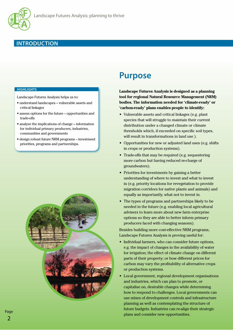
Purpose Landscape Futures Analysis is designed as a planning tool for regional Natural Resource Management (NRM) bodies. The information needed for ‘climate-ready’ or ‘carbon-ready’ plans enables people to identify:
• Vulnerable assets and critical linkages (e.g. plant species that will struggle to maintain their current distribution under a changed climate or climate thresholds which, if exceeded on specific soil types, will result in transformations in land use ).
• Opportunities for new or adjusted land uses (e.g. shifts in crops or production systems).
• Trade-offs that may be required (e.g. sequestering more carbon but having reduced re-charge of groundwaters).
• Priorities for investments by gaining a better understanding of where to invest and what to invest in (e.g. priority locations for revegetation to provide migration corridors for native plants and animals) and equally as importantly, what not to invest in.
• The types of programs and partnerships likely to be needed in the future (e.g. enabling local agricultural advisers to learn more about new farm enterprise options so they are able to better inform primary producers faced with changing seasons).
Besides building more cost-effective NRM programs, Landscape Futures Analysis is proving useful for:
• Individual farmers, who can consider future options, e.g. the impact of changes in the availability of water for irrigation; the effect of climate change on different parts of their property; or how different prices for carbon may vary the profitability of alternative crops or production systems.
• Local government, regional development organisations and industries, which can plan to promote, or capitalise on, desirable changes while determining how to respond to challenges. Local governments can use mixes of development controls and infrastructure planning as well as contemplating the structure of future budgets. Industries can re-align their strategic plans and consider new opportunities.
Landscape Futures Analysis helps us to:
•understandlandscapes–vulnerableassetsandcritical linkages
•assessoptionsforthefuture–opportunitiesandtrade-offs
•analysetheimplicationsofchange–informationfor individual primary producers, industries, communities and governments
•designrobustfutureNRMprograms–investmentpriorities, programs and partnerships.
hIghlIghts
IntroduCtIon
Page
3
Landscape Futures Analysis: planning to thrive
AF
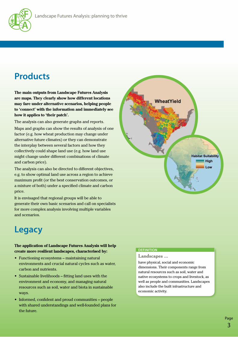
Products The main outputs from Landscape Futures Analysis are maps. They clearly show how different locations may fare under alternative scenarios, helping people to ‘connect’ with the information and immediately see how it applies to ‘their patch’.
The analysis can also generate graphs and reports.
Maps and graphs can show the results of analysis of one factor (e.g. how wheat production may change under alternative future climates) or they can demonstrate the interplay between several factors and how they collectively could shape land use (e.g. how land use might change under different combinations of climate and carbon price).
The analysis can also be directed to different objectives, e.g. to show optimal land use across a region to achieve maximum profit (or the best conservation outcomes, or a mixture of both) under a specified climate and carbon price.
It is envisaged that regional groups will be able to generate their own basic scenarios and call on specialists for more complex analysis involving multiple variables and scenarios.
legacy The application of Landscape Futures Analysis will help create more resilient landscapes, characterised by:
• Functioning ecosystems – maintaining natural environments and crucial natural cycles such as water, carbon and nutrients.
• Sustainable livelihoods – fitting land uses with the environment and economy, and managing natural resources such as soil, water and biota in sustainable ways.
• Informed, confident and proud communities – people with shared understandings and well-founded plans for the future.
Landscapes ...have physical, social and economic dimensions. Their components range from natural resources such as soil, water and native ecosystems to crops and livestock, as well as people and communities. Landscapes also include the built infrastructure and economic activity.
dEfInItIon
IntroduCtIon
AF
Page
4
Landscape Futures Analysis: planning to thrive
MEthod
Components
Landscape Futures Analysis consists of several components:
• Baseline data – information about the region. This will include natural resources (such as landforms, soil, water, vegetation, animals and climate) as well as economic and social data. It may be primary data or derived from models (e.g. calculating surface run-off using a hydrological model).
• Landscape systems – modelling the interactions between elements of the landscape. Models of climate change are used to generate alternative future scenarios and are coupled with other models (e.g. wheat production and species vulnerability). Economic components are also incorporated – such as how profits may vary as production costs or market prices change.
• Landscape Futures Analysis – the development of alternative scenarios of the future and presenting the information as maps and/or graphs. This involves:
– developing alternative primary scenarios, e.g. the effect of different prices on profit or the vulnerability of different species to climate change
– analysis of multiple variables and their interactions, e.g. the likely response of producers to different combinations of climate and carbon price, or the optimal land use to achieve different objectives (and how the ‘optimum’ changes for different objectives)
– selecting appropriate formats to present the results.
Landscape Futures Analysis can integrate existing regional climate models and scenarios with other regional databases for advanced analysis, land use optimisation and new insights.
hIghlIghts
Process
People involved with developing Landscape Futures Analysis have found the experience as informative and rewarding as the end result.
Every application is a collaborative effort with numerous partners. Researchers steer the technical components but regional NRM planners and local resource managers and landholders provide essential local knowledge as well as highlighting the questions for Landscape Futures Analysis to answer.
The highly collaborative approach results in researchers and potential users all learning and improving their capacity for such work. It also contributes to the development of a better and more robust product.
The ‘analysis’ aspect of Landscape Futures Analysis is modular. It can involve:
• Synthesis – integrating different databases and existing models. A key feature is the integration of climate models to generate locally relevant projections.
• Alternative scenarios – running various ‘what if’ scenarios considering issues in isolation and in combination.
• Vulnerability – considering the resilience (or adaptive capacity) of social and biophysical features and the potential impact of change on them (i.e. the likely exposure of features to change and their sensitivity to it).
• Optimisation – using different approaches to combine trade-offs and scenarios and demonstrate how land use may change to meet alternative objectives (e.g. using a constrained land use approach, multi-functional analysis and strategic assessment – see ‘Results’ for more information).
Landscape systems ...explore the relationships between different components of a landscape and how they respond to change. It considers the distribution and performance (e.g. profitability) of different land uses and their interaction with the natural environment.
dEfInItIon
Page
5
Landscape Futures Analysis: planning to thrive
AF
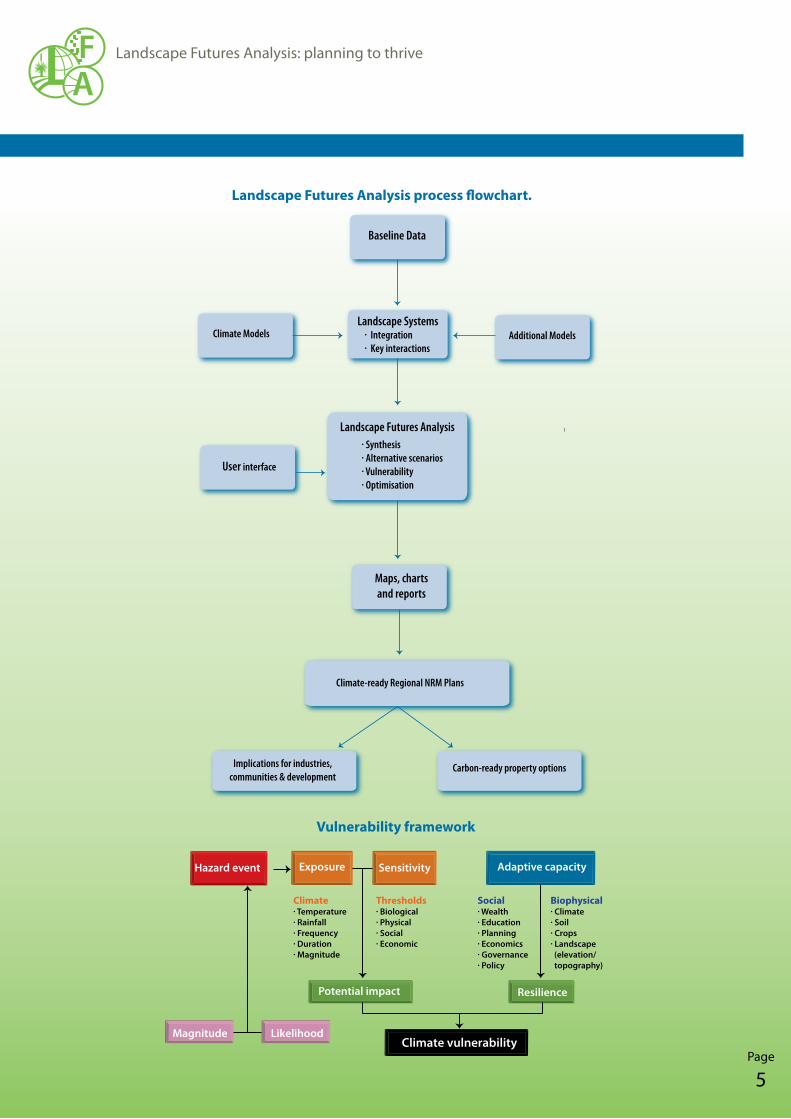
Baseline Data
Climate ModelsLandscape Systems
Additional Models
User interface
· Synthesis· Alternative scenarios· Vulnerability· Optimisation
Landscape Futures Analysis
Maps, charts and reports
Climate-ready Regional NRM Plans
Implications for industries, communities & development
Carbon-ready property options
· Integration· Key interactions
MEthod
Exposure Sensitivity Adaptive capacity
Potential impact Resilience
Magnitude Likelihood
Climate· Temperature· Rainfall· Frequency· Duration· Magnitude
Thresholds· Biological· Physical· Social· Economic
Social· Wealth· Education· Planning· Economics· Governance· Policy
Biophysical· Climate· Soil· Crops· Landscape (elevation/ topography)
Climate vulnerability
Figure 1: Vulnerability framework.
Hazard event
Landscape Futures Analysis process flowchart.
Vulnerability framework
AF
Page
6
Landscape Futures Analysis: planning to thrive
Projects
Landscape Futures Analysis has been developed over several years with input from a number of previous collaborative activities:
• Landscape Science Cluster – involving South Australian universities, government agencies and the CSIRO, the Cluster was formed in 2007 to develop new technologies and capacities to analyse, model and demonstrate future options to manage and conserve landscapes.
• Lower Murray Landscape Futures – covering parts of South Australia and Victoria – considers the social, economic and environmental impacts of achieving NRM targets with changes in climate, commodity prices and water availability.
It has recently been advanced by:
• Climate Change, Communities and Environment – (CCCE, see below)
• Adapted Future Landscapes, from aspiration to implementation – developing and testing a ‘user interface’ for Landscape Futures Analysis and exploring ways to enhance its usefulness to regional NRM bodies.
The CCCE project commenced in 2008/09 and concludes in 2012/13. It involves three sub-projects:
• Eyre Peninsula Landscape Futures. Assessing the impact of climate change on wheat production, biodiversity and carbon sequestration, along with the subsequent social and economic implications.
• SA Murray Darling Basin – climate change response options. Assessing the impact of climate change to understand adaptation and alternative opportunities for Local Governments in the SA Murray-Darling region – including adaptation options involving horticulture, tourism, carbon sequestration and biofuel production.
• Developing Landholder Capacity – managing climatic risks to irrigation. Building irrigators capacity to adapt to climate risks and variable resource availability in the Bookpurnong to Kingston-on-Murray districts of the Riverland, South Australia, by developing tools to help irrigators make decisions about water allocations and crop types under a changed climate.
Spin-off projects are already beginning to occur as other parties now apply the information from Landscape Futures Analysis:
• Future Farming Landscapes – incorporating information from Landscape Futures Analysis, a carbon auditing tool and biodiversity values to develop and trial ‘next generation’ property plans. It is funded by Caring for Our Country and Australian Wool Innovation for farming properties on Eyre Peninsula and the South East of SA.
Climate Change, Communities and Environment has been funded by the South Australian Government through the Premier’s Science Research Fund, with additional support from the Australian Government’s Strengthening Basin Communities program (a part of Water for the Future) and from the CSIRO. It is managed by the University of Adelaide, working in conjunction with CSIRO and other partners such as regional NRM Boards and State agencies.
ClIMAtE ChAngE, CoMMunItIEs And EnvIronMEnt
MEthod
Page
7
Landscape Futures Analysis: planning to thrive
AF
outPuts
scenarios and strategies
The main outputs from the recent Climate Change, Communities and Environment project were:
Climate change scenariosProjections were developed of possible changes in climate for the regions and the likely implications, e.g. for grain yields and the distribution of selected native plants. The scenarios also estimated flow-on responses, such as how the local economy, and hence community, may change if primary producers changed their operations to optimise profit under an altered climate.
For each region, four climate change scenarios were developed, (baseline, mild, moderate and severe warming and drying). Each was defined by temperature, mean rainfall and atmospheric CO2 concentrations. An additional three scenarios projected changes in the seasonality of rainfall. Assessments were made of the impact of climate change on biodiversity, agriculture, forest growth and socio-economics.
Vulnerability assessments and adaptation strategiesAssessments were made of key risks and opportunities arising from climate change (and other factors, such as a price on carbon). Alternative responses, based on different land uses, were tested under a range of conditions (e.g. different levels of climate change or market prices for grains, carbon or biodiversity conservation). The assessments allowed further consideration of the skills and information communities would require for adaptation to changes, and the planning and infrastructure issues likely to arise for local governments and regional development.
Climate vulnerability assessments, were based on a vulnerability framework, including exposure, sensitivity and adaptive capacity.
Optimised strategies A mix of alternative land uses were analysed across the regions to produce the best outcomes against specified objectives (e.g. balancing changes in water availability with increased vegetation cover for carbon and biodiversity benefits). The optimisation provided further clarity about key capacity building requirements and the types of natural resource management programs and partners that would be most beneficial in the future.
The integrated analysis, used several methods:
• Target based landscape futures analysis – considering opportunities, their cost-benefit and trade-offs, to achieve regional NRM targets.
• Constrained land use change – a time-series analysis of the profitability of different land uses (e.g. irrigated and dryland agricultural commodities, woody perennials for renewable energy, cereal crops for biofuels, and plantings for carbon or biodiversity), subject to changes in climate and prices (e.g. for oil, electricity, carbon, water, food and biodiversity) – and including an assessment of their impact on carbon sequestration, biodiversity, food production, water use and energy production.
AF
Page
8
Landscape Futures Analysis: planning to thrive
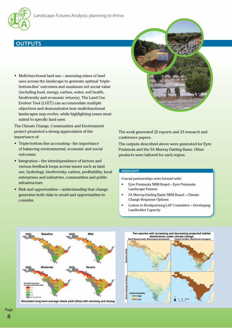
• Multi-functional land use – assessing mixes of land uses across the landscape to generate optimal ‘triple-bottom-line’ outcomes and maximum net social value (including food, energy, carbon, water, soil health, biodiversity and economic returns). The Land Use Evolver Tool (LUET) can accommodate multiple objectives and demonstrates how multi-functional landscapes may evolve, while highlighting zones most suited to specific land uses.
The Climate Change, Communities and Environment project promoted a strong appreciation of the importance of:
• Triple-bottom line accounting - the importance of balancing environmental, economic and social outcomes.
• Integration – the interdependence of factors and various feedback loops across issues such as land use, hydrology, biodiversity, carbon, profitability, local enterprises and industries, communities and public infrastructure.
• Risk and opportunities – understanding that change generates both risks to avoid and opportunities to consider.
outPuts
The work generated 22 reports and 23 research and conference papers.
The outputs described above were generated for Eyre Peninsula and the SA Murray Darling Basin. Other products were tailored for each region.
Crucial partnerships were formed with:
• Eyre Peninsula NRM Board – Eyre Peninsula Landscape Futures
• SA Murray-Darling Basin NRM Board – Climate Change Response Options
• Loxton to Bookpurnong LAP Committee – Developing Landholder Capacity
hIghlIght
Page
9
Landscape Futures Analysis: planning to thrive
AF
Project specific outputs
Eyre Peninsula Landscape Futures• Additional climate change projections in formats to
suit models for grain production (APSIM and wheat economics), biodiversity (species vulnerability), carbon sequestration and biomass.
• Social networks were mapped (termed a Social Ecological Network Model) to identify the degree of connectedness within interests in the region and assess their capacity to adapt.
• The Eyre Peninsula Regional Sector Agreement, an agreement involving State and Local Government, the regional NRM Board and Regional Development Australia, is not a direct product of this project, but was significantly influenced by it. The agreement commits the parties to collaborate in climate change investigations, communication and planning.
SA Murray Darling Basin – climate change response options• Additional climate change projections: derived values
for humidity, wind speed and evapotranspiration, scenarios for individual towns, and estimates of flows in the River Murray and streams of the eastern Mt Lofty Ranges.
• Additional socio-economic evaluation of risks and opportunities for non-primary production sectors, such as tourism and alternative energy production.
Developing Landholder Capacity – managing climatic risks to irrigation• Development of a software tool – Integrated Land
use Strategic Assessment (ILSA) – to help individual irrigators make decisions about alternative crop types and varieties, downsizing or expansion, and water trading under changed climates.
outPuts
AF
Page
10
Landscape Futures Analysis: planning to thrive
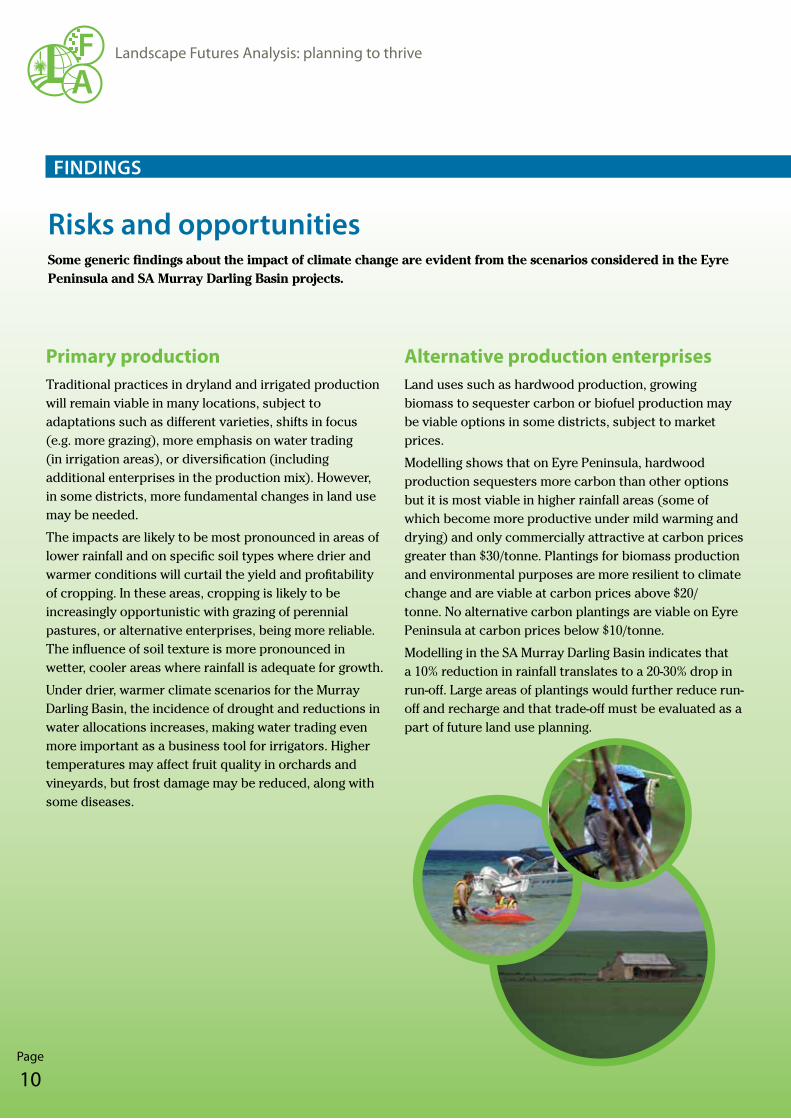
risks and opportunitiesSome generic findings about the impact of climate change are evident from the scenarios considered in the Eyre Peninsula and SA Murray Darling Basin projects.
Alternative production enterprisesLand uses such as hardwood production, growing biomass to sequester carbon or biofuel production may be viable options in some districts, subject to market prices.
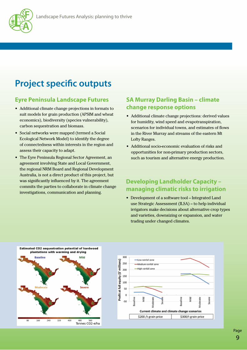
Modelling shows that on Eyre Peninsula, hardwood production sequesters more carbon than other options but it is most viable in higher rainfall areas (some of which become more productive under mild warming and drying) and only commercially attractive at carbon prices greater than $30/tonne. Plantings for biomass production and environmental purposes are more resilient to climate change and are viable at carbon prices above $20/tonne. No alternative carbon plantings are viable on Eyre Peninsula at carbon prices below $10/tonne.
Modelling in the SA Murray Darling Basin indicates that a 10% reduction in rainfall translates to a 20-30% drop in run-off. Large areas of plantings would further reduce run-off and recharge and that trade-off must be evaluated as a part of future land use planning.
Primary productionTraditional practices in dryland and irrigated production will remain viable in many locations, subject to adaptations such as different varieties, shifts in focus (e.g. more grazing), more emphasis on water trading (in irrigation areas), or diversification (including additional enterprises in the production mix). However, in some districts, more fundamental changes in land use may be needed.
The impacts are likely to be most pronounced in areas of lower rainfall and on specific soil types where drier and warmer conditions will curtail the yield and profitability of cropping. In these areas, cropping is likely to be increasingly opportunistic with grazing of perennial pastures, or alternative enterprises, being more reliable. The influence of soil texture is more pronounced in wetter, cooler areas where rainfall is adequate for growth.
Under drier, warmer climate scenarios for the Murray Darling Basin, the incidence of drought and reductions in water allocations increases, making water trading even more important as a business tool for irrigators. Higher temperatures may affect fruit quality in orchards and vineyards, but frost damage may be reduced, along with some diseases.
fIndIngs
Page
11
Landscape Futures Analysis: planning to thrive
AF
BiodiversityDifferent species have different sensitivity to climate change, but the distribution (or range) of many will variously shrink, expand or shift under climate change scenarios. Successful migration will be important to the survival of species adversely affected by climate change, highlighting the importance of corridors and good connectivity between areas of suitable habitat.
Under warmer, drier climates the species most at risk are those requiring moister, cooler locations. Wetter and more elevated districts in any region thus become highly important refuges for species conservation.
Social networksThe analysis of social networks on Eyre Peninsula highlighted the importance of community leaders in responding appropriately to climate change. The region was found to have a high level of social capacity with many connections between ‘nodes’ (people and organisations) within the community. A relatively small number of nodes are very highly connected, implying they support the broader network – and a few individual nodes are crucial in connecting important sub-groups (which had strong connectivity between themselves).
MethodologyThere are some ‘must have’ features for Landscape Futures Analysis to succeed.
fIndIngs
EngagementResearchers must engage with representatives of local communities, industries and government. The engagement is essential for the research (e.g. to locate suitable databases and expert opinion), helps to direct the analysis to practical questions, permits the researchers to learn from locals while developing their technical skills, and builds understanding and capacity within the region.
ConfidenceTo accept the outputs from Landscape Futures Analysis, people must have confidence in the climate change projections, as well as the analysis' datasets and sub-models. Being based on CSIRO and Bureau of Meteorology information gives authority to the projections. Further confidence comes from building relationships and trust, which can be nurtured in collaborative projects and by inviting strategic input to the Analysis.
ScalesFor regional engagement, especially with landholders, it is imperative to generate products with relevance at local, even property, scale. Being able to locate themselves and see the information in a familiar context enables users to more easily connect with and understand the information. Further applications for enterprise planning will be developed in a new project beginning in 2013.
Opportunities and risksIdentifying opportunities as well as risks provides a wider range of outputs for users and brings an air of confidence and optimism to the analysis. It is easier to accept and deal with risks when opportunities are also evident. Discussing both risks and opportunities provides for a more engaging conversation with communities.
AF
Page
12
Landscape Futures Analysis: planning to thrive
Renewable energyRenewable energy is likely to become more important in the future, both in terms of providing secure local energy supplies and as a viable land use, be it wind power, solar energy, biofuels or biomass production. In the SA Murray Darling Basin it was concluded that further investigations were warranted into mallee biofuel and wood biomass opportunities, in recognition that both may have local potential in a carbon economy.
TourismTourism, and other non-agricultural industries, may become more important to regional economies in areas where current production systems will be challenged by a warmer, drier climate. Planning is required to ensure such alternatives are geared up for significant roles and able to operate successfully in a changed climate.
Biodiversity conservationThe importance of connectivity and corridors, and the growing value of conservation areas in wetter, cooler areas, indicate that strategic planning is needed to ensure adequate provision for shifts in the distribution of species under climate change. Trade-offs may be needed between managing for the conservation of priority species or the maintenance of a functioning, but altered, ecosystem. Plantings for biofuels, grazing or biomass may also need to be factored in, with recognition of their contributions to local ecosystems.
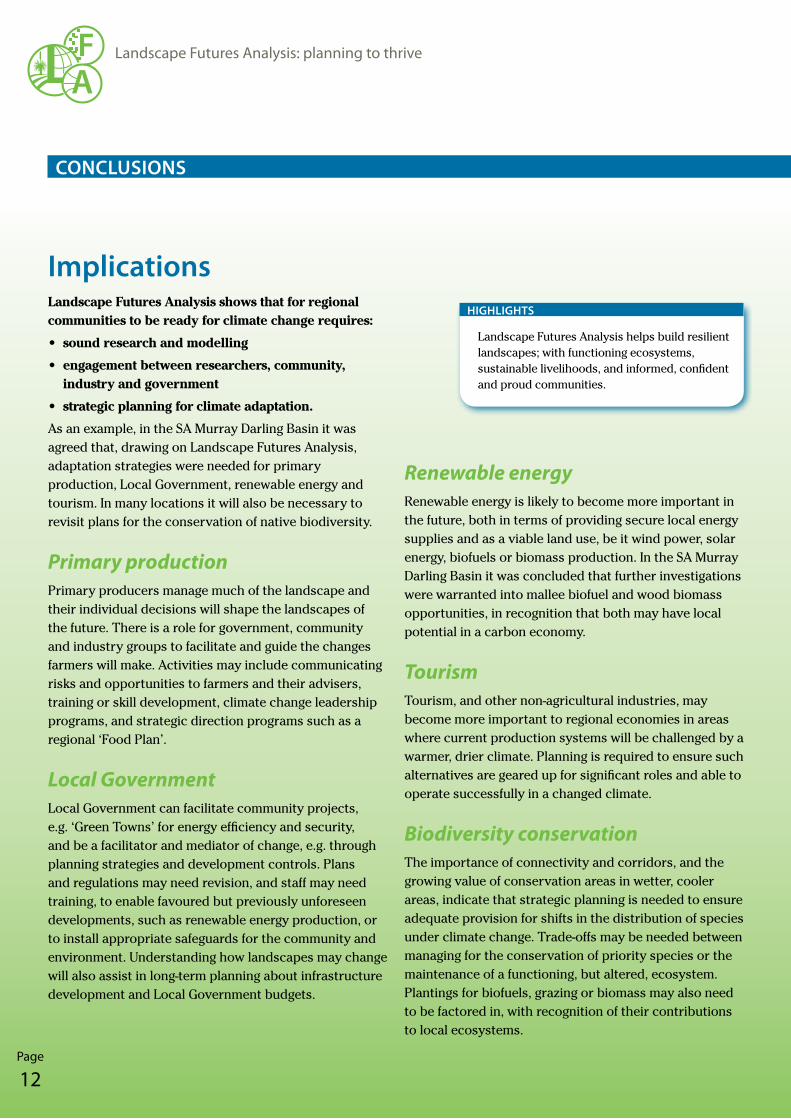
ImplicationsLandscape Futures Analysis shows that for regional communities to be ready for climate change requires:
• sound research and modelling
• engagement between researchers, community, industry and government
• strategic planning for climate adaptation.
As an example, in the SA Murray Darling Basin it was agreed that, drawing on Landscape Futures Analysis, adaptation strategies were needed for primary production, Local Government, renewable energy and tourism. In many locations it will also be necessary to revisit plans for the conservation of native biodiversity.
Primary productionPrimary producers manage much of the landscape and their individual decisions will shape the landscapes of the future. There is a role for government, community and industry groups to facilitate and guide the changes farmers will make. Activities may include communicating risks and opportunities to farmers and their advisers, training or skill development, climate change leadership programs, and strategic direction programs such as a regional ‘Food Plan’.
Local GovernmentLocal Government can facilitate community projects, e.g. ‘Green Towns’ for energy efficiency and security, and be a facilitator and mediator of change, e.g. through planning strategies and development controls. Plans and regulations may need revision, and staff may need training, to enable favoured but previously unforeseen developments, such as renewable energy production, or to install appropriate safeguards for the community and environment. Understanding how landscapes may change will also assist in long-term planning about infrastructure development and Local Government budgets.
ConClusIons
Landscape Futures Analysis helps build resilient landscapes; with functioning ecosystems, sustainable livelihoods, and informed, confident and proud communities.
hIghlIghts
Page
13
Landscape Futures Analysis: planning to thrive
AF
ConClusIons
Information and social networksThe very high connectivity of a relatively small number of influencing ‘nodes’ indicates they are critical in supporting a broad social network. The people or organisations in those focal nodes are likely to be important sources of information and ideas to stimulate change. They give local networks strength and adaptive capacity, but also a degree of vulnerability, should they fail to persist.
The thinking and action required to combat climate change demand cross-sectorial responses due to the inter-relationships between different components of the landscape. Existing organisations and layers of administration need to find new ways of collaborating or new structures will be needed. The Eyre Peninsula Regional Sector Agreement is an example of a new integrated arrangement.
Climate-ready communities require:
• researchandmodelling
•engagementwithresearchers,industryandgovernment
•strategicplanningforclimatechange.
hIghlIghts
AF
Page
14
Landscape Futures Analysis: planning to thrive
ConClusIons
Applications Landscape Futures Analysis has shown how external factors, such as climate change and a price on carbon, may drive changes to our landscapes.
These changes may be in land use, hydrology and the availability of water, the distribution and abundance of plant and animal species, and regional economies and communities. The science-based analysis has shown the importance of:
• understanding the interactions between the components of any landscape
• assessing trade-offs and setting priorities
• developing adaptation plans to manage risks and optimise opportunities
• clarifying the roles of different groups and the collaborations required for a ‘climate-ready’ future.
The priorities for further development and enhancement of the approach are:
• improving the user interface so a wider range of regional users can apply the tool
• working with regional planners, communities and industries to apply the findings in their activities, especially for adaptation planning
• developing more tools for application at the enterprise scale.
The tools involved in Landscape Futures Analysis and the processes involved are readily transferable. Existing local databases and climate modelling from any region can easily be incorporated into Landscape Futures Analysis.
Landscape Futures Analysis can make important contributions to climate change adaptation planning in any part of Australia. It has potential to be a valuable contributor to the development of resilient communities, sustainable land uses and healthy environments across the nation. A key challenge is to expand the use of Landscape Futures Analysis to help other regions, maximising its value and contributions to the future of Australia.
Existing local databases and climate modelling from any region can easily be incorporated into Landscape Futures Analysis.
hIghlIghts
Page
15
Landscape Futures Analysis: planning to thrive
AF
Benefits Landscape Futures Analysis has contributed to:
• Awareness and understanding. It has raised awareness of climate change projections and understanding of the likely consequences for the Eyre Peninsula and SA Murray Darling Basin.
• Engagement and relationships. Researchers, industry and community groups have collaborated with local, regional, State and even national level administrative agencies (e.g. Local Government and regional NRM bodies). The process of working together has helped forge stronger relationships and trust between researchers, communities, industry and government.
• Clarity and confidence. Understanding the risks and opportunities that are likely to arise has generated confidence to deal with the future. It has highlighted sectors in the economy with prospects for growth, including non-agricultural industries, acting as a catalyst for further investigation of those opportunities.
• Increased capacity. Researchers, community and industry representatives, planners and administrators have all enhanced their skills through working with and being involved in Landscape Futures Analysis. The researchers have further developed and refined the tools at their disposal, and the processes they follow, making Landscape Futures Analysis readily transferable to other locations.
• Clearer roles and responsibilities. Individuals and businesses will be key determinants of how land and other resources will be used in the future, but they do not make such decisions in isolation. Landscape Futures Analysis has shown that there are roles for organisations and institutions to:
– share and communicate information
– develop skills and understanding
– facilitate and mentor positive changes – including the removal of any barriers
– provide appropriate strategic direction, infrastructure and services
– install appropriate checks and balances to manage unwanted changes.
• Adaptation planning. The regions involved in the Analysis are now able to instigate further, tightly focused, strategic planning (e.g. into renewable energy or non-agricultural opportunities) as well as immediately applying the findings for their own planning. Examples include:
– asset protection strategies for vulnerable features of the landscape
– investment priorities and guidelines
– program design – the scope, content, priority locations and delivery mechanisms to facilitate or promote change on-ground (be it for biodiversity plantings or new agricultural ventures)
– partnership development to enable cross-sectorial responses to climate change and the carbon economy.
• Spin-offs. New insights have strengthened the importance of the Eyre Peninsula Regional Sector Agreement in assisting adaptation to climate and other changes. The regional projection information is being translated to the farm scale and delivered through the Future Farming Landscapes project.
Collectively, these benefits will ultimately result in more resilient landscapes, characterised by:
• Functioning ecosystems – maintaining natural environments and crucial natural cycles such as those associated with water, carbon and nutrients.
• Sustainable livelihoods – fitting land uses with the environment and economy, and managing natural resources such as soil, water and vegetation in sustainable ways.
• Informed, confident and proud communities – people with shared understandings and well-founded plans for the future.
ConClusIons
AF
Page
16
Landscape Futures Analysis: planning to thrive
Copyright 2012, University of Adelaide.
Published by: University of Adelaide - Environment Institute, Adelaide, SA. Contact: Prof. Wayne Meyer, www.adelaide.edu.au/environment/
Prepared by: Peter R Day Resource Strategies Pty Ltd. Contact: Peter Day, www.resourcestrats.com.au
Editing and design by: Substitution Pty Ltd. Contact: Anne Burgi, www.substitution.com.au
Planning for the future
Prof. Wayne Meyer,
Director, Landscape Futures Program,
University of Adelaide – Waite Campus, PMB 1, Glen Osmond, SA 5064
e-mail: [email protected]; phone: +61 (0)8 8313 8110
Dr Brett Bryan
Principal Research Scientist
CSIRO Ecosystem Sciences, PMB 2, Glen Osmond, SA 5064
e-mail: [email protected]; phone: +61 (0)8 8303 8581
Landscape Futures Analysis offers exciting opportunities for regions and industries across
Australia as they plan for their future. It enables people to systematically assess options and
to consider how changes (e.g. in climate, in the prices of commodities - including carbon, or in
conservation priorities) may – individually and collectively – affect land use.
That understanding paves the way for strategic planning, investment and development planning,
and the design of programs to build the capacity of landholders to adapt and thrive under changed
conditions.
To see how Landscape Futures Analysis can help your planning for the future, contact the
Landscape Futures Program at the University of Adelaide or CSIRO Ecosystem Sciences.
• University of Adelaide
• CSIRO Sustainable Agriculture Flagship and Climate Adaptation Flagship
• Government of South Australia through
– Eyre Peninsula NRM Board
– SA Murray-Darling Basin NRM Board
– Loxton to Bookpurnong LAP Committee
our PArtnErs
MorE InforMAtIon
![THRIVE BROKERAGE BENEFIT - EasyEquitiesresources.easyequities.co.za/EasyEquities_THRIVE_Benefit... · 2020-05-04 · [THRIVE BROKERAGE BENEFIT ] THRIVE BROKERAGE BENEFIT | LAST UPDATED](https://img.pdfslide.net/doc/110x75/5f47a68b1c951a2c8e4d057e/thrive-brokerage-benefit-e-2020-05-04-thrive-brokerage-benefit-thrive-brokerage.jpg)