Embed Size (px)
Citation preview

PLATE 1. THE HEAVENS AS THEY WERE ON 3 RABI' I786/25 APRIL 1384, THE BIRTHDATE OF ISKANDAR SULTAN. In opaque watercolor, ink, and gold on paper in a nativitybook compiled in 813/1410-11 by Mai)miid ibn Yai)ya ibn alHasan al-KashL
Size of the original: 26 X 33.5 cm. By permission of the Wellcome Institute Library, London (Wellcome MS. Persian 474,fols. 18b-19a).
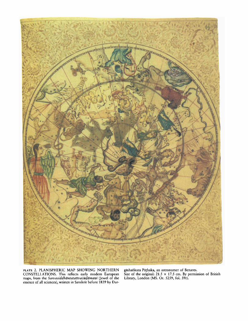
PLATE 2. PLANISPHERIC MAP SHOWING NORTHERNCONSTELLATIONS. This reflects early modern Europeanmaps, from the Sarvasiddhiintatattvacut!iima1Ji Oewel of theessence of all sciences), written in Sanskrit before 1839 by Dur-
gashaitkara Pathaka, an astronomer of Benares.Size of the original: 21.5 X 17.5 em. By permission of BritishLibrary, London (MS. Or. 5259, fo!' 59r).
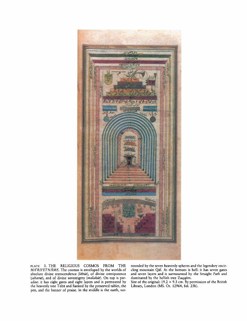
PLATE 3. THE RELIGIOUS COSMOS FROM THEMA'RIFETNAME. The cosmos is enveloped by the worlds ofabsolute divine transcendence (lahut), of divine omnipotence(jabarut), and of divine sovereignty (ma/akut). On top is paradise: it has eight gates and eight layers and is permeated bythe heavenly tree Tuba and flanked by the preserved tablet, thepen, and the banner of praise. In the middle is the earth, sur-
rounded by the seven heavenly spheres and the legendary encircling mountain Qaf. At the bottom is hell: it has seven gatesand seven layers and is surmounted by the Straight Path anddominated by the hellish tree Zaqqum.Size of the original: 19.2 x 9.3 em. By permission of the BritishLibrary, London (MS. Or. 12964, fol. 23b).
PLATE 4. AL-KHWARAZMI'S MAP OF THE RIVER NILE.The map shows the south to the right, with the Nile rising astwo groups of streams in the Mountains of the Moon; at theleft are the Delta and the Mediterranean. The lines across themap are climate divisions, the farthest right representing the
equator. The map would be read in Arabic with south (right)at the top.Size of the double folio: 33.5 x 41 em. By permission of theBibliotheque Nationale et Universitaire, Strasbourg (MS. 4247,fols. 30b-31a).
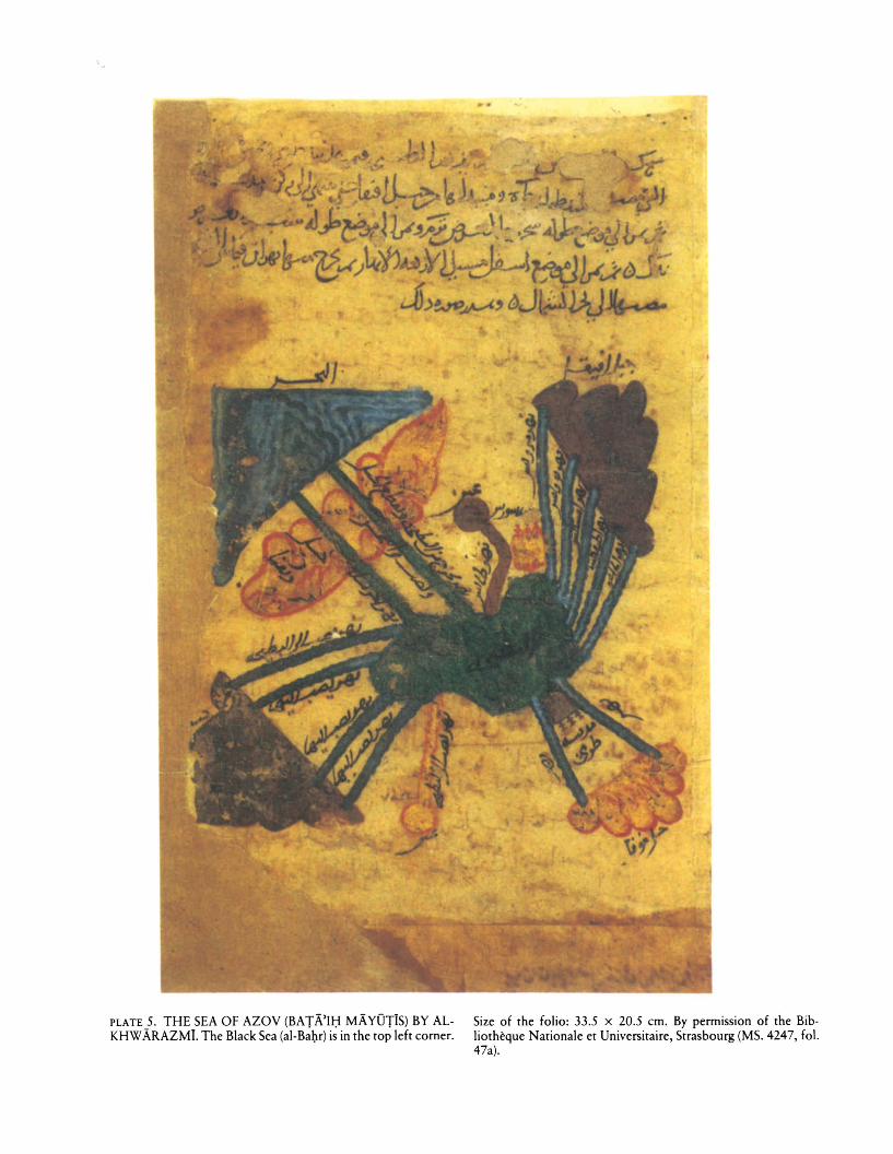
PLATE 5. THE SEA OF AZOV (BATA'Il;f MAYOTIS) BY ALKHWARAZMI. The Black Sea (al-Ba~r) is in the top left corner.
Size of the folio: 33.5 x 20.5 ern. By permission of the Bibliotheque Nationale et Universitaire, Strasbourg (MS. 4247, fol.47a).
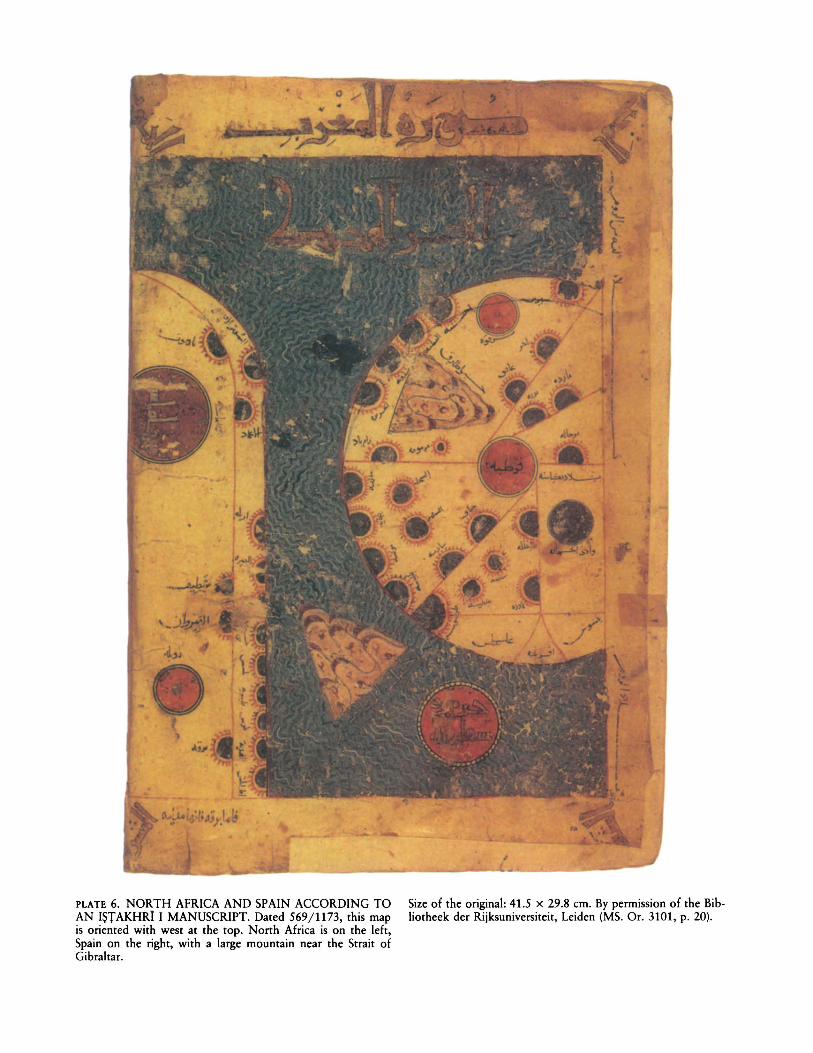
PLATE 6. NORTH AFRICA AND SPAIN ACCORDING TOAN ISTAKHRI I MANUSCRIPT. Dated 569/1173, this mapis oriented with west at the top. North Afriea is on the left,Spain on the right, with a large mountain near the Strait ofGibraltar.
I
Size of the original: 41.5 x 29.8 em. By permission of the Bibliotheek der Rijksuniversiteit, Leiden (MS. Or. 3101, p. 20).
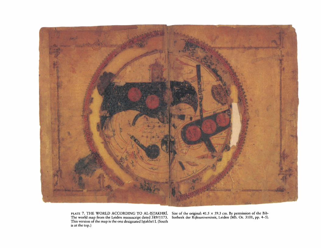
PLATE 7. THE WORLD ACCORDING TO AL-IHAKHRi. Size of the original: 41.5 x 59.3 cm. By permission of the BibThe world map from the Leiden manuscript dated 589/1173. Iiotheek der Rijksuniversiteit, Leiden (MS. Or. 3101, pp. 4-5).This version of the map is the one designated I~takhri I. (Southis at the top.)
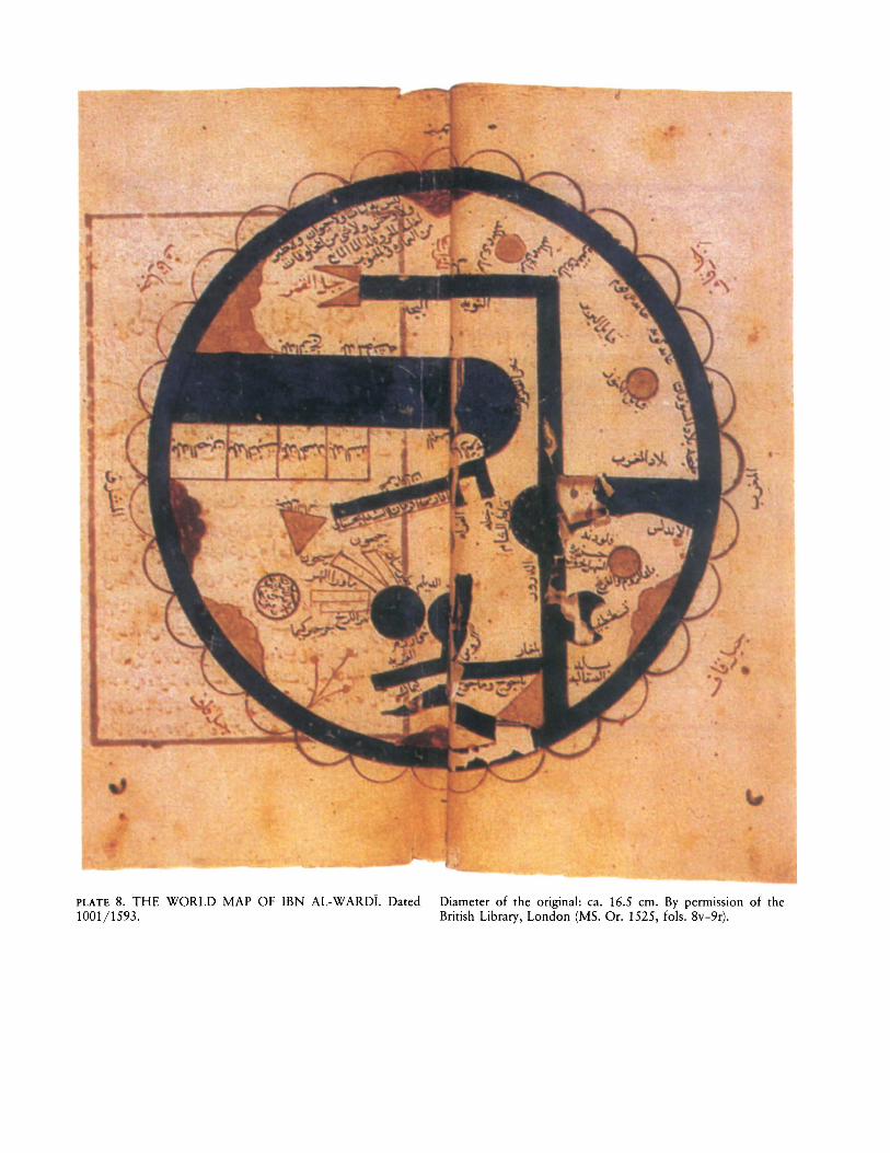
PLATE 8. THE WORLD MAP OF IBN AL-WARDI. Dated1001/1593.
Diameter of the original: ca. 16.5 em. By permission of theBritish Library, London (MS. Or. 1525, fols. 8v-9r).
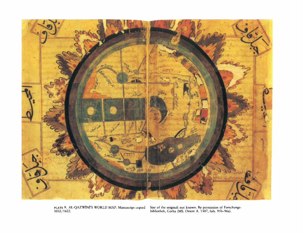
PLATE 9. AL-QAZwINI'S WORLD MAP. Manuscript copied1032/1622.
Size of the original: not known. By permission of Forschungsbibliothek, Gotha (MS. Orient A. 1507, fols. 95b-96a).
-1)
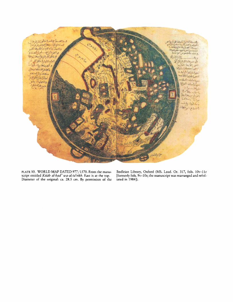
PLATE 10. WORLD MAP DATED 977/1570. From the manuscript entitled Kitiib ai-bad' wa-al-ta'rikh. East is at the top.Diameter of the original: ca. 28.5 em. By permission of the
Bodleian Library, Oxford (MS. Laud. Or. 317, fols. lOv-ll r[formerly fols. 9v-10r; the manuscript was rearranged and refoliated in 1984]).
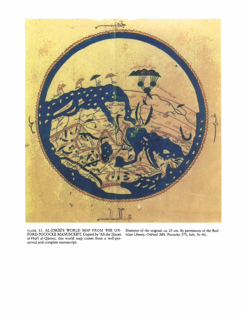
PLATE 11. AL-IDRlsl's WORLD MAP FROM THE OXFORD POCOCKE MANUSCRIPT. Copied by 'Ali ibn I:IasanaI-HuH al-Qiisimi, this world map comes from a weIl-preserved and complete manuscript.
Diameter of the original: ca. 23 em. By permission of the Bodleian Library, Oxford (MS. Pococke 375, fols. 3v-4r).
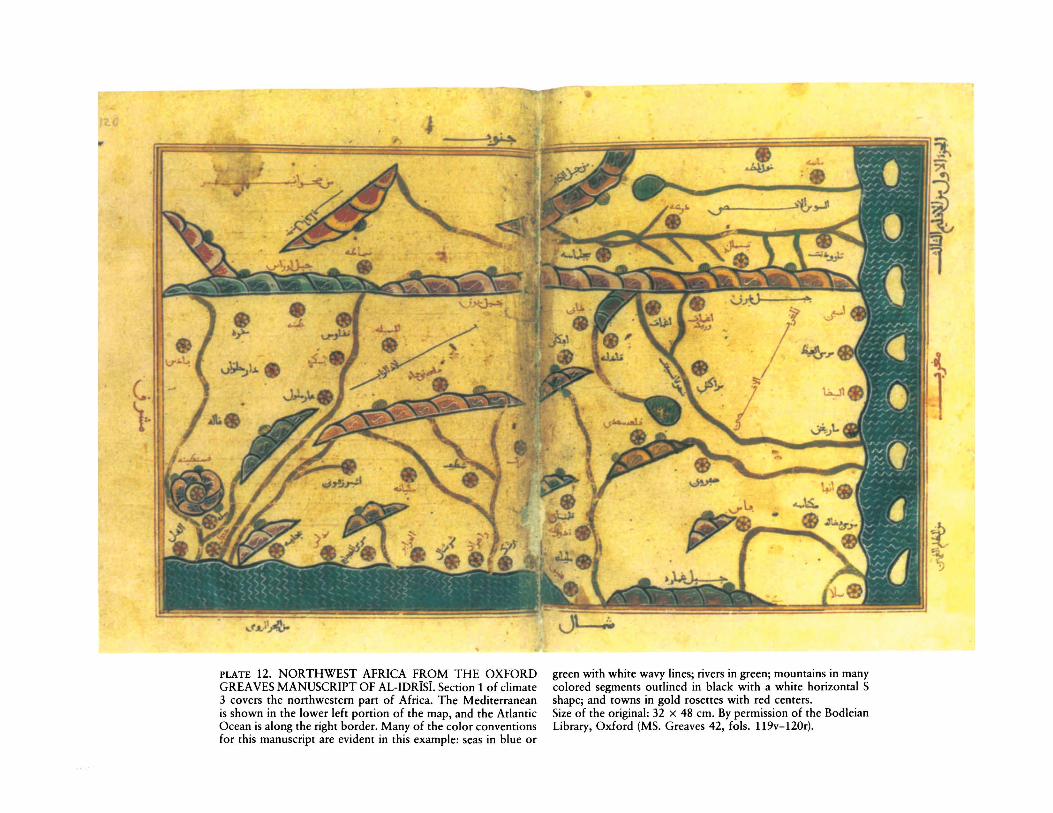
PLATE 12. NORTHWEST AFRICA FROM THE OXFORDGREAVES MANUSCRIPT OF AL-IDRISI. Section 1 of climate3 covers the northwestern part of Africa. The Mediterraneanis shown in the lower left portion of the map, and the AtlanticOcean is along the right border. Many of the color conventionsfor this manuscript are evident in this example: seas in blue or
green with white wavy lines; rivers in green; mountains in manycolored segments outlined in black with a white horizontal Sshape; and towns in gold rosettes with red centers.Size of the original: 32 x 48 em. By permission of the BodleianLibrary, Oxford (MS. Greaves 42, fols. 119v-120r).
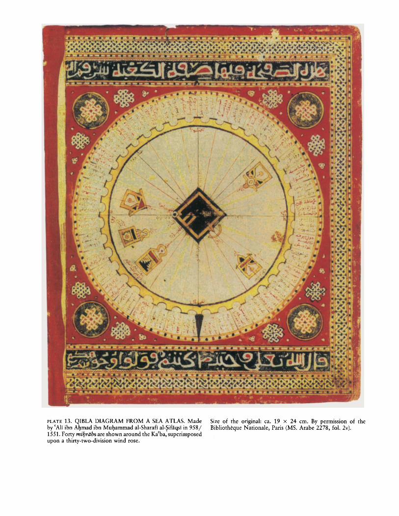
PLATE 13. QIBLA DIAGRAM FROM A SEA ATLAS. Madeby 'Ali ibn Al)mad ibn Mul)ammad al-Sharafi al-?ifaqsI in 958/1551. Forty mi!Jriibs are shown around the Ka(ba, superimposedupon a thirty-two-division wind rose.
Size of the original: ca. 19 x 24 em. By permIssIOn of theBibliotheque Nationale, Paris (MS. Arabe 2278, fo\. 2v).
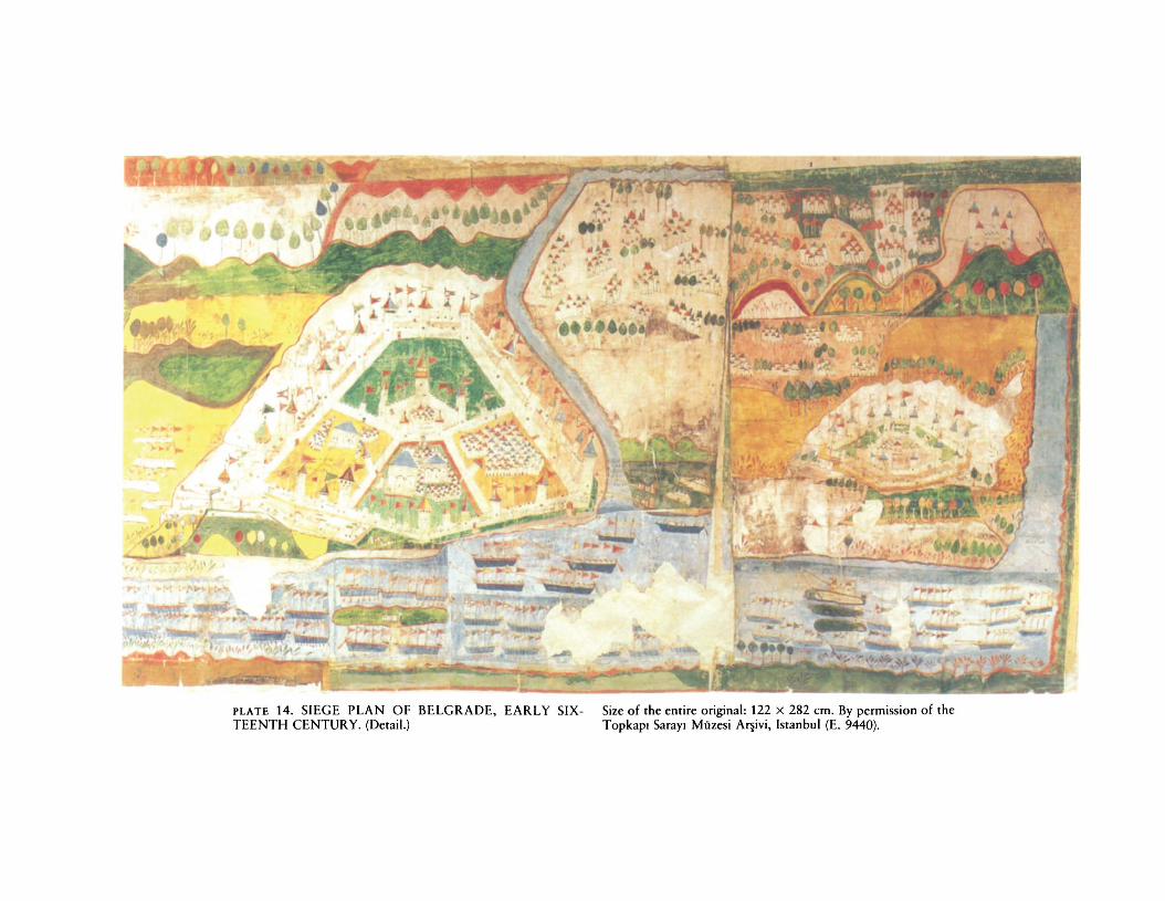
PLATE 14. SIEGE PLAN OF BELGRADE, EARLY SIXTEENTH CENTURY. (Detail.)
Size of the entire original: 122 X 282 em. By permission of theTopkapi Sarayl Miizesi AI1ivi, Istanbul (E. 9440).
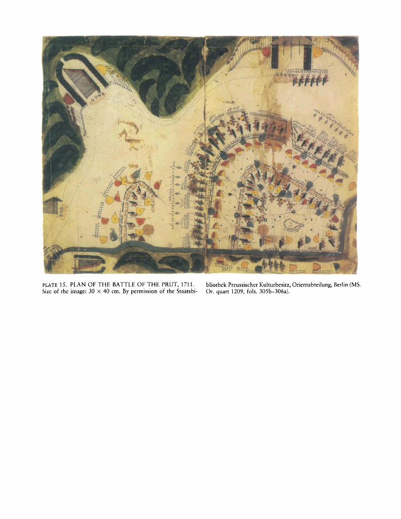
PLATE 15. PLAN OF THE BATTLE OF THE PRUT, 1711.Size of the image: 30 x 40 em. By permission of the Staatsbi-
bliothek Preussiseher Kulturbesitz, Orientabteilung, Berlin (MS.Or. quart 1209, fols. 305b-306a).
~..,,~;
J~-'~/;-
i!:~'. 2--t:'f"/""c'
~~~.
P'~qy.~~,q1t~,. t·,
1 19 i~
~~,\;\~.::t ~:-t\:~:o,~~~~(\:),\"../~ ~~.(',~
"-...,..• v·
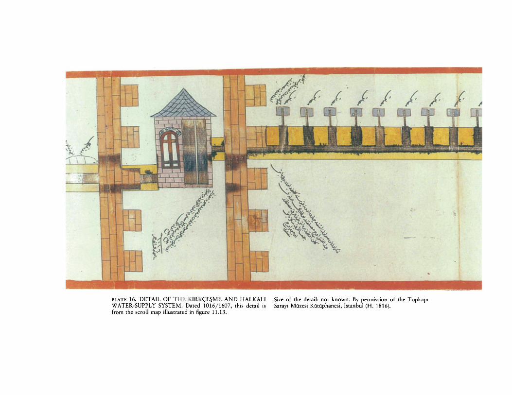
PLATE 16. DETAIL OF THE KIRK<;ESME AND HALKALIWATER-SUPPLY SYSTEM. Dated 1016/1607, this detail isfrom the scroll map illustrated in figure 11.13.
Size of the detail: not known. By permission of the TopkaplSarayl Miizesi Kiitiiphanesi, Istanbul (H. 1816).
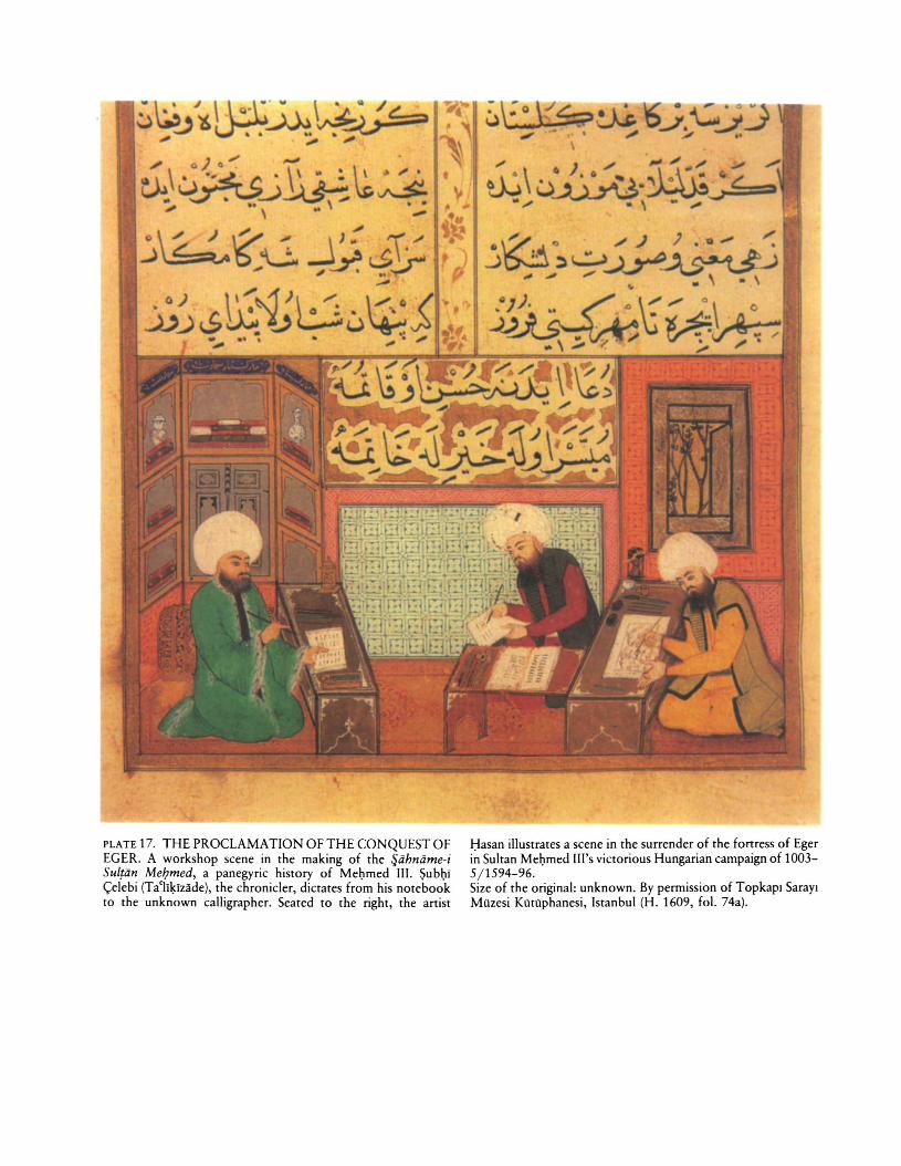
PLATE 17. THE PROCLAMATION OF THE CONQUEST OFEGER. A workshop scene in the making of the fjahname-iSultan MeIJmed, a panegyric history of Mei)med III. Subi)i<;:elebi (Ta(li~izade), the chronicler, dictates from his notebookto the unknown calligrapher. Seated to the right, the artist
Hasan illustrates a scene in the surrender of the fortress of Egerin Sultan Mebmed Ill's victorious Hungarian campaign of 10035/1594-96.Size of the original: unknown. By permission of Topkapl SaraylMuzesi KUrliphanesi, Istanbul (H. 1609, fol. 74a).
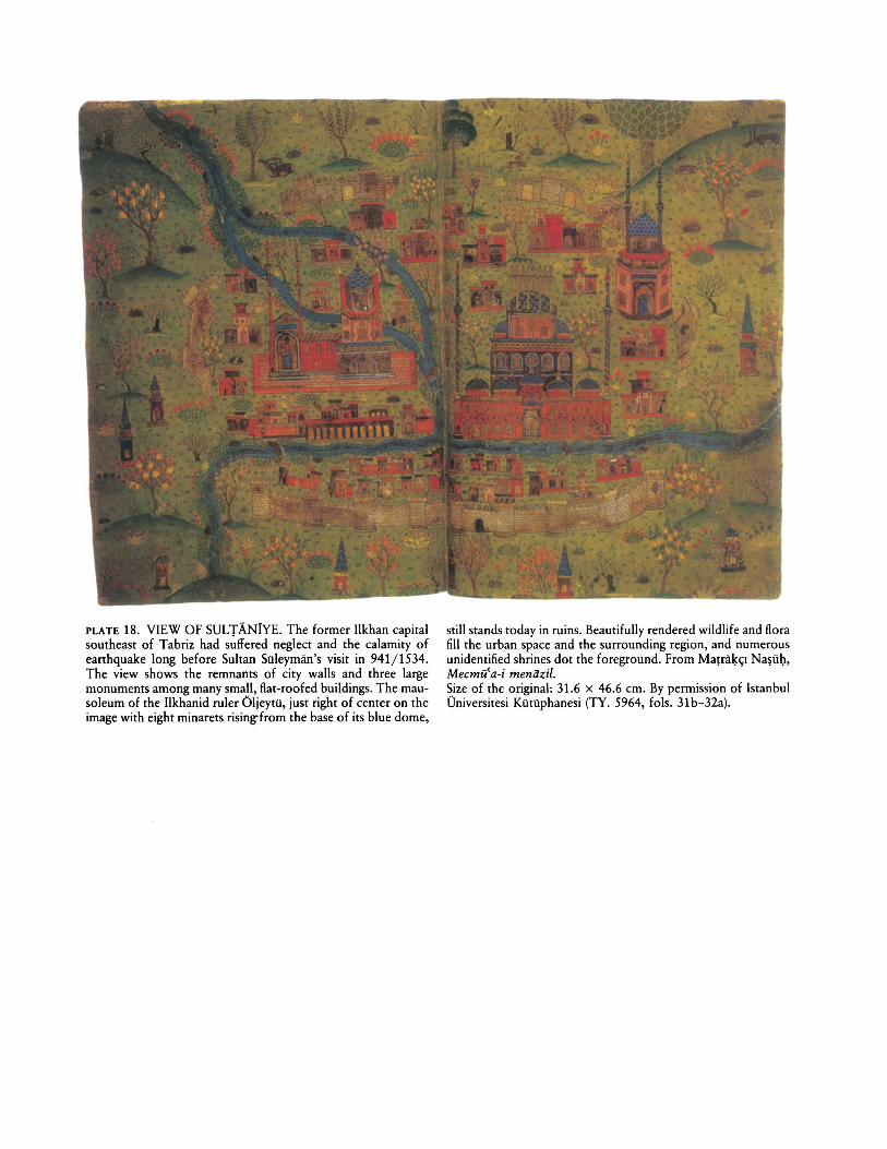
PLATE 18. VIEW OF SULTANiYE. The former Ilkhan capitalsoutheast of Tabriz had suffered neglect and the calamity ofearthquake long before Sultan Siileyman's visit in 941/1534.The view shows the remnants of city walls and three largemonuments among many small, flat-roofed buildings. The mausoleum of the Ilkhanid ruler Oljeytii, just right of center on theimage with eight minarets rising-from the base of its blue dome,
still stands today in ruins. Beautifully rendered wildlife and florafill the urban space and the surrounding region, and numerousunidentified shrines dot the foreground. From Ma!ral.«;l Na~ii\:l,
Mecmu'a-i meniizil.Size of the original: 31.6 x 46.6 em. By permission of IstanbulOniversitesi Kiitiiphanesi (TY. 5964, fols. 31b-32a).
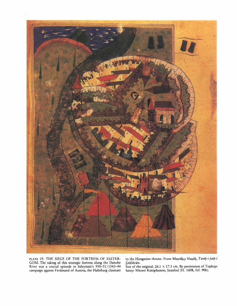
PLATE 19. THE SIEGE OF THE FORTRESS OF ESZTERGOM. The taking of this strategic fortress along the DanubeRiver was a crucial episode in Siileyman's 950-51/1543-44campaign against Ferdinand of Austria, the Habsburg claimant
to rhe Hungarian throne. From Ma~ra~<;1 Na~I1Q, Tiiril:?-i fetlJ-i~a~liivun.Size of the original: 26.1 x 17.5 cm. By permission of TopkapiSaray I Miizesi Kiitiiphanesi, Istanbul (H. 1608, fol. 90b).
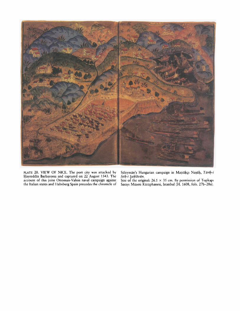
PLATE 20. VIEW OF NICE. The port city was attacked bytlayreddin Barbarossa and captured on 22 August 1543. Theaccount of this joint Ottoman-Valois naval campaign againstthe Italian states and Habsburg Spain precedes the chronicle of
SOleyman's Hungarian campaign in Ma!ra~~1 Na~iib, Tiiri1}-ifet/J-i Sa~/iJvun.
Size of the original: 26.1 x 35 cm. By permission of TopkapiSarayl Mozesi KOtOphanesi, Istanbul (H. 1608, fols. 27b-28a).
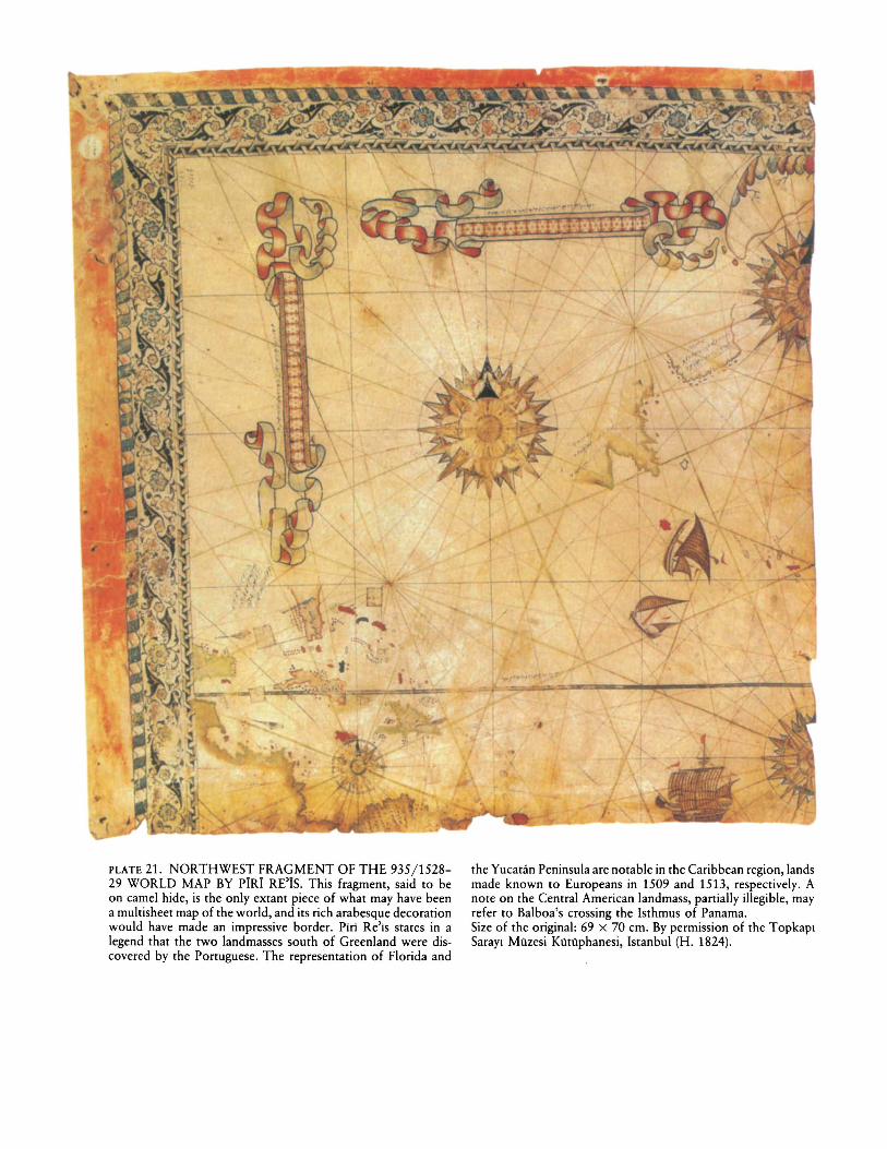
PLATE 21. NORTHWEST FRAGMENT OF THE 935/152829 WORLD MAP BY PiRi RE'iS. This fragment, said to beon camel hide, is the only extant piece of what may have beena multisheet map of the world, and its rich arabesque decorationwould have made an impressive border. Piri Re'is states in alegend that the two landmasses south of Greenland were discovered by the Ponuguese. The representation of Florida and
the Yucatan Peninsula are notable in the Caribbean region, landsmade known to Europeans in 1509 and 1513, respectively. Anote on the Central American landmass, panially illegible, mayrefer to Balboa's crossing the Isthmus of Panama.Size of the original: 69 x 70 cm. By permission of the TopkapiSarayl Miizesi KiitOphanesi, Istanbul (H. 1824).
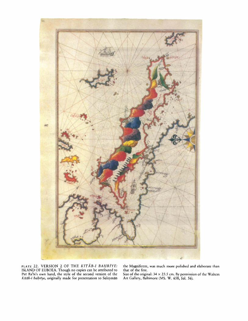
PLATE 22. VERSION 2 OF THE KITAB-I BAl;lR[YE:ISLAND OF EUBOEA. Though no copies can be attributed toPirI Re'is's own hand, the style of the second version of theKitiib-i balJn·ye, originally made for presentation to Siileyman
the Magnificent, was much more polished and elaborate thanthat of the first.Size of the original: 34 x 23.5 cm. By permission of the WaltersArt Gallery, Baltimore (MS. W. 658, fol. 56).
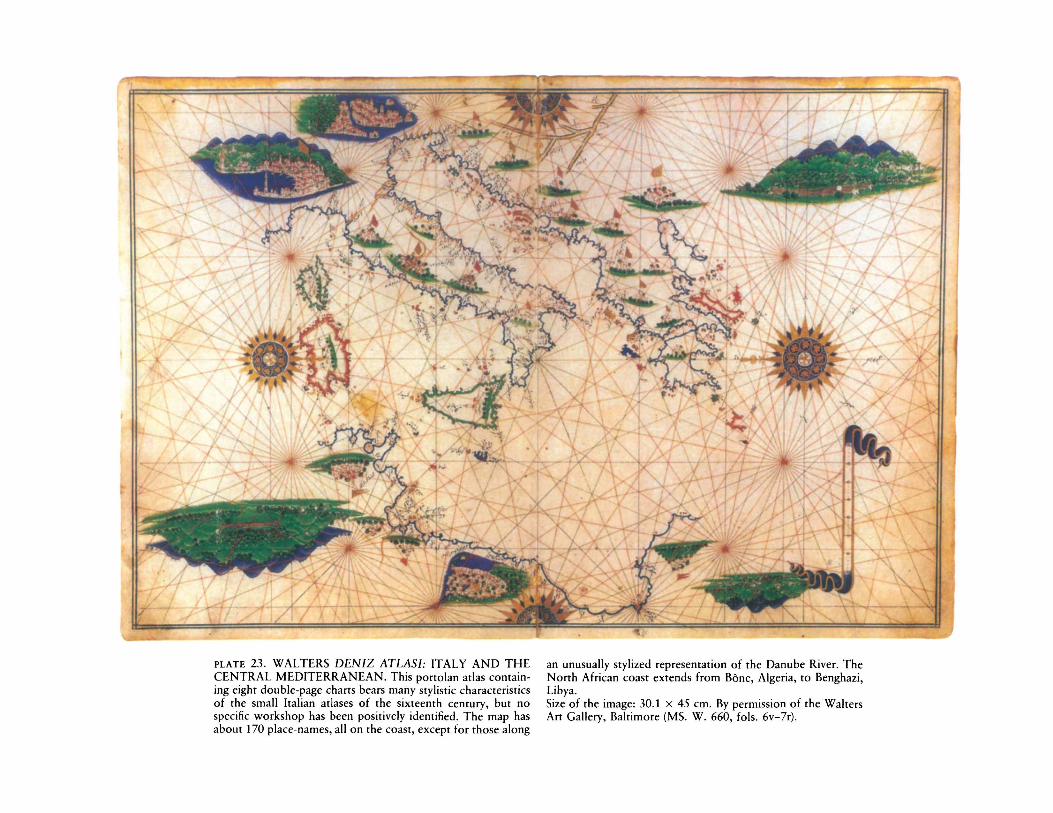
PLATE 23. WALTERS DENIZ ATLASI: ITALY AND THECENTRAL MEDITERRANEAN. This portoIan atlas containing eight double-page charts bears many stylistic characteristicsof the small Italian atlases of the sixteenth century, but nospecific workshop has been positively identified. The map hasabout 170 place-names, all on the coast, except for those along
an unusually stylized representation of the Danube River. TheNorth African coast extends from Bone, Algeria, to Benghazi,Libya.Size of the image: 30.1 x 45 em. By permission of the WaltersArt Gallery, Baltimore (MS. W. 660, fols. 6v-7r).
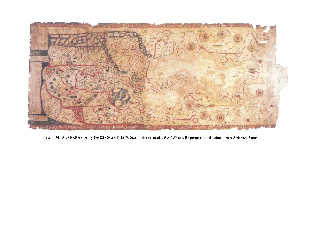
PLATE 24. AL-SHARAFi AL-~IFAQSi CHART, 1579. Size of the original: 59 x 135 em. By permission of Istituto Italo-Afrieano, Rome.