Embed Size (px)
Citation preview

Please find attached your:
FCI Premium Commercial <0.25Ha This search has been arranged by CLS Property Insight (‘CLS’), 17 Kings Hill Avenue, Kings Hill, West Malling, Kent ME19 4UA. Telephone No: 01732 753910, email: [email protected] and is subject to CLS’ terms and conditions. Full details of CLS’ terms and conditions can be viewed at https://www.clsl.co.uk/Content/PDFs/Website/TermsConditions-B2B.pdf.
The search was compiled by Future Climate Info Limited and is subject to FCI’s terms and conditions. Full details of FCI’s terms and conditions can be viewed at http://www.futureclimateinfo.com/Content/images/PDF/FCI-terms-and-conditions.pdf, or sent upon request.
Both CLS and FCI are registered with the Property Codes Compliance Board (‘PCCB’) as subscribers to the Search Code. The PCCB independently monitors how registered firms maintain compliance with the Code, for more information please go to: www.propertycodes.org.uk.
If you have any questions regarding the contents of this search or would like to find out more about the products that CLS provides, please contact our Customer Services Team on 01732 753910 or [email protected].
SAMPLE

Premium Commercial <0.25HaEnvironmental | Flood | Ground Stability | Energy & Infrastructure
Regulated by RICS
If you require assistance, please contact your Search Provider or alternatively contact FCI directly with your Report ID.Tel: 01732 755 180 | Email: [email protected] | Web: www.futureclimateinfo.com
Report Details
Address:Sample, Sample
Requested by:Sample
Grid Reference:E: 123456 | N: 123456
Date:27/04/2018
Report Reference:Sample
Report ID:1000085419
Professional Opinion1.ENVIRONMENTAL PASSConsideration(s):1.10 EMFs
2.ENVIRONMENTAL SETTING PASSConsideration(s):2.03 Site Inspection (Redevelopment)2.05 Groundwater Vulnerability
3.FLOOD PASSNo further recommendations
4.GROUND STABILITY PASSNo further recommendations
5.ENERGY & INFRASTRUCTURE PASSConsideration(s):5.07 EMFs5.20 Power Stations
Subject Site
Air Quality Index: Some Polluted Areas (See 1.26)
This page should always be read in conjunction with the full report. The Professional Opinion indicates the potential risks and any other potential issues associated with the property. The results should be disclosed to client and/or lender and/or insurer as appropriate.
A ‘Pass’ is given if no potential property specific risk has been identified.
A ‘Pass with Considerations’ is given where there are potential hazards in the locality to bear in mind, or if there are features nearby which some clients might consider could affect them.
A ‘Further Action’ is given if there is a potential property specific risk and a further action is advised.
In the event of a request to review the Professional Opinion based on additional information, or if there are any technical queries, the professional advisor who ordered the report should contact us at [email protected], or call us on 01732 755 180.
SAMPLE

Premium Commercial <0.25HaEnvironmental | Environmental Setting | Flood | Ground Stability | Energy & Infrastructure
Request by: Sample References: Sample Id: 1000085419 Date: 27/04/2018
Tel: 01732 755 180 | Email: [email protected] | Web: www.futureclimateinfo.com 2 of 11
1. ENVIRONMENTAL (INC. CONTAMINATED LAND)
1.01 Professional Opinion | Further Guidance
The way in which land and property is used can have a material impact on third party land and property. The nature of the existing use can give rise to regulatory action if compliance with current environmental regulations is not adhered to and any current use that the property is put to should take into account the sensitivity of the environmental setting. If there is any data identifying sensitive receptors, which may have a significantly increased sensitivity to contamination, these will be highlighted within the report.
In any case, it should also be confirmed that any conditions associated with planning permissions have been signed off by the Local Planning Authority and that there are no residual issues from a building control point of view.
To purchase Contaminated Land Insurance, please visit CLS at www.clsl.co.uk, call 01732 753 910 or purchase via your reseller. More details on this policy are available at http://www.futureclimateinfo.com/Residential/ContaminatedLand
It should be noted that if any development of the property is considered, a professional inspection and Phase 1 Environmental Survey (Environmental Screening) should be undertaken as part of any Conceptual Site Model to comply with the National Planning Policy Framework. The local Planning Authority may also identify the phased investigation process as a condition of planning approval.
1.03 Official Contaminated Land | Register Entries & Notices PASS
Tonbridge and Malling District (B) Council data indicates that the property is not within 25 metres of an area of land that has been designated Contaminated Land under Part 2A of the Environmental Protection Act 1990.
1.10 Electrical Infrastructure | Substations PASS (WITH CONSIDERATIONS)
Data provided by the Ordnance Survey indicates that the property is within 25 metres of one or more electricity substations.
CONSIDERATIONS: Electric and Magnetic Fields (EMFs) are produced wherever electricity is used. There are guidelines to limit exposure to electric and magnetic fields (exposures in the home are usually well below these guideline levels). There is no definitive evidence to link EMFs to both long and short term health risks.
If you are concerned about EMFs further information and advice is available from Public Health England at www.gov.uk/government/collections/electromagnetic-fields, or from www.emfs.info.
1.19 Past Industrial Land Uses PASS
In the Professional Opinion of the FCI Risk Team the property is not on or within 25 metres of any former industrial land uses depicted on historic Ordnance Survey maps, from which the level of environmental risk is likely to result in the property being determined Contaminated Land under Part 2A of the Environmental Act 1990.
1.22 Radon Gas PASS
Data provided by the British Geological Survey (BGS) indicates that the property is not in a Radon Affected Area.
This is because the property is in a Lower probability radon area (less than 1% of homes are estimated to be at or above the Action Level of 200 Bq m-3), therefore no protective measures are required.
1.25 Air Quality Management Area NOTE
Although information on air quality is not included within the Environmental risk assessment in this report we are able to provide information from DEFRA.
SAMPLE

Premium Commercial <0.25HaEnvironmental | Environmental Setting | Flood | Ground Stability | Energy & Infrastructure
Request by: Sample References: Sample Id: 1000085419 Date: 27/04/2018
Tel: 01732 755 180 | Email: [email protected] | Web: www.futureclimateinfo.com 3 of 11
Data provided by DEFRA indicates that the property is not in or within 100 metres of an Air Quality Management Area (AQMA). An AQMA is declared where the air pollutants occur above EU and Government targets, and where the council is required to create and follow an Air Quality Action Plan (AQAP) to improve air quality.
Please note that though this property is not within an Air Quality Management Area, this does not necessarily guarantee good air quality. For more information on air quality please visit https://uk-air.defra.gov.uk/air-pollution/.
1.26 Air Quality Index NOTE
The MappAir® air quality dataset provided by Earthsense includes information on Nitrogen Dioxide (NO2) and ParticulateMatter (PM2.5) from vehicle emissions and indications from other sources. The model gives an indication of annual meanpollution for 2016 at a resolution of 100 metres.
The data indicates that the property is in an area with a rating of 2 or Some Polluted Areas. A rating of 2 means there is a moderate chance of pollution levels exceeding healthy levels, particularly in poor weather conditions. There is a fair chance of higher pollutant concentrations around major roads.The accuracy has been assessed to have approximately 90% of locations within one band of the measured concentration.
For further information on air quality go to https://uk-air.defra.gov.uk/
1.28 Checked Datasets
The dataset categories analysed in this section are listed below. For more information, please visit our website.
Official Contaminated Land | Register Entries & Notices Artificial GroundPotentially Contaminative Current Land Uses Discharge ConsentsElectrical Infrastructure | Electricity Pylons Electrical Infrastructure | Overhead Power LinesElectrical Infrastructure | Power Cables and Lines Electrical Infrastructure | SubstationsEnvironmental Permits | Closed Mining Waste Facilities Environmental Permits | End of Life VehiclesEnvironmental Permits | Industrial Sites Environmental Permits | Waste SitesFuel / Petrol Stations Landfill | CurrentLandfill | Historic OFCOM Mast Site Clearance LocationsPast Industrial Land Uses Pollution IncidentsPotentially Infilled Land Radon GasSurface Dangers or Hazards | COMAH Sites Water Abstractions
2. ENVIRONMENTAL SETTING
2.01 Aquifer Designation PASS
Data provided by the British Geological Survey (BGS) indicates that the property is located within 25 metres of an area where the aquifer designation at the property location is "Secondary undifferentiated aquifer". It has not been possible to attribute a specific category to the rock type. Usually this is because the rock layer was previously been designated as both minor and non-aquifer in different locations due to the variable characteristic.
2.02 Bedrock Geology PASS
SAMPLE

Premium Commercial <0.25HaEnvironmental | Environmental Setting | Flood | Ground Stability | Energy & Infrastructure
Request by: Sample References: Sample Id: 1000085419 Date: 27/04/2018
Tel: 01732 755 180 | Email: [email protected] | Web: www.futureclimateinfo.com 4 of 11
Data provided by the British Geological Survey (BGS) indicates that the property is located within 25 metres of an area where the Bedrock Geology is sandstone and [subequal/subordinate] limestone, interbedded.
2.03 Ecological Features PASS (WITH CONSIDERATIONS)
We have analysed data about the ecological setting of this property and these features may present themselves as receptors of contamination should this be present from historic or current land uses. The property is on or within 25 metres of the following classifications:
Feature Source DistanceAncient & Semi-Natural Woodland Natural England 6 m
Ancient and Semi Natural Woodland Natural England 0 m
Ancient and Semi Natural Woodland or Plantation on an Ancient Woodland Site
Natural England 0 m
National Character Area: Wealden Greensand Natural England 0 m
Natural Area: Wealden Greensand Natural England 0 m
Priority Habitat Natural England 6 m
Woodland Forestry Commission 13 m
Woodland Natural England 0 m
Regardless of whether or not the property has historically been subject to a contaminative use any current use that the property is put to should reflect the sensitivities of this designation.
The way in which land and property is used can have a material impact on third party land and property. The nature of the existing use can give rise to regulatory action if compliance with current environmental regulations is not adhered to.
CONSIDERATIONS: If redevelopment of the property is being considered compliance with the National Planning Policy Framework will be required. This would require the production of a conceptual site model and intrusive investigation cannot be ruled out. A Chartered Environmental Surveyor or appropriate consultant should be appointed to produce the conceptual site model.
2.04 Geological Permeability PASS
Data provided by the British Geological Survey (BGS) indicates that the property is located within 25 metres of an area where the predominant permeability flow type is Mixed. The minimum permeability index is High and the maximum permeability index is High.
2.05 Groundwater Vulnerability PASS (WITH CONSIDERATIONS)
Data provided by the Environment Agency indicates that the property is located within 25 metres of an area where groundwater resources may be vulnerable from activities carried out on the surface. The Groundwater has been assigned as having highly permeable groundwater with intermediate leaching potential.
Groundwater resources may be vulnerable from activities carried out on the surface of the land. Other information, such as depth of groundwater and thickness and type of overlying cover will always be required for a site-specific assessment.
CONSIDERATIONS: If redevelopment of the property is being considered compliance with the National Planning Policy Framework will be required. This would require the production of a conceptual site model and intrusive investigation cannot be ruled out. A Chartered Environmental Surveyor or appropriate consultant should be appointed to produce the conceptual site model.
2.07 Superficial Deposits PASS
Data provided by the British Geological Survey (BGS) indicates that the property is located within 25 metres of an area where the Superficial Deposits is/are clay, silt, sand and gravel.
SAMPLE

Premium Commercial <0.25HaEnvironmental | Environmental Setting | Flood | Ground Stability | Energy & Infrastructure
Request by: Sample References: Sample Id: 1000085419 Date: 27/04/2018
Tel: 01732 755 180 | Email: [email protected] | Web: www.futureclimateinfo.com 5 of 11
2.08 Checked Datasets
The dataset categories analysed in this section are listed below. For more information, please visit our website.
Aquifer Designation Bedrock GeologyEcological Features Geological PermeabilityGroundwater Vulnerability Source Protection ZonesSuperficial Deposits
3. FLOOD (INC. FLOODABILITY RATING)
3.01 River and Sea Flood Risk PASS
Data provided by the Environment Agency indicates no risk of flooding from River or Sea within 25 metres metres of the property.
3.02 Surface Water Flood Risk PASS
Data provided by JBA Risk Management indicates that there is no risk of Surface Water flooding within 5 metres of the property. Surface water flooding occurs when heavy rainfall overwhelms the drainage capacity of an area. In these instances, the rainwater does not drain away through the normal drainage systems or soak into the ground, but lies on or flows over the ground instead.
3.03 Groundwater Flooding PASS
Data provided by JBA Risk Management indicates that the property has negligible risk from groundwater flooding.
3.04 Surface Water Features PASS
The Ordnance Survey Map indicates that the property is not located within 250 metres of a body of surface water, such as a stream, river, canal, reservoir, lake or pond.
3.05 Floodability Rating PASS
The JBA Floodability Rating at this location is Clear. Clear indicates that the likelihood of flooding is very low.
JBA Floodability data is derived from their high resolution UK flood hazard maps which are used by most insurers when assessing flood risk. Where a higher Floodability Rating is indicated further investigation into flood risk is usually advisable.
Please always check that your Buildings Insurance policy covers Flood Damage, as the terms of any commercial mortgage or loan (as appropriate) may require all risks to be covered to meet the lender's terms, furthermore if the property is leasehold the landlord may also require that all perils cover is put in place as a requirement of any lease.
3.06 Historic Flooding PASS
Data provided by the Environment Agency indicates that the property is not in or within 250 metres of an area that has flooded in the past. This includes all types of flooding, including Groundwater. However, we would always recommend asking the vendor to confirm whether or not they are aware of any previous flooding at the property.
Please see the previous sections for the Flood Risk as of the date of this report.
3.07 Flood Storage PASS
SAMPLE

Premium Commercial <0.25HaEnvironmental | Environmental Setting | Flood | Ground Stability | Energy & Infrastructure
Request by: Sample References: Sample Id: 1000085419 Date: 27/04/2018
Tel: 01732 755 180 | Email: [email protected] | Web: www.futureclimateinfo.com 6 of 11
Data provided by the Environment Agency indicates that the property is not located within 25 metres of a Flood Storage Area (land designed and operated to store flood water).
3.08 Dam Break PASS
Data provided by JBA identifies areas of England and Wales that are most likely to suffer damage to property following the sudden and catastrophic failure of a large reservoir embankment or dam. This is a worst case scenario, it’s unlikely that any actual flood would be this large. The flooding is predicted using advanced modelling techniques to ascertain if a property or site is potentially at risk in such an event.
This property is not located in the potential path which water would follow if a reservoir dam or embankment was to fail.
3.09 Sewer Flooding NOTE
Please note that information on Sewer Flooding is not included in the flood risk assessment in this report. This information is held by the water company responsible for the public sewer network. Sewer flooding happens for a number of reasons but is most likely to occur during storms, when large volumes of rainwater enter the sewers and sewage escapes from a manhole or a drain, or by backing up through toilets, baths and sinks. Sewer flooding can also occur when pipes become blocked.
3.10 Checked Datasets
The dataset categories analysed in this section are listed below. For more information, please visit our website.
River and Sea Flood Risk Surface Water Flood RiskGroundwater Flooding Surface Water FeaturesFloodability Rating Historic FloodingFlood Storage Dam Break
4. GROUND STABILITY
4.02 Subsidence Risk Rating PASS
The Subsidence Risk Rating produced by Property Assure based on subsidence damage insurance claims is Low, with a risk exposure equal to or below the insurance subsidence incidence rate for England and Wales. This correlates to a rate of 1 or fewer incidents in every 1000 residencies.
The Subsidence Risk Rating assesses the risk of subsidence caused by soil shrinkage. Soil Shrinkage accounts for over 75% of all insurance subsidence incidents in England and Wales and the two main causes are clay shrinkage triggered by vegetation (60% of cases) or leaking drainage (15% of cases) washing away fine particles in the soil or softening the soil.
4.05 Geohazards | Running Sand PASS
The British Geological Survey indicates that the property is within 50 metres of an area of slight potential where sand can be fluidised by water and ‘run’ if the water table rises, with the potential to remove support from overlying buildings and cause subsidence damage. Certain constraints may apply to land uses involving excavation or the addition or removal of water.
4.13 Mining | Mining Hazards (Non-Coal) PASS
The British Geological Survey indicates that the property is located within 50 metres of an area where sporadic underground mining of restricted extent may have occurred. potential for difficult ground conditions are unlikely and localised and are at a level where they need not be considered.
The Presence of past underground mining is not known to have occurred. Areas are categorized on the basis that the rock type present are known to have been worked in other areas. Areas therefore have the potential for underground mining but there is little or not evidence of mining activity. It should be noted, however, that there is always the possibility of the existence of other
SAMPLE

Premium Commercial <0.25HaEnvironmental | Environmental Setting | Flood | Ground Stability | Energy & Infrastructure
Request by: Sample References: Sample Id: 1000085419 Date: 27/04/2018
Tel: 01732 755 180 | Email: [email protected] | Web: www.futureclimateinfo.com 7 of 11
sub-surface excavations, such as wells, cess pits, follies, air raid shelters/bunkers and other military structures etc. that could affect surface ground stability but which are outside the scope of this dataset.
4.16 Natural Cavities PASS
The British Geological Survey indicates that the property is within 50 metres of an area where soluble rocks are either not thought to be present within the ground, or not prone to dissolution. Dissolution features are unlikely to be present.
4.17 Checked Datasets
The dataset categories analysed in this section are listed below. For more information, please visit our website.
Professional Advice Subsidence Risk RatingGeohazards | Collapsible Deposits Geohazards | Compressible GroundGeohazards | Running Sand Geohazards | Shrink-SwellLandslips/slides | Mass Movement Landslips/slides | Slope InstabilityMining | Britpits Mining | Cheshire Brine Compensation AreaMining | Coal Mining Mining | Mining Cavities (Non-Coal)Mining | Mining Hazards (Non-Coal) Modified Ground | Artificial GroundModified Ground | Historical Analysis Natural Cavities
5. ENERGY & INFRASTRUCTURE
5.07 Electrical Infrastructure | Substations PASS (WITH CONSIDERATIONS)
Data provided by the Ordnance Survey indicates that the property is within 25 metres of one or more electricity substations.
CONSIDERATIONS: Electrical substations can emit Electric and Magnetic Fields (EMFs). Businesses and employees who work near to electrical infrastructure must manage the risks. Further information and advice is available from Public Health England at www.gov.uk/government/collections/electromagnetic-fields, or from www.emfs.info.
5.15 Oil and Gas | Invitation Area (inc. Shale Gas) PASS
Data provided by the Department for Business, Energy & Industrial Strategy (BEIS) indicates that the property is within an area for which Petroleum Exploration and Development Licence (PEDL) applications have been invited in the 14th Landward Licensing Round. Please bear in mind that these areas are quite large, almost half of the country was included in the 14th round.
The main reason for the 14th Round was to facilitate exploration for shale gas. Shale gas (methane) is trapped in impermeable shale rock. Hydraulic fracturing (or ‘fracking’) of the shale rock enables the shale gas to flow. Fracking has been used in the UK for many years but recent improvements in technology have made the exploitation of shale gas reservoirs more economical.
A PEDL is the first step to starting drilling, but it does not imply prior consent to actual activities. An operator wishing to drill an exploratory well must first negotiate access with landowners, as well as obtain consents form a number of bodies, including planning permission and environmental permits. BEIS will only give consent to drill once the planning authority has granted permission to drill, and if the relevant planning conditions have been discharged. An operator wishing to start production from a development site must start again with the permissions process.
If a PEDL licence is granted, it will appear below, under 'Oil and Gas | Current and Historic Sites'.
5.20 Power Stations PASS (WITH CONSIDERATIONS)
Data provided by the Department for Business, Energy & Industrial Strategy (BEIS), indicates that the property is within 3000 metres of an active power station.
SAMPLE
Premium Commercial <0.25HaEnvironmental | Environmental Setting | Flood | Ground Stability | Energy & Infrastructure
Request by: Sample References: Sample Id: 1000085419 Date: 27/04/2018
Tel: 01732 755 180 | Email: [email protected] | Web: www.futureclimateinfo.com 8 of 11
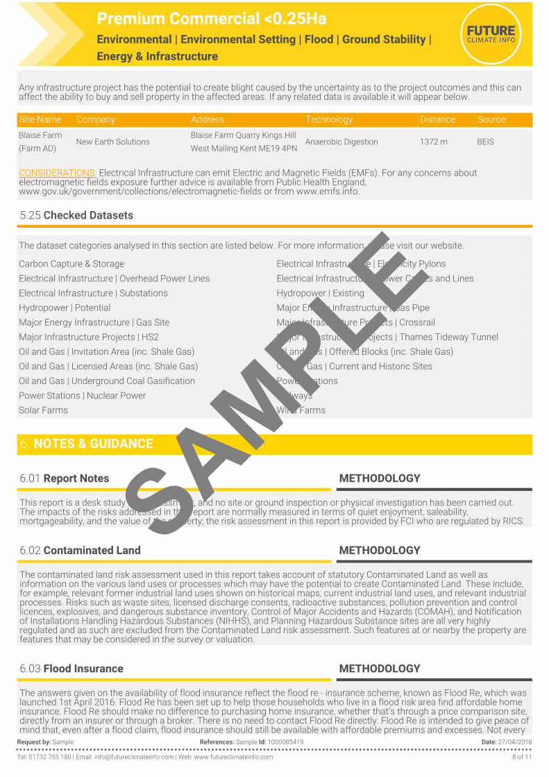
Any infrastructure project has the potential to create blight caused by the uncertainty as to the project outcomes and this can affect the ability to buy and sell property in the affected areas. If any related data is available it will appear below.
Site Name Company Address Technology Distance SourceBlaise Farm (Farm AD)
New Earth SolutionsBlaise Farm Quarry Kings Hill West Malling Kent ME19 4PN
Anaerobic Digestion 1372 m BEIS
CONSIDERATIONS: Electrical Infrastructure can emit Electric and Magnetic Fields (EMFs). For any concerns about electromagnetic fields exposure further advice is available from Public Health England, www.gov.uk/government/collections/electromagnetic-fields or from www.emfs.info.
5.25 Checked Datasets
The dataset categories analysed in this section are listed below. For more information, please visit our website.
Carbon Capture & Storage Electrical Infrastructure | Electricity PylonsElectrical Infrastructure | Overhead Power Lines Electrical Infrastructure | Power Cables and LinesElectrical Infrastructure | Substations Hydropower | ExistingHydropower | Potential Major Energy Infrastructure | Gas PipeMajor Energy Infrastructure | Gas Site Major Infrastructure Projects | CrossrailMajor Infrastructure Projects | HS2 Major Infrastructure Projects | Thames Tideway TunnelOil and Gas | Invitation Area (inc. Shale Gas) Oil and Gas | Offered Blocks (inc. Shale Gas)Oil and Gas | Licensed Areas (inc. Shale Gas) Oil and Gas | Current and Historic SitesOil and Gas | Underground Coal Gasification Power StationsPower Stations | Nuclear Power RailwaysSolar Farms Wind Farms
6. NOTES & GUIDANCE
6.01 Report Notes METHODOLOGY
This report is a desk study risk assessment, and no site or ground inspection or physical investigation has been carried out. The impacts of the risks addressed in this report are normally measured in terms of quiet enjoyment, saleability, mortgageability, and the value of the property; the risk assessment in this report is provided by FCI who are regulated by RICS.
6.02 Contaminated Land METHODOLOGY
The contaminated land risk assessment used in this report takes account of statutory Contaminated Land as well as information on the various land uses or processes which may have the potential to create Contaminated Land. These include, for example, relevant former industrial land uses shown on historical maps, current industrial land uses, and relevant industrial processes. Risks such as waste sites, licensed discharge consents, radioactive substances, pollution prevention and control licences, explosives, and dangerous substance inventory, Control of Major Accidents and Hazards (COMAH), and Notification of Installations Handling Hazardous Substances (NIHHS), and Planning Hazardous Substance sites are all very highly regulated and as such are excluded from the Contaminated Land risk assessment. Such features at or nearby the property are features that may be considered in the survey or valuation.
6.03 Flood Insurance METHODOLOGY
The answers given on the availability of flood insurance reflect the flood re - insurance scheme, known as Flood Re, which was launched 1st April 2016. Flood Re has been set up to help those households who live in a flood risk area find affordable home insurance. Flood Re should make no difference to purchasing home insurance, whether that’s through a price comparison site, directly from an insurer or through a broker. There is no need to contact Flood Re directly. Flood Re is intended to give peace of mind that, even after a flood claim, flood insurance should still be available with affordable premiums and excesses. Not every
SAMPLE

Premium Commercial <0.25HaEnvironmental | Environmental Setting | Flood | Ground Stability | Energy & Infrastructure
Request by: Sample References: Sample Id: 1000085419 Date: 27/04/2018
Tel: 01732 755 180 | Email: [email protected] | Web: www.futureclimateinfo.com 9 of 11
residential property is eligible to benefit from Flood Re, for full information about the scheme, including eligibility, see http://www.floodre.co.uk/.
An overall ‘Floodability Rating’ is given in this report based solely on JBA Floodability data. This shows the combined flood hazard, in 5 metre grid cells, from multiple sources i.e. river, sea and surface water flooding (certain groundwater flood data is also included). Over 85% of insurers use this data when assessing flood risk. The Floodability Rating is represented by colour indicators (black, red, amber, green or clear). For locations rating Black 1 (High) and Black 2 (Very High) there is more likely to be a correlation between Floodability and a residential property being included within Flood Re by a participating insurer. These indicators however provide no assurance or guarantee that insurance / insurance covering flood risk will or will not be available, no reliance should be placed upon the colour indicators, and appropriate additional enquiries should be made as to the actual availability (or not) of insurance / insurance covering flood risk. Every insurance application is unique, so other perils, risks or a previous claims history may mean that insurance is not available in any event.
Future Climate Info has partnered with HomeProtect to deliver home insurance for residential properties in areas considered to be at risk of flooding. HomeProtect policies are underwritten by AXA Insurance plc. Get an immediate, online quote at http://www.homeprotect.co.uk/floodcover.
6.04 Flood Risk and Impact on Value METHODOLOGY
The flood risk assessment in this report is based on the best available historic, river, sea, and surface water flooding data. This includes data supplied by the Environment Agency and Jeremy Benn Associates (JBA). A flood risk assessment using these data sources, however, should not be regarded as definitive. Because the flood risk assessment is based on theoretical risk models, there is always the possibility that exceptional weather conditions and/or failure of flood defences can cause flooding that was not anticipated. No site visit has taken place.
The Professional Opinion on flood risk given in this report is based on a flood risk assessment of River, Sea and Surface Water flooding, using Environment Agency and JBA data. If there is a history of flooding it is reported but it is not included in the flood risk assessment because circumstances can change, for example the provision of flood defences, causing the flood conditions to be different today. Susceptibility to groundwater flooding is reported but is also not included in the flood risk assessment; this is because the data identifies geological conditions which could enable groundwater flooding to occur, but does not model the risk of such an occurrence.
RICS advises that flood risk does reduce the value of a property, compared with a similar property without such a risk. This depends on the particular circumstances of the property, any history of flooding, and the provision of flood defences. For some ‘at risk’ property, for example, the reduction in value may be offset by an increase due to the property’s amenity value close to a river, stream or coast.
6.05 Flood Planning, Flood Warning and Reporting, and Flood Resistance and Resilience Measures METHODOLOGY
Detailed advice on flooding and resistance and resilience measures, flood risk planning and costs, and flood warning and reporting systems, is available from the following websites:
Government: https://www.gov.uk/prepare-for-a-flood/find-out-if-youre-at-riskInsurance Industry: https://www.abi.org.uk/Insurance-and-savings/Topics-and-issues/FloodingRICS: www.rics.org/uk/knowledge/consumer-guides/guide-to-flooding
6.06 Standard T&Cs, QUERIES & COMPLAINTS
This report is supplied by Future Climate Info Limited subject to Terms and Conditions of Business, available at http://www.futureclimateinfo.com/Content/images/PDF/FCI-terms-and-conditions.pdf. In the event of product and content queries please contact [email protected]. Our formal complaints procedure can be found at http://www.futureclimateinfo.com/complaints.
6.07 Searchcode T&Cs
IMPORTANT CONSUMER PROTECTION INFORMATION
This search has been produced by Future Climate Info Ltd, 17 Kings Hill Avenue, Kings Hill, West Malling, Kent, ME19 4UA, Telephone 01732 755 180, Email: [email protected], which is registered with the Property Codes Compliance Board (PCCB) as a subscriber to the Search Code. The PCCB independently monitors how registered search firms maintain compliance with the Code.
SAMPLE

Premium Commercial <0.25HaEnvironmental | Environmental Setting | Flood | Ground Stability | Energy & Infrastructure
Request by: Sample References: Sample Id: 1000085419 Date: 27/04/2018
Tel: 01732 755 180 | Email: [email protected] | Web: www.futureclimateinfo.com 10 of 11
The Search Code:
Provides protection for homebuyers, sellers, estate agents, conveyancers and mortgage lenders who rely on the information included in property search reports undertaken by subscribers on residential and commercial property within the United Kingdom.
Sets out minimum standards which firms compiling and selling search reports have to meet. Promotes the best practice and quality standards within the industry for the benefit of consumers and property
professionals. Enables consumers and property professionals to have confidence in firms which subscribe to the code, their products and
services.
By giving you this information, the search firm is confirming that they keep to the principles of the Code. This provides important protection for you.
The Code’s core principles
Firms which subscribe to the Search Code will:
display the Search Code logo prominently on their search reports. act with integrity and carry out work with due skill, care and diligence at all times maintain adequate and appropriate insurance to protect consumers conduct business in an honest, fair and professional manner handle complaints speedily and fairly ensure that products and services comply with industry registration rules and standards and relevant laws monitor their compliance with the Code
Complaints
If you have a query or complaint about your search, you should raise it directly with the search firm, and if appropriate ask for any complaint to be considered under their formal internal complaints procedure. If you remain dissatisfied with the firm’s final response, after your complaint has been formally considered, or if the firm has exceeded the response timescales, you may refer your complaint for consideration under The Property Ombudsman scheme (TPOs). The Ombudsman can award compensation of up to £5,000 to you if the Ombudsman finds that you have suffered actual financial loss and/or aggravation, distress or inconvenience as a result of your search provider failing to keep to the Code.
Please note that all queries or complaints regarding your search should be directed to your search provider in the first instance, not to TPOs or to the PCCB.
TPOs Contact Details:
The Property Ombudsman scheme, Milford House, 43-55 Milford Street, Salisbury, Wiltshire SP1 2BPTel: 01722 333306, Fax: 01722 332296, Email: [email protected], Web: https://www.tpos.co.uk/You can get more information about the PCCB from www.propertycodes.org.uk
PLEASE ASK YOUR SEARCH PROVIDER IF YOU WOULD LIKE A COPY OF THE SEARCH CODE
6.08 Report Licensing METHODOLOGY
7. USEFUL CONTACTS
Local Authority : Tonbridge and Malling Borough CouncilTel:Visit:
01732 844 522http://www.tmbc.gov.uk/
Environment Agency | l North Lutra House, Dodd Way, Off Seedlee Road, Bamber Bridge, Preston. PR5 8BXTel:Visit:Email:
08708 506 506www.environment-agency.gov.ukenquiries@environment-agency.gov.uk
JBA Consulting | South Barn, Broughton Hall, Skipton. BD23 3AETel: 01756 799919
SAMPLE

Premium Commercial <0.25HaEnvironmental | Environmental Setting | Flood | Ground Stability | Energy & Infrastructure
Request by: Sample References: Sample Id: 1000085419 Date: 27/04/2018
Tel: 01732 755 180 | Email: [email protected] | Web: www.futureclimateinfo.com 11 of 11
Public Health England | Wellington House, 133-155 Waterloo Road, London. SE1 8UGTel:Visit:Email:
020 7654 8000https://www.gov.uk/government/organisations/[email protected]
The Coal Authority Property Search Services | 200 Lichfield Lane, Berry Hill, Mansfield, Nottinghamshire. NG18 4RGTel:Visit:Email:
0845 762 [email protected]
The British Geological Survey | Environmental Research Centre, Keyworth, Nottingham, NG12 5GGTel:Visit:Email:
0115 936 3143http://www.bgs.ac.uk/[email protected]
Ordnance Survey | Customer Services Ordnance Survey Adanac Drive Southampton SO16 0ASTel:
Visit:
Please contact our helpline on 08456 05 05 05 between 8:30am and 5:30pm, Monday to Friday.
If you are calling from outside the UK, please call us on +44 8456 05 05 05 (international calls are charged at the standard rate).www.ordnancesurvey.co.uk/
Department for Business, Energy & Industrial Strategy | 1 Victoria Street London SW1H 0ETTel:Email:
020 7215 [email protected]
SAMPLE