Embed Size (px)
Citation preview
www.naikgroup.com New York , New Je rsey , Pennsy lvan ia
PN-‐8T Jamaica Reconfiguration Study Jamaica, Queens, New York
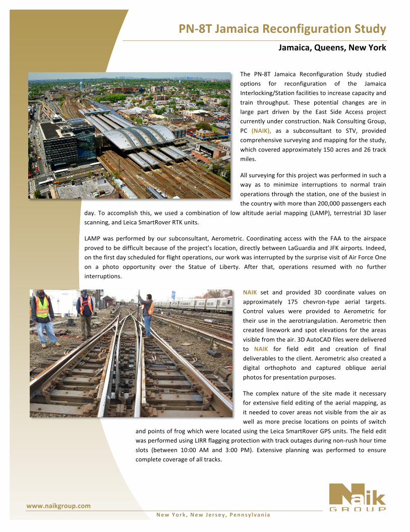
The PN-‐8T Jamaica Reconfiguration Study studied options for reconfiguration of the Jamaica Interlocking/Station facilities to increase capacity and train throughput. These potential changes are in large part driven by the East Side Access project currently under construction. Naik Consulting Group, PC (NAIK), as a subconsultant to STV, provided comprehensive surveying and mapping for the study, which covered approximately 150 acres and 26 track miles.
All surveying for this project was performed in such a way as to minimize interruptions to normal train operations through the station, one of the busiest in the country with more than 200,000 passengers each
day. To accomplish this, we used a combination of low altitude aerial mapping (LAMP), terrestrial 3D laser scanning, and Leica SmartRover RTK units.
LAMP was performed by our subconsultant, Aerometric. Coordinating access with the FAA to the airspace proved to be difficult because of the project’s location, directly between LaGuardia and JFK airports. Indeed, on the first day scheduled for flight operations, our work was interrupted by the surprise visit of Air Force One on a photo opportunity over the Statue of Liberty. After that, operations resumed with no further interruptions.
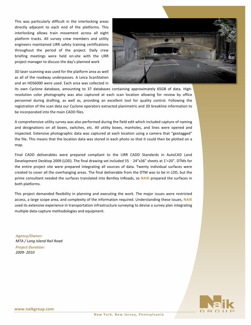
NAIK set and provided 3D coordinate values on approximately 175 chevron-‐type aerial targets. Control values were provided to Aerometric for their use in the aerotriangulation. Aerometric then created linework and spot elevations for the areas visible from the air. 3D AutoCAD files were delivered to NAIK for field edit and creation of final deliverables to the client. Aerometric also created a digital orthophoto and captured oblique aerial photos for presentation purposes.
The complex nature of the site made it necessary for extensive field editing of the aerial mapping, as it needed to cover areas not visible from the air as well as more precise locations on points of switch
and points of frog which were located using the Leica SmartRover GPS units. The field edit was performed using LIRR flagging protection with track outages during non-‐rush hour time slots (between 10:00 AM and 3:00 PM). Extensive planning was performed to ensure complete coverage of all tracks.
www.naikgroup.com New York , New Je rsey , Pennsy lvan ia
Agency/Owner: MTA / Long Island Rail Road Project Duration: 2009-‐ 2010
This was particularly difficult in the interlocking areas directly adjacent to each end of the platforms. This interlocking allows train movement across all eight platform tracks. All survey crew members and utility engineers maintained LIRR safety training certifications throughout the period of the project. Daily crew briefing meetings were held on-‐site with the LIRR project manager to discuss the day’s planned work
3D laser scanning was used for the platform area as well as all of the roadway underpasses. A Leica ScanStation and an HDS6000 were used. Each area was collected in its own Cyclone database, amounting to 37 databases containing approximately 65GB of data. High-‐resolution color photography was also captured at each scan location allowing for review by office personnel during drafting, as well as, providing an excellent tool for quality control. Following the registration of the scan data our Cyclone operators extracted planimetric and 3D breakline information to be incorporated into the main CADD files.
A comprehensive utility survey was also performed during the field edit which included capture of naming and designations on all boxes, switches, etc. All utility boxes, manholes, and lines were opened and inspected. Extensive photographic data was captured at each location using a camera that “geotagged” the file. This means that the location data was stored in each photo so that it could then be plotted on a map.
Final CADD deliverables were prepared compliant to the LIRR CADD Standards in AutoCAD Land Development Desktop 2009 (LDD). The final drawing set included 55 – 24”x36” sheets at 1’=20”. DTMs for the entire project site were prepared integrating all sources of data. Twenty individual surfaces were created to cover all the overhanging areas. The final deliverable from the DTM was to be in LDD, but the prime consultant needed the surfaces translated into Bentley InRoads, so NAIK prepared the surfaces in both platforms.
This project demanded flexibility in planning and executing the work. The major issues were restricted access, a large scope area, and complexity of the information required. Understanding these issues, NAIK used its extensive experience in transportation infrastructure surveying to devise a survey plan integrating multiple data-‐capture methodologies and equipment.