Embed Size (px)
Citation preview
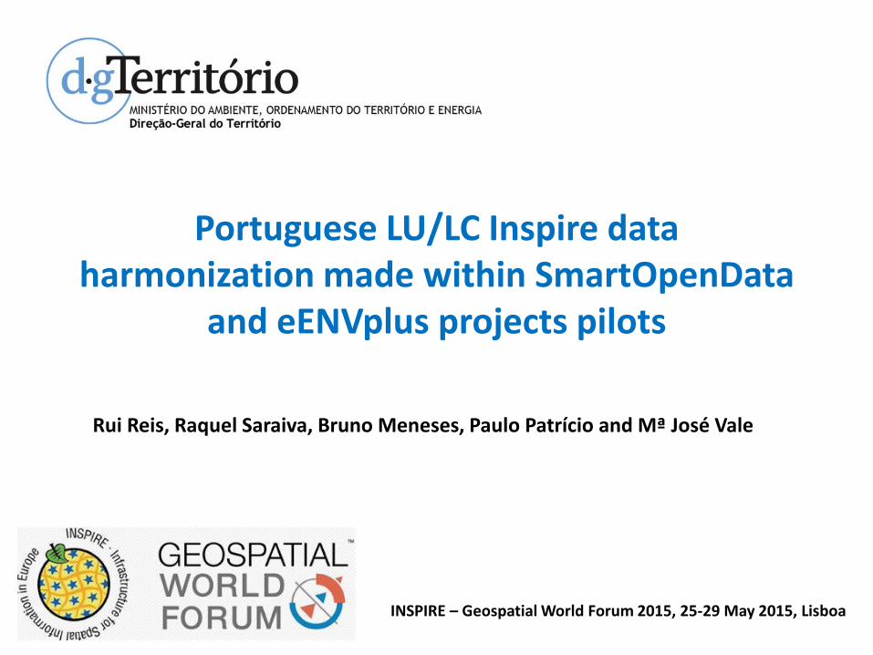
Portuguese LU/LC Inspire data harmonization made within SmartOpenData
and eENVplus projects pilots
Rui Reis, Raquel Saraiva, Bruno Meneses, Paulo Patrício and Mª José Vale
INSPIRE – Geospatial World Forum 2015, 25-29 May 2015, Lisboa

Summary
• This communication describes the Inspire data harmonization performed in the context of the development of pilots for Portugal under the European projects eENVplus and SmartOpenData and its relevance to Inspire implementation.
• Summary:– Pilots being developed in the projects eENVplus and SmartOpenData
– Characterization of harmonized datasets
– Harmonization and validation workflow
– Issues on LC datasets harmonization
– Used tools and results
– Conclusions and relevance
INSPIRE – Geospatial World Forum 2015, 25-29 May 2015, Lisboa

Atlantic Ocean
Pilots
• eENVplus Project: – The objective is to create an open and interoperable
infrastructure capable to integrate existing infrastructures according to the requirements of Inspire and international standards.
• Objective of the Portuguese pilot: – To develop an application to monitor land cover changes
between different dates for an area defined by the user and to develop a prototype integrating web services for data used to build indicators and monitor urban dynamics.
– To evaluate the adequacy of available datasets to evaluate the sustainability of urban growth combined with socio-economic evolution and environmental pressures.
INSPIRE – Geospatial World Forum 2015, 25-29 May 2015, Lisboa

Pilots
• SmartOpenData Project: – To create a Linked Open Data infrastructure (including software tools and data) fed by
public and freely available data resources, existing sources for biodiversity and environment protection and research in rural and European protected areas and its National Parks.
INSPIRE – Geospatial World Forum 2015, 25-29 May 2015, Lisboa
• Objective of the Portuguese/Spanish pilot:
– Land use/cover changes have impacts in water quality degradation that need to be understood. Thus, it is fundamental to access the changes over time occurring mainly in watersheds enclosing water bodies used for public supply. The study area covers the Zêzere watershed which is part of the larger international Tagus river watershed.

Datasets
• eENVplus data : – land cover datasets for 1990, 2007 and 2010 (COS),
– administrative units (CAOP) and
– land use dataset (CRUS).
• SmartOpenData data: – land cover datasets ,
– administrative units and
– data collected at environmental stations used to monitor water quality evolution over time.
• Harmonized datasets: – land cover datasets:
• COS 1990, COS 2007, COS 2010 (each dataset has a different nomenclature),
– land use dataset (CRUS),
– administrative units (CAOP),
INSPIRE – Geospatial World Forum 2015, 25-29 May 2015, Lisboa

LC datasets
• COS'90: Min. dist. 40m, MMU=1 ha.– 76 base classes.
– This nomenclature allows the combination of base classes to form new (composite) classes. The total number of existing combinations in the country is around 700.
• COS 2007: Min. dist. 20m, MMU=1 ha.– Hierarchical nomenclature with 5 levels and 193 classes.
– Third level equivalent to CLC nomenclature.
• COS 2010: Min. dist. 20m, MMU=1 ha.– Some classes of COS2007 were disaggregated, for instance by forest species (Pinus
pinea, for instance) but also in Agro-forestry systems, clear cuts, new plantations and burn areas.
– This gave origin to a nomenclature with 225 classes.
INSPIRE – Geospatial World Forum 2015, 25-29 May 2015, Lisboa

Source dataset & Inspire data specifications
Remodeled dataset Inspire compliant
Rules
TransformationMappingData models
Data Harmonization
Validation
Validated dataset
INSPIRE – Geospatial World Forum 2015, 25-29 May 2015, Lisboa

Issues
• Approaches to the harmonization of LC data
1. Using reference nomenclature (e.g. CLC)– Enables some comparability with other LC datasets
– Needs matching of nomenclatures
– CLC less detailed than max resolution of PT LC datasets (COS 2007/2010 - Level 3 of 5)
2. Dataset own nomenclature:– ex: if we intend to harmonize a COS dataset in its full resolution.
– Need to register nomenclature as codelist in Inspire.
3. Translating existing nomenclature to EAGLE data model– Towards semantic comparison with other LC classification systems
– Clear separation between LU and LC components
– Description of classes using one or more LC components, LU attributes, additional CHaracteristics.
INSPIRE – Geospatial World Forum 2015, 25-29 May 2015, Lisboa

Issues
• Evaluation of approaches:
• Inspire LC data specification in itself does not impose any particular nomenclature, instead it allows the use and coexistence of different LC nomenclatures.
• Semantic comparison with other LC classification systems is not our primaryobjective.
• Thus, 3rd option (translation into EAGLE data model) was discarded.
However:
• Use of reference nomenclature (CLC) would make change detection between different dates trivial.
Thus:
• We used the first option (use of reference nomenclature-CLC):
Also because CLC nomenclature has the right resolution for the pilots.
INSPIRE – Geospatial World Forum 2015, 25-29 May 2015, Lisboa

Data Model
• The following Inspire application schemas were used:
• LC theme:• LandCoverVector
• LandCoverNomenclature
• LU theme:• PlannedLandUse
• LandUseNomenclature
• AU theme:• AdministrativeUnits
INSPIRE – Geospatial World Forum 2015, 25-29 May 2015, Lisboa
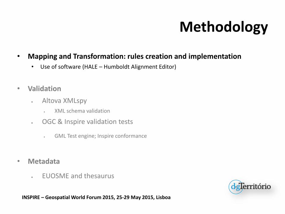
Methodology
• Mapping and Transformation: rules creation and implementation
• Use of software (HALE – Humboldt Alignment Editor)
• Validation
Altova XMLspy
XML schema validation
OGC & Inspire validation tests
GML Test engine; Inspire conformance
• Metadata
EUOSME and thesaurus
INSPIRE – Geospatial World Forum 2015, 25-29 May 2015, Lisboa

Land Cover
INSPIRE – Geospatial World Forum 2015, 25-29 May 2015, Lisboa
HALE workflow (for each LC dataset/COS):
1. Study of Inspire data specification for land cover;
2. Download of Inspire data model – xsd format (LandCoverVector);
3. Alignment:1. Mapping of COS entities and attributes with Inspire app. schema,
2. Matching between COS and CLC nomenclatures.
4. Output: GML file created after the harmonization proccess.

Land Use
INSPIRE – Geospatial World Forum 2015, 25-29 May 2015, Lisboa
HALE workflow:
1. Study of Inspire data specification for land use;
2. Download of Inspire data model – xsd format (PlannedLandUse)
3. Alignment:1. Mapping of CRUS entities and attributes with Inspire app. schema,
2. Matching of national (CRUS) nomenclature with HILUCS (Hierarchical INSPIRE Land Use Classification System) in order to connect to a register managed within INSPIRE
4. Output: GML file created after the harmonization proccess.
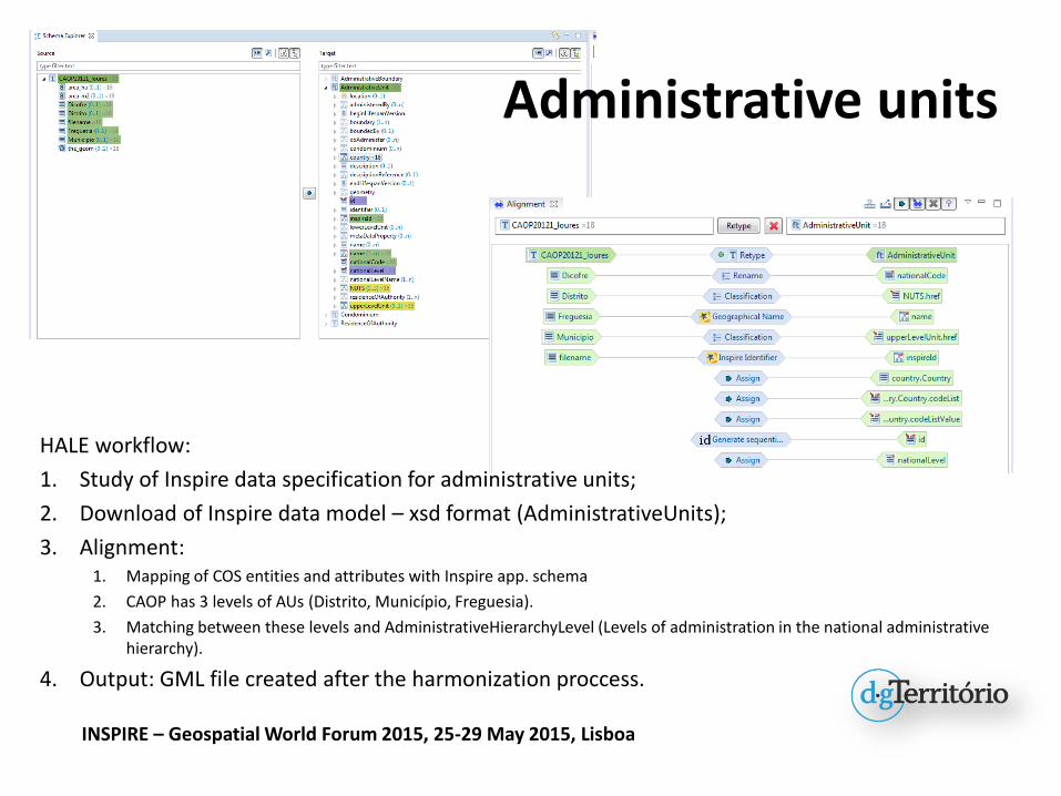
Administrative units
INSPIRE – Geospatial World Forum 2015, 25-29 May 2015, Lisboa
HALE workflow:
1. Study of Inspire data specification for administrative units;
2. Download of Inspire data model – xsd format (AdministrativeUnits);
3. Alignment:1. Mapping of COS entities and attributes with Inspire app. schema
2. CAOP has 3 levels of AUs (Distrito, Município, Freguesia).
3. Matching between these levels and AdministrativeHierarchyLevel (Levels of administration in the national administrative hierarchy).
4. Output: GML file created after the harmonization proccess.

Methodology
• Mapping and Transformation: rules creation and implementation• Use of software (HALE – Humboldt Alignment Editor)
• Validation
Altova XMLspy
XML schema validation
OGC & Inspire validation tests
GML Test engine; Inspire conformance
• Metadata
EUOSME and thesaurus
INSPIRE – Geospatial World Forum 2015, 25-29 May 2015, Lisboa

Validation
INSPIRE – Geospatial World Forum 2015, 25-29 May 2015, Lisboa
Altova XML spy
Upload the harmonized datasets (xml file) and run the process. Success message if the harmonization OK. If not, there’s a message explaining where it fails.

Validation
INSPIRE – Geospatial World Forum 2015, 25-29 May 2015, Lisboa
OGC Validation tests (GML)
Inspire conformance (ETS)
eENVplus Validator: http://showcase.eenvplus.eu/client/validation.htm

Methodology
• Mapping and Transformation: rules creation and implementation• Use of software (HALE – Humboldt Alignment Editor)
• Validation
Altova XMLspy
XML schema validation
OGC & Inspire validation tests
GML Test engine; Inspire conformance
• Metadata
EUOSME and thesaurus
INSPIRE – Geospatial World Forum 2015, 25-29 May 2015, Lisboa
INSPIRE – Geospatial World Forum 2015, 25-29 May 2015, Lisboa
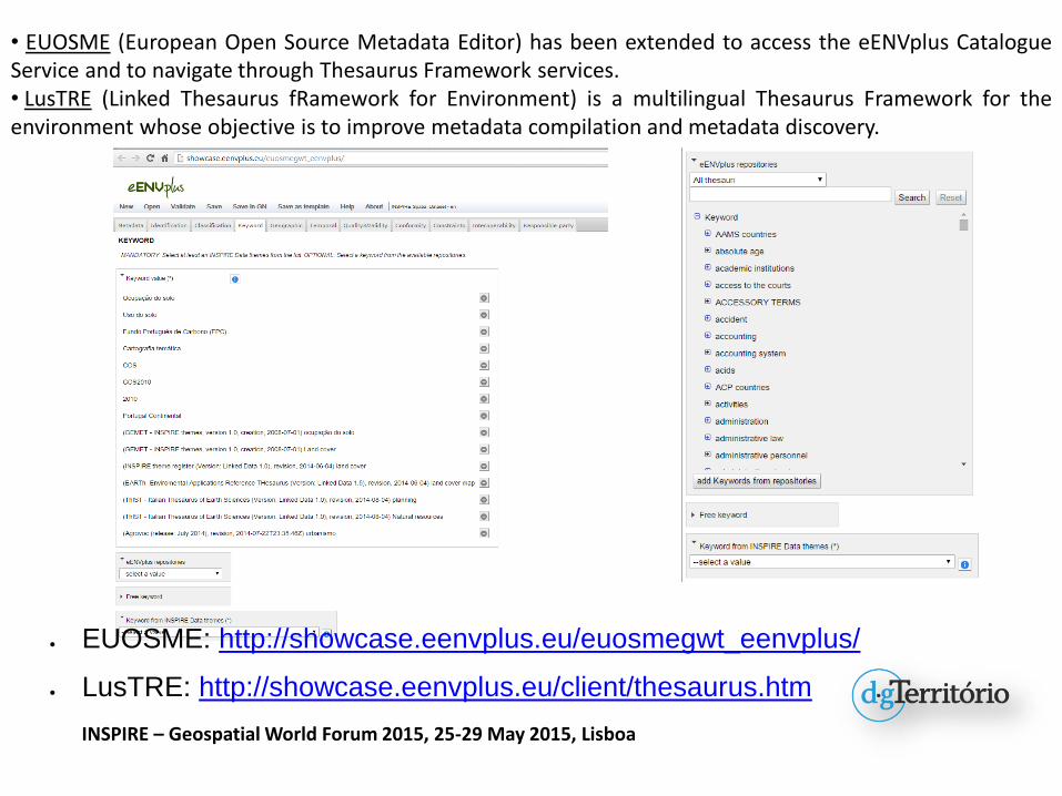
• EUOSME (European Open Source Metadata Editor) has been extended to access the eENVplus CatalogueService and to navigate through Thesaurus Framework services.• LusTRE (Linked Thesaurus fRamework for Environment) is a multilingual Thesaurus Framework for theenvironment whose objective is to improve metadata compilation and metadata discovery.
EUOSME: http://showcase.eenvplus.eu/euosmegwt_eenvplus/
LusTRE: http://showcase.eenvplus.eu/client/thesaurus.htm

Conclusions
• Results– The harmonization using another nomenclature as reference needs the matching
between the classes in the dataset’s nomenclature and the classes in the reference nomenclature.
– Result of projects’ participation are harmonized LC, LU and AU datasets according to theInspire data specifications.
• Relevance– Projects are a platform to test alternative solutions and to exchange ideas with different
partners prior to the adoption of state-of-the-art solutions.
– DGT has the responsibility to harmonize several datasets from various Inspire themes.
– The workflow used to harmonize the datasets according to the Inspire data specificationsand the results obtained:
• basis for the harmonization of national datasets for these themes.
INSPIRE – Geospatial World Forum 2015, 25-29 May 2015, Lisboa

Obrigado
DIREÇÃO GERAL DO TERRITÓRIORua da Artilharia Um, 1071099-052 LisboaPortugal (+351) 21 381 96 00 Fax: (+351) 21 381 96 99
Rui REIS*; Raquel SARAIVA; Bruno MENESES; Paulo PATRÍCIO; Maria José VALE
INSPIRE – Geospatial World Forum 2015, 25-29 May 2015, Lisboa
Special thanks to the Epsilon-Italia team: Giacomo Martirano, Stefania Morrone